Newspaper travel stories, 1987-2016
The majority of these originally were published in The Sacramento Bee. A couple dozen ran in the Las Vegas Review-Journal and Santa Barbara News-Press in 2006. Several ended up in newspapers that included the Baltimore Sun, Boston Globe, Buffalo News, Calgary Herald, Chicago Tribune, Dallas Morning News, Denver Post, Fort Lauderdale Sun Sentinel, Fort Worth Star-Telegram, Kansas City Star, Miami Herald, Milwaukee Journal, New York Daily News, Rocky Mountain News, The Times of London and Toronto Star.
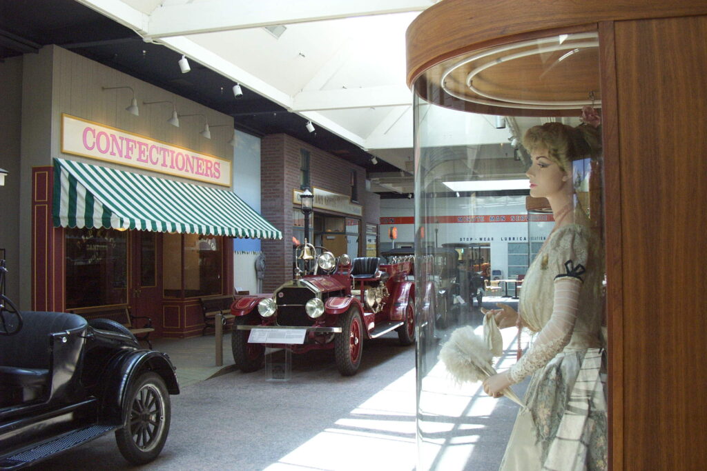
RENO – Unlike their roulette counterparts so prevalent in this gambling mecca, wheels do not revolve at the National Automobile Museum a few blocks east of downtown. Better yet, taking a pedestrian spin among the sprawling facility’s 200-some vintage vehicles is a low-risk proposition.
These motorized marvels, some dating from the 19th century, are for the most part in pristine condition. Chrome shines, paint sparkles and, for many visitors, visions of combustible companions from driving days gone by kick into high gear. Great-Grandpa was tempted to replace his horse-drawn carriage with a Model A, wasn’t he? Grandma would have loved that Phaeton. Remember the day Dad pulled into our driveway in a little red bug?
Tanks for the memories.
One of the museum’s few cars that does not look as though it just rolled off the factory floor is a 1907 Thomas Flyer that won a “round the world” race from New York to Paris – presumably in a westbound direction. This four-cylinder workhorse (60-horsepower, actually) logged 13,341 miles on roads that would make today’s chain-chewed stretch of Interstate 80 in the nearby Sierra seem as smooth as a Corian countertop. The Flyer has a rugged, dusty look that can be compared with a photograph of the vehicle as it appeared before the adventure began in Times Square.
“There has not been another attempt at a round-the-world auto race since 1908,” a museum sign says, “and as the current world record holder, this is arguably the most historic American automobile in existence.”
Dozens of other cars made from 1890 to 1913 also are in the museum’s Gallery 1, and each has a story to tell. A red 1903 Ford Model A, which originally sold for $850, is one of only 1,708 such vehicles ever manufactured. “Building an automobile was only half of Henry Ford’s idea,” the exhibit reports. “Building it inexpensively was the other half.”
Not far from the Thomas Flyer rests a 1912 Rambler that appeared in the opening dock scene from the blockbuster movie “Titanic.” A bright-yellow 1913 Mercer Raceabout, the type that won a 300-mile Chicago competition that year at the average speed of 66.8 miles per hour, is exhibited before a fun painting of automobile racing’s early days. Television star Andy Griffith donated a 1912 Baker to the museum, noteworthy because the black, boxy contraption ran on a 60-volt battery. Gas-powered cars were cheaper in those days, so the electric Bakers went out of production in 1916.
The second of the museum’s four galleries is home to a most-distinctive 1921 Rolls-Royce whose outer body is composed mostly of solid copper sheeting and ebony trim. Accessories were made with silver and nickel. Such custom-made contraptions apparently were not unusual in those days between world wars.
“Bodies were constructed from virtually any suitable material and included aluminum, steel, German silver, wood, wicker, papier-mâché and fabric,” a sign before the coppery Rolls explains. “The more exotic the construction, the greater the appeal to elite buyers, who wanted a one-of-a-kind automobile to ‘one-up’ their friends and the rest of the world. It was not uncommon for a maharajah to order a Rolls-Royce (of) polished metal trimmed in gold or silver with special guns and lamps, just for the purpose of tiger hunting.”
All four galleries are entered off interior “streets” that run past false storefronts and glass-enclosed mannequins. Everything reflects the progression of our automobile culture. Gallery 1 is behind a blacksmith, Gallery 2 (whose vehicles were made from 1914 through 1931) is reached through a candy shop, Gallery 3 (1932-1954) is just past a full-service gas station and Gallery 4 (1954 to the present) starts behind a mall and exits out a suburban garage topped by a basketball hoop.
Among cars parked on the streets is a 1933 Phaeton, a six-cylinder sedan that helped Chevrolet cut into Ford’s dominance. The Chevy, whose innovations included a defroster, radio and bumper guards, in May was curbed by the Palace theater, whose marquee advertised “Gone With the Wind.”
After a while, visitors who are not four-wheeler fanatics likely will run out of sightseeing gas. A gift shop and cafe offer some relief. A series of large paintings by Robert Cinkel also are worth checking out; they hang in the lobby area and in a hall leading to the exhibits. The suffragette movement and prohibition are depicted, among other 20th century milestones.
The National Automobile Museum, 10 Lake St. South, is open from 9:30 a.m. to 5:30 p.m. Mondays through Saturdays, and from 10 a.m. to 4 p.m. Sundays. Admission is $7.50 general, $6.50 for seniors and $2.50 for ages 6 through 18. Children ages 5 and younger enter for free. For more information: (702) 333-9300 or www.automuseum.org.
YORK, England — For those of you who cannot get enough of the California State Railway Museum or cannot seem to avoid going there when out-of-towners come to visit, the English equivalent here is worth seeing for comparison’s sake.
The National Railway Museum is larger than Old Sacramento’s — in fact it bills itself as the world’s largest such attraction. Its barn-like South and Great halls, connected by a “subway” passage, contain more than enough rail cars and other exhibits to keep you rolling along for a pleasant hour or two. A cafe and gift shop may encourage you to linger longer.
Whereas Great Britain’s monarchy is one thing that distinguishes it from the United States, the National Railway Museum’s royal rail cars are unlike anything displayed at its Northern California cousin. Queen Victoria, who ruled for an astounding 64 years beginning in l 837, was the first British monarch to embrace the comforts of train travel - first-class all the way.
Her personal rail car on view here was completed in 18 69. Its bedroom, bathrooms, salon and ladies -in-waiting room fulfilled all the queen’s needs, good news for the driver because previously he had been required to stop the train if her royal majesty wanted to venture from one car to another.
Audio “umbrellas” triggered by people moving under them offer insights on the royal rail vessels. For example, one outside the ladies-in-waiting room encourages visitors to compare the small bathroom there with Victoria’s more spacious commode. “The queen sat here,” you can think in an old-world variation of the “George Washington slept here” travel game.
The bathroom in George Vs rail car has a story to tell, too. Its bathtub contains a red line, more than a foot below the taps, that water was not to breach. The king — he ruled from 1910 to 1936 — and his wife, Queen Mary, traveled extensively by rail to rally the home front during World War I. The tub’s red line served a patriotic purpose.
It is “believed that the shallow water was an act of solidarity to share with the people the inconvenience of wartime water rationing,” an umbrella speaker says.
Also in the South Hall:
- An entire freight train from the era of 1850-1950, when two-thirds. of the British railway system’s profits were from the transporting of goods. Behind the locomotive are attached a goods wagon, welltrolley wagon, mineral wagon, closed van, ventilated van, ballast wagon and brake van.
- A carriage truck, made in 1908, that during journeys sometimes had the horses still strapped on and the owners still inside the wagons. Automobiles made the carriage cars obsolete for their original purpose, but they later were used to carry goods and, during war years, military vehicles.
- A third-class car from 1898 that served on an east coast route to Scotland. It features an early example of a side corridor, which prevents walking passengers from constantly bumping into their seated compatriots.
Many historical signs and display cases that include information such as the fir i rails, in the Middle Ages, were made of wood, with the horse-pulled cars used mainly to transport minerals short distances, as from a canal to a river. There also is a description of “branch lines,” a system of rural routes that moved farmers and produce to urban markets. Mostly gone now, branch lines were so widespread in the early 1900s that nowhere in England or Wales was farther than 20 miles from a “wayside halt” (train stop).
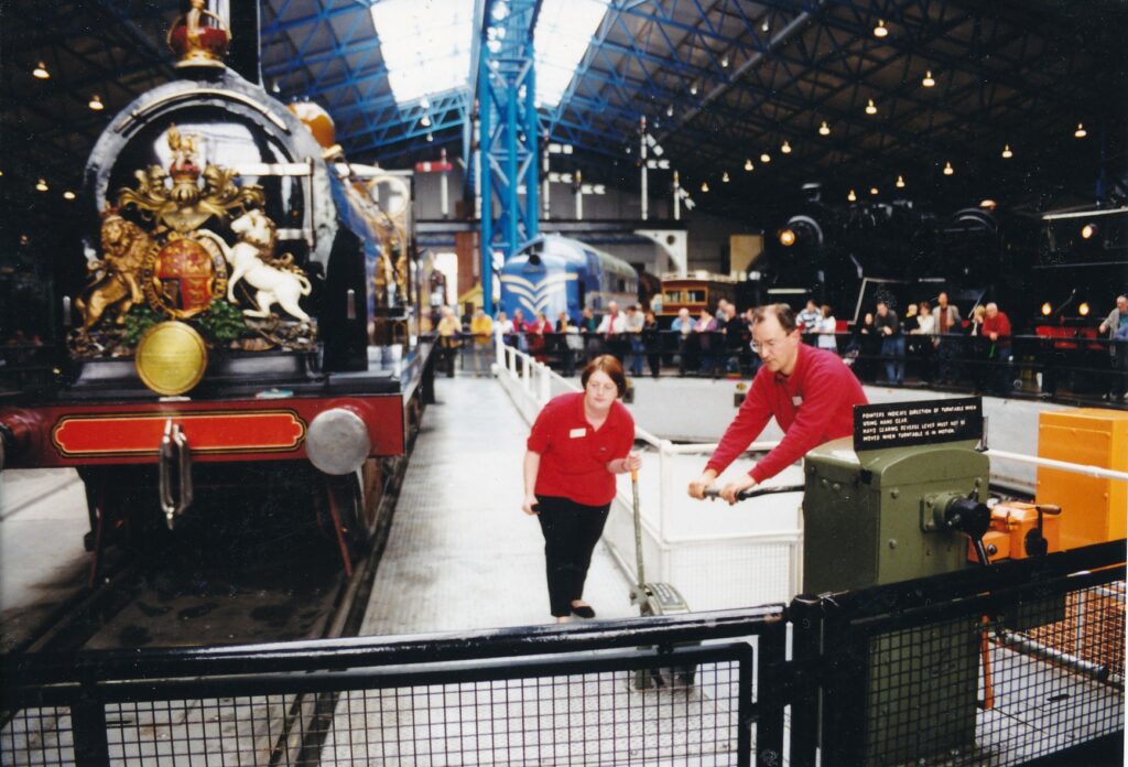
The Great Hall is dominated by its Locomotive Turntable. One of 24 surrounding engines of various eras and designs is parked daily on the spinning platform. Museum “explainers” (docents) such as Mark Abbott and Claire Palmer describe the locomotive before rotating it so that all sides can be viewed from one standing position. On the day I visited, the featured engine was Express Passenger Locomotive No. 14, which ran between London and Brighton at about 40 miles per hour from 1882 to 1926. It was named after Prime Minister William Gladstone.
The National Railway Museum, a one-third-mile walk from the York railroad station, is open from 10 a.m. to 6 p.m. daily except Dec. 24-26. Admission is 5.50 pounds general, 4.50 pounds for seniors ages 60 and above, 3.80 pounds for students. For more information : call 1904-621-261; fax 1904-611-112 or visit the Web site www.nmsi.ac.uk/nnn/.
NEVADA CITY – Some 3,000 nearby acres are protected for public growth and critter consumption thanks largely to one busy woman: Cheryl Belcher. That assessment was offered with abandon and unquestionable sincerity during a hike last weekend east of town, near Emigrant Gap.
The exact location is a secret due to concerns about poachers. The poaching concerns are due to the hike’s easy to-steal attraction: insect-eating pitcher plants. A 10-acre fen (an area of water-logged land) that features thousands of the plants has been set aside by the landowners as a conservation easement, at the urging of the Nevada County Land Trust.
Belcher has been the land trust’s executive director for eight years. Public growth is what the organization strives for, setting aside county lands for trails and purposes related to culture, history, science and other forms of education.
Critter consumption is what the pitcher plants do.
Slender-stalked, bulbous-topped and overwhelmingly green at this time of year, pitcher plants lure insects with nectar. Whatever sweet hopes the bugs anticipate are dashed by their becoming stuck in the fragrant muck. Down the hatch they go, as Belcher’s right-h and woman on the excursion, Carolyn Chainey-Davis of the California Native Plant Society, explained.
Once trapped at a pitcher plant’s top, or what Chainey-Davis calls the “fish lip,” the insects are doomed. “There are downward-pointing hairs in the tube portion of the pitcher that make it increasingly hard to get out,” she said while holding one of the plants.
Chainey-Davis sliced open the stalk, revealing at the bottom a cluster of black, dead bugs. “Look, there’s a little baby insect,” said someone, pointing.
“Ahh,” cooed at least one other hiker.
Belcher, an energetic force of human nature whose voice sounds like Jane Fonda’s in one of the actress’s customarily determined roles, repeated the “Ahh” and instructed the dozen or so others: “OK, everybody: One… two… three… “
“Ahhhhh, ” the group obeyed.
Typically, Chainey-Davis said, pitcher plants consume the insects through a pool of bacteria-rich water in their stalks’ lowest reaches. However, due to a low-rainfall year and/or the lateness of the season, the particular plant she held had not progressed very far in digesting the bugs.
After walking about the fen’s periphery for an hour or so, the group gathered for sandwiches, chips and cookies, all provided by the gregarious and much-praised Belcher. Praised in part, perhaps, because she finagles a food angle into all the land-trust excursions, which raise funds for the organization in addition to being laid-back outdoor fun. Open to the public, the outings continue through October and resume again in April.
Today, land-trust members only are gathering in a future park outside Nevada City for a relaxed exploration of its features. Belcher says she holds five or so such private events each year as a way of thanking members for their financial support.
Beginning on Wednesday, the land trust’s come-one, come-all excursions resume with a nine-mile hike that encompasses Grouse Ridge, Sand Ridge, a small lake and Five Lakes Basin. Walking begins at 7:30 a.m. and should wind up by 4 p.m.; land-trust members pay $7, nonmembers $14.
Also this fall:
- At 4:30 p.m. Friday, Ed Scofield of the Nevada County Fairgrounds will conduct a behind-the-scenes preview of the evening’s Draft Horse Classic. Clydesdales, Belgians and other equine exquisites will appear in the show, which begins at 6:30 p.m. Tickets, which include parking and performance, are $25 for members, $30 for nonmembers.
- The same fees apply for a trek to Hidden Lakes Retreat on Saturday starting at 1O a.m. and lasting about five hours. The lodge overlooks a mountain and will be the site of a “gourmet lunch.” Canoeing and biking are among the billed activities.
- Also starting at 10 a.m. Saturday a tour of Dutch Flat will be given by Jim Ricker of the Golden Drift Historical Society. This three-hour, bring-your-own-lunch affair costs $10 for land-trust members, $15 for nonmembers.
Following that is a tour of homes that run on solar energy on Sept. 29, a music-accompanied champagne brunch on the Litton Trail on Oct. 14, a Chalk Bluff excursion that includes discussions of American Indian sites and an underground petrified forest on Oct. 20, and a look at aspen carvings by 19th and 20th century sheepherders at Pole Creek on Oct. 27.
Details about 2002’s fund-raising outings by the Nevada County Land Trust should begin emerging next February, Belcher said. For reservations on any of this year’s events or for more information: (530) 272-5994 or www.nevadacountylandtrust.org.
CARSON CITY – “Bullion, booze and boom” could be the historical buzz phrase for California’s eastern neighbor. Belly up to the Nevada State Museum and learn why.
The sprawling facility across the street from Nevada’s Capitol concerns itself with far more than mining, miners’ drinking and nuclear tests, of course. Geology, wildlife, American Indians’ longtime presence and many tidbits about the Silver State’s 142-year history are touched upon in displays that are well-organized and informative, if a little stale. (A tribute to cultural diversity, for example, dates itself unflatteringly by depicting only males. The violent undertone of many stuffed animals, which include a bald eagle, makes taxidermy as educational tool seem like an idea whose time has come and gone.)
Soon after entering the museum, visitors encounter a re-created ghost town, complete with an assay office, general store, carpenter shop and saloon. Next to the latter is a grizzled, “talking” miner. Push a button and hear him say such things as, “When I was young, this was a lively little town.” An accompanying sign says that three-quarters the 600 towns ever established in Nevada “were long ago abandoned or are now only mere remnants of their former conditions.”
One 19th century Nevada town, which like many others was founded after the California Gold Rush, lives on today as a popular tourist attraction. It serves as a narrative star in one of the museum’s livelier descriptions of prospecting’s early days.
“One of the few pleasures enjoyed by the western miner was the consumption of alcoholic beverages, and consume them he did!” a ghost-town sign reads. “Waybills from the Virginia and Truckee Railroad indicate that while 55 tons of pianos, organs, stoves and sewing machines were shipped to Virginia City in 1879, ten times that weight in beer was carried, despite the existence of numerous breweries within the city.”
The concept of getting bombed in Nevada manifested itself in a much more destructive way beginning on Jan. 27, 1951, when an atomic test was conducted northwest of Las Vegas. Forty-one years and more than 900 nuclear explosions later, testing ceased over and under (only buried bombs were blasted after 1963) the state. The museum claims that some of the bombs’ flashes, 10 times brighter than the sun, could be seen as far as 500 miles away. Higher cancer rates in neighboring communities are acknowledged, which is sobering. But the fun with fission and fusion angle also gets museum play:
“During the 1950s the detonations were used as a marketing ploy for tourism,” reads an exhibit that includes little souvenirs of the total-annihilation-kitsch variety. “You could buy atomic cocktails, ‘atomic lunches’ to take to a viewing site or have your hair done up like a mushroom cloud.”
The nuclear-test exhibit is part of a three-room Nevada history assemblage on the second floor. Mining gets a lot of play here, with a blasting machine, miner’s lunch box and a rock drill among the items on display. A second mining boom, at the beginning of the 20th century, is credited with spurring the birth of Fernley, Las Vegas, Minden and Sparks. The March 17, 1897, boxing match in Carson City between “Gentleman” Jim Corbett and Bob Fitzsimmons is detailed. Fitzsimmons’ “famous solar plexus punch” proved decisive in the 14-round prizefight, which was the first ever filmed.
Some attention, though arguably too little, is paid to the state’s profoundly influential gambling heritage.
Elsewhere on the second floor, two rooms are devoted to anthropology, specifically the region’s Washoe, Shoshone and Paiute tribes. Hunter-gatherer tools, baskets and pine-nut mush sticks are displayed, and a large diorama shows an 18th century Indian family of seven going about their daily lives. A geology exhibit heavy on rocks (silicates, tungstates, molybdates, phosphates, arsenates, vanadates, chromates, sulfates, manganates and any number of other “ates”) leads to the 17,000-year-old skeleton of a mammoth that was unearthed in the Black Rock Desert, which is west of Winnemucca – as so many wondrous things are.
In addition to the ghost town, downstairs contains the unfortunate stuffed animals and “Meet the Press,” starring a 6-ton coin-making machine. Its up-and-down, riches-to-rags-to-riches-again story is entertainingly recounted here in what originally was the Carson City Mint.
A long-running temporary exhibit further celebrating the state’s American Indian heritage, “Under One Sky,” continues through December 2004 in a neighboring building that also houses the museum’s gift shop.
Nevada State Museum, 600 N. Carson St., is open from 8:30 a.m. to 4:30 p.m. daily. Admission is $3 general and $2.50 for students under age 18 and seniors. For more information: (775) 687-4810.
When planning a trip to the Atlantic provinces, many tourists are drawn to “Canada’s Ocean Playground,” Nova Scotia’s self-description. Others opt for the charms of petite Prince Edward Island or the secluded beauty of Newfoundland.
Less attention is paid to the fourth maritime province, despite its lying between Maine and those three trendier destinations. Which is a shame, really, since so much of what Canada is about is represented by New Brunswick.
For starters, “Nouveau-Brunswick” has a linguistic appeal, a certain je ne sais quoi in its being the country’s only officially bilingual province. A good many store placards are in French and English, and highway and other government instructions must be presented in both languages.
Thirty-five percent of the population is French-Acadian, and an estimated 50 percent of New Brunswickers are fluent in both French and English.
There’s also a strong sense of history in this Maine-size province, situated between the northeast American state and Nova Scotia. Discovered in 1535 by Jacques Cartier, the region was home to many of North America’s earliest European settlers. French and British troops fought there in the mid-18th century. In 1867, New Brunswick became one of the four original provinces in the Canadian Federation.
Furthermore, there are plenty of things to keep visitors occupied in friendly New Brunswick. Warm beaches, spectacularly high tides, beautiful bays and river valleys, covered bridges, dense and hilly forests, abundant seafood and more are available in an area that can be explored adequately in as little as one week.
As a matter of fact, six days were all I had to work with during my springtime visit. I rented a car in Bangor, Maine, and scooted east to make a 1,200-mile, clockwise trip about New Brunswick. What follows is a sketch of the attractions I saw and accommodations in which I stayed. All prices are given in Canadian currency.
Day One
For those of you who rooted for the redcoats in 1775-1783 and are loyal to the cause of British colonialism, Fredericton is a must see. After the American Revolution, many Tories hightailed it to this settlement, named after King George III’s second son, Frederick. Benedict Arnold, after he’d earned his traitor stripes, made his home there for a year.
The turncoat general is not among those resting in the Loyalist Cemetery, which broke ground in the cruel winter of 1783. A few tombstones have survived the centuries, and can be visited a mile east of downtown, hidden among trees next to the mighty Saint John River.
A capital haunt for Loyalists and their fans, Fredericton also is New Brunswick’s capital, a role it has played for 206 years. The Legislative Assembly Building, at the corner of Queen and Saint John streets, features a renovated Assembly Chamber and a library that boasts a 1783 edition of the Doomsday Book. Out front is a small birch tree that was planted to honor the Prince of Wales’ marriage to Lady Diana Spencer in July 1981. The government building has tour guides and is open to the public until 9 p.m. in the summer; from Labor Day to mid-June it closes at 4 p.m.
Next door is The Playhouse. financed by publishing baron Lord Beaverbrook in his dying year, 1964. It is the home of Theatre New Brunswick and hosts many touring events. The Beaverbrook Art Gallery, across the street, has one of Spanish surrealist Salvador Dali’s masterpieces. The 10-by-15-foot “Santiago el Grande.” The museum costs $3 for adults and $2 for seniors and is open daily except for Christmas and New Year’s.
Also worth a look is Christ Church Cathedral. a fine example of Gothic architecture that was completed in 1853. Saint John River, which snakes through Fredricton just north of downtown. can he enjoyed by strolling along The Green. The pedestrian oath can be accessed behind the Beaverbrook Art Gallery. It ends at the Loyalist Monument and Cemetery.
The Green also runs behind the Lord Beaverbrook Hotel, which was refurbished this year. Though my room featured such luxuries as remote-control TV and a telephone in the bathroom, the shower water was tepid. Located cater-cornered to the Legislative Assembly Building, much of its clientele is government officialdom. Rooms start at $76, and suites cost up to $225 per night.
Day Two
Heading north from Fredericton, motorists have a choice of roads to take them up the Saint John River Valley. One of the options is the Trans-Canada Highway (Highway 2), which generally is in good shape, allows speeds up to 63 mph and has frequent roadside gas stations and convenience stores. It offers sporadic views of the Saint John.
By contrast. Highway 105 constantly hugs the river all the way to Saint-Leonard, 147 miles from Fredericton. Its hilly, curvy course would be ideal for driving enthusiasts of that ilk were it not for a severe pothole problem. Highway 105 is not the type of road that allows drivers lingering looks at scenery or to have a piping-hot, filled-to-the-rim coffee cup in one hand.
Though the natural beauty of the valley is the star attraction. some of its manmade adornments deserve honorable mention. Many striking, well-preserved homes and churches dot hills on both sides of the Saint John.
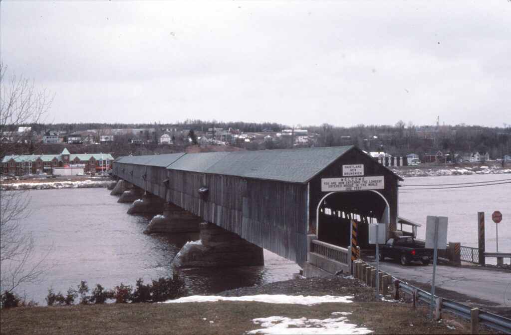
Hartland, about halfway to Saint-Leonard. is what signs claim to be the world’s longest covered bridge, at 1,282 feet. The bilingual twin cities of Grand Falls/Grand-Sault have a huge hydroelectric power station. Nature takes center stage again at Grand Falls Gorge, a 75-foot drop of the river in a one-mile stretch.
Golfers should plan for a round near Four Falls, a tiny settlement just north of Perth-Andover and 40 miles south of Grand Falls. Aroostook Valley Country Club rests right on the Maine-New Brunswick border. The 18-hole course, according to a local hacker. “is one of the best in northeastern Canada.” Anyone can play there during summer months, although it’s best to reserve tee times for weekend play.
At Saint-Leonard, the clockwise tour diverts to Highway 17 and a bump-riddled 90 miles to Campbellton. Nestled in extreme northern New Brunswick at the base of Baie des Chaleurs (the bay of warmth), Campbellton is a pocket of English speakers in the French-dominated Restigouche Uplands. Across the bay, in fact, is a memorial to a decisive French defeat at the hands of the English in June 1760. It is on the Quebec portion of a gorgeous, 30-mile drive that runs west from Campbellton, on Highway 134 in New Brunswick and Highway 132 in Quebec.
Campbellton’ s fortunes are heavily dependent on its salmon industry. The fish is honored annually in a late-June festival. In 1989, the city unveiled “Restigouche Sam,” a 28-foot, silver salmon. The scaled-up sculpture livens Salmon Plaza, a reel’s cast from the bridge that crosses Baie des Chaleurs to Quebec.
By New Brunswick standards, the Aylesford Inn (8 MacMillan Ave.) is inexpensive, with rooms starting at $40. The bed-and-breakfast is very clean, has a refreshingly informal air and offers good food and views of the bay.
Day Three
Baie des Chaleurs can be seen for several hours east of Campbellton, first by taking leisurely Highway 134 through Belledune and Nigadoo. Once through the pulp-mill town of Bathurst, drivers not yet sick of water can resume their skirting of the bay by taking Highway 11 northeast. Several good beaches are beside the route, and a 10-mile detour east of Grand-Anse ends at the inviting sands at Maisonnette.
Northeast New Brunswick is known as the Acadian Coast, after French descendants who fled L’Acadie – an area in Nova Scotia and southern New Brunswick – after British troops triumphed there in 1755. The Acadian peninsula is shaped like a lobster claw, and its tip is at Miscou Island, accessible by a free ferry from Lameque Island. Just below is Shippagan, which has a marine museum that’ s open only during summer months.
South of Shippagan, Highway 11 leads to the end of the peninsula, at Chatham. In between are several more beaches, though there are limited opportunities to see the Atlantic Ocean from the road.
The Atlantic Host Inn in Bathurst is similar to Fredericton’ s Lord Beaverbrook in that there is room service, an indoor pool, remote-control TV and that ever-important telephone in the bathroom. It’s located just off Highway 11 on Vanier Boulevard, and charges $60 and up.
Day Four
Chatham is at the base of Miramichi Bay, which can be further viewed by taking Highway 117 to Escuminac, site of a moving monument to 35 fishermen killed in a June 1959 storm. From there, the road turns south and cuts through forestial Kouchibouguac National Park. Right off Highway 117, and close to Highways 11 and 134, is the entrance and information center. The park has more than 15 miles of cross-country trails and a primitive winter campsite.
Within an hour’s drive south of Kouchibouguac are at least three tourist attractions of dubious worth. Richibucto has a church that pays homage to the sea with a lighthouse-shaped steeple and a roof that resembles waves. Rexton is the hometown of Great Britain’s only prime minister not born in the British Isles, Andrew Bonar-Law, whose former house is now a museum. Shediac, “The Lobster Capital of the World,” has a gigantic lobster sculpture that, like Campbellton’s “Restigouche Sam,” is marooned in a city park.
Ferries to Prince Edward Island depart hourly during summer months from Cape Tormentine, less than an hour east of Shediac. Below Cape Tormentine, Highway 16 parallels the Nova Scotia border to Fort Beausejour, host of yet another French defeat and a National Historic Site since 1926. In strolling about the hilltop fortifications, it’s difficult to picture how British troops were able to win the day.
Nearby Sackville has a distinctly English feel, exemplified in the quaint Marshlands Inn. Three 19th century houses have been converted to contain 25 guest rooms, furnished with antiques, old-fashioned bathtubs and, among other things, fly swatters. The attractive downstairs restaurant serves breakfast and dinner, and free hot chocolate and cookies are available to guests beginning at 9:45 p.m.by the fireplace. Rates range from $47 for a single to $109 for a family of four.
Day Five
Tourists are pulled to Moncton, a half-hour northeast of Sackville, by Magnetic Hill. Off Exit 488 of Highway 2, a series of signs directs cars “down” a slope to a point where their engines are to be cut and gearshifts put in neutral. Vehicles then glide backward, seemingly uphill – an optical illusion that can be spoiled by trying the stunt going forward instead of backing “up.” At least it’s free, provided you skip the adjoining amusement park.
The world’ s highest tides – 48 feet – have been measured in the eastern edge of the Bay of Fundy, between New Brunswick and Nova Scotia. Through such radical ups and downs, “flowerpot rocks” have been formed at Hopewell Rocks, a half-hour south of Moncton off scenic Highway 114. At low tide, the rocks have an Easter Island eeriness.
Highway 114 continues northeast through Fundy National Park, a summer- and wintertime playground.
New Brunswick’s largest city, with 80,000 residents, is Saint John. It’ s not to be – but often is – confused with Newfoundland’s biggest settlement, St. John ‘s. Incorporated in 1785, Saint John is Canada’s oldest town, and was home to North America’ s first police force, according to New Brunswick Tourism.
A sampling of Saint John’s past is on display at the Loyalist House, downtown at 120 Union St. Built from 1810-1817 for a British sympathizer who fled New York, the Georgian mansion has mostly original furniture, windows and floors. It is stuffed with interesting items, including a unique piano-organ and a 1795 pressure cooker of a design used by Napoleon’ s army.
William Merritt, longtime curator of the Loyalist House, told me the last person to live there was a photographer for the local newspaper. Prior to his death in 1958, the widower often would grab a gun from his large collection, take aim from the kitchen and fire across a pantry to targets 40 feet away in the sitting room.
A few blocks north is Saint John City Market, a block-long, 115-year-old venue for stalls that sell vegetables, fish, paintings and flowers, among other things. Just north of the market is Loyalist Cemetery, permanent home for many Tories routed from New England after the Revolution.
Saint John’s main drag, King Street, runs south of Loyalist Cemetery to the harbor. It is bordered by dozens of shops, banks and restaurants and, at four blocks long, is an easy stroll in a city that offers many walking tours.
The Delta Brunswick, at 39 King St., is one of the province’s swankiest hotels. It is thoroughly modern, has complimentary bottles of Perrier and liquor-packed, in-room mini-bars, and is connected to a three-level indoor mall. But luxury and perfect location don’t come cheaply; Delta Brunswick charges $120 to $160 for a single, and a family of four stays for no less than $190.
Day Six
The final leg of New Brunswick’s clockwise tour, from Saint John to St. Andrews By-The-Sea, is merely 60 miles. There is time, therefore, to see one of the best historical museums I’ve encountered: New Brunswick Museum, at 277 Douglas Ave. in Saint John. Within a weathered, brown exterior are three floors of carefully marked and well-spaced exhibits. Included is an award-winning model of Ocean Hawk II, a retired tugboat now berthed at the end of King Street, and hundreds of colorful drawings in the “Five Centuries of Botanical Illustration” wing.
Upstairs, maps, photographs and text guide visitors through the history of New Brunswick. One curmudgeonly Loyalist, Munson Jarvis, is quoted from reflections he made in 1787 on Tories returning to the United States:
“Many, it is true, have gone back to the states., some from one cause, some from another, but generally speaking those that have gone back were a set of poor wretches that had they staid here must have been supported by the publick at least every winter. Very few people of any consequence have left us… I am in great hopes this in a short time will be a country of plenty tho a cold one.”
Adults pay $2 to enter the museum, open daily except Mondays and major holidays.
St. Andrews, in extreme southwest New Brunswick, is a good place to wind down from a week’s worth of driving and sightseeing. The business district lies completely within a flat, four-block stretch of Water Street, all but a handful of the 1,800 residents are Anglophones, and modest tourist attractions include an aquarium/museum and St. Andrews Blockhouse, a National Historic Site.
Canada’s oldest summer hotel, the Shiretown Inn, was built in 1881. Now part of the Best Western network, the inn is situated cater-cornered to the post office and Market Wharf, at 218 Water St. It contains a fine seafood restaurant and bar. Summer room rates start at $66.
“People are uncommonly friendly here” is an all-too-common refrain of tourism departments and chambers of commerce.
There is no guaranteed cordiality, anywhere. Not all Midwesterners are nice and, for that matter, not all Parisians are rude.
Admittedly, you are more likely to get a smile from a truck-stop waitress in Goodland, Kansas, than you are from a stockbroker in the 2nd Arrondissement. And in New Brunswick, you are likely to get plenty of smiles, from people in all walks of life.
During my weeklong drive about the maritime province, the only stone-faced person I encountered was the Canadian customs official in St. Croix — and she was only businesslike.
Sandi Kersys, an off-season waitress at Dimitri’s Souvlaki restaurant in Fredericton, broke out in a big grin when I said: “… And to drink, well, I’d like a good New Brunswick beer, but I just got here from California and don’t know what to order.”
“Oh! Sit tight,” said the youthful Kersys, already hopping back to the kitchen, “while I bring you a good one.” She returned with a can of Alpine, an agreeable regional brew.
A few minutes later, she delivered my side order of french fries. “Prince Edward Island potatoes,” she pointed out, with an abundance of pride and teeth.
More insight on Canadian fare was dished out by Shirley Ayles, who with her husband, Richard, runs the Aylesford Inn in Campbellton. While serving breakfast to two other guests and me one sunny day in mid-April, the 30-something proprietress said it was unfortunate we had missed out on fiddleheads. The edible ferns are harvested in May and considered a delicacy when properly cooked.
Ayles told us she perches at the bow of a small boat and navigates when a group from the inn scours the shores of Baie des Chaleurs and Restigouche River for fiddleheads. “I do the mapping!” laughed Ayles, whose good English still is catching up with her native French.
She also was enthusiastic in helping me plot a sightseeing route in the Campbellton area. “Be sure to see the water,” was her practical advice.
I met John Blakely, co-proprietor of the Marshlands Inn in Sackville, on the final day of the 1991 Master’s. I found it jolly good that I was joined by the transplanted Englander — in a hotel dripping Anglophilia from every sleigh bed and teacup — in watching Welshman Ian Woosnam win the prestigious olf tournament.
That evening, when I came down from my room for complimentary hot chocolate, I found Blakely viewing a Calgary-Edmonton playoff game. “Did you see much hockey before you moved to Canada?” I asked, settling into what probably was a Victorian-era armchair.
“Not at all. But I’ve grown to like it quite a bit,” said the dignified, middle-aged man. Our conversation lasted for nearly two periods, and through occasional comments he directed at the television set, it was obvious he knew the game of hockey well.
Between goals and penalties, we slapped about many topics, including the monopolistic state of New Brunswick politics. A recent premier, Richard Hatfield, led the province for 17 years and was “a complete clown” by the time he left office, Blakely said.
In 1985, Hatfield was acquitted after a small bag of marijuana was found in his suitcase before it was loaded on a plane also carrying Queen Elizabeth II. During an earlier royal visit, Hatfield explained away a rambling, incoherent speech he made in the presence of Princess Diana by saying he was just “totally drunk on her charm.”
Despite Hatfield’s professed innocence and abstinence, voters were hung over from his lengthy, chaotic reign and just said no to his Progressive Conservative Party. Now, the unicameral provincial government is PCP-free.
“The Liberals control the Legislative Assembly 58 to zip, said Blakely, shaking his head. Such a political wipeout is practically unheard of in democracies.
Willard Merritt, curator of the Loyalist House in Saint John, led me on a highly detailed inspection of the National Historic Site. His descriptions were given in a slightly rushed, emotion-devoid voice flattened by his 22 years as chief tour guide. But in straying from the tired script, Merritt dropped the monotone and became an animated conversationalist.
He told me that as a young man, he had considered teaching English, but opted instead to instruct science and mathematics, because “that way I wouldn’t be marking papers all the time.” One of his first postings was near Magnetic Hill in Moncton, where he was charged with a 49-student class. It must have become easier after that; Herritt remained an educator for 39 years.
Kersys, the sometimes waitress, during summer months manages Vacationland RV Park in Brackly Beach, Prince Edward Island (a small Maritime province Canadians call “P.E.I.”). Why does the Montreal native spend the off-season in Fredericton?
“Because New Brunswickers are the friendliest people in Canada,” she said. With a smile.
BODEGA BAY – Has the Central Valley’s fog season become a proverbial low cloud over your mood? Perhaps a few hours’ drive west is in order. There is a good chance that, as they say, the coast is clear.
Wintertime can be the best time for meandrous motoring up and down Highway 1 north of the Bay Area. Consider:
- Temperatures tend to be as warm if not a tad warmer than they are in Sacramento.
- Until spring, whales can be spotted during the ups and downs of their annual migration.
- Traffic is much lighter than in the summer.
- Lighter traffic means less-crowded hiking trails.
From Bodega Bay to Gualala, about 50 miles north, are at least four splendid little hikes that can be done in one day. Such an itinerary is not necessarily recommended, but jt is possible. A determined travel writer, for example, could depart Sacramento shortly after 5 a.m., arrive at the first trail here by 8 a.m., keep the pedal to the medal and boots to the trails until 4 p.m. — and still have time for a leisurely visit to Fort Ross State Historic Park.
On an unwaveringly clear Friday in early December, when the temperature hovered around 60 degrees Fahrenheit, each of the trails had something to offer that was unique from the other three. Following are brief descriptions of all four, progressing south to north along the coastal highway.
Horseshoe Cove Overlook trail is on the finger-shaped land that curves around Bodega Bay, with its tip pointing south. What most distinguishes this hike from the other three is its 360-degree, hilltop view. To the north is the coastline, below and to the east are the sprawling Bodega Marine Laboratory and village, to the south is the bay, and to the west is — you guessed it — the Pacific Ocean.
Five or six deer scampered about during my visit, which means that counting me there were six or seven mammals on the hillside that early morning. The trail — dueling signs measure it at 0.5 and 0.7 miles, one way — rises gently to the overlook. Plenty of boulders there allow places for restful gazing and let climbers gain higher perspectives of the view.
Getting to the trail head is a big tricky. From Highway 1, turn west on East Shore Road, then right at the stop sign, on Bay Flat Road. Continue for almost 3 miles to the Campbell Cove Campground, where the road takes a hairpin right up the hill. At the fork, go right to the parking lot. Horseshoe Cove Overlook trail starts on the right, or east, side.
No fees are charged for this hike. To psych yourself up for the views, consider renting Alfred Hitchcock’s “The Birds,” which by journalistic law must be mentioned in any travel story that mentions Bodega Bay.
About 25 miles up from Bodega Bay, and a few miles north of Fort Ross, is Stillwater Cove Regional Park. It stands out among these coastal hikes because, being east of Highway 1, the ocean is not its star attraction. Gigantic firs and redwoods tower over and darken the trail to the point where my mind kept suggesting T take off my sunglasses, which I had done at the trail head. This dark and moist path also was eerily quiet, giving it a cathedral-like air.
Along the path are countless places to compare the firs’ tough bark with the redwoods’ strangely spongy coating. But as a sign implores, “Please do not disturb anything, do not remove anything. All features protected.” Keeping with the cathedral analogy, amen to that.
The loop trail is pretty short, less than a mile total, but has the steepest terrain among the four hikes. At the far end is a stream crossing that offered two immediate alternatives: do a tightrope-performer imitation across a slender fallen log, or hop among partially submerged stones to the other side. The creek appeared pretty tame, though it had not rained much recently.
Off northbound Highway 1, turn right into the park entrance, pay the $3 per vehicle parking fee (make sure you have the right change; self-registration was in effect in early December) and drive to the day-use parking lot, where the trail begins. For more information: (707) 847-3245 or (707) 527-2041.
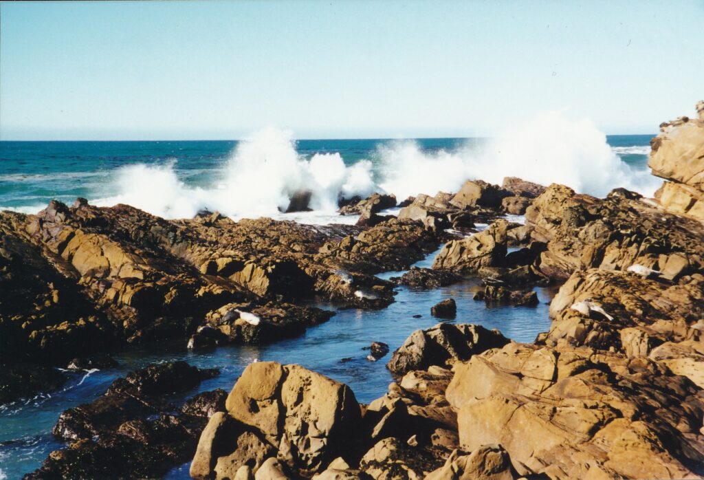
Harbor seals were what made the trail special in Salt Point State Park. A dozen or so were soaking up sunshine while midday, tame waves splashed about the rocks. In trying to get closer for a photograph, I fear I spooked a few of the seals to slip into the water for cover, but after a few moments they recognized my advance had stopped and resumed their lounging.
For those who are wise enough not to stumble about the small cliff-side in search of the perfect 4-by-6 glossy or panoramic shot, the Salt Point trail is flat and undemanding. The seals I encountered were only a few hundred yards from the trail head, but footpaths appeared to continue quite a ways up the coast. There is nothing to keep you from exploring and, perhaps as I did, encountering deer.
To reach the trail, which is less than 5 miles from the Stillwater Cove hike, turn west off Highway 1 into the Grestle Cove Campground entrance and proceed to the main parking lot. Day-use fee is $6 per vehicle, with self-registration possible despite a ranger’s shack near the entrance. If you have visited Fort Ross earlier that day, the fee you paid there covers your time at Salt Point, too. For more information: (707) 847-3221.
As mentioned, Hollywood has made birds part of the Bodega Bay mystique. However, Whale Watch Point in Gualala Point Regional Park is a special place to admire our feathered friends. At this stage in the 2-mile loop trail, a ledge hovers perhaps 30 feet over a broad beach. Immediately to the left on the ledge is a knob of trees from behind which birds suddenly appear, sometimes to hover in the wind, looking down at the shore, close to and maybe unsuspecting of hikers’ presence. Their grace in flight, seen at such close range, is awesome.
Beach access is easy off the Gualala trail. Part of the loop goes south of the park’s boundary, providing opportunities to check out — closely and legally from the public access path — some cliff-side residences. (You may be interested to know that a 2-foot snake slithered across the path the afternoon I visited.)
The regional park’s entrance is just south of town, to the west of Highway l. The day-use parking fee is$3 per vehicle; your Stillwater Cove receipt from the same day waives that charge. For more information: (707) 785-2377.
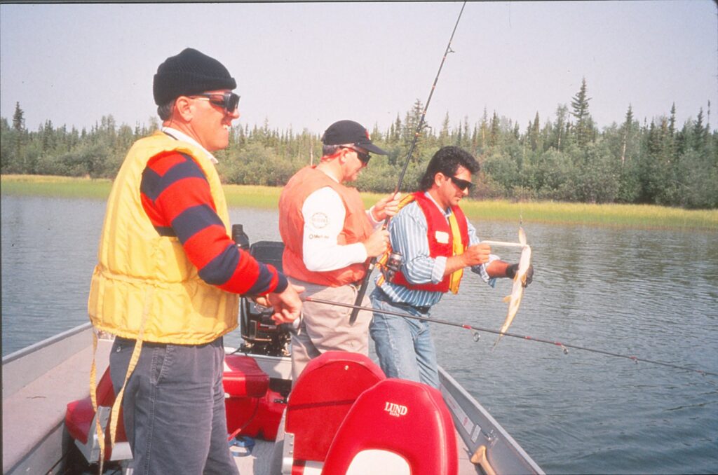
YELLOWKNIFE, Northwest Territories — Bill from Phoenix and Earl from Ottawa briefly were in town to pursue local government approval of a satellite tracking system. To bide time before a meeting that Monday in July, they tracked down a fishing trip.
The middle-age businessmen arranged a five-hour outing along the Ingraham Trail, a 45-mile road that passes several lakes east of Yellowknife. Their guide, Carlos Gonzales, formerly was a maitre d’ and maître flambeur at a luxury hotel, and would prepare for Bill and Earl a gourmet meal in the outback.
As they departed the Yellowknife visitors center, Bill sought quick assurance on the fishing possibilities. “We will catch a lot, won’t we?” he asked Gonzales, who’d managed only two hours’ sleep due to a late tour the night before. “Guys at the hotel were saying they went fishing and kept hauling them in, one after the other.”
Gonzales groggily — but gamely– indicated that success was probable, and that he’d do all he could to help.
“You understand we’re a bit competitive,” Bill said. Earl chuckled.
Prelude Lake didn’t immediately yield any fish, though Bill and Earl remained patient as they tried out lures from Gonzales’ tackle box. At one point, Bill’s line had a green-and-orange, 10-inch contraption with multiple hooks that resembled a fish and made a resounding kerplunk sound upon hitting the water.
Earl, using a modest silver lure, remarked: “Bill, the idea is to try to catch fish, not give them a concussion.”
Soon, both men were catching several northern pike that measured as long as 22 inches. All were returned to the water. Gonzales’ policy is “catch and release,” to ensure a lasting supply.
“I got one!” Earl said as his line tightened. His words barely were completed before the fish escaped, and his line fell limp.
“I got one!” Bill said a moment later.
“Thanks for stealing my fish, Bill.”
“I want to see your name on it, Earl.”
Gonzales, hooking into the jocular spirit, said as he examined the fish: “Let’s see …. (it says) B … I … L … L.”
“Thanks for stirring him up for me, Earl,” Bill said, beaming.
As the men motored about the lake, which is 12 miles long and has at least a half-dozen inlets, they saw various wildlife.
A red-headed grebe dove in and out of the clear water with a minnow in its mouth. A family of bald eagles feasted on a rabbit in their hillside nest, near the top of a tall — by Northwest Territories standards — tree of about 25 feet.
“Bald eagles aren’t the good hunters we’re led to believe,” Gonzales said. “Sometimes, it takes them 15 to 20 tries” to catch their prey.
On one side of a small bay were several paths that beavers had created by dragging wood down to the water. Gonzales pointed toward a beaver dam on the inlet’s other side, and explained that the industrious creatures are savvy enough to transport dam materials to areas still surrounded by trees. Where winter temperatures often plunge below minus 50 degrees Fahrenheit, shelter from the wind can have life-saving benefits.
Meanwhile, Bill’s line had become stuck in submerged weeds.
“Bill, you’ll have to dive in and retrieve that lure,” Earl joked.
Later, Earl developed temporary problems with his casts, and plopped a few near the 20-foot boat.
“What’s the problem, Earl?” Bill asked, preparing to reel in another good-natured gibe.
“Dunno.”
“You might consider taking your finger off the line” when you cast, Bill said. Even the neutral host, Gonzales, couldn’t suppress a laugh.
Lunch was prepared and served on a smooth, lakeside rock that Gonzales said was 2.2 billion years old. The oldest rock found on Earth is 150 miles from Yellowknife — its projected age is 3.98 billion years. The Earth, Earl said, is about 4.6 billion years old.
After expertly making a fire and assembling a picnic table he had hidden near the shore, Gonzales whipped up glazed carrots, barbecued caribou sausage, rolls, tea and, for dessert, peach flambe. He also had brought along a pasta salad and apples.
Bill and Earl said they found it all quite tasty.
Before leaving the lunch site, Bill sat back and remarked how odd it was there weren’t many mosquitoes around to spoil the day. “Maybe Carlos sprayed here early this morning,” he said.
“You were here?” said Gonzales, playing along. “How can you tell?”
“I have a really sharp sense of smell, and can detect a lingering odor of mosquito spray,” Bill said. After a pause, he smiled
and added: “Unless it’s Earl that I smell.”
“Yes, it’s me,” Earl said, feigning a sniff of his armpit.
Gonzales had launched his half-day and daylong excursions less than a month before. He was the Ingraham Trail 1 s only guide.
In addition to fishermen, he catered to bird watchers and other sightseers, in groups no larger than six. He said he hoped to expand his operation in 1995, possibly offering shorter outings on a body of water less than two miles from downtown Yellowknife: Long Lake.
In 1994, Gonzales charged $89 to $225 Canadian for each outing, or roughly $70 to $170 in U.S. currency. For more information, contact Yellowknife Outdoor Adventures, 904 Finlayson Court, Yellowknife, NWT X1A 3A6, Canada; telephone (403) 873-3751.
EUREKA – Many visitors to this neck of the redwoods flock to the so-named national park between here and Crescent City. A most pleasant day can be spent on its fringes, if time allows.
A morning’s exploration of Patrick’s Point, a picnic on the beach at Humboldt Lagoons and a short but spectacular hike in Prairie Creek Redwoods – all three are state parks near Redwood National Park – represent a worthy itinerary. This variety pack of Northern California outdoor pleasures requires comparatively little time in an automobile, as all three state parks are clustered within 50 miles of Eureka.
Patrick’s Point State Park, 25 miles up the coast off Highway 101, has a network of gentle trails that cut through lush forest and shoot off toward the ocean. Rocky Point and Wedding Point are where the Pacific’s vastness and crashing waves can best be enjoyed. Whales go by any time of year other than summer, park officials say.
On a mid-May Friday, for example, a ranger said some whales were seen migrating north. Schoolchildren on a field trip tried to summon the necessary patience to spot them. In the parking lot closest to Wedding Rock, a newly married couple posed for pictures.
If you go, consider skipping the short but strenuous hike up Lookout Rock. Its ocean views are obstructed.
Also, if climbs and descents needed to sample Wedding and Rocky points are off-putting, try Patrick’s Point, accessible by a level path.
For hundreds of years, this area was a seasonal home of the Yurek people. Sumeg Village, built in 1990, pays tribute to these American Indians and is the site of yearly celebrations. A Yurek canoe, exhibited outside the visitors center, also is worth a look. Carved from a tree, it symbolically links its maker with the land: Two footrests represent the boat’s kidneys, a knob near the front is its heart, and lungs are carved in the bow.
The visitors center and ranger’s shack have maps for $1. Camping costs $12 per night or up to two vehicles and seven people, but the 124 sites tend to be booked solid between Memorial Day and Labor Day. Call (800) 444- 7275 for reservations.
For a picnic lunch on the beach, get back on northbound 101 for a few miles to the Dry Lagoon exit for Humboldt Lagoons State Park. The beach’s gray, soft sand extends several hundred feet toward the ocean and perhaps a mile lengthwise. A liberal sprinkling of large driftwood pieces make do as picnic tables. On that weekday in May, six people were there: One couple walked along the water, collecting seashells; another pair sunbathed while their two dogs frolicked; and the third couple sat slumped in beach chairs, each with a cold beverage taken from the cooler by their side.
Humboldt Lagoons has a visitors center, open summers only, a mile or so farther up the 101. A small boat ramp there allows people to cross the Stone Lagoon to Ryan’s Cove, where there are six developed campsites that can be used for $7 apiece per night. Fishing for cutthroat trout is allowed in Big Lagoon, three miles to the south, and in Freshwater Lagoon, three miles to the north.
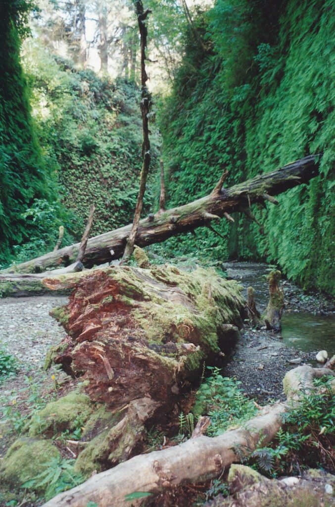
Cap off the day by walking the Fern Canyon Loop Trail in Prairie Creek Redwoods State Park. Driving there is not especially easy – seven-mile Davison Road, heading west from 101, is mostly gravel and a few small streams run through it – but many people make the effort. You are unlikely to be alone here.
From the parking lot, hikers walk down to Home Creek and head up the canyon. On both sides of the creek bed, lush green ferns cover the 50-foot walls. What still is California feels more like an Amazonian jungle. All that is lacking are monkey calls and – a good thing since walking in the creek is inevitable – flesh-eating fish.
The chance to see Roosevelt elk in Prairie Creek Redwoods is a bonus. A few dozen of the big, brown creatures grazed on a large field just off Highway 101 on that May weekday. Nothing but a few yards of grass stood between them and the picture-snapping people who had gotten out of their vehicles for a closer, perhaps somewhat dangerous, look. (I also encountered a lone, medium-horned elk on the loop trail. Neither one of us showed any aggression.)
If you take the short hike, be forewarned that the return portion of the loop is poorly marked. From the creek bed, look to the left for stairs – not just an uphill path, which comes first. At the top of that ascent, turn left at the trail’s one sign and go past another set of stairs, which lead left to the meadow in which I saw the elk, until eventually the path is composed of wooden planks for a while, then rails appear and you go down again to the creek bed.
For more information about Patrick’s Point State Park: (707) 677-3570 or http://calparks.ca.gov/north/ncrd/ppsp.htmI.
For more information about Humboldt Lagoons State Park: (707) 488-2041 or http://calparks.ca.gov/north/ncrd/hlsp.html.
For more information about Prairie Creek Redwoods State Park: (707) 464-6101, Ext. 5301 or http://calparks.ca.gov/north/ncrd/pcrsp.html.
All that glitters is not just the Gold Rush exhibit. Countless other cultural nuggets can be mined from the Oakland Museum of California, which concentrates almost exclusively on the golden state and its art, history and environment.
Until summer, however, the museum has the spotlight trained on its sesquicentennial showpiece about the originala49e rs, their contemporaries and their legacy. If current plans pan out, the exhibit will be displayed in Sacramento in three stages starting June 20. But if you have gold fever now and want to see “Gold Rush! California’s Untold Stories” in one day, make plans to visit the Oakland Museum soon – and set aside an extra hour or two to enjoy the permanent collection.
For visitors who have either forgotten what they learned in elementary school or, like me, never knew, the museum explains a rather basic question that neatly ties in with the whole Gold Rush phenomenon: Why do we call our state California?
The inspiration occurred way back in 1510, more than two and a half centuries before the Spanish began settling here in earnest. Writer Garci-Ordonez de Montalvo’s “Las Sergas de Espladian” was published in Seville. He set his romantic story in “an island called California.” The ”griffins” in the following passage are a type of Spanish vulture, which the museum says suggests the California condor:
“(California) was inhabited by black women without a single man among them, and they lived in the manner of Amazons. In their land there are many griffins. Their urns are of gold, and so is the harness of the wild beasts they tamed to ride, for in the whole island there is no metal but gold.”
The permanent collection is arranged in three levels, the top of which is devoted to California artwork. Among the paintings are two by regional celebrity Wayne Thiebaud, “Delicatessen Counter” (1961) and “Urban Square” (1980). There are several striking works by Maynard Dixon (1875-1946), including “Scab” (1934) and ”The Knower” (1930s). I also enjoyed “View of Stockton” by Alburtus Del Orient Browere (1814-1887), which depicts an 1854 downtown that sharply contrasts with what drivers today see off the freeway.
A large work by Joan Brown, “Model With Manuel’s Sculpture” (1961), provides a taste of the museum’s next major exhibit. From Sept. 26 of this year through Jan. 17, 1999, 126 of her works will be divided between Oakland and the University of California, Berkeley Art Museum. The artist, who died in 1990, gained fame during the Bay Area’s Beat days in the ’50s.
Photographs include the familiar “Migrant Mother” by Dorothea Lange (1895-1965). The black-and-white shot of a weathered, anxious woman and her three young children, taken in Nipomo in 1936, perhaps sums up the Great Depression as well as any one image can. Also on Level 3 is a photographic montage by David Hockney, “Telephone Pole,” in which the well-known artist used dozens of small prints from an instamatic camera to piece together a Los Angeles scene in 1982. Look closely, and you can spot what appear to be tips of Hockney’s moccasins.
Level 2 uses hundreds of photographs to help tell the state’s history. Full-size wagons and a classic ’50s automobile, along with smaller souvenirs, period displays and an elaborate sculpture, are complemented by the museum’s breezy but detailed signs. In the automobile display, for example, you learn:
- The nation’s first gas station was established in 1909 at the corner of Wilshire Boulevard and La Brea Avenue.
- The nation’s first stoplight was erected in the mid-1920s, also in Los Angeles.
- More than 13 million California-registered vehicles are driven 95 billion miles each year on the state’s 179,000 miles of roads.
As at almost any museum, a few of the pieces are a bit dated — unintentionally, that is. One of the period rooms, depicting a modern California home’s interior, contains an archaic VCR and a yellowing game of Trivial Pursuit laid out over a black-leather footrest. And the “Pictorial History of California People, Progress and Politics” ends with a photograph of George Deukmejian, “Governor (1982-).” He left office more than seven years ago.
Throughout Level 2, placards hung from the ceiling feature California-related quotes. Included is this comment, made in 1864 by a visitor from Vermont: “All the Sacramento Valley is good for, in my opinion, is to raise mosquitoes and fever ague.”
Fever ague? That was a new one to me, but the long-dead New Englander’s nasty criticism riled my Sacramento Valley feathers. To quote Jack Kerouac in the nearby Beat era display, “I don’t know. I don’t care. And it doesn’t make much difference.”
Quotes also are hung over Level l’s natural sciences exhibits. “Men argue. Nature acts,” Voltaire tells us. “A hen is only an egg’s way of making another egg,” says Samuel Butler (whose corporal line of thought extended to the title of his classic novel, “The Way of All Flesh”).
Whereas Level 2’s display advances chronologically from the entrance, Level 1 follows a different but equally appropriate progression. Upon entering, you are informed about the sea and coastal characteristics of California. In succession from there, as if you were trekking from a north state beach to Nevada, you encounter descriptions of the coastal mountains, Central Valley, foothills, High Sierra and, heading south, the state’s desert landscapes. Among other things, learn:
- What trees lives up to 5,000 years. (Great Basin bristlecones in the White Mountains.
- What desert animal remains active even when its body temperature reaches 115 degrees Fahrenheit. (The desert iguana.)
- The appearance of a California flying fish, whose fins are used in both swimming and flying. (It’s primarily light blue, and about a foot long.)
Digging for those and other fun facts should convince you that the Oakland Museum of California is a gem — even without the Gold Rush exhibit.
AT A GLANCE
Getting there: From westbound Interstate 80, go south/east on Interstate 580. Then go west on Interstate 980/880 to the Jackson Street exit and follow signs to the museum. The Lake Merritt BART station is one block to the south; the Amtrak station is in Jack London Square, about 10 blocks away.
Museum hours: Through July 26, special hours to accommodate the Gold Rush exhibit are 10 a.m. to 5 p.m. Tuesday through Sunday, with the museum staying open until 9 p.m. on Fridays. After July 26, hours are expected to return to 10 a.m. to 5 p.m. Wednesday through Saturday, and noon to 7 p.m. Sundays.
Admission: Through July 26, adults pay $8; seniors and students $6; and children under 5 are free. Tickets are $3 less for everyone after 3 p.m. Fridays; the first Sunday of each month has a $3 flat free for everyone age 5 and above. After July 26, expect prices to go down $3 from the regular levels.
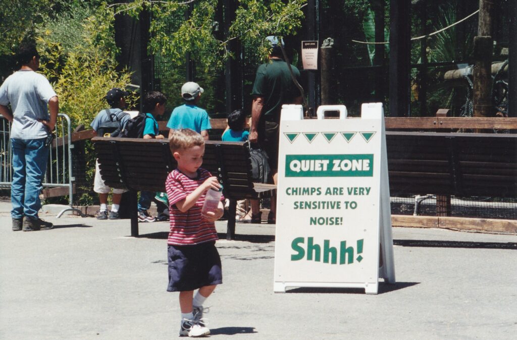
OAKLAND – A prominently placed sign, with big, green letters, declares this a “quiet zone.” The residential primates have little tolerance for noise. “Shhh!”
A chimp-sized boy runs by, oblivious of the sign, screaming, “There’s a monkeeey!” “I see two of them!” a pal chips in at dozens of decibels.
Not far behind is a toddler, so young and undeveloped that he is being pushed around in a stroller. “Monkeeey!” he screeches, showing off perhaps 10 percent of his vocabulary.
The only comparably loud noise comes from nearby blue and yellow macaws. “Sku-whack! Sku-whack!” they roar, perhaps trying to be heard over the juvenile din.
Welcome to a school-year weekday at the Oakland Zoo, where field-tripping children are little kings and queens of the jungle and many animals are difficult to find. The sun is beating down pretty intently this late-May afternoon, and creatures’ comfort is found mainly in the shade, as far from the screaming kids as possible. The only lion seems passed out under a tree, and the sun bear is not living up to his name, wherever he is.
Caged and segregated, animals here deserve what escapism they can manage. What seems less justified is the zoo’s $3 parking charge, though entrance fees are comparable to those at the Sacramento Zoo. The Oakland facility also offers a Sky Ride that, for $2 per person daily during the summer, is overall (and over all} a good deal.
The zoo, easily accessible off the 508 freeway, has areas designated as the African Savanna, African Veldt, African Village, Tropical Rain Forests, Australian Outback and Children’s Zoo. The latter has goats that can be petted or fed. A half-dozen, gentle amusement-park rides are near the main entrance, costing 75 cents to $1.50 apiece. A small train motors about, and the Zoo Meadow invites picnicking.
Zoo eateries offer dishes that feature pigs, cows, chickens and turkeys, creatures otherwise not on display here.
Enclosures have signs that describe their inhabitants, passing along such information as:
- The lappet-faced vulture, Africa’s largest carrion-chomping bird, is “almost as tall as a first-grader” when it “unhunches.”
- A reticulated giraffe ‘s “watermelon-sized heart pumps blood to the brain some 15 to 17 feet above the ground.”
- The “roller” in lilac-breasted roller “comes from the spectacular rolling and noisy acrobatic display that the male performs during the breeding season.”
- Though only 12 to 22 inches long and weighing around 10 pounds, the rock hyrax is a distant relative of the elephant.
- Ninety percent of a Bengal tiger’s hunting expeditions “end in failure.”
More tidbits can be obtained via a zoo key ($3) that triggers audio presentations outside some enclosures.
Strollers can be rented for $4, with $1 of that refunded upon return. The gift shop is impressively well-stocked.
The Oakland Zoo is just east of the 508 freeway, off the Golf Links/98th Avenue exit. Hours are 10 a.m. to 4 p.m. daily. Admission is $6.50 general, $4.50 for those ages 2 through 14, and for those 60 and older. For more information: (51O) 632-9525 or www.oaklandzoo.org.
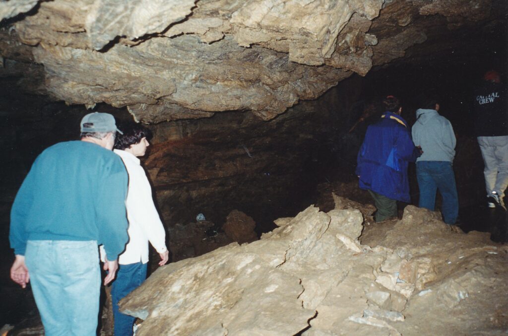
CAVE JUNCTION, Ore. – When you get down to it, the underground attraction at Oregon Caves National Monument compares unfavorably with those in Sierra Nevada foothills caves, such as Moaning Caverns near Vallecito.
Vandalism is one cause, as the caves here in southwestern Oregon were plundered and defaced for decades before President William Howard Taft established the monument in 1909. Then a careless, by hindsight, series of passage widenings and blast-created tunnel ls altered the natural flow of air in the caverns, resulting in freezing temperatures that cracked and broke off precious formations.
Even so, touring the caves here can be an instructional and entertaining experience for tourists already in the area, looking for a pleasant place to spend a day. Oregon Caves’ 480-acre park aboveground has some short trails and, in good weather, offers picnic possibilities.
Stephanie Shepherd led a group of 16 tourists into the caves on a warm day in mid-May. The National Park Service ranger proved to be a knowledgeable and good-humored guide during the 90-minute tour. Her upfront confessions to certain anxieties were refreshing, too.
As in most cave tours anywhere, at one point the lights were turned out so that visitors could experience total darkness. Here, Shepherd re-flicked the switch within a second or two. “I don’t like the dark,” she admitted with a smile.
About midway through the half-mile subterranean excursion, Shepherd paused during her narration, then said, “If it were up to me, this would be the end of the tour. When we get to the next part, you’ll see what I mean. It makes me a little nervous.”
The next part was a gaping hole in the floor, one that appeared to be several dozen feet deep. “I’m scared of heights,” she admitted, this time without as much of a smile.
Speaking of spooky, Shepherd’s group encountered a Townsend’s big-eared bat. This little fellow, however, appeared harmless enough as he was comparable in size to a deck of cards, and clung motionlessly to a wall several feet above the trail. Out of the seven other varieties of bats found in Oregon Caves, Shepherd said, two are listed as endangered.
Bats can enter and exit through any of the caverns’ small openings, which are covered with horizontal steel rungs. Larger mammals, some with destructive impulses, cannot fit through. “We have a real problem with vandalism,” Shepherd said. “People try to break in all the time.”
Indeed, Oregon Caves has comparatively few stalactites, stalagmites and other formations that can make underground tours so much more entertaining. One example of vandals’ work is a list of names scribbled on one rock by a 19th century schoolteacher who was leading a field trip. Though done in pencil, the writing has been sealed by geological chemistry and cannot be removed without sandblasting.
In order to connect the lower and upper caverns, and to widen other passages, dynamite created quite a mess, too. Over the past dozen years, Shepherd said, some 13,000 tons of debris has been carted out of Oregon Caves in 5-gallon buckets.
Earthquakes have left their mark, too, though only in the form of small cracks. “If you’re in a cave near an earthquake, you probably won’t feel a thing. Kind of like a fish in a fishbowl,” said Shepherd, who studied temblors in earning a geology degree. She bemoaned the fact that while here in Oregon, she missed a recent earthquake in her home state of Arkansas.
The caverns’ first entrant of European descent (pardon the pun) was Elijah Davidson, a young man who in 1874 chased his dog – who was chasing a bear – into a large hole in the mountain. Thirty-fiv e years later, Taft authorized federal protection of the site. Much of the blasting work was done in the 1930s.
Visitors today traverse rooms that Shepherd says are 10,000 to 2 million years old. At one point, they will pass a tree root that extends down 55 feet from a Douglas fir. In caverns so lacking in distinctive limestone formations, that root and the possibility of seeing a bat help fill the void.
Oregon Caves National Monument tours, which last 90 minutes, are offered from 9 a.m. to 6:30 p.m. through Labor Day weekend, and until 4 or 5 p.m. from then until Dec. 3. After that, the caves are closed to visitors for three months. Admission is $7.50 general, $5 for those 16 years old and younger (children must be at least 42 inches tall). Temperatures inside the caverns are always in the mid-40s, so bring a sweatshirt or coat.
More-adventuresome, four-hour cave excursions are being introduced on a trial basis this summer; departures are at 10 a.m. Candlelit tours will be given nightly at 7 through Labor Day; tickets are 50 cents more than the daytime tours. Shepherd said the evening excursions’ guides will focus on some the colorful characters who have been in the caves.
For more information: (503) 592-2100 or www.nps.gov/orca/.
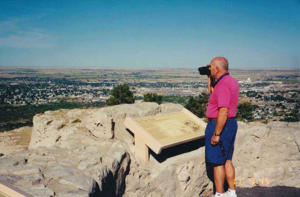
SCOTTSBLUFF, Neb. – Out here where the Y’all Come Motorcycle and Code Valley Pig clubs pick up trash by the highway and yellow-and-red Pioneer stakes indicate what seeds were used in the cornfields, tucked among low rolling hills and highlighted by peaceful Great Plains sunsets, are landmarks of our country’s past.
A century and a half ago, some 400,000 people passed through the North Platte River valley in a quest for better lives out West. Slowed by exhaustion, disease and weather but prodded on by desire, they at this point had completed one-third of the Oregon Trail. Chimney Rock, a 120-foot monolith atop a 225-foot funnel-shaped base, was a heralded sight on the way from Independence, Mo., to Oregon City, Ore.
“The landmarks indicated our progress and helped to break the monotony,” emigrant Phoebe G. Judson wrote near Scottsbluff in 1853. “Like the milestones along the journey of life, there was one less to pass.”
Chimney Rock National Historic Site and Scotts Bluff National Monument, a half-hour’s drive from each other in western Nebraska’s panhandle, give modern-day adventurers an idea what cross-country travel was like in those pre-Civil War days. Along with nearby Fort Laramie National Historic Site in eastern Wyoming, they represent worthwhile tourist stops between the popular destinations of Mount Rushmore, about 200 miles north, and Denver, a similar distance to the south.
Fur trappers and traders such as William Henry Ashley, who rolled the first wagon by Chimney Rock in 1827, were the first white people to see the strikingly shaped product of Great Plains erosion. Its current name, initially was put down on paper in 1830 by fur trader Warren A. Ferris (“… Nose Mountain, or as it is more commonly called, Chimney… “), had some competition in those early days. According to the historic site’s museum, the spire also was likened to Bunker Hill Monument in Boston, the Trinity Church in New York City, a lighthouse, a steamer ship’s smokestack and the then-uncompleted Washington Monument.
Indians called it something else, but 19th century pioneering sensibilities vetoed the nickname “Elk Penis.”
Twenty-three miles west on the Oregon Trail, also off Highway 92, is Scotts Bluff National Monument. The cluster of cliffs and mesas, described by one early traveler as “a Nebraska Gilbraltor,” covers 3,000 acres. The monument is just across the North Platte River from Scottsbluff, which with 14,000 residents is by far the panhandle’s biggest town.
One of the park’s best features is the North Overlook, offering a tremendous view of the river valley and town. The South Overlook, a short stroll away on the same bluff top, gazes across at other protruding mounds of sandstone and clay, down to the visitors center and over to Mitchell Pass, another milestone of the Oregon Trail.
Visitors can reach the overlooks via a road that winds up through three tunnels to a parking lot. From there, paved, comparatively level paths lead to the vista points. Another option is the moderately steep Saddle Rock Trail, which like the road leaves from the visitors center and is 1.6 miles long. A round-trip hike takes about 90 minutes.
Both Scotts Bluff and Chimney Rock are “outlier” formations of the Wildcat Hills to the south. Twenty million years ago, they were level with the plains.
Something about their geological makeup makes them more erosion-resistant, however, and as such they literally are standouts on the landscape.
Also off the visitors center is a short trail that leads to Mitchell Pass’ summit. It features wagon-wheel ruts from the 19th century trail. The ride back then must have been bumpy. just one part of an adventure that emigrant Sarah Sutton wrote about near the site in May 1854:
“It has been windy, cold and rainy. Can’t get enough to make a good fire. Our cattle mixed together makes a good deal of trouble. We hear more noise than if we were in the bustle of town. The men ‘Hoy, Hoy, Hoying,’ and the cattle bawling, and bells rattling. Oh what a time.”
Fort Laramie National Historic Site, 50-some miles to the west in Wyoming, is a collection of renovated and reproduced buildings from a former military outpost. After its purchase by the Army in 1849, Fort Laramie offered some protection for the Oregon Trail’s traffic and, after railroads made that that route obsolete, was a base from which troops were deployed during the Indian wars of the 1860s and ’70s.
Half of the 20 buildings are ruins or in serious disrepair, but the rest are wonderful representations of what they looked like during the fort’s heyday. Especially detailed and impressive are the Cavalry Barracks, with its upstairs rows of cots and soldiers’ possessions, and Old Bedlam. The latter is the oldest standing building documented in Wyoming.
Down by the Laramie River – named after early 19th century trapper-explorer Jacques La Ramee, a French Canadian – are tents and a wagon in what was known as “Soap Suds Row.” Here, according to an audio tour that can be rented from the visitors center for $3, women employed by the Army washed and mended clothes. Often they made more money than privates. They enjoyed another benefit, too.
“If a white girl was ever brought into the post,” the audio tour quotes Elizabeth Burt, wife of an officer stationed at Fort Laramie in the 1880s, “no matter how old or ugly, she soon began to yield to the blandishments of the captivating soldiers, and in a wonderfully short time, entered into the bonds of matrimony.”
Such a dreamy attitude was not shared by all officers’ wives, however. Consider this other offering on the audio tour:
“July 8, 1868. Arrived at Fort Laramie about 8 a.m. I was never so disappointed in any place in my life as this. My heart sank within me when I saw the fort. Dreary beyond description.”
Chimney Rock National Historic Site is 3 1/2 miles southwest of Bayard, Neb., off state Highway 92. Direct access to the rock is limited to a half-mile hike at the end of a short dirt road. The nearby visitors center, operated by the Nebraska State Historical Society, is open from 9 a.m. to 5 p.m. daily, till 6 p.m. in the summer. Admission is $2 general, free for children accompanied by adults. For more information: (308) 568-2581.
Scotts Bluff National Monument charges $5 per private vehicle. The visitors center is open from 8 a.m. to 5 p.m. daily; the summit road closes at 8 p.m. in the summer and at 5 p.m. the rest of the year. For more information: (308) 436-4340 or www.nps.gov/scbl.
Fort Laramie National Historic Site is 3 miles southwest of the town of Fort Laramie off Highway 26. The grounds are open from 8 a.m. to dusk year-round; the visitors center shuts at 7 p.m. in the summer and at 4:30 p.m. other times. Admission to the site is $2 general, free for those 16 and younger. For more information: (307) 837-2221 or www.nps.gov/fola.
GOLD HILL, Ore. — Without being pushed, a soda bottle and golf ball roll uphill. A heavy object dangles motionless by a string from the ceiling, but not straight down. Two people standing within inches of each other change heights when they switch positions.
All that and more strange stuff happens, or at least it appears to, at the Oregon Vortex. This offbeat tourist attraction, also known as the House of Mystery, could serve as a quick side trip for those attending the Shakespeare Festival in Ashland, Ore., 30 miles to the southeast. Here the stage is scientific, or paranormal, or… who can explain?
John Litster tried. The scientist reputedly conducted some 14,000 experiments at the vortex during the 1930s, ’40s and ’50s. He theorized there was some sort of light refraction involved. But he left orders for his wife to bum all his notes when he died, perhaps because they were so inconclusive or — an Oregon Vortex tour guide suggested - “he felt the world wasn’t ready to hear what goes on here.”
Albert Einstein, arguably the century’s greatest thinker, corresponded with Litster and offered a theory: Objects might change in size as they move, but since the devices that measure size would be similarly altered, there is no way to record those changes.
If Litster and Einstein could not confidently explain the Oregon Vortex, don’t expect a journalism major too, either. What follows is merely a summary of what my tour group was told about the site, and a description of what I saw happen — or what I thought I saw happen through my naturally skeptical eyes.
The vortex, in the hills a few miles east of interstate 5, has been measured as a circular area whose diameter is roughly 165 feet (or, as a sign attests, 165.357 feet — implying that the scientific work done here was extremely exacting, and therefore creditable). Tour guide Maria said we could imagine the vortex as an orange, and the surrounding corona (27.5625 feet wide) as the orange peel.
It is within the vortex, and to a lesser extent in the corona, that the phenomena occur. Indians reportedly were aware of the site’s strange properties long before scientists and tourists began their examinations. Horses, it is said, would not tread in the area, which was called “the forbidden ground.” (Which is a good anecdote and catchy phrase to lure tourists, no?)
Outside the gift shop, where visitors assemble to await the tour guide, is a bulletin board that features pages from “Paradox: A Round Trip Through the Bermuda Triangle.”
Author Nicholas R. Turner discusses vortices at the North Pole, the Bermuda Triangle and, at some length, here.
The Oregon Vortex, he wrote, separates “one reality from another. Animals refuse to enter this strange, small area, and its magnetic effects extend thousands of feet above, giving fits to aircraft instruments.11 (Think twice before booking a flight to Gold Hill.)
After a quick lecture that suggested 15 warped magnetic lines, or “earth lines,” also might explain the vortex, Maria began having the 15 or 20 of us conduct a series of experiments. Throughout the half-hour tour, she encouraged people to take photographs, “because your pictures will show what is going on here.” They are the only proof, she said again and again.
First, she had people stand on any of three small, concrete circles. The tour members were told to relax and close their eyes. She said they would feel themselves being pulled backward. Sure enough. People started leaning: and had to catch themselves before toppling over. (Maria had demonstrated this first — the power of suggestion?)
Next, she grabbed two L-shaped copper wires, holding one in each hand by the small part of the L so that the longer part pointed in front of her. She walked slowly from the corona to the vortex. Suddenly, the wires started spinning. Then the tour group members tried.
Wires spinned. “Don’t let them hit your face!” Maria warned. (I tried, but nothing happened; Maria said the more sensitive the person, the greater the wires’ movement. Ahem.)
After an experiment in which people appeared to change heights as they switched positions, this one involving two facing, wooden posts with foot-and-inch markings and a pole that was rested atop the participants’ heads, perpendicular to the posts, we advanced to the Mystery House. This run-down wooden shack, which before its foundation was damaged in 1907 was a mine’s assay and toolshed, now rests at a slant.
Outside the shack, Maria asked us to look inside, through the glassless window, and guess how much higher the opposite end was. Estimates ranged from 10 inches to 4 feet. Maria pointed to a piece of paper nailed above the window and said the opposite side is as high as the paper, a difference of 10 feet. Heads shook in amazement. We stepped inside.
To much laughter, we regarded each others’ tilting poses. Compared with the floor and ceiling, we leaned comically. Maria stepped on a level platform — she tested it with a carpenter’s leveling guide, with a bubble in the middle, as she did at other stations along the tour — and slowly looked down at her toes. She turned around, and again slowly looked down at her toes. This second time, though, she had to lean farther. Other people tried, with similar results (me, too, I must admit).
It was in the house, on surfaces that certainly seemed would cause the bottle and ball to roll one way, that in fact they rolled the other. Outside the shack again, we conducted two more tests in which people appeared to change heights as they switched places. Many photographs were taken, heads still shook in amazement, and I took more notes.
“What are you writing down, sir?’ the tour guide had said to me before. “My name’s Maria — make sure you get that down right.” Subsequently, on a disproportionate number of occasions, she summoned me to serve as an experiment’s “volunteer.” I believe I irritated her. She saw me as a doubting Thomas, despite all the visual evidence she had showered us with.
In this mysterious, “forbidden ground” of inexplicable occurrences, perhaps Maria judged that I, too, was not on the level.
The Oregon Vortex is open from 9 a.m. to 6 p.m. in June, July and August, and from 9 a.m. to 5 p.m. the rest of the year. The last tour is given approximately 45 minutes before closing time. Admission is $7 general, $6 for those age 65 and older, and $4.50 for those ages 5 to 11. For more information: call (541) 855-1543, access Web site www.oregonvortex.com or e-mail mystery@oregonvortex.com.
Directions: From northbound Interstate 5, take Exit 40, Highway 234. Proceed north through Gold Hill to Sardine Creek Road and turn right. The Oregon Vortex is about 4 miles from Highway 234.
AJO, Ariz. – Of North America’s four desert regions, the Sonoran is the warmest and claims the greatest variety of plants and animals. The most pristine part of the Sonoran, according to at least one source, is Organ Pipe Cactus National Monument.
The 7,500-square-mile park rests atop the Mexican border in Arizona, about 150 miles southwest of Phoenix. Its visitors center, where a slide show makes the “most pristine” claim, is the starting point for two driving tours and the place to load up on water. Where daytime temperatures can top 120 degrees in the air and approach 175 degrees at ground level, water bottles cannot be neglected.
Both tours take visitors past gently sloping hillsides teaming with saguaros, chollas, creosote bushes and the national monument’s star attraction, organ pipe cacti. Whereas the saguaro, practically omnipresent in Arizona, typically grows straight up from one thick truck and has a few upward-reaching “arms,” an organ pipe cactus has a curving cluster of branches at its base. These shoot out a bit, then up, striking whoever named them to think of the grand pipes above church organs. Perhaps he or she was not familiar with octopuses, whose forms are suggested by the cactus, too.
Of the two tours, Ajo Mountain Drive is shorter (21 miles) than the temporarily closed Puerto Blanco (53 miles), and park rangers routinely recommend taking it if visitors have time for only one tour. Mostly unpaved, it takes a couple of hours to negotiate and can accommodate any vehicles smaller than motor homes. A self-guided-tour pamphlet, which can be purchased in the visitor center for 75 cents, describes 22 stops along the way and greatly enhances the experience.
For example, the third stop is at a large saguaro, where visitors can learn many things about the stately cactus. Its flowers bloom in May and June, its fruit maturing a month later. Many animals dine on the fruit’s red pulp and its tiny black seeds. The Tohono O’odham people grind its seeds into a buttery substance that is considered a delicacy. Saguaros stay generous past their fruit-bearing prime: Their decaying, hole-dotted trunks provide shelter for birds, and their “skeletal ribs” once constituted building materials for American Indians.
Next is a description of the creosote bush, another giving plant that is also abundant in the Chihuahuan (southern bits of Arizona, New Mexico and Texas, plus much of northern Mexico) and Mojave (the Death Valley area of California and Nevada) deserts. (North America’s fourth desert region is Great Basin, encompassing most of Nevada and large chunks of Oregon, Idaho and Utah.) Indians long have boiled creosote leaves to make tea, and used the bush’s chemicals to combat colds, intestinal disorders and venereal diseases, among other ailments. Indian women “would lie in heated branches to ease the soreness of childbirth,” one trail sign reports.
Certainly, each desert plant is exploitable to some extent. Organ pipes are no exception. Their pithaya fruit, like a saguaro’s, mature in July, have red pulp and small seeds. Tohono O’odham people have eaten the fruit raw or dried, and have made syrup, jams and a mild wine from it. Seeds can provide flour and cooking oil.
Organ pipes are very sensitive to cold, which explains why they grow mainly in extreme southern Arizona and more extensively in Mexico. Their branches’ contractions, or rings, indicate episodes of cold-related stress. Flowers open up at nighttime in June and July. Lesser long-nosed bats drink their nectar, in the process being sprinkled by pollen dust, which the bats then transport to other cacti for fertilization. The bats, whose numbers sadly are decreasing, are part of a national monument community that includes more than 50 species of mammals and 40-plus types of reptiles.
Visitors who are moderately fit and have the time and inclination to vacate their automobiles for an hour or two might enjoy the 4.1-mile Estes Canyon and Bull Pasture trail that stems off from the driving tour’s halfway point. The 800-foot elevation gain culminates at a point where ranchers once surveyed their cattle. When I took the hike in March, I encountered a snake in one of the bushes, so tread alertly.
Near the driving tour’s end is another good excuse to leave the car: a short trail that passes many cholla cacti. Nearby Teddybear Pass is an eye-catching collection of the yellow, fuzzy, low-growing teddybear cholla cacti.
The monument’s other driving tour, Puerto Blanco Drive, is closed for construction through at least October. It heads west from the visitor center, passes by a few abandoned mines and gives hikers access to a few others, and skirts the Mexican border for a long stretch.
Rangers report that some 200,000 undocumented migrants passed through Organ Pipe in 2001, and an information sheet handed to all park visitors says, “Opportunistic crimes can occur in remote areas of the monument, especially those near our 30 miles of international border. … Potential crimes include vehicle or property theft, and reckless driving as vehicles involved in illegal activity flee back to Mexico.”
Though such warnings are not likely to scare off seasoned tourists, the monument’s relative remoteness might. If the thought of driving at least three hours, one-way, from Phoenix to the visitors center only to face one or two driving tours on unpaved roads is too much, you might consider instead remaining in Phoenix. That sprawling city boasts, among many other things, a splendid spot to see organ pipe cacti and hundreds of other desert plants: the Desert Botanical Garden, a few miles east of downtown and near the zoo and Municipal Stadium, where the Oakland Athletics conduct spring training every March. For more information about the garden: (480) 941-1225 or www.dbg.org.
If you do trek down to Organ Pipe, the monument has a year-round, first-come-first-served campground near the visitor center. North of the park about 35 miles up Highway 85 is the town of Ajo, which has several pleasant motels, including the oddly named Marine Motel (1966 N. 2nd Ave., Ajo, AZ 85321; 520-387-7626).
The entry fee for Organ Pipe Cactus National Monument is $5 per vehicle. The visitors center is open from 8 a.m. to 5 p.m. daily (closed Christmas). For more information: (520) 387-6849 or www.nps.gov/orpi.

SAN FRANCISCO – Bench strength is a key ingredient for any successful big-league team. On a recent sunny Saturday with the Padres in town, the Giants’ dugout at Pacific Bell Park contained a scattered and rather sorry collection of graybeards, baby faces and soft bodies. No one had a glove, no one wore spikes. A few played with cameras. Many were women, and frankly, they looked more fit than the men.
Fortunately for professional baseball’s integrity, San Francisco was playing a night game. By then Barry Bonds and the rest of the first-place team, led by manager Felipe Alou (a graybeard, admittedly, but a baseball-savvy one), had taken over the dugout. The scraggly bunch that had been there earlier was long gone. Or if any people from the 10:30 a.m. ballpark tour were there that night, they were among the 42,521 fans who saw San Diego end the Giants’ nine-game winning streak in a 2-1 squeaker.
The tour, however, was a triumph. Steven Yung, who like the Giants came here from New York, escorted the 25 or so visitors throughout the stadium, at Third and King streets, south of Market Street in the China Basin district. A wonderful guide, what with his booming voice and Baseball Encyclopedia-like command of facts and statistics, Yung made the tour an interesting and surprisingly intimate experience. His group not only sat in the dugouts, but also hung out in a luxury suite, cruised through the press box and even got to see the visiting players’ batting cages, behind their dugout and deep inside the stadium’s bowels.
Yung shared an amusing insight about those inside cages, one that suggests why “home-field advantage” can have some sinister depth to it. Whatever happens in the cages can be seen through four large windows by premium-seat ticketholders and, presumably, Giants personnel. What does that matter, you ask?
Well, let’s say that during a crucial part of that night’s game the Padres planned to bring in a pinch hitter. He likely would warm up in the batting cages. Such a sighting by a Giants aide could be relayed to Alou, who then could plot a countermove. Although the Giants also have an indoor batting cage, its windows can be covered by curtains, Yung said with an implied wink. Advantage: Giants.
(A follower though not a fan of the franchise, I recall how the 1951 New York Giants were accused of stealing signs to help Bobby Thomson hit his “shot heard round the world,” a dramatic pennant-winning homer. And of how John McGraw, the Giants’ most-famous manager, notoriously cheated as a player in the 1890s. And of Hall of Fame pitcher Gaylord Perry, a longtime Giant who threw an emphatically illegal “spitball.” All that and still no world championship for nearly 50 years!)
Tours, offered almost daily, recently were expanded with a seven-minute introductory video. In it, broadcaster Mike Krukow says that any baseball fan who has been to Wrigley Field (Chicago), Yankee Stadium (New York) or Fenway Park (Boston) – the sport’s classic venues – should also see a game at Pac Bell. “It’s magic,” Krukow says. Indeed, broadcasters and writers throughout the country tend to cite Pac Bell as one of their favorites.
The video also shows footage from stadium construction, which began in late 1997, and of the first regular-season game three and a third years and $350 million later, on April 11, 2000. Last year’s thrilling end to the National League Championship Series, with Pac Bell erupting upon David Bell (no relation) scoring the decisive run against St. Louis, is replayed. The subsequent World Series loss is not mentioned, however. Rather, Tony Bennett sings “I Left My Heart in San Francisco” while more feel-good footage is shown. No surprise there.
Yung then led his group to Section 328 on Pac Bell’s fifth and highest level. On that day San Francisco Bay disappeared into a low white mist, making Oakland invisible. Upper-deck seats behind the backstop were being power-washed. (How else to clean up after a barrage of bobbled beers, dripping ’dogs and pulverized peanut shells?) A lone mini-tractor mowed the green outfield expanse. Home plate was no more than a teensy white dot.
“Some people call this the nosebleed section,” Yung said, reasonably. A little less credibly, he added: “Now I’ve been to other big-league parks, and believe me, this isn’t nosebleed.”
He pointed out the 80-foot Coca-Cola bottle sculpture (which hides four adult-compatible slides) in the left-field stands. The huge baseball glove next to it is of the “three-fingered” style used by players in the 1930s. Pointing toward right field, Yung said the foul corner there is 309 feet from home plate, less than the major-league minimum but nevertheless permitted due to its 25-foot-high brick wall. That corner actually was where ballpark planners first envisioned home plate. Rather than seeing the bay, fans would have looked out toward downtown and the Golden Gate Bridge. A wind study changed things.
The way Pac Bell is built now, Yung said, “it acts as a wind block. … When you sit up here or down in those seats, you hardly feel the wind at all.” Sitting in the center- or left-field bleachers is another, though untold on the tour, story. Out there, you’ll be reminded of the Giants’ previous home, blustery Candlestick Park.
A stop or two later Yung’s tour group reassembled in luxury suite No. 62, the only one of Pac Bell’s 67 suites that has not been sold. Rather, it is rented on a per-game basis for up to 30 people and costs something like $4,000. The interior lounge has comfortable furniture, carpeting, a sink and a TV on which people can watch the game “or whatever they want,” Yung said. In front outdoors are stadium seats that, the tour guide said, at 21 inches are a sometimes-meaningful 3 inches wider than the stadium norm. Speaking of the need for larger seats, food and beverages are not included in the luxury-suite rental. You can’t bring your own, either; catering for 30 people costs $1,200 to $1,400.
From there Yung led us through the press box’s top level, by the door for KNBR (AM 680, the Giants’ flagship radio station) broadcasters, and down via an elevator to the lower level. There, Yung explained, toil the “print media. You know, newspapers and magazines.” A few people yawned.
The tour concluded with a stop by both dugouts, immediately preceded by Yung bellowing out two rules: Don’t step on the grass (the groundskeepers are quite finicky about such things) and don’t play with the dugouts’ telephones. What would you say, anyway? “Get Worrell up in the pen … and what’s happening in the Padres batting cage?”
A better call is to take the Pacific Bell Park tours, which are offered at 10:30 a.m. and 12:30 p.m. daily from March 1 through September, except when day games or other events prevent them; call (415) 972-2400 for updated schedules. Tours also are offered in the off-season, twice Mondays-Thursdays and three times Fridays-Sundays. Tickets are $10 general, $8 for AAA members and seniors ages 55 and older, and $5 for children ages 12 and younger. They can be purchased online through the Giants Web site, accessed through www.majorleaguebaseball.com; through Tickets.com; or at any Giants Dugout Store.
Game tickets, by the way, range from $10 to $70. Tours are a bargain by comparison and allow access to many areas of the ballpark not open to the masses during games.
PALM SPRINGS – Other than drinks, the coolest attraction in this desert resort town is its aerial tramway, which carries visitors nearly 6,000 feet up Mount San Jacinto and about 30 degrees down the Fahrenheit scale.
Such a transition in temperatures can be especially refreshing in June, July and August, when the average highs in Palm Springs are, respectively, 104, 108 and 107 degrees. Getting a mile or so closer to the sun is not such a bad idea, eh?
The Palm Springs Aerial Tramway has lifted more than 11 million people up and down the mountain since its September 1963 opening. Four and a half years ago, the installation of two Rotair cars put a new spin on the ride.
Two cars, which are attached to a cable that has them passing at the ride’s halfway point, have interior, rotating passenger decks. During the 10-minute ride up or down San Jacinto, the decks go around twice, allowing visitors to see the Coachella Valley below, the tramway station above and anything in between without their having to move. This feature is a major improvement over the “old days,” as I can attest from also having ridden the lower-tech tram a few times in the early 1990s.
(Rotair cars are used in only two other places, tramway literature says: on Mount Titlis in Engelberg, Switzerland, and on Table Mountain in Cape Town, South Africa.)
The 2.5-mile one-way trip passes five steel towers, the tallest of which is 228 feet, and through “five unique life zones,” with the Sonoran Desert below and the arctic/alpine climate above. The journey is smooth, though looking down at the jagged rocks far below can give stomachs a jolt.
In addition to its cooler air, the top greets visitors with a can’t-miss observation deck on the top floor, a gift shop, bar and two restaurants, one of which is a cafeteria whose entrees run from $5 to $10. It’s open from noon to 3 p.m. for lunch and from 4 to 7:30 p.m. for dinner. A small museum and video theater also are within the three-story “mountain station.” Behind the structure are self-guided nature trails and several longer hiking paths, totaling 54 miles as part of San Jacinto State Park and Wilderness Area.
Animal appreciators might spot hawks, great horned owls, western grey squirrels, kit foxes, raccoons, weasels, deer or mountain lions. Plant pupils will be able to identify big-cone pines, Jeffrey pines and white firs.
Hollywood has tapped into the tramway’s beautiful scenery in TV shows such as “Columbo,” “General Hospital” and “The Six Million Dollar Man” and in movies that include “Dressed To Kill” and “Fugitive Nights.” Many centuries before, the canyon at what’s now the tramway entrance contained the Cahuilla village of Mala. Cahuillan woman excelled in making baskets from grass and tree roots, and as recently as the 1920s used earthen jugs to haul water from sources that now are tapped by Palm Springs and other nearby desert towns.
The Palm Springs Aerial Tramway, a few miles west of downtown off Palm Canyon Drive at the end of Tramway Road, costs $21 general, $19 for ages 60-plus and $14 for ages 3 through 12; tickets can be purchased onsite or, for a $5-per-order shipping fee, online at www.pstramway.com. Trams leave about every half-hour starting at 8 a.m. weekends and 10 a.m. weekdays; the last car down is at 9:45 p.m. daily. For more information: (888) 515-TRAM (888-515-8726).
Sidebar:
Other Palm Springs attractions include:
- The Palm Springs Desert Museum, 101 Museum Drive. Artworks and science exhibits, with dance, drama and music performances in a 440-capacity theater. General admission is $7.50 general. For more information: (760) 325-7186 or www.psmuseum.org.
- The Palm Springs Air Museum, 745 N. Gene Autry Trail. World War II planes are displayed along with descriptions of various WWII air campaigns. Admission is $10 general. For more information: (760) 778-6262. or www.air-museum.org.
A good place to stay is the Motel 6 two miles east of downtown at 595 E. Palm Canyon Drive. Expansive grounds, huge pool, bargain rates – and dogs are welcome. For more information: (760) 325-6129 or www.motel6.com.
A great place to eat, especially for vegetarians, is Native Foods, 1775 E. Palm Canyon Drive. The all-vegan menu includes decadent chili cheese fries and The Mama Mia, a pizza without peer. For more information: (760) 416-0070 or www.nativefoods.com.

PALM SPRINGS, Calif. — Walking into almost any museum is like stepping back in time, but in this famous desert town there is a facility that transports you to the past in an especially vivid, three-dimensional way.
Palm Springs Air Museum takes the “living history” concept for quite a ride. Visitors can circle around more than two dozen shiny, ready-to-fly aircraft from World War II that are displayed over 70,000 square feet inside three hangars. A squadron or two of elderly docents, many of them veterans, are ready to take your questions or show you aro und.
Speakers play 1940s music nonstop. Scattered among the aircraft are several automobiles from the 1920s and 1930s, including a 1930 Packard and one of only 51 Tuckers ever built, that the museum’s website says “set the scene on the road to World War II.”
Being organized is one of the cornerstones of effective military operations, and the Palm Springs Air Museum (which celebrates its 10th anniversary on Nov. 11) honors that concept by being exceptionally tidy. As you enter the front lobby and pass the Battle of Midway mural, you can imagine an unusually low-key drill sergeant telling you what to do. Left face, forward march into the Pacific Hangar. Right face, forward march into the European and B-17 hangars. At ease and watch “Mission Berlin,” “PT Boats,” “Nazi POWs in America” or one of the other films that are screened starting at 11 a.m. in the Buddy Rogers Theater.
With shoes scuffed, pants wrinkled and collar nonexistent, l was 100 percent civilian when I visited the museum this summer. For me, the most interesting aspect of the experience was being able to get a close-up look at the aircraft.
One of the most impressive was in the Pacific Hangar, which concentrates on the Allies’ fight against Japan that ended with the atomic bombings of Hiroshima and Nagasaki in August 1945. All shiny and mostly blue, with a white underbelly and folded wings, the museum’s F6F- 5 “Hellcat” stands 13 feet tall, weighs 7 tons, has six 50-caliber machine guns capable of firing 400 rounds apiece and can fly nearly 1,000 miles at speeds up to 380 mph.
“Hellcats, once they came into the war (in August 1943), were in every naval air engagement until the end of the war,” an accompanying plaque says. “The F6F was possibly the single most effective aircraft in its class in the war in the Pacific Theatre.” In one battle, popularly referred to as the “Marianas Turkey Shoot,” the Hellcats led the way in downing 366 Japanese planes while losing just 26 of their own.
The hangar’s other exhibits include one that details the Battle of Leyte Gulf, a three day affair in October 1944 called “the largest naval battle ever fought. … When it was over, the Japanese fleet had been reduced to almost complete ineffectiveness. Gen. Douglas MacArthur, a mid-20th century U.S. military and political icon, stars in another exhibit that includes original newspaper front pages that reported on his exploits.
Over in the European Hangar, visitors can — for a supplemental charge — tour the insides of a B-17 bomber. With a glass oval nose ringed by yellow metal, the plane’s front section includes a provocative drawing of “Miss Angela,” clad in a red one-piece swimsuit and windblown, curly blond hair. B-17s were a key player in the war, when 16 of them a day were completed at Seattle’s Boeing facility. The “Flying Fortresses” (so named by a Seattle Daily Times columnist) made nearly 300,000 sorties during the Second World and Korean wars, including a 1,000-bomber raid on Berlin– accompanied by 400 fighter planes — in February 1945.
The museum’s Web site, www.air-museum.org, contains a wealth of information not just about the facility but about the men and women who fought the war. Click on “Tuskegee Airmen” and learn about the 992 African American aviators who flew some 15,000 sorties in the European Theater and completed more than 1,500 missions. They represented the only escort fighter planes not to have lost a bomber to enemy fire. Sixty-six of the airmen were killed in action; 32 were shot down and taken as prisoners of war. (A colorful, upbeat, 60-foot-long mural by Stan Stokes pays tribute to the Tuskegee flyers in the museum’s European Hangar.)
For first-person reports of heroic, observational and mundane incidents during the fighting, click on “War Stories.” Among the dozens of entries is this one by Bill Masters, under the subheading “C-46 Over the Hump.”
“All in an instant I saw the tail of the ship go by my head, felt the cool air on my face and pulled the ripcord. The news thing I remember was the stillness — after a few minutes of confusion in the airplane, there I was suspended in the night sky somewhere between India and China, clapping my hands together to keep them warm and humming to myself.”
The Palm Springs Air Museum, a few miles northeast of downtown at 745 N. Gene Autry Trail, is open from 10 a.m. to 5 p.m. daily. Admission is $10 general, $8.50 for seniors and students ages 13 through 17, and $5 for ages 6 through 12. For more information: (760) 778-6262 or www.air-museum.org.
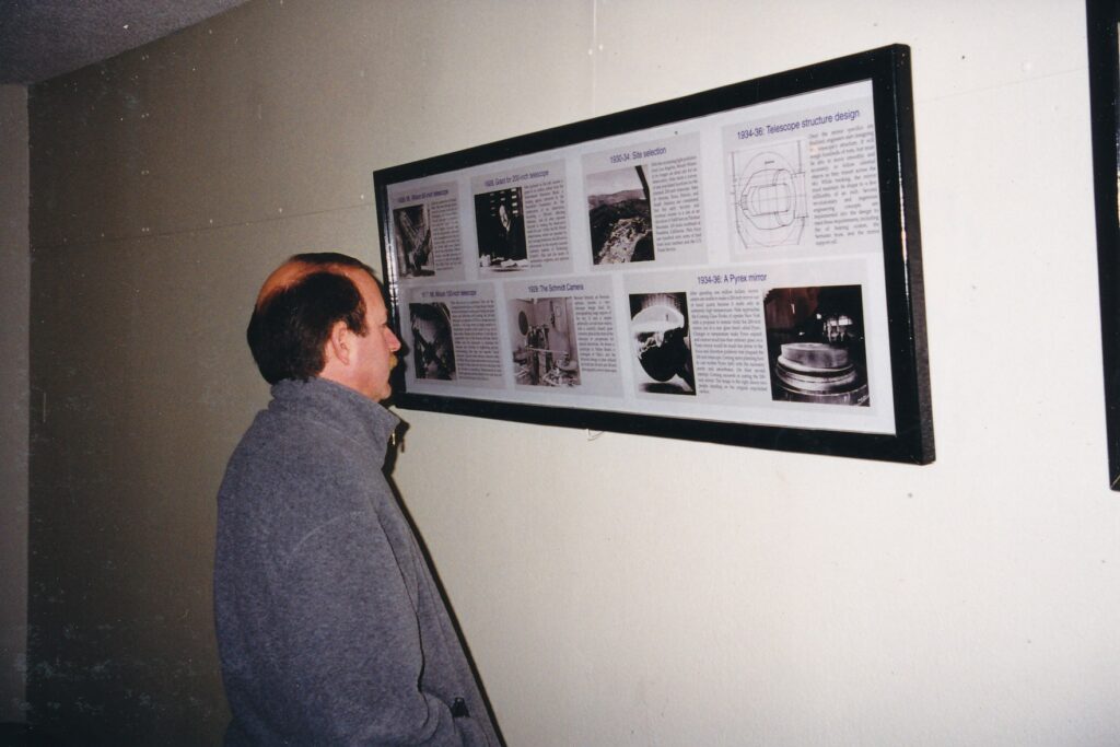
PALOMAR OBSERVATORY — Admission is free at this important scientific site, and visitors pretty much get what they pay for.
Having seen the smaller Lick Observatory near San Jose last year, I should have known better than to expect excitement here high in the hills between Los Angeles and San Diego. If anything, Lick was more rewarding in that a staff member was around to give brief tours. At Palomar, only yellowing signs recount the observatory’s history, and the museum has shut down because its celestial photographs were taken before Sputnik, seemingly.
“The fact that the museum is out of date conveys the false fact that Palomar is out of date,” the facility’s assistant director, Robert Brucato, told the region’s Valley Roadrunner newspaper last fall. “It has stayed a first-class research facility. The museum sends the wrong message, that it’s an antique. For that reason alone it needs to be updated.” No reopening date has been set.
Palomar and its 200-inch Hale Telescope may indeed remain “first class” among astronomers, but tourists are unlikely to moon over the old signs, a comically unimpressive scale model of the big lens or the darkened chamber in which the telescope appears — from the glassed-in viewing area — to be little more than a motionless shadow. A small gift shop sells slides of Saturn, but countless Southern California attractions run circles around this place.
What Palomar does best, arguably the only thing of any interest it does at all, is stargaze, which is a purely nighttime activity. The public is admitted only mornings and afternoons. Anyone’s genuine enthusiasm for the moon, the planets and the stars does not translate well here during the daytime hours. When I visited on Super Bowl Sunday, the observatory’s massive dome was all but invisible due to a heavy cloud bank and mist.
Perhaps on a sunny day, of which Southern California certainly has its share, a visit would be more satisfying. The white dome would contrast nicely with a bright blue sky. Coming over from and back to Interstate 15 some 40 minutes away, drivers pass by pretty orange and avocado orchards and can pause to enjoy hilltop views. Picnic tables are clustered near Palomar’s parking lot, but l cannot say how attractive such a setting would be for lunch because pea-soup air made any scouting implausible.
Palomar Observatory was born thanks to a $6 million grant, in 1928, from the Rockefeller Foundation. George Ellery Hale, who two decades earlier supervised construction of the then-progressive 60-inch telescope atop Los Angeles’ Mount Wilson, asked Corning Glass Works of upstate New York to manufacture a 200-inch Pyrex lens for Palomar. ln 1936, the unpolished, 20-ton “mirror blank” was transported to Pasadena on a special, 14-day train ride that due to the cargo’s fragility never exceeded 25 miles per hour.
Construction of the 135-foot-tall, 137-foot-diameter dome and the lens’s polishing were stalled by World War II, and it was not until 1949 that the 200-inch telescope became wholly operational. Edwin Hubble, who has had the posthumous dishonor of his name being associated with a beleaguered satellite, took the Hale Telescope’s first photographic image.
Today, high-tech sensors and juiced-up computers help make the Hale Telescope much more capable of observing and detecting celestial objects than it was a half-century ago. Astronomers from the California Institute of Technology, Jet Propulsion Laboratory and Cornell University share the 200-inch window to the stars.
By the way, “palomar” in local La Jolla dialect means “pigeon haven,” and in closely related Spanish means “pigeon house” — fitting for a place that really doesn’t fly as a tourist attraction.
Palomar Observatory is about a three hours’ drive from Los Angeles and two hours from San Diego. Its elevation is 5,202 feet, so in wintertime consider bringing a coat. Grounds and the Hale Telescope’s viewing area are accessible from 9 a.m. to 4 p.m. daily except for Dec. 24 and 25. The gift shop is open daily from July 1 to Aug. 31, weekends only the rest of the year. For more information: (760) 742-2119 or http://astro.caltech .edu/observato ies/palomar/public.

What took 225 million years to create and is being destroyed by humans at the breakneck pace of a couple hundred years?
The planet’s oil supply, you say? Certainly that’s a good guess, and probably a correct one. However, what I had in mind are the wonders left to be taken in at – not taken from — Petrified Forest National Park, about 110 miles east of Flagstaff in northern Arizona. Billed as having the world’s largest collection of exposed fossil trees, the park is pillaged at the estimated rate of one ton of petrified wood per month. Some of the thieves can’t live with the guilt, or parents discover their children’s “souvenirs” and order confessions: The park’s received mail includes many letters of apology and packages of returned rocks.
Despite that depressing crime report, visiting the park is a pleasure thanks to the petrified samples that do remain and to some awesome vistas. A 28-mile road that runs between Interstate 40 to the north and Highway 180 to the south passes by all the featured attractions. Most of the petrified wood is in the park’s southern section, which in my opinion makes it the place to start — especially if you drive there from Flagstaff. (Albuquerque is about 200 miles east of the park.)
Behind the Rainbow Forest Museum, two miles past the southern entrance station, visitors walk out the back door and are treated to a jolting sight: Tree stumps and fallen trees scattered everywhere, all of them very thick, most with brown exteriors that look exactly like bark, many with exposed insides that are improbably colorful One tree, the park’s largest, somehow managed to retain much of its roots system, which flares out from the bottom like a blooming dark flower.
The man who turned to me and remarked, “What a waste of good wood!” was mistaken. The wood’s been gone for a couple hundred million years. What’s left, and what gives the petrified trees their hardness and bright interiors, are silica and minerals that slowly replaced the wood after fallen trees became covered with silt, sand and volcanic ash. Sometimes buried hundreds of feet underground, the compacted, petrified trees eventually were pushed back up to the surface as the earth shifted, movement that caused some of them to break into several pieces. That’s why several trees behind the museum, on the 0.4-mile Giants Log Trail, look as though they have been attacked by chainsaws.
Children might be more interested in the museum’s dinosaur exhibits. On the day I visited, kids cooed over an old diorama that shows two phytosaurs engaged in a bloody battle. Phytosaurs, crocodile-like reptiles that were as long as 40 feet, are the most common fossil animal found in the park. Metoposaurs (giant amphibians), aetosaurs (10- to 15-foot-long plant-eating lizards), rauisuchians (vicious late Triassic-era predators) and therapsids (prehistoric rhinoceroses) also once called the region home.
Six miles north of the museum, Crystal Forest gives visitors another great excuse to stretch their legs over a short trail (this one’s 0.8 miles long) that allows many close-up views of petrified beauties. They are scattered liberally about several small, generally light-colored sandstone hills. A few miles farther up the road, Jasper Forest once was jam-packed with petrified food, but it was ransacked in the late 19th and early 20th centuries thanks in part to the establishment of a nearby cross-country rail line in 1882.
Although the area was declared a national monument by President Theodore Roosevelt in 1906, no rangers patrolled it for another 15 years. Jasper Forest continued to be raided; sometimes, collectors used dynamite to break up the unwieldy logs. A trail sign quotes a woman’s diary describing a scavenging trip there in 1917: “Oh such a time as we did have deciding which part of the forest to leave and which part to pack out.”
Fortunately, no one made off with the nearby Agate Bridge, a 100-foot-long petrified log that spans a 40-foot-wide dry creek bed. In 1917, rangers reinforced the tree by installing a supporting concrete bridge underneath it. Such aggressive (and, frankly, unsightly) preservation is a practice of the past; if discovered today, Agate Bridge would be allowed to crack and tumble at its own pace.
Continuing north, park tourists encounter Blue Mesa, whose one-mile loop trail has a steep section that will get the blood pumping; the Tepees, a modest collection of cone shaped hills with layers in subtle blues, purples and grays; and Puerco Pueblo, ruins of a 100-room complex inhabited by American Indians from, roughly, 1100 to 1380. Also in that mix of central-park attractions is Newspaper Rock, where I encountered a commotion of a dozen or so people who used binoculars (two provided by the park on pedestals, the others wisely brought by the visitors) to examine the 600-some images carved 650 to 2,000 years ago on the rocks below — images that might have represented “the news of the day,” hence the site’s modem nickname. Both it and the pueblo are listed on the National Register of Historic Places.
Across the Burlington Northern Santa Fe Railway line and 1-40, both of which bisect the elongated, F-shaped (if you use a lot of imagination) park, the main road offers a half dozen chances for drivers to pull off and see the Painted Desert. These badland hills and mesas, mainly alluvial in origin, erupt in earth-tone colors that are especially pronounced around sunrise and sunset, when skies are clear. The Painted Desert Inn, a National Historic Landmark that in the 1920s was a lodge and jumping-off place for guided automobile tours, was redesigned during the Depression in a rustic, Southwestern style and today contains a bare-bones museum and gift shop.
The park’s northern entrance, as is the case down south, has a gift store, snack bar and visitors center that every half-hour screens a worthwhile introductory video. There’s also a ranger kiosk on each end of the main road where cars can be inspected for stolen wood. Don’t take the chance: Minimum fines exceed $300, and cheap petrified wood is easy to buy just outside the park’s boundaries.
Petrified Forest National Park is open daily from 7 a.m. to 7 p.m. Entry is $10 per vehicle. For more information, call (928) 524-6228 or visit www.nps.gov/pefo.

PHOENIX — Summertime visits to Arizona’s capital can be enjoyed in a variety of ways, most of them in artificially cooled environments. Not too many people want to dwell outdoors, where overnight temperatures can top 90 degrees Fahrenheit.
If you have a free morning or afternoon, some interest in American Indian artifacts and access to an air-conditioned vehicle, consider driving to the Heard Museum. This sprawling complex of 10 exhibit galleries, courtyards, an amphitheater, gift shop and cafe is in Phoenix’s northern downtown — the city’s two clusters of high-rises are divided by Interstate 10.
The museum’s cornerstone is its Native Peoples of the Southwest Gallery. Count on spending at least a half-hour, but perhaps much longer, strolling through the gallery’s three sections — divided geographically as the Sonoran Desert, the uplands and Colorado plateau. The region’s rich Indian history unfolds through a well-organized display of utensils and tools, drawings and even a walk-through adobe.
Among the first things you learn in the Sonoran Desert section, for example, is that the Hohokam Indians thrived in southern Arizona for 1,150 years, beginning in AD. 300. Among their many accomplishments was the development of a canal system whose framework remains in use today. The tribe’s name stems from the Piman word “huhugam,” roughly translated as “the people who have come before.”
At the gallery’s other end is a colorful collection of more than 500 Hopi katsina dolls, many from the private collection of the late Barry Goldwater, a U.S. senator who in 1964 was the Republican nominee for president and who became a champion of American Indian rights in his later years. The dolls, which the Hopi consider to have the “spirit essences of all things in the material world,” according to a museum plaque, are carved from cottonwood root and given to small girls.
“When a girl receives one, it is with a prayer-wish for her health, well-being, future growth and fertility.”
Children are the focus of other Heard offerings, including in the Freeman Gallery, which is billed as “interactive” — one of the modem museum culture’s buzz words to whip up interest in the arts. At tables, kids can use crayons to color animal sketches, learn the principles of basket weaving, make a twig figure and design a pouch necklace, among other things.
Within the museum’s other galleries are several exhibits scheduled through the summer, including:
- “Blue Gem, White Metal,” 20th-century Indian jewelry from the collection of the late Charles Garrett Wallace, through Sept. 19. The quantity of the items displayed – pendants, earrings, rings, necklaces, cuff links, etc. — is staggering, as is the beauty of their turquoise rocks. Wallace, who opened a trading post in Zuni, N.M., in 1918, encouraged and employed such acclaimed Indian artists as Leekya Deyuse, Leo Poblano and Teddy Weahkee.
- “Art in 2 Worlds; The Native American Fine Art Invitational 1983-1997,” through October. My favorite was “Nevada Rips,” a mixed media by Jack Malotte of the Western Shoshone tribe, who studied art in Oakland. His 1986 work shows an atomic explosion in the Nevada desert, with images of the moon, fighter jets and the international nuclear symbol incorporated. “I draw the atom bombs and militarization of Nevada with a lot of colors to draw people’s attention,” Malotte is quoted under the work. “I think about these things because it is all around us in Nevada, within our Shoshone consecrated lands. I want my drawings to wake people up.”
- “Horse,” a study of the traditional interaction between Indians and the animal, through January 2000. Saddles and saddle blankets, sculptures and paintings of horses, and even horse’s tails (which visitors can stroke) are displayed. Indian tribal songs can be heard through headphones.
If you can stand the heat for a few minutes, check out Dr. Dean Nichol’s Sculpture Garden just off the Native Peoples’ entrance. “The Bath,” by Michael Naranjo of the Santa Clara Pueblo, might cool you off.
The Heard Museum, 2302 N. Central Ave., is open from 9:30 a.m.to 5 p.m. daily except for major holidays. Admission is $7 general, $6 seniors, $3 children ages 4-12. For more information: (602) 252-8848 or www.heard.org.
Among the other indoor attractions downtown is the Phoenix Art Museum, seven blocks south of the Heard at 1625 N. Central Ave. Scheduled temporary exhibits include “Canos Paralelos: Vis ual Parody in Contemporary Argentinean Art,” July 24 to Sept. 26; and “Monet at Givemy: Masterpieces From the Musee Mannottan,” Sept. 18 to Jan. 2, 2000. Hours are 10 a.m. to 5 p.m. Tuesdays, Wednesdays, Saturdays and Sundays; 10 a.m. to 9 p.m. Thursdays and Fridays. Admission is $6 general, $4 seniors and full-time students, $2 ages 6-18. For more information: (602) 253-8662 or www.phxart.org.
Farther south, past Interstate 10 in the southern portion of downtown, is Historic Heritage Square, a collection of small eateries and restored Victorian structures that can be toured. Also within the square are the Arizona Science Center and Phoenix Museum of History.
A few blocks’ farther south is Bank One Ball park, home of the Arizona Diamondbacks professional baseball team. Tickets to their games are expensive and can be hard to obtain, but you can check out the unique stadium — there’s a swimming pool over the right-field fence, and the retractable dome apparatus make the place resemble an airport hangar — by lunching or merely drinking at Friday’s Front Row Sports Grill, perched high beyond left field. Ballpark tours are given Mondays through Saturdays at 10:30 a.m., noon, 1:30 and 3 p.m., provided there is no game conflicting, for $6 general, $5 seniors and students.
The Arizona State Capitol Museum is a free treat on the west side of town, about two miles from the ballpark. Among the exhibits is a wax figure of the first governor, George W.P. Hunt, whose facial expression is almost comically all-business. Hours are 8 a.m. to 5 p.m. weekdays, with guided tours at 2 p.m., and 10 a.m. to 3 p.m. Saturdays. For more information: (602) 542-4581 or http://dlapr.lib.az.us.
For more information on visiting Phoenix, contact the Phoenix & Valley of the Sun Convention & Visitors Bureau at (602) 254-6500.
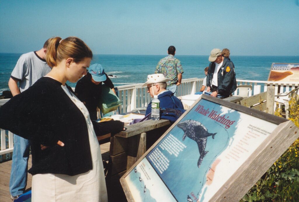
PESCADERO – Mist along the dark coast accentuated the old lighthouse’s slowly spinning beam, creating an eerie effect that reminded one approaching visitor of Steven Spielberg’s “Close Encounters of the Third Kind.”
Her destination was the Pigeon Point Lighthouse Hostel, off Highway 1 about halfway between Half Moon Bay and Santa Cruz. The Sacramento woman and a few dozen other travelers that mid-April night would occupy the hostel’s four cottages, each containing a kitchen and dining area, lounge, shower and bathrooms. Lodgers would spend under $20 apiece to stay in a room with three bunk beds, or about $50 a pair to sleep in a single-bed chamber.
Those are great rates for superb views of and access to the Pacific Ocean’s rugged coastline, under the shadow of a lighthouse that, at 118 feet, is among the country’s tallest. Tours inside the tower have been suspended for what might be years due to bits of iron and brick having crumbled from near the top during a recent winter storm, but the tiny state historic park’s grounds remain open daily from 8 a.m. to sunset.
Last month was a prime time to visit the area, in no small part because wildflowers were bright, colorful and abundant. Also, several whales were spotted spouting by. A park volunteer, after seeing one such aquatic giant and accompanying calf on a Saturday morning, remarked that he had never seen the sea mammals come so close to shore. Another volunteer, Larry Wurdeman, patiently and enthusiastically answered visitors’ questions.
Gray whales, who actually are born black but take on a lighter appearance as they acquire scars and barnacles, also pass Pigeon Point in late fall and early winter, Wurdeman said. They tend to be farther out to sea during that, their southbound migration. (To see them then, Wurdeman instructed, visitors should stretch an arm out and place their thumb’s tip on the ocean horizon; whales tend to pass in the area between the tip and first knuckle.)
Pigeon Point Lighthouse first beckoned to boats in 1872, its lamp burning lard oil to shine through a 16-foot-tall, 6-foot-thick, 8,000-pound lens of a kind designed by Frenchman Augustine Fresnel a half-century before. Soon kerosene replaced lard, and in the 1920s electricity began powering the beam. It was not until 1972, the lighthouse’s centenary year, that the Fresnel lens was replaced with a modern one.
A small gift shop sells T-shirts, postcards, pins and other Pigeon Point trinkets a few dozen yards inland from the fenced-off lighthouse. A path around the fence ends at a small wooden platform, where passing motorists assuming the roles of whale-watcher wannabes train their binoculars on the ocean. During weekends in April, park volunteers set up tables nearby that had exhibits such as a sea lion’s skull and a small bottle containing whale lice.
If you want to stay at the hostel, in buildings that from 1939 to 1972 housed Coast Guard personnel who operated the lighthouse, keep in mind that reservations should be made well in advance. For example, the Sacramento woman with Spielbergian flashbacks and her companion had called about securing a private room, for a Friday and Saturday night, five months before. No earlier reservation had been possible.
Also be prepared to adopt Hostelling International’s spirit of working a bit to help restrain the facility’s operating costs. Each guest is asked to sign up for a five- to 10-minute chore, such as mopping a bathroom’s floor or emptying trash cans. The responsibility is not policed, but anyone who shirks it should be ashamed of himself.
Bring food that can be cooked in the hostel’s four kitchens, where pots, pans, dishes and appliances are supplied. Also pack towels and bedding; sleeping bags are outlawed by hostel literature, though several guests used them that spring weekend. Ear plugs are a sensible option for those who would rather not be awakened by early risers’ voices, which pass easily through the cottages’ thin walls.
Guests must check in before 9:30 p.m., and “quiet” time begins at 11 p.m. – though again, in April there were a few who violated that reasonable mandate. From 10 a.m. to 4:30 p.m., even those who are spending more than one night in the hostel are barred from the property. Such a minor inconvenience, common to most hostels throughout the world, is offset by several day-trip possibilities, including:
- A hike or two in Butano State Park, 12 miles from the lighthouse via the quaint town of Pescadero. Its five-mile Mill Ox and Jackson Flats loop trail passes through peaceful, humbling redwood groves up to and down from a fire road. The slightly shorter, substantially steeper Ano Nuevo Trail is great exercise, though its views are modest.
- Any of the four state beaches just north of Pigeon Point, from San Gregorio down to Bean Hollow, or any of the public beaches to the south, including a large, wide and soft one at the end of Waddell Creek.
- Santa Cruz, 30 miles to the south, or Half Moon Bay, 23 miles to the north. The former can be difficult to navigate, but among its many other charms Santa Cruz has great vegetarian-food possibilities (for a low-cost, high-quality vegan meal before 6 p.m., try the Asian Rose at 1547 Pacific Ave.; 831-458-3023). The latter coastal town is smaller and welcoming, in a modest way. More and more Bay Area commuters have filled up Half Moon Bay.
Two years ago, construction of a nine-unit bed-and-breakfast on 3 acres immediately south of the lighthouse was halted thanks to a $2.65 million purchase of the property by the Peninsula Open Space Trust. In so doing, POST thwarted what would have been the first commercial development on the ocean side of Highway 1 between Half Moon Bay and Santa Cruz County, whose boundary with San Mateo County is about eight miles south of Pigeon Point. The B&B’s framework has been removed, so now a dirt patch there awaits Mother Nature to retake control.
The Pigeon Point Lighthouse Hostel’s office answers phone calls from 7:30 to 10 a.m. and from 5:30 to 10 p.m. Bunk-bed rates are $15 per night for Hostelling International members, $18 for nonmembers. A $15 fee is assessed for the smaller, private rooms. For more information: (650) 879-0633. On the Internet, visit California State Parks’ description of Pigeon Point Light Station State Historic Park at http://cal-parks.ca.gov/default.asp?page_id=533.

MANITOU SPRINGS, Colo. – Heading westward on Interstate 70 near the Kansas-Colorado border, drivers on a clear day are treated to an illusion – that there is one mountain standing alone on the plains.
Yet Pikes Peak, still some 150 miles away at that point, is emphatically not alone. More than 50 other mountains in Colorado also top 14,000 feet. Pikes Peak is the most famous, however, and because it rises so quickly on the Rockies’ eastern range, it is the first visual evidence for westbound travelers that there are bumps ahead.
Getting to the top of this Colorado milestone is not much of an obstacle thanks to the Pikes Peak Cog Railway, which slowly has clacked up and down the 14,110-foot mountain since 1891. The three-hour, 10-minute round trips are offered from the third week of April through the first week of November.
Perhaps fittingly, prices are a bit steep. In 2000 a cog railway ride cost almost $25 general, and about half that for children. By comparison, driving up the 19-mile Pikes Peak Highway cost $10 per person and up to $35 per vehicle. The road takes a toll on brakes and gears, as well. Two other options are biking and hiking. Keep in mind, though, that going from the base in Manitou Springs, a kitschy western suburb of Colorado Springs, to the summit entails a vertical climb of more than 7,000 feet.
That cog railway price doesn’t seem so high now, does it?
With few financial misgivings and no physical ones, I boarded the railway on a late-summer afternoon. More than 200 of us squeezed into two cars on the 1:20 p.m. run, many of us anticipating a break from base temperatures that were uncomfortably in the upper 80s. Certainly the scenery was cool as we began the ascent.
“Keep in mind all these rock formations are natural,” said Jen Pope over the train’s tinny speaker system. “We didn’t come up here with a hammer and chisel.”
The 20-something tour guide, or “conductor,” then instructed passengers: “OK, I want everyone to look to the left.” Because seat rows face each other, heads turned both ways. Some of us took a while to catch on that she was joking. To solve that problem, Pope directed our glances by referring to the “three-seat side” and the “two-seat side.”
(Tip: If you take the cog railway, request seats on the three-seat side, which looking up from the trains are on the left and are designated A, B and C on the tickets. The most spectacular views are on this side, which looks over the downslope.)
Our bearings established, Pope told us that coming up off the three-seat side was a waterfall higher than Niagara Falls. I’ll be, some of us thought as we headed up what’s referred to as Son-of-a-Gun Hill. What we passed, however, was little more imposing than a bathroom’s shower stall.
“I didn’t say it was longer or bigger,” Pope said, “I said it was higher.” Humor with an altitude.
Twenty-seven minutes into the journey we passed, again on the three-seat side, a white house that Pope told us is occupied for six months a year by a couple who other times reside in Oregon. “Dennis and Barbara’s driveway,” the dirt road that leads from the house, winds its way for 60 miles down the mountain.
“Not 16, but 60!” our guide said. “That’s 60 miles to Safeway for groceries and 60 miles back home.”
Soon after, at 1:51 p.m., a patch of aspens whose leaves had turned bright yellow became visible. Indians are known to have chewed on the trees’ bark as a remedy for minor aches and pains, said Pope, adding: “So perhaps that’s where we got the saying, ‘Take two aspens and call me in the morning.’”
By 2 p.m., we had traversed the 8-mile track’s longest straight stretch, three-quarters of a mile long. We had reached Inspiration Point, so named because its view reportedly inspired Katherine Lee Bates to write the poem “America the Beautiful. ” Below us, the tree-carpeted mountain flowed down to the Colorado Springs metropolitan area. Beyond was the Great Plains.
“Now look out there where it’s kind of flat, dull, boring, nothing going on. That’s just Kansas,” said Pope to much laughter. (Later that afternoon, on the descent, engineer Mike Doty informed us that from Inspiration Point, a tall white object often visible on the horizon is the grain elevator in Goodland, Kan. That struck a personal note because my first newspaper job was in the 5,000-residents town, some 200 road miles from Colorado Springs.)
Ten minutes later we reached the timber line, above which no trees grow because roots cannot penetrate the permanently frozen ground 12 inches below the surface. Out the train’s two-seat, or uphill, side were nothing more than piles of rocks and boulders. Down the mountain were wagon trails that though unused for a century are preserved due to the extremely slow grass growth, Pope said. Also visible was more of “Dennis and Barbara’s driveway.”
The cog railway’s routine ride up the mountain was derailed at 2:21 p.m. when Doty, the engineer, informed passengers that power had been lost on the summit. As a result, we would not be allowed to detrain atop Pikes Peak, where normally riders can patronize the Steamer Stop Shop souvenirs store and Cog Wheel Cafe. Nor would any restrooms be accessible, so the idea was to stop only long enough on the summit for people to take pictures out the large, open windows.
The main danger with the power outage, Doty later explained, was emergency medical technicians would be denied the best means to treat sudden cardiac and other health problems. Railway pamphlets and workers warn that people who have heart or lung problems should not make the ride without first consulting their physician.
“Welcome to the summit,” Pope announced at 2:37 p.m., but due to our incarcerated circumstances her subsequent joke lost some of its punch: “While we’re up here, please watch your language. We’re a lot closer to heaven.”
There was not much grumbling, however, and the mood was elevated when upon our descent Doty informed passengers they could receive a $5 refund or a free ride any time before season’s end as compensation for the abbreviated journey.
Pope spread more cheer by recounting some of the more-oddball questions she had fielded in her three years on the mountain. Among them:
- “How far is it between the mile markers?”
- “When do the deer turn into elk?”
- And, looking at marmots, one passenger asked: “Why are the bears so small up here?”
Just below the timber line, Doty pointed out a half-dead, 2,200-year-old bristlecone pine on the three-seat side. At 3:42 p.m., about 10 minutes before trip’s end, we came to a jolting stop. “Guess we blew a tire,” wagged one rider.
Doty had let the train reach its automatic-stop speed of 9.2 miles per hour. That had not happened in four years, he said. “I was due.”
Due to the cog railway’s popularity, reservations are advised throughout the season. From late June through mid-August there are eight daily departures, from 8 a.m. to 5:20 p.m. Fewer runs are offered other times. For more information about the Pikes Peak Cog Railway: call (719) 685-5401; visit www.cograilway.com; e-mail cogtrain@iex.net; or write to P.O. Box 351, Manitou Springs, CO 80829.
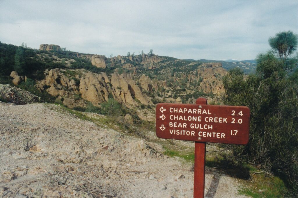
PINNACLES NATIONAL MONUMENT– Your boots are submerged in rushing water, the walls are closing in and it’s nearly pitch black. Fatigue from four hours’ strenuous hiking has made your knees creak and your thighs moan. And there just might be a rattlesnake nearby.
Welcome to Bear Gulch Caves. Amusement parks’ water rides have nothing on this place.
The caves — a misnomer, by the way– are the main attraction at one of the country’s quirkiest national monuments. What you see here, you see, used to be somewhere else, far away. And Mother Nature, not man, is responsible for the relocation.
Pinnacles features remnants of a volcano that was an estimated 24 miles long and 8,000 feet high. More than 22 million years ago, it broke apart. Seismic activity along the San Andreas Fault has nudged some of the remnants 195 miles to the northwest, at the rate of one inch a year.
That slow but steady migration has resulted in a striking landscape blip on the otherwise gentle, green hills east of Soledad, 200 miles south of Sacramento. Scattered and stacked lava rocks provide hikers and other visitors with visual lesson in the theory of plate tectonics. If you see the San Andreas Fault has managed this, it’s easier for you to imagine continents breaking off and drifting apart.
Global geological ponderings take a back seat to personal-safety considerations in Bear Gulch Caves, which actually are talus passages. This is no hole in a mountain, but rather a mostly dark place that is covered by settled rock debris. There are no stalactites or stalagmites. There are, however, bats. And potentially a nasty reptile or two.
“There was a Russian who was bit by a rattlesnake in there,” said Charles Ewing, an interpretive ranger with the National Park Service. “We flew him out and he spent a week in a hospital,” where he suffered further with a bad reaction to anti-venom medicine.
That’s enough bad luck for anyone to grope for the vodka bottle.
Generally, though, people emerge healthy… if somewhat relieved… from Bear Gulch Caves. Most injuries are minor, Ewing explained, the result of slips and falls. The rushing water happens only after periods of rainfall. If the water is any higher than ankle deep, the caves are closed, as they were in mid-January.
The walls may not be literally closing in, but passages can be narrow, short or both. Anyone who is unusually wide or tall, who can’t painlessly squat and waddle, or who is claustrophobic should stick to the trail above the caves. (I am a moderately wide 6-footer who, during my late-January visit, struggled in a few passages, sometimes having to carry my small backpack with my teeth in order to squeeze through.)
As for the bats, none of the 16 species found at Pinnacles is among the rare types that crave human blood. Townsend’s big-eared bats are listed as endangered, and in an effort to help them rangers closed Bear Gulch Caves during the summer pupping season in 1997. They plan to do the same this year, Ewing said. The smaller Balconies Caves will remain open.
No matter which caves you plan to visit, you must have a flashlight.
Ewing, speaking one Friday afternoon in the Bear Gulch Visitor Center on the east side of Pinnacles, went on to say that park officials hope people will become less focused on the caves. The monument’s 36 miles of well-tended trails, he pointed out, offer tremendous opportunities to examine the lava rock formations, 150 types of birds and many wildflowers that bloom in the spring.
Pinnacles’ main tourist season is, in fact, from President’s Day through Memorial Day. Weekends are quite busy, Ewing said, and he urges people to visit weekdays, if at all possible, especially if they hope to land a camping site.
Bear Gulch Caves can be reached via a fairly flat, I-mile trail that begins near the visitor center. For those who wish to stretch their legs a bit more, the 5-mile Condor Gulch/High Peaks loop is a wonderful way to sample the monument’s above-surface charms. When the caves are wet, as they were during my visit, hikers might well begin with the loop and visit the caves last. That way, boots are squishy only for the final half-mile, which is downhill.
(Another option, of course, is to pack an extra pair of shoes and socks, allowing your feet to be dry and comfortable no matter what you do after leaving Bear Gulch Caves.)
The Condor Gulch portion of the loop is a 1.7-mile, steady climb from the visitor center. Where it runs into the High Peaks Trail is where the sweep of Pinnacles’ distinctive rock formations becomes most apparent. As hikers continue along the loop, they cannot miss one rock that is almost embarrassingly phallic … leaving one to wonder if it might someday be named after a certain former governor from the South.
Stair-like steps that have been blasted into rock, along with metal railings, offer much needed assistance in the trail’s ups and downs around Hawkins Peak, elevation 2,720 feet. Hikers can pause to catch their breath and, perhaps, watch as turkey vultures circle silently nearby. The silence and beauty of the scene make up for almost any soreness from the climb.
During Pinnacles’ spring tourist season and during the fall, ranger-led tours are sometimes offered. On April 22, the monument’s 90th anniversary will be celebrated in the visitors center area, with speakers and high-school bands providing the entertainment.
To find out about special activities, possible cave closures and other Pinnacles news, call (408) 389-4485 for recorded information. Rangers on duty in the visitor center can answer questions through that number, too, from 9 a.m. to 5 p.m., seven days a week.
Note: Highway 146 enters Pinnacles National Monument on both the east and west sides but does not connect. Only hikers can go from one of the road’s dead-ends to the other. In addition to the visitor center, the east side boasts more parking, and is closer to Sacramento than the west entrance.
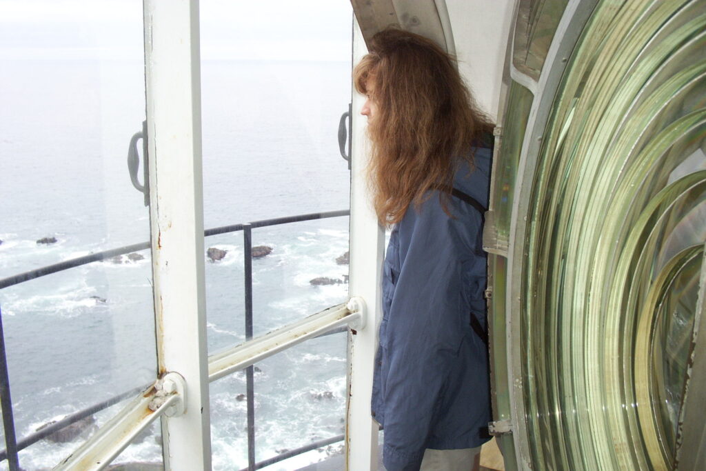
POINT ARENA – Shipwrecks happened here a lot in the late 19th century, by some accounts daily. Arena Rock, extending a mile out from the coast at a depth of 6 feet, is a treacherous sea monster hungry to snare, ravage and consume whatever craft dare to come near.
The weather at Point Arena Lighthouse, some 130 miles up the coast from San Francisco, also can be beastly. Tour guide Sharon Secco, on an overcast afternoon in late October, said that fog can be especially thick.
“I’ve had people come to the gate (a few hundred yards from the 115-foot tower) and ask me, ‘Do you really have a lighthouse out there?’ ”
Point Arena Lighthouse indeed is out there and draws some 30,000 visitors annually. Anyone who can mount the tower’s 145 interior steps will be rewarded with interesting talks by docents such as Secco and above-it-all views that, together, easily justify the small admission fee. Furthermore, small groups can rent any of the three onsite bungalows as vacation lodging and experience the setting in a leisurely way that also generates funds to maintain the lighthouse site.
Spanish explorers were the first nonnatives to come upon the area, sailing by as part of a journey led by Juan Rodriguez Cabrillo in the mid-16th century. The small promontory on which the lighthouse now sits became known as “Punta Barro de Arena,” or Point Bar of Sand. Nonnative settlement began in 1844, and 14 years later the U.S. government took over the land.
Northern California’s lumber industry, surging with the spectacular growth of San Francisco and other towns to the south, used the coastal waters as a seafaring superhighway for deliveries. Arena Rock took a nasty toll, however, and by 1869 the U.S. Lighthouse Board pinpointed where a light station should be constructed. On May 1, 1870, the brick-and-mortar tower’s beam began shooting some 19 miles out over the Pacific Ocean.
Shipwrecks continued with depressing frequency, despite the dependable assistance provided by the lighthouse and its fog signal building. Small earthquakes that were recorded in 1888 and 1898, however, foretold of another type of disaster. The April 18, 1906, earthquake that killed more than 3,000 people in San Francisco and caused some $500 million damage to its buildings also wreaked havoc far to the north. Point Arena’s living quarters were rendered uninhabitable, the lighthouse sustained major cracks and assumed a precarious leaning stature, and its lens was destroyed.
Aware of how vital the lighthouse was to ships’ safety, Congress soon authorized $72,500 for reconstruction, which was completed by Sept. 15, 1908. The new structure, whose builders specialized in industrial chimneys, is reinforced with iron bars and features a doughnut-like buttress near it top that provides further earthquake protection. A 2-ton Fresnel lens, composed of 666 hand-ground glass prisms, was set floating atop 20 gallons of mercury and kept spinning by a gravitational, clock mechanism-like weight that every four hours had to be re-raised by the light-keeping staff. In 1928, a small electric motor superseded that manual task.
The lighthouse, which came under Coast Guard control in 1939, became fully automated in June 1977, when the Fresnel lens went dark and an aircraft-type, rotating beacon was placed atop the structure. “It’s kind of sad,” Secco told four visitors in October before we ascended the small remaining staircase – salvaged from the original tower – to inspect (and touch, if we had the unfortunate inclination to) the old lens and look out the surrounding glass windows. “This was very valuable at one time. People put a lot of work into it.”
The new beacon’s beam extends some 25 miles and aids mostly fishing boats these days, Secco said.
A few paces from the tower in a building that also contains a museum, souvenirs are sold in a small gift shop. Exhibits include photographs of the lighthouse’s original and current versions, along with sometimes-too-sketchy details of noteworthy shipwrecks. A clip from the Oct. 30, 1897, Mendocino Beacon describes in evocative prose rather foreign to modern journalism a rescue attempt made on the capsized schooner Caspar:
“The little boat was rushed on the top of a receding wave and with a few vigorous strokes shot through the crest of a mighty breaker that came thundering in toward shore. Suddenly, it was whirled broadside and half-filled with water as it rode over the top of the waves. The force of the water flung the skiff upon the bridge of the Caspar.
“The men attempted to get at the lifeboats atop of the cabins, but just as they were swung into position the vessel careened on her side and a wave swept across her. The boats were washed away. One more dingy was left, but another wave crashed over the vessel and ground her into the rocks. All the men left on board were swept away.”
Today’s visitors are unlikely to witness such tragedies, but from November through April might be treated to the sight of passing whales. Bird lovers might spot black oystercatchers, solitary sandpipers, rhinoceros auklets and marbled murrelets, among other feathered friends.
In 1984, the Point Arena Lighthouse Keepers began leasing and caring for the site, assuming ownership two years ago. The nonprofit group conducts tours of Point Arena Lighthouse on an informal basis from 10 a.m. to 4:30 p.m. daily, May through September. Hours constrict by an hour or two the rest of the year, weekends only in December and January. Admission is $4 general, $1 for ages 12 and younger. (Hours and prices are subject to change; call 707-882-2777 for up-to-the-minute information.)
The site’s three bungalows, which in the early 1960s replaced staff quarters that were built within a year or two of the 1906 earthquake, each contain three bedrooms, two bathrooms, a full kitchen and fireplace, and have lawn chairs and a picnic table outside. For those not adequately entertained by what Mother Nature has to offer outdoors, there’s also satellite TV. Rates range from $170 to $300 per night. For reservations and more information: visit www.pointarenalighthouse.com; call (877) 725-4448; fax (707) 882-2111; or write to Point Arena Lighthouse Keepers Inc., Attn.: Reservations, P.O. Box 11, Point Arena, CA 95468.
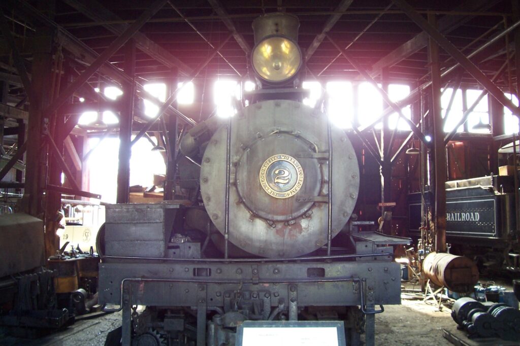
JAMESTOWN – Cabooses are known as “crummies,” said docent Bill Gillaspie, because “engineers used to spend so much time living in them, and they were crummy.”
Nicer adjectives are in order for Railtown 1897 State Historic Park, where Gillaspie has volunteered since the early 1990s. On a beautiful morning in mid-November, the Air Force veteran and former school-bus driver gave me a personal tour of the 26-acre site, which is a 100-mile drive southeast of Sacramento. That was mighty kind of him considering he did not know I was there on business.
Railtown 1897, although associated with the sleek and extensive California State Railroad Museum in Old Sacramento, is not a sophisticated tourist attraction. Some of its locomotives no longer are operable, most of the other exhibits are in pieces and/or look grimy, and the only hint of something higher-tech is a video screened next to the gift shop. A feeling of nostalgia is what this place is about, and is what Gillaspie embraced when he chirpily said, “Are you ready to step back into history?” as we approached the Roundhouse.
The 1910 shed’s name is a stretch, as the building bends a bit but is far from circular. “Kids like to tell me the Roundhouse isn’t round, so I tell them it’s a quarter-round,” the guide said with a twinkle in his eye.
The first thing we encountered in the Roundhouse was a “movie star.” Locomotive No. 3 has that nickname because it has appeared in dozens of films, starting in 1919. From what I saw, however, No. 3 is not ready for its close-up, Mr. DeMille. Flecked, dirty paint and huge gaps where engine parts should be do not scream screen siren.
Here and at several more stops along the tour, Gillaspie asked if I remembered this or that scene from “Back to the Future Part III.” I have seen the film but have to dig pretty far back into the past to recall details. If you are contemplating a visit to Railtown 1897, you might enhance the experience by reviewing the 1990 Michael J. Fox sci-fi adventure flick. It relied heavily on Railtown 1897’s stock materials, including Locomotive No. 3.
Locomotive No. 28, built in 1922 and as such is 31 years younger than No. 3, has a more active existence these days. It pulls tourist trains on a six-mile, 40-minute round trip on weekends, April through October. Special “Santa” rides will be offered hourly from 11 a.m. to 3 p.m. on Dec. 17 and 18; such excursions cost $6 general, with discounts for children.
When my host and I were about to step up into a short passenger car, constructed more than a century ago to negotiate the sharp curves on Sierra Railroad’s Angels Camp branch, Gillaspie piped, “All aboard!” I wonder whether he used to say that at school-bus stops.
The little coach has a ghostly feel, what with a lack of lighting, the dusty, spottily shredding cloth seats and brown-with-age pull-down shades. Gillaspie pointed out a few windows whose rippled glass indicates they are original. A wood stove in the corner provided warmth, he said, but passengers could get toasty if they sat too near it. Seat backs flip back and forth so that riders could always face forward.
A nearby motorized passenger car, a sort of 1920s minivan, was used for runs to and from the Hetch Hetchy reservoir project. From one of the rear seats, a metal chute flows down to just above the tracks, before the rear wheels. Whoever sat by the chute was charged with occasionally pouring sand down it so that the little railcar would have traction and not spin its wheels.
At one point, Gillaspie – who introduced me to many railroad terms, such as “2-8-2” and “Shay,” whose meanings I quickly and stupidly forgot – mentioned something about a “petticoat” being inside train engines. “Oh, so the TV show’s name was a real pun,” I said in reference to the 1960s CBS comedy “Petticoat Junction.”
No, the guide said, cueing up an anecdote he no doubt replays for most tour groups. The show’s title was a reference to its female characters dipping their undergarments into the railroad’s water tank. A replica of the tank used in “Petticoat Junction” was built in the 1980s and rests on Railtown 1897’s grounds.
The tour’s other highlights included examining a hand car used by John Wayne in a 1930s film. Hollywood props such as wooden signs of fictional railroads that were attached to Locomotive No. 3, a fascinating perspective painting from the mid-1990s TV show “The Adventures of Brisco County Jr.” and a blown smokestack from “Back to the Future Part II” are in or just outside a former repairs shed. Gillaspie encouraged me to pick up an ultra-light fake rail that actors used, though real rails weigh 100 pounds “and some of those movie stars couldn’t lift their own suitcases,” the guide practically spat.
Among the other noteworthy motion pictures that used Railtown 1897 equipment and nearby scenery were 1929’s “The Virginian,” starring Gary Cooper and which the state historic park claims was the first “talkie” filmed outside a studio; 1952’s “High Noon,” Cooper’s iconic spin as a lone-crusader sheriff; and director-star Clint Eastwood’s 1992 Western masterpiece, “Unforgiven.” “The Lone Ranger,” “Gunsmoke” and “Little House on the Prairie” are among the many TV shows that used the site.
Railtown 1897’s existence can be traced, not surprisingly, to 1897, when Sierra Railroad opened a line from Jamestown to Oakdale. Branches to Sonora and Angels Camp were added soon after; all commercial operations ceased in 1935. Opened for tours and tourist train rides in 1971, the complex was sold to the state in 1982.
The historic park, a few blocks south of Highway 120 just beyond downtown Jamestown, is open daily from 10 a.m. to 3 p.m. until April, when spring and summer hours commence: 9:30 a.m. to 4:30 p.m. Tours cost $2 general, $1 for ages 6-12. On site is a gift shop whose DVDs for sale do not include, ironically, “Back to the Future Part III.” For more information: (916) 445-6645 or www.railtown1897.org.
Sidebar:
For more of the rail thing, visit one of these other regional train museums.
California State Railroad Museum, Second and I streets in Old Sacramento. Countless exhibits and train rides during the summertime. Open daily from 10 a.m. to 5 p.m. Admission is $6 general, $2 for ages 6-17. For more information: (916) 445-6645 or www.csrmf.org.
Nevada State Railroad Museum, 2180 S. Carson St. (Highway 395) in Carson City. Tourists can ride steam trains weekdays from mid-May through September, with special events that include “Santa” runs from 9 a.m. to 4 p.m. the weekend of Dec. 10-11. Open daily from 8:30 a.m. to 4:30 p.m. Admission is $4 general, $3 for ages 65-plus, and free for children ages 18 and younger. For more information: (775) 687-6953 or www.nsrm-friends.org.
Western Railway Museum, about 12 miles east of Interstate 80 on Highway 12, between Fairfield and Rio Vista. Specializes in interurban railcars and includes rides into the surrounding country. Open weekends from 10:30 a.m. to 5 p.m. year-round; also open Wednesdays through Fridays from Memorial Day to Labor Day. Admission is $10 general, $9 for ages 65-plus, and $7 for children ages 2-14. For more information: (707) 374-2978 or www.wrm.org.
SIMI VALLEY — A spy exhibit in the Ronald Reagan Presidential Library and Museum includes a KGB assassin’s umbrella and a pair of black leather pants worn by Diana Rigg in “The Avengers.”
Never mind which item excited me more.
“Spies: Secrets From the CIA, KGB and Hollywood” continues through July 14 at the presidential facility, in the northwest reaches of greater Los Angeles and a 380-mile drive from Sacramento. The site’s permanent displays include many pictures and mementos from Reagan’s two terms and a painstaking re-creation of the Oval Office as it was from 1981 to 1989.
The spy exhibit begins with our country’s initial escapades into espionage, during the American Revolution. In late 1775, the Second Continental Congress created the Committee of Secret Correspondence, which among other things “employed secret agents abroad, conducted covert operations, devised codes and ciphers, funded propaganda activities (and) authorized the opening of private mail.”
An illustration of Nathan Hale, “probably the best known but least successful American agent in the Revolutionary War,” shows British soldiers preparing to execute him in 1776. Hale’s last words are widely reported to have been, “I only regret that I have but one life to lose for my country.”
Past a plastic sculpture of George Washington, wearing a uniform used by Barry Bostwick in a 1984 TV miniseries about the first president, are Civil War displays such as a replicated Confederate cipher wheel. Thadeus Lowe, an “aeronaut in the Army of the Potomac Balloon Corps,” is pictured. Somehow, he rigged a telegraph connection in his spy balloon Intrepid, and “may have been the first man to use a camera to gather intelligence about enemy activities.”
The exhibit’s core, past a 1885 camera concealable behind a soldier’s coat and a Nazi Enigma machine (“Zur Beachtung!”, the back of its lid screams), is the Cold War room. There, visitors can find things such as:
- A replica of a plaque the Soviet Union gave to the U.S. ambassador in Moscow around 1950. For years, it hung behind his desk. Inside it, however, was a listening device.
- A KGB assasin’s umbrella like the one used to kill Bulgarian dissident Georgi Markov on Sept. 7, 1978, in London. The device’s tip fires a poison-filled pellet.
- Two larger displays, one recounting the 1960 U-2 spy incident in which U.S. pilot Francis Gary Powers crashed in Sverlovsk, was captured and later exchanged for a Soviet officer arrested three years earlier in New York. The other is dedicated to the 1962 Cuban Missile Crisis, and includes light tables used for satellite images than confirmed the presence of Soviet missiles 90 miles from the Florida coast.
- More concealed devices, including a shaving-cream dispenser with a hidden storage compartment. (Unlike a similar contraption in the film “Jurassic Park,” however, this one does not appear to be capable of spewing the cream.) A watch camera that takes six pictures per roll, a fake wall plug that is actually a listening device and a shoe whose sole contains tracking equipment also are exhibited.
Speaking of funny footwear, the shoe phone Don Adams put to hilarious use in the 1960s spy spoof “Get Smart” are part of the Hollywood exhibit. Other TV shows represented in this section are “The Man From U.N.C.L.E.,” “I Spy,” “Mission Impossible” and, of course, the black leather pants program.
The Reagan museum had another temporary exhibit in mid-March, one that marked Ron and Nancy’s 50th wedding anniversary. In keeping with their celluloid heritage, the couple became engaged at Chasen’s restaurant, “a favorite with Hollywood during the golden age of the movie studios.” The actual booth where Reagan popped the question is part of the exhibit.
Near the booth are a smattering of letters Reagan wrote to his wife on their anniversary dates. Among them is this tender note penned while Reagan was California’s governor. On March 4, 1970, he wrote:
“My Darling: Sometimes it must seem as if the world is made up of … campus slobs and legislators — but that is only the outer layer. Underneath is the place where I think about you round the clock and across the calendar — I spend most of my time there. … For 18 years it has been March 4 every day. Only this March 4 I’m 18 times as much in love as on that first one, when I was really born. I’m as grateful as I am in love. (signed:) Guv.”
In addition to the re-created Oval Office, which includes the desk chair Reagan used as governor (1967-1975) and president, the permanent displays are composed of photographs, clothes, computer displays (some of which did not function in March) and gifts the Reagans received when he was “leader of the free world.” Especially gaudy presents include an ivory elephant overlaid with gold and embedded with rubies, sapphires and diamonds, from Queen Sirikit of Thailand.
The Ronald Reagan Presidential Library and Museum is open from 10 a.m. to 5 p.m. daily. Admission is $5 general, $3 for seniors and free for children 15 and younger. To get there, take the Highway 118 exit from Interstate 405, exit at Madera Road South and continue three miles to Presidential Drive. Turn right and go up the hill, past banners that commemorate each of the U.S. presidents. For more information: (800) 410-8354 or www.reagan.utexas.edu.
SEATTLE, Washington — Renting a car represents one of the most enduring bargains in travel. As long as the rental agreement allows unlimited mileage, you’ll usually save money over public transportation.
Last summer, a friend and I saved hundreds — perhaps thousands –of dollars when we rented a car for touring British Columbia, the Yukon and Alaska. For less than $15 a day, not including gasoline, we drove what’s classified as a mid-sized vehicle to our heart’s content. And as so often happens with car rentals, we had ordered a subcompact model, but due to overbooking received a larger car at the same cost.
Taking advantage of the half-price airline wars, we flew to Seattle for $145 round trip. Experience had taught me that renting a car in the United States tends to be much thriftier than doing so in Canada.
Our road trip covered more than 5,600 miles, including some 1,500 miles on gravel. Spread over three weeks, that averages out to just under 300 miles’ driving each day. For some travelers, that would be an enervating pace. For us, it worked out perfectly.
The scenery was always interesting, often spectacular. We saw myriad wildlife, including black bears, moose, foxes, deer and an eagle. We also had time to experience many tourist attractions that were not fully devised by Mother Nature.
Following is an outline of our journey, made in the summer of 1992. Perhaps teamed with an episode or two of “Northern Exposure,” this will inspire you to consider a behind-the-rented wheel look at what lies beyond the Washington border.
We began with Hope, where we pitched our tent that first night on the road. Located in British Columbia about 160 miles from Seattle, the town’s Caribou Trail Park was tranquil and, like all campgrounds during our trip, cost $10 or less (prices in this article are converted to U.S. currency).
Fraser Valley Canyon was the star of our second day. Routes 1 and 97, the latter of which eventually becomes the Alaska Highway, led us north through the scenic canyon to Prince George, where we turned west on Highway 16 and camped at Fraser Lake, site of our first mosquito bites. Subsequently, we were told by several Canadians that the blood-sucking insects are at their worst in late June, and largely are gone by August.
The next morning, we continued west on Highway 16 to Kitwanga, where we turned north on one of two roads that cross from British Columbia to the Yukon: the Cassiar Highway. Immediately to our right was the village of Gitwangak, which features a street lined with totem poles, one of which had toppled.
A hundred miles to the north is the turnoff for Stewart, B.C., and Hyder, Alaska. Stewart, the most northerly ice-free port in Canada, also calls itself “Movie Capital of the North.” Its Arctic appearance has been used in “Bear Island,” “The Thing” and “The Iceman,” all of which received cool receptions at the box office. Hyder, four miles away, is a bizarre border town whose main attraction is three bars that stay open all night.
On the way to and from Stewart, we passed Bear Glacier, which has a bluish tint and reportedly glows in the dark. There were several smaller glaciers and hundreds of waterfalls along the 40-mile detour to Stewart.
Back on the Cassiar, we experienced extremely rough road conditions for the next 45 miles. Crews appeared to be preparing the road for paving; about three-fourths of the 464-milehighway had a sealed surface when we drove it.
Our fourth night was spent at the Northway Motor Inn, a refreshingly modern motel in Dease Lake. When we awoke the next morning, we were 150 miles from the Yukon and 400 miles from its capital city, Whitehorse.
The highlight of our brief stay in Whitehorse, home to 21,000 people, was catching the Frantic Follies Vaudeville Revue at the Westmark Hotel. A moderately talented but agreeable troupe presented skits and songs that mostly dealt with the Klondike gold rush of the late 1890s. Cornball was served in large helpings.
“Did you know there’s a drinking problem in the Yukon?” asked one of the players. “The statistics are staggering.”
Especially funny was the cabin-fever couple of Tweedledee and Tweedledum, who fought over the morning newspaper and gauged their hunger on how far their stomachs protruded over their pants. Also good was a staging of Robert Service’s poem, “The Cremation of Sam McGee.” Admission was about $15.
Of the two campgrounds we tried in Whitehorse, MacKenzie’s RV Park was better. It had quiet sites, hot showers and a convenience store.
The Klondike Highway heads 333 miles north from Whitehorse, past the Dempster Highway turnoff, to the unpaved streets of Dawson City. Perhaps grasping at straws, one tourist publication proclaims: “At the turn of the century, Dawson was the largest city west of Winnipeg and north of San Francisco.”
Much of the gold-rush flavor is retained at Diamond Tooth Gertie’s, a gigantic saloon that has nightly shows featuring can-can girls and legalized gambling. My friend and I were there the night slot machines made their debut. Someone (else) won $5,000.
We heartily recommend staying at the squeaky-clean 5th Avenue Bed & Breakfast and discourage patronage of the cramped and musty Klondike Kate’s Motel. Both have doubles for around $50. Ironically, Klondike Kate’s Restaurant had a winning menu, including several vegetarian items.
Free tours of Dawson City depart four times daily from the helpful Visitor Reception Centre on Front Street. The Robert Service Cabin on 8th Avenue has daily recitalsof “The Cremation of Sam McGee,” “The Shooting of Dan McGrew” and other poetry
by the popular bard, who lived in Whitehorse and Dawson City in the early part of this century.
Following a memorable three-day trek up and down the Dempster Highway, which would have cost us $350 apiece without a rental car, we backtracked to Dawson City to ford the Yukon River by ferry. Crossings on the seasonally operated barge are free, but the lines often are long. We queued for two hours.
Whether the much-ballyhooed Top of the World Highway was worth the wait was debatable. Scenery was splendid, but no better than what we had encountered in British Columbia and along the Dempster. The gravel road was in jarringly bad shape for an 80-mile stretch that straddles the U.S.-Canada border, and an endless trail of behemothic recreational vehicles made the going agonizingly slow.
Driving back toward the Yukon on Highway 2, we lucked upon a free campground near Northway, Alaska. It was quiet and, to our great delight, mosquito-free. For the first time in more than a week, we were able to have a leisurely picnic.
After another night in Whitehorse, we took a three-day side trip to Juneau, Alaska. The first stage was a 120-mile drive down the Klondike Highway to Skagway, Alaska, where we caught the ferry to Juneau. Without taking our car, the seven-hour passage cost us $24 apiece. Reservations on the Alaska Marine Highway line should be made in advance; the toll-free number is (800) 642-0066.
The charming Yukon village of Carcross — an amalgamation of the original name, Caribou Crossing — rests about halfway between Whitehorse and Skagway. We stopped there because of its picturesque setting and enjoyed walking across its bridges and browsing at the Matthew Watson General Store.
Skagway, another turn-of-the-century boom town, today consists primarily of restaurants, hotels and gift stores. The Gold Rush Cemetery, a mile north of town, has a wild-west flavor and gem of a waterfall. Among its permanent occupants are Jefferson “Soapy” Smith and Frank Reid, who gunned each other down on a presumably dusty Skagway street in 1898.
We began our return to Seattle by rejoining the Alaska Highway east of Whitehorse and continuing to its official beginning, 850 miles down the road. Along the way, Watson Lake, Yukon, is distinguished by its Sign Post Forest, which features more than 10,000placards from around the world. If you’re determined to find your hometown, be prepared to spend an hour searching.
There are plenty of accommodations to choose from in Fort Nelson, B.C., 230 miles north of the Alaska Highway’s official end, in Fort St. John.
Last year (1992] was the 50th anniversary of the highway, which was hastily built after the Pearl Harbor attack to facilitate deployment of U.S. troops and machinery. When we traveled it, the famous road suffered from frequent gravel patches, mile after mile of burned-out forest and the omnipresent RVs.
There’s an acceptable municipal campground in the comparatively large city of Prince George, B.C.,a few miles west of downtown, not far off Highway 97. Back down near the U.S. border, in the resort area of Harrison Hot Springs, we stayed at the wonderful Rainbow’s End campground. Its convenience store, combination laundry room and video arcade, hot showers and manicured tent sites wouldn’t appeal to hard-core outdoorspeople, but we felt we’d sufficiently done the wilderness bit.
Our final two days were split between Vancouver and Seattle. The metropolises were a bit off-putting in that they contrasted starkly with what we’d experienced in northwestern Canada. On the other hand, they provided a segue to life in the urban wasteland known as Southern California.
Ever been at a social gathering and found yourself unable to stop staring at someone? A beautiful, or at least striking, presence? That is how I can be at Yosemite, in the captivating company of Half Dome.
Rising assertively over the valley by more than 4,700 feet, the gargantuan granite dome’s rounded top looks as though it were created by a massive melon scooper. However, something since has gone radically amiss. A slice of its northwest side is gone, leaving a relatively smooth and vertical wall that surely no human could climb (although the first one did in 1875).
It’s a pretty weird sight. Hard to look away from.
I first set eyes upon Half Dome in the early 1990s, and in the intervening years I have visited Yosemite a dozen times. Among my favorite moments have been those spent in quiet contemplation before Half Dome, including a special trip two weeks after my father died.
Its striking beauty, overwhelming size and utter indifference to time and to the “ants” who scurry about on it provided a solace that I could receive nowhere else, at least nowhere so conveniently close to my home. (Yosemite Valley is about 160 miles from Sacramento.)
About those “ants,” which is what people on the big rock resemble from a distance: They can reach Half Dome via an 8.2-mile (one-way) trail that steeply ascends from the valley floor, passing Vernal and Nevada falls before heading around the back of Half Dome and then up the formation’s eastern, sloping side. The final 400 feet finds hikers pulling themselves up with the aid of steel cables. The trail can get crowded on a summer day, with as many as 1,000people reaching the summit.
I have never been on Half Dome. Its trail’s elevation gain and popularity have dissuaded me. But I have seen it from many perspectives, and last month persuaded two friends to accompany me on three day-hikes that, together, yielded views of Half Dome from the east, west, south and north.
Those hikes – Clouds Rest, Panorama and North Dome – require enough exertion that my college buddies (Dave Williams of Rancho Palos Verdes and Dave D’Antonio of Castro Valley) and I were pretty wiped out when the long weekend came to a close. By “college buddies, ” you see, I mean college-era, not college-age. We are not as spry as we were when we were 18 years old and disco was queen.
Clouds Rest Trail
In order to squeeze those hikes into three days, we left Sacramento at 4:30 a.m. on a Saturday. First up was the Clouds Rest Trail, which starts near Tenaya Lake off Tioga Pass Road (Highway 120). With an elevation gain of 1,775 feet – starting as it does above 8,000 feet in the thin High Sierra air – the trail leads to a rocky mountaintop with 360-degree views that include Half Dome.
Rather than give you a blow-by-blow of the hike, which I am averse to re-experiencing, I’ll just say that it starts calmly, becomes excruciating for an hour-long upward stretch, eases off for a bit and then resumes sucking the air out of one’s lungs until, finally, the ascending ends. All t old, the 14.5-mile round trip kicked my national park pass.
Once we caught our breath on the surprisingly crowded (how can so many people have this much energy?) summit, I noticed a young woman in a bright-red shirt who was clinging with hands, boots and a worried expression to an outcropping. Half Dome peeked out in the hazy distance behind her, to the west.
“I rock-climbed for the first time last week, ” Irene Lee, a Carnegie Mellon University senior from Oregon, told me a few minutes later, when she was back on solid ground. “It got a little scary over there. It was scarier on the way down.”
My attention was further distracted when all of a sudden someone was incongruously yelling: “Ice cold beer! $20. Ice cold beer! Bidding starts at $20.”
Tim Schiller has an enthusiastically pursued appreciation of adult beverages, apparently. Why else would he schlep Bud Lights to a mountaintop?
Schiller, a Fresno resident who arranges Fresno State football road-game excursions, said Clouds Rest compares favorably to other Yosemite trails he has t rod.
“(Best) day hike… this is going to be right up there,” he said. “other than the logistics of getting here – great.”
Then, though the fit and beer-guzzling Schiller might not have intended to rub it in, he rubbed it in: “Not hard.”
Vache Geyoghlian of Fresno joined friend Schiller this day on the Clouds Rest Trail. He deemed it a “different way” to see Half Dome, an alternative to climbing the famous formation itself. “You see this amazing view all around you, and that really is what it’s all about.”
Heather San Julian, who completed the day’s trail-taking Fresno trio, said she is made aware on this hike “how much rock is out there. It really goes on forever.”
Panorama Trail
On Sunday, “the Daves” and I got up early, again, to catch the bus that takes tourists from Yosemite Lodge up to Glacier Point, a high spot that often is highly populated with people looking over at Half Dome and down at the valley. We rubbed shoulders with the masses for a few minutes before re-embracing quietude on the 8.5-mile-long, 3,200-foot-elevation-loss Panorama Trail.
If you have time for just one day hike at Yosemite, I recommend Panorama. In addition to its wondrous starting point at Glacier Point, its meandering path unspools a steady stream of varied and striking views of Half Dome, starting from the west and working its way to the south. Meanwhile, you pass through a manzanita forest, which for me is wonderful because I love that rusty-branched and bright-green-leafed bush.
Furthermore, at the lightly populated Illouette Fall and the bustling Nevada Fall, hikers who have packed swimsuits can cool off in cold mountain water. And yes, there is water and the falls are tumbling even during the late summer of this depressingly long drought.
On the Panorama Trail’s descent-interrupting 800-foot uphill stretch, North Carolinians Dustin Long and Melissa Addington passed us. It was impressive. Rather than having joined us seated (and lightly napping, truth be told) on the bus, they had walked up to Glacier Point, via the Four Mile Trail.
“It’s something you need to do before you die,” Long said, cutting right to the chase. “I’ve never seen mountains like this in my life.”
North Dome Trail
On the third morning, we again dragged our moaning muscles out of bed and returned to the Tioga Pass Road, this time to the Porcupine Creek pullover lot and the North Dome trailhead. The path proceeds nonthreateningly through the forest for an hour or so, and the going doesn’t get strenuous (some steep ups, steeper downs) until hikers reach the dome stretch – North in the foreground, Half lurking imposingly behind.
Although Panora arguably is the national park’s must-take trail, North Dome is my favorite. I have taken this 8.8 -mile (round trip) path five times in the past eight years, never tiring of its intimate access to Half Dome, which faces North Dome imposingly from across the valley. No one standing on the northern slab of granite, gawking at the more famous slab of granite, takes the view for granted.
On the slightly downward south slope of North Dome (be reassured that its tilt toward the valley is not dangerous), married couple Monica Lanctot and Adam Graham of San Diego shared their impressions of the hike.
“We read about it and (were told) it was moderate, ” Lanctot said. “I would say the first half is easy. The second half is difficult. But the reward here is totally worth it.”
Graham, who said he has hiked up Half Dome a couple of times, was impressed by how much he could see on the North Dome Trail. “I’d heard that there were no better views of the valley than here, and that’s the case.”
Indeed, we could see cars creeping along thousands of feet below, amid the valley’s green meadows.
I asked Lanctot to compare North Dome with her experiences on the Clouds Rest and Panorama trails.
“It’s not nearly as well-traveled, so it’s a much more pleasant hike in terms of the amount of people, “she said. “This definitely has the best views of Half Dome…. The Panorama hike is probably the easiest one.”
The Daves and I concurred.
As we made our way off North Dome, I took a moment to look once again at Half Dome. I wondered how soon I would see it again, from whatever direction or altitude. On that happy day, my soul will rejoice – and yes, I will stare.
Clouds Rest Trail, from Tenaya Lake to Clouds Rest, is an out-and-back hike that encompasses 14.5 miles total with a 1,775-foot elevation gain. The only practical way to access the trailhead at the west end of the lake, 31 miles east of Crane Flat, is to drive there via Tioga Pass Road and look for a spot to park on the shoulder. A moderately paced hike, with enough time on Clouds Rest to soak in the 360-degree views, takes about 10 hours.
Panaroma Trail, between Glacier Point and Yosemite Valley, is 8.5 miles one-way with a 3,200-foot change in elevation. Many hikers take the tour bus from Yosemite Lodge and find the trailhead across from the Glacier Point store. Through Nov. 8, bus departures ($25 one way; www.yosemitepark.com/glacier-point-tour) are at 8:30 a.m., 10 a.m. and 1:30 p.m. A moderately paced hike takes about five hours.
North Dome Trail, from Highway 120 (Tioga Pass Road) to the top of the granite dome, is an out and-back hike that encompasses 8.8 miles total. The only practical way to access the trailhead at Porcupine Creek, 26.5 miles east of Crane Flat, is to drive there and hope for a propitious parking spot in the small roadside lot. A moderately paced hike, with an hour spent on the dome, takes about six hours.
Note: Due to snow accumulations, Tioga Pass Road is closed for half the year, typically from mid November to mid-May. For the latest information, check the California Department of Transportation’s website, www.dot.ca.gov
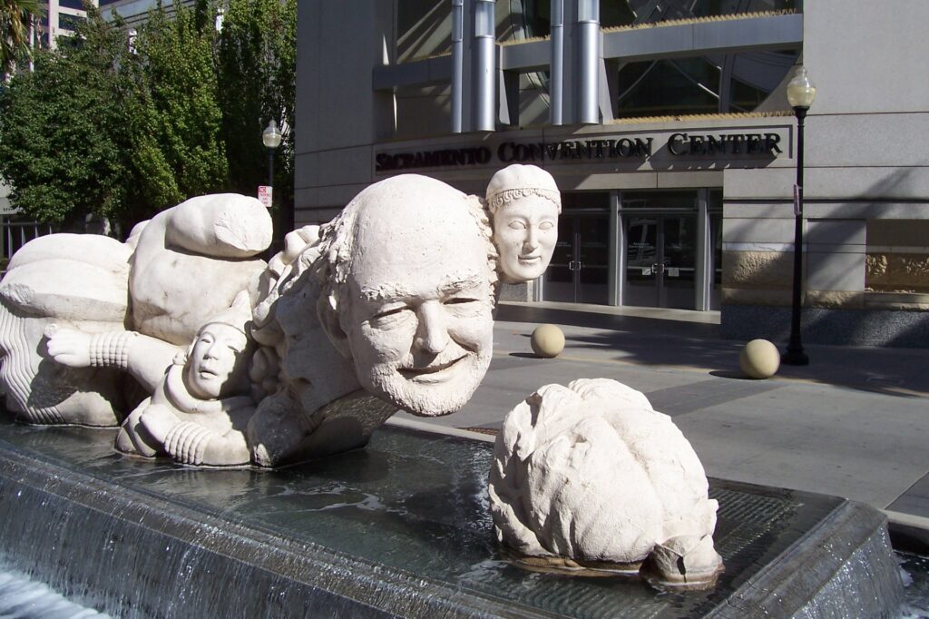
SACRAMENTO, Calif. – Known for being the state’s capital and for not much else, “River City” (occasionally referred to as “Sack o’ Tomatoes” or “Sacred Tomato”) often is passed through by tourists on the go between the Bay Area and Lake Tahoe. Why stop here unless the tank’ s getting low?
Well, except for the Capitol building, Sacramento does not have any famous tourist attractions. And to be honest, nothing is a showstopper, although the California State Railroad Museum comes closest. A co1Ieague of mine remarked after I moved here in 1994: “It’s a nice place to live, but you wouldn’t want to visit here.”
He had a point but expressed it too starkly. Sacramento had some charms then and, aside from a growing traffic-congestion problem, its charms have increased substantially over the past dozen years. If you have a reason to visit Sacramento – say, you have friends or relatives here you would like to see – you will be able to entertain yourself pretty well here for a day or two.
With about 450,000 city residents and some 2 million people in the metropolitan area, Sacramento cannot help but have ways to keep tourists and the locals entertained. Below is a quick rundown of the capital city’s most noteworthy tours, museums, restaurants, entertainment spots and special events. (A point of orientation: Downtown Sacramento is sandwiched between Old Sacramento on the west and midtown – a mostly residential neighborhood with scatterings of restaurants and other businesses – on the east.)
Tours
The Capitol (downtown at 10th and L streets; www.capitolmuseum.ca.gov), with its 120-foot-high Rotunda under a gilded dome, is the city’s signature building.
Unfortunately, the east-side annex is mammoth and not as visually pleasing as the old part, which was constructed in 1869. The 40-acre Capitol Park that surrounds the complex is marvelously landscaped with hundreds of tree and bush varieties, plus a moving Vietnam War memorial. Unfortunately, a proliferation of panhandlers can detract from an otherwise enjoyable stroll in the park. Free Capitol tours begin on the hour from 9 a.m. to 4 p.m. daily.
Governor’s Mansion State Historic Park (on the border of downtown and midtown at 1526 H St. www.parks.ca.gov) also offers hourly tours, from 10 a.m. to 4 p.m., although a small fee is charged. Edmund G. “Pat” Brown was the last governor to live here his full term; in 1967, Nancy and Ronald Reagan quickly bolted for quieter digs in the suburbs.
The neighborhood is noisy and rather dicey, so it’ s hard to blame them.
Museums
California State Railroad Museum (in Old Sacramento at Second and I streets; www.californiarailroadmuseum.org), is the best museum in town and among the best railroad museums anywhere. Visitors can gain close-up looks at massive engines and walk through vintage passenger cars, in addition to checking out hundreds of other exhibits that include an extensive and operational model-train display. Hours are 10 a.m. to 5 p.m. daily; admission is $5 general.
Crocker Art Museum (near downtown at 216 0 St., www.crockerartmuseum.org), is housed in a sprawling Victorian building just east of Interstate 5. Exhibits change constantly and invariably are interesting; permanent works include some by the internationally renowned Wayne Thiebaud, a local living legend. Check the website for hours; admission is $6 general.
Sutter’s Fort State Historic Park (in midtown at 2701 1 St.; www.parks.ca.gov) marks the spot of Sacramento’s first Euro-American settlement. John A. Sutter was a mover and shaker, played a key role in sparking the Gold Rush and has lots of things named after him in this town. School buses are a common sight outside this low-key attraction that features docents often dressed in period costumes. Hours are 10 a.m. to 5 p.m. daily; admission is $4 general.
Some other worthwhile museums include the California Museum for Women, History and the Arts, downtown at 1020 0 St.; the California State Indian Museum, in midtown at 2618 K St.; the California State Military Museum, in Old Sacramento at 1119 Second St.; the Leland Stanford Mansion State Historic Park downtown at 802 N St.; and the Towe Auto Museum, in Old Sacramento at 2200 Front St.
Restaurants
Biba Restaurant (in midtown at 2801 Capitol Ave, www.biba-restaurant.com), is a perennial critics’ favorite and specializes in Italian cuisine, The Firehouse Restaurant (in Old Sacramento at 1112 Second St.; www.firehouseoldsac.com) also annually draws raves from local newspaper and magazine writers. Its intimate patio is a popular destination for fine diners in the warm months.
Vegetarians can do no better than Andy Nguyen’s Vietnamese Restaurant, a mile southeast of downtown at 2007 Broadway — and not just because there are no other veggie eateries in town. Ifs a peaceful, compassionate place in a city that fancies itself as gustatorily progressive but is in fact chockablock with trendy meat-and-arugula restaurants. Aside from Andy Nguyen’s, another low-cost local venture is the Mexican themed and usually jam-packed Ernesto’s, in midtown at 16th and S streets.
Anglophiles will enjoy breakfast or brunch at the very popular Fox & Goose Public House, at 1001 R St., a half-mile or so south of downtown. It turns into a pub at night. Streets of London Pub, in midtown at 1804 J St., is another top draw for people who love all things United Kingdom. Good old American craftsman beers are superbly served at the River City Brewing Co., in the open-air Downtown Plaza shopping center a few blocks northwest of the Capitol.
Special events
The Sacramento Jazz Jubilee (www.sacjazz.com), is held throughout Old Sacramento and downtown at the convention center at 14th and I streets, perhaps peaked in the 1990s but due to its heavy emphasis on Dixieland music has drawn smaller crowds in recent years. Still, it’s a good time, and other types of jazz are being performed more often in the long-running annual festival. Nexi year’s celebration will be over Memorial Day weekend, as always: May 25-28.
The California State Fair (www.bigfun.org), which brings the massive Cal Expo grounds to life the last two weeks in August and through Labor Day in September, has seen its attendance figures dip lately, too. Drunken rowdiness, especially on Friday and Saturday nights, has prompted organizers to establish earlier closing times on some days. The event remains popular, however, and lures people from throughout California’s lengthy Central Valley (which extends, basically, from Bakersfield to Redding).
Gold Rush Days (www.oldsacramento.org), which has been going on for almost a decade, on Labor Day weekend turns Old Sacramento into a Gold Rush-era place. The streets are dirt-covered, horses power the transportation system and 1850s re-enactments and stagings are all the rage.
For a city its size, Sacramento has a lot of film festivals. Held at downtown’s Crest Theatre (1013 K St.; www.thecrest.com), they include: the Sacramento Jewish Film Festival, March 3,4 and 6, 2007; the Sacramento International Film Festival, March 29- April 2, 2007; the Sacramento French Film Festival, mid-July; the Sacramento Film & Music Festival, early August; and the Sacramento International Gay and Lesbian Film Festival, in mid-October. For more information about the festivals: www.sacramentocvb.org/FILMindex.cfm.
Quick insider tips
Bring your own bicycle or rent one to experience the American River Bike Trail, a well-paved and rustic-feeling gem along one of the two waterways (Sacramento River being the other) that give this town its “River City” moniker. Catch indie films while you can at the struggling-to-survive, art-deco Tower Theatre (www.thetowertheatre.com), a mile or so south of downtown at 2508 Land Park Drive. Get a healthful deli meal at the Sacramento Natural Foods Co-op (www.sacfoodcoop.com), southeast of downtown by a mile and a half at 1919 Alhambra Blvd.
Gunshots blasted through the breezy October air. Barrels smoked, and the shooters who still stood sneered. Once the Wild West dustups had settled, five gnarly cowpokes lay sprawled on the ground, dead as dirt. Some of the outlaws had even been killed once before that day.
Those of us watching now from picnic tables, and earlier from the train, applauded courteously. Eventually, the leather-clad, pistol- packing and totally play-acting men stirred from their dramatized deaths and resumed mingling among us. Everybody, passengers and bad boys alike, enjoyed a catered barbecue lunch in a park on the banks of the Sacramento River. By high noon, we were fixin’ to return to Woodland, where we had begun the “Great Train Robbery” tourist trek two hours earlier.
Sacramento River Train offers excursions on most weekends and many Fridays, from Woodland toward (and sometimes to) West Sacramento. Along the way, the diesel-locomotive-powered string of vintage 20th century railway cars rambles across what is described as the American West’s longest wooden trestle, the 8,000-foot Fremont Bridge. Passengers can get great views of the river, surrounding agricultural land and, on clear days, the Sierra Nevada and Coastal Range.
Although the season’s final “Great Train Robbery” is scheduled Saturday morning, several other specialty runs are a-comin’ down the tracks. At 10 a.m. today and next Sunday, the “Great Pumpkin Express” takes children and their parents to a patch where they grab a gourd to go. On board during the two-hour trip, families can wash down gingersnap cookies with hot chocolate.
On weekends from Nov. 30 through Dec. 7, and daily from Dec. 13 through Dec. 23, the “Christmas Train” takes passengers — who are asked to wear pajamas — on 90- minute rides. Santa Claus and his elves have been booked as entertainment, somewhat surprising because of their many other commitments that time of year.
The “Great Train Robbery” romp was a hit with 10-year-old Kaitlyn Urquhart and the rest of her Gold Country kin. Seated around a table in Sacramento River Train ‘s elevated dining car on the way back to Woodland, as they picked at crumbs from father Bill Urquhart’s 47th birthday cake, the friendly foursome praised the three-hour adventure.
“It was fun, and they really include you,” said Bill Urquhart, in a verbal nod to gunslinger impersonator Jay Lawson, a retired Lodi firefighter who had stopped by to show the family from Placerville a nugget of genuine Placerville gold.
“We liked the shows,” said mother Sharon Goldsmith, referring to the lunchtime “shootout” in Elkhorn Regional Park and an earlier dramatization at “Robber’s Roost,” trackside just past the trestle.
“They’re entertaining, ” 13-year-old Heather Urquhart chirped, as sister Kaitlyn bobbed her head in agreement.
Sacramentans Trudy Ziebell and Lisa Wuriu also seemed to be having a good time. Ziebell recently retired from the state Department of Public Health, and co-workers including Wuriu sponsored the train trip as a going-away gift. The pair, who together five years ago rode Canadian rails for three days and three nights from Vancouver to Toronto, each had something nice to say about this day’s short outing.
“I love trains, so it’s just fun,” Ziebell said.
“The food was delicious,” Wuriu added. (Lunch was catered by Ludy’s Main St. BBQ in Woodland.)
Rail buffs who have not yet hopped aboard in Woodland might want to ride along on a brief report of the regional line’s history:
Sacramento River Train operates on tracks built 97 years ago by the Northern Electric Railway. Soon renamed the Sacramento Northern Railway, the line transported people and freight between Woodland and Sacramento until just before World War II, when passenger service ended. Ownership changed a couple of more times until 1991, when Yolo Shortline Railroad Co. launched tourist excursions.
Five years ago, the Sierra Railroad Co. took over and since has renovated the railcars into what the company calls a “plantation-style” look. One of the cars, built in the mid-1950s with an open platform, was used by England’s Queen Elizabeth during a train tour of Canada.
Sierra Railroad Co. also oversees the famous Skunk Train between Fort Bragg and Willits and the Sierra Railroad Dinner Train out of Oakdale.
In addition to the Wild West, pumpkin and holiday excursions, Sacramento River Train regularly offers brunch, dinner and murder-mystery trips. Valentine’s Day weekend brings a dinner and dance trip, St. Patrick’s Day features a three-course lunch, and the “Eastern Egg Express” rolls out on April 11 and 12, 2009.
“Day Out With Thomas,” shorter rail trips with storytelling and music geared for children, attracted about 20,000 riders when they debuted in 2007 and will be back for a third year in May.
For details on prices (which range from $24 to $79) and schedules, call Sacramento River Train at (800) 966-1690 or go to its website, www.sacramentorivertrain.com.
TAKE A RIDE
Sacramento River Train is far from being Northern California’s only tourist-train operator. Consider these other excursions (diesel-powered unless otherwise indicated):
- California State Railroad Museum, Sacramento: Six-mile (round trip) rides weekends, April through September; steam- powered. Also “Spookmotive” trains today and next weekend and “Polar Express” excursions between Thanksgiving and Christmas. (916) 445-6645; www.csrmf.org
- Napa Valley Wine Train, Napa: Daily 36-mile (round trip) ridesto St. Helena and back, with lunch and dinner optional. (800) 427-4124; www.winetrain.com
- Nevada County Traction Co., Nevada City: Three-mile (roundtrip) rides to a Chinesecemetery, where a half-hour tour is given, summers only; open cars. (530) 265-0896; www.northernqueeninn.com
- Niles Canyon Railway, Fremont: Ten-mile(one-way) rides between Sunol and Fremont, many Sundays throughout the year; today’s runs are the last until January. (925) 862-9063; www.ncry.org
- Railtown 1897 State Historic Park, Jamestown: Six-mile (round trip) rides weekends, April through October; steam-powered. Also spring wildflower trains and summer wine excursions. (209) 984-3953; www.csrmf.org
- Roaring Camp Railroads, Felton: Nine-mile (one-way) rides between Felton and the Santa Cruz Beach Boardwalk, daily in the summer, weekends in September. Seventy-five-minute steam-train excursions to Bear Mountain, daily in the summer and sporadically the rest of the year. Ten “Holiday Lights” trains through Santa Cruz are scheduled Nov. 29-Dec. 22. (831) 335-4484; www.roaringcamp.com
- Shasta Sunset Dinner Train, McCloud: Three-hour rides start at 6 p.m. most Fridays and Saturdays; Thursday evening murder-mystery trains and weekend afternoon excursions in the summer. (800) 733-2141; www.shastasunset.com
- Sierra Railroad Dinner Train, Oakdale: Thirty-two-mile (round trip) rides, more than 200 each year in categories that include dinner, murder-mystery and, this month, “Great Pumpkin Express”; some steam-powered. (800) 866-1690; www.sierrarailroad.com
- Skunk Train, Fort Bragg and Willits: So named because of the original stinky gas engines. Forty mile (round trip) rides up to Northspur, halfway between Fort Bragg and Willits; some steam-powered. “Great Pumpkin Express” this morning and next Sunday. (800 ) 866-1690; www.sierrarail road.com
- Western Railway Museum, Suisun City: Fifty-minute rides on interurbans (streetcars) several times a day when the museum is open, which is Wednesdays- Sundays in the summer and weekends the rest of the year. “Pumpkin Patch Trains” run today and next weekend. The museum is about 12 miles east of Fairfield off Highway 12. (707) 374-2978; www.wrm.org
- Yosemite Mountain Sugar Pine Railroad, Fish Cam p: Four-mile (total) rides through the Sierra Nevada just south of Yosemite National Park, daily March through October and occasionally in the winter months; some steam-powered. (559) 683-7273; www.ymsprr.com
- Yreka Western Rail road: Sixteen-mile (round trip) rides to the “Old West” town of Montague for lunch ; call for schedule. Weekly pumpkin-themed excursions end next Saturday. (800) 973-5277; www.yrekawesternrr.com.
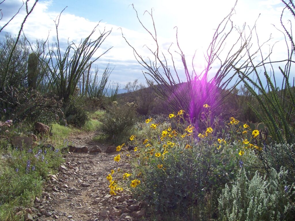
TUCSON, Ariz. – “Lucky to be alive” is a phrase that applies especially to the saguaro, an anthropomorphic cactus whose mere sighting signals you have arrived in Arizona.
Their ramrod-straight stems rising as high as 50 feet, often sporting several mid-body arms that also curve determinedly skyward, saguaros have overcome tremendous odds to survive and thrive. In their lifetimes, healthy saguaros produce some 40 million seeds, of which only a few germinate. Most instead are eaten by birds and other desert creatures or rendered useless by the scorching sun.
If a seed is to have any chance it must become imbedded under the protective shade of a host plant, such as a palo verde tree or mesquite. Then patience comes into play: A baby cactus might grow only one-quarter inch in its first year. Fourteen years later, it might be a foot tall, and it won’t flower or produce fruit until its 30th birthday. After a half-century, it could reach 7 feet, and 25 years later the first arms may begin to form as prickly balls. Ultimately, if the saguaro is not ravaged by nesting animals, blown over by heavy winds (its roots extend only 3 inches into the ground) or “rustled” by criminals who would use or sell it for subdivision landscaping, the cactus could weigh 8 tons and live for a total of 175 years.
Saguaro National Park in southeastern Arizona pays tribute to the grand cactus and allows visitors to walk among forests of it. Split into two areas with sprawling Tucson in between, the park now is approaching what many consider to be its most exciting season. From late April through early June, saguaros will be flowering. That follows on the heels of a sensationally colorful early spring, when other desert plants blossomed with blue, purple, orange, yellow and white petals – on a carpet of green — thanks to an unusually wet February.
The park’s western section, subcategorized as the Tucson Mountain District, features a six-mile, unpaved loop drive and more than 40 miles of hiking trails, including an easy short one that leads to Indian petroglyphs. Encompassing 24,000 acres, it’s about one-third the size of the park’s Rincon Mountain District. East of Tucson, Rincon has an eight-mile, paved loop road and an extensive trail system that for backpackers includes primitive campsites. Both sections have a visitors center.
Higher in elevation with more precipitation than its western counterpart, Rincon’s terrain — in addition to accommodating saguaros — rises to include oaks, ponderosa pines and Douglas firs. The Tucson Mountain District, which my wife and I visited in mid-March, tends to be warmer and is more cactus-intensive. Hedgehog cactuses, teddy-bear chollas, barrel cactuses and ocotillos are omnipresent. Hard as we tried, though, we did not see any foot-tall baby saguaros, though no doubt they exist.
We sampled two easy trails, the first being King Canyon. After heading up a dry creek bed for a half-hour or so, we ascended to the formal trail, formerly a railway constructed by the Civilian Conservation Corps in the 1930s. The desert blooms were extraordinary, and if we had had more time we would have made the four-hour round trip to the top of Wasson Peak, elevation 4,687 feet (about 1,800 feet higher than the trailhead).
Sunlight was in its waning hour when we arrived at the Signal Hill Trail, a half-mile path that leads up to an outcropping and the petroglyphs, believed to be 700 to 1,300 years old. The designs we saw, many of which were circular, some of which were stick figures, are believed to represent territorial claims, tell stories or simply be whimsical. Signal Hill was a nice way to end our visit, though the two-mile road we drove on to get there was a rocky-ribbed rough one.
Just outside Tucson Mountain District’s main entrance is the very popular Arizona Sonora Desert Museum, a combination nature trail and zoo. Hundreds of vehicles were parked in its huge lot when we drove by. For more information: (520) 883-2702 or www.desertmuseum.org
Some of the noncaptive animals that populate the region are Gila woodpeckers, gilded flickers, screech owls, cactus mice, roadrunners, Gila monsters, javelinas and diamondback rattlesnakes. If you go, be sure to take binoculars for plant and wildlife viewing.
Mid-spring’s the time to visit Saguaro National Park, where the average high temperature doesn’t top 90 degrees until June (it’s 98.5 degrees that month, the hottest; January’s average high is 64). The flowering saguaro season is followed by its maturing fruit, which today is devoured by animals but for centuries has been an important food source for Tohono O’odham Indians. They make jams, candy and even wine from the red-fleshed fruit.
Saguaro forests are bouncing back after being in general decline for much of the 20th century. The cactuses were decimated not just by animals, wind and rustlers, but also by something that has been eliminated in the park since 1979: livestock grazing. Cattle trampled seeds and seedlings that otherwise might have had a shot at the incredible life that the luckiest saguaros enjoy today.
Saguaro National Park’s two sections are about 30 miles apart. Admission is $10 per vehicle, good for seven days. For more information: (520) 733-5153, www.nps.gov/sagu or the unofficial Web site www.saguaro.national-park.com.
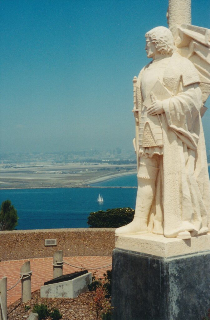
SAN. DIEGO – During my three-day stay, a front-page story in the local newspaper reported that commuters here have it worse than those in all but four other U.S. urban areas. Los Angeles and San Francisco also were in this dubious top five.
In a place where driving is painful for residents, tourists can expect frustrations, too. For that and other reasons, such as mounting fuel prices, I explored the city’s public-transportation system. I treated San Diego as I would a large foreign city, in this case pretending my car was not in my downtown motel’s parking lot.
The results were overwhelmingly positive. Using the trolleys, buses and my legs – anyone who finds strolling distasteful should stick to battling traffic – I went everywhere I desired. Driving might have, in some cases, saved me a little time, but it probably would have been aggravating.
Using a two-day “tripper” pass, which in May cost $8 and can be bought at any trolley stop, I enjoyed unlimited use of San Diego’s public-transit system. (One-, three- and four-day trippers also are sold, then for $5, $10 and $12, respectively.) My destinations were Tijuana, the Mexican border metropolis; Qualcomm Stadium, where the Padres played the Atlanta Braves; and Cabrillo National Monument, which from the tip of Point Loma offers sweeping views of San Diego and the Pacific Ocean.
Following are more details about the three sites and the public-transit way to visit each.
Tijuana
From the Civic Center trolley stop, a trip down to San Ysidro takes about 40 minutes and in May cost, without a tripper pass, $4.50 round trip. Along the way riders pass under the Coronado Bridge, by the sprawling National Steel and Shipbuilding Co. and Naval docks, and through National City, Chula Vista and Imperial Beach. This Blue Line route goes as far north as Mission San Diego, while the Orange Line circles downtown San Diego and shoots over to Santee.
Upon disembarking in San Ysidro, those bound for Mexico by foot walk a few dozen yards to the customs building; where they proceed up a ramp, cross via a pedestrian bridge the southbound traffic on Interstate 5, go down another ramp, pass through a heavy, spinning gate, continue through a small courtyard past a bored-looking Mexican officer and enter the madness that is Tijuana through one of two other metal gates.
After stepping through one of those second gates, I put my head down through a gantlet of yellow-shirted cab drivers who parroted “Taxi?” I veered right to a plaza, where almost immediately a well-dressed huckster approached. “Naked women! Two girls is better than one, no? A senorita sandwich!”
My being alone, male tourist must have fit his clientele profiling.
Young men gestured that I enter their restaurants. Older men said, “Look at my stall, senor. You want cigars?” Children held out their hands for change. Old people sitting on the Tijuana River bridge mumbled requests for assistance, paper cups by their feet.
The last solicitation I received before re-entering the customs building came from a man who emerged from behind a bush, when I was two strides away. “Naked woman,” he said with a wink. “Nice senorita.”
Without question, Mexico has a lot to offer tourists. Tijuana is not my cup of tea, but I acknowledge that to many it’s a tasty shot of tequila. Cheers to them.
My return to the United States was marginally more involved than my exit had been. Walking across the multiple lanes of vehicles lined up (stopped – there was little danger) to cross the border northbound, I went up another ramp, waited about 10 minutes in a line and was waved through by a U.S. Customs official. He seemed to smirk when I showed him my California driver’s license; the two men in front of me had merely said “U.S. citizen” and produced no identification.
Qualcomm Stadium
The Padres’ home field, like those for the Oakland Athletics, Chicago Cubs, New York Yankees and a few other big-league baseball teams, can be reached conveniently by public rail. Fans need only get aboard a northbound Blue Line trolley, with a transfer sometimes required at the Old Town or a downtown station. At game’s end, several southbound trolleys are lined up to handle the surge in riders.
The game I saw convinced me of three things. One, Qualcomm is a friendly stadium whose palm trees behind the outfield fences and wonderful scoreboards help make up for the fact it is fully enclosed (unlike San Francisco’s Pac Bell Park, for example, which does not have multilevel, wraparound seats). Two, the Padres’ Rickey Henderson plays like he is 26, even though he’s 42. And three, “view” seats for $8 are a far better option than the $9 “lower view.”
For more information about the Padres:http://padres.mlb.com/NASApp/mlb/sd/homepage/sd_homepage.jsp.
Cabrillo National Monument
Bus 26, which runs once an hour to and from the Old Town Transit Center, drops people off right outside Cabrillo’s visitors center. A trolley-bus combination from downtown to the national monument takes an hour, or a few minutes more depending on how you time the bus connection.
Cabrillo, which charges $5 per private vehicle but admits bus passengers for free, is a wonderful place from which to look back from Point Loma to San Diego’s skyline, its harbor, Coronado Island and the Pacific Ocean. The two-mile (round-trip) Bayside Trail enhances those views, plus through several signs allows hikers to learn about the area’s history, climate, vegetation and wildlife.
The visitors center, open daily from 9 a.m. to 5:15 p.m., has a few displays and screens documentaries at the top of each hour. Outside, on a bluff that overlooks the point where San Diego’s harbor gives way to the ocean, is a statue of Portuguese-born Juan Rodriguez Cabrillo. In September 1542, either he or one of his crew members was the first European believed to have set foot on the West Coast.
During World War II, this tip portion of Point Loma·was occupied by the Army’s 19th Coast Artillery. On the lookout for a feared Japanese attack, soldiers spotted 61 possible enemy targets during the war, though most turned out to be fishing boats or whales, and the rest never were identified.
“In a way we was kind of hoping they’d show up,” a Sgt. Ernest Johnson is quoted in a small military-history exhibit off Cabrillo’s parking lot. “They (the Japanese) had sent some shells in up the coast a ways, one of (their) submarines had fired. We was hoping – we was looking for them.”
For more information about Cabrillo National Monument: (619) 557-5450 or www.nps.gov/cabr.
For more information about San Diego’s public-transportation system: (619) 233-3004 or www.sdcommute.com.
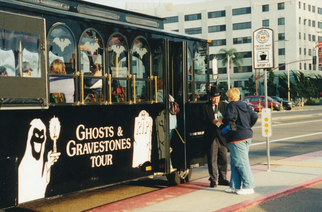
SAN DIEGO – A little girl ran out the back door and into, at neck level, a steel clothesline. She needed immediate help, but the town’s only doctor could not be found. She died.
Take heart: Her presence lives on in a nearby “cold spot.”
A cold spot, explained guide Tom on the Ghosts & Gravestones tour, is shoebox-sized and feels five to 10 degrees cooler than the surrounding outdoor air. Those who find this usually elusive spot have a sensation similar to sticking their hand in a refrigerator, he said.
The 18 of us in that evening’s group were directed to a small plant bed, around which was a circular path. The bed is where, Tom said, he and many others have felt this mystical cold-spot phenomenon. Each of us slowly walked around the bed, our right hands out, palms up to better sense a temperature change.
No one immediately claimed to feel something, but then again, only ghouls rush in.
Ghosts & Gravestones is family-friendly, 2.5-hour outing that explores San Diego’s mystical past. For $28 general ($12 for children ages 4 through 12), tourists get to see the Thomas Whaley House, site of the cold spot, along with a quirky cemetery and another “haunted” house.
Actually, the Whaley House is recognized by the U.S. Department of Commerce as being one of 30 haunted structures in the country and one of two in California, the other being San Jose’s Winchester Mystery House. Believed to be the state’s oldest two-story brick house, built in 1856, it supposedly has been ghost-infested since the Whaley family was beset by a series of tragedies, including the visiting girl’s death.
My tour group was shown photographs of Whaley House rooms that each have a white, blurry image in some portion of the frame. A deadly serious man told us he had taken the pictures as part of his “scientific” work to prove the place is haunted.
Whatever. Even those who do not believe in ghosts can appreciate the tour for its goofily sincere staging and for Tom’s – or presumably any other “conductor’s” – storytelling. As the black trolley that ferries tourists around claims, the evening is “guaranteed to raise your spirits.”
Among Tom’s tales concerned 19th century sailors’ unfortunate propensity to succumb to scurvy, a disease caused by insufficient intake of vitamin C. Victims would be sewn up into old sails. “The last stitch would go right through the sailor’s nose to make sure he wasn’t alive and would scream out.”
As the trolley passed by the Horton Grand Hotel, we were told how its Room 309 is haunted by card shark Roger Whittaker. Though hiding in a wardrobe closet, he nevertheless was shot dead by someone he had cheated in a gambling hall owned by none other than Wyatt Earp. Room 309 guests report such strange, late-night phenomena as lights flicking on and off, curtains being pulled back, wall pictures being tilted, and playing cards, if left out before bedtime, by morning having been dealt into poker hands.
The hotel in which Whittaker was shot no longer exists, but the Grand Horton’s Room 309 has a wardrobe and suits his soul. “Roger Whittaker seems to have found that armoire very comfortable, so he has checked in,” Tom quipped.
Villa Montezuma was the tour’s first stop. This imposing, freshly painted Victorian, a diamond in a rather rough neighborhood just off Interstate 5, is another site of otherworldly sightings. Jesse Shepard, who could play piano masterpieces though he had no musical training – he just “divined” the works, we were told – designed and supposedly now haunts the structure.
Tom also drove us to Pioneer Park, where some of the town’s early citizens are buried. The gravestones are oddly placed, however – no bodies are beneath them. For whatever reason, the bones (initially placed in wooden caskets that since no doubt have decomposed) are under a hill we had crossed on our walk from the bus. That was a little spooky. And strange. Our stop here was at sundown, and Tom – wearing what could be a 19th century caretaker’s outfit and holding an old-style lantern – led us through the park in a manner befitting a Vincent Price or Bela Lugosi flick.
Some of those buried in the park tied in with the longest ghost story Tom spun that evening, about a shady French Arcadian named Yankee Jim Robinson. In the 1850s he was hanged in what today is San Diego’s Old Town district, where the Whaley House is.
The little flashlights we had been given for the Pioneer Park walk turned out to be freebies, as was a snack sack, consisting of fruit juice and candy bars. Those were nice touches on a frighteningly agreeable, if somewhat chatty, adventure.
Reservations are required for the Ghosts & Gravestones tours. They depart from the Cruise Ship Terminal, a few hundred feet south of the Star of India along the city’s main waterfront, at 6:30 p.m. Wednesdays through Sundays. Some changes are planned for the tour beginning in 2002. For reservations: (619) 298-8687.
The Thomas Whaley House (619-298-2482; 2482 San Diego Ave. at Harney Street) and Villa Montezuma (619-239-2211; 1925 K St. at 20th Street) can be toured separately, and more extensively, during the day for $5 or less apiece.
SAN DIEGO – Stepping aboard the stately Orion on a gorgeous day, I was told seven women would join me on the three-hour sailing adventure.
“Sounds grim, but I’ll try to manage,” came out my mouth as my brain gave itself a high five and yelled “Sweet!”
Tina, one of the seven Tennesseans who were here on an annual girls-only vacation that until 2001 had been spent in Florida, said: “Three hours with us! You’ll feel like either you’re in heaven or in hell.”
How right she was: The latter, lower destination dominated. An adventure I had paid $55 for turned out to be little more chills-inducing than dangling one’s feet in a Chattanooga swimming pool. This Tennessee Tina was no “Survivor,” and I yearned to vote off the un-magnificent seven. The four-man crew was sympathetic, but I could form no alliances here.
Things sure looked promising as we motored past the dozens of other sailboats docked behind the Sheraton’s east tower on Harbor Island. Once clear of the marina, one of the younger women, Kim, did her home state proud by volunteering to crank up the main and front sails. Captain Keith Korporaal cut the engine and I luxuriated in the quiet progress we were making toward the Pacific Ocean.
The 64-foot, 30-ton wooden sailboat, built in 1934 and kept in sparkling good shape by Korporaal and his Orion Charters Inc. crew, leaned leeward as it cut smoothly through the wakes of other, sometimes speeding craft. We passed closely by sea lions lounging on red buoys, while a few hundred feet away were several of the mammoth, gray Naval vessels that dock in this sprawling harbor. Soon, to the right, we were coming upon Cabrillo National Monument and the cliffs at Point Lorna’s farthest reaches.
All of a sudden the front sail was taken down, the Orion was turned around and we crawled – dogs paddle faster – back toward the city skyline on what became a tourist’s voyage of the damned: in this case, the tourist being me.
Turns out the Tennesseans had asked Captain Keith to take it easier. A lot easier. Tina, or Mary Ann, or Jamie, or one of my other shivering shipmates even requested that the vessel stop completely so that she and the others could lie down and sun themselves. Kind of like one does on the beach, I thought, for free.
“This is the first time we’ve ever been asked to slow down,” Korporaal told me at the time, a believable claim he repeated after two more hours of bobbing along at a pace coral growth could match. Conversing with him and drinking beer were for me saving graces on an outing that otherwise would have felt like three days rather than three hours.
Like coughing fits in orchestra halls, snippets of the women’s chatter interrupted whatever pleasantness I was experiencing.
“Socks would be nice!” said one, who like most of her pals had underdressed for the occasion. “Jamie’s talking about going below to get away from the cold!”
“Can I squeeze in over there in the sun?” “Is there any hot chocolate?”
“We’re thinking of going down below and getting some coffee.” “It’s not so bad now. The boat’s kind of slowed down.”
And lost opportunities for great adventures are kind of frustrating, I thought.
Korporaal, a tall and lean former Marine in his mid-50s, is a San Diego native whose teenage love affair with a buddy’s Penguin craft evolved into his launching Orion Charters 16 years ago. The company’s fleet consists of the Orion on which we rode and a smaller sailboat that carries a maximum of six clients. Excursions such as mine are offered daily, at 9 a.m., 1 and 5:30 p.m., with reservations recommended. Longer chartered outings also can be arranged.
Later this year, Korporaal said, his company will more intently market an eight-hour, $85-per-person sailing excursion down to the Coronado islands, in Mexican waters. Sea life will be the focus. It sounded wonderful to me.
Tina and the gang, meanwhile, were sprawled out on the front deck, blabbering about where they were going to have dinner and yapping on someone’s cellphone. Kin from back home had relayed news that Kim’s daughter had sustained a mildly broken arm while she and her team of champion jump-ropers – no, really, I’m serious: jump-ropers – were on a celebratory skating excursion. Having spent more money on this tour than on any I had taken in nine years, I could not have cared less about an owie in Cookeville.
Call me an insensitive brute, but please do not call me if there’s room for one more on a sailboat with seven unadventurous women.
Orion Charters Inc. can be reached by phoning (619) 574-7504, or by visiting its Web site at www.orionsailing.com/index2.html.
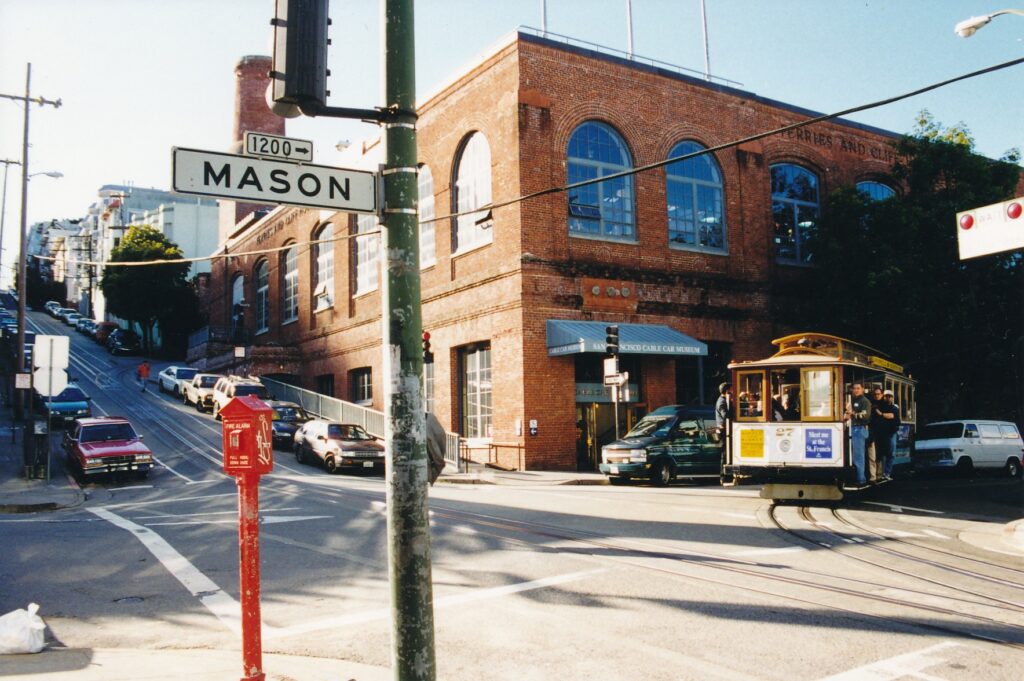
SAN FRANCISCO — Living as we do so close to the Bay Area, many of us take for granted things that tourists get quite excited about, such as cable cars. Did you know –perhaps you suspected as much, but were not certain — that there is no other operating cable-car system on the planet?
The San Francisco Cable Car Museum, in the city’s Nob Hill district, lets you come to grips with facts and figures about the quaint, clacking darling of the city’s tourism industry. Gripping is the operative concept, if not necessarily in the knowledge you will gain, at least in the literal sense of how cable cars operate.
Best of all, the museum is a free ride. A sprawling gift shop might tempt you and your wallet to fall off the wagon, with its cable-car models that play “I Left My Heart in San Francisco” when you wind them, but there is no charge for enjoying the exhibits.
Rather like an aquarium that is perched on the coast, the cable-car museum is on a platform that overlooks massive machinery driving the system’s four lines: Powell Street, its cable 9,050 feet long; Mason Street, 10,050 feet; Hyde Street, 15,700 feet; and California Street, 21,500. (Apparati for the California Street line were silenced in early January for repairs that are expected to continue through the spring.) The building, at the corner of Washington and Mason streets, popularly is called the Car Barn.
The drone made by cables, pulleys or “sheaves” (pronounced “shivs”) that are 14 feet in diameter, motors installed in 1984 and the gear-reducers — identifiable by their “Philadelphia Gear Corporation 1892” labels — becomes a white-noise background for visitors who wander around the museum and gift shop. Among many other things, they can learn:
- In the system’s heyday, the last two decades of the 19th century, nine rail companies operated the city’s 22 cable-car lines. Gauges were not standardized until 1956.
- Today, there are 40 cars in the system, with no more than 26 used on any given day.
- The cables move constantly at 9.5 miles per hour.
- Each cable lasts 75 to250 days, though rarely do they ever “snap” completely. Their usual problem is fraying, detected by a network of rings that electronically informs the operations center, which shuts down the line for splicing or other repairs.
“Anatomy of a Grip” displays the actual component and an accompanying sign testifies to the grinding wear-and-tear of a transportation system unique in this era of plane s, space shuttles and automobiles.
The overriding principle of cable-car motion seems counter to what holds true on today’s roads: whereas motorized vehicles stop when brakes are applied, cable cars stop when the grips are released. The latter move by grabbing hold of the constantly moving cable line. The piece of metal that grips, called a “die,” lasts an average of four days.
Repair and upkeep are so intensive, and the supporting tunnels and system of pulleys are so extensive, that cable cars are impractical in most cities. In San Francisco, however, they have endured for more than 125 years due not just to popular support, but also to their effectiveness in hauling people up and down the famous hills. As one museum display points out, when San Francisco was springing to life in the mid-19th century, horses were not physically able to meet the demands of pulling carriages up — and keeping them from careening down — the sometimes laughably steep streets. Driving those streets can be difficult, too.
Cable cars, invented in 1873 by Andrew Smith Hallidie, eased the burden of many horses (and, for that matter, street-cleaners). Two pictures of Hallidie posing on cable cars can be found among the museum’s photographs, which also include a blow-by-blow account of the system’s overhaul in 1982-1984, including the ceremonial participation of then mayor Dianne Feinstein. A picture of Kearny Street taken about one month before the massively destructive April 18, 1906, earthquake shows cable cars, lots of people on bikes, some horse-drawn carriages and — maybe off in the distance — a motorized vehicle of two.
Another display uses a mural-size illustration and blown-up newspaper headlines to report how the city proposed in January 1947 to shut down the cable-car system, but voters came to the rescue in November by approving that generation’s Proposition 10. Nearby, visitors can sit through a 17-minute video that gives an overview of the system’s history and operations.
The San Francisco Cable Car Museum, at 1201 Mason St., is open from 10 a.m. to 5 p.m. daily through March 31; beginning April 1 it stays open an extra hour through September. It is closed only on New Year’s Day, Thanksgiving and Christmas. For more information, call (415) 474-1887.
Sometimes, it’s fun to play tourist in “The City.” Without out-of-state visitors in tow, you can come here and not act like it’s your ho-hum turf. Try pretending that you live more than 90 minutes away, that you are here for the first time, and that you need a quick overview of the city’s many possibilities.
I’m not suggesting you should go so far as to call it “Frisco,” but you might consider taking a “duck” tour.
DUKW vehicles, rooted in World War II military operations, are the essence of sightseeing adaptability. With their six wheels and propeller, they traverse land and sea seam less ly, and passengers don’t have to move. Open-air seats are high enough off the ground (or water) that patrons can see over the tops of cars, bobbing seals and other low-profile obstacles.
The tours are offered in dozens of other cities, including Boston, Seattle, and Oahu, Hawaii. A couple of companies offer them in San Francisco.
On a sunny weekday early this fall, three women from Australia were upbeat about their Bay Quackers adventure.
“I thought it was fabulous, ” said Debbie Bloomfield of Tin Can Bay, near Brisbane on east-central Australia’s Gold Coast. I spoke with her near Fisherman’s Wharf a few minutes after we had de ducked. She and her aunts, fellow Aussies Roseanne Dean and Helen Elms, had just started an eight-week, round-the-world trip whose itinerary was to include Las Vegas, New York, Europe and Bangkok, Thailand.
It was only their second day in San Francisco, but already they had taken four or five tours.
“He’s the best guide that we’ve had, ” Bloomfield said about the Bay Quackers’ congenial Ingemar Olsson. “The other tour operators were very talky. They enjoyed the sound of their own voices.”
The aunts nodded in agreement. Suddenly, finding herself being interviewed by a Yankee reporter, Bloomfield blurted, “We already made the papers!”
They all laughed, and laughed even harder when she referred to her elderly companions as “the dementia sisters.” (Am I alone in thinking Australians are more amused by life than we Americans are?)
Earlier, at noon, we had boarded Psychadela-Duck. Bay Quackers names its hybrid vessels after San Francisco neighborhoods; can you guess which part of town this one referred to? (Answer: Haight-Ashbury.) Another vessel, “Peking Duck, ” is a goofy nod to Chinatown. That should give you an idea of the duck tour humor’s sophistication level — that and the fact riders are encouraged to blow their duck whist les at pedestrians and open-windowed drivers. “Quack, quack!” Olsson would prompt us.
“Does anyone know the dominant architectural style in San Francisco?” Olsson said as we rattled away inland from the wharf area. “It starts with a ‘V’ and ends with ‘ictorian.’ “
He continued with the one-liners for all 90 minutes. Depending on one’s mood, they induced chuckles or groans. Here’s a sampling:
- As we passed the San Francisco Giant s’ ballpark, originally called Pacific Bell Park, later SBC Park and now AT&T Park (after just eight years in existence! ), Olsson pointed out some street signs that still say “SBC Park.” “I think they should leave the signs as is — SBC Park, for ‘Some Big Corporation.’ Quack, quack!”
- In the bay just south of the ballpark, as we slowly made our way around the USS Cape Horn, Olsson said we could tell friends we had “sailed around Cape Horn.”
- “This duck is 63 years old. Well, that’s two years younger than I am, but we are both Coast Guard inspected and certified.”
- As the Psychadela-Duck waddled up the ramp from water to land, the guide cracked dryly, “This is what I call evolution.”
- Near the Ferry Building, Olsson pointed out a eight-legged statue with birds underneath. “I call that one ‘Crouching Spider, Hiding Pigeons.’ Quack quack!”
Even some of the “serious” things Olsson said had some humorous aspects. For example, as we passed Union Square he pointed to the tall monument that honors a Naval victory during the Spanish-American War. Atop it is a female figure Olsson said was modeled after Alma Spreckels, a former nude model who married sugar baron Adolph Spreckels. That particular couple’s union, Olsson claimed, gave birth to the expression “sugar daddy.”
On the Monday I rode along, Psychadela-Duck was maybe three-quarters full, with 15 passengers. By the time we returned, a dozen or more people were lined up for the 2 p.m. tour.
John E. Scannell, Bay Quackers’ president and chief executive officer, told me via e-mail that “2008 was our best year ever, and our ridership during the summer beat our expectations. We have been experiencing a softer shoulder season, which can be attributed to the slower economy and the drop in leisure travel.”
Tickets, which can be reserved via telephone for the time being (until the Web site is renovated), must be purchased at Bay Quackers’ small office at 2800 Leavenworth St. No. 16, a block and a half from the water just south of Jefferson Street.
The fare is $35 general; $32 for students, military veterans and people ages 62 and older; and $25 for children ages 12 and younger. From November through February, daily departures are at 11 a.m., 1 and 3 p.m. For tickets and more information, call (415) 431-3825 or go to www.bayquackers.com.
DUKW, a vehicle with military history
Here’s how the Bay Quackers’ Web site (www.bayquackers.com) describes its vehicles:
“The DUKW… is a six- wheel-drive amphibious truck developed by the United States during World War 2 for transporting goods and troops over land and water and for use approaching and crossing beaches in amphibious attacks. The DUKW was used in landings in the Pacific, in North Africa, and on D-Day on the beaches of Normandy…
“Although its designation as a DUKW may seem to be a military pun, in fact in the terminology developed for military vehicles in World War 2, the D indicates a vehicle designed in 1942, the U meant ‘utility (amphibious),’ the K indicated all-wheel-drive and the W indicated two powered rear axles.”
Also used in the Korean War, the vehicles were tools of police and fire departments before they found new life as tourist trekkers.
SAN FRANCISCO — Those of you angling for a low-cost attraction in this high-ticket town; take heart. Near Fisherman’s Wharf is something nautical, something nice. Something not overpriced.
Set your sails on Hyde Street Pier, where for $5 you can climb aboard some stately old ships that once journeyed to and from other continents, up and down the Pacific Northwest coast. Check out the decks, rooms and box beds that sailors called home for months at a stretch. Look up at the massive masts and riggings or gaze out toward Alcatraz Island and the Golden Gate Bridge, all the while your body sensing the bay’s gentle rocking of the boat.
The pier was built in 1922 as a terminal for the Golden Gate Ferry Co. Anyone driving up Highway l had to park and float across the bay here in order to continue north — until the great bridge’s completion in 1937. Fourteen months later, the pier closed, and since 1963 it has been a nursing home for retired vessels. Today there are five such old ladies of the sea, with a sixth being repaired elsewhere but due to return this spring.
The pier is part of San Francisco Maritime National Historic Park, a laid-back oasis just west of frenetic Fisherman’s Wharf and the teeming city behind them. “America’s only floating national park” also contains a pleasant garden area with well-tended grassy slopes, rows of concrete bleachers that look out toward the bay and are great for picnics and for watching people jog by on the path below, and a free maritime museum that has neat exhibits and — at least on a rainy day in late January — clean public bathrooms. (If you’ve come from the wharf, take note of that last, promising fact.)
Speaking of relief, back on the pier educational opportunities extend to the men’s restroom. A plaque opposite the sinks explains the slang expression “head” derives from holes at the front or head of sailing ships, allowing for “a direct drop” into the sea. As unpleasant as that may have been, the alternative of a toilet placed mid-vessel might have been worse: “When the ship plunged into the ocean, a geyser of water would fly up through the drainpipe to discomfort the user.”
Sleeping is another bodily obligation that can test a seafarer’s mettle. Aboard the Balclutha, at 301 feet long and 1,689 gross tons the largest vessel at Hyde Street Pier, sailors bunked in the forecastle (or “foc’sle”). This triangular room has two doors in its broad back wall leading to the deck, and wooden beds stacked three high on the other two walls that merge at the bow. Despite each bunk being framed by foot-high planks, seas could be rough enough to bump men out of beds and hurl them against the back wall or through one of the doors.
Below deck is a collection of old ship parts — rudders, anchors, sections of masts, and a couple of bells, among other things. After its launch in 1887 from Cardiff, Wales, the Glasgow-built Balclutha made several trips between Europe and San Francisco, rounding South America’s tip. There, too, sailors encountered more peril. A display points out that in 1905-06 alone, eight sailing vessels similar to the Balclutha either were lost or wrecked in that Cape Horn region.
Back when ships relied on sails for power and sailors went months without setting foot on land, personalities really came into play. No doubt they still do aboard long naval or other types of voyages. According to one Balclutha sign, and to many Hollywood films such as “Mister Roberts,” one type of commonly found personality is a “sea lawyer.”
“Almost every crew had its agitator — a malcontent who found no good in anything, who urged the men to demand this and that from the captain, but, like the Duke of Plazatorroi led his regiment from behind. He was never bold enough to take his grievances aft and his ravings soon fell on deaf ears.”
Two-thirds as long and one-quarter as heavy as the Balclutha, the C.A. Thayer is a more-intimate ship to be explored at the pier. Constructed near Eureka in the 1890s, this schooner traveled among West Coast ports and made the region’s last commercial sailing voyage in 1950. Below deck, skipper Ed Shields narrates a video of that final run to Alaska.
The TV that continually runs Shields’ film is about all you will find in the cargo area, the middle of which is covered by a wooden grid that allows for some natural lighting. The grid also allows sounds from on deck to come down. Overheard in January were two young boys peering through the grid and yelling, “Let’s go down and see the slaves!” It was not a moment that reflected proudly on our nation’s history, or perhaps on our schools’ lessons of tolerance and tact.
The oceangoing tug Hercules, paddle-wheel tug Eppleton Hall and scow schooner Alma also are moored at Hyde Street Pier, though they were not available for boarding when I visited. Absent was the sidewheel ferry Eureka, which during its service from 1922 to 1941 was the world’s largest passenger ferry, holding up to 2,300 passengers and 120 vehicles. She now is being repaired elsewhere, with park officials anticipating her return this spring.
Off the pier and back in the museum, visitors can learn much more about all matters nautical. Particularly interesting, and fun for children, is the interactive ship-communications exhibit upstairs. Among the things you can learn about, and tap out on a fake transmitter, is the Morse code distress signal.
Prior to 1912, troubled ships would transmit a “CQD” (CQ for a general call, D for distress). In Morse code, that was a rather cumbersome dah dit dah dit, dah dah dit dah, dah dit dit. However, the Titanic’s sinking made officials realize an easier-to-identify signal was needed. Hence “SOS” became the norm, with its simple dit dit dit, dah dah dah, dit dit dit.
In addition to its displays and clean bathrooms, the museum contains at least one other noteworthy lure: Upstairs is a free distance viewfinder, which can be trained on Alcatraz, the hills of Marin County and the retired ships off Hyde Street Pier.
The pier is open from 9:30 a.m. to 5:30 p.m. daily. Admission is $5 general, $2 for seniors and children ages 12 to 17; there is no charge the first Tuesday of every month. The museum, at the foot of Polk Street, is free and open year-round from 10 a.m. to 5 p.m. For more information about San Francisco National Historic Park: (415) 556-3002 or www.nps.gov/safr/. To find out what public transportation services the area, visit that website or call MUNI at (415) 673-6864.
On the first Saturday of every month (except for September, when the event is held on the second Saturday) from 8 p.m. to midnight, Hyde Street Pier is the site of an alcohol free “Chantey Sing” aboard one of the ships. Bring something soft to sit on, something warm to wear and a mug for hot cider. Admission is free, but reservations are required. Call (415) 556-6435 or e-mail peter_kasin@nps.gov.
As we fret and stagger through a stock market crisis, many of us are investing in the heavy trading of one particularly grim historical phrase: the Great Depression.
Will the 2010s be the new 1930s? Some of us suddenly are interested in learning about those trying pre-World War II days, much as an accident suddenly makes us interested in the finer points of our car insurance policies.
One small and somewhat strange chapter of the Depression was written on the streets of San Francisco, specifically at the southwest corner of Pine and Sansome. There, the Pacific Coast Stock Exchange began trading in a lavishly renovated building in the first week of January 1930, a few meager months after the pivotal crash on New York’s Wall Street.
Fifteen months later, the building’s dominant piece of interior art, a mural accessible only to a few hundred captains of capitalism, was completed by a world-famous communist: Diego Rivera.
Thanks to San Francisco City Guides, a nonprofit organization that gives more than 60 free tours each week, the public can see Rivera’s “Allegory of California” in its still-private setting.
Rick Evans gave the inaugural Stock Exchange Tower tour on Oct. 20. Tours will be offered at 3 p.m. every third Monday until, Evans suspects, popular demand creates the need for more. (Evans is scheduled to give the next tour, at 3 p.m. Nov. 17.)
About 15 of us gathered around Evans in the lobby at 155 Sansome St., beneath the administrative wing of the stock exchange complex designed by renowned San Francisco architect Timothy Pflueger.
“This space you are standing in is the best art deco space not just in San Francisco, but in the United States,” Evans said. “Kids look at these elevator doors and think that what’s going to come out of them is the Wizard of Oz.”
He spoke for a few minutes about the lobby’s intricately jagged, gold-colored ceiling, saying its inspiration was a bar’s ceiling in Berlin. Pflueger wanted it to be made of glass, but earthquake fears prompted it to be composed of plaster instead.
We also spent a few minutes outside, around the corner on the steps of the stock exchange’s dramatic Pine Street entrance. Cascading concrete steps leading up a landing lined with thick concrete columns give the structure a big-money feel, but inside is a fitness center. Money traders left the premises in 2002 for higher-tech digs.
By now, more than a half-hour into what Evans had announced would be a 45-minute tour, some of us were eager to see the mural. That happy moment was soon to arrive, but first we rode up to the 10th floor and admired its three elevator doors, made of copper, silver, bronze and brass, and covered with spare but compelling drawings.
Finally, a few strides to the left (appropriate, considering the artist), we came upon “Allegory of California,” which an accompanying plaque identifies as “Riches of California.” It looms beside and over the open stairway that leads to an 11th-floor landing. As we ascended, we walked right beside the 30-foot mural’s lower portion — a careless visitor easily could brush his elbow against the precious artwork.
From the landing, Evans briefly talked us through the painting’s imagery. Rivera’s assignment was to honor the state’s many resources, both human and natural. The overpowering female figure on the mural’s wall portion holds in her left hand fruit and grain, representing California’s agricultural wealth. Her lowered right hand burrows underground, where two miners with headlamps hold a mechanized drill.
On the bottom right, James Marshall pans for gold and, nearby, Luther Burbank tends to a plant. Artist Victor Arnautoff also is depicted. In the center, a young man holds an airplane, signifying the promise of youth.
Four more planes appear on the mural’s smaller ceiling segment, which is dominated by the same woman. She is shown in full, nude and outstretched as though she were doing a burlesque imitation of Superman. Again, Evans said, the allusion is to airplanes and to what in 1931 was considered to be the modern age.
Rivera arrived in San Francisco in November 1930 to begin work in the Stock Exchange Building and on a smaller project, a fresco in the loggia at the California School of Fine Arts, now the San Francisco Art Institute.
At some point soon after, he met tennis star Helen Wills Moody, whose eight Wimbledon singles titles have been bested only by Martina Navratilova’s nine such crowns. She was a friend of the stock exchange project’s art director, Ralph Stackpole, whose art deco statues remain on either side of the concrete steps on Pine Street and over the 155 Sansome St. entrance.
Moody became one of Rivera’s favorite models, and in “Allegory of California, ” her likeness appears as the central earth goddess figure and the flying nude on the ceiling. The likeness is not exact, however. According to Evans, there was some concern at the time that Rivera’s central figure — nude, no less — should not be a recognizable celebrity. The artist acquiesced, altering Moody’s nose and jaw line in the mural.
It took five years of trying for City Guides to persuade the City Club, an upscale and private group that occupies the 10th- and 11th-floor dining halls and smaller rooms, to allow the tours.
Presumably, some pushing and pulling also was present in Rivera’s mind, before the communist — a champion of the lower classes — agreed to paint in such a hoity-toity place.
“He only got away with painting the mural here because it was in a private club that the public would never come into, ” Evans said.
Rivera’s tumultuous life, art intertwined
Diego Rivera was born in Guanajuato, Mexico, on Dec. 8, 1886. His family moved to Mexico City six years later and, by century’s end, young Diego had decided on a career in art.
By 1907, he was in Spain studying with painter Eduardo Chicharro. After two years, feeling his artistic soul needed more than just lessons about technique, he moved to Paris, where a Russian painter, Angelina Beloff, became his common-law wife.
During the World War I years, Rivera absorbed himself in the cubist style of painting, but in 1918 a friend persuaded him to see some classic frescoes in Italy, and his lifelong devotion to murals was born.
Shortly after his return to Mexico in 1921, Rivera married Guadalupe Marin, with whom he had two children. (They divorced in 1928.) Starting in 1923, he painted more than 100 frescoes on the Ministry of Public Education’s courtyard walls. The four-year project made him famous throughout the Western art world.
In 1922, Rivera began one of his life’s two storybook, rocky relationships when he joined the Mexican Communist Party. In the decades to come, he sprinkled his works with communist imagery, but he still accepted big commissions from the Mexican government and capitalists.
Such contradictions resulted in his being expelled from the party in 1924 and 1929, although Rivera was instrumental in bringing political outcast Leon Trotsky to Mexico and even hosted the Soviet revolutionary before they began to spat.
The allegation that Trotsky slept with Rivera’s second wife may have played a role in their falling out. Frida Kahlo, who as a teenager met Rivera in 1922 and for years plotted to gain his affection before they married in 1929, had many adulterous lovers. So did Rivera. The artistic pair, whose love affair is compellingly recounted in Salma Hayek’s 2002 film “Frida,” split for most of 1940. They reunited on his 54th birthday (when she was 34), remaining together until her death at age 47 in 1954.
Rivera’s courtship with the communists had a sad ending, t oo. After the war, he made a few major, and groveling, attempts to regain his party status. Rejection was swift and complete in all cases.
Rivera died three years later, of heart failure, in the Mexican city of San Angelo. He was two weeks shy of his 71st birthday.
Whereas communism and Kahlo were longtime Rivera associations, a short one is worth mentioning because of its rather bizarre nature. In 1932, American millionaire Nelson Rockefeller asked Rivera to paint a mural in the Radio Corporation Arts building of Rockefeller Center. (Rockefeller’s mother was a big fan of the artist.)
Rivera began “Man at the Crossroads, ” but because the work contained an image of Trotsky’s old pal Vladimir Lenin, Rockefeller pulled the plug. Rivera’s uncompleted work was chipped off the wall in 1934, earning the “red”-blooded Mexican muralist a footnote in the prologue to the Cold War.
IF YOU GO
Alas, it is too late to see Frida Kahlo artwork at the San Francisco Museum of Modern Art, which closed the special exhibit on Sept. 28. However, at your leisure, you can see some of her husband Diego Rivera’s other Bay Area murals. Find them at:
- The San Francisco Art Institute, 800 Chesnut St. (“The Making of a Fresco Showing the Building of a City”)
- Diego Rivera Theater of City College of San Francisco, 50 Phelan Ave. (“Pan-American Unity”)
- Stern Hall at the University of California, Berkeley (“Still Life With Blossoming Almond Trees”)
HOW TO GET THERE
One good way to get to the Stock Exchange Building: Take Amtrak’s Capitol Corridor train and the Amtrak connector bus to the Ferry Building, then walk the five or so blocks to 155 Sansome St.
INFORMATION
For more information about San Francisco City Guides: www.sfcityguides.org or (415) 557-4266. Reservations are not accepted. Donations at the end of tours, in the $5 per-person range, are appreciated.
SAN FRANCISCO – “For the next couple of hours, you will be the rock stars of San Francisco,” guide Eric Blanc told us as we rolled behind him, single file, at the start of our Segway tour of the city’s Marina District.
We saw no mosh pits and no underwear was tossed our way, but the seven of us tourists received many stares and had our pictures taken often that sunny Friday afternoon. Rock stars? No. Curiosities? Definitely. Segways are sighted less often than unicycles, and barely more often than unicorns.
A Segway Human Transporter, or HT, looks something like a pogo stick atop a platform that rides a few inches above the ground between two 16-inch-diameter wheels. Riders control forward and backward motion by leaning and make turns by twisting a handle with their left hand. Balance is kept by a gyroscope, which along with speeds of up to 12.5 miles per hour (8.5 mph for our tour) are powered by a battery that reportedly can go up to 24 miles between rechargings.
Since October 2004, the San Francisco Electric Tour Company has been offering the Segway forays from near the corner of Beach and Hyde streets, a few blocks west of Fisherman’s Wharf. Three times a day through October (twice daily November through March), three-hour tours begin with a 30-minute training session that includes a short video screening. Riders are given bright vests, protective helmets and charged $65 apiece.
Why take the tour, especially with that high price tag? I was attracted to the novelty of Segways, which I presume is what appeals to most people. Neither the six other members of Blanc’s group, which included a family of five from Minnesota, nor I had been on such a contraption.
Being stared at was part of the package, certainly, but it was not until the train ride home that I began to feel any embarrassment. That belated sensation stemmed from early on in the tour, when a man who watched us emphatically snarled at me after I cheerfully told him “Hello!” He perhaps was thinking about how Segways fit into our society; I was not looking at such a big picture then, but merely enjoying the ride. Deeper thoughts came post-tour.
Our training session consisted of learning how to turn the Segway on, to make sure the platform is level before we step on it, to use smooth but subtle motions with our feet and (mostly) lower bodies to go forward or backward, to turn, to stop and to step down before turning the thing off. The first few moments or even minutes felt a bit awkward, but not extraordinarily so, and before long I felt pretty comfortable.
Turning was tricky occasionally because as a bicycle rider I am programmed to use my arms and torso; with a Segway, it’s all in the left wrist. Also, once or twice I started going right when I meant to go left, or vice versa. After a half-hour or so, my feet started to hurt a bit, too. However, those were minor problems and attributable to my shortcomings, not a Segway’s.
Before we quietly motored off – Segways make a low whirring sound that probably includes the tires’ rubber interacting with the road – we each had to sign a waiver that contained at least two mentions of accidental death. Adding fuel to the paranoia fire, Blanc told us, “My goal for this tour is no deaths.”
He was funnier, marginally, when atop a hill in Fort Mason he veered toward a long stairway leading to shops below. “We’ll take these steps very carefully,” Blanc’s voice crackled over walkie-talkies strapped to each of our handlebars. “As long as we do it slowly, we should be OK.” Then he turned away because, my gawd! you would not want to steer a Segway down stairs unless you have a yen for broken bones.
Earlier, on our way back from the end of Municipal Pier, we had graduated from a maximum speed of 4.5 mph to 8.5 mph. The latter seems much faster on a Segway than it does in a car or even on a bike, as the pier’s pockmarked path could conceivably bump you off the human-transport machine.
Riding through a long parking lot afforded great views of the Golden Gate Bridge and Alcatraz Island, which Blanc said often are not visible due to fog. After a 10-minute pit stop at the vegetarian restaurant Greens (try the chocolate vegan cupcakes, $2.17 after tax), we scooted on over to the Palace of Fine Arts, some of whose sculptured females have their rear ends pointed toward downtown (their faces are buried into the entablature). That little touch was the designer’s way of protesting underfunding, Blanc said.
Our guide shared quite a few other tidbits during the tour: The National Maritime Museum is free and shaped like a ship, Fort Mason was the launching point for sailors headed out to the Pacific theater of World War II and the Korean War, the Palace of Fine Arts is the only surviving building from the 1915 Panama-Pacific International Exposition. (I later learned that the world’s fair, which opened a few months after the Panama Canal opened in the notorious month of August 1914, featured a 5-acre model of the canal zone. Fairgoers were taken about it on a moving platform and heard a narration through individual telephone receivers.)
On our return from the palace, the driver of an idling tour bus yelled to Blanc, “Hey! Look back there! Someone fell down!” Then he laughed like an obnoxious drunk when Blanc turned around only to see that everyone was fine. Blanc shrugged; such was a routine annoyance.
Why the mean-spirited jokes? “Segways are an easy target,” the guide said. People see the strange vehicles and the riders’ goofy bright vests and are drawn to be droll, or at least make a stab at it.
The tour was different, for sure, but it was a lot of fun. I recommend it for anyone who is at all curious about Segways. However, and this gets back to the pedestrian’s snarl, later I thought about the usefulness of Segways. Sure, they are “no emission” transporters (a myth of sorts, as electricity that charges them comes from, often, polluting sources) and make gloriously little noise.
They are not entirely safe, though, as the pre-tour waivers suggest. Getting on and off the things improperly can result in their slamming into your shins, which hurts enough to matter. Running into a pedestrian, automobile (moving or not) or another Segway rider spells more pain, and possible property damage. They are heavy, about 80 pounds, and not collapsible. You cannot carry much on them, although among the four Segway models I found on www.segway.com is one with a golf-bag attachment.
Who could make good use of a Segway? One anonymous online analysis suggests it might be good for postal workers. The military apparently is interested.
My thinking is that Segways, which start at $4,500 on amazon.com, are nothing more than a segue from inefficient transportation (such as cars or “light trucks”) to a future with quieter, pollution-free devices that have more carrying capacity. Meanwhile, if you want to scoot around on your own and feel “green” about doing so, ride a bike. Or put on some comfortable walking shoes.
The San Francisco Electric Tour Company, at 757 Beach St., offers tours daily at 9 a.m., 12:45 and 4 p.m. Reservations are important, and can be done through the Web site (www.sfelectrictour.com) or by phone (415-474-3130 or 877-474-3130).
SAN FRANCISCO – Painted ladies, wedding cakes, funny hats. These things I encountered not at some hoity-toity family gathering in the Hamptons, but rather alongside the gritty, noisy streets of downtown San Francisco.
Buildings are what were described by those pedestrian but vivid phrases during a walking tour on a recent sunny Sunday. City Guides, a nonprofit organization sponsored by the San Francisco Public Library, has more than 200 volunteer docents who conduct 90-minute to two-hour tours daily, year-round. From now through September, 32 different excursions are being offered, as many as 15 a day.
This impressive undertaking has grown in scope steadily since its debut in 1978 and represents a free way for visitors to learn more about the city in a fairly relaxing manner. (Only a couple of the walks are deemed by organizers to be strenuous.)
Jason Cohen led the “Rising Steel” tour that began at 11 a.m. just east of Union Square. He did a fine job, evidenced by the fact that of the two-dozen people who started with him, all remained two hours later despite how easy it would have been to bail. “Thirty buildings in two hours are guaranteed, or your money back,” Cohen announced good-naturedly before we headed east down Maiden Lane.
A half-block later we stood before Xanadu Gallery, a 1948 brick structure designed by Frank Lloyd Wright during his late-in-life career resurgence. Here and at several subsequent stops, Cohen pulled out a laminated photograph to illustrate one of his stories. Wright, our guide said, had such a huge ego that he would not acknowledge being influenced by other architects. However, Xanadu’s entry is a dead ringer for a 19th century building by Henry Hobson Richardson – we could tell because Cohen held up a picture of that Chicago structure, which we were able to compare with the gallery over his shoulder.
Cohen often referred to Chicago because San Francisco’s architecture was substantially patterned after the 1893 World’s Columbian Exhibition in the Midwestern city. That world’s fair launched a nationwide City Beautification/Beaux-Arts movement. Also, prior to moving out West two years ago, Cohen was a tour guide for the Chicago Architecture Foundation.
San Francisco was a hotbed for construction projects after the 1906 earthquake and fire, which claimed all but 17 or so downtown buildings. “A Victorian city burned down and a new, modern city rose in its place,” Cohen said. A steady evolution of urban architecture has followed the fire’s immediate aftermath, when seven- to 10-story Chicago-style buildings were prevalent.
A clash of styles is found at the intersection of Grant Avenue and Sutter Street. On the southwest corner is a 1907 “jewel box” building of short but colorful stature – a “painted lady” that harks back to Victorian times. Across Grant on the southeast corner is the 1908 White House, a large, Beaux-Arts building that Cohen said “has many classic designs, what academics of the time thought architectural design should be.”
The 100 block of Sutter Street features an interesting side-by-side comparison of the 1910 Chicago School Building and the 1917 Hallidie. The former is topped with six stories in the Chicago style, but underneath are two stories that have a strikingly different Art Deco façade. Cohen speculated that the 1930s “modernization” facelift didn’t extend to the upper floors because of costs and because “people who walked by wouldn’t notice, anyway.”
Of the neighboring Hallidie, he said, “In terms of architectural history, this is the most important building in San Francisco” because its glass-wall skin designed by Willis Polk is some 40 years ahead of its time.
Down the block and across Sutter Street, at No. 111, the 22-story Hunter-Dulin building (1926) features an early example of terra-cotta designs around its tall entry. Terra cotta, Cohen explained, was lighter and easier to work with than the previously preferred granite. Hunter-Dulin also is where novelist Dashiell Hammett placed private-eye Sam Spade’s office in “The Maltese Falcon.”
Strolling north along Montgomery Street at the corner of Bush Street, we encountered that day’s first example of a “wedding cake.” George Kelham’s 1927 Russ building has a broad, boxy base of more than a dozen stories, then slims to another box of several floors before a thinner-yet tower climbs farther.
Such a design, Cohen explained, stemmed from a 1916 New York City ordinance that was triggered by anxieties about the cold, dark canyons being created beneath ramrod-straight skyscrapers. Diminished square-footage on upper floors would allow for more light to reach the streets below, giving such structures a multi-tiered or wedding-cake appearance.
Not long after that our group was jolted into late-1980s architecture when we saw the “Grim Reaper” building at 580 California St. and the “Hypodermic Needle” skyscraper at 404 Montgomery St. Each is topped with a jarring feature or two, hence the specific nicknames that need to be seen to be understood.
San Francisco’s planners had become concerned about the “Manhattanization” of their city’s skyline, said Cohen (who quickly apologized to anyone in the group who might be from New York), so they dictated that all new high-rises have distinctive tops. Hence the broad and sometimes-disdainful nickname for such structures: “funny hats.”
One of San Francisco’s landmarks, the Transamerica Pyramid, at 600 Montgomery St. is at the edge of the financial district and farther than our 12-block-long tour ventured. Cohen nevertheless took a few minutes to describe it, saying that though at 840 feet it is the city’s tallest building, its top 212 feet is “empty space” to create the triangular tower. He also said that the 1971 skyscraper was made shorter than envisioned due to complaints it would block residences’ and other buildings’ views of the bay.
“The probably hurts its design,” he said, “as it now looks stubbier.”
Before concluding at Battery and Market streets, beside the 1901 Mechanics Monument (Cohen showed us two pictures of it standing defiant amid the devastation of the 1906 fire), our guide led us by another survivor, the 1903 Merchants Exchange Building at 465 California St. Photographer Ansel Adams and architect Julia Morgan had offices there, and it hosted the world’s first television broadcast. Across the street, providing yet another contrast in a tour filled with them, is a circa. 1900 hitching post for horses.
Topics of other free City Guides walking tours cover a lot of ground, figuratively and literally, from “Art Deco Marina” to “Victorian San Francisco.” Among the others are “Bawdy & Naughty,” which concerns itself with the city’s freewheeling Gold Rush-era days; “Haight-Ashbury,” about gingerbread homes and, presumably, psychedelic happenings; and “Palace Hotel,” an in-depth look inside the restored 1909 grand example of the Beaux-Arts style.
Departure sites vary. Donations from walkers are appreciated, though Cohen applied little pressure to his group (which responded generously, regardless). For more information about the tours: (415) 557-4266, www.sfcityguides.org or e-mail tours@sfcityguides.org.
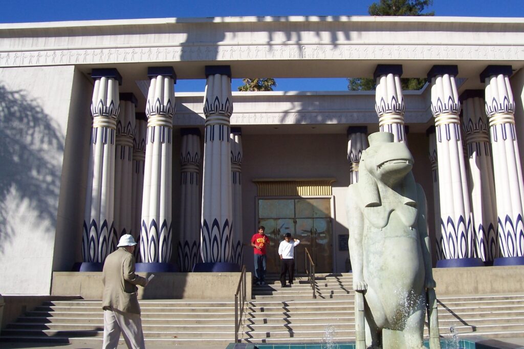
SAN JOSE, Calif. — It seemed like a clever idea at the time. Split the day between the new and the old: The Tech Museum of innovation and the Rosicrucian Egyptian Museum and Planetarium. We would contrast how things were thousands of years ago compared with how they are today, right this minute. Which museum would better capture our interest?
Score one for ancient Egypt. Although the Rosicrucian collections are nothing spectacular, they represent a serviceable introduction to one of the planet’s cultural foundations. Our visit to The Tech, on the other hand, was a disaster.
The downtown museum, only a few years old, either was having an extraordinarily unlucky day or is in desperate need of an electronic overhaul. We quickly lost track of how many “high-technology,” hands-on exhibits were not functioning, but here is a sample:
- In the Innovation Gallery, a teenage girl approached the 3-D scanner. ‘Tm sorry,” she was told by one of the museum’s legions of blue-shirted staff members. “It’s not working. Could you come back in a few minutes?”
- In an upstairs passageway, a contraption whose metal arms and claws are supposed to spell your name was “temporarily out of order.”
- In the Life Tech Gallery, which focuses on breakthroughs in medical science, I started punching buttons on the virtual operating room’s computer. “An error has occurred inside a plug-in contained on this page,” the screen informed me before I had gotten anywhere.
- Nearby, an exhibit supposedly would take an ultrasound image of my fingers. I put my hand in the thing and turned toward a computer screen that said, “We’re sorry, but this station is currently unavailable.”
Despite such contradictory drawbacks — shouldn’t a museum dedicated to the positive power of high-technology be fully operational? — The Tech was heavily trafficked that Saturday morning. People must have been having fun in some part of the three-story building, which includes an IMAX theater and gift shop. Practically the only things that I found at all mind-nurturing, though, were a couple of comments displayed over the upper level’s Imagination Playground.
“Play is the highest form of research,” scientist Albert Einstein once remarked. “We don’t stop playing when we grow old; we grow old because we stop playing,” playwright George Bernard Shaw once quipped.
My wife, Kari, as she watched children run about the museum trying this and that exhibit, also said something quotable. “This place would be a germaphobe’s nightmare,” she told me. “Everyone is touching everything.”
I hope those kids were having more success with the high-tech machines than we were.
A few miles west of downtown, the Rosicrucian museum is housed within a Parthenon-like building (fronted by several stone columns) and surrounded by beautiful gardens. If you go, be sure to take a little stroll outside.
The dark and solemn interior contains what the museum says is “the largest display of authentic Egyptian artifacts on the West Coast.” When we visited, they included a stele on loan from the Berlin Museum that contains tales of King Esarhaddon of Assyria. Among the permanent exhibits are a model of the Tower of Babel, a replica of the Zoser pyramid complex on the plateau of Sakkarah and — most interesting, I thought – a walk-through tomb replica based on examples from Beni Hasan, Egypt. Docents give frequent tours of the tomb’ s many rooms.
On the lower level, you can find a few mummies and an explanation of the mummification process.” A priest would cut a slit in the abdomen and the organs would be removed,” an interpretive sign explains. “The lungs, liver, intestines and stomach were mummified separately. The brain was thrown out as trash.”
A case of mind didn’t matter, apparently.
The Tech Museum of lnnovation, 201 S. Market St., is open from 10 a.m. to 5 p.m. Tuesdays through Sundays. Admission is $8, which includes one IMAX film. For more information: (408) 294-8324 or www.thetech.org.
The Rosicrucian Egyptian Museum & Planetarium, at 1342 Naglee Ave. in Rosicrucian Park, is open from 10 a.m. to 5 p.m. weekdays and from 11 a.m. to 6 p.m. weekends. Admission is $9 general, $7 for students with ID and seniors, and $5 for ages 5 through 10. For more information: (408) 947-3632 or www.rosicrucian.org.
ALBUQUERQUE, N.M. — Going up, up and away is a big deal in this city, especially during the nine-day Albuquerque International Balloon Festival in early October. But visitors have access to another uplifting experience, albeit with “strings” attached, for the rest of the year.
The Sandia Peak Tramway has been transporting people from the region’s desert floor to the mountain’s thickly forested top for four decades. A half-hour drive northeast of downtown, the tramway is said to be the world’s longest at 2.7 miles. The 14-minute trip that takes visitors up 3,819 feet, to an elevation of more than 10,000 feet, is a safe but thrilling ride over steep canyons that usually allows riders glimpses of wildlife below.
In operation year-round, the tramway caters to hikers in the summer, skiers in the winter and to sightseers all the time. I boarded on an overcast morning that was on the tail end of a late-summer period of extensive rains and flooding in the metropolitan area. The views on top were not as far-flung as they are on a clear day, which was disappointing but not a disaster. A wonderful hike made it all worthwhile.
From the mountaintop’s small cluster of service buildings, I left most of my fellow tram riders behind and set off on the Crest Trail. Its beginning includes a short nature trail peppered with interpretive signs. I learned, among other things, that Engelmann spruce, aspens and corkback fir are the small mountain range’s predominant trees. In touching the corkback fir’s spongy bark, I was reminded of sequoias and coastal redwoods in California.
The trail continues perhaps two miles to the Kiwanis Cabin. This solid one-room structure, composed mostly of bricks, was constructed by the Civilian Conservation Corps in 1936 and restored in the mid-1990s. Its original purpose, when it was a wood structure that burned down once and blew away another time in the 1920s, was to serve as lookout for wayward hikers, mountain climbers and skiers. Today, reaching it represents a great way for visitors to burn calories while breathing clean alpine air.
The CCC, by the way, was a very busy bunch. Established by the Franklin Roosevelt administration during the Great Depression as away to employ thousands of people and to strengthen our nation’s infrastructure, the corps’ accomplishments from 1933 to 1942 are startling: 46,000 bridges, 125,000 miles of roads, 13,000 miles of hiking trails, 89,000 miles of telephone lines and 300,000 erosion-control dams. Its workers also planted more than a billion trees.
Also impressive is the tramway. Constructed for $2 million in the mid-1960s, its two cars (each with a maximum capacity of 50) take hundreds of thousands of people up and down the mountain every year. Cars clip along at 13.6 miles per hour and pass over just two towers, which means if you ride, you experience a lot more hang time than even Michael Jordan could manage in his prime. As for those “strings” attached, the tramway’s track rope is more than five miles long and weighs 52 tons.
Birdwatching is popular on Sandia Peak, and with a little patience and good binoculars you might be able to spot copper hawks, falcons, flickers, golden eagles, ravens, red-tail hawks, woodpeckers and wrens, among other species. On terra firma (or from the tram car’s enveloping windows), keep your eyes peeled for black bears, bobcats, mountain lions, mule deer, porcupines, raccoons and skunks. The area also boasts 30- some types of reptiles.
Animals in less-natural forms can be found in the mountaintop High Finance Restaurant, open daily for lunch (sandwiches and soups run $7.50 to $10) and dinner (entrees are $16 to $30). You also can grab a snack or meal down below, where there also is a gift shop.
Sandia Peak’s 70-year-old ski area, with four chairlifts and 30 miles of slopes, is open from mid-December to mid-March. Peak season, so to speak, is mid-December through New Year’s, a period when the ski area is open from 9 a.m. to 4 p.m. daily. Otherwise, it is closed on Mondays and Tuesdays. Lift tickets are $41 general for all-day $31 for half-day. For more information, call (505) 242-9052.
Sandia Peak Tramway operates year-round from 9 a.m. to 8 or 9 p.m. Round-trip fare is $15 general, $13 for ages 62 and older, and $10 for ages 5 through 12; parking is $1 per vehicle. For more information: (505) 856-7325 or www.sandiapeak.com.
Sidebar:
Albuquerque’s Old Town, a mile or so west of modern downtown, is chockfull of interesting restaurants, shops and other attractions. Its National Atomic Museum is especially interesting.
Nuclear medicine and power are discussed in extensive displays. But the museum’s raison d’etre is its study of the Manhattan Project during World War II and the atomic age that it bore. Learn about J. Robert Oppenheimer and other scientists who gathered in nearby Los Alamos to build “the bomb.” See replicas of “Little Boy “and “”Fat Man;” the atomic devices that were exploded over Hiroshima and Nagasaki to end the war.
Watch an excellent documentary of the Manhattan Project that screens twice daily: “Ten Seconds That Shook the World.”
In my opinion, the museum has a noticeably pro-nuclear bias, although lip service is paid to the suffering of Japanese survivors of the August 1945 atomic attacks and to the 1986 nuclear-plant disaster at Chernobyl in the Soviet Union. Certainly, visiting the museum provides plenty of fuel for thought about where humankind has been and what paths it should take in the future.
The National Atomic Museum, at 1905 Mountain Road NW, is open from 10a.m. to 5 p.m. daily. Admission is $5 general, $4 for ages 6 through 17 and ages 60-plus. For more information: (505) 245-2137.
Framed by an airplane window, Sao Paulo could be some crazed artist’s vision of a futuristic megalopolis. Thousands of densely packed high-rises cut through the city like a white mountain range, with residences and roads extending to all horizons. On a clear day, you can see Sao Paulo forever.
A clear day in the Southern Hemisphere’s largest city, however, occurs once in a blue moon. Our lunar neighbor and — everything else seen from the streets of Sao Paulo — has a brownish tint. A chronic pollution problem is one the grim realities of a city that is certain to amaze but not guaranteed to please.
More than 17 million people live in Sao Paulo, and more than 20 million are expected to inhabit this Brazilian city by the end of the century. More than half the country’s industry is there, as is its economic heart. Brazilians who dream of success and fortune pour into Sao Paulo, the South American equivalent of if you can make it there, you can make it anywhere.
The predominant images when considering Brazil’s two largest cities are Rio de Janeiro is for play and Sao Paulo is for work. Indeed, first-time visitors are likely to be swept up by the charms of Rio and put off by the all-business appearance of Sao Paulo. But just as there is an ugly side to Rio, there are some redeeming values to Sao Paulo.
The good and the bad wage a fierce war in Sao Paulo. It’s best to consider the negative aspects first. After all, tourists must overcome the bad before they can begin to discover the good.
Smog is not the only aesthetic problem. The city’s main waterway, named Rio Tiete across the north and Rio Pinheiros to the west, has been reduced to a brown channel of raw sewage and chemical waste. Unfortunately, the stinking mess serves as the median to Sao Paulo’s semi-loop roadway and is hard to avoid since it flows by the main bus terminal and leads to the international airport.
Another sore sight are the slums, known in Brazil as “favelas.” The massive influx of poor Brazilians has left its sad, pervasive mark. Living conditions can assume nightmarish proportions in a city that connects less than 50 percent of its residents to the sewer system. A northern suburb in the foothills, for example, includes a family of 15 squeezed into a two-room shack. The mother has mental disabilities, and the father either is ignorant of or refuses to employ birth control.
A potential major obstacle for tourists is getting around. The subway is easy enough to figure out but offers limited service. Buses are the main source of public transportation, but comprehensive timetables don’t exist.
Renting a car is an adventure anywhere in Brazil, but the maze of Sao Paulo’ s crisscrossing and one-way streets is too much for most visitors. The best way to get around is by taxi, but that can be expensive, depending on the driver’s honesty.
Compounding the transportation woes is the language barrier. Very few “Paulistinos” speak English, so a working knowledge of Portuguese is needed to understand directions.
If you can see past the smog and slums, communicate adequately and manage to get around, the good sides of Sao Paulo will emerge. The place to start is downtown, or “Centro,” at the Praca da Republica.
One of the few attractions accessible by subway, Republica has the added advantage of a square-mile area of shop-lined streets that are open only to pedestrians. Rua Barao de Itapetininga, which runs southeast from the park, leads walkers past banks, street musicians and many varieties of stores and restaurants to the impressive Municipal Theater. Just beyond, a bridge overlooks one of the city’s major traffic arteries, Vale do Anhangabau.
Kitty-corner to Republica is Edificio Italia, at 42 stories the tallest building in Sao Paulo. There are two observation decks on top, but they’re open only to patrons of a fancy restaurant and bar. Pack your wallet with cruzeiros and dress up if you want the elevated view.
Buildings that are almost as tall as Edificio Italia line both sides of Avenida Paulista, the hub of which is a mile southwest of Republica. Paulista is Brazil’ s Wall Street, playing host to the country’s major financial institutions.
Three other noteworthy attractions are lined up from east to west, south of downtown by several miles.
On the left, just east of Rio Pinheiros, is Institute Butanta. Snakes give this place its charm. Thousands of the slithery reptiles are kept outside in two large pits — one each for poisonous and non-poisonous varieties — and “milked” six times a day. Their venom is used for medicinal purposes.
In the center, between the suburbs of Jardim Paulista and Vila Mariana, is the spacious and imaginative Parque do Ibirapuera. It contains a planetarium and several museums, along with a reproduction of Japan’s Katura Palace. The park was designed by Oscar Niemeyer, the principal architect of Brasilia’s unique government structures.
On the right side of the east-west line of attractions is Museu Paulista and the surrounding Pargue Ipiranga. The museum has impressive firearm and coin collections, but its most interesting display is a room-size miniature model of what Sao Paulo looked like in 1841. That quaint little village bears no resemblance to the monster city that exists a century and a half later.
Paulistinos must occasionally feel the need to escape their urban environment. Those that can afford it head for the beaches, most of which are accessed by the 12-lane freeway straight south to the port city of Santos. One of this year’ s biggest beach exoduses was during a three-day weekend in April. On Good Friday, nine of the Santos road’s 12 lanes ran south, and the traffic pattern was reversed on Easter Sunday. Those that remained in Sao Paulo Saturday enjoyed a rare smog-free day.
There are countless good beaches on the scenic coastal route between Santos and Rio de Janeiro. One of the best — and least mauled by tourists — is Praia Preto (Black Beach), some 60 miles from Santos just before the fishing village of Sao Sebastiao. Preto is nearly as long as Rio’ s Copacabana and Ipanema beaches, and has cleaner sand, water and air. A large, mountainous island protects Preto from large waves, and the warm water is still under six feet deep more than a hundred yards out from the shore.
Sao Paulo is 290 miles southwest of Rio de Janeiro. The 50-minute flight costs around $100 one-way. The express buses that link the two cities charge $10 to $15, take about eight hours and offer varied scenery through an inland route.
SEATTLE — Science fiction is an acquired taste, as in some people do not buy into the concept of bigheaded aliens who want to phone home and starship captains who “materialize” in and out of dodgy situations.
Other people, and you probably know a few, can’t get enough of creative intergalactic meanderings, time-traveling mad scientists and people who somehow get trapped in plant pods and emerge as humorless zombies.
The Science Fiction Museum and Hall of Fame in Seattle definitely will appeal to hard-core sci-fi fans, plus can entertain many of us who have seen a few “Star Trek” episodes and – maybe after a beer or two – have been amused by old “Planet of the Apes” reruns and occasionally were drawn to the old “X-Files” television show for reasons beyond the undeniable appeal of actors David Duchovny and Gillian Anderson.
Under the shadow of Space Needle a few miles north of downtown, the museum is filled to the gills with memorabilia from old movies and TV programs. Among them:
- Darth Vader’s black helmet, as worn by David Prowse (and from whom James Earl Jones’ magnificent voice magically came), from “The Empire Strikes Back.”
- Four rubber masks that were employed in ‘”The Coneheads.”
- The “Planet of the Apes” costume worn by Roddy McDowell, whose simian character was known as Cornelius.
- A Star Fleet communicator from the “Star Trek” TV series (1966-69). J overheard one baby boomer dude say to his friend, as they stood before the exhibit, “As soon as I saw a flip cell phone, I knew I had to have one because of that show.”
Earlier, I encountered another reference to that landmark space-adventures show, which starred William Shatner and Leonard Nimoy and inspired several big-screen follow-ups and several offspring TV series. Nichelle Nichols, who played Lt. Nyota Uhura on the original show, apparently wanted to quit after the first season. However, the Rev. Martin Luther King Jr. talked her out of it, saying she had become a role model for African American women.
Another display enlightened me about another show from my childhood, “My Favorite Martian” (1963-66). Evidently, it represented some sort of sci-fi evolution for the red-planet crowd.
“In the 1950s, Martians began to lose their menacing reputation and took on more benign roles,” an interpretive sign explains. “In this popular television series, the eccentric Martin (a Martian portrayed by Ray Walston) provided comic relief.”
In general, the museum is an imaginatively arranged homage to all things scientifically speculative. Visitors can breeze through in a half-hour, taking quick peaks at familiar or provocative objects (such as a mesmerizing video tribute to “The Jetsons,” “Blade Runner” and the “Matrix” movies on a screen that’s as large as a living-room wall). Or they can spend hours in the darkly lit rooms, watching clips from old TV shows (including the 1965 series premiere of “Lost in Space”), clicking computer screens for more information about sci-fi hall of famers (who include Issac Asimov, Ray Bradbury, Steven Spielberg, Mary Wollstonecraft Shelley and Kate Wilhelm) and reading detailed displays that explain how some well-known special effects were realized.
The museum also contains some thoughtful comments from some of science fiction’s best writers.
- “The future isn’t what it used to be.” — Arthur C. Clarke
- ‘That which is never attempted never transpires. — Jack Vance
- “Earth isn’t a place, it’s an idea.” – James Blish
The Science Fiction Museum and Hall of Fame, in the Frank Gehry-designed building that also houses Experience Music Project, is open from 10 a.m. to 5 p.m. Mondays, Wednesdays and Thursdays, and from 10 a.m. to 6 p.m. Fridays through Sundays (it’s closed on Tuesdays). Admission is $12.95 general, $10.95 for military members, and $8.95 for ages 7 through 17 and for seniors. For more information: (206) 724-3428 or www.sfuomeworld.org.
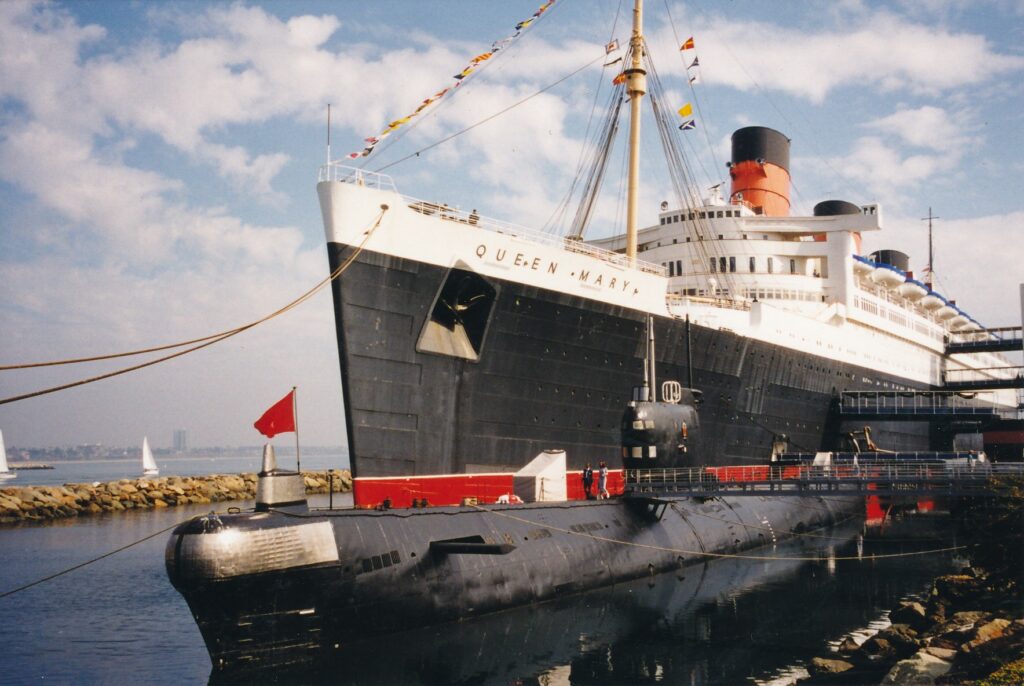
LONG BEACH — “We patrolled the Mediterranean, Indian, Atlantic and Pacific Ocean,” the Russian captain says in an accent thicker than a Siberian parka. “Maybe we already have your photograph!”
Welcome aboard Scorpion, a spy submarine launched by the Soviet Union in 1972 and decommissioned by Russia six years ago. The 300-foot black vessel, which during its communist red-letter days could carry up to 22 nuclear-tipped torpedoes, now is docked eerily next to the Queen Mary. Thirties decadence meets Cold War intrigue meets tourists fresh from a day at nearby Disneyland.
Welcome, readers, to the 21st century.
Scorpion was among 79 Foxtrot-class subs built from 1958 to 1984 by the Soviets. Cuba, India, Libya and Poland also acquired the vessels, which are powered by diesel engines and nearly 400 tons of batteries. They are capable of remaining submerged for up to 10 days and traveling more than 400 miles under water.
Self-guided Scorpion tours, which can be purchased as part of a combination ticket with the Queen Mary, allow visitors to explore the sub’s innards at a leisurely pace. Walking from front to rear, tourists pass through seven compartments, each one featuring an instructive little speech by the speakers-dispensed captain’s voice.
“Most of my 75 crew members are between 19 and 23 years of age,” he says, adopting a tone of Bolshevik bonhomie. “They receive special privileges for serving on submarine. Better pay, more holidays, wonderful food, and me!”
Walking ·through Scorpion entails plenty of ducking and, through the circular holes that separate some compartments, limber maneuvering. “Please be watching head — not to bump.” Aye-aye, captain courteous.
If you think visiting a submarine is uncomfortable, imagine trying to live in one. Soviet sailors were allowed a one-minute shower, in saltwater, every third day. Three men would take eight-hour turns sleeping on a thin bed pad whose sheets were jettisoned after one week. The food probably was not “wonderful,” and could be washed down with just one glass of white wine per day. Scorpion has three toilets, two washroom sinks, little elbow room and no place to hide.
No place, that is, except for the political officer. If you saw what Sean Connery’s character dispensed with early in “The Hunt for Red October,” you know the political officer stereotype: the hard-core Kremlin lackey who is feared and despised by everyone else on board. He and he alone had access to the “spy room,” whose door remains locked on the otherwise accessible Scorpion of today. “Not even captain knows what is being recorded here,” our tape-recorded guide says, sounding gloomier than a vodka shortage.
Foxtrot submarines, in addition to possessing creature discomforts, posed considerable dangers for their officers and crews. Cold War missions were tense affairs with potentially enormous ramifications. Playing cat and mouse with enemy ships could become a delicate dance with fate, especially when subs went deep.
Scorpion often dove to and rested some 800 feet below the surface. “I can hide there so quietly that few Western vessels can ever detect me,” says the chameleon captain, suddenly sounding like an evil maniac Richard Burton might encounter on the Wall’s cold side. Descend past 1,000 feet, though, and “hull will be crushed like empty can of carrion.”
Statistics, it is obvious by now, are a big part of the Scorpion story. Try these on for size:
- Including batteries, men and torpedoes, the submarine weighs more than 2,500 tons.
- Foxtrots are capable of moving at 16 knots surfaced, 15 knots submerged. At 8 knots surfaced, they can travel 20,000 miles.
- Should a sub be diving or climbing at more than 30 degrees off horizontal, it would lose control and sink.
- Soviet sailors typically would spend the first 10 days of their monthlong shore leave convalescing in a sanitorium.
Submarine-movie buffs are sure to appreciate one more thing about the Scorpion: everyone gets to look through the search periscope. The fixed view is a bit mundane, however. Rather than see a British aircraft carrier or Alaskan seaport, you are likely to spy on the Queen Mary parking lot — area “Al0” the day I visited. Ah, the boredom of warm peace.
Scorpion submarine, as is the Queen Mary, is open from 10 a.m. to 6 p.m., with extended summertime hours. Submarine-only tickets are $10 general and $9 for seniors, military personnel and children ages 4 to 11. Queen Mary combination tickets, which through April 25 include the wonderful ‘Treasures of the Last Russian Emperor’ exhibit on board the big ship, are $25 general, $23 for seniors and military personnel, and $19 for kids.
The Queen Mary complex can best be reached via southbound Highway 710; a parking fee is assessed. For more information: (562) 435-3511 or www.queenmary.com.

DEATH VALLEY NATIONAL PARK — The early 20th century conceit of building a European castle in California was not limited to William Randolph Hearst’s monster on the Central Coast. A double-take-provoking domicile bloomed in the desert, too.
Scotty’s Castle, the most-popular tourist attraction in northern Death Valley National Park, is not quite the egomaniacal erection that is Hearst Castle in San Simeon. Constructed from 1922 to 1931, Death Valley Ranch was an opulent oasis for Chicago insurance magnate Albert Johnson and his wife, Bessie. Johnson was drawn to the region by a bigger-than-life cowboy who had persuaded the Midwestern businessman to sponsor his gold prospecting.
The riches that Walter Scott mined came not from Death Valley — though others made their fortunes there — but from Johnson’s deep pockets. Born in Kentucky and a rider with Buffalo Bill Cody’s Wild West Show for a dozen years, Scott possessed both a flamboyant appeal that allowed him to take money from willing others and an unwavering dedication to spending it.
Despite Johnson’s upright, pious nature, he was attracted to the fun-loving Scott and allowed him to become the desert mansion’s mascot. During the 1930s and ’40s, reporters and paying lodgers flocked to what became known as Scotty’s Castle.
Scott survived the Johnsons and died in 1954. He is buried on a hill overlooking the estate, which since 1970 has been operated by the National Park Service.
Tours of Scotty’s Castle are given daily year-round, even in July, when the park’s average high temperature is 115 (nights cool to a crisp 88). I visited in March, when the mercury’s range is typically 80 to 53 degrees.
Megan Ream led my 10:10 a.m. tour (they usually are offered at least once an hour). “Please don’t ask me anything that happens after 1939,” said the NPS intern from Memphis, dressed in Depression-era attire. Tourists are supposed to feel as though they are stepping back into the desert heyday of Scott and the Johnsons. “These people aren’t dead yet. … Please work with me on this.”
We entered the main house after sitting for a few minutes in the patio between it and the similarly sized and decorated annex. Ream told us the architectural idea of Death Valley Ranch was for it to resemble a 15th century Spanish castle, with touches of the American Southwest.
The main house’s large living room illustrates that blending of styles. Its redwood beams were “aged” several hundred years with their curvy-groovings finish. Curtains, in a proverbial tip of the cowboy hat to the Wild West, are made from leather.
Such rawhide window treatment was fodder for Scott’s sense of humor, Ream said. She recounted that the chief resident wrangler would bring stubborn mules into the room, point to the curtains and tell the animals, “If you don’t listen to every word I say, they’ll be you.”
Scott’s first-floor room contains another oddity that speaks to his colorful character. A hole in the wall leads out to an ornamental piece of metal that flares open to the left, toward a door, and to the right, toward a window. Ream said that the best guess for its purpose was that Scott would need only one shotgun blast, through the hole and sprayed out in two directions, to fend off a burgling team.
The kitchen has more of a European-castle ambience, what with its Spanish tile, “pretend” well in the corner and refrigerator concealed within an old-looking cabinet. We also walked quickly through the annex, which was a bit disheveled as a modern heating and cooling system was in the final stages of installation.
Insights into how the estate was cooled, electrified and adequately stocked with water are given in technology tours that are given a few times daily. Their target audience are engineer types and those who, like me, have taken the general tour and are intrigued enough to pay for more information.
Mike Schraml of the Park Service escorted one other man and me under the main house and around the huge pool outside that never was finished; decorative ceramic tiles for it still are stored below.
The much-repeated theme of Schraml’s presentation was how water is so important to the mansion, which uses about 1 million gallons each month. Citing Mark Twain, Schraml told us: “Whiskey is for drinking, and water is for fighting.”
Those who visit Scotty’s Castle, which is about 50 miles northwest of Death Valley’s headquarters at Furnace Creek, should consider taking another half-hour or so to explore Ubehebe Crater, a 10-mile detour off the main road. Formed 3,000 years ago by a series of volcanic explosions, the crater is 500 feet deep and a half-mile wide. From the parking lot is a wide, rocky trail that heads up to a satisfying overlook.
Scotty’s Castle tours, given from 9 a.m. to 5 p.m., all cost $8 general, $6 for ages 62 and older, $4 for ages 6 through 15 and for those with disabilities, and are free for ages 5 an younger. The grounds, which include a nicely grassed and shaded picnic area, are open from 7:30 a.m. to 6 p.m. For more information: (760) 786-2392 or www.nps.gov/deva.
Sidebar:
Here are some other attractions within Death Valley National Park:
Around Furnace Creek: Artist’s Drive, an automotive spin past hills that are especially colorful in late-afternoon light; Badwater, at 282 feet below sea level the lowest point in the Western Hemisphere; Devil’s Golf Course, white, salty terrain sprinkled with jagged spires; Natural Bridge, a large rock span; and Zabriskie Point, which offers dramatic views of badlands.
Around Panamint Springs: Lee Flat Joshua Trees, the finest such forest in the valley; and Wildrose Charcoal Kilns, 10 beehive-shaped structures built in 1876 to provide fuel for mining operations.
Around Scotty’s Castle: Eureka Dunes, at nearly 700 feet the state’s tallest; and the Racetrack, where rocks leave trails as they slide across a dry lakebed.
Around Stovepipe Wells: Mosaic Canyon, a hike past polished marble walls; Salt Creek, home to a rare pupfish; and Titus Canyon, which contains a ghost town, petroglyphs, bighorn sheep and colorful rock formations, among other things.
A $10-per-vehicle fee is imposed upon each vehicle entering the park and allows unlimited access for seven days.
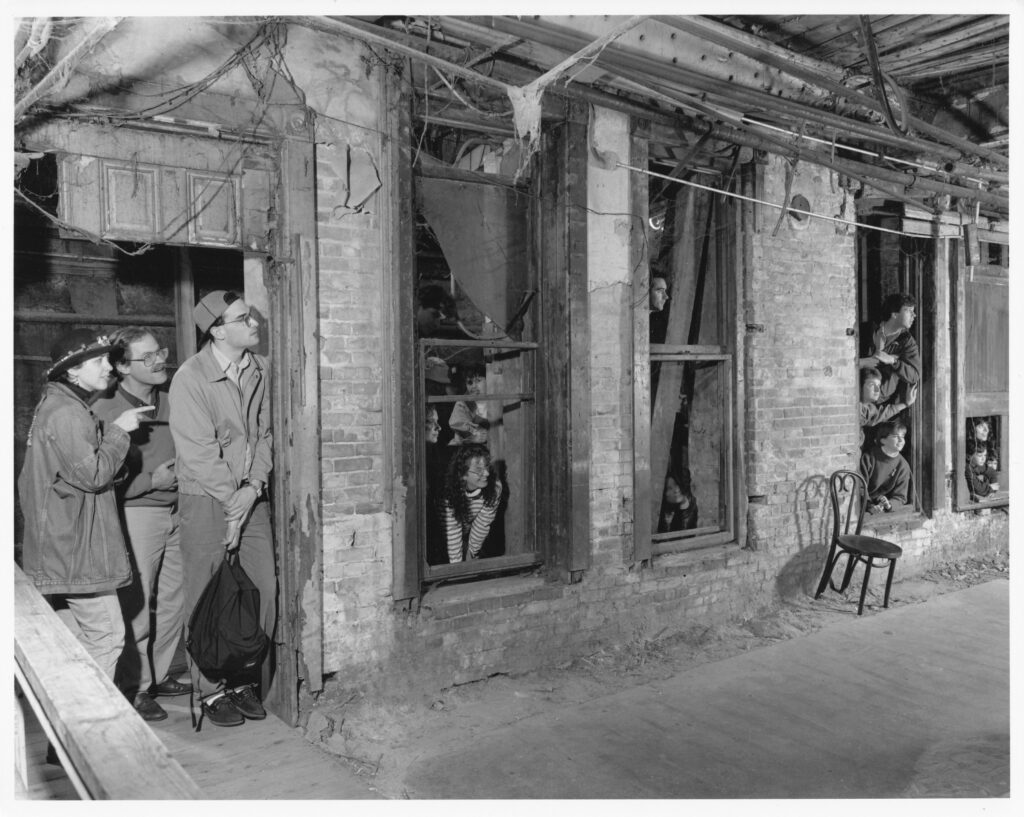
SEATTLE — Long before Boeing, Starbucks and Microsoft, the bedrock of this Northwest city’s economy was sewing.
Pardon?
You read correctly. The Klondike Gold Rush of 1897 turned Seattle into the major supply town for prospectors heading north. The population soared. Soon there appeared to be an inordinate number of young women, without visible means of support, living in the downtown area. When surveyed, they listed their profession as “seamstress.” Nudge-nudge, wink-wink.
Rather than run the women out of town, Seattle’s political leaders decided to raise considerable revenue by taxing each prostitute … er, seamstress, rather … $10 per month. And all that, explained a tour guide named Airi, led to the expression, “A stitch in time is two bucks.”
That and many other groaners help make Bill Speidel’s Underground Tour one of the most delightful, and different, tourist attractions on the West Coast. For 90 minutes, visitors stroll from one subterranean passage to another, occasionally surfacing to cross streets, constantly being entertained by a skilled team of tour guides.
Unfortunately, young and vibrant Airi will not be with that team much longer. She and her fiancé are moving to Los Angeles, where she intends to pursue an acting career. Judging from the Underground Tour she conducted in late April, she deserves success.
Tour groups assemble in Doc Maynard’s Public House, a pub and nightclub in Pioneer Square. There, events in Seattle’s history that led — sometimes in a roundabout way — to the Underground Tour are explained in a 20-minute, humorous talk.
In 1889, a fire started by an overturned pot of burning glue spread rapidly through the downtown’s mostly wooden structures. Fire hoses lost pressure almost immediately, and a human chain of seawater buckets reaching up from the coast was disbanded when massive stores of ammunition in a hardware store began exploding. Eventually, 33 blocks burned down.
Reconstruction was quick and remarkably uncoordinated. Buildings sprung up before city officials could implement their plan to elevate street levels nearest the water. Undeterred, officials ordered the streets raised anyway. Stone walls were erected on each side of the roadways and filled with whatever materials were available… debris from the fire, dirt from the partially leveled hillsides, businesses’ garbage, even dead horses… before the surfacing work.
So for about a decade this was the situation: Many downtown Seattle streets were 10 to 32 feet higher than the buildings’ ground floors and the sidewalks around those buildings.
Ladders were placed at intersections so people could climb up from one sidewalk, cross the street, and climb down to another sidewalk. As Airi pointed out, that was not an especially flattering way for ladies in long dresses “and 20 pounds of underwear” to walk about with their shopping bags. Nor was it a good situation for men on drinking binges, 17 of whom fell to their deaths.
Back in those days, Airi explained, there was no such thing as Alcoholics Anonymous to assist heavy drinkers. “In those days,” she said to much laughter, “we had a one-step program: street to sidewalk.”
Bridges were placed over parts of some sidewalks and, eventually, complete sidewalks covered the old ones, which remained in use and were illuminated by sky lights imbedded in the new walkways. Our tour group gathered under and a few minutes later over an original skylight, whose glass plates have turned a purplish color over the decades.
During one of our treks above ground, we passed a manhole cover that Airi called “a plaque in honor of the seamstresses”… on it was written “SEWER.”
In 1907, a bubonic plague outbreak prompted the underground portion of Seattle to be condemned. Only illegitimate business still was conducted there, including a flourishing liquor trade during the Prohibition years. Rats became an overwhelming problem.
To combat the critters, Airi said, the city took several steps, among them paying 10 cents for each slaughtered rat. Citizens needed only to bring in a rat’s tail for what in today’s currency translates to about $5. Inevitably, some people began breeding rats so they could claim the reward, and there was some apocryphal talk about tails being cut at a point where they would grow back.
“It was our first retail operation,” Airi cracked, admitting it was her “worst joke, scraping absolutely the bottom of the barrel.” It was appreciated by the good-natured group, however.
Prices for Bill Speidel’s Underground Tour are $7 general, $6 for age 60 and above, $5.50 for ages 13 through 17 and college students with identification, and $2.75 for ages 6 through 12. Tour times vary throughout the year. In June: 10 and 11 a.m., 1, 2, 4 and 6 p.m. weekdays; 11 a.m., noon, 1, 2, 3, 4 and 6 p.m. weekends. In July and August: hourly from 9 a.m. to 7 p.m. weekdays; hourly from 10 a.m. to 7 p.m. weekends. All tours depart from Doc Maynard’s Public House, in the Pioneer Building on Pioneer Square, nearest the intersection of First Avenue and James Street (which becomes Yesler Way nearer the waterfront).
For tour schedules of other months and for more information: (888) 608-6337, (206) 682- 4646 or access the Web site www.Undergroundtour.com
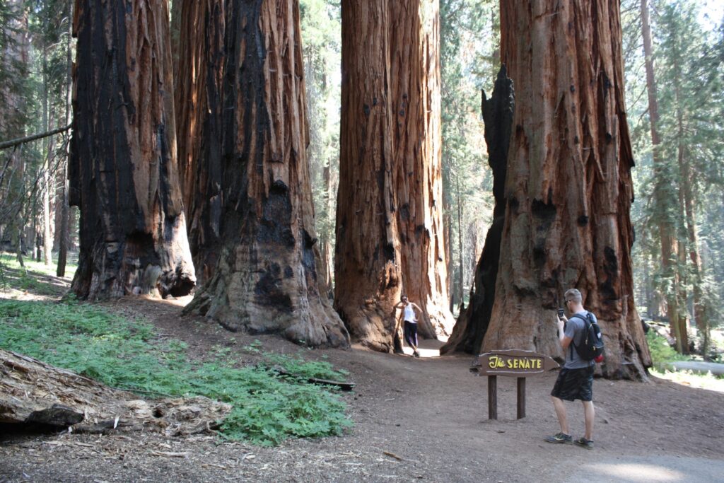
Welcome to California’s oldest national park, where the trees are outrageously huge, the sky can be dispiritingly beige, and the bears are non-threateningly black.
Of the half-dozen times I have been to Sequoia National Park in the past decade, I have seen bears on at least three occasions. By contrast, during my dozen-plus visits to Yosemite National Park, I encountered bears only once (on a slope beside the Hetch Hetchy reservoir).
“Bears like to hang out in the meadows,” longtime Sequoia ranger Dawn Ryan told me in her Lodgepole office in early August. “That’s where most of the food is. They’re around any time, day or night; they’re mostly active at dusk and dawn. But there are bears that are out all the time.”
I enjoy seeing bears in the wild. That sentiment might be different if brown bears, aka grizzlies, had not been exterminated from California in 1922. What we are left with is black bears, 25,000 to 30,000 of them statewide, and no, they are not out to eat you.
Since 1900, there have been 61 fatal attacks by black bears on humans throughout North America. According to the Wikipedia entry “List of fatal bear attacks in North America,” no black bear has ever killed a human being in California.
But enough about convivial wildlife. After a superquick history lesson, it’s time to fawn over the flora.
Stars of the show
In terms of its national park status, Sequoia is six days older than Yosemite. They were established, respectively, on Sept 25 and Oct. 1, 1890. Whereas both have outstanding groves of (thank goodness this isn’t radio) sequoiadendron giganteum, Sequoia’s Giant Forest is especially dense with the evergreen behemoths and boasts the world’s largest by volume.
The General Sherman Tree, at 275 feet tall, is shorter than coastal redwoods (which can approach 380 feet) and even some giant sequoias. However, it makes up for any such shortcomings with a base diameter of more than 36 feet, and a base circumference of almost 103 feet.
Park-produced literature, in raconteur mode, is fond of saying, “Every year the General Sherman grows enough new wood to produce a 60-foot-tall tree of usual size.”
All told, the Giant Forest that represents the heart of Sequoia National Park has 8,400 of its namesake trees that are more than 1 foot in diameter at their bases. Redwood Mountain Grove, about 20 miles north of Giant Forest and in Kings Canyon National Park, is larger, but requires more physical exertion to explore and has fewer landmark attractions.
Giant Forest, in addition to General Sherman, contains a couple of mild (no major ups and downs) sequoia-showstopper trails: Congress and Big Trees. It also has a small but effective (in terms of describing giant sequoias) museum and the stellar Moro Rock.
It’s not that the 275-foot-high granite formation is amazing to look at. In fact, it can be hard to detect from the extremely curvy portion of Generals Highway heading up from Three Rivers. Nor is the view from its top often rewarding; gazes toward the Central Valley are usually quite compromised by smog. The National Parks Conservation Association ranks Sequoia dead last (tied with Kings Canyon) in air quality.
What distinguishes Moro Rock is its incredible inlaid stairway, 400 steps that were carved and otherwise created by the National Park Service in 1931. Mounting it is a mostly single-file proposition that I have always found to be surprisingly nontaxing, maybe because frequent stops are required to let pass those going the opposite way. The stairway is on the U.S. National Register of Historic Places.
“Honestly, it’s great,” Jesper Vernooij, a tourist from the Netherlands, told me on top of the dome on a relatively clear day. “Usually, if you want to go to a place like this, you really have to make an effort. Which is a good thing. But it is good that it’s also accessible to people who do not (otherwise) have the opportunity to go and stand on a rock like this and have a view like this.”
A seasonal summary
Although the August heat that allowed Vernooij and others to be clad in T-shirts and shorts has surrendered to the calendar’s march toward winter, prepared visitors still can access Giant Forest and Moro Rock from the park’s southern entrance via Highway 198.
“Usually, the first snow comes around Thanksgiving,” said ranger Ryan, who said daytime highs typically are between 30 and 42 degrees this time of year. “It’s good to check that because chains can be required at any time.”
She urged motorists to monitor the weather via the National Oceanic and Atmospheric Administration’s website Weather.gov, by clicking on the map.
Ryan, who after 10 years at Sequoia was soon to leave for a new post as superintendent of McCarthy Beach State Park in Minnesota, spoke warmly of wintertime in Giant Forest.
“The giant sequoias all that much more red, with all the snow,” she said. “It’s so peaceful here. You can snowshoe, and of course cross-country ski.”
Equipment for those activities can be rented from the 17-year-old Wuksachi Lodge, a most fetching wood-and-stone structure with a gorgeous dining room. Guests are housed in three nearby buildings; the grounds seem often to be populated with grazing deer.
(If you are considering a winter- or springtime visit to Sequoia National Park, keep in mind that the stretch of Generals Highway between Wuksachi Lodge and Grant Grove, which contains Kings Canyon National Park’s main visitors center and lodging options, can be closed by snow issues.)
Ryan also spoke enthusiastically about springtime in Sequoia.
“Oh my gosh. It’s beautiful,” she said. “If we get snow in the winter, the waterfalls, the hike up to Tokopah Falls is just amazing. It’s the biggest waterfall in this area. … It’s a moderate hike, I would say. A two-hour round-trip hike, up a glacially carved valley. So when you get up there, and look back down hill, you see the U-shape of the glacier.”
As the year progresses, so does nature’s palette.
“The spring flowers start to come out around June or so,” Ryan said. “The lupins are beautiful. The dogwoods start to bloom, their big white racks of flowers.”
From Memorial Day through Labor Day, all Sequoia’s main attractions are open, and a small network of free shuttles run between Dorst Creek campground to the north and peaceful Crescent Meadow to the south. Trails, too, connect all the spots without too many taxing ups and downs.
One of the park’s steeper trails leads down to Crystal Cave, open typically from late May on into November. Its parking lot, about a 40-minute drive south of Wuksachi Lodge and well off Generals Highway via another winding road, requires that visitors trek down a half-mile path to the cave’s opening and its distinctive spider-web gate,
Rebecca Jones of Lansing, Mich., in her third summer with Sequoia Parks Conservancy, which offers the Crystal Cave tours, instructed my 3 p.m. group on a summer Sunday to get to the gate within 20 minutes. There’s no time crunch on the return, she told us.
“When you’re walking back up the trail, please stop, frequently, for a long period of time,” she said, anticipating correctly that the uphill return would tax some people’s hiking abilities. “Enjoy the scenery. Check out the multiple waterfalls,” but watch out for poison ivy.
In my opinion, Crystal Cave is less compelling than some of the half-dozen other subterranean chambers (including Moaning Cavern, in Vallecito) I have toured. Its stalactites and stalagmites are comparatively few and far between. In 2016, the basic discovery tour cost $18 general – which I am fine with, in that whatever you think of the cavern, it should be preserved, and proper preservation can be costly.
Other than Generals Highway and its offshoot to Crystal Cave, the only paved route in Sequoia is Mineral King Road, parts of which are gravel and all of which is twisty – would you believe an alleged 398 turns in the 25 miles it wiggles eastward from Three Rivers to just past the Mineral King Ranger Station? (I haven’t tried to count during my three round trips.) Closed to the public in wintertime, it is a remarkably scenic road that has some great trails branching off from the small parking lot at its end.
One pleasant way to end a summer day in Sequoia, or to wrap up a multiday visit to the park, is to attend the Wolverton Barbecue ($25 per adult in 2016). The all-you-can eat buffet, heavy on meats and light on produce, has traditionally been held on a picnic-tabled patio that overlooks a meadow near the General Sherman Tree, but next year moves north a few miles to the Wuksachi Lodge.
This past summer, Brandon Richardson of Birmingham, Ala., entertained barbecue diners by impersonating Charles Young (1864-1922), a so-called Buffalo soldier who in 1903 became the first African American superintendent of a national park. Young’s was a military assignment and lasted only a few months, but he played an acclaimed managerial role in the park’s early road construction.
“I understand that our greatest tool, our greatest weapon, in defending and protecting these parks, is education,” channeled Richardson, decked out in a turn-of-the-century Army uniform replica. “You must educate people on what is here. Because one walk through these parks will convince even the least thoughtful of men of the needfulness of preserving these mountains as they are.”
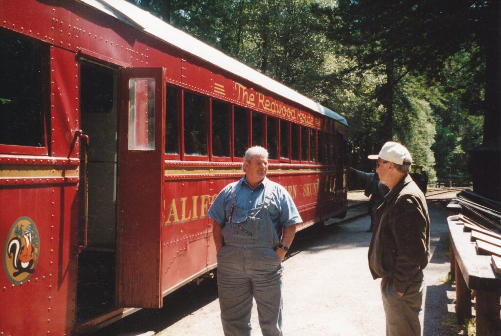
FORT BRAGG – Spewing black pollutants from its gasoline engine and pot-bellied stove, with all the subtlety of a cigar-smoking patron in a cramped restaurant, the motorcar clanked along the Noyo River at 11 miles per hour. When the trailing wind was blowing faster, as it often did, locals could smell the thing coming.
The distinctive odor gave rise to the nickname Skunk Train, Fort Bragg’s biggest tourist lure. lt’s relaxing, it’s hokey, it fouls the air. This ride has everything, even the kitsch and stink.
Passengers board at the downtown depot, between Highway 1 and the Pacific Ocean, lor half-day, full-day or Saturday-evening barbecue excursions. Most trips are on the 1925 and 1935 motorcars, though diesel-electric and steam engines are used occasionally. Conductors double as tour guides, pointing out some of the passing attractions.
On a sunny weekday morning in mid-May, Jim Baskin drove three dozen tourists on a three-hour round trip from Fort Bragg to Northspur, the halfway point of a line that in summer can keep running to Willits. As the 1935 motorcar approached a 1,200-foot tunnel built by Chinese laborers, Baskin pointed out old railroad pilings in Pudding Creek, to the north. The original line ran over the creek, he said, because late-19th century technology made hillside tracks prohibitively expensive.
Through the tunnel, trains begin a dance with the Noyo, crossing back and forth many times. Between Fort Bragg and Willits are 32 bridges and trestles, Baskin said, adding that the original line had 115. Fort Bragg receives 85 percent of its drinking water from the Noyo, though at the time the season’s rainfall was 17 to 20 inches below average, and the Noyo was more trickle than torrent.
Soon, to the south a hundred feet or so from the track, was a coastal redwood tree’s stump, with what Baskin said was a cluster of huckleberry plant growing on top. Early ranchers, he said, mistakenly thought that by cutting down the large trees they would be permanently clearing the land for grazing. However, as is evident by saplings around this stump, redwoods’ root systems are proficient in producing sprouts.
One of the taller coastal redwoods visible from the train was determined, in 1963, to be more than 1,000 years old. At that time, Baskin said, experts speculated that if every board foot of the tree were construction-quality, three houses of 1,600 square feet apiece could be made from it – roofs and sidings included.
Several times along the journey, Baskin tooted the motorcar’s horn. He is required to do so at every station, however tiny, just in case a local wants to board. He also is charged with tossing a stuffed sock out the window, which is what passes for postal service along the Skunk line.
A station sign is about all that remains in Alpine, which before burning down in 1922 was home to as many as 2,500 residents. From what can be seen out the train’s windows, one can only wonder how evidence of such a large community could disappear so quickly.
At Northspur, Baskin turned the motorcar around while passengers had 35 minutes to patronize the gift and food shacks that local residents operate. Cuddly bears carved out of redwood and jam preserves are among the items for sale.
Lumber, not tourism, was the market force that launched this railway in 1885. Once the line reached inland six miles, tourist expeditions began. Full passenger service flourished between 1911 and 1929, when it was possible to leave Fort Bragg in the morning and arrive in the Bay area that night.
Automobiles and the Great Depression spelled doom for that part of the Skunk Train’s history. Today, however, it is going strong as a contemporary tourist diversion, with a strong whiff of the past.
Skunk Trains have half-day (40 miles) and full-day (80 miles, between Fort Bragg and Willits) excursions from late May through late October, with limited runs the rest of the year. Costs range from $29 to $39 general, with discounts for children and AAA memberships. For more information: (707) 964-6371 or www.skunktrain.com. To make reservations: (800) 77-SKUNK (777 -5865).
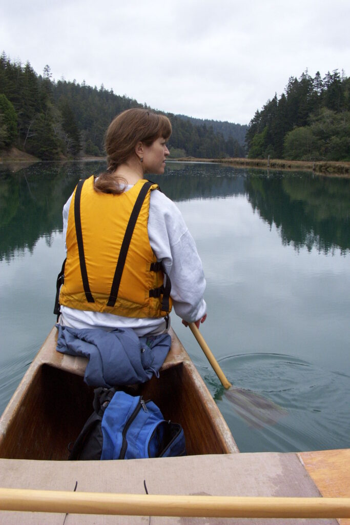
MENDOCINO – We swam laps amid pink and white flower petals that had dropped from plants that shimmied up the translucent, triangulated ceiling. Classical music played softly over hidden speakers. The air was sweetly tropical, the water just right. We would follow our exertions with a dip in the hot tub, tucked modestly behind planters a few steps away.
Even aquatic icon Esther Williams would appreciate the indoor pool at Stanford Inn by the Sea, just south of Mendocino off Highway 1. And unlike many of us middle-class mortals, she probably could afford frequent stays at the pampering lodge. Kari and I were there on our honeymoon, splurging to the tune of $1,079.32 for three nights. A VW camper gal and Motel 6 guy are not accustomed to such outlay, but as many of you know, money tends to fly out the window round wedding time.
Fly not gently like a bird to a feeder, mind. But rather surge like a thousand rabid bats out of a cave disturbed by a rambunctious band of Cub Scouts. But I digress.
A pampered celebration is what we desired, and the result was as close to perfect as could reasonably be expected. Stanford Inn, in addition to its prime coastal location and sensational pool, boasts a renowned vegetarian restaurant. My wife and I, both vegans, wanted to avoid the usual anxieties we encounter when eating out. Having six meals in the Ravens’ dining room added immensely to our senses of pleasure and relaxation, overfilling our stomachs for a late breakfast and mid-evening dinner each day during our late-October stay.
Some of the produce prepared by Ravens’ chefs comes from the terraced organic garden on Stanford Inn’s expansive grounds, which also includes a pond, horse pasture, grazing llamas and a massage studio. Guests can work off their large meals by strolling through the gardens down to a boathouse on the Big River, where bikes can be borrowed for no charge. Canoe rentals run about $20 an hour, with paddlers able to venture as far as 8.5 miles upstream. Our two-hour canoe trip on a cloudy afternoon was pretty tame stuff, with the river’s smooth surface being mirror-like. Along the way, we shared a beer while observing many egrets and one lazing seal.
Aside from the pool, walking paths and boathouse possibilities, guests can exercise by walking to Mendocino. Traversing the Big River Bridge, however, can be a bit dicey as the space between speeding Highway 1 traffic and the railing is tight. Mendocino, which emerged as an artists’ retreat in the 1950s, has plenty of galleries and restaurants that we found worthy of our eyes but not deserving of our recently thinned wallets. Walking out onto an undeveloped, grassy bluff a hundred yards or so past town, yielding southward views of the coastline, proved to be our highlight.
In any event, Stanford Inn by itself was sufficiently entertaining for our short stay. Our second-floor room, which Kari described as Ralph Lauren rustic, had a wonderfully warming fireplace with a limitless supply of wood, a porch that overlooked the grounds and offered a partial ocean view, a small refrigerator to store our leftovers from Ravens, a compact radio (pre-tuned as we entered the room to a classical station from Chicago, of all places) and even a VCR to go with the cable-fed television. As a result of that last amenity, I was able to tape games 4 and 5 of the World Series while we were having dinner, then speed-watch them afterward.
Ah, the romance of honeymoons.
Rooms also have wonderfully thick and comfortable bathrobes that we used for the few minutes’ walk in brisk outdoor air to and from the pool. Everything about Stanford Inn’s rooms, lobby and general layout reflect a tasteful, thorough attention to detail. We were quite impressed.
While its llamas seem to have their movement restricted, Stanford Inn’s small collection of dogs and cats practically have the run of the place. One big black pooch, which I took to be an old Labrador, hung out in the lobby/gift shop area and even managed a few forays into Ravens, where he came up to our table and politely if furtively asked for a snack. The first night in our room, an orange-and-black calico cat came in through the porch window and subsequently spent much of the days and the entire nights curled up in a chair near the fire. “That’s Callie,” a front-desk employee said with a sigh and knowing smile when we reported on our “roommate.”
Guests are welcome to bring their own pets, though the per-night charge for one is $25; add $12.50 for each additional furry friend.
As room rates start at $245 a night, perhaps the pet surcharges can be shrugged off as a comparatively small indulgence. A two-bedroom, two-bath suite is the most-expensive lodging option, going for up to $720. We opted for an Internet “three times three” special, wherein for $925 plus tax we received three dinners with our three nights’ stay (breakfasts are complimentary for all guests). However, and this is a very big however, payment is due upon reserving, which in our case meant we paid for our honeymoon six months before we took it. (Drinks and tips added $116.82 to our Internet rate, and we paid for them upon checkout.)
Such a bold demand for prepayment, we figured, probably was worth the anticipated pleasure of having a vegetarian restaurant onsite. Indeed, Ravens had a variety of tempting vegan dishes and we were able to try all of them. Breakfast options, which included poached tofu atop portabella mushrooms and multi-grain pancakes, were paced by the Stanford Citrus Polenta – grilled citrus polenta with a cashew nut sauce, and organic garden greens in tamari sauce on the side. Dinner highlights were a seaweed strudel and pumpkin/lentil/potato curry dish, but perhaps our favorite of all we ate there was the chocolate torte dessert.
Ravens is open to non-guests, too, but without an Internet special such as ours diners should expect to pay $60 to $100 for a two-person meal.
One small quibble: My wife and I were a bit alarmed that more than one server seemed unable to grasp the distinction between vegetarian and vegan fare. One young man, even on our second or third meal with him after we had carefully and repeatedly explained what vegan means (no animal products whatsoever), continued to offer us cream with our coffee.
No matter, really. We were comfortable with the food preparation and loved the peaceful hours we spent in the dining room. Stanford Inn and its restaurant were the ideal honeymoon spot for us, and we hope to return again and again once we’re wealthier. If only last spring I had placed a large bet on the Anaheim Angels.
The Ravens serves breakfast from 8 to 11 a.m. (till noon on Sundays) and dinner from 5:30 to roughly 8 p.m. daily. For more information about it and The Stanford Inn by the Sea: call (800) 331-8884, visit www.stanfordinn.com or e-mail info@stanfordinn.com.
LA JOLLA — Children scamper about the exhibits, pushing buttons, pulling levers and touching the interactive television screen.
Are they learning, or just playing?
They seem to be emphasizing the latter, but with luck they are absorbing a few of the facts that flood visitors to Stephen Birch Aquarium-Museum. No doubt they also will retain visions of colorful marine creatures tanked in the $14 million facility, which opened in September 1992.
As its hyphenated name suggests, the aquarium-museum is a combination of display and description. The northern wing is the Arthur M. and Kate E. Tode Hall of Fishes, composed of 33 tanks that range from suitcase-size to 50,000 gallons. The southern wing, Scripps Hall of Oceanography’s Exploring the Blue Planet, explains some scientific basics about our water, air, land and life.
The Blue Planet exhibits are geared toward visitors’ participation. Adults who are accustomed to the stuffed animals and clumsily written plaques of other museums can share with children the fun of pushing, pulling and touching for data.
A basic lesson in water density, for example, is activated by a lever. Identical objects are dipped in two tubes, one of which contains tap water and the other, seawater. The object sinks deeper in the less-dense, salt-free tap water.
“Why does the breeze at the beach change direction when the sun sets?” asks the top of a small trap door. Lift and read:
“Each day the sun’s energy raises the temperature of the land faster than it raises the sea surface temperature. Warmer air over the land rises, cooler air from the ocean moves inland, making a convection current we call a sea breeze.
“When the sun sets, the land and the air above it cool quickly. The air above the ocean is now warmer and rises. The convection current moves in the opposite direction, and we feel a land breeze.”
The Ocean Supermarket exhibits triggered by bar codes. Visitors aim a scanner “gun” at products such as toothpaste, bug spray, salad dressing and aluminum cans. A computer screen then explains how those items are made possible, in part, by the ocean.
Did you know that matches can be marine-based? Sulfur that sparks the flame often is found trapped under submerged salt domes, along with crude oil deposits. “When high-sulfur crudes come to the surface at offshore oil platforms,” the screen reads, “the oil smells like rotten eggs. Miners call it ‘sour crude.’ “
Instruction takes another form in the museum’s “submarine.” Visitors are “loaded” into a small room and watch their 3,780-foot “descent” through a “porthole.” Frankly, the concept sinks as entertainment. Disneyland’s “Star Wars,” it’s not. The narrators’ drone of deep-sea tidbits is a tad dry.
At one point — the sub is descending and crustaceans are swarming outside the porthole — one “co-pilot” has a revelation.
After a dramatic pause, he gushes: “It’s amazing to me that some of the largest animals on the planet survive by eating some of the smallest.”
Attention editors and newscasters: Scratch one candidate for quote of the day.
Hundreds of silver sardines in Tank No. 1 greet entrants to the Hall of Fishes. The wing is divided into five sections: Northwest Coast, Southern California, Kelp Forest, Mexico and Expedition Gallery. There’s no need for gadgetry to show off these living displays of sea creatures.
In one of the 13 Southern California tanks, a two-spot octopus the size of a broccoli flower hides in a rusted-out metal tube. Every now and then, he stretches, to the delight of patient spectators. Next door are jellyfish, hypnotic in their fluidity and translucence.
The largest tank, Kelp Forest, has an acrylic window that’s 21 feet wide and 13 feet high. Some of the finned frolickers inside are mammoth, too. Seating is provided for the landlubberly public.
If you go, be sure to cap your visit by walking outside to Parker Foundation Tide Pool. The boulder-bordered display boasts the Pacific Ocean as its backdrop. So to speak.
The Stephen Birch Museum-Aquarium, which also has a gift shop and snack stand, is open from 9 a.m. to 5 p.m., every day except Thanksgiving and Christmas. Admission is $6.50 for adults, $5.50 for seniors at least 60 years old, $4.50 for students, $3.50 for children ages 3 to 12, and free for toddlers. Parking is $2.50 per vehicle.
Getting there: Take the La Jolla Village Drive exit off Interstate 5. Go west about a mile, and turn left at the fourth light: Expedition Way. Proceed several hundred yards to the parking lot.
STOCKTON — Forty-five miles down south and a few years down memory lane, “The Macarena” still is danced and appreciated.
An uncharacteristically large crowd has assembled in Billy Hebert Field, home of the Ports minor league baseball team. Tonight’s lure is a free T-shirt, the front of which screams “Build it!” under an artist’s conceptual drawing of a downtown stadium. On the back, in equally large type, is printed “Mudville.”
Smoke from a meaty barbecue behind the first-base bleachers drifts over the infield, where the hometown heroes take off their gloves and run to the dugout, giving way to the visiting Lake Elsinore Storm. Twilight’s last gleaming peeks over the left-field fence. The low-tech scoreboard — no big-screen replays at this old ballpark — sadly states the Ports trail by an embarrassing 12-0.
But there is joy in Stockton, for mighty Casey has strutted out.
The huge-headed, monstrously mustachioed but slim-hipped mascot leads eight children in dancing “The Macarena,” which is so very far past its mass popularity that most people long ago tired even of ridiculing it. But tonight the upbeat song’s skippy beat and free-flowing movements have baseball fans tapping their toes, laughing at the kids’ missteps and applauding Casey’s enthusiasm.
Such a scene has its charms and represents one of the best ways to spend a summertime evening in Stockton. The Ports, whose 1999 season continues through Sept. 5, over the years have attracted a lot of Sacramentans and other northern neighbors who appreciate a good game at a great price from seats close the field. Stockton by day can be entertaining, too, with its agreeable mix of modest attractions that easily can fill an afternoon.
After all, Stockton this year was one of 30 nominees for the National Civic League’s 1999 All-America City Award. Though it was not among the 10 winners announced June 26 in Philadelphia, the recognition of being a contender was a source of pride for many locals.
Picnics are a possibility in dozens of parks that include sprawling Oak Park, which contains Billy Hebert Field, and Victory Park, closer to downtown and home of the Haggin Museum. Albert Bierstadt (1830-1902) stars in the museum’s central lobby, with several of his Northern California-inspired paintings that include “Looking up the Yosemite Valley” and “Moose.” To the right is a room with canvasses mostly from the 19th century, including interesting works by Jan Monchablon and Harry Willson Watrous. Local history is detailed to the left, where among other things visitors can learn Stockton once was known as “The City of Windmills.”
Tod Ruhstaller, museum director, reports the Haggin’s next major exhibit will run from Oct. 17 until year’s end: “Picturing California’s Other Landscape: The Great Central Valley.” Bierstadt, Ansel Adams, William Keith and Wayne Thiebaud are some of those whose works will be displayed, on loan from “sources throughout the Central Valley and the Bay Area,” Ruhstaller said.
“I think for people who live in the Central Valley it will give them an opportunity to reconsider their perceptions of where they live,” he added. Heath Schenker of the University of California, Davis will be the exhibit’s guest curator. The Haggin Museum, 1201 N. Pershing Ave., is open from 1:30 to 5 p.m. Tuesdays through Sundays; admission is free, with a donation encouraged. For more information: (209) 462-1566.
Downtown is a mile or so south of Victory Park. It has a quaint feel of sorts, with a number of spruced-up stores and modern buildings countered by many shuttered, run down structures. The Fox Theatre (242 E. Main St.; 209-462-2694) is worth a gander, if not for its concerts — Pablo Cruise and Anne Murray have performed there within the past few months — at least for its ornate central lobby.
The waterfront area is being “revitalized,” in developers’ jargon, with a park and pedestrian walkway. An old grain storage facility has been converted into the Waterfront Warehouse, mostly filled with offices but also housing the Greater Stockton Chamber of Commerce, a pleasant atrium, clean public bathrooms and Peta’s Yacht Harbor Restaurant (209-941-8605), which offers German food and some outdoor, riverside seating.
Across the street, at 402 W. Weber Ave., is the Children’s Museum of Stockton and its re creation of a small city in which kids learn the basics of commerce, among other things. The museum’s founding force was Janet Geng, a teacher who was among the 30 people injured when a gunman killed five children at a local elementary school playground in 1989. She organized the board of directors that today oversees the facility, open 9 a.m. to 4 p.m. Mondays through Saturdays during the summer. Admission is $4. F or more information: (209) 465-4386.
Downtown’s waterfront is where the Ports might relocate someday. Tom Seidler, the Class A California League team’s president, said in early June, “The ballpark is still being studied. We’re looking at opening day in 2001.” A final decision might come as early as Sept. 1, he said. In the meantime, baseball fans who buy a souvenir program at Billy Hebert Field can take it downtown and use its computer-enhanced cover as a guide to figure out where the new stadium would be built.
The free T-shirt’s Mudville reference, by the way, stems from the famous poem “Casey at the Bat,” printed in the San Francisco Examiner on June 3, 1888, under the pseudonym of “Phin.” Author Ernest Lawrence Thayer’s inspiration for the rhyming sale, in which the big batter strikes out, reportedly was Stockton. Hence the mascot and, derivatively, “The Macarena.”
Ports tickets are $5 to $8 general, with people ages 3 to 12 or above 55 charged $3 apiece. The remaining home stands are July 4-9 (excluding the 6th), July 20-28 (with the game on July 21 in Lodi), Aug. 11-14, Aug. 21-23 and Aug. 31 to Sept. 5. Games usually start at 7:05 p.m. For more information: (209) 944-5943 or www.stocktonports.corn.
To learn more about Stockton’s attractions, festivals and other goings-on, a good source is the Web site www.recordnet.com.
Directions to Billy Hebert Field: Take Interstate 5 south to the March Lane exit, and tum left. Proceed a few miles east to El Dorado Street and tum right, or south. After about a mile, tum left on East Fulton Street and look for the stadium and parking on the right.
SCOTTSDALE, Ariz. — A sudden eyesore on the landscape can drive a proud homeowner to rage. Five decades ago, an especially proud homeowner threatened to blow up his residence and relocate when power lines were being strung across his desert vista.
Frank Lloyd Wright’s wife talked him down from that impulse, the story goes, by pointing out such fresh starts are not practical for someone in his 80s. It also is said the architect turned his back on that southward view forever, but the structures of his Taliesin West were saved. Today, they constitute a national historic landmark that testifies to the genius of one of the century’s most creative and influential Americans.
Taliesin (Welsh for “shining brow” and pronounced tally-essen) West was a work in progress for the last quarter of Wright’s long life, from 1937 until his death at age 91 in 1959. It was both a winter home for the Wisconsin-born architect and a residence for his students.
Keeping with Wright’s philosophy of having a structure reflect its environment, young proteges gathered nearby rocks and used them for the walls, which resemble the surrounding terrain. Some buildings were partially submerged, to make them less jarring on the landscape. Redwood beams were stained, not painted, for a more natural look. Air flowed freely through glassless windows, and light canvas roofs lessened the need for artificial light.
“No (structure) should ever be on any hill or anything,” Wright wrote in “An Autobiography” in 1932. “It should be of it, so hill and house could live together each the happier for the other.”
Today, Taliesin West remains what it was created to be: a place for people to develop their skills in design and grow more culturally aware. The Frank Lloyd Wright School of Architecture occupies the Arizona site from roughly November to May. Year-round, it is one of the Phoenix area’s most compelling tourist attractions. Students such as Eric Flesch and architects-in-residence such as Frank Henry, who as a young man knew Wright, conduct the complex’s outstanding tours.
Flesch, a well-spoken young man whose enthusiastic “Let’s keep going!” directed my tour group from one attraction to another, expertly mined the wealth of material that Wright and Taliesin West have to offer. Architectural concepts and their implementation in things that we saw were clearly and concisely explained. Thanks to Flesch, this was not a tour for architectural junkies only.
In the Wrights’ living room, for example, Flesch pointed out how the sloping ceiling gently dictates separate areas for sitting (where the ceiling is lower) and standing. The heavily windowed east side gives way to a light ceiling and mortared west wall, admitting the sun’s warmth when most needed, in the mornings, and restricting its access after noon. Through renovations in furniture placement and the height of southern windows, Wright managed to keep the sacrilegious power lines just out of his seated guests’ sight.
By extending the room’s southeast corner and having it made mostly of glass, Wright set the corner free, Flesch said, adding: “It makes it feel bigger than it really is. lnstead of emphasizing materials, he emphasized freedom and light.”
As they listened to Flesch, visitors lounged in furniture designed by Wright. Such intimacy with a wonderfully artistic creation, the Taliesin West living room, is an experience to be treasured. Perhaps it could be compared with joining Beverly Sills in a sing-along, or running with Jesse Owens, or having dinner with Winston Churchill.
Greatness is right there with you.
The tour group examined four other rooms, starting with the office. Its rough-looking walls reflect early attempts at “desert masonry,” Wright’s idea of having concrete hold together the stacked rocks. The canvas-toned ceiling diffuses light, which facilitates architectural plan drawing and reading. Glass, which for years Wright resisted because it was “too civilized for the desert,” Flesch said, was added to the windows around 1950 but hardly lessens the room’s outdoor-like ambiance.
Wright’s creativity and attention to detail are evident in the smallest building shown to tourists, the Kiva theater. Used merely for storage when the architect, his students and staff members migrated to Wisconsin for the summer months, Kiva is a simple space with just one window. During the winter, it held film screenings. The low ceiling is twice-recessed, centered by a large, artificial skylight. The desert masonry creates what Flesch called a “natural mosaic” on the walls. Artificial light comes from beneath some glass floor tiles. Kiva is cozy, but sophisticated.
The music pavilion, Wright’s last design for Taliesin West, illustrates his “squeeze and release” technique. Visitors must walk through a low door and tight hallway before coming upon the large auditorium, thereby attaining what Flesch called “a release of tension.” The pavilion’s adaptable space is used for concerts, dinner parties and plays, and the day of my tour was being prepared for an evening performance of Steve Martin’s play, “Picasso at the Lapin Agile.”
Cultural activities also are the primary function of the tour’s last stop, the Cabaret Theater. Narrow and deep, the room slopes down to a small stage and projection screen.
To the right, a piano is tucked into a concrete hollow. Flesch adroitly played a bit of Johann Sebastian Bach to show how acoustics are enhanced by the feature.
Flesch guided what is billed as the 9O-minute “insights tour,”” which cost $20 per person in March. Six dollars cheaper was the 60-minute “panorama tour,” but the savings in money and time are negated by it not including the glorious living room. Taliesin West’s interiors can be explored more in-depth through a three-hour “behind the scenes tour,” which cost $35.
From Oct. 15 through April 15, desert walk tours are offered. A combination ticket for that and the insights tour cost $32 when I bought one. Frank Henry was the guide, ably fulfilling the role despite a rather rude, interruption-happy group of 15 or so. We spent two hours walking about Taliesin West’s 600 acres as Henry described the region’s flora and fauna, pointing out how Wright borrowed many of his structural ideas from nature.
Henry was armed with many other insights, including the rather sobering fact that at the time Wright bought the property for the then-excessive price of $60 per acre in 1937, there were 30,000 people living in Phoenix and 300 in Scottsdale, which was 13 miles away, Today, Phoenix’s population is 2.8 million, and Scottsdale has grown practically to Taliesin West’s doorstep.
The architectural school is fully accredited now, but not in Wright’s Day. Back when Henry was of college age in the late’50s, the standard practice was for Taliesin West students to have obtained a bachelor’s in architecture before studying under the old man — who did not, Henry said, possess so much as a high school diploma. Wright did not operate within the confines of rigid textbooks, and at some point spoke to the matter.
“Were I a Rockefeller, Ford or DuPont,” he said, “I would buy up our leading universities, close them, and hang out the sign: Closed by the beneficence of one, Frank Lloyd Wright.”
Neither Flesch nor Henry addressed the personal failings of Wright’s life, such as his scandalous abandonment of his wife and six children in 1909, by which time his career was flourishing thanks to designs such as his prairie houses, the Larkin Building in Buffalo, N.Y., and the unity Temple in Oak Park, Ill. At age 42, he ran off to Europe with the wife of a client.
Soon he returned to the United States and oversaw construction of Taliesin, his residence in Spring Green, Wisc., the area where Wright’s later proteges and today’s architectural school students spend the non-Arizona months. But in 1914, his mistress, her two children and four others were killed when a servant set Taliesin on fire and shot anyone trying to escape. Wright was on assignment in Chicago at the time.
Two decades of personal frustration followed the tragedy. There were relatively few commissions and, as Flesch said, by the early ’30s many people assumed Wright was dead. The professional resurrection that followed, however, is the stuff of legend.
Through designs such as the Fallingwater (1936), the Usonian house concept (1937), the Johnson Wax Co. building (1939), the Guggenheim Museum (1956; construction was completed shortly after his death) and the Marin County Civic Center (1957), he towered over the architectural world.
As both Taliesin West tour guides pointed out, Wright produced nearly one-third of his 1,141 designs during the last decade of his life. In all, 532 were built, and 409 remain standing. They are living testaments to the pride and inspiration of a man who told the New York Times in 1953. “The physician can bury his mistakes, but the architect can only advise his clients to plant vines.”
IF YOU GO
Directions: From downtown Phoenix, take Interstate T7 north to Bell Road. Go east and continue for several miles, Bell eventually becomes Frank Lloyd Wright Boulevard. Turn left at Taliesin Road, which comes soon after Pima Road and has a traffic light. Taliesin West is another mile up the hill.
Hours and tour options: Taliesin West is open from 8:30 a.m. to 5:30 p.m. panorama tours ($14 general, $11 for seniors and students, $3 for children ages 4 to 12) are offered at least every half-hour from 10 a.m. to 6 p.m. Insights tours ($20 general, $16 seniors, students and children) are at 9 and 9:30 a.m. Behind the scenes tours ($35 per person) are at 9 a.m. Tuesdays and Thursdays; reservations are required. The desert walk ($20 separately, or $32 in combination with the insights tour) is at 11:15 a.m. daily, Oct. 15 through April 15; reservations are suggested.
Information: Taliesin’s address is P.O. Box 4430, Scottsdale, AZ 8526T-4$A. Call (602) 860-2700. For more-detailed descriptions of Taliesin West and for biographical information about Wright, visit www.franklloydwright.org. The Taliesin West Bookstore has an extensive collection of books by and about the architect. Ken Burns’ recent PBS documentary on Wright’s life is another good source of information.
DEATH VALLEY NATIONAL PARK – Technically, this is a walk in the park. Never mind that it took me two hours to drive here, from the remote high-desert town of Ridgecrest, and that I am devoting an entire day to the enterprise.
The Telescope Peak trail here represents one of the most scenic, arduous day hikes in California. From its summit, you can look from the “Lower 48’s” highest point, Mount Whitney (elevation 14,494 feet), to the continent’s lowest point, Badwater (282 feet below sea level}, simply by turning around.
Getting to the summit today will require my hiking 17 miles. As I park my car shortly after 9 a.m. on a cloudless spring day, a half-mile past the 10 charcoal kilns on the national park’s west-central side, it occurs to me this might be more difficult than it was in 1993.
Within the first hour, I learn of my first mistake. Thinking the dirt road was becoming undriveable, I had left my small car a mile short of the Mahogany Flat campground, where it turns out a sedan is parked. The energy I burned climbing up the road sure would have come in handy later in the day. Oh well. The road that turns off from Highway 178 is awful, and it’s better not to have a flat tire or engine problem here.
A few minutes past the trailhead is a ledger on which hikers should write their names, start times and when they return. Above it, a sign says: “This trail requires one to be in good cardiovascular condition. The trail climbs from the 8,000-foot level to the 11,049-foot level in a mere seven miles! Although the trail is in excellent shape, hikers are the ones that might not be.”
My fears exactly.
Soon, off to the left, are the first delicious views of Death Valley’s sandy floor, a mile and a half down.
However, one should not walk and gawk at the same time; stop before sightseeing, as the trail’s drop-off here is steep and rocky.
About a half-hour past the sign-in post, the path veers west and Telescope Peak is visible. Snowcapped even now in mid-May, it is to the left of a series of five or six large mounds around and over which hikers must traverse. At the point the trail resumes its southern course toward the peak, just before the mounds, a pile of rocks can serve as a place to congratulate yourself for the hard work already done, and as a point of relief in that the few miles are gently sloping ones.
The cool air, however, for me has become much more pronounced, and both years I have been at this little rock pile, the breeze has been brisk enough for windbreaker consideration.
At noon, I guess that at least five of the trail’s one-way seven miles (or six of my eight miles, thanks to the questionable parking decision) are behind me. A pleasant half-hour spent on a relatively flat portion is giving way to a fork, where to the left is a snowbank and to the right is a steep climb over one of the mounds. Wind, altitude and growing weariness are dimming thoughts of “summiting” today, as is the preponderance of snow on the ground.
Other creatures are managing. Six-inch black lizards still can be spotted up here, as can black hawks and small piles of scat from unseen animals. Whatever they are, they are hardy.
After resting again at 12:30 p.m., I am very surprised to look up and see two hikers descending not far away.
Both women are considerably overweight and wearing shorts and T-shirts, with no backpacks or, incredibly, water bottles. They had made it to the top, however, perhaps helped by being in their 20s. When with a buddy I reached the summit 7.5 years ago, I was comfortably on the right, OTHER side of 40.
I will press forward until 2 p.m., I decide without much conviction.
Five hours after locking my car some 8.5 miles away and 3,500 feet below, my stroll through the park is at least half-over. Somehow, my legs, lungs and heart continued functioning till the summit, which is the size of a modest living room and has but a few large rocks to rest upon.
All I hear is the wind and, every few minutes, a bird’s cry. The temperature must be about 60 degrees Fahrenheit. Down at Badwater, visible to the east through a thin gauze of dusty air, it is likely 100 degrees at 2:15 p.m. (Later, I learned Death Valley’s high temperature that day was 111.)
Snow imposed an occasional problem on the switchbacks near the summit. More than once I was forced to scramble up slippery slopes to reconnect with the trail. For that reason alone, I would recommend Telescope Peak be attempted in mid-fall rather than in the spring.
Having taken a few pictures and being poised to leave, I notice a military-green, steel box that I now remember contains comments from those who have made it here. Foolishly, I hold brief hope of finding my own signature from November 1993, but this book was begun six years later and is filling up quickly.
Opening it, I learn the two women who had passed me are from Wisconsin. “Blessed be!” they wrote.
Four days ago, Rebecca Boudreaux penned: “The dry, cool air is like an elixir. Nature’s best to all who come here!” The entry below hers: “Pam Young and Alex Kuttner were here. He refuses to write.”
One more, from five days ago and written by David Kabal of Boulder, Colo.: “Every year I make this pilgrimage, and remember why I do. Great weather. Great view.”
Hiking back took me about half the ascent’s time, though it proved difficult in that concentration was of vital importance on some of the trail’s thinner, less-stable stretches. One false step and a hiker’s survivors would forevermore emphasize the first word in Death Valley National Park.
Camping possibilities abound in the park. Ridgecrest, population 28,000, offers a full range of services. Driving there from Los Angeles takes about three hours; from Sacramento, via Bakersfield, the trip likely will take at least seven hours.
TEREZIN, Czech Republic — Many thousands who died at Auschwitz arrived there from this 18th century fortress, a sort of way station for the doomed. From its conversion to a “ghetto” in November 1941 until Nazi Germany’s surrender in May 1945, some 150,000 people spent time in Terezin, a majority in transit to death camps.
The fortress was conceived under Austrian Emperor Josef II as a hindrance to Prussian attacks from the north, which might have incited Adolf Hitler to make it one of his Nazi empire’s sadistic showpieces. Prior to the ghetto’s establishment, in 1940 the “Small Fortress” — part of the original defense system — less than a mile away was made into a Gestapo prison. The atrocities committed there against prisoners were similar to those at Auschwitz, though on a smaller scale and with a few twists.
Today the prison is preserved as a national memorial and can be toured individually or with a guided group. In the town of Terezin, site of the ghetto, a well-conceived museum retells the terrors of 1940-1945. These two attractions easily can be visited as a day trip from Prague, less than 50 miles to the south.
The Small Fortress had long served as a prison, with its most famous inmates being the young men directly involved in the 1914 assassination of Archduke Francis Ferdinand, heir to the throne of the Austrian Empire, an event that precipitated World War I. Nazis intended to detain only Czechs there, but later included other nationalities and, ultimately, some British prisoners of war. In all, 32,000 men and women were imprisoned over the years, with at least 2,500 killed within the grounds and another 8,000 sent to perish in concentration camps.
Among the similarities between the Small Fortress and Auschwitz, of course, were forced labor, insufficient food rations, next to no sanitation and unbelievably crowded sleeping quarters. Among the differences was that instead of quick death by gassing, the preferred fate for the political prisoners at Terezin was a slow death through disease and starvation.
Captors lorded over the Small Fortress while themselves enjoying the good life, which included a 150-seat cinema and a swimming pool by which prisoners sometimes would pass on their way to being executed. That empty, crumbling pool is one of the more chilling sights in the former prison, along with a painted sign that repeats the cynical greeting at Auschwitz, “Arbeit macht frei” (work brings freedom).
My tour group’s English-speaking guide, Milos, who was very good, said the German guards often would culminate a night of heavy drinking with contests to see who could kill a prisoner with the fewest blows. Torture was another form of entertainment.
Whereas Auschwitz “standing cells” contained four prisoners in a space about 1 yard square, at Terezin’s Small Fortress 60 people were crammed into a concrete pen about the size of a modest American kitchen. No one had room to sit or lie down, there were no toilets and ventilation was poor. Mornings, the door was opened and survivors faced a 4- mile walk to a 12-hour shift in an underground Nazi arms factory.
Admission to the Small Fortress and to the Terezin museum is about $4 apiece general, less for students and young children. Bohemia Travel Service, which mans a kiosk in central Prague a block southwest of the Mustek subway stop in Wenceslas Square, offers daily trips to Terezin. The five-hour bus excursion sets off at 1 p.m., includes a guided tour of the Small Fortress, allows about an hour to peruse the museum’s exhibits and costs about $25.
Oxbow Overlook in Theodore Roosevelt National Park’s north unit is a view that compares favorably with any, and the ease with which wildlife can be seen here might be unrivaled outside zoos.
Were it not in North Dakota, Roosevelt surely would be heavily trafficked. Thank goodness for big favors. Remoteness gives the park a tranquil, calm air that is vital to its appeal.
In a sort of directional soup, Roosevelt is composed of a north and south unit some 60 miles apart, with an undeveloped ranch property in between, all in west-central North Dakota. The south unit, at 46,158 acres, is nearly twice as large as the north unit and has more visitors due to its being right off Interstate 94. People who see just the south portion are missing out.
“The north unit is more beautiful,” said Amanda Smith, an interpretive park ranger at the south unit’s visitors center. “The hills are more impressive. More colorful. There’s more wilderness in the north unit.”
Indeed, Smith’s observations applied when I visited both units in mid-September. I spent more time in the south unit but wished the bulk of my day had been north, where more buffalo roamed and the deer played. (There were no antelope, no discouraging words were overheard and the sky was partly cloudy all day.)
Both units feature automobile tours, and Oxbow Overlook is the exclamation point that ends the north unit’s 14-mile route. A short, wheelchair-accessible path from the parking lot leads to a cliff-top viewing area. Below are the North Dakota badlands, in all their curious beauty, and the snaking Little Missouri River. Late-afternoon sunshine accentuated the formations when I visited; the sharp angles of early morning light would be equally beautiful.
Roosevelt the man, our 26th president, spearheaded the national parks system largely thanks to his having lived here in the 1880s. He wrote extensively about his surroundings, and his environmental sentiments are shared by many today.
“There can be no greater issue than that of conservation,” Roosevelt is quoted in the south unit’s visitors center, where a 13-minute film that pairs his writings with park scenes airs frequently. “Just as we must conserve our men, women and children, so we must conserve the resources of the land in which they live.”
On the way to and from Oxbow Overlook, I encountered many buffalo. Some were off grazing in the distance, while others were uncomfortably near — such as in my lane, showing no inclination to make way. An adult bison can weigh 2,000 pounds and reach speeds of 35 mph, comparable numbers to my Honda Civic hatchback. The standoffs lasted perhaps a minute apiece before the animals in question sauntered off enough for my metallic beast to squeeze by.
By the way, do you know the difference between a buffalo and a bison? According to park literature, bison is the correct scientific name for North America’s largest mammal, which can live to be 30 (pity my car can’t say the same). The word buffalo stems from the early French explorers’ label “les boeufs,” or oxen.
As you know, buffalo nearly were exterminated from the continent by frontiers men’s genocidal practices of the 19th century. By 1900, fewer than 300 of the shaggy-headed creatures remained. However, thanks to President Teddy Roosevelt and others their numbers have rebounded past 150,000. In 1956, 29 bison were brought to Roosevelt’s south unit, 20 were reintroduced to the north unit six years later, and today several hundred buffalo live within the park’s boundaries.
Another intriguing creature on display here is the prairie dog. Several of their “towns” can be seen just off the south unit’s 36-mile scenic route. The communal rodents, whose squeaking is easily heard, have built themselves some nice subterranean spreads. Below their mound-surrounded holes are, in order of descending appearance, a listening post, toilet, dry room and chamber.
Deer, too, are abundant in the park. According to ranger Smith, there also are almost 500 elk in the south unit, and 19 bighorn sheep up north. Prairie rattlesnakes slither around, which along with the presence of poison ivy are things hikers need to keep in mind.
Both units have several trails off the driving routes. I tried one nature trail in each unit and found both to be well-marked and interesting. Pamphlet guides were available for both.
Up north, the 1.6-mile (round trip) Caprock-Coulee trail follows a series of coulees, narrow valleys formed by water erosion. Along the way you can see examples of differential erosion, in which iron-rich layers form shelves because they disintegrate more slowly than the material above and below them. An ash tree’s trunk is smooth from buffalo having used it as a scratching post. Petrified wood can be seen on a facing hillside.
The south unit’s Ridgeline Nature Trail, a bit shorter but steeper than the Caprock Coulee, similarly passes by vegetation such as sage, prickly pear cactus and grass. Roosevelt park is, after all, surrounded by Little Missouri National Grassland. Sweeping views of the badlands are one highlight. Another is you can see how two man-sparked fires, in 1958 and 1974, have killed juniper trees but that the terrain even so has thrived with life.
Attention political history buffs: Not to be missed in the south unit’s visitors center is the T-shirt Roosevelt was wearing when a would-be assassin shot him in the right chest on Oct. 14, 1912. Roosevelt — seeking a return to the White House, this time as a Bull Moose Party candidate — was saved by the bullet’s hitting a pocket watch, and finished his speech. The T-shirt reflects where the bullet hit.
Admission to Theodore Roosevelt National Park is $5 per person up to $10 per vehicle. The south-unit visitors center is open daily from 8 a.m. to 8 p.m. early June through Labor Day, from 8 a.m. to 5 p.m. May 1 to early June and the day after Labor Day through Sept. 30, and from 8 a.m. to 4:30 p.m. the rest of the year (Mountain time). The north-unit visitors center is open year-round from 9 a.m. to 5:30 p.m. (Central time). For more information: (701) 623-4466 (south unit), (701) 842-2333 (north unit) or www.nps.gov/thro.
Both units contain campgrounds. Indoor accommodations and other services are in Medora, next to the south unit, and Watford City, 15 miles north of the north unit’s entrance.
Weather: The south unit’s average daily temperatures in January are a high of 27 degrees Fahrenheit and a low of 1 degree; April, 58 and 29; July, 87 and 54; and October, 62 and 30. Annual precipitation is 32 inches; most occurs from April through September.

Mystery shrouds Tikal, the renowned Mayan ruins in northern Guatemala. Were humans sacrificed there? What does “Tikal” mean? Was it a city or strictly a ceremonial center? What caused this great civilization to end?
Despite those and many other questions, Tikal is inarguably one of the premier vacation stops in Central America. The number of visible structures, the freedom for visitors to explore them and the jungle setting combine to place Tikal a notch above other regional ruins, including Copan in Honduras and Chichen Itza in Mexico.
Tikal’ s principal ruins are bunched in the center of Tikal National Park, which covers 222 square miles. The site was discovered in the mid-19th century, though the park wasn’t established until the 15-year Tikal Project was completed by the University of Pennsylvania and Guatemalan government in 1970. Clearing and renovation work continue today, though at a slower pace than during the project.
The most picturesque part of Tikal is the Great Plaza, which is bounded by two temples and two acropolises. To the east is Temple 1, known as the Temple of the Great Jaguar. At 145 feet, Temple 1 is the highest structure in the Great Plaza and also boasts many traits of Mayan architecture: it rests on a platform, is heavily terraced and pyramidal, once featured lavish carvings on each terrace, and has steps going up the front. Unfortunately for ruin climbers, the steps of Temple 1 are closed due to erosion.
Directly across the plaza is Temple 2, which is a squat version of Temple 1. Its 50 steep steps are passable and lead to three rooms at the top. Known as the Temple of the Masks, the pyramid offers an excellent view and a fair bit of exercise.
There are also plenty of opportunities to climb around the facing acropolises. The North Acropolis is one of Tikal’s oldest structures, with some of its 100 buildings having been built around 200 B.C. Over the succeeding 1,000 years, the Mayans extended the acropolis and buried old rooms under new ones. Traces of the various stages of construction can be observed today. A short tunnel at the lowest level ends at a wall with a giant, mustachioed mask; a flashlight is needed to find this hidden treasure.
The 700-foot Central Acropolis features dozens of well-preserved rooms, many of which were used as sleeping quarters. By going inside any of these rooms, it’s easy to appreciate the practicality of Mayan architecture. The surrounding limestone walls are 16 inches thick and continue to keep rooms cooler than the tropical temperatures outside. Many of the original wooden beams are still in place.
A smaller but equally interesting ruin is the Great Plaza Ballcourt, squeezed in between Temple 1 and the Central Acropolis. The game played there involved a rubber ball and two holes to put it in. Players wore pads and were not allowed to use their hands. The winners, some historians believe, were sacrificed by having their hearts ripped out. “Win at all costs” had a different meaning in those days.
Directly west of the Great Plaza are Tikal’s two tallest structures. Temple 3, which reaches 180 feet, is partly covered and is hard to climb. A better objective for tourists is Temple 4, which lies farther down the path and is 210 feet tall. It, too, is difficult and somewhat dangerous to climb, but the view from atop is well worth the effort and risk. From there you can see the tops of Tikal’s biggest ruins and the green expanse of the park’s lush forest.
The four temples discussed above all were constructed during Tikal’ s “Late Classic Period,” which ran roughly from 550 to 900 A.D. “Ruler C,” the 22nd Mayan leader at Tikal, ordered the construction of the first three temples. They were completed around 700 A.D. Temple 4, a tribute to Ruler C, was built later that century and required 400,000 tons of limestone.
Another Tikal structure worth mentioning is the Great Pyramid. It sits at the center of the “Lost World” complex, located southwest of the Great Plaza. The pyramid, which was built around 600 A.D., is similar to architecture found at the Teotihuacan ruins north of Mexico City. It stands almost 100 feet high and shows no sign of having had a building on top.
Most of Tikal rests on a bed of limestone. That has led some historians to guess Tikal meant “the place of the limestone.” Others, though, define the Mayan word as “the place of the whispers” or “the place of the voices.”
Scattered throughout Tikal are stelas, rectangular slabs of rock that stand upright and have curved edges on top. When made, they each had elaborate drawings and messages on their fronts. Often, stelas paid tribute to Mayan leaders. And nearly as often, the leaders · faces would later be ordered rubbed off by jealous successors.
Each stela was originally fronted by its own altar, a short, cylindrical rock. The altars also had elaborate designs, some of which have survived the centuries well. If there were human sacrifices at Tikal, they were likely carried out on the altars.
In its heyday, during the Late Classic Period, Tikal had an imposing number of large, ornate buildings that no doubt served as royal palaces and shrines. Some archaeologists believe that Tikal was a ceremonial center that was inhabited only by priests, attendants and administrators.
But William R. Coe, a field director during the Tikal Project and editor of Tikal Reports, contends that the site’s many small buildings suggest there was also a lower class in residence. He estimates at least 10,000 people once lived within the central area of Tikal.
What brought this great society down has been heavily analyzed, but only theories have resulted. Earthquakes, famine, land erosion and peasant revolt are possible explanations for the decline of Tikal and the Mayan civilization in general. It is believed humans had ceased living at Tikal by 1500.
Animal life still thrives at Tikal. More than 280 species of birds have been recorded in the park. Woodpeckers make a racket day and night, wild turkeys seem to be everywhere, and sharp eyes should be able to spot a toucan or two. Spider monkeys chase each other on high branches and swing on vines. Jaguars, small deer, pumas, ocelots and snakes also inhabit the park, though encounters with them are improbable.
Tikal National Park is open from 6 a.m. to 5:30 p.m. Admission is $1.25 per person, per day. The best time to explore the area on your own is in the early morning, before tour buses arrive about 9 a.m.
Lodging at Tikal is limited. There are three hotels, the best of which is the Jungle Lodge. A night there costs about $25 per person — outrageous by Guatemalan standards. There’s no hot water, and the electricity is on only from 6:30 to 10 p.m. Most tourists stay in the town of Flores, less than an hour’s drive from the ruins.
Tikal is 345 miles by road from Guatemala City, but buses take up to 24 hours to traverse the mostly mountainous terrain. Infinitely quicker and more comfortable are the 30-minute flights offered by Aviateca and Aereoquetzal. The “gringo fare” is about $110 round trip; Guatemalans pay considerably less.
Two-day tour packages cost around $200 and include a full-day guided tour of the ruins, lunch, lodging and breakfast in a three-star hotel in Flores, and enough time the second day to return to Tikal or explore Flores. It’s also possible to take one-day air excursions from Guatemala City. One of the best tour operators is Servicios Turisticos de Peten (STP).
SANDIA PARK N.M. — What Ross J. Ward accomplished with Tinkertown is no small feat. The rural museum’s extraordinarily extensive and creative collection of miniature carvings, sophisticated “dollhouses” and a 50,000-bottle labyrinth of walls represent a huge, wacky achievement.
A tiny 20-rnile drive from Albuquerque, on the eastern side of the Sandia Mountains that loom over New Mexico’s largest city, Tinkertown is a tucked-away treasure that has been charming tourists since 1983. Its 22 rooms, squeezed into what originally was a five-room wood cabin, are so jam-packed with things to see that repeat visits would be a pleasure, too.
Ward, born poor in South Dakota, became hooked on Old West themes during a family visit to Knott’s Berry Farm in 1949. Soon he and a buddy started constructing little Wild West theme parks with items they fetched from alleyways behind stores.
“We didn’t know we were involved in found object art or recycling in those days,” Ward writes in his brief memoirs, for sale in Tinkertown’s impressively stocked gift shop. “We weren’t ahead of our time, we just did it that way because we didn’t have any money!”
In 1952, the IO-year-old Ward started to carve figures for a personal miniature circus, which grew to contain 35 wagons and five tents. He continued his time-consuming hobby through high school, at the expense of earning good grades, and began showing his creations at roadside attractions and other small venues in the “Black Hills region. It was shortly after he met Allegra Mott, whose family’s miniatures business thrives to this day, that he was inspired to launch Tinkertown.
Over time, the dusty Western burgh came to include 26 buildings, some 300 people and a cemetery. Housed now beside a slender, dark passageway behind protective glass, Tinkertown begs to be examined at a very slow pace. Indeed, its beauty is in the details.
Take, for example, the Monarch Hotel. Astonishingly elaborate, although no more so than any other place in “town,” the two-story structure is sure to spark a smile with its offbeat political statement. In the upper left room, an older man is putting on his pants while an “experienced” woman in a robe stands at the foot of the bed. In the outer hallway, a well-dressed man holding a bouquet of flowers is knocking at the door.
“Republican Rep. Hiram Fogfield prepares to leave for Washington after a successful campagne [sic] out West,” Ward’s caption reports, while “Democratic hopeful Philbert Phencepost arrives, a day late and a dollar short.”
Apropos of nothing but good fun nonetheless, atop the hotel is literally a fiddler on the roof — whose bow moves at the touch of a button before the display. Several other tourist triggered animations are sprinkled throughout Tinkertown, including:
- The beer-hoisting elbows of drinkers in Clair D. Lune’s Lucky Nugget Saloon, where a tail-swinging donkey laps up spills on the floor and scrounges for snacks.
- Emily, the rope-jumping redhead in a yellow dress who’s out front of Perry’s Polar Pantry, a comparatively uncluttered building whose fan was made from a wooden drawer pull and whose floor comes from a shoebox cover, illustrating Ward’s «nothing goes to waste” approach.
- A craftsman pounds his hammer before The Great Southwestern Indian Trading Post, which takes cluttering to a new level and then crams lots more stuff in, just for good measure. Impressive detail work includes a teeny-tiny coffee mug on one of the store’s shelves it’s engraved “Carla.”
- At a construction site, laborers saw and hammer while, off to the side, the outhouse’s door opens to reveal a man who surely would prefer more privacy.
Boot Hill Cemetery, a few normal person’s strides from Tinkertown’s main drag in one of the museum’s small rooms, gently amuses with its epitaphs. “Here lies an atheist -All dressed up and nowhere to go,” reads one. A sign advises: “Think kindly of the undertaker –he’s the last to let you down.”
Circle Carnival Wild West Room contains several circus displays, including a massive (for a miniatures museum, that is) big tent under which dogs jump through clown-held loops, bears go up and down on a seesaw and a woman spins from a rope using only her teeth, among other things. Another, smaller tent houses carnival side shows such as “‘Percilla the Monkey Girl,” “Emmet the Alligator Man” and “El Diablo, Famous Fire Eater.”
And on and on it goes, downcreaky hallways, past walls of beer and wine bottles embedded in cement, under and even over license plates seemingly of all states and eras. Several witty and provocative quotations are scattered about, generally written in sloppy-chic style with a paintbrush on broken pieces of wood. Among them:
- “Life is uncertain. Eat dessert first.” (anonymous)
- “Travel is fatal to prejudice, bigotry and narrow-mindedness, and many of our people need it sorely. Broad, wholesome, charitable views cannot be acquired by vegetating in one’s little comer of Earth.” (Mark Twain)
- “Great spirits have always encountered violent opposition from mediocre minds.” (Albert Einstein)
- “The first person that went to apply for a permit to put up something on their own land should have been shot for treason.” (Chief Rolling Thunder)
The best quote of all, however, was made by Ward himself Sadly, the big spirit who made the most of his small dreams died in 2002 following several years’ struggle with Alzheimer’s disease. His legacy lives on, however, thanks to Ward’s repulsion for idleness.” I did all this while you were watching TV,” he said about his life’s little work.
Tinkertown Museum, off Highway 536 a few miles north of interstate 40, is open from 9 a.m. to 6 p.m. daily, March 15 through October. Admission is $3 general, $2.50 for ages 62 and above, and $1 for ages 4 through 16. For more information: (505) 281-5233 or www.tinkertown com.
Sidebar:
Have a big appetite for small things? Check out www.,vorldofrnirnatures.org, museums.html, which lists several throughout the country, Canada and England (but not Tinkertown!). They include:
- Angel’s Attic in Santa Monica, Calif.
- Mott’s Miniatures Museum & Dollhouse Shop in Buena Park, Calif.
- The Denver Museum of Miniatures, Dolls & Toys in Colorado
- Ida Dennie Willis Museum of Miniatures, Dolls & Toys in Tulsa, Okla.
- American Museum of Miniature Arts in Richardson, Texas
GREEN VALLEY, Ariz. – A door that leads down to an intercontinental ballistic missile bunker has a sign on its inside that warns, “Watch for rattlesnakes.”
And while you’re doing your best to avoid a snakebite, you also might want to brace yourself for a pesky nuclear attack.
Such a danger — the obliteration-of- everything-as-far-as-the-eye -can-see variety, that is — seems remote today at the Titan Missile Museum, about 25 miles south of Tucson. Visitors can examine the decommissioned ICBM site through a one-hour tour, and for those of us who remember the Cold War, this place is a blast!
Er, let’s call it a hoot instead, OK?
Titans, for two decades ending in 1984, were to be used in the U.S. response to a Soviet nuclear attack. Of the 54 launch sites, in Arizona, Arkansas and Kansas, only this Green Valley one has been preserved. The museum opened in 1986, and the site was declared a National Historic Landmark eight years later.
On a quickly warming Thursday morning in early spring, silver-haired Carl Immel and Merle Jones teamed up for the day’s first tour. About 20 people were treated to their insights and good humor. After watching a short video, visitors assembled outside the museum in a gravelly corral about which were scattered a security jeep, rescue helicopter, weather watchtower, motion-detectors and other items that played a role in what the U.S. Air Force called Site 571-7.
Immel, in a clipped tone that reflects a military background and suggests he has given the tour many times, recited facts about the Titans and described some of the site’s routines. Among the ICBM’s impressive numbers were its height (103 feet), speed (15,000 miles per hour) and weight of its propellants alone (315,000 pounds). In its first two and a half minutes of flight, it would consume some 25,000 gallons of fuel.
While leading the group toward the missile silo’s observation platform, Immel was asked by a middle-aged man, “What was the closest we came to launching a missile?”
“Well,” Immel said, “one that comes to mind is the Kennedy assassination.” “Really!” the visitor said, impressed for some reason.
“Yes,” the guide said. “During the Cuban Missile Crisis, this site didn’t yet exist.”
After looking down through glass panels at the missile, pointing still menacingly toward the sky, the tour group headed to the subterranean control room’s stairway. On the way Immel pointed out, among many other things, a wooden pole atop which were three lights. The blue/green one, he said, was to indicate things at the site were OK. The yellow light meant caution. And the red one in the middle?
“If that light went on, the siren would make a horrible sound that said, ‘Get the heck out of here.’”
Jones took over as visitors went down the 55 stairs to a pair of 3-ton doors. Air Force personnel assigned with missile duty would pass here from the stair’s “soft destruction” status to the “hard destruction” area containing the control room. Walls for this part of the site, Jones said, are 4 to 9 feet thick, composed of concrete and steel.
Assembled inside the control room, the group saw further evidence of blast-resistant features: eight huge springs to give the underlying platform and its vital military equipment some jiggle room.
As anyone who has seen movies or TV dramas that depict a U.S. missile site might expect, the control room includes a bright-red safe with two locks. Inside are the two keys needed to send the ICBM toward, presumably, the Soviet Union. Jones pointed out that the missile would be programmed for three possible targets, which he showed could be designated or changed with the push of a button.
Each key would have to be inserted by a different person, Jones said, a safety measure that was assured by having the key entries more than one person’s reach apart. The keys had to be inserted within two seconds of each other and held “on” for five seconds.
An ICBM launch also would require the control room’s operators to know the day’s eight-numeral code, of which there were some 16.75 million possibilities, Jones said. (“Carl and I take this opportunity to say you should play the Arizona lottery. It’s only 5 million to 1.”) Only the U.S. president could order a strike; his military aide’s briefcase “football” that contained the launch codes would transmit them to the Titan sites.
Once launched, Titan attacks could not be aborted, Jones said in a rather blase tone. Missiles would proceed to their targets unflinchingly, barring rocket failure. Detonation, Immel had said earlier, would be programmed as either the “air” (25,000 feet over the target) or “ground” (1,000 feet above land) variety.
From the control room, visitors went down a tubular hall to the silo’s second of nine levels. Immel, taking over again, talked more about the ICBMs’ features and capabilities. Through two large windows, the tour group could see the Titan and two mannequins, Charlie and Charlene, attending to “launch preparations” while outfitted in protective suits.
The hour was up and it was time to mount those 55 stairs, which the museum makes a big deal about in terms of visitors’ health. Really, they are not much of a challenge, though one woman found the steel-mesh steps gave her vertigo.
“When you get topside,” Immel said, “feel free to ask Merle and me any questions. If we can’t answer your question, we’ll just tell you it’s classified.”
Outside, Jones encouraged us to sign the museum’s comments book. “If you have any negative to say” about him or Immel, he said, “we ask that you write it in pencil.”
The Titan Missile Museum, one mile west of Interstate 19 off Exit 69, is open from 9 a.m. to 5 p.m. daily from November through April, and from 9 a.m. to 5 p.m. Wednesdays through Sundays the rest of the year. Admission, which includes the one-hour tour, is $7.50 general, $6.50 for veterans and anyone 62 or older, and $4 for children ages 7 through 12. Reservations are advised: (520) 625-7736.
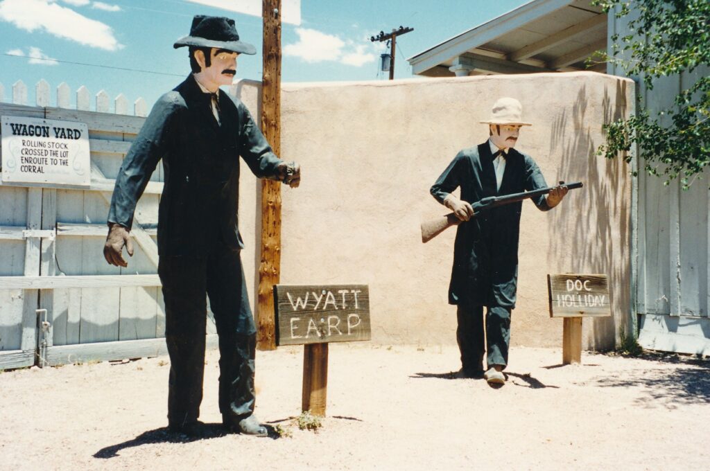
TOMBSTONE, Ariz. — Plaster statues of Wyatt Earp and Doc Holliday stood beside me. Five equally cheesy replicas of the Clanton gang faced us, some with plastic guns drawn. I asked myself: “Is there a more overblown confrontation from the 19th century?”
I reached for a memory but drew a blank.
Ah, the so-called “Shootout at the O.K. Corral” on Wednesday, Oct. 26, 1881, in the rough-and-tumble desert town of Tombstone. Three unsavory men killed by four “good guys” who, truth be told, left a bad taste in many mouths.
We sure as shootin ‘cannot forget those 30 seconds of Wild West violence — Hollywood and the television industry won’t let us. “Wyatt Earp” is the latest of a mess of films about the gunfight, and another TV production looms.
Tombstone heralds itself as “The Town Too Tough to Die.” After two fires nearly killed it in the 1880s, silver lodes provided the cure. Once mines closed for good in 1909, however, Tombstone was on its way to oblivion before the promotional parade of westerns and TV shows resuscitated it as a tourist destination.
Tougher critics might call it a tourist trap, but Tombstone’s desire to take your money hasn’t reached theme-park proportions. There are three or four attractions that cost $2 to $4 apiece, and one of the more interesting sites, Boothill Graveyard, is free. The town itself is off the beaten track, 75 miles southeast of Tucson and 30 miles north of the Mexican border.
Tombstone Courthouse arms visitors with insights about the town’s origin and history. Built in 1882 to house Cochise County’s government, the courthouse was vacated a half-century later when Bisbee replaced Tombstone as the county seat. Briefly a hotel, it became a museum and state historic park in 1959.
The town’s gruesome name is traced to the good fortune of prospector Ed Schieffelin. In the mid-1870s, he arrived at nearby Camp Huachuca and announced his intention to strike it rich.
Soldiers scoffed, telling him all he’d find would be his tombstone. After he instead found silver, the name seemed apt.
By 1882, Tombstone’s population was 15,000. Having rebounded from one fire, the town saw its brief period of prosperity end with another blaze in 1886. What has happened there since is of little interest to nonresidents. No matter — this one-trick town already had notched its claim to fame.
The gunfight pitted City Marshal Virgil Earp, his brothers Wyatt and Morgan Earp, and Doc Holliday against five members of Ike “Old Man” Clanton’s gang. The museum uses drawings and newspaper clippings to describe the battle, which actually played out on a street and vacant lot. “The Shootout Pert-Near the O.K. Corral”?
Triple homicides have lost some of their news value over the years, but that dusty showdown dominated Page 1 of the next day’s Tombstone Epitaph. Under the headline “YESTERDAY’S TRAGEDY”:
“Three Men Hurled Into Eternity in the Duration of a Moment,” the story began: “Stormy as were the early days of Tombstone, nothing ever occurred equal to the event of yesterday.”
A copy of that issue can be purchased at the Epitaph’s office, where a monthly newspaper still is produced. It also can be bought at the O.K. Corral, a museum of sorts that has the plaster statues and a 30-minute “Historama” about the town. The presentation, narrated by Vincent Price, features five miniature displays and a film that suffers from a weak projector light.
Before leaving Tombstone Courthouse, fans of the 1881 gunfight can chuckle at a more-obscure case of Wild West “justice.” On Dec.8, 1883, five outlaws lost control during a store robbery in Bisbee and killed four citizens. Soon they were captured and hanged in Tombstone. The scaffold still stands outside the courthouse-turned-museum.
The outlaws’ leader, John Reith, did not participate in the robbery and was sentenced to life imprisonment. A museum display finishes the tale:
“A mob of Bisbee and Tombstone citizens, not satisfied with the verdict, assembled outside the courthouse, the morning of Feb. 22, 1884, and forced the jailer to release Reith into their custody. Reith was then taken to a telegraph pole, blind-folded, and hung.” A photograph shows the lynching.
The coroner, Dr. George E. Goodfellow, was comically noncommittal in his report. He wrote: “I find that the deceased died of emphysema of the lungs which might have been caused by strangulation, self-inflicted or otherwise.”
Tombstone Courthouse also displays objects from the town’s bawdy past, including a roulette wheel and table for Faro, a popular card game of the 1880s. Mining equipment takes up most of one room. Near a stagecoach is a plaque detailing one man’s discomfort during the 17-hour ride from Tucson. John Gray, after moving from California to Tombstone in 1878, wrote:
“Jammed like sardines in the hard leather seats (we were) creeping much of the way, letting the horses walk, through miles on alkali dust that the wheels rolled up in thick clouds of which we received the full benefit.”
Hardships were relieved in the Bird Cage Theatre, which probably is the country’s only former cathouse that is registered as a national monument. Through the gift-shop entrance, and for a $3.50 charge, tourists can see the stage, several gambling tables, pianos, typewriters and other doodads from the 1880s. Overlooking the scene are 14 small perches, or “bird cages,” that held prostitutes and their johns.
Backstage are several posters from the theater’s heyday, including one from Tombstone Undertakers: “WHY WALK AROUND HALF DEAD WHEN WE CAN BURY YOU FOR ONLY $22? BOOT HILL STILL OFFERS FINE VIEW PLOTS FROM $12.” A note at the bottom says, cryptically: “Ask about our layaway plan.”
Throughout the year, Tombstone offers special events. Territorial Days are held the first weekend in March; Wyatt Earp Days, Memorial Day weekend; Vigilante Days, the last weekend in June; Rendezvous of Gunfighters, Labor Day weekend; Helldorado Days, the third weekend in October; and Emmett Kelly Jr. Days, the second weekend in November.
Shootouts are staged at 2 p.m. Fridays and Saturdays at the Helldorado Amphitheater. The O.K. Corral has re-enactments of the famous gunfight, along with other Wild West stories, at 2 p.m. on the first and third Sundays of each month.
TOMBSTONE AT A GLANCE
How to get there: from Tucson, take Interstate 10 east to Highway 80, and proceed 27 miles south. For variety in your return, consider taking Highway 82 west to Highway83 north to Interstate 10.
Climate: Spring average high temperature is 78 degrees, average low temperature is 46 degrees, average rainfall is 1 inch; summer highs 93, lows 63 and rainfall 7.46; fall highs 80, lows 54 and rainfall 2.2; winter highs 65, lows 35 and rainfall 2.11
For more information: Contact the Tombstone Chamber of Commerce, P.O. Box 995, Tombstone, AZ 85638; telephone(602) 457-9317, fax (602) 457-3911.
TONOPAH, Nev. — Tourists’ wallets are what is mined these days in Tonopah, Nevada’s first boom town of the 20th century.
Today’s haul in no way compares with the riches of yesterday, however. Until the last big silver mine’s closing in 1948, some $150 million in minerals were extracted. That translates to $1.2 billion in modern money.
The discovery of silver and gold by Belle and James Butler in 1900 sparked a rush that came on the heels of the 1898 Klondike madness in Alaska. By 1902, Tonopah contained 3,000 residents and 30 saloons. Twenty more bars were in place two years later, and just before World War I the population peaked at around 7,000.
Today, some 2,600 inhabit this laid-back town, which is a bit closer to Las Vegas (207 miles to the southeast) than Reno (238 miles to the northwest) off scenic Highway 95 in west-central Nevada. Its main tourist attraction is Tonopah Mining Park, which curator and manager Shawn Hall told me had more than 6,000 visitors last year.
Hall, author of five books on Nevada ghost towns and a local school board member, came to the area more than 20 years ago from Massachusetts. How appropriate for a Red Sox fan to be cultivating a gloried past. Tonopah was in top form around the time of Boston’s last world championship.
Babe Ruth, a young pitcher and blooming slugger on that 1918 Red Sox baseball team, may never have set foot in Tonopah, but another 1920s sports superstar did. In his pre-glory days, heavyweight boxing champion Jack Dempsey was a bouncer and tended bar at the landmark Mizpah Hotel (a commanding five-story structure that still stands downtown, though it is boarded up). Howard Hughes bought into the area’s abandoned mines in his golden years — golden in the figurative rather than literal sense, as his mining foray didn’t yield much.
A dilapidated, one-room shack and separate, shoddy outhouse within the 100-plus-acre mining park speak of another famous Tonopah resident: “the butcher of Burbank.” Susan Graham came here in 1949, married a local and left him in 1951 for a life of crime in Los Angeles. Before long she and two male accomplices murdered an elderly woman and, in 1955, the three were executed.
Susan Hayward won a best-actress Oscar for portraying Graham in 1958’s “I Want To Live!”
Graham’s shack is found along the mining park’s self-guided tour. Three head frames are the tour’s standout — or more descriptively, stand-up — attractions. They include the Mizpah, built in 1902 and one of the West’s first such steel structures; and the Silver Top, or “Grizzly,” whose lower rail tracks and bridge are being restored.
The Desert Queen mine and head frame were linked to a tragedy on Feb. 23, 1911, in which 17 miners died in an underground fire. “The hero of the day was Big Bill Murphy, who personally answered the distress calls from below, rode the cage into the inferno and brought many men to safety,” reads an interpretive sign outside the Desert Queen. “On the third trip, he never returned.”
Hall says he tries “to get one major thing done each year” at the park. In mid-March, a small trail that goes over a caved-in tunnel to a platform on which visitors can look down into the passage was almost completed. Hall said the region has some 500 miles of mining tunnels.
Since opening in 1997, the mining park has expanded steadily and visitation has increased tenfold. “Most people will stay two to four hours because there’s so much to see,” Hall said. The local motel industry should be thankful, he says, “because by the time people are done seeing all there is (at the park), it’s too late to go to another town.”
Those who spend the night in Tonopah might anticipate going to bed early. At 8 p.m. the day I was there, the cracked sidewalks along Main Street were dark and quiet. The Club House Saloon contained a few pool players and barflies, the Cranky Crab Seafood Restaurant had a handful of patrons, and that’s about it.
The eight or so motels along Main Street all had vacancies; I spent $42 to stay at the Silver Queen (775-482-6291), which like many of the town’s mining structures seems to be in a state of “arrested decay.”
Aside from the mining park, visitors might also enjoy the town’s Central Nevada Museum, expected to re-open in April after a half-year renovation. Inside will be mineral displays, historic photographs, stuffed animals, old washing machines and whatnot. Outside are a few cabins, rusted machinery, a well-conceived nature trail and, interestingly, a winged, 2,000-pound, World War II “smart bomb” of a type tested in the surrounding desert.
Tonopah Mining Park’s hours are 9 a.m. to 5 p.m. daily, April through September; 10 a.m. to 4 p.m. Wednesdays through Sundays, October through March. Admission is $3 general, $5 per couple and $7 for a family. For more information: (775) 482-9274. Central Nevada Museum, which is free, is open from 9 a.m. to 5 p.m. Tuesdays through Sundays, April through September; and from 10 a.m. to 5 p.m. Wednesdays through Sundays the rest of the year. For more information: (775) 482-9676. For more on both attractions: www.tonopahnevada.com.
SAN FRANCISCO – Any Pollyanna types who are interested in kicking the habit might consider a trip to the Presidio.
There can be found a collection of devices that though created by humans are utterly inhumane. “Torture: Exhibition of European Instruments of Torture and Capital Punishment From the Middle Ages to the Present” is on display at the Herbst International Exhibition Hall through Oct. 14.
Placed against the large room’s walls, and lined down the center, is a rogues’ gallery of pain-inflicters.
Organizers of the show, which is on loan from the Criminal Medieval Museum of San Gimignano in Siena, Italy, want visitors not just to acknowledge past atrocities of justice, but also to help guard against present and future abuses.
After all, what really puts the sad in this sadistic display is that similar tortures still are perpetrated throughout the modern world.
That being acknowledged, one hardly can help from being fascinated by the devices, and to some extent be impressed by the depravity of thought given to their creation. Starkly written signs describe each piece, and often there is a drawing or painting worth a further thousand words of explanation.
Following are a few of the devices and excerpts from their posted descriptions. Keep in mind that the recipients of these tortures sometimes were guilty of nothing more than speaking their minds, not going to church or in some way not conforming. Others, of course, had committed atrocious crimes.
“The Saw.” Picture a long, serrated blade with a handle on each end, the kind of thing two lumberjacks would use to cut down a tree in the pre-chainsaw era. Now warp that image by having the saw applied downward, between the legs of a person strung up by his widely separated ankles.
Such a positioning “assures ample oxygenation of the brain and impedes the general loss of blood; the victim does not lose consciousness until the saw reaches the navel — and even the breast, if one is to believe accounts of the early 1800s.”
“The Goat’s Tongue.” Mild by comparison, the concept here was more to provoke a confession than to kill.
The party deemed guilty was tied to a tree trunk with his feet, having been soaked in saltwater, spread before him. “Then a thirsty goat, which was without water for several days, was tied up at the base of the tree. The goat licked the soles until the flesh was worn away and one could see the bone. At this point, generally, even the innocent confessed.”
“Head Crushers.” Death was assured with these things, two-sided clamps with spikes pointing inward from each wooden bar. Pressure, through the two long screws, would be applied slowly but relentlessly.
“All comment seems superfluous. First the teeth are crushed into their sockets and smash the surrounding bone, then… until the brain squirts through the fragmented skull.”
“The Headsman’s Sword.” Theoretically a quick way to kill, this 3-foot-long, round-topped weapon that rather resembles a huge butter knife required a skilled executioner.
“A long apprenticeship is needed for perfecting aim and force, a period during which the young aspirant – whom we must certainly forgive occasional errors of inexperience – is apt to slice off a few shoulders, arms and brainpans; but sooner or later he will earn his keep on the third try, and in good time on the first.”
“Two Thumbscrews.” Clamps with inward-pointing spikes, these little magnifiers of misery seemingly could be made as handy as a pocketknife. Plus, they had economic benefits.
“The returns in terms of agony inflicted in ratio to effort invested and time lost are highly satisfactory, particularly where complex and costly equipment is wanting.”
Also displayed are “The Spanish Donkey,” a three-dimensional triangle on which victims were straddled for days, weights attached to their legs; “The Rack,” on which the deemed criminals would be slowly stretched, limb sockets torn apart and eventually the spine snapped; “Shrew’s Fiddle,” wooden planks in whose holes a woman’s head and two wrists would be locked for days, until skin was rubbed off; and spike-sprinkled chairs, on which men and women would be tied down and left to bleed to death.
On a recent Saturday, the exhibit was heavily visited by mostly adults. However, one boy who appeared to be about 12 years old was huddled doggedly over the chastity belt display, refusing to give ground for several minutes. A family of four, despite signs clearly forbidding such behavior, frequently touched and caressed other displays. They occasionally laughed.
Human behavior can be so depressing.
“Torture” is open daily from 10 a.m. to 8 p.m. at the hall, at the intersection of Montgomery and Moraga streets. Admission is $9 general, $6 for seniors, students with ID and military personnel or veterans. For more information: (415) 646-0606 or www.torturamuseum.com.
The website includes a list of lectures, all beginning at 7 p.m., that are held at Herbst in conjunction with the exhibition. Among them are “Torture and the United States Prisons,” Aug. 29; “Death Row in Texas,” Sept. 6; and ‘The Women Are Burning: A Brief History of European Witch Hunts,” Sept. 26.
Welcome to this, the World’s Greatest Travel Story.
What’s that? You’re somewhat skeptical of such a statement? Well, let it serve as a warning. You’ll need more than one grain of salt to read through this hyperbolic feeding frenzy. What follows are some American towns’ self-ascribed claims to fame.
Piqua, Ohio, dubs itself the “Underwear Capital of the World.” Other towns likely to get over your skin are Fort Payne, Ala., the “Sock Capital of the World,” and Seaford, Del., the “Nylon Capital of the World.” Scores of those socks and nylons, no doubt, have tramped on floors covered thanks to Dalton, Ga., the “Carpet Capital of the World.”
There’s a lengthy — though not always tasteful– list of towns that boast of food production. St. George, S.C., is the “Grits Capital of the World.” Heartier fare is served at Alliance, Neb., the “cattle Capital of” … the tourism office can’t decide whether it’s Nebraska, the United States or the World. Heck, let’s just call it the “Cattle Capital of the Universe,” OK?
Alliance should team up with Owensboro, Ky., the “Barbecue Capital of the World,” which also could make a killing with Kouts, Ind., home of the “World’s Largest Hog Market.” Fish lovers would do better to visit Crisfield, Md., the “Hard Crab Capital of the World,” or Chincoteague, Va., the “Clam Capital of the World.” Less conventional palates might be satisfied at Martinsville, Ind., the “Goldfish Capital of the World.”
A good place for dessert is Hershey, Pa., the “Sweetest Place on Earth.” If that sounds too indulgent, consider instead what’s produced in Cordele, Ga., the “Watermelon Capital of the World.”
Many of you probably would rather fill up in Toppenish, Wash., where the world’s most hops are produced.
Ready to have some fun? Put the spouse and kids into your utility vehicle and head up to Clinton, Mont., the “Testicle Festival Capital of the World.” Where else could you find 1,600 pounds of fried calf testicles being eaten by 2,500 visitors? Beaver, Okla., might steal some of Clinton’s thunder with its “World Champion Cow Chip Throw.”
Either attraction makes Payson, Ariz., the “Festival Capital of the World,” seem mundane.
If it’s sightseeing you crave, don’t neglect Cawker City, Kan., where the world’s co-largest ball of twine — it shares top billing with Darwin, Minn.– weighs 16,750 pounds. And there’s good news from the Kansas tourism office: “It’s still GROWING!”
Hermitage, Pa., boasts the “World’s Largest Display of American Flags.” The patriotic juices also flow in Charleston, Ill., which contains the “World’s Tallest Abraham Lincoln Statue.”
More exciting, perhaps, is the claim to fame of Seattle, Wash. Its Freeway Park, believe it or not, is “the nation’s first major park to be built over a freeway.” Imagine! And few who have seen the “World’s Only Corn Palace” in Mitchell, S.D., are likely to forget it.
Guymon, Okla., takes pains to point out it “sits on the world’s largest deposit of natural gas.” Sandy, Utah, wants tourists to know it has the “most-married and youngest population in the United States.” Its residents won’t soon be doing business with Batesville, Ind., the “Casket Capital of the United States.”
Tombstone, Ariz., has the macho distinction of being “The Town Too Tough to Die.” Hollidaysburg, Pa., prefers the softer sell, proclaiming itself “Horne of the Slinky Toy.” Gen. Ulysses S. Grant, whose chief subordinate orchestrated the torching of Atlanta, Ga., pardoned Port Gibson, Miss., during the Civil War by finding it a town “too beautiful to burn.”
Terre Haute, Ind., produced the first pay toilet. Vice President-elect Richard Nixon made his Checkers speech in Wheeling, W.Va. Saltville, Va., “was the main supplier of salt for the Confederacy.”
Many of you probably consider Pasadena, Calif., to be the “City of Roses,” what with its Tournament of Roses Parade and Rose Bowl football game. But there are at least two other towns that bill themselves as the “City of Roses”: Thomasville, Ga., and Richmond, Ind.
There also seems to be a discrepancy involving one of our holidays. Both Waterloo, N.Y., and Boalsburg, Pa., claim to be the “birthplace of Memorial Day.”
The World’s Greatest Grasping at Straws Award in towns’ claims to fame, however, goes to Myton, Utah, population 468 and — just like “The Mile High City” of Denver, Colo. — elevation 5,280 feet. According to a Utah tourist guide, Myton is “Most Famous For: At one time being the largest city in the area and for being one of Butch Cassidy’s stopping places.”
Sounds like a perfect spot for the next Elvis sighting!
A man named Williams founded a town in Tennessee, and not being a modest man, he decided to call it Williams Crossroad. Quickly, he filled out the post office application.
Government officials became puzzled when the application arrived. They could not read Williams’ scrawl, so they summoned a handwriting expert to decipher the town’s proposed name. Even the expert was baffled.
“This is difficult,” he said.
And it remains Difficult, one of our country’s many towns that have eye-catching names. For various reasons — some disputed and others, by now, unknown– we have on our maps and atlases places such as Burnt House, Colon, Dismal, Hard Cash, Monkeys Eyebrow, Nimrod, Poverty, Smartt, Stupidville and Two Guns.
The list is as endless as it is amusing.
Difficult is not the only town whose name was botched at birth. Residents of another Tennessee community couldn’t decide what it should be called, so they sent a list of candidates to the U.S. Postal Service. The officials replied they liked Number One, meaning the first candidate. The residents, misunderstanding, christened their hamlet Number One.
Postal Service practicality dictated the naming of Thursday, W.Va. When Bill Mossor opened a general store in the 1920s, he summoned friends to help name his post office. Several suggestions were written down, but one of the application form’s 10 lines still was blank. Someone told Mossor to write the day there. Soon, the storekeeper learned Thursday was the government’s choice.
“The inspector came along to inspect the office,” Mossor wrote years later. “I asked him why they picked Thursday for a name when we had shorter names that we liked better. He said the railway mail clerks often sort the mail by the looks of it, and throwing it in a pile that just looks like that name.” Thursday, for them, would be easy to spot.
Legends played roles in the labeling of many communities. On land that became part of Nebraska, there lived a tribe that boasted a beautiful woman — the chief’s daughter. One day, she was kidnapped. The tribe’s warriors set out to rescue her.
Within a week, the tribe’s women found all the warriors dead on a battlefield. The women’s tears formed a river from whose banks a town, Weeping Water, sprang in the 1850s.
Buzzard Roost, Ga., also is linked to an Indian tale. It is said to be a spot where, after drinking bouts, tribesmen would lie down to sleep off intoxication.
Booze was on the mind of other towns’ founders. In the early 19th century, a group of men liked to gather and pass around a jug of spirits. They considered themselves a happy social circle, supposedly the explanation behind Social Circle, Ga.
Because there already was a Bryant, S.C., residents of Byron were asked to propose a name that would prevent confusion. The state’s Department of Tourism recounts what followed:
“A meeting of the residents was called and someone is said to have suggested that the town be called ‘Beer’ in honor of the favorite beverage of many of the citizens. Objections were raised on the grounds that it would result in unfavorable publicity, so ‘Tea’ was chosen as a compromise.
“A slightly different version is that the group was unable to agree on a name until, in midafternoon someone suggested that it was ‘tea time,’ when the name Tea was unanimously adopted. The town was founded in 1894.”
A saloon proprietor said, “You bet!” when he was asked if he could think of a name for his stage-stop town, thereafter known as Ubet, Mont.
Buckhead, Ore., was a settlement plagued by drunken riots and shootings. In an attempt to soften its image, it was renamed Sweet Home.
On the surface, Paradise does not seem to be an especially interesting name for a town. After all, the exaggeration of physical or climatic attributes is an affliction common among those trying to christen their new surroundings. But it was a rollicking inn called “Pair O Dice” — not utopian delusions — that inspired Paradise, Mont.
A diner inadvertently named Erbacon, W.Va. According to historians Rosalie Carr and Rip Johnson, a man in a boarding house was presented with a choice for breakfast: ham or bacon.
“Er … bacon,” he decided.
In 1884, activists in North Dakota were determined to make their town site the county seat. Someone from a neighboring community objected, alleging an abuse of power. The county commission’s chairman made a stand.
“There has been much talk about our not having power to locate this county seat where we see fit,” P.T. Parker reportedly said. “But we’ll show you that we can do it. And furthermore, just to show what we can do, we’ll name this county seat ‘Cando.’ “
Such can-do spirit was exhibited by the founder of Defiance, Pa. A man named Little proved he was not short on determination when he bravely opened a store in Bedford County, whose only store up to that point was operated by the powerful coal company.
Human grit and suffering help explain the derivation of other town names, such as Coldfoot, Alaska. In 1900, the search for gold led a group of would-be prospectors from nearby Slate Creek to a point along the Koyukuk River. Fearing their quest was becoming dangerous, they contracted cold feet and turned back.
In northeastern Montana, a band of weary pioneers determined they had gone far enough and established the former community of Faranuf.
Back east, in West Virginia, two hunters bagged a buffalo and skinned it before bedding down for what promised to be a cold night. In the morning, one of the men found himself trapped in a frozen buffalo hide, requiring his partner to thaw the primitive “sleeping bag.” Hence the village of Frozen, W.Va.
Injured soldiers inspired the naming of Recovery, Ga. Casualties were treated there during the First Seminole Indian War in 1817, and Recovery was the site of a Confederate hospital during the Civil War.
There’s a grisly story behind Horseheads, N.Y. Arlene Booth of the state’s Department of Economic Development said it was “so named because General Sullivan, on his pursuit of Indians, buried his troop’s horses in this southern tier area of the state. When settlers arrived and began to till the soil, the horses’ heads were exposed.”
Presumably, there is no similar explanation for Caesar’s Head, S.C. But the animal kingdom probably suffered in Deadhorse, Alaska, and Hogshooter, Okla. A cow that fell off a cliff in Break Neck, W.Va., paid the ultimate price for having a town named after it.
In the absence of folklore, drama or wit, town labelers sometimes leaned on location. Eighty-eight, Tenn., is 8.8 miles east of Glasgow, Ky. Between, Ga., is equidistant from Monroe and Loganville. The North Dakota town of Portland was so dubbed by railroad officials because it was midway between the two better-known Portlands — in Maine and Oregon.
Everyone makes mistakes, including the person who filled out the paperwork for Arab, Ala. According to Russell Nolen of Alabama’s tourism office, the city was supposed to be named after a man’s son, either Arad or Ahab.
Dawn Dawson, who works for the Division of Tourism in South Carolina, described how for the town of Swansea, something got lost in the translation:
“An old German kept a store near the area, and when travelers stopped by to ask for the distance to Friday’s Ferry, the storekeeper would say in halting English, ‘How many miles? Zwanzig (the German word for 20).’ His listeners, who didn’t speak German, must have thought he was saying ‘Swansea,’ so the area 20 miles from Friday’s Ferry was called Swansea, as it is today.”
Tropic, Utah? Someone was guilty of — at the very least a mistaken impression, right? Well, its founders thought it had a balmy climate. But then, they were comparing it with Panguitch, a town on the other side of Bryce Canyon National Park that, at 6,666 feet above sea level, is all of 366 feet higher than Tropic.
Settlers of Sublimity, Ore., decided the location was sublime when they arrived in 1852.
Reality comes up a bit short of the images created by towns such as Blunt, S.D.; Colon and Funk, Neb.; Dwarf, Ky.; Romance, W.Va.; and Goon Dip, Alaska. All were derived from people’s surnames or nicknames.
The most fitting name of all might be Enigma. Its derivation, according to a book called “Georgia Place Names,” is unknown.
TOWNSVILLE, Australia — Its name sounds redundant, if not laughable.
Townsville? The people who christened it must have lacked imagination. They might as well have named the place Hamletburg or Cityshire, right?
Actually, this settlement on Queensland’s northeastern coast is named after its founder, Capt. Robert Towns. His tombstone rests atop the city’s dominant feature, 950-foot Castle Hill.
In visiting this comparatively dry tropical city — it receives an average 40 inches of rain annually — a good place to establish bearings is on Castle Hill. A handful of viewing platforms reveal the hilly coastline and interior, Magnetic Island and the intervening Cleveland Bay, the Coral Sea and, of course, the city itself.
The hill looms over a lively downtown that is anchored by the Flinders Mall, two pedestrian-only blocks that have shops, banks, the main post office, a few hotels, information booths and restaurants. Most of the mall’s tenants shut down at 5 p.m. Monday through Thursday, and by 1 p.m. on Saturday, but Friday night shopping extends to 9 p.m. A band entertains the locals, who come out in droves for this and the Sunday morning market, which Flinders Mall hosts from 8:30 a.m. to 12:30 p.m.
The Breakwater Sheraton/Casino poses little threat to Atlantic City, Las Vegas or Monte Carlo, but affords gamblers the chance to play slots, craps, blackjack, poker, bingo and other games. There’s also a gigantic television screen on which to watch sports such as cricket test matches or Australian rules football.
The Town Common, an 8,000-acre environmental park about three miles north of Townsville, is a fowl place to visit. Hundreds of bird species can be spotted there. The best time to go is early morning, when temperatures aren’t oppressively hot.
Twenty-seven well-tended holes make Townsville Golf Club a superior small-city course. The normal greens fee is $15, but only$10 is charged before 10 a.m. on weekdays. Club rentals are$15 for a full set and $9 for a half-set. Shirts with collars are required.
In the late 1980s, the Great Barrier Reef Wonderland Complex opened a few blocks east of Flinders Mall. Combination tickets that cost up to $18 admit visitors to the Museum of Tropical Queensland, featuring extensive displays of area reptiles and insects; the Great Barrier Reef Aquarium, which has a touch tank and a coral reef enclosure; and the Omnimax theater, offering two films, one of which always is “The Great Barrier Reef.”
The complex, which also has food stands and souvenir shops, serves as the launching site for many tours. Pure Pleasure Cruises operates the only one-day trips to the Great Barrier Reef. For $95, tourists are taken on the “Wave Piercer” catamaran to Kelso Reef, about 50 miles northeast of Townsville. Snorkeling and fishing equipment are provided at no additional charge during the 3½-hour docking at Kelso. A smorgasbord lunch, along with morning and afternoon “teas” (snacks), also are included.
Two companies run boats between the complex and Magnetic Island. The crossing takes about 20 minutes, with round-trip fares topping off at $12 for adults. On the island, bicycles can be rented for $10 per day, mopeds for $19 and mokes – small open-air, four-wheel vehicles cost about $26, with a per-kilometer surcharge of 25 to 30 cents.
Another daytrip is rafting on the Tully River, a few hours’ drive north of Townsville in Australia’s wettest rain forest. Four hours on the river are broken up by a barbecue lunch of sausages, veggie burgers and salads. Dinner also is included in the $109 excursion. Beware: The guides all seem to derive great pleasure from capsizing their rafts and human cargo. At least the water is warm.
A variety of car rental companies operate in Townsville, among them Hertz, Avis and Thrifty. One of the cheapest is
Rent-a-Rocket, which charges about $40 per day for clunkers that may have hundreds of thousands of kilometers behind them. Insurance and unlimited kilometers are included.
Bicycles rent for $10 per day at the Transit Centre, a few minutes’ walk south of downtown, not far from Rent-a-Rocket. With the exception of Castle Hill, Townsville is flat, so pedaling is easy. The difficulty in renting cars and bicycles is to stay on the “wrong” side of the road.
Buses run infrequently and charge adults $1.40.
Accommodations span the gamut in Townsville, from hostels to luxury hotels. The Strand Motel, across the road from Cleveland Bay, has air-conditioned rooms from $34. The Sunseeker, a few minutes’ walk from Flinders Mall, doesn’t have air conditioning and is plagued by street noise, but has nightly rates from $20 and weekly rates from $120.
TOWNSVILLE, IF YOU GO
Where it is: Roughly 800 miles north of Brisbane on Queensland’s northeastern coast, off the 1,200-mile Great Barrier Reef.
When to go: The best weather is from June through September, when it rarely rains and temperatures typically are in the 70s. Heavy precipitation can occur anytime from October through March, when it also tends to be hot and humid.
How to get there: Qantas has flights from LAX to Cairns, a few hundred miles north of Townsville. Other airlines fly from Los Angeles to Sydney, Melbourne and Brisbane. Round trips to Townsville range from just under $1,000 to more than $2,500.
What to take: Hats and light, long-sleeved shirts offer protection against sunburn. Be sure to use sunscreen lotion.
Pronunciation tip: Natives pronounce the name of their homeland “uh-strale-ya.” And they really do say “No worries” — often.
For more information: Write to Townsville Enterprises Limited, P.O. Box 1043, Townsville, Queensland 4810.
A tourist who packs poorly is like a fourth marriage there’s plenty of excess baggage.
The society gal who gathers 10 pairs of high heels for a weekend at the ski lodge, the businessman who takes his 10-iron, 5-wood, 2-putter golf bag everywhere “just in case”… those types are beyond hope.
But you, you”re reading something in a travel section, and probably know a thing or two about efficient packing. You stuff socks in corners, roll rather that fold clothes to prevent creases, are willing to wear pants more than one day in a row, and leave your boom box at home. But have you reached a point at which you’re stuck for new ideas?
Well, perhaps some of the following suggestions will inspire you to lighten that load a bit more.
- Pack old clothes that can be chucked along the way: socks with holes in them, shirts that are out of style or on the verge of rag status, jeans that have been washed so often they’re more gray than blue.
- Take nylon underwear and polyester socks, which dry quickly. You know, the bikini briefs with flower patterns and socks that, even fresh out of the package, tend to have runs. Avoid all-cotton items; even a small percentage of synthetics speeds drying.
- A friend at work told me black is a great traveling color in that it doesn’t show dirt. For women, exercise leotards work as tops and bathing suits, while thick tights can substitute for nylons and thermal underwear. Men’s nylon jogging shorts can double as underwear and triple as swimsuits.
- Pack just one set of clothing. Switch with what you have on and wash every two or three days. Or wait longer, splash on increasing amounts of perfume and tell gagging companions: “I’m being European.”
- Extremists could wash their only set of clothes at night, sleep in the buff and don the dried duds next morning. This might work best for young, amorous couples.
- Slip in a little laundry detergent and do your wash in the sink. If your clothes are quick-drying, they will be ready to pack or put on by morning.
- Rather than using laundry detergent, clean your clothes with shampoo, which also can be used as soap.
- Or forget shampoo, which can get messy if its container breaks. Use soap instead soap found while traveling, preferably. Heck, my grandmother used soap on her hair for 94 years, home and away. And when she died, there wasn’t a trace of gray! (Her hair was pure white, actually.)
- Definitely forget shaving cream. Shave in the shower. After all, you’ve probably been scraping your skin long enough that you shou ldn’ t need a mirror, right?
- Vitamins, aspirin and other pills can be combined in one bottle.
- Try to keep footwear to a minimum. Unless you’re attending a formal event, leave dress shoes behind and settle for sneakers. Canvas shoes and loafers are scrunchable backups.
- Hats are lifesavers in sunny vacations spots, and protect your head in rainstorms. However, they can be a burdensome bit of baggage on planes and buses. Collapsible, canvas hats, such as the kind you might find at Kmart for $5, are extremely practical, though not stylish. One option for headwear is to buy at your destination, where you’re bound to find a straw hat or sombrero that you’ ll love until the moment you arrive home.
- If picking up pamphlets as you go and reading motel Bibles don’t satisfy your literary needs, pack a large, engrossing paperback, whose pages can be torn off once they’re read. I scattered chapters of “The Rise and Fall of the Third Reich all over New Zealand.” Books written in English though perhaps not fine examples of English literature can be found almost anywhere.
- Keep your paperbacks intact and swap them with companions or other travelers. Occasionally, you can find a book swap of some sort; the Alberta tourist center at the Saskatchewan border in Lloydminster, for example, has a one-for-one trading bin.
- Don’t buy souvenirs. What you by for yourself, well… remember the hat theory. You’ll hate that native drawing of rainbows once it’s on your bedroom wall, or that stuffed piranha once it’s on your coffee table. What you buy for friends likely won’t please, either. Even requested items might disappoint. If your co-worker really wants a handwoven rug from Panajachel, he can fly to Guatemala City, take the four-hour ride on a chicken bus and pick one out for himself.
But if you’re stuck at the airport awaiting your flight home, and you have a piddling amount of native cash or coins, go ahead buy that “I (heart shape) Rio” bottle opener or that “Land of Ah’s ” Kansas toothpick holder.
- If you must shop on the road. make sure of the desirability of your purchases and consider shipping them home. Or perhaps you’ll have created enough space by throwing away ratty clothing and tearing out paperback pages to fit new things in your bags.
- Somehow, squeeze in a small backpack. It can be used to tote necessities such as a camera, sunscreen and guidebooks on short outings while your suitcase rests securely, you hope in a hotel room. Also, backpacks are practical carry-and for flights.
John Steinbeck produced some sensational fiction, including “Of Mice and Men,” but I am partial to his account of man and dog.
Four decades ago, the Salinas-born writer set out from his Sag Harbor, N.Y., home on a 10,000-mile drive through 34 states. His wheels were a custom-made truck he christened Rocinante, after Don Quixote’s horse. His sole traveling companion was a 10-year-old, French-born poodle whose formal name was Charles le Chien. “Travels With Charley: In Search of America” is Steinbeck’s account of their adventures.
Among the book’s charms is it exposes a bit of Steinbeck the man. By then he was 58, his last great novel (1952’s “East of Eden”) eight years behind him, his death eight years ahead (1968). In “Charley,” his guard seems down; he strongly and entertainingly states his opinions. He comes across as a friendly, frequently lost bloke who is content to sit back with a stranger and chat over coffee, preferably spiked. He is humble, reflective, insightful, resourceful … or if none of that, certainly a good enough writer to persuade most readers that he is.
He also makes observations about dogs, and traveling with them, that still resonate. Here in 2002, the centennial of Steinbeck’s birth, I find myself drawn to “Charley” and to thoughts of the peripatetic pooches I have known. Consider, if you will, my sister Portia’s dog, Pepper.
Like Charley, Pepper was born in France, where Portia’s family lived for most of the 1990s. Pepper was a pipsqueak, though, at 12 pounds, and was a black and eventually blind fur ball of unclear breeding. Her claim to fame is she flew across the Atlantic Ocean seven times, and in 2000 moved with her human companions to Brazil. Oh, the frequent-flier points she could have earned! Last summer, perhaps miffed that for once she had been left behind during a family vacation, she wandered from home and has not been seen since.
Dad, for 15 years, had a border collie mix who pretty much supplanted Mom as their household’s leading lady. Martha was always a sweetie, but on a road trip in 1982 she also was sneaky. Somewhere along Interstate 70 in western Kansas, left alone in the back seat, she ate all the sandwiches Dad and Portia had packed for lunch.
My dog, a 6-year-old Australian shepherd named after an early 20th century baseball player, pops up in the passenger seat and sniffs the dashboard’s vents whenever we pass farm animals. While so doing, Tinker (will my next two dogs be Evers and Chance?) makes a squealing, whiney sound. In that way, he exhibits a nervousness that Steinbeck’s Charley showed when that duo drove into Yosemite National Park in 1960.
“Less than a mile from the entrance I saw a bear beside the road, and it ambled out as though to flag me down,” Steinbeck writes in “Travels With Charley. “Instantly a change came over Charley. He shrieked with rage. His lips flared, showing wicked teeth that have some trouble with a dog biscuit. …
“I was never so astonished in my life. To the best of my knowledge Charley had never seen a bear, and in his whole history had showed great tolerance for every living thing. Besides all this, Charley is a coward, so deep-seated a coward that he has developed a technique for concealing it. And yet he showed every evidence of wanting to get out and murder a bear that outweighed him a thousand to one. I don’t understand it.”
Though strange animals are bound to excite many an otherwise-calm dog, people who are strangers often are mere objects of curiosity. Steinbeck counted on his canine companion to break the ice when they made camp in Maine near two trailers full of French Canadian potato pickers. (The “Grapes of Wrath” author had a thing about migrant workers.)
“The incident came off as smoothly as one might expect of a tested and well-rehearsed script,” according to Steinbeck. “I sent out my ambassador and drank a cup of coffee while I gave him time to operate. Then I strolled to the camp to relieve my neighbors of the inconvenience of my miserable cur.” Everybody but the dog ended up in relaxed conversation, a “very, very good” bottle of cognac drained in the process.
Gina Spadafori, whose syndicated pet column appears Saturdays in Scene, has read “Charley” and considers its description of redwoods to be “some of the most beautiful writing I have ever come across.” She echoes Steinbeck’s notion of dogs being good ambassadors. At interstate rest areas, which Spadafori finds “creepy” because of crime anxieties, canines can lighten the mood and spark some mingling.
“Everyone is your friend when you travel with a dog that’s not scary, (a dog) that people react to in a very friendly way,” she says, citing Labrador retrievers and bichons frises as good examples. “Dogs are a social lubricant; people talk to you if you have a dog.”
Spadafori, by the way, has written that “rest areas aren’t well-suited for canine travelers” in the bathroom sense. For doggie relief, she favors “fields at the edge of restaurant and gas clusters, off the road and far enough from traffic for a quick game of fetch.”
Charley’s needs were met even less formally during the 1960 trip. Leave it to Steinbeck to describe one such outing, in the rural Midwest, so lyrically:
“What was so wonderful was that I could come again to a quiet country road, tree-bordered, with fenced fields and cows, could pull up Rocinante beside a lake of clear, clean water and see high overhead the arrows of southing ducks and geese. There Charley could with his delicate exploring nose read his own particular literature on bushes and tree trunks and leave his message there, perhaps as important in endless time as these pen scratches I put down on perishable paper.”
Making messes where they are not supposed to can land travel companions in the doghouse. I am referring specifically to lodgings, which can present further perils for pet owners. A few weeks after I had adopted Tinker from the Sacramento SPCA, a friend and I took him on an overnight trip to Reno. Dimly, we left Tinker alone in the motel room for 10 minutes — plenty of time for him to chew off part of the curtains, to the tune of $45.
Robin Glass of Sacramento insists that a few years ago in Yuma, Ariz., the two dogs she and her mother were traveling with locked them out of a motel room. After several failed attempts at finding a pass key, management finally opened the door. Whitney and Brittany, both miniature poodles and the latter a retired show dog, had made themselves at home.
“They were absolutely all over the beds, bouncing around,” said Glass, a legal secretary. “I swear they set it up.”
When dogs become too troublesome, or catering to their every need puts too big a damper on one’s trip, boarding might be necessary. Steinbeck, his Rocinante adventure interrupted for business and a brief reunion with his wife in Chicago, resorted to a kennel. Charley, who was to be cleaned and clipped during his stay, pouted at the parting. His owner, however, was not fooled:
“He is a fraud and I know it. … I know for a fact that five minutes after I had left Charley he had found new friends and had made his arrangements for his comfort. But one thing Charley did not fake. He was delighted to be traveling again, and for a few days (after being kenneled and cleaned) he was an ornament to the trip.”
Sidebar:
Copies of “Travels With Charley” can be found in local libraries, bookstores and from such Internet sites as www.amazon.com. For more information about Steinbeck, visit www.steinbeck.org, the Web site for The National Steinbeck Center, One Main St., Salinas, CA 93901; phone (831) 796-3833; e-mail info@steinbeck.org. The center’s 22nd annual Steinbeck Festival is planned Aug. 1-4. For more information about centennial events in Monterey County and elsewhere: www.steinbeck100.org. (Steinbeck was born on Feb. 27, 1902.)
Through Dec. 31, the Monterey Aquarium has an exhibit that chronicles the friendship between Steinbeck and marine biologist Edward “Doc” Ricketts. For more information: www.mbayaq.org or (831) 648-4800.
To read an Edward Weeks review of “Travels With Charley” that appeared in the August 1962 issue of Atlantic Monthly: www.theatlantic.com/unbound/classrev/charley.htm.
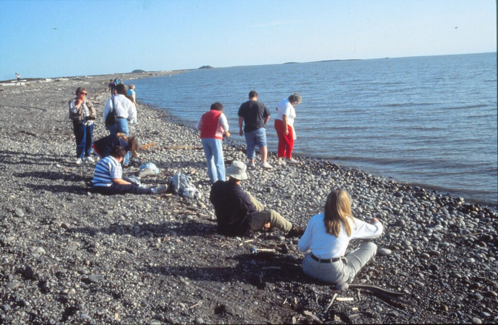
TUKTOYAKTUK, Northwest Territories — “Big Man,” one of our tour guides, was describing some aspect of life in the Arctic Circle when a siren sounded. It was 9:45 p.m.
During the school year, he told us when the wailing abated, children must be inside their homes before 10 p.m. But on the day of our tour, in late June, there was no curfew. Youngsters could stay up all night, every night in the summer, without fear of running afoul of the law.
Time loses much of its meaning if the sun never sets — not for another month and a half, anyway. As Big Man explained, when children decide to go out and play at 3 a.m., “it just doesn’t matter.”
“Tuk,” as it’s called in these parts, is surrounded on three sides by the Beaufort Sea, part of the Arctic Ocean. Inuvik, the area’s principal town, lies 85 miles to the south. The polar ice cap is 100 miles to the north.
In the 1970s, Tuk thrived during a brief oil-exploration boom. But all the oil companies eventually departed. Tourism has become the dominant industry, with groups such as mine being flown in from Inuvik for visits that range from two hours to a day.
Our other tour guide, Winnie, told me that she occasionally plays host to some of the visitors. In her new, stylish home, she serves caribou soup and other native dishes.
Prior to joining the Arctic Tour Company, Winnie was a social worker in Tuk for 18 years. Frustrated by the increasingly difficult nature of her dealings with troubled youths and adults, she quit in 1990.
Crime, she explained, is a major problem in Tuk. There are five police officers in a town with 950 residents. Drinking is epidemic, Winnie said, even though there are no liquor stores or bars. Booze can be obtained through mail orders, or from friends and relatives who come up from Inuvik. There also are bootleggers.
The primary source of entertainment appears to be television. Big Man — who was given that nickname when he was a toddler, and as an adult stands taller than most other Tuk residents — bragged there are seven TV channels available, including three from Detroit. The library shut down three years before, and the golf course was abandoned because hackers couldn’t afford to replace all the balls lost in the Beaufort Sea.
The present school building is only a few years old, and offers instruction through eighth grade. Those wishing to continue their education must do so in a southern town, usually Inuvik.
From December through mid-April, Big Man said, students can be driven to Inuvik over a frozen river. The 1 20-mile trip takes about two hours, he said.
Dogs are common sight in Tuk, though they rarely allowed to play with children. Most are employed exclusively to pull sleds on winter hunting expeditions, and all are supposed to be chained up in the off-season. The owner of any dog found wandering about town is given just one warning; after that, the canine is shot.
The landscape immediately south of Tuktoyaktuk is dotted with “pingos,” hills pushed up by heaving permafrost that resemble pimples. Two of the world’s largest pingos are visible from the Tuk shoreline.
Tour groups routinely are taken down to the shore for a “toe dipping ceremony” in the Arctic Ocean. This harmless but rather goofy tradition occurs near a far-stretching line of huge, black sandbags. Tuktoyaktuk, Big Man explained, is slowly sinking into the sea.
On our way back to the airport, we saw in the distance a clump of large radar equipment and buildings. The military installation is a remnant from the Cold War, built in 1955 to detect a Soviet attack. The DEW — Distant Early Warning — line station is supposed to be replaced by a fully automated outpost a few miles to the south.
The year-old, 19-seat plane that had flown us up from Inuvik passed over four caribou on the return flight. The pilots backtracked and flew low so that the animals could be seen from both sides of the aircraft.
On the way up to Tuk, the plane ride offered a spectacular view of the lake-clogged Mackenzie Delta. We also passed over a reindeer farm that was founded two decades ago during an unexplained lull in caribou migration. As has been the case for centuries, native people rely on caribou for much of their food and clothing.
A few miles before Tuktoyaktuk, we could see the polar ice cap out one side of the airplane and an Eskimo ghost town out the other. According to the pilots, the settlement may have predated the birth of Christ but has been unoccupied for 200 years.
Under clearly visible stacks of lumber are remains of the town’s residents, who due to tundra conditions could not have subterranean burials.
The Arctic Tour Company excursion began at 8 p.m. in Inuvik, lasted three hours and cost approximately $90 U.S., including taxes. I signed up for the tour that afternoon, so there apparently is no need to make reservations in advance for the daily excursion.
For more information on other Arctic Tour adventures, write to P.O. Box 2021-A, Inuvik, Northwest Territories, Canada X0E OTO, telephone (403) 979-4100. Or, to learn about other Arctic activities and tour companies, contact the Inuvik Bureau at P.O. Box 2719, same postal code, telephone (403) 979-4545.
OAKLAND – A major component in the U.S. response to September’s terrorist attacks is our Navy, which also played a key role the last time thousands of Americans were killed in one day on U.S. territory.
On the 60th anniversary of Japan’s attack on Pearl Harbor, I visited two former naval vessels docked in the East Bay: one that harks back to the president who oversaw our nation’s efforts in World War II, and one that symbolizes American grit and might in revenging the tragic events of Dec. 7, 1941. Both the USS Potomac, used by Franklin Delano Roosevelt as “the floating White House,” and the USS Hornet, a huge (figuratively and literally) success in WWll’s South Pacific battles, now are open to tourists.
History lessons ahoy!
Dan Strohl, a Navy veteran who is retired from a career in electronics, took me aboard the Potomac and enthusiastically shared tales about the yacht’s glory years. He also recounted how the 165-foot vessel eventually was sold by President Truman, for a time was owned by Elvis Presley, was used by drug smugglers before being confiscated and, for a couple of weeks around 1980, was under water. Since 1995, following a $5 million restoration, the Potomac has been open for tours and short cruises. The national historic landmark is berthed off Franklin D. Roosevelt Pier, at the foot of Clay Street in Jack London Square.
Having exchanged hands so many times since President Truman sold it, and having sunk, today’s Potomac has very few original pieces left. The wheel and some of the navigational equipment remain from the ship’s construction in 1934 as a Coast Guard cutter, Strohl said. He also pointed out a wooden dish holder, hanging in the parlor, that dates to FDR’s days.
Before the United States entered World War II immediately after Pearl Harbor, Roosevelt spent a lot of time aboard the Potomac – perhaps a total of two months a year, Strohl guessed. For FDR, the lures were many. The Potomac:
- In Chesapeake Bay or cruising along the coast or Hudson River provided an environment better than Washington’s for the 32nd president’s sinusitis.
- Was a place on which FDR could entertain and lobby dignitaries in a somewhat informal atmosphere that eluded fishing forays and card games. According to Strohl, it was on the Potomac that FDR persuaded Depression-era automakers to release new models a few months before Jan. 1, thereby stimulating sales by tapping into consumers’ Christmas-shopping impulses.
- Offered a break from the notoriously bland White House meals boiled up by a “Mrs. Nesbit,” who Strohl said was a longtime FDR nemesis. The docent added that among the Potomac’s 54 naval crewmen, presumably a few could cook up a storm.
The Potomac also might have offered FDR a refuge from his wife, Eleanor Roosevelt, who never overnighted aboard. The first lady did, however, celebrate her 57th birthday on the ship in 1941, and rode along when FDR took England’s King George VI and the reigning Queen Mum to Mount Vernon in 1939.
Toward the bow, away from the parlor, is the communications room. In there, Roosevelt gave a nationwide radio address that announced the Lend-Lease Act of 1941, Strohl said. Another milestone in the United States’ growing alliance with Great Britain occurred when FDR secretly consulted with Prime Minister Winston Churchill off Newfoundland in August 1941; the Potomac took Roosevelt part of the way there.
In a passage between the radio and engine rooms, Strohl pointed out a disused, 85-pound piston that attests to the Potomac’s might. Though today the yacht cruises at 11 knots with 500-horsepower engines, at one time 650- horsepower engines were aboard.
“It was made to be maneuverable,” Strohl said. “In those days, in the Thirties, it was a hot ship.”
Getaway speed never came into play for the “floating White House,” which had a pace of life that seems awfully quaint in today’s frantic world. Stretched out on cushions in the stem’s patio area, FDR typically would have legislative papers on his left and stamp books on his right, Strohl said while re-enacting the pose. Each day at 5 p.m., Roosevelt would knock off work and have a drink. He enjoyed serving his guests, too, Strohl said.
Much of the Potomac’s interior floor is covered with dark-green linoleum squares that also can be found on the USS Hornet, a vastly different sort of vessel permanently moored a few miles away off Alameda Point.
Eighth in a line of USS Hornets, the seventh having sunk in October 1942’s Battle of Santa Cruz, this Essex-class aircraft carrier had a most-distinguished war record. According to the museum’s promotional materials, the new Hornet was launched in August 1943 and was not touched in 59 attacks. Its pilots shot down 62 Japanese planes in one day. Also, from its deck was launched the first carrier strikes in the liberation of the Philippines and the renewed bombings of Japan.
Hornet capped its military service by retrieving the Apollo 11 crew and capsule from the first “moon shot” in July 1969. The 894-foot-long carrier, which during its heyday had a crew of some 3,500 men and contained more than 100 aircraft, was decommissioned in 1970.
A few years ago, the USS Hornet was turned into a museum, and visitors are free to stroll about the flight deck, whose squishy surface reflects decades of uncontested weathering; and the hangar deck, which includes a gift shop, video-presentation area and perhaps a dozen aircraft used during the period in which Hornet served our country. Docents lead small groups up and about the towering navigation bridge above and to one of the engine rooms below.
The USS Hornet Museum is at Pier 3 in the former Alameda Naval Air Station. Its hours are 10 a.m. to 5 p.m. daily except Tuesdays, Christmas and New Year’s Day. Admission is $12 general; $10 for veterans, students and seniors age 65 and beyond; and $5 for people ages 5 through 18. For more information: (510) 521-8448 or www.uss-hornet.org.
The USS Potomac is open for dockside tours from noon to 4 p.m. on Sundays and from 10 a.m. to 2 p.m. Wednesdays and Fridays. Admission is $5 general; $3 for ages 6 through 17 and for seniors ages 60 and beyond; and $10 per family. For more information: (510) 627-1502 or www.usspotomac.org. To enquire about chartered cruises: (510) 627-1215 or e-mail info@usspotomac.org.
PARIS – One evening you throw an indescribably lavish party for your country’s leaders in your new castle, which is considered one of the most important architectural achievements of the century, and the next morning you wake up in prison, where you will remain until you die 19 years later.
In history’s grand category of the bigger they are, the harder they fall, Martha Stewart’s got nothing on Nicolas Fouquet.
As France’s finance minister under then-youthful King Louis XIV, Fouquet managed to dip his well-manicured hands into the country’s pot enough times to secure a mighty fortune. However, being merely rich and powerful failed to satisfy the man whose personal motto was “How far will he not rise?” Frankly, he wanted to leave his mark in real estate, and with enough francs he certainly managed to do so.
Eighteen thousand workers toiled 24/7 (it is doubtful that 17th century French wits went about in their big wigs and leotards saying “vingt-quatre sept,” but one should not be too presumptuous) and razed three villages to establish Vaux le Vicomte. Architect Louis Le Vau, sculptor Charles Le Brun and gardener Andre le Notre teamed up to create a masterpiece.
On Aug. 17, 1661, Fouquet threw a house-warming party. Buffet tables groaned, music filled the air and people made merry. Then someone whispered into the king’s ear that perhaps Monsieur Fouquet had needed more than just wealthy ancestors and wise investments to create such opulence. Louis, already feeling a bit insecure about the upstart finance minister’s country estate, seized the chance to have Fouquet arrested. Soon after, he secured the services of Vaux’s three creators to do his former finance minister one better. The result was Versailles.
Today, Vaux le Vicomte is one of the grand chateaus of Europe, and perhaps one of the most underrated. On a sunny and warm Saturday late last May, seemingly not more than a few hundred people strolled about its palace and gardens. Meanwhile, nearby Versailles was undoubtedly bulging with busloads of tourists. What a shame for Vaux’s bottom line, but what a relief for those who can visit Vaux without fighting crowds.
The comparative difficulty in getting there may discourage some tourists. Those who are not in tour groups or do not have cars must take a five-mile cab or public bus ride from the Melun train station. Another limiting factor is that many Americans and other foreigners who are “doing” France have time only to see Versailles. Vaux is ideal for repeat visitors.
Count on spending a full morning or afternoon if you go. Admission, about $10, includes headset rental for a self-paced tour of the four-story chateau. Built with white stone covered by slate, it is mostly surrounded by a moat and has as its main feature an Italian-style lounge in the rear, topped with a grand dome. Last May, the room was furnished only with marble busts and large, metal holders for votive candles. The effect, coupled with the outstanding views toward the gardens beyond, was peaceful and moving.
Le Notre’s exterior design, after two centuries of neglect, was restored by a 25-year-project at the end of the 19th century. Gazing over the grounds, from the chateau steps to the Hercules statue on a hill one mile away, even the most self-congratulatory home gardener is bound to feel a bit inadequate. Vaux’s gardens are immense, so very clean, orderly and clever. One of Le Notre’s “tricks” is that the kilometer-long grand canal is invisible from the chateau. Visitors see it slowly emerge as they stroll toward Hercules, who from the castle looks as though he is supported on a fountain; he is not, thanks to more of Le Notre’s visual playfulness.
Pools and fountains are sprinkled throughout, so to speak, as are finely carved statues such as one showing two lions in which the male is licking the top of his mate’s head. She seems to be smiling. The fountains were turned on only the second and fourth Saturday afternoons from March to October last year. Candlelight tours were offered Saturday evenings during that same period. Similar schedules are in effect this year.
Vaux also has a self-service restaurant, large gift shop and electric-cart rentals for those who need help getting around. Paddle boats, shaped like swans, can be rented for exploring or merely enjoying the grand canal.
For more information about Vaux le Vicomte, go to www.vaux-le-vicomte.com. Another great source for visiting Vaux or other Paris and environs attractions is the city guide by PBS mainstay and European travel expert Rick Steeves.

PASADENA, Calif. — Things don’t look too promising for the hungry vegan couple as they survey the scene at Lake Avenue and Boylston Street. Carl’s Jr. at one corner, McDonald’s across the street, KFC at the third corner and… What does that placard on the fourth comer, at the Orean restaurant, say? Could it be?
“The first vegetarian fast-food drive-thru” is what it says, and on that cloudless August afternoon my wife and I felt as though we had just won the lottery. My selections — a burger, fries and a soft drink — proved to be quite yummy and harked back to my pre- 1988 life as a meat-snarfing young man on the “all-American” diet. Burritos, chili dogs and pizzas also are on Orean’s menu, with the only ingredient not qualifying as vegan (no animal products whatsoever) being the optional vegetarian cheese, which contains casein (a milk byproduct).
The greater Los Angeles area is one of the greater places on the planet for vegetarians and vegans who enjoy eating out. Sure, getting around in this motorist’s nightmare of perpetually clogged freeways and backed-up surface streets can give anyone an upset stomach. But once you are seated in any or the region’s many peaceful, welcoming “beans and greens” establishments, drive-time frustrations melt away and taste buds’ clamor for food becomes more insistent than deafening car alarms.
I once lived in Torrance and still a couple times a year escape from vegetarian-unfriendly Sacramento to see friends and dine at some outstanding veggie restaurants in Southern California. The eatery I used to patronize when I resided down there in the early 1990s, and my sentimental favorite, is The Spot (www.worldfamouspot.com), at 101 Second St. in Hermosa Beach. This is a quiet, friendly place that’s only a two-minute walk from the beach and its miles-long pedestrian and bicycle path.
The Spot is vegetarian, not vegan, so some dishes contain cheese, eggs and/or milk. I always — no exceptions, much to the chagrin of my more adventuresome wife — opt for the Super Garden Burrito (slightly under $10), which consists of garden veggies, baked tofu and beans (black or pinto) wrapped in a tortilla that is smothered in “savory sauce.” That condiment used to be sensational, and still is wonderful despite recent tinkering that makes it less oily and fattening. (Don’t you hate it when health food gets more healthful?) Basically, it consists of tofu, almond (or safflower) oil, brewer’ s yeast, soy sauce and a few spices blended to cream-colored goodness. Who needs cheese when there’s savory sauce?
Well, Native Cheese certainly is worth pursuing. The best fake cheese l have ever tasted, and I have tried dozens of them, graces several dishes at Native Foods (www.nativefoods.com). At 1110 Gayley Ave., near UCLA and the Wilshire Boulevard exit off interstate 405, Native Foods is hands-down the best vegan restaurant in the state, if not the country. Its foods are simple, varied and exceptionally realized, at reasonable prices. The Mama Mia pizza ($13.95), Philly Peppersteak Sandwich ($9.25), Chili Cheese Fries ($6.50) and Sam’s Native Cheesecake ($5) all are great. I imagine everything else is, too, but I can’t help but stick with my favorites.
Native Foods, by the way, is also in Costa Mesa, Palm Desert and Palm Springs. If you are a vegetarian, you simply cannot miss this place. Ifs worth driving many, many miles out of your way to experience Native Foods.
My wife and I also are impressed with Leaf Cuisine (www.leafc uisine.com), a neat and tidy little restaurant at 11938 W. Washington Blvd. in Culver City. (A branch recently opened in Sherman Oaks.) This place practically screams “It’s good for you!” The menu — and this is a mouthful for the health-food crowd — is organic, vegan, raw and kosher. We tried three wraps, all $8 and loaded with greens and other salad ingredients: the Bombay Burrito (lentil croquettes with coconut curry sauce), the Flying Falafel (sprouted chickpea falafel croquettes with tahini sauce) and the Mediterranean Medley (sun-dried tomato and walnut croquettes with spinach pesto sauce).
Everything was delicious, with the sauces exceptionally tasty. And best of all, the food made us feel good. Just what the doctor ordered — the doctor who cares about nutrition, that is, which if you will allow me to say so is a rare breed of doctor indeed.
In my opinion, The Spot, Native Foods and Leaf Cuisine represent the best of Los Angeles-area vegetarian restaurants. Honorable mentions include Real Food Daily (www.realfood.com), a popular, all-vegan eatery with locations in Santa Monica and West Hollywood. Its varied fare includes tacos, nut loafs and soups, though I strongly suggest you avoid ordering the BBQ Tofu Chop Salad, a dish that doesn’t seem to know what it wants to be and as a result isn’t much of anything. Follow Your Heart (21825 Sherman Way in Canoga Park), a combination health-food store and restaurant in the San Fernando Valley, has an extensive selection of veggie fare. Friday night is pizza night; we found the crust to be superb but were not impressed with the tofu topping, which was too mild and too liberally employed.
As for Orean in Pasadena, here’s something else it offers that vegans are unlikely to encounter anywhere else: Soft-serve ice cream. Yum!
To find more vegetarian, vegan and raw restaurants in the greater Los Angeles area, check out “Miki’s Guide to Vegan Dining in L.A.!” (www.randomgirl.com/veganla.html) and “Vegetarians in Paradise” (www.vegparadise.com/restaurants/html).
For many, food represents one of traveling’s biggest pleasures. Eating particular things in particular places becomes a symbolic pursuit: pizza in New York, barbecue in Texas, haggis in Scotland, feijoada in Brazil, monkey brains in China, etc., ad nauseam and perhaps ad nauseous.
For vegetarians, and especially for vegans, food can represent one of traveling’s biggest hassles. Finding a restaurant that serves meatless dishes is hard enough. Finding one whose veggie meals qualify as vegan, with no animal broths, eggs or dairy products whatsoever, inadvertently can turn travel eating into a weight-loss campaign.
Which might be good thing, come to think of it. Go away, go vegan, go hungry and come back skinny as a celery stick!
But seriously, what’s a traveling vegan to do?
“One thing I’ll do that helps is to take food with me,” said vegan Sue Richards, a project manager in her late 40s who lives in Roseville. “Soups and hot cereals that require only hot water, cartons of soy or rice milk, an organic cereal, herb teas and the grain beverage that I like, Luna bars. My suitcase frequently carries more food than clothes!”
Indeed, packing for vegans is as much an art of meal-planning as it is of folding and rolling clothes. Recently, Richards and a few other members of the Sacramento Vegetarian Society shared thoughts on how they approach travel in terms of their diets, and what parts of the country and world they have found to be vegetarian-friendly.
I carry a large bowl, eating utensils and a knife for cutting fruits, etc., in my luggage,” said vegan Bill Ewald, 58, an antiquarian-book seller and retired Sacramento firefighter. “Sometimes I carry an extra suitcase with just food in it. … I also carry a jar of organic almond butter and buy bread – non-wheat for me – locally for sandwiches.”
The longer the trip, the more occasions vegans will have for “living off the land” wherever they might be. Richards takes stock of the situation immediately: “The first thing I do when I reach a new town is check the phone book for health od and grocery stores.”
Linda Middlesworth of Sacramento also surveys the scene.
“If there are no restaurants to be found that have vegetarian food, I opt for a grocery store and buy vegan yogurt, vegan energy bars and Muir Glen V-8 juice – items generally available in standard grocery stores,” said the 57-year-old graphics designer, a globe-trotter who has been on the vegan trail in Japan and Russia, among other places.
Middlesworth, an animal-rights activist who tends not to suffer meat-eaters gladly, said she usually can make do in restaurants.
“If nothing vegan appears on the menu, I ask the waiter/waitress to make me a veggie plate with mushrooms, potatoes, rice and whatever fresh veggies they have,” she said. “When my plate arrives, it always looks far better than the brown and white plates of the carnivores next to me. The chefs are generally bored with the same dishes over and over, and I think they get creative with my veggie dish.”
Davis residents Kendra and Robb Curtis, 40-something vegans who met through an online vegetarian dating service a few years ago (www.veggiedate.com) and married last summer, make their own breakfasts and snacks from “cereal bars, fruit, crackers, chips, bagels” and the like, Kendra said.
“For lunch and dinner, we will either try to find a restaurant that offers something vegan or, if that’s not successful, we’ll find a grocery store and buy something there,” she continued. “We’ve found that you have to be very creative when traveling as a vegan.
“You can almost always find something at any restaurant. If there isn’t anything on the menu, we just request to have a dish that is on the menu modified.”
Ewald pointed out that certain ethnic restaurants tend to be better bets for vegans. Mexican eateries generally can whip up “a plain whole-bean and rice burrito, with guacamole, if it is made with fresh vegetables each day and contains no dairy,” he said.
“Middle Eastern- and Mediterranean-style restaurants have vegetarian and vegan food options,” Ewald added. “Chinese, Thai and other similar restaurants also will have vegetarian and vegan fare but are prone to a lot of refined sugar in their food, which I do not consume, so I personally avoid this type of restaurant except in emergencies.”
Sugar, as Richards found in researching an article for the Sacramento Vegetarian Society’s newsletter, often is processed with animal bones. For dessert-loving vegetarians, that is sour news. Another cause for indigestion: Many wines and beers are processed with fish intestines, eggs and other animal products.
Mary Rodgers, a longtime member of SVS and a vegan for the past 12 years, echoes Ewald’s endorsement of ethnic restaurants. The Sacramentan adds Indian, Vietnamese, Ethiopian and African (“except American soul food”} to his vegetarian-friendly list.
Once inside a restaurant, though, a vegan must continue researching.
“If a server who actually knows that ‘vegan’ means and recommends specific items, relax and eat,” said Rodgers, 52, an editor and graphics artist.
“When asking questions about ‘vegetarian’ options, be specific,” she advised. “Lots of people think vegetarians eat ‘birds and seafood, so veganism really baffles them. It’s a good idea to ask questions before you get to the table and be sure to talk to someone who knows what’s in the food.
“Call ahead or nab a restaurant staff person before you’re seated, unless for some reason you want to subject your companions to the tedious details of what’s available for you to eat, or not eat. Most chefs at nice restaurants are happy to whip up something special, especially if you give them the courtesy of a little advance notice.
“Be friendly, not confrontational, when asking questions,” Rodgers continued. “Vegans are what, one percent of the population? Don’t expect the entire restaurant industry to know exactly what you want, and don’t forget to say ‘thank you’ to those who do.”
Rodgers said vegans on the go might as well forget about U.S. restaurants whose fare is billed as American, Czech, English, French, German or Irish. “Add most Italian restaurants to the list, unless you like overpriced white pasta – most likely with egg – with tomato sauce and iceberg-lettuce-based salads.”
Steer clear of “family” restaurants, anything heralded as a “bar and grill” or from where the waitperson proclaims, “Yeah, we’ve got a few salads,” Rodgers said.
Where in the world can someone with a produce-based diet confidently expect to find nutritional happiness?
Sheila Compton, the local veggie society’s secretary, said, “Portland, Ore., the home of the inventor of the Gardenburger, is the best city for vegetarian/vegan restaurants.”
Compton also had warm words for her home country. “England has the best vegetarian/vegan food,” she said, recalling a recent trip there. “They always had great substitutes for meat on the menu, such as textured soy protein and ‘Quorn,’ which will be soon available over here. The most memorable vegetarian meal I have experienced was in a little tea shop in Bath, England. They had vegan sausage rolls.”
Speaking of sausage, Middlesworth is optimistic about one of the planet’s most notorious meat-grinding countries. “In Germany, there is a trend to be vegetarian,” she said. “I know many young people who are vegetarian and have even changed their parents from the old sausage-eating traditions. There are always vegetarian offerings there in nice restaurants in major cities.”
Closer to home, college towns are likely to be vegetarian-friendly “because of the variety of students,” Ewald said.
Places such as Boulder, Colo., and Santa Cruz come immediately to mind.
Rodgers is partial to Green’s Restaurant in San Francisco. “Any meal at Green’s is memorable, with the incredible views of the waterfront, Marin County and the Golden Gate Bridge. It’s not cheap, but it’s usually worth it.” Other California restaurants she recommends are Upstairs Cafe in Jackson, Grounds in Murphys and Joubert’s in San Francisco. She tiled the north state’s Arcata “that most vegan-friendly of towns,” and added, “Vegans won’t go hungry in Mendocino, either.”
“Most large metropolitan areas seem to have a lot of options for vegetarians and vegans,” Kendra Curtis said. “It’s the small country towns that are a little more difficult, especially small towns in the Midwest and in the South.”
She said it is easier now to eat out as a vegetarian than it was when she adopted the diet 14 years ago. “Of course, it’s more difficult being a vegan,” added Curtis, who went vegan a few years ago. “But tohave a vegan meal usually just requires asking your waiter or waitress to leave the cheese off of a vegetarian entree.”
Richards was not quite as upbeat. “I think it’s easier to find vegetarian foods now, but it’s not easier to find vegan,” she said. “Most nonvegetarian restaurants don’t have a vegan option, even if they have one or two token vegetarian ones.”
A final piece of travel advice comes from Rodgers, now in her 28th year of vegetarianism.
“Go into ‘feast or famine’ mode,” she said. “I’m always prepared to skip a meal but tend to overeat a tad when I find good vegan fare and have no clue where my next decent meal is coming from. Not the healthiest strategy, but it keeps me from spending too much time thinking about meals instead of enjoying the trip.”
YOSEMITE NATIONAL PARK, Calif.– Showers can be a hiker’s best friend. The $1.50 they cost in Curry Village doesn’t seem unreasonable, especially when Yosemite Valley’s temperature tops 90 and trailblazing has friends scrambling to be upwind.
If you don’t care to tap your wallet, however, showers are free on the hike to the top of Vernal Fall. Just be prepared for more exercise, and forget about hot water.
The 1.5-mile trek begins at Happy Isles Nature Center, two shuttle stops southeast of Curry Village. As of mid-July, the water temperature of Merced River was 40 degrees. And on this first leg of the Mist Trail, water is not something just to see. It most assuredly will be felt, too.
Until visitors reach a bridge four-fifths of a mile from Happy Isles, their path is fairly gentle, yet unrelenting. The next 0.7 miles to the crest is stair climbing on high, sometimes skinny and slippery rocks. It’s also where spray from the 317-foot waterfall bombards hikers.
“Certainly, it’s as wet as it’s been in the last six of seven years,” said Bob Clopine, a ranger in the park’s public information office. “Our last good wet year was 1983.”
What makes 1993 such a smashing (and splashing) year for the Vernal Fall hike is runoff from last winter’s heavy snowfall, which has helped end the state’s lengthy drought. Throughout the park in early July, rivers and creeks were bursting at the seams, hiding rocks and partially submerging trees that in previous years were several yards from flowing water.
One warm Saturday at Vernal Fall featured heavy foot traffic — a lot of people with water-logged shoes. Slowly ascending The trail were an abundance of pained expressions, worn by people who were unprepared for the dousing and/or had their stamin as stretched by the unexpectedly steep incline.
The scene beside Vernal Fall was much happier. The pained expressions had given way to smiles and looks of wonderment. On the giant, flat and blessedly dry rock bed were women in bikinis, men without shirts and more than enough sunshine to dry the dampest spirits.
Water’s dominant role was acknowledged by Lafayette Bunnell when he named the fall in 1851.
“The Vernal Fall I so named because of the cool, vernal spray in contrast at midday with summer heat, reminding me of an April shower, and because of the blue grass curiously growing among dark rocks and gray, dripping flowers, making it an eternal April to the ground,” Bunnell is quoted in “Place Names of the Sierra Nevada,” by Peter Browning. “The Indian name is Yan-o-pah, meaning a little cloud, because of the spray through which the old trail passed, and because of the circular rainbow, nowhere else seen in the mountains.”
The Mist Trail continues on to Nevada Fall, allowing another two miles of strenuous hiking. Most visitors are content with the walk to Vernal, though, and can catch a glimpse of Nevada by venturing out onto the Merced River.
in July, the only way to see the 574-footNevada Fall from Vernal Fall was to hazard a few steps out on a gigantic log that had fallen part-way across the river. The log, about 100 yards upstream of the smaller waterfall, was in an area Clopine said is called Emerald Pool. Many people swim there, when the current isn’t so deadly.
“We certainly don’t recommend people swim there, but they do,” Clopine said. He guessed that by summer’s end, when the flow abates, hikers again would take daring dips in Emerald Pool.
Safety also is a concern on the second, wet half of the hike to Vernal Fall. The combination of a smooth, wet trail and hikers’ tiredness can cause accidents.
“You think you may be on a nice, solid rock, but it’s very slippery,” Clopine cautioned. “It’s easy to slip and fall on them.”
Though the unusually wet conditions posed increased dangers to hikers, there had been no serious accidents halfway through 1993, Clopine said. “A few sprains, a few broken bones” represented the only casualties, the park ranger said.
He encouraged anyone walking the Mist Trail to take a few precautions.
“Watch your step, wear good shoes, wear clothing that will keep you dry and watch your footing, particularly corning down,” Clopine advised.
Anyone hesitant to take the plunge in climbing to the top of Vernal can gain a comparatively dry view of the waterfall from two lower vantage points: the bridge, and a short deviation from the Mist Trail, a few hundred feet past the bridge.
The latter allows visitors to safely penetrate the Merced River on a dry, rocky platform that juts out from the bank. A plaque nearby displays inspirational words of John Muir (1838-1914), the pioneer naturalist who helped promote and protect Yosemite.
“Great strength and permanence, combined with beauty of plants both frail and fine. … Water descending in thunder, and the same water gliding through meadows and groves in gentlest beauty.”
Shuttle buses — like Vernal Fall’s “showers” — are free. Happy Isles Nature Center is stop No. 16 of the 19-stop service, which runs at 10- to 20-minute intervals from 7:30 a.m. to 10 p.m., late June through Labor Day weekend.
For recorded information about Vernal Fall and other Yosemite National Park attractions, call (209) 372-0200. To speak with a park ranger in the valley, call (209) 372-0265.
IF YOU GO
Where it is: In Yosemite Valley, approximately 320 miles from Los Angeles, via Bakersfield and Fresno. Happy Isles Nature Center shuttle stop.
Length and elevation gain: Three miles round trip, with a climb of 1,084 feet. Allow two to four hours.
Fees: Parking, shuttle buses and the hike are free. Admission to Yosemite National Park is $5 per vehicle, good for one week. People 62 and older are eligible for Golden Age Passes, which are free and allow entrance to all U.S. national parks for one calendar year.
Average daily temperatures: January, 47 degrees high, 25 low; April, 65-34; July 89-50; October, 72-39. For temperatures at elevations higher than the valley, which is roughly4,000 feet above sea level, subtract 10 to 20 degrees.
Where to stay: There are at least 15 campgrounds in Yosemite National Park, including six in the valley. For reservations, call (800) 365-2267. To inquire about lodging, call (209) 252- 4848 or write to Central Reservations, Yosemite Park and Curry Company, 5410 East Horne, Fresno, CA 93727.
VIENNA, Austria — Classical music is not this capital city’s only charm. Many pleasures await visitors, who are likely to find Vienna easy to navigate and its people welcoming, even to those not intimate with German.
The grandest of tourist attractions is Schloss Schonbrunn, palace for the last several generations of the long-ruling Hapsburg dynasty. Its most outstanding feature is the Great Gallery, a 40-by-10-meter room that among many notable occasions was where Soviet leader Nikita Khrushchev and U.S. President John F. Kennedy met in 1961. An audio tour describes the room as “one of the most magnificent rococo interiors in Europe.”
Schonbrunn’s most durable resident was Franz Josef, who ruled the Austrian empire from 1848 until his death in 1916, at age 86. “One must work until one drops from exhaustion,” said the emperor, who rose daily at 4 a.m. and was at his desk by 5. Every Monday and Thursday, in the Audience Chamber, he made himself accessible to any member of the empire who desired a chat.
The Dining Room also claims an interesting Franz Josef tidbit: Though 10-course meals often were served, he ate so fast and dishes subsequently were cleared so quickly that guests would leave the table still hungry. “If the empress was present,” the audio tour recounts, “the situation was no different, as she ate even less than the emperor, and finished even faster. However, since Elizabeth (popularly known as “Sissy”) was always going on starvation diets in order to preserve her figure, she rarely attended these family meals.”
Wolfgang Amadeus Mozart, 6 at the time, first performed for Elizabeth in the Mirror Room. According to his proud father, young Mozart jumped on the empress’ lap and “covered her face with kisses.” The 18th century boy genius also appears, beguilingly, in a crowd of people in one of the Hall of Ceremonies’ five large paintings. He is one of a few people “looking” toward the painter.
Among Schonbrunn’s other features is a two-faced clock whose back is reversed so that it can be quickly read from a mirror’s reflection. Napoleon Bonaparte’s son spent much time in Vienna, and his stuffed pet bird is displayed in a glass case. The Blue Chinese Salon is where Austria’s final emperor, Karl I, signed off the Hapsburgs’ eight-century rule on Nov. 11, 1918, when World War I ended.
Schloss Schonbrunn is a few miles east of Vienna’s central city, or Ring, and can be reached by U-bahn (subway) No. 4. Palace self-guided tours are offered from 8:30 a.m. to 5 p.m. daily (closing is at 4:30 p.m. November through March), and admission ranges from roughly $3 for children ages 6-15 to $10 for grown-ups. For more information: www.schoenbrunn.at. What is billed as the world’s oldest zoo is on Schonbrunn’s expansive grounds, which are worthy of a leisurely stroll and picnic.
Assuming you are interested in art and culture — why else visit Vienna? — you also should consider spending a few hours at the Kunsthistorisches museum, off the Ring in Maria Theresienplatz. The second level (called the first floor in Europe) contains an astoundingly vast collection Renaissance and Baroque paintings. Among the most popular are two depictions of the seasons by Lucas van Valckenborch (1538-1597) and Guiseppe Arcimboldo (1527-1593). The museum is open from 10 a.m. to 6 p.m.
Tuesdays through Sundays, until 9 p.m. on Thursdays, and costs about $6 general.
Vienna’s central city is dominated by Stephansdom (St. Stephen’s Cathedral). Admission to the 13th century Gothic church is free, though ascending to one of the two towers or descending to the catacombs requires you part with a few dozen schillings (a couple of dollars).
Tucked into a small street between the cathedral and Kunsthistorisches museum is the Salvador Dali museum (Josefplatz 5), worth a quick look if you appreciate the Spaniard artist’s odd style. Representative among the more than 250 works is the sculpture “La Venus Spatiale,” a headless, naked woman severed at the waist with her trunk pushed back to reveal eggs resting atop her abdomen. Two bugs are crawling about and there is a Dali signature piece, the melting clock, on her neck. Hours are from 10 a.m. to 6 p.m. daily and admission is about $6 general.
The Historisches museum, two blocks outside the Ring off Karlsplatz, is a good place to visit near the end of your Vienna vacation. A scale model of the city on Floor 2 will help remind you where you have been. Also, check out the finely detailed paintings by 19th century Austrian Weldmuller. This city-history museum is open from 9 a.m. to 6 p.m. Tuesdays through Sundays; admission is roughly $7 general.
A few miles east of the Ring, just across the Danube River, is the distinctive architectural presence of the United Nations complex (U-bahn stop Kaisermuhlen-Vienna International Center). Guided tours, about $3, are given weekdays at 11 a.m. and 2 p.m. Across the street is a nice park from which to regard the buildings.
Getting around Vienna is a snap. A 24-hour public-transportation pass costs about $4 and is good for unlimited subway, tram and bus travel. A 72-hour Vienna Card, for $15, combines unlimited travel with discounts of 5 percent to 50 percent at many museums, restaurants and stores.
Accommodations seem to run the gamut, as they do in any large city. I was content at Hotel Michelbeuern (Eduardgasse 4), five U-bahn stops north of the Westbanhof train station, four blocks from the subway station on a quiet street. My room, with a bathroom and cable TV (the channels include CNN International), cost about $35 in February.
Breakfast was included. For more information: www.hotelmiche lbeuern.at.
FLAGSTAFF, Ariz. – The Taliban’s destruction of enormous Buddha statues in Afghanistan has been roundly criticized, but it must be admitted Americans have not always acted in the best interests of historical preservation.
One example occurred near here in the late 1800s, when “pothunters,” in search of Indian artifacts, dynamited walls of ancient cliff-side dwellings in order to shed more light on their looting. Opposition to such practices finally resulted, during President Woodrow Wilson’s administration, in the establishment of Walnut Canyon National Monument.
Limited reconstruction and renovation of the dwellings, in recent years done by American Indians whose tribes are thought to be descended from the site’s original inhabitants, have resulted in a tourist attraction whose appeal is physical as well as historical. To best see the dwellings, visitors must descend some 240 stairs. More to the point, who goes down, must come up.
“We recommend water and not to rush back up the steps and try to make it a challenge, but to take it easy on the way up,” said John Portillo, a district ranger for the National Park Service.
A patient examination of the dwellings also is in order at the monument, 10 miles east of Flagstaff off Interstate 40. The Island Trail to which Portillo referred passes closely by five clusters of dwelling remains and is short enough – just under a mile – that the 185-foot climb back to the visitors center is not so daunting.
At each cluster, interpretive signs describe what is known about the people who lived here from around 1100 to 1250. They are referred to as the Sinagua, a name derived from the Spanish description of mountains without water, or “sierra sin agua.” The Northern Sinagua lived in Walnut Canyon and a few miles north of Flagstaff in what is now Wupatki National Monument. The Southern Sinagua populated the spectacular, multistory cliff-side dwellings at Montezuma National Monument, 50 miles south of Flagstaff.
About 300 dwellings were on the cliffs of Walnut Canyon, one-story affairs that tended to be about 8 feet deep and maybe 12 feet wide. Their man-made walls were more than a foot wide and composed of limestone bricks and mortar made from sandstone and clay. Some exterior walls of the trail’s fourth cluster have been rebuilt.
Fires inside the rooms resulted in scorch marks still visible on the back, or cliff-side, walls. Park rangers have performed experiments in which they found that when most of the doorway was covered, air would flow in from underneath to feed the fire, and smoke would exit through a small vent above the door.
Supposedly, some of the Sinagua people’s fingerprints still are visible on the rocks. However, visitors are asked not to leave the paved trail. That reasonable request was ignored by a few people on a mild Monday in mid March.
Through archaeological evidence gathered at Walnut Canyon and other nearby sites, much has been learned about the Sinagua. The men, who averaged 5 and a half feet tall, wore cotton loincloths. Women, a few inches shorter, had fringed aprons. Both sexes had flattened back skulls, a result of having been strapped to cradleboards as infants.
They grew squash, beans and corn wherever they could in the canyon; a display inside the visitors center says each Indian family daily consumed 3 quarts of corn meal. Their diets also included pinyon nuts, yucca seeds and Arizona black walnuts, for which the canyon is named, along with bighorn sheep, deer, rodents and other small mammals.
The Sinagua came to Walnut Canyon from the San Francisco peaks to the north. Those mountains and Anderson Mesa, where the Indians probably went upon deserting the canyon, are visible from the Island Trail.
The “island” description, by the way, stems from the effect of long-ago earthquakes. The temblors blocked off a stream bed that had been forming the canyon, and when the corroding water flow veered off in another direction, the land in between the old and new beds slowly became isolated. The Island Trail circles that piece of isolated land.
The trail head, which begins out back of the visitors center, starts at 6,690 feet above sea level. “A lot of visitors come out here and they’re not used to the altitude, and that affects their respiration,” ranger Portillo cautioned. Heat exhaustion is not an infrequent problem, he said, though rangers and other park volunteers come to the rescue with water and a helping hand.
Scattered about the Island Trail and the slightly longer, but flat and wheelchair-accessible, Rim Trail are posted descriptions of the area’s vegetation. Variety abounds, partly due to the steep terrain that results in drought resistant plants on the sun-splashed, south-facing slopes and quite different growth on the shaded, moist north-facing sides.
Among the plants found off the trails are Arizona black walnuts, whose nuts are sweet and whose hulls, when soaked, make a potent brown dye; Douglas fir trees, whose twigs and needles have acted as a coffee substitute; New Mexican locust, which the Hopi Indians use to treat rheumatism; wax currant, a Hopi cure for stomachaches; Rocky Mountain juniper; the needles from which make a tea that the Navajo employ as a headache remedy; and hoptree, whose leaves are so stinky the Spanish description for them means “skunk tail.”
Area wildlife includes mountain lions, bobcats, gray foxes and coyotes on the ledges; badgers, skunks and black bears in the creek beds; and the occasional grazing mule deer and elk. Known to fly about are the ash-throated flycatcher, dark-eyed junco, mountain chickadee and Townsend’s solitaire, among other birds.
According to Portillo, the park’s busiest tourist season is summertime. On the Monday I visited in mid-March, the modest parking lot still was largely empty at 9:30 a.m., but by noon had filled up. Walnut Canyon National Monument is open from 8 a.m. to 5 p.m. in the fall and spring; hours extend to 6 p.m.
June through August, while from October through December the park opens at 9 a.m. For more information: (520) 526-3367 or www.nps.gov/waca.
SAN FRANCISCO — As the state struggles with an electricity shortage and consumers are absorbing the shock to their checking accounts, there is some talk of penny-pinching through the quaint use of candles.
May I suggest there is a potentially large supply of them near Fisherman’s Wharf, inside the recently re-opened Wax Museum?
Oh sure, there are several paraffin personages here worth preserving, but others so little resemble their real-ife models that you might as well stick a wick in them and let the flame do its work. Steve McQueen, for example, is identifiable by name tag only. He could be almost any star this side of Diana Ross. Want to save a buck in utility bills? Let this wax dud star in a different sort of “Towering Inferno.”
Twenty years ago, I visited Madame Tussaud’s in London, and in 1994 I sampled another large wax museum somewhere near Disneyland. Throw in the San Francisco entry and that’s two wax museums too many. Every one has been a disappointment, in pretty much similar ways.
Many wax figures have the Steve McQueen problem: You simply cannot recognize them without a scorecard.
Others have a pasty look, as if they have been embalmed and are lying in open caskets for viewings. Some have impossibly smooth, shiny faces, the texture rather like that of an apple that has been rubbed vigorously on pant legs. A high percentage, especially in San Francisco’s museum, have oddly shaped bodies draped in poorly fitted clothing.
Frank Sinatra, with his spindly frame, looks like a puppet. (Who would pull the strings? The mob?)
Last summer the Wax Museum at Fisherman’s Wharf opened its $15 million facility at 145 Jefferson St., across from Boudin’s sourdough bakery and cafe. More than 250 petroleum-enhanced statues are inside the building, which for some reason was modeled after a train station in Santiago, Chile — honest, I kid you not — designed by that towering French engineer, Alexandre-Gustave Eiffel. Also housed in the structure is a Rainforest Cafe.
Once past the museum’s ticket desk, visitors descend stairs to the first, and one of the best, displays. The famous outstretched-arms-at-the-bow scene from “Titanic” is re-created. Leonardo di Caprio’s wax figure is good, but Kate Winslet’s is superb. The subtle touch that most caught my eye is the upper gums are visible in her smile, which was so infectious in that 1997 blockbuster that it alone could have launched a thousand ships.
Forgive me for waxing poetic about Winslet. Nothing past her at the museum compares. Practically the next face one encounters, jarringly, is Adolf Hitler’s. Does he really merit a spot? Nearby are gathered six figures under the “Humanitarians” banner. The Rev. Martin Luther King Jr., with graying hair, looks close to 60, an age he barely half attained before being assassinated in 1968.
“WWII Generals” are next, with a cigar-chomping Winston Churchill flashing a peace sign while leaning on a bullet-riddled jeep. He and Douglas McArthur have that shiny, rubbed-apple complexion. Though they were not generals, Presidents Franklin Delano Roosevelt and Harry Truman are included. They both look like FDR, frankly.
Around the corner are three “Dictators.” A poor imitation of Fidel Castro stands creepily in a trench coat, looking like some thug lurking around the corner waiting for a lone girl to pass by. By comparison, his companions, Saddam Hussein and Napoleon Bonaparte, look as friendly as cheese with crackers.
There is lots of cheesiness in this place. “Vixens” has that sort of feel to it, complete with a pinheaded Marie Antoinette. I must admit to being a bit smitten with Jezebel, though, whose golden dress covers just one breast while a red robe is draped leisurely over the other. “Scientists” follow, with Albert Einstein more closely resembling “The Waltons” grandpappy, actor Will Geer, on a bad hair day. Salvador Dali, in the “Artists” section, is one of the gems, his upturned eyes maniacal, his moustache handle barred and his left hand poised for mischief.
Next are the “World Leaders.” Have you ever experienced “Sesame Street’s” game and jingle “One of These Things Just Doesn’t Belong Here?” Apply that to this assemblage of Mao Tse-tung, Nikita Khrushchev, Mikhail Gorbachev and… John Major. You remember Major, of course. But like everyone else on the planet, you’ll forget him soon enough.
More U.S. presidents are propped up next. They are a pretty sorry, waxy lot. Ronald Reagan and George Bush (the elder) have grainy, brown faces that look as though they have been left out in a sandstorm. Richard Nixon has a goofy smile, totally out of character. Lyndon Johnson’s not bad, nor is Jackie Kennedy, but John F. Kennedy could be just as easily be, say, Richard Gephardt.
On and on it goes. Major religions are depicted, including Judaism (Moses wielding a stone tablet) and Buddhism (Prince Siddhartha Gautama on a serpent’s throne). Christianity gets the star treatment with an interesting, three-dimensional adaptation of Leonard da Vinci’s “The Last Supper.” Sir Thomas Lawrence’s “Pinkie” and Sir Thomas Gainsborough’s “Blue Boy” are among the other re-created paintings, the former much better realized. Da Vinci’s “Mona Lisa” looks as if she has stayed up all night partying, what with the bags under her eyes and an expression that suggests she is battling the need to throw up.
“The Chamber of Horrors” is rather entertaining. “Not recommended for young children, expectant mothers, those prone to dizziness or those faint of heart,” overstates an entrance sign; this is not anything like a loop-de-loop roller coaster. However, a striking figure of Elvira, Mistress of the Dark gets things off to a most bustling start, and the electrocution chair is breezy fun for those who sit atop it.
Toward the end is a gathering of sports heroes, many with ties to the Bay Area. All but Tiger Woods are poorly realized. Steve Young has a femine-esque body; Joe Montana looks dead drunk. Joe Dimaggio is, maybe, 4-foot-6. Michael Jordan’s head appears to have been squeezed in a vise.
Around the bend are Hollywood stars, including a Clint Eastwood figure that could more easily pass for Walter Brennan. Eddie Murphy, though, is darn good in his “Beverly Hills Cop” pose. Jodie Foster’s wax statue looks convincingly alluring, but not much like Foster. The less-distinguished Penelope Ann Miller comes to mind.
Wax Museum at Fisherman’s Wharf is open from 9 a.m. to 10 p.m. Sundays through Thursdays and closes an hour later on Fridays and Saturdays. Admission is $12.95 general, $10.95 for seniors and $6.95 for children ages 4 through 11. For more information: (415) 202-0400 or www.waxmuseum.com.
WIELICZKA, Poland — Understandably, the first order of business for tourists in this south-central region of Poland is to see Auschwitz. Nearby, however, is something remarkable that tends to be overshadowed by the notorious Nazi death camp.
Wieliczka Salt Mine, a few miles outside Krakow, was in 1978 hailed by the United Nations Educational, Scientific and Cultural Organization (UNESCO) as one of the world’s 12 most-priceless monuments. It is Europe’s oldest working mine, having begun operations in the 13th century. Today’s visitors are escorted through 2 miles of the underground complex’s 150 miles of rooms and tunnels, passing along the way many salt-rock sculptures and a large, ornate chapel 110 yards below the surface.
Unmarried readers take note: One of the sculptures is of a dwarf miner with the powers of Cupid. Females who kiss its left or right cheek will romance, respectively, a blond- or brown-haired man and dance with him on the next New Year’s Eve. Males can express similar hair-color preferences for a mate, but the cheeks they must kiss are the dwarves’ rear ones.
That there is any humor down below is a bit surprising considering how dangerous mining can be. In the 16th century, an estimated 10 percent of Wieliczka’s miners died in fires, floods and gas explosions. To honor the victims, wooden crosses and chapels were constructed. However, when in 1697 a chapel was consumed by fire, it was decreed that no flammable paintings or statues would be allowed. The benefit of that ruling has been 300 subsequent years of rock-salt sculptures, which are what make Wieliczka special.
A first-hand appreciation of the art requires legwork, and lots of it. Upon arriving in the reception area and with admission fees arranged, tourists then descend 328 wooden stairs. (Good luck taking that in stride.) Soon after, presuming ankles, knees and hip joints continue to function, the first sculptures are encountered. One is of Nicolaus Copernicus, the Polish astronomer who visited the mine in the 15th century. Another scene, spiced with flashing lights and a prerecorded drama, tells the legend of Wieliczka’s founding.
Kinga, the daughter of a Hungarian king, upon her marriage to a Polish duke was given a salt mine in her native land. For some reason perhaps clear to someone, but then again maybe not, she tossed her engagement ring into the mine’s shaft. Later, while approaching Krakow, she ordered a well be dug and from it a lump of salt was extracted that contained her ring. A salty tale it is, peppered with harmless nonsense.
Though St. Anthony’s Chapel, which held masses as early as 1698, is one of Wieliczka’s many impressive sights, it is small stuff compared with the Chapel of the Blessed Kinga.
More than 40 yards long and 12 yards wide, composed entirely of salt rock, it is an intriguing contrast to the continent’s extraordinary wealth of famous cathedrals. Many rtworks have been carved into its walls, including a re-creation of Leonardo da Vinci’s “The Last Supper.” Its newest work is a statue of the Polish pope, John Paul II, completed in December 1999. The bulk of the chapel was created by three men, all volunteers, from 1895 to 1927.
Visitors also pass through a chamber so large that during World War II, the Nazis had Jews and other slave laborers assemble airplane parts on its floor. Near the 90-minute tour’s end are, still subterranean, rest rooms, a cafe and gift shops. Even farther below is a sanatorium, but tourists are not shown it or an alleged basketball court. The fast, pitch black elevator ride that ends the tour is frightening enough for many to wish they had remained above ground.
As it does for Auschwitz, Cracow Tours arranges bus rides to and guides for Wieliczka for slightly under $25 per person. Guides’ accents can be so thick that they’re unintelligible. My tour leader had that drawback, plus she continued with her spiel at a point when jackhammers completely drowned her out; the workers ceased making noise the moment she closed her mouth. You can tour Wieliczka by arranging your own transportation, but don’t arrive too late in the afternoon or you might miss the last English tour; times vary year-round.
If the thought of having your bathroom remodeled or your kitchen counter retiled or a backyard deck installed makes you weary, seek out a little perspective. Visit the Winchester Mystery House and be thankful you have so little to worry about.
Sarah Winchester’s home-improvement projects were more than just temporary inconveniences. They went on, and on, and on…… 24 hours a day, 365 days a year, for 38 years. By the time she died in 1922, some of the house’s 160 rooms had been redone up to 10 times. She oversaw every phase of construction and deconstruction. A lot of what she ordered seemingly made no sense.
A stairway runs into a ceiling. Doors open to nowhere. A cabinet has shelves one-half-inch deep. A chimney rises through four stories only to stop, uselessly, a foot and a half from the roo. The oddities go on, and on, and on. Unlike the many debt-challenged homeowners of today, Winchester had no trouble paying for all her domestic fuss. She was heir to the firearms company that produced a repeating rifle known as “The Gun That Won the West.” The Winchester Mystery House, seen by thousands of puzzled tourists every year, is the home that confuses the world.
It also can be a bit troubling. One theory about Winchester’s motivations is the continuous work would ward off spirits of the many unfortunates who found themselves — and consequently met their maker — at the business end of Winchester guns. American Indians, Filipinos, Australian Aborigines, Boers, horse thieves, perhaps even Gen. George Armstrong Custer’s men at Little Big Hom — there is plenty of ghoulish grist for the mill.
On a recent Friday morning, Laurel Johnson was leading a tour group through 110 of the rambling structure’s rooms. Before beginning her spiel in Winchester’s seance room, where the wary widow is said to have made nightly visits, Johnson looked over the group and remarked, “My, you guys are quiet.”
“We’re scared!” said a bearded man to much laughter, some of it nervous.
By that time Johnson already had pointed out many of the home’s stranger features, among them the abundance of things that number 13. Anyone who is superstitious might understandably be spooked by the 13 hooks in the seance room for Winchester’s 13 robes she wore to address spirit s, the 13 drains holes in an elaborate Italian sink, the 13 gas jets on the ballroom chandelier (the item came with 12 jets, Johnson explained, but Winchester ordered that a 13th be added), the 13 palm trees lining the front drive, several stairways with 13 steps, and the 13 bathrooms, the 13th of which has 13 windows.
Even in death, Winchester’s fondness for that storied number was evident. Her will has 13 parts and was signed by her 13 times.
Some numbers associated with the house were higher, of course, such as 17 chimneys, about 40 bedrooms, 47 fireplaces and 52 skylights. Among the 950 doors are the two front ones, which Winchester bought for $3,000 but ordered permanently shut when the 1906 earthquake struck right after their installation. Among the 10,000 windows is a $1,500 stained-glass one that though designed to make light refract like a rainbow was placed in an interior room. Johnson pointed out a plain window in the same room, which she said cost about $2, that opens to the back of an elevator shaft.
Then there are the 40 stairways. Not surprisingly, the one that leads nowhere has competition in terms of oddity. What Johnson called the “goofy staircase” has 44 steps, with seven landings for complete turns, but rises only 9 feet. The “7-11 staircase” features seven steps down to a landing that, on the other side, has 11 stairs leading to the same second floor, which over there is a few feet higher. Stairs also lead from the landing down to the first floor.
This prompted Johnson to say, perhaps not precisely:
“So here the servants had to go down to go up to go up, go up to go up to go down, go down to go up to go down, or go down to go down to… “
Those in the tour group who had been frightened before experienced new terror as they tried to keep up with the raconteuring tour guide.
Travel wise: Winchester Mystery House
Admission: There are as many anecdotes as there are floorboards at Winchester Mystery House. The mansion tour, on which you’ll hear many of them, costs $13.95 for those ages 13- 64, $10.95 for ages 65 and older, and $7.95 for ages 6 to 12.
A “Behind-the-Scenes” tour visits the stables, fruit-drying shed, garage and basement, among other things. It costs $10.95 general and $9.95 seniors; anyone younger than 13 is not allowed.
Combination tickets for the two tours cost $21.95 general, $18.95 seniors.
Any ticketholder can take the self-guided garden tour, which allows a leisurely look at how Winchester also paid careful attention to the mansion’s exterior and its landscaping.
For more information: (408) 247-2101 or www.winchestermysteryhouse.com.
Getting there: From Sacramento, take Interstate 80 west to Interstate 680, which becomes Interstate 280 in San Jose. Take the Winchester Boulevard exit; at the stoplight, tum left. At the next stoplight, Winchester Boulevard, turn left and proceed a few blocks to the mansion, which is on your right.
YARMOUTH, Nova Scotia — Bond. James Bond. Even secret agents need a home, a place to hang their hats and double entendres, a workbench on which to clean their weapons, a cozy armchair in which to enjoy — not inhibited by the on-the-job need to shoot straight — a guilt-free martini by the fireplace.
Bond’s house can be found on the Yarmouth County Historical Society’s walking tour. This Bond, though, was no “double zero.” A 19th century physician, his relation to Ian Fleming’s superspy is merely coincidental. Whether he preferred his clam chowder shaken, not stirred, has yet to be confirmed by a history sleuth.
The walking tour is No. 2 in a Yarmouth tourist guide list of 101 things to do. But it deserves top billing in this seaport town, the ferry link to Bar Harbor and Portland, Maine. Visitors with the slightest interest in history and architecture will find the 2.5-mile tour a pleasant combination of instruction and exercise.
Walkers begin at the Yarmouth County Museum, built as a church in the late 1800s and converted to its present use in 1969.
Its strengths are an extensive display of ship models and other maritime displays. The museum is open year-round and charges a nominal admission fee.
A few stops later is the Firefighters Museum of Nova Scotia. The two-story building is jam-packed with memorabilia donated by fire departments throughout Canada and the United States.
Upstairs, there’s a collection of firefighter helmets, including one from Vienna that has an Austrian flag decal on one side and a swastika on the other. Downstairs, there’s an American fire truck from the same era on which buffs can climb and work the levers.
Several blocks away, past the business district, are two striking examples of Gothic revival architecture. Triangles and other sharply defined geometrical shapes are marks of distinction in these homes, which conveniently are side by side.
Unfortunately, one of the two was gutted by a fire in December 1991. Decades ago, it was the residence of Alfred Fuller, founder of the Fuller Brush Company.
Dr. Bond’s home, built in 1894, later belonged to Mrs. A.N. Rankin, who at one time owned the New York Yankees baseball team. In the back yard is a “pest house,” where smallpox victims were confined.
Nearby are examples of “widow’s walks,” which resemble prison sentry boxes. Built on roofs, they purportedly allowed captain’s wives to scan the harbor for their husbands’ returning ships.
The Yarmouth Light — No. 10 on the things-to-do list — offers exercise that’s riskier than the historical walk. It is situated atop a pile of boulders, small rocks and seaweed that are a 15 minutes’ drive from Yarmouth, just beyond the small settlement at Cape Forchu.
Signs warn visitors about the slippery surroundings and dangerous waters of the Bay of Fundy, at which the world’s highest tides have been recorded. Even so, the temptation to climb farther to be closer to the sea, to see a more dramatic sunset — is powerful.
The lighthouse itself is unique in that its oblong shape bears a slight resemblance to the space needle in Seattle.
Downtown Yarmouth, a modest assemblage of quaint stores and other services, is where tourists can accomplish No. 53 on the list: “Shop.” Mr. Leonard’s Discount Store has inexpensive souvenirs that tend to tout Nova Scotia or Newfoundland. One T-shirt, for example, states: “When I die and heaven doesn’t want me, take me straight to Newfoundland.”
For those who are tired by a full day of walking, hiking and shopping, the tour guide’s list offers these suggestions: “Do nothing” (No. 1), “Stop at the bar” (8), “Lounge around” (22), “Read a book, magazine or paper” (at the local library — 26), “Play bridge” (47) or “Listen to colloquialisms” (86), which presumably can be accomplished in tandem with No. 8.
YARMOUTH — IF YOU GO
By ferry: Prince of Fundy Cruises operates daily, May through early September, from Portland, Maine. Approximately 11 hours, the trip costs $75 per person and $98 for a car, one way. Cabins are extra: (800) 341-7540.
Marine Atlantic has daily service, mid-June to mid-September, and biweekly or triweekly service the rest of the year from Bar Harbor, Maine. Approximately six hours, the trip costs$45 per person and $75 for a car, one way: (800) 341-7981.
By rental car from United States: Yarmouth is about 650 miles from Bangor, Maine. An effective way to break up the trip is a night in Truro, Nova Scotia, which features the convenient, moderately priced Best Western Glengarry Motel: (902) 893-4311.
By rental car in Canada: Yarmouth is about 400 miles from Saint John, New Brunswick, and 210 miles from the region’s other large city, Halifax, Nova Scotia.
When to go: Summer offers the best weather and most tourist activities, though off-season allows more intimacy with natives. The last snowfall in 1992 was late April.
Where to stay: The Rodd Grand Hotel is located downtown, along the walking tour, and boasts spectacular views of the harbor. Summer rates start at about $85: (902) 742-2446.
Sand trap doesn’t describe a hazard at Yellowknife Golf Club; it describes the course.
The nine holes are laid out over a beach-like terrain from which spruce and pines protrude, often to block shots.
A few holes don’t have fairways. Golfers shoot over — or at least try to — and walk through the arid forest to greens that, in 1994, were converted to grass. Previously, players putted on a sand surface that was firmed by used motor oil. They erased footmarks by dragging a mat.
Balls that have not yet been knocked on the greens can be removed from the sand and placed on a 2-inch-high, plastic turf pad provided by the pro shop.
That can be awkward for those accustomed to swinging at a lower target. One Yellowknifer said it normally takes him three rounds to adjust if he has been playing “in the south,” where fairways usually are grass-covered.
Randy Freeman and Gordon Lopatka, who work for the Prince of Wales Northern Heritage Center, the capital city’s only museum, were paired with me my first time at Yellowknife Golf Club.
Course rules, they pointed out, specify that no penalty shot is assessed when a raven steals the ball.
Had Freeman or Lopatka ever been victimized by the winged thieves? No, but, “I’ve seen ravens flying around with golf balls in their beaks, and you gotta figure they belonged to other golfers,” Freeman said.
Another wild card — and animal — at the course is bears. Freeman and Lopatka encountered three one day.
“From a distance I thought they were dogs,” Lopatka said. “I wondered, ‘Who would bring their dogs to the golf course?’”
Closer inspection identified them as bears. Lopatka said he and Freeman adopted a sensible strategy.
“We got off the green and slowly moved off in a direction away from there.”

YELLOWKNIFE, Northwest Territories — Just how cold and miserable are winters in Canada’s most northerly capital city? Visitors from the United States, especially Southern Californians, can’t help but wonder.
Steve Yanciw, a Yellowknife Golf Club employee who joined me one warm July evening in the clubhouse, offered a stark anecdote. In early 1994, when the temperature was minus 52 degrees Celsius (about minus 61 degrees Fahrenheit), a strip joint in downtown Yellowknife burst into flames. Firefighters’ efforts were slowed because every few minutes they had to cut off the ends of their water hoses, which quickly become clogged with ice.
Another “19th hole” companion, Randy Freeman, described how he ventured into minus 50 degrees Celsius weather with shorts on. He and his wife, on their way to a vacation in Florida, “ran to the cab” from their home and endured another frosty moment — the walk from Yellowknife’s airport terminal to the southbound plane.
Despite the hardships and challenges of such brutal winters, more than 16,000 people live year-round in Yellowknife. Most adapt to the cold realities, somehow, and many flourish with a busy slate of outdoor sports, indoor social gatherings and high-pay employment. Within 10 years, the capital’s population is projected to reach 30,000.
Tourists have several options in Yellowknife. During cold months, there’s ice fishing, cross-country skiing and northern lights viewing. From mid-June through August, most other activities are possible– the sun shines up to 20 hours a day and pushes the Fahrenheit thermometer into the 80s.
Downtown Yellowknife and the Old Town section easily can be toured by foot. The latter area sprung to life during gold exploration in the 1930s, and a few buildings from that era remain. Among them is Wild Cat Cafe, a favorite among tourists and locals, by all accounts. Across the street is Bush Pilot Brew Pub, a combination microbrewery and sports bar that has free peanuts and a view of Back Bay.
Four walking tours of Old Town are detailed in a chamber of commerce pamphlet. The directions are sometimes confusing or inaccurate, making featured buildings difficult to find, but most tourists persevere long enough to stroll down Ragged Ass Road. Streetsign replicas are sold in Northern Frontier Regional Visitors Center; the bottom line is about $30 Canadian (roughly $22 in U.S. currency).
Yellowknife’s population growth has resulted in a downtown with several buildings taller than 10 stories. Amid the shadows, tourists can stroll to malls, restaurants and other businesses. One of the better souvenir shops is North West (cq) Company Trading Post, located between Old Town and downtown.
The Prince of Wales Northern Heritage Center is Yellowknife’s only significant museum, and has several examples of artwork by two of Canada’s native groups, the Dene and Inuit. European exploration of the arctic region, including the deadly search for a northwest passage, are described in colorful detail. The museum also has a cafeteria that’s worth sampling.
The neighboring Northwest Territories Legislative Assembly offers free tours throughout the year. The structure, completed in 1993, has a distinctly arctic feel. The Chamber, for example, has its seats and podiums encircling a polar bear skin. The secondary meeting room’s musk ox hide — head included — also is a centerpiece and serves the dual purpose of covering telephone wires on the floor.
The visitors center has information on city and regional guided tours. Among the better deals is a four- to five-hour excursion onto Great Slave Lake. Bluefish Services provides the transportation and fishing gear and cooks your catch on a shore’s rocky slope. Grayling is the normal dinner fare; the monetary fare was $49 Canadian in 1994.
Free tours of Long Lake, two miles north of downtown, were offered once a week that summer. Tourists helped paddle two “war canoes” as guides discussed local geology, flora and fauna.
Gulls and arctic terns, protecting their nonflying chicks, dive-bombed the canoes during the four or five occasions they were paddled near colonies.
Another Yellowknife-area lake, Frame, is outlined by a trail. Hikers and bicyclists pass the museum, City Hall, an indoor swimming pool, the main hospital and the Assembly building.
An offshoot path leads to a mounted Bristolair freighter that transported goods around the Arctic region four decades ago.
Visitors to the Northwest Territories shouldn’t be content to remain within Yellowknife city limits, of course. Nature and exercise surround the capital, including on the Ingraham Trail, a road along a series of lakes that heads eastward about 45 miles.
Five miles out of town is a bridge across Yellowknife River. Just before is a turnoff for Eagle Point Rentals, which in 1994 rented paddle boats, canoes and power boats for hourly rates of $10 to $15 Canadian ($7 to $11 U.S.). The river is flat, and as such paddling upstream is not too much of a struggle.
Twenty miles down Ingraham Trail is the Prelude Lake turnoff, which in a half-mile comes to Prelude Nature Trail. The gentle hike, which takes about an hour, is sprinkled with plaques that describe local wildlife and vegetation.
According to the signs, birds include whiskey jacks, a “curious, sometimes pushy” species; ruffled grouses, which when startled “will flush up like a rocket and make you jump”; and boreal chickadees, whose wings flap 30 times per second and whose hearts can beat up to 1,000 times per minute. Snowshoe hares, hikers are informed, have wide, furry feet to let them walk on snow and help prevent frostbite.
Societal parallels can be drawn with another trail-side animal, whose plaque is titled “Voles are Loners.” The rodents “don’t like each other. If there are too many voles, there isn’t enough to eat. Then they fight. And if they fight too much, there aren’t many voles left.”
Thirty miles east of Yellowknife is Cameron Falls Hike. The moderate, up-and-down path takes a vigorous 15 minutes to traverse. It leads to a pleasant, multitiered waterfall and three wooden benches from which to observe it.
For more information about Yellowknife and the territory, contact Economic Development and Tourism, Government of Northwest Territories, Box 1320, Yellowknife, NWT X1A 2L9, Canada; telephone 800-661-0788. Ask for an “Explorers’ Guide” and map.
YELLOWKNIFE, AT A GLANCE
How to get there: By road, Yellowknife is 950 miles north of Edmonton; approximately 150 miles were unpaved in July 1994. By air, Canadian North and First Air have regularly scheduled routes from Edmonton and other Canadian cities.
Hours of daylight: 20 hours on June 21; 4 hours on Dec. 21.
Precipitation: Annual rainfall, 6 inches; annual snowfall, 55 inches.
Population: 1991 census: 15,179.
Yosemite is a national park for all seasons. The majority of its 3.5 million-plus annual visitors go between Memorial Day and Labor Day weekends, when most schools have breaks and long road trips are not compromised by bad weather. Northern Californians such as ourselves have more flexibility.
We can go in the spring, when Yosemite Valley’s spectacular waterfalls are at or approaching full flow. We can go in the fall, when leaves on the valley’s dogwoods and black oaks change color. Animals, which shy from the summer hordes of humans, are more likely to be out and about in either season.
Which leaves the winter, another time we can go — but be advised that for overnight trips, now is the time to make arrangements. Securing the lodging you want on the date you prefer can be a challenge if you wait until the last minute.
Yosemite Valley has a special appeal in the coldest months. Marty Maskall of Fair Oaks remembers spending a long winter’s night there as a young woman.
“In college, in the mid-’60s, we had a cabin at Curry Village,” she said. “When we got there, there was no snow. The next morning, there was snow on the ground. It was a winter wonderland.”
Jeff Kessler of Salinas has been to Yosemite five times in the winter, most recently in January 2007.
“I go to Yosemite mainly to take photos,” Kessler said. “I get up early in the morning and start hiking as the sun is coming up. The beauty of the snow-covered valley and the quiet of the winter is unsurpassed. I can hike for hours and sometimes not see another person.
“It’s the kind of calm that makes me forget about where I am headed and focus on what I see with every step.”
The valley is not high enough, at 3,966 feet, to have constant snow cover. The same can be said for the park’s other wintertime lodging possibility, the Wawona Hotel, 30-some miles to the south. In between the two, however, the Glacier Point Road heads up to Badger Pass Ski Area, whose base has an elevation of 7,200 feet and where snow-related activities abound.
Badger’s five lifts access 10 downhill trails, half of which are classified as intermediate, 35 percent as beginner and 15 percent as advanced. Lift tickets are $38 per day, with complete equipment rental priced at $24. The ski area, the Sierra Nevada’s first, has 90 miles of marked cross-country trails, 25 miles of which are machine groomed. One especially popular cross-country excursion is the 21- mile loop to Glacier Point. (Cross-country ski equipment rents for $21.50 per day.) Downhill and cross-country instruction is available.
On the four nights before full moons and on the brightest night itself, January through March, up to 40 people tramp out from the Badger lodge on two-hour guided snowshoe walks. The charge is $14.75 per person, or $5 if you bring your own snowshoes. Participants must be at least 8 years old. Make reservations at the Yosemite Lodge activities desk or by calling (209) 372-1240or (209) 372- 4386
Full moons, by the way, can illuminate the valley’s natural attractions in memorable ways. Granite glist en s, and waterfalls, in the moments right a er moonlight reaches them, can have lunar rainbows. The next six full moons will be on Thursday, then Dec. 12, Jan. 11, Feb. 9, March 11 and April 9.
Many overnight visitors to Yosemite opt for Curry Village. Families feel especially comfortable there, what with the huge breakfast and dinner buffets in the central dining hall and a variety of children’s activities year-round. From mid-November until early March, weather permitting, Curry has an ice skating rink ($8 general, $6 kids 12 and younger; skate rentals are $3) where you can glide in the shadow of Half Dome.
With more than 600 rooms and cabins, Curry Village is the valley’s least-expensive lodging option.
“I love it, ” Fair Oaks’ Maskall said. “I would even go to the tent cabins in winter, because you just bundle up…. I think they’re the best value in the park.”
At press time, Curry Village already was sold out for 2008’s remaining full-moon nights. You might still be able to secure something on Jan. 10, however, for $69 to $85.
The Ahwahnee, one of the most famous mountain lodges in the world, has rooms available for the December full moon, on the 12th, for $449 to $493. You can book a room at the Yosemite Lodge, clean and like a standard motel, but with spectacular views, in mid-December for $120 to $143. The Wawona Hotel has rooms available then, too, from $69 to $152.
Kessler describes Yosemite Lodge as “more spartan than luxury, but who stays in their room much when they’re at the park?”
A decade or so, Linda and David Middlesworth of Sacramento splurged for a winter’s stay at the Ahwahnee. Not everything, he reports, went as hoped.
“Our stay was disappointing for several reasons, ” David Middlesworth recounted. “First, the heating system could not be adjusted, and our room was like a steam bath. The carpet was old and it had an odor. The hotel was undergoing a renovation at the time and is possibly improved since our stay.
“On the positive side, the views from a variety of places in the hotel are spectacular,” he continued. “The best part of our trip was the four-hour cross-country ski trip along the Merced River. The snow and weather conditions were perfect for a breathtaking trip in a storybook environment. The amazing thing is that we were the only ones doing it!”
Which touches upon one of the best reasons to visit Yosemite National Park when it’s not summer: no summertime crowds.
IF YOU GO
To make reservations for overnight stays in Yosemite National Park, visit www.yosemitepark.com, where you also can find more details about late fall and early winter activities, including Vintners’ Holidays (now through Dec. 4), the Bracebridge Dinner (Dec. 15-26) and Chefs’ Holidays (Jan. 11- Feb. 5).
Or call (801) 559-4884.
For more information about Yosemite: www.nps.gov/ yose.
This prescribed sequence of events would give Smokey Bear heartburn:
Build a huge campfire and let it roar for hours. Then push its orange-hot embers off a cliff toward a national park forest that has not been rained upon much, if at all, for months.
Listen as scores of people gathered below in lawn chairs and on blankets cheer, then belt out “America the Beautiful.”
Repeat each summer evening – for more than three-quarters of a century.
As the National Park Service marks its 100th birthday (a few days ago, on Aug. 25), one of its more curious tales is that of the Yosemite Firefall. The cascade of burning red fir bark that was shoved off Glacier Point, some 3,200 feet above Curry Village, was enjoyed by generations of visitors.
“It looked like a waterfall of fire, ” said Scott Gediman, a Yosemite National Park public affairs officer who has been a park ranger for 20 years. “It was incredibly popular.”
Nearly 50 years have passed since the last firefall fell, but its memory burns brightly for those who saw it. And for those fit enough to hike Yosemite’s Four Mile Trail, there still are great views to be had below Glacier Point, none of which involves flames, smoke and sing-alongs.
‘Let the fire fall!’
The person who initiated the Yosemite Firefall is widely acknowledged to have been James McCauley. He and his wife ran the Mountain House, a small, two-story hotel built atop Glacier Point in 1873, from 1880 to 1897. As early as 1872 but perhaps later, possibly in frustration that more people were not enjoying the blaze, he pushed a campfire off the cliff. People below noticed and were awestruck. Being a businessmen, McCauley heeded their clamoring for more such entertainment and made the firefall a nightly event.
The firefall was discontinued for short periods of time, including for a few years after McCauley left the scene, and also for a few years just before World War I and during World War II. Camp Curry (established in 1899) and the Glacier Point Hotel (which operated from 1918 until the late 1960s, when it – Hello, irony! – burned down) coordinated the 9 p.m. summer ritual.
Gediman, who recalls witnessing the firefall at age 5 (“I’ve been coming here since literally in a stroller, with my parents”), last month in a phone interview recounted the nightly routine:
“There was the traditional firefall call where the person at Curry Village below would yell up and say, ‘Hello, Glacier Point!’ And the Glacier Point person would yell, ‘Hello, Curry Village!’ And the Curry Village person would say, ‘Let the fire fall.’ They called it the firefall call.”
Google “vintage Curry Village posters” and your first option is likely to be one that depicts a flaming orange gusher coming down the mountain, right on top of the trees. In checking out Yosemite firefall videos on YouTube, however, you will see that the reality was not that dramatic.
(By the way, Gediman told me that no one was injured, nor were any forest fires ignited, during the long history of the Yosemite Firefall.)
Russell Cahill of Olympia, Wash., who was a park ranger a half-century ago, recently posted on a Yosemite Firefall appreciation website that by 1967 the firefall had sparked such undesirable side effects as “uncontrolled camping, massive traffic jams and bad criminal behavior.” On Jan. 25, 1968, a final, wintertime version of the Yosemite Firefall was ceremonially enacted.
Gediman addressed the firefall tradition’s demise.
“You had literally hundreds of people out in the meadow, there was traffic, and also it was kind of a philosophical shift,” he told me before elaborating:
“For example, we used to feed the bears. We literally set up bleachers………. The rangers would pour
the garbage out, and the bears would go and eat the garbage. It was basically entertainment for the visitors.
“And so part of it is, I think with the firefall, the feeding of the bears, the Indian field days – a lot of these things were done for quote-unquote entertainment for the visitors, and so there became a shift in the thinking that, hey, people come to a park like Yosemite, and people should be enjoying the park and the natural beauty. It’s not really necessary, or appropriate, for us to do these things for entertainment for the visitors.”
About those Indian field days:
“We would have the local Indians, mostly the Miwoks, (come and) they would put on the headdresses and stuff that weren’t even appropriate for them, ” Gediman said. “That’s not what they actually wore. But based upon the movies and the TV shows, that’s what Indians looked like….
“No one was trying to be insulting to them. And with the firefalls, no one was trying to cause any damage. It wasn’t like there was any sort of nebulous or negative connotations with this. It was just the way things were done.”
Make that 4.6 miles
Most people get to Glacier Point, off which the Yosemite Firefall embers were shoved for all those decades, via tour bus (there are three runs daily from Yosemite View Lodge) or automobile. My buddy Dave D’Antonio of Castro Valley and I last month walked up to Glacier Point and back to the valley floor via the 144-year-old Four Mile Trail.
A few weeks earlier, President Barack Obama and his family hiked down the same path, which itself is a testament to the trail’s scenic allure. Indeed, the trail offers sweeping views of El Capitan, Upper Yosemite Fall, the valley below and, ultimately, Half Dome.
Four Mile Trail, which actually is closer to 4.6 miles one way (that extra 0.6 miles is a big deal if you are struggling at all on the ascent), contains innumerable switchbacks but, in my opinion, requires less exertion than the Upper Yosemite Fall hike across the valley or the grueling Clouds Rest Trail off Tioga Pass Road. As far as the park’s day hikes go, it is moderately difficult, but not extreme. I would advise extra caution on the descent, though, as there is a lot of loose dirt and sand, sometimes on patches of asphalt.
Asphalt? Why, I asked Gediman, are there remnants of that on a national park trail?
He referred to the period from when President Abraham Lincoln bestowed protected status on Yosemite Valley and Mariposa Grove in 1864 to California’s ceding of Yosemite lands to the federal government in 1906, and to the New Deal years three decades later.
“You basically had entrepreneurs … who would build these trails and these roads and charge tolls for them,” Gediman said. “The Four Mile Trail was one of them. I don’t know exactly when it was paved, but what happened in the 1930s and 1940s was for a lot of these trails in the park, the whole idea was to pave them. To basically make them easier to maintain and make them easier for visitors to use. Of course, that’s not the way we do things anymore.
“But I continue to be amazed, after all my years here and go out, that there is pavement on the trails throughout the park.”
As Dave and I slowly ascended the mountain that bright Monday morning in mid-July, we leap frogged a larger group whom we reconnected with at Glacier Point. Standing in a semi-circle before us, they took turns commenting about the Four Mile Trail.
“It was a beautiful trail the whole way up, ” said Carrick Moore Gerety of Los Angeles. “…….. From the bottom to the top, you’re looking at the same beautiful fall. Lots of great tree shade.”
“I would say definitely start in the morning, ” suggested Jesy Odio, a Costa Rican who is studying in Los Angeles. “This is not something that you wouId want to do after lunch.”
“You really can see how you started from the bottom, and climbed all the way to the top,” said Catalina Odio, Jesy’s sister who also resides in Los Angeles. “So now, you look back down, and you can see the tiny little cars, and you can’t believe that your legs actually took you that far up the mountain.”
“We don’t have, like, rocky mountains,” said Carla Orozco of San Jose, Costa Rica. “So that’s pretty cool, so we can see something different from what we see in Costa Rica.”
Her sister, Cristina Orozco, also of San Jose, commented: “We saw deer, and then a bird just flew around me. I could hear how he spread his wings while he was flying. It was really beautiful.”
Further reflections
My pal Dave recalls seeing the Yosemite Firefall during a family camping outing in the mid-1960s, when he was 5 years old. The evening before our hike, I attended a family gathering at which my wife Kari’s aunt and uncle, Barbara and Sam Kamilos of Carmichael, shared some of their firefall memories.
Barbara recalls seeing the firefall in the early 1950s, when she walked the Four Mile Trail with her sister and their dad. She and Sam took their two young sons to Camp Curry in the early 1960s.
“In the evening, ” Sam said to Bruce Kamilos, 55, who was sitting between us, “we picked you up and one of us held you in our arms, and we went outside to where we could get a spot to see the cliff …
“I was surprised that some of the pieces of wood were pretty big pieces of lumber, “Sam continued. “It wasn’t just little sticks going over, but major pieces. It kind of looked like demolition stuff, they’d been tearing down a cabin or something.”
“It just kept coming, that’s what was so impressive,” Barbara said. “It wasn’t just one shot.”
“The importance of some of these things tends to inflate after it’s all over, ” Sam added. “I think it was just kind of one of the things you expected to do at Yosemite.”
Yosemite National Park
Free admission through Sunday, Aug. 28, as part of the National Park Service’s 100th birthday weekend. Also enter for free on Sept. 24 (National Public Lands Park) and Nov. 11 (Veterans Day).
If you are interested in seeing a natural “firefall” at Yosemite, there is a chance every February that Horsetail Fall will resemble a flaming stream going down a cliff side. But conditions, which include snowpack, temperatures and sky clarity, must be just right. For more information, visit www.nps.gov/yose/planyourvisit/waterfalls.htm.
Want to avoid traffic and parking hassles in Yosemite Valley? My friend Dave D’Antonio and I did when we visited in mid-July by taking the Yosemite Area Regional Transportation System (YARTS) bus from the Merced Amtrak station for $25 round trip; the fare includes park admission. YARTS also has routes to the valley that originate in Fresno, Mammoth Lakes and Sonora. For more information, visit yarts.com.
YUMA, Ariz. — One hundred years ago, on a hill overlooking the Colorado and Gila rivers, in a town where the average high temperature for July is 106 degrees Fahrenheit, there was a prison. Any of its inmates judged not to have bathed recently had to spend two days in solitary confinement.
Law and odor in the Wild West.
Yuma Territorial Prison, home for more than 3,000 alternately sudsy and sweating criminals from 1876 to 1909, is one of two state historic parks in this southwest Arizona town. Yuma Crossing, which honors a 19th century Army outpost and a propitious place to ford the then-mightier Colorado, is less than a mile away. The parks complement each other and can be visited comfortably in a half-day.
The prison park includes a juicy museum, main cell blocks, a “New Yard” that includes solitary-confinement cells, and a broad, wooden guard tower that allows sweeping views of the river valley and, beyond, California’s Chocolate Mountains and Arizona’s Gila Mountains. Off the parking lot is a short nature trail that passes the prison cemetery, which contains 104 of the 111 inmates who died in the facility.
Photographs of scores of prisoners, with brief descriptions of their wayward behavior, are packed into the museum along with larger displays dedicated to especially noteworthy inmates and events. Pearl Hart, one display case explains, was one of the 29 women incarcerated at Yuma. She and Joe Boot committed what is believed to have been the last stagecoach robbery in Arizona, in 1899. Released after three years, Hart unsuccessfully tried to capitalize on her fame by becoming an actress. Boot, after two years, escaped.
His fate is unknown. Four of his criminal contemporaries, however, paid a high price for premature freedom, according to a story from the June 11, 1898, Arizona Sentinel that is posted near Hart and Boot’s exhibit:
“The four American convicts, O’Neil, Kelly, McDonald and ‘Cherokee Bill,’ who escaped from the Territorial Prison recently, seem to have jumped from the frying pan into the fire. A Mexican line rider was in Yuma yesterday and stated that the convicts had been captured and forced into the Mexican army, where they will probably remain as long as they are able to carry a gun.
“As they are fugitives from justice, they have no rights that any country is compelled to recognize, and the only thing they can do is take their medicine like little men.”
Of the 42 “little men” who escaped, only two managed to do so from inside the facility — all the others were either on work detail or in transit. Richard Lorraine, a 20-year-old printer imprisoned for burglary, and A.A. Steward, a 27-year-old laborer convicted of assault with intent to commit murder, went over the New Yard’s wall in separate escapes in 1900. Their stories, complete with mug shots, are displayed in one of the solitary cells.
The main cell blocks were built to hold six inmates in each 9-by-12-foot room, for a total capacity of 204. Today, visitors can walk through at least one of the cells, but lost forever is a second floor that contained a prisoner hospital. Visitors also can walk through the old entrance, or “sally port,” which was used as a prop in at least two movies from the 1930s: “Red River Valley,” with Gene Autry; and “The Three Musketeers,” starring a young John Wayne.
Closed due to overcrowding, with no possibility of expansion, the site was converted to a high school from 1910 to 1914. Yuma High’s sports teams still are called the Criminals, or “Crims.” Down-and-outers camped in the cells during the Depression, and for years local residents raided the property for scrap materials. Even so, more than enough remains to make this a worthy tourist attraction.
Established in 1997, Yuma Crossing is perhaps the less compelling of the two state historic parks. Only a handful of people were there on a pleasant Sunday morning in mid-March. What they saw were some low-key though well-marked displays beside a paved trail and inside a few 19th century structures.
Anything from the 1800s is tourist bait in Arizona, and the Commanding Officer’s Quarters is billed as the state’s “oldest Anglo-built adobe building.” Each of its four rooms is decorated to reflect the period when Yuma Crossing served as a quartermaster depot for the Army (mid-1860s to 1883). The master bedroom, for example, has two pairs of ladies boots on an antique footlocker and a revolver on the bed.
Quechan Indians had the area to themselves before the Anglo incursion began in the mid-1770s, when Spaniard Juan Bautista de Anza rode through while establishing a land route from Mexico to what became San Francisco. He befriended the Quechan leader, Chief Olleyquotequiebe (whom Anza called “Palma”). Missionaries and other Spaniards soon settled there, but feeling neglected and exploited, the Quechans rebelled in 1781 and regained control for almost seven decades.
The discovery of gold in Northern California in 1848, and the subsequent rush of prospectors from points east, brought thousands of people to cross the Colorado River in Yuma. Quechans ran ferry services for a while, but white businessmen such as steamboat entrepreneur George Alonzo Johnson (who had the main house built) and later the Army assumed control.
A half-hour film in the park’s visitors center does a good job of recounting how the Indians lost their hold on the crossing.
One of the Army’s three storehouses still stands, and inside are a few interesting items: an orange and yellow reproduction of a Butterfield stagecoach, which carried up to nine passengers and 250 pounds of mail; a restored Wells Fargo mail wagon, circa 1865, found abandoned in Welton, Ariz.; and a “belly dump wagon” that hauled grains in the late 1800s and was used for road construction in the early 20th century.
Local high-schoolers, in 1995-96, made a marvelously detailed model of the Army depot. It and few other displays are in the Office of the Depot Quartermaster, near the storehouse.
Yuma Crossing State Historic Park, 201 N. Fourth Ave., is open from 9 a.m. to 5 p.m. daily. Admission is $3 general, $2 for children ages 7 to 13. For more information: (928) 329-0471 or www.pr.state.az.us.
Yuma Territorial Prison State Historic Park, 1 Prison Hill Road, is open from 8 a.m. to 5 p.m. daily. Admission fees are the same as they are at Yuma Crossing; visitors who see both parks the same day can receive a $1 discount. For more information about the prison: (928) 783-4771 or www.pr.state.az.us.