Newspaper travel stories, 1987-2016
The majority of these originally were published in The Sacramento Bee. A couple dozen ran in the Las Vegas Review-Journal and Santa Barbara News-Press in 2006. Several ended up in newspapers that included the Baltimore Sun, Boston Globe, Buffalo News, Calgary Herald, Chicago Tribune, Dallas Morning News, Denver Post, Fort Lauderdale Sun Sentinel, Fort Worth Star-Telegram, Kansas City Star, Miami Herald, Milwaukee Journal, New York Daily News, Rocky Mountain News, The Times of London and Toronto Star.
AGATE FOSSIL BEDS NATIONAL MONUMENT, Neb. – Prairie dogs whose burrowed passages resembled spiral staircases, 3-foot-tall rhinoceroses, and horses with clawed feet and camel-like heads roamed the Great Plains 20 million years ago.
Remnants from such Miocene-era critters have since the 1890s been extracted from the grassy terrain of northwestern Nebraska. Two hills, named University and Carnegie to honor sponsors of turn-of-the-century scientists who flocked here, have yielded thousands of samples.
Visitors — and there were few in evidence on a warm weekday last September — to Agate Fossil Beds National Monument can learn about the extinct animals through a winning diorama in the museum and two gently climbing trails.
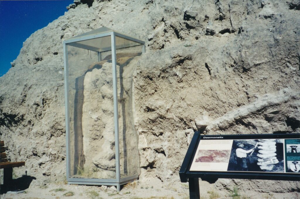
The Daemonelix Trail, near the park’s entrance off Highway 29, passes by a few corkscrew-shaped fossils that one of the region’s pioneer geologists, Erwin H. Barbour, concluded were taproots. More than a decade later, in 1904, paleontologist Olaf Peterson discovered a rodent skeleton inside one of the corkscrews. Like today’s prairie dogs, these beaver-like palaeocastors lived in burrowed communities.
At two miles round trip, the Fossil Hills Trail is twice as long but not as interesting as the Daemonelix in terms of what scientific discoveries can be seen. However, it boasts sweeping views of the rolling countryside. Both trails are lined with signs that identify vegetation, which includes the entertainingly named broom snakeweed, erect knotweed, lanceleaf groundcherry, prickly poppy, smooth scouringbrush and wild licorice.
Details about the small rhino (menoceras) and strange horse (moropus) are found in the visitors center. Its diorama also displays reproductions of a couple of daphoenodons. These long-tailed hunters had characteristics common to dogs, which they resemble, and bears. The visitors center also features an extensive collection of lndian artifacts given to James Cook, a longtime friend of Red Cloud who lived nearby in Agate Springs Ranch.
Agate Fossil Beds National Monument is 44 miles north of Scottsbluff, Neb., and some 150 miles south of Mount Rushmore. lts visitors center is open from 8 a.m. to 6 p.m. during the summer, until 5 p.m. the rest of the year.
The park fee is $2 general, free for those younger than 16. For more information: (308) 668-2211 or www.nps.gov/agfo.
Similarly themed, government-operated attractions in the Rocky Mountains include Florissant Fossil Beds (Colorado), Fossil Butte (Wyoming) and Hagerman Fossil Beds (ldaho) national monuments.
ALAMEDA, Calif. – Earlier I had strolled by a stall where old baseball equipment, including crackly leather gloves and scratched wooden bats, were for sale. I’m a fan, so when I saw a young man walk by wearing an ancient (1930s?) catcher’s mask, I took an impulsive swing at friendly conversation.
“So, do you play softball or something?” I asked.
The man was a good sport, considering how naive I was being. He didn’t so much as scowl or snicker when he patiently explained, “I got it for sex.”
So punctuated my first visit to the renowned Alameda Point Antiques and Collectibles Faire, a monthly market by San Francisco Bay that often has more than 500 vendors and 10,000 customers. What I needed to obtain, obviously, was a clue, but what you will find there is an extensive and varied collection of items that must be at least 20 years old. (Catalogs that list antiques, and items related to restoration such as polishes and finish restorers, are the only exceptions.)
The fair, which spreads out over a massive patch of concrete at the former site of the Alameda Point Naval Station (it was closed in 1997), also offers awesome views of the San Francisco-Oakland Bay Bridge , the San Francisco skyline and the humongous cargo ships parked nearby. You can soak it all in a week from today, as the event is held from 6 a.m . to 3 p.m. on the first Sunday of every month, rain or shine.
“Sporting” goods aside, one exhibitor who made me look twice was selling vintage eyeglass frames. It was almost dizzying to regard all the funky options, and rather difficult, too, as people crowded around the displays to get a closer look. The website www.allynscura.com can give you an idea of the seller’s 50,000-some frames (some from the 18th century, allegedly). Ones at the fair sold for $35 to $150.
At another stall, European linens looked tempting, especially as part of the many fluffy pillows and bed covers that were tastefully arranged. Twenty-five kitchen towels for $100 struck me as a good deal. So-called “shabby chic” home and garden furniture was peddled at the Atelier de Campagne (out of Corralitos) exhibit, which also deserved high marks for presentation. Tabletop plastic radios that reminded me of the 1960s variety constituted yet another intriguing display, which when I strolled by had the full attention of a man wearing a kilt.
Indeed, people of all kinds and ages seemed to be enjoying themselves at the November fair, even though predictions of bad weather — not realized, as it turned out — probably had kept hundreds of vendors and thousands of customers from attending. It seems a passionate subset of folks embraces the thrill of the hunt for cool, quaint, retro, quirky and (oftentimes, but not always) inexpensive stuff for their homes and wardrobes. Plus, an antiques fair represents an environmentally friendly way to redecorate or invigorate.
Other items for sale included pleasantly rusty garden ornaments, old American Indian blankets, paintings and prints, mid-century modern furniture and kitsch. Vintage clothes from a variety of eras could be purchased, too. Some vendors clearly have a specialty, while others sell a mishmash of glassware, linens, furniture, signs and old tools. A few stalls were selling gorgeous vintage and estate jewelry.
Catherine, a woman from Oakland who declined to give her last name, caught my attention when she walked by pushing a cart, atop which was a mannequin. Again, I reached out to a stranger.
Fortunately, her shopping motivations had been entirely family-friendly that day.
“My daughter’s been looking for a mannequin for years,” Catherine said, explaining that her 15-year-old offspring is considering a career in fashion design. “The bargains just pop out at you, and you’ve got to get them right away, or they’ll be gone.”
Later in the parking lot, sisters Kate Raymond of Oakland and Caroline Rogers of Antioch were loading a large painting and assorted other items into their car. They said they have been coming to the antiques fair, which was launched in 1998, intermittently for the past six years.
“It’s a lot of fun to be outside, feel the cool air and find lots of bargains,” Raymond said. “We see all these things that remind us of our mom.”
The siblings admitted being a little disappointed in the day’s limited number of vendors and were not successful in their search for holiday-decoration bargains. However, they planned to give it another shot in December.
Other island fun
If you decide to attend next weekend or sometime next year (the first three event dates for 2009 are Jan. 4, Feb. 1 and March 1), consider making a day of it by exploring Alameda.
The finger-shaped island (once a peninsula) near Oakland is liberally peppered with interesting residential architecture: An estimated 9 percent of its homes are Victorians, many of them survivors of the infamous 1906 earthquake. Bungalows are omnipresent, and there seems to be quite a bit of renovating/updating going on — perhaps supplemented, in some cases, by finds from the antiques fair.
The downtown district is worth a look, too. Its main artery is a gentrified, four-block stretch of Park Street, chock-full of eateries, boutiques and other merchants.
Half a block off Park, at 2317 Central Ave., sits the Art Deco masterpiece Alameda Theatre. In May, after a multimillion-dollar renovation project, it began showing first-run movies again after decades of disuse and disintegration. (Tickets are $10 general for the seven-screen cineplex; visit www.alamedatheatres. com.) Originally opened in 1932, it is similar to another creation of Bay Area architect Timothy L. Pflueger: the Paramount Theatre in Oakland.
If you’d like to see more of the bay, park your vehicle anywhere along Shoreline Drive, south of downtown. Join walkers, joggers and bicyclists on the paved trail that runs for a couple of miles in Carlsbad State Beach, or take your shoes and socks off and step out onto the soothingly soft sand.
Admission to the Alameda Point Antiques and Collectibles Faire is $15 from 6 to 7:30 a.m ., $10 from 7:30 to 9 a.m., and $5 from 9 a.m. until closing.
For more information about the event, visit www.antiquesbybay.com.
For more information about Alameda’s historic downtown district, visit www.shopparkstreet.com.
The capital city has its own monthly antiques fair. Although it’s not as big an undertaking as what is staged on the tarmac in Alameda, the Sacramento Antique Faire typically has hundreds of vendors.
Held from 6:30 a.m. to 3 p.m. every second Sunday of the month, the local fair has two advantages over its cousin by the bay: Admission is cheaper, at $3 per person, and there’s a roof of sorts - stalls are scattered beneath the freeway, on either side of 21st Street between W and X streets. The next fair will be Dec. 13. For more information, visit www.sacantique-faire.com.
California is home to a few other similar events, including:
- The Rose Bowl Flea Market, on second Sundays in Pasadena.
- The San Francisco Fall Antiques Show, held in late October in the Fort Mason Center.
- The Santa Monica Outdoor Antiques & Collectibles Market, on first and fourth Sundays.
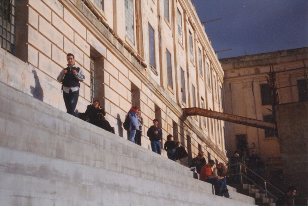
SAN FRANCISCO – Alcatraz is a nice place to visit, but you would not have wanted to live here.
Not as a prisoner, certainly, when “the rock” was a federal penitentiary from 1934 until 1963. Former inmate Jim Quillen, who wrote “Alcatraz From Inside,” found the hard time he served to be maddeningly impersonal.
“You were a number, you weren’t a name,” his recorded voice says in the cell house audio tour. “I wasn’t Jim Quillen. Hell, I was Number 586, and nobody wanted that. Everybody wants to be an individual. They want to be human. And you weren’t, at the rock.”
Today, humans are all over the 22-acre island in San Francisco Bay, making reservations practically mandatory despite at least eight ferry departures daily from Pier 41. Alcatraz is perhaps the hottest tourist ticket in town – deservedly so, what with its magnificent views and echoes of a colorful past. For many of us who live in Northern California, however, it is a more-familiar sight than site. We can forget how going there is fun, whether for the first time or to become reacquainted after several years’ absence.
We also can forget, or be surprised to learn, that Alcatraz was a military post and detention facility for much longer than it housed such hard-case civilian criminals as Al “Scarface” Capone and George “Machine Gun” Kelly. Some 400 troops were stationed there during the Civil War as part of the Union’s western defenses, and during those dark years of 1861 to 1865 the island held soldiers convicted of desertion and other crimes, as well as the crew of a captured Confederate ship. Decommissioned as a fort in 1907, Alcatraz for the next 26 years was a “disciplinary barracks” and had among its captives conscientious objects from World War I.
The rock’s signature, federal-penitentiary period began when the Bureau of Prisons assumed control, using the converted cell house to incarcerate a total of 1,545 men in those 29 years that ended when U.S. Attorney General Robert F. Kennedy ordered the decaying facility closed. No one was executed at Alcatraz, though five inmates committed suicide and eight were murdered here.
The audio tour, $4 extra for visitors and more than worth it, recounts in sometimes-gruesome detail how prisoners could pay little heed to the notion of live and let live.
“And I heard that old familiar ‘pop-slap,’ you know,” says a former inmate’s voice on tourists’ headsets when they are in the dining facility. While listening to this excerpt, visitors can see a collection of knives used by prison cooks – utensils not always used for food preparation. “And, uh, Chili had drove one into Sosa’s back. It was just like an ice pick. He stuck it right in the back; actually it went through and come out the front. And, uh, that was the ‘pop-slap’ I heard.”
Such violent incidents are unsettling to hear about, certainly, but nothing seems to capture the imagination more than Alcatraz’s tales of escape. A pamphlet sold for $1 near the audio tour’s entrance lists all 14 bids for freedom made during the federal prison era, involving a total of 36 men (no women ever were incarcerated or employed as guards). In the first, on April 27, 1936, Joseph Bowers was shot dead as he tried to climb over a fence. In the last, on Dec. 4, 1962, John Paul Scott attained the unique distinction of being the only known prisoner to successfully swim from Alcatraz to the mainland. Exhausted from the effort, though, he was unable to pull himself up from rocks near the Golden Gate Bridge and was re-captured.
In between were two much-ballyhooed escape attempts, one soaked in blood and the other in mystery. On May 2, 1946, a gang of six prisoners led by Bernard Coy managed to overpower two guards, attain weapons and take several officers hostage. Two guards died in the three-day siege, as did Coy and, ultimately, four of his cohorts. The audio tour does a great job of describing this “Battle of Alcatraz,” pointing out two cells where guards were held and a hole in the ceiling where U.S. Marines dropped explosives onto the out-of-control inmates.
Subtlety was the weapon of choice during a three-man escape try on June 11, 1962, one that inspired director Donald Siegel’s 1979 movie “Escape From Alcatraz.” Clint Eastwood plays Frank Morris, who along with brothers Clarence and John Anglin somehow widened their cells’ vent holes enough to crawl through. They walked and crawled up to the roof, made their way down to the water and …
No one knows what happened to the trio, or if anyone does, he or she is not talking. No wonder Hollywood came calling. Other well-known movies about the federal prison are the interminable “Birdman of Alcatraz” (1962, directed by John Frankenheimer), starring Burt Lancaster as a brainy but extremely dangerous felon who in reality kept birds only during his preceding stint in Kansas’ Leavenworth penitentiary; and “The Rock” (1996, by Michael Bay), a noisy and wholly implausible action-adventure starring Sean Connery as the only man ever to have escaped from the place.
Another $1 pamphlet, available from self-serve kiosks near the ferry dock, lists some other fun facts about Alcatraz as a federal prison:
- Though the three-tiered cell house contained 336 cells, most 5-feet-wide by 9-feet deep and 7-feet tall, at least 34 cells were unoccupied at any given time.
- Families of the guards who lived here rarely locked their doors.
- Alcatraz boasts one of the coast’s largest western gull colonies. The parade ground is closed to visitors for half the year (beginning in early February) to allow the nesting.
The pamphlet also details a 19-month occupation by American Indian protesters in 1969-1971 and contains a nicely large and detailed site map. Walking about the island, up and down its sometimes steep slopes, represents another appealing aspect of what has been National Park property since 1972: its exercise possibilities.
Then again, rumor has it San Francisco’s streets can get your heart pumping, too.
Blue and Gold Fleet offers rides to and from Alcatraz throughout the year, departing from Pier 41. The current schedule, featuring eight departures on weekdays and 10 on weekends, all between 9:15 a.m. and 2:45 p.m., expands in early March. Tickets are $9.25 general, $7.50 for those ages 62 and above; audio tours are $4 extra. Children ages 5 to 11 are charged $6 for the ride, $8 with the audio tour. Web orders (from www.blueandgoldfleet.com/abcsc.htm) include a $2.25-per-ticket surcharge.
For more information about Alcatraz trips and other Blue and Gold services, which include city tours and excursions to Angel Island, Sausalito and Tiburon: (415) 773-1188.
BADDECK, Nova Scotia – “I believe that it will be possible in a very few years for a person to take his dinner in New York at 7 or 8 o’clock in the evening and eat his breakfast in either Ireland or England the following morning.”
Such was the foresight of Alexander Graham Bell in 1896, seven years before the Wright brothers accomplished manned flight.
Best known for inventing the telephone at age 29, Bell lived another 46 years that were full of research, original thought and family happiness. His story is comprehensively told at the Alexander Graham Bell National Historic Site in Baddeck, Nova Scotia.
The Scottish-born inventor spent much of the second half of his life off Baddeck Bay, at the Beinn Bhreagh estate. The property, which can be seen from the museum site, has been retained by Bell’s descendants.
Hundreds of photographs, scores of memorabilia and a multimedia narrative compose the museum’s displays. Much attention, of course, is given to the invention that U.S.A. Patent No. 174,465 refers to simply as “Improvement in Telegraphy.”
Bell rang in the telephone era in what has become a legendary and frequently dramatized fashion. What he said on March 3, 1876, to assistant Thomas A. Watson was, precisely: “Mr. Watson, come here. I want you.” Whether he would have wanted his primitive device to lead to computer modems, facsimile machines, car phones and voice mail, however, is arguable.
Perhaps a better debate would center on Bell’s priorities. Was invention — pardon the pun — his true calling? There was another interest that predated the telephone, an altruistic passion that was gleaned from his grandfather’s work with, ironically, phonetics.
Bell began working with deaf mutes when he was in his early 20s. Before the turn of the century, he founded the American Association for the Promotion of the Technology of Speech to the Deaf, which contributed to a dramatic increase in the percentage of deaf students being taught to speak.
“Recognition of my work for and interest in the education of the deaf has always been more pleasing to me than even recognition of my work with the telephone,” the museum quotes Bell.
Helen Keller was among those who benefited from Bell’s efforts.
Rendered blind and deaf shortly after birth, Keller was 6 years old when she met the bearded Scot in the mid-1880s. They became lifelong friends. The museum has an especially poignant photograph of the two flying a kite in 1906.
Another of Bell’s students was his wife, Mabel. They met in Boston in 1871, and were married six years later. Their two daughters, Elsie May and Marian, were born with hearing problems.
Shortly after their marriage, Mabel wrote in a letter that is displayed at the museum: “What a man my husband is! I am perfectly bewildered at the number and size of the ideas with which his head is crammed.”
The cranial commotion was used for the study of X-ray technology, sheep breeding, hydroplanes and anti-submarine warfare, among many other things. A concern for fishermen lost at sea spurred Bell to pursue an easier method to make sea water potable.
Bell earned his place in history books when he was young. Yet, as the museum shows, he remained a curious, generous, loving man until his death in 1922.
“Wealth and fame are coveted by all men, but the hope of wealth or the desire for fame will never make an inventor,” Bell said. “You may give him wealth or you may take away from him all that he has, and he will go on inventing. He can no more help inventing than he can help thinking or breathing. Inventors are born, not made.”
BELL MUSEUM SITE — IF YOU GO
What: The Alexander Graham Bell National Historic Site, 25 acres that comprise a museum, picnic areas and a gift store.
Where: Baddeck, a small Nova Scotian town on Cape Breton Island. Fifty miles from Sydney, on the north end of the island, and 230 miles from Halifax.
Hours: Open daily year-round, 9 a.m. to 9 p.m., July through September; 9 a.m. to 5 p.m., October through June.
Admission: Free.
More information: Contact Alexander Graham Bell National Historic Site, P.O. Box 159, Baddeck, Nova Scotia BOE 1B0; (902) 295-2069
Not all reality TV is bad. “The Amazing Race” is a decent show, what with its quick peeks at some of the world’s most interesting places. There’s no cheaper way to perch on the Eiffel Tower in Paris, mount a go-cart in Mumbai or hop out of a plane over Honolulu.
The show’s contestants sometimes are interesting. Their true characters seem to emerge during the course of a season, with cameras documenting their every deed, whether dumb or endearing. Not that I can recall many details. I watch the show, I don’t devour it. Please understand I am not obsessed.
But what the heck. Earlier this summer I applied to be on “The Amazing Race.” I found a willing friend to be my partner, we filled out the application forms, we made a three-minute videotape and we’re waiting to see if CBS bites. Winners split $1 million, you see, which speaks to a casual fan such as myself.
In case you need it, here’s a primer on the show, although I’ve made it clear that I am no expert. What little insights I have obtained came from the most recent season, the seventh. Oh, and recently I went onto eBay for the first time in my life and purchased bootlegged copies of the other six seasons, on DVD, for $100. Sixty-some hours of viewing followed, but I leisurely stretched that out at home over a couple of workweeks.
Eleven or 12 teams of two (usually) people apiece strap on their big, awkward backpacks and race via airplane, train, bus, taxi, foot, dog sled or whatever around (mostly) the globe, no doubt accumulating powerful body odor along the way. Most weeks, the show lasts an hour and one team is eliminated for finishing last in that particular “leg.” Host Phil Keoghan, a much-hugged New Zealander, delivers the bad news in person.
Say, remember when Kevin and Drew, the frat brothers from New York, were bounced in Season 1? Man that was poignant. But I digress.
Teams start each leg with U.S. currency of diverse amounts, from $1 (or even nothing) to several hundred bucks. They must complete a few quirky tasks and frequently imposing travels before their next “pit stop,” where they will mingle and rest for precisely 12 hours. Many contestants also manage to be outrageous jerks along the way – such as “married entrepreneurs” Jonathan and Victoria in Season 6 – but as far as I know boorish behavior is not encouraged.
Although my applying was a lark, I figured the honest way to go about it would be in “Amazing Race” fashion. My partner was to be Dave Williams, my college roommate in another century. He lives in Rancho Palos Verdes, a ritzy southern suburb of Los Angeles. I decided to get down there and return via ground-level public transportation. Flying or driving down would have been too pampered.
I began this leg of the race … er, rather, I started the trip with $218. Even though I was to be gone for only two days, my backpack was distressingly heavy. No wonder why shrill actress/girlfriend Hayden often demanded that long-suffering actor/boyfriend Aaron lug her load in Season 6.
Funny how every now and then I remember a contestant or two.
Out the door at 5:53 a.m. on a soon-to-be-sunny Friday, I hoofed the mile or so to Sacramento’s Amtrak station at Fifth and I streets. Even broke into a brief jog to make a pedestrian light across 16th Street. Like Season 4’s Steve and Dave, rotund air-traffic controllers who admitted their bodies qualified as excess baggage, I had not intended to run during the race. Trip. Stop that.
One-way train fare to Los Angeles was $57, $11 more that it would have been had I made a reservation or purchased the ticket online. However, in the spirit of the TV show, I made it a last-minute transaction. With cash, natch.
As for the 5.5-hour train trek to Bakersfield and the subsequent 2.5-hour bus ride to Union Station, I’ll spare you the details. Maybe if there’s room at the end of this story I’ll tell you all about it. (Teaser: The bus’s air conditioner was not working; Bakersfield’s high that day was 94 degrees.)
Detour! As Keoghan would say, “A detour is a choice between two tasks, each with its own pros and cons.” In Season 5, for example, teams in Russia had to choose between “block five shots” (dress up as a hockey goalie and prevent slapshots from scoring) and “drink one shot” (gulp a small glass of vodka that contestants balanced on a sword).
My choice could have been called “forage” or “gorge.” Food was a necessity, and as a vegan I am always challenged to find food on the road. In “forage,” I would stroll around downtown, looking against odds for a suitable restaurant. In “gorge,” I’d take a 70-minute bus ride to Native Foods, a vegan haven in Westwood. My bus from Union Station to Dave’s house was to leave in four hours.
“Gorge requires luck, but can be accomplished quickly,” Keoghan might say. “Forage is easy and a sure thing, but completing this task will take a very long time.”
Saying sure to the sure thing, I ran a gantlet of panhandlers as I walked 25 minutes from Union Station to the bus stop at Seventh and Main streets. The scenery changed during my ride on slow old No. 20, as I passed by the Los Angeles County Museum of Art and through Beverly Hills. At one sparkling gas station there, a woman with a BMW and a man with a Porsche both chatted on cell phones as they pumped gas. Which reminds me: “The Amazing Race” contestants are not allowed to possess cell phones. More than anything else, that fact makes me want to participate.
Native Foods was a five-minute stroll from Bus 20’s end of the line, and by 4:30 p.m. I had ordered about $40 worth of animal-products-free food for that meal and tomorrow’s. By 5:15 I was stuffed and managed to plop on the 20 back to downtown.
To make my connection less tight, in what I fancied was effective race strategy, I got off the bus at Wilshire Boulevard and Western Avenue to board the Red Line subway to Union Station, seven stops away. I saved 12 minutes. The shortcut was reminiscent of Season 1’s Team Guido, a middle-aged gay couple with an overconfidence problem, when they ditched a train for a cab in Avignon, France.
My pseudo cleverness mattered not a whit, however, as the Palos Verdes Peninsula bus left 15 minutes behind schedule. It was the last No. 444 of the day, and I was sweating as the minutes passed, fearing I somehow had missed it. (I was sweating long before then, actually; see Amtrak bus ride above.)
By the way, public transit in Los Angeles is easy to pay for. I slipped three dollar bills into the first bus’s automated toll collector and the driver handed me a day pass, good for all bus and subway rides until 3 a.m. Negotiating the tangled web of routes is not a simple matter, though. Luckily I did online research – a la Rob and Amber, reality TV’s glamour couple, for plane schedules in Season 7 – before I left Sacramento.
For those of you who arrive at Union Station with no specific plan of attack, information kiosks (ital) might (unital) be staffed. Otherwise, make your way through the underground pedestrian walkway to the Gateway Center, from where Metro buses depart. (A Green Line subway entrance is contained in the walkway.) As you enter the Gateway Center, to the left is a system-wide map, and around the corner from it are pamphlet timetables for most or all bus routes.
Another tidbit of possible interest: My adventures described so far occurred on the day after London’s tube and bus bombings. Police were much in evidence at Union Station and the Red Line stops, though the bus ambience seemed normal. Fear was nowhere in evidence.
At 8:30 p.m. I arrived at Dave’s home, a proverbial pit stop that indeed resulted in almost exactly 12 hours of rest. By 9 a.m. the next day, Dave and I already were hard at work on the day’s first and most important task: making the “Amazing Race” application’s video.
Dave’s 10-year-old daughter, Zelpha, was our preternaturally talented cinematographer and director. She even makes a guest appearance in the video, fully matching her dad’s onscreen charisma and exposing me as a thespian fraud of no small proportions. What we cobbled together for the tape is hard to describe, though I will say it involved a $2 emergency blanket, a bucketful of tennis balls, 10 empty beer bottles and some screaming.
The clock was ticking even for this slapstick task, as at 2 p.m. we had to leave for the Hollywood Bowl, where an elaborate picnic spearheaded by Dave’s wife, Yolanda, would be followed by a sing-along presentation of “The Sound of Music.”
I enjoyed that outing, but not as much as Season 7’s Uchenna and Joyce were jazzed by the whirling dervishes in Istanbul, Turkey. The two minutes they clocked with that task contrast pretty darn sharply with the six-plus hours on a wooden bench I sat watching a too-far-away-to-appreciate parade of costumed ticket holders (no, no one dressed as a Nazi, thank goodness) and a 40-year-old film that implies Austrians heroically resisted their German occupiers.
Anyway, our video project could be likened to a “fast forward,” an “Amazing Race” concept in which teams can do just one task and then skip to the pit stop. (A fast-forward favorite: best friends and mightily civilized Oswald and Danny sipping hotel orange juice in Season 2.) I had hoped that Dave and I could finish assembling our application before the Hollywood Bowl, thereby making it possible for me to go directly from there to the downtown Greyhound station and a ride home to Sacramento. However, complications that included my poor onscreen acting (the delightful circus clowns in Season 4 were infinitely more natural in front of the camera) proved fatal to my fast-forward dreams.
When Dave and I walked from his house to the bus stop the next morning, he was left with a “roadblock” – a task that only one teammate can perform. For frisky Colin in Season 5, one roadblock was to cook and completely eat an ostrich egg, equivalent to about a dozen chicken eggs. For my pal Dave, he had to scurry home to get his three still-sleeping kids ready for church. You go, baby! You’re the man!
(Hyperbolic cheerleading is another characteristic of “Amazing Race” contestants. One of many examples: The deplorable Flo from Season 3. Why CBS allowed her to participate is beyond me.)
Sunday’s trip through the Central Valley was no less uneventful than Friday’s. (My wallet suffered, though – the last-minute fare of $78 was more than $30 above what I could have obtained earlier online.) I arrived home at 7:02 p.m., presumably in first place among all those who were doing what I did that weekend. Rather than receive a one-week Caribbean cruise (a typical reward for those who win a leg) or $1 million, I got a few licks from our dog and the cold shoulder from our cats. My wife was in Seattle on a less-contrived, family matter.
All in all mine was an amazing adventure, in its own way probably superior to what many contestants experience on the TV show. Catching up with old friends was wonderful. I also enjoyed taking public transportation, a way of living that is going to overpower single-vehicle travel just as surely as Nicolaus Copernicus made a mockery of the flat-Earth society.
As any “Amazing Race” aficionado can attest, there is no edge of the planet to fall off of – just a few cliffs off which to bungee jump.
Regardless of whether I ever shame myself on national TV, I will look forward to seeing and (ital) loving (unital) – I no longer can deny it! – all the “Amazing Races” that viewers can sustain. The next season starts at 8 p.m. Tuesday, Sept. 20 on Channel 13. For the first time, teams will consist for four people, family members only.
Which is a good place to end, with you thinking about three relatives with whom you willingly would travel around the world. As monolingual contestants say in Brazil, Portugal, Singapore, Vietnam and everywhere else where English is not spoken, “Good luck!”
Now that you have had enough time, one hopes, to recover from New Year’s Eve revelry, perhaps you can stomach the thought of a brewery tour.
If so, full steam ahead to San Francisco, where you can drop anchor at the southeast corner of Del Haro and Mariposa streets for one of the best brewery tours imaginable. “Best, ” in this case, signaling one of the world’s most scintillating phrases: free beer.
“The beers you’re going to taste here are the most-copied beers in the world, ” assistant brewmaster Mark Carpenter told me before the afternoon tour on Tuesday. The 37-year Anchor Steam employee, whose commute from Petaluma takes him over the Golden Gate Bridge twice a day (“It’s not so bad”), listed Christmas Ale as an example. It arrived in 1975, long before a Chico-based competitor unleashed its Celebration Ale.
Ryan Murphy, who has been with the company for three years and has been giving the free tours for about four months, began by telling us about the brewhouse. It’s in a marvelous art deco structure built in 1937 that, before being bought by Anchor Steam owner Fritz Maytag in 1977, was a manufacturing site for Chase & Sanborn coffee.
As we all stood in the tasting room, whose wall decorations include fascinating black-and-white photographs of Janis Joplin and friends touring Anchor Steam (then nearby, on Eighth Street) in June 1966, Murphy talked about the origins of various Anchor Steam beers. Shortly after mentioning Liberty Ale, whose April 18, 1975, debut commemorated the 200th anniversary of Paul Revere’s midnight ride, Murphy described Anchor Steam’s Small Beer. Which, by the way, is an odd name for something that comes in a 22-ounce bottle.
Murphy said Small Beer has a comparatively light alcoholic content — about 3 percent. It’s the kind of beer, he said, that in past centuries was enjoyed by working-class people, sailors (“who couldn’t get drunk on it and fall off the ship”) and children.
“Did you just say children?” asked an apparently astonished tour-taker. “Yes, by all means, ” Murphy replied. “It helped them get to sleep.”
Boozy wit and wonder also were on display later, in the hallway outside where Anchor Steam beers are mixed in open-air tanks. Through a window, we watched an employee pour yeast into a rectangular 1,800-gallon container. A hose was shooting liquid into the bubbling, light-brown contents.
“It’s a beer jacuzzi!” exclaimed one excited young man.
“That’s where to go swimming!” said an older man who appeared to be a frequent tour-taker. (Later, he complained that people were prolonging the tour by asking too many questions — “Let them ask all they want when we’re in the tasting room!”)
All told, the tour took about an hour.
After the tasting room introduction, Murphy addressed us before three big copper containers that are integral to the beer-making process. He talked a lot about grains, fermentable sugars and temperatures, but like many others I was enjoying the atmosphere and not so much interested in the science.
Down in the bottling room, he said that during full production, the place is strewn with broken glass , spilled beer and water. Controlled and professional chaos, no doubt, but the room does inspire one’s imagination to roam toward bacchanalia.
Anchor Steam, aside from Prohibition (1920-33) and a pause between owners in 1959-60, has been brewing beer in San Francisco for more than a century. Its free tours at 1705 Mariposa St. are offered at 11 a.m. and 2 p.m. most weekdays, but due to their immense popularity (understandable, considering the generous free tastings), reservations are essential.
Phone (415) 863-8350 or e-mail info@anchorbrewing.com a month in advance, if possible. For more information, visit www.anchorbrewing.com.
See how and where the beers are made
Want free beer?
Grab a designated driver, or take public transportation and a cab, to one of the following California brewery tours.
- Anderson Valley Brewing Co., Boonville (17700 Highway 253): More than 750 solar panels provide the “juice” to make Boont Amber Ale, Barney Flat’s Oatmeal Stout and a half-dozen other colorfully labeled beers. Stop by the visitor center for a tour, $5 apiece, at 11 :30 a.m . and 3 p.m. Thursdays through Mondays. (800) 207-2337 or www.avbc.com.www.
- Bootleggers Brewery, Fullerton (401 S. Richman Ave.): Golden Chaos and three other beers are made here in Greater L.A. The brewmaster himself gives free tours from 2 to 7 p.m. Fridays. (714) 871-2337 or www.bootleggersbrewery.com.
- Budweiser Brewery Tour, Fairfield (3101Busch Drive): There’snothing intimate about touring this massive facility, but the post-tour beer is free and repeat visitors probably outnumber first-timers.
- Free guided strolls through the plant are given at the top of the hour, 10 a.m. to 4 p.m. Tuesdays through Saturdays (Mondays, too, June through August). There’s no need to call ahead. (707) 429- 7595 or www.budweisertours.com.
- Butte Creek Brewing Co., Chico: Organic beers brew here. “We are happy to give tours of our facility, ” says head brewer Jason Ganis, but “due to our large workload and small staff, it is necessary to make an appointment.” (530) 894-7906 or www.buttecreek.com (the Web site is still “under construction.”
- Lagunitas BrewingCo., Petaluma (1280N. McDowell Blvd.): The maker of Lagunitas India Pale Ale and a few other beers proclaims, “No dogs are harmed in our brewing process.” (Another slogan: “Beer Speaks, PeopleMumble.”) Free tours are given at 3 p.m. weekdays, no reservations needed, or you can opt for an online virtual tour (www.lagunitas.com). (707) 769-4495
- Mad River Brewing Co., Blue Lake (195 Taylor Way): Steelhead ales, porters and stouts are produced here, along with a few other labels. Tours of the small business near Eureka are offered on a drop-in basis, when brewery things are hop-pening. Store hours are 11 a.m . to 6 p.m . Tuesdays and Wednesdays, 11 a.m. to 7 p.m . Thursdays and Fridays, and 11 a.m. to 6 p.m. Saturdays. (707) 668-5680 or www.m adriverbrewing.com .
- Mendocino Brewing Co., Ukiah: A predatory bird theme is embraced by the makers of Red Tail Ale and Blue Heron Pale Ale, among others. Tours of both the old (Hopland) and new (Ukiah) facilities are available if you call ahead. (707) 463-2627 or www.mendobrew.com.
- North Coast Brewing Co., Fort Bragg (455 Main St.): The makers of Red Seal Ale, Scrimshaw and a dozen other beers give free tours at noon Saturdays, no reservations needed.(707) 964-2739 or www.northcoastbrewing.com.
- Sierra Nevada Brewing Co., Chico (1075 E. 20th St.): One of the state’s most popular independent breweries, makers of the omnipresent, green-labeled pale ale, gives free tours at 2 :30 p.m. weekdays and Sundays; and continuously from noon to 3 p.m. on Sat urdays . No reservations needed. (530) 896-2198 or www.sierranevada.com.
- Skyscraper Brewing Co., El Monte (3229 Durfee Ave.): The makers of Lug Nut Lager and three other limited-production beers give free tours from noon to 4 p.m. on the first Saturday of every month, excluding December. It’s best to call ahead. (626) 575-0770 or
- www.skyscraperbrew in g.com.
- Stone Brewery Tours, Escondido (1999 Citracado Park way) : The makers of Stone Ruination IPA and Arrogant Bastard Ale, among a handful of other beers, have free tours at 2 and 6 p.m. weekdays; noon, 2, 3, 4, 6 and 7 p.m . Saturdays; 2, 3 and 4 p.m. Sundays. (760) 471-4999 or www.stonebrew.com.
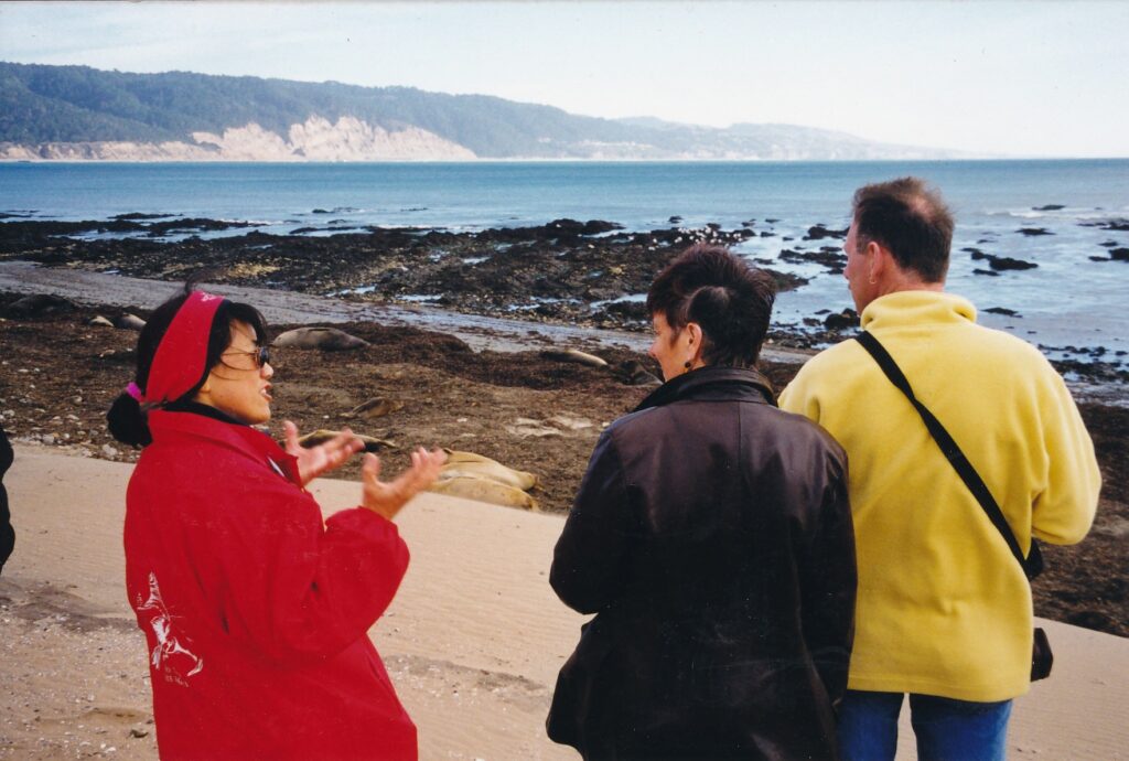
“You guys are going to see a fight!” docent Cheryl Wong told her 12 followers near the end of a two-hour walking tour at Ano Nuevo State Reserve.
For the past minute or two, we had been gazing out toward the Pacific Ocean and, down to the right, a rocky beach. There, dozens of northern elephant seals were sprawled out motionlessly in characteristic, Honey-they-sure-look-dead-to-me fashion. Ten minutes before, we had been much closer to that beach, on a broad-rock platform where another tour group now stood.
But suddenly, as Wong noted, something was moving other than just the tourists’ adjusting their binoculars and snapping too many photographs. Two bulls were closing in on each other, their 2-ton, blubber-ballooned bodies flub-flubbing like a free-flow waterbed being pranced upon by a cat. They were about to engage in a battle of dominance, which if there had been any female seals around would have yielded the winner a harem. The loser would flee by sea, in complete disgrace. Blood would flow.
Wong’s tour group could not have been more delighted.
In a manner similar to macho athletes who bump their chests to celebrate some thrilling if basically meaningless achievement, the two bulls rose their heads and made contact. It was quite a collision. What their bodies lacked in hardness they made up for in weight, and one bull bounced back a few feet. Seizing the advantage, his opponent struck forward and sank his teeth deep into some neck fur. Raw flesh could be seen a hundred yards away, where Wong’s group stood. Five minutes later, the battle was over, the loser having swum away while the victor, out in the surf, raised his head in triumph and bellowed.
Not every tour ends with such a theatrical flourish, of course. But between now and the end of March, you have an opportunity to see fairly up-close — hikers are asked to stay at least 25 feet away from the seals — one of nature’s greatest comeback stories in action.
The elephant seals’ mating season is, after all, what has made it possible for a species that numbered at most 100 in 1892 to attain what Wong says is a population of 160,000 today along North American West Coast.
During the 1998-99 mating season, an estimated 4,000 elephant seals flopped, jiggled and plopped ashore at Ano Nuevo. The state reserve is on a beautiful coastal point some 160 miles southwest of Sacramento and 55 miles south of San Francisco, between Half Moon Bay and Santa Cruz on Highway 1. Walking tours are given daily, regardless of weather conditions, for what might be the best bargain anywhere near the Bay Area: $4 per person. You’ll pay a higher physical price, however, in that the hikes are some 3 miles long and include plenty of soft-sand-hill maneuvering.
Wong, in her third year at Ano Nuevo, set a pretty brisk pace that cool afternoon in mid December, but she remained good-natured about stragglers and practically bubbled with enthusiasm for her subject. “Any questions? ” she frequentiy asked. “Come on, don’t you have any questions? You’re such a quiet bunch.”
About 20 minutes into our hike, before we had seen any elephant seals, we stopped beside a trail sign that explained what types of whales can be seen offshore from November through March. Some of the migrating mammals are killer whales, Wong said, but only certain types of them actually kill and consume elephant seals. “Kind of like high-schoolers, not all of them are bad,” she told us.
A bit farther down the path, we stopped again to keep a respectful cushion between us and the tour group that had set out 15 minutes before us. During this break, Wong spouted statistics and recounted rituals of the elephant seals’ mating season.
Pregnant females come ashore in December to give birth, usually within a week. They nurse their pup for three to four weeks, and often then join a bull’s harem to breed again. During their entire stay on land, they have nothing to eat or drink. Remarkably, through lactation they still are able to provide their pups with the fat-content equivalent of “21 milkshakes a day,” Wong said. In early spring, females return to the water and head toward Hawaii for nourishment.
Males arrive a bit earlier at Ano Nuevo, as was evident during our hike a week before Christmas, by which time onJy a few females had been spotted. At first, they mostly just lie around. Later in the season the dominant males protect and go about impregnating their harem, though only 3 percent of male elephant seals attain such “alpha” status, Wong said. Once mating season finishes, the males too swim toward a remote state of our union, though in their case it’s aloha Alaska, not the tropical paradise of Hawaii.
Pups weigh about 75 pounds at birth, but within a month of “milkshakes” are four times that heavy. Wong said some “super-weeners” can attain 600 pounds of blubbery bulk by springtime. Most pups, deserted by their mountainous moms and pops, remain at Ano Nuevo through April to learn how to swim. Survival until the next mating season is far from guaranteed.
As we came upon our first seal sightings, perhaps 40 minutes into the tour, it was striking how still and quiet the fat, male beasts were. “Give them a (TV) remote, and they’d be like any guy on a Sunday,” one tourist quipped. His companion smiled, then suggested that if the female had laughed, they’d have just started to date; if she had scowled, they would likely be a long-married couple.
Sorry. It’s hard not to speculate about mates during mating season.
Ano Nuevo State Reserve is open year-round. The $4 elephant seal tours are offered only December through March. Tickets are sold on-site at the visitors center, though for weekend visits especially it is a good idea to reserve ahead by phoning (800) 444-4445. “Equal Access” tours for people with disabilities also are available, with reservations mandatory. Parking is $5 per vehicle.
For more information: (650) 879-0227 (recorded), (650) 879-2025 or www.anonuevo.org.
SAN FRANCISCO — Exposing photographic paper to nothing more than a burning rag, processing that paper and mounting it for display in a museum might seem like a strange idea. You can picture it, however, at the Ansel Adams Center for Photography.
After which, it still might seem like a strange idea.
Marco Breuer’s burning-rag prints, along with a few in which he used only a struck match to create images, are part of the “Phenomena: The Politics of Science” exhibition.
Museum staff member Heather Johnson, who gave me a tour of the works, said Breuer’s contribution is her favorite.
“I love its intensity because I’ve never seen anything like it before,” she told me. “It’s this sort of instant violence that ends up with these violent images,” which are black-and-gray blotches on a white background.
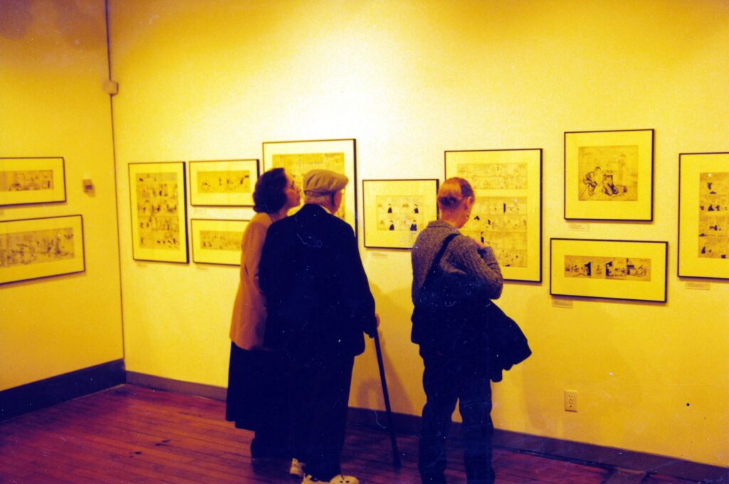
You can judge for yourself through May 2, the “Phenomena” exhibit’s planned last day. A possible companion excursion is the Cartoon Art Museum, another visual smorgasbord whose works are oftentimes humorous and, in a way, more realistic than the photographs at the Adams center. The two museums are within three blocks of each other just south of the intersection of Market and Fourth streets.
The photographic museum’s cornerstone is its permanent collection of Adams prints, 19 of which were hanging when I visited. The famous photographer and San Francisco native, who died in 1984 at age 82, primarily is known for his black-and-white photographs of Western landscapes. Typical of his work is a 1942 shot of the White House Ruin at Canyon de Chelly National Monument in northeastern Arizona.
Adams and the environment had a complicated relationship, which is addressed on one of the biographical signs the museum has placed between prints. His name and works often have been used in affiliation with environmental causes, and yet the attention he brought to remote sites drew many tourists and, with them, destruction.
“People are surprised when I say I never intentionally made a creative photograph that related directly to the environment,” Adams is quoted, “though I am greatly pleased when a picture I have made becomes useful to an important cause.”
In 1973, he appeared on a television advertisement for a car manufacturer, as part of the “Drive a Datsun, plant a tree” campaign. “Adams’ rationale for the endorsement,” the museum sign reports, “was that cars are a necessary part of modem life and that smaller, fuel-efficient vehicles, like Datsun, have less of an environmental impact.”
As ambiguous as Adams’ environmental stance was, his photographic images are sharply defined and easy to appreciate. The “Phenomena” works form quite a contrast, as is evidenced by Breuer’s burning-rag prints.
Like Breuer, Alison Rossiter created her images without camera or film. She arranged sand pebbles on photographic paper, which after exposure and developing look remarkably like real pictures of stars and galaxies. On a nearby wall are three other prints that seem to be of the night sky, but instead are what Davide Mosconi captured when various objects were tossed into the air. The worth of such visual tricks is debatable, but they are interesting.
Perhaps most interesting of all, or at least most diverting among the “Phenomena” prints, are a series of nine by Catherine Chalme rs. Sharp and colorful, on stark white backgrounds, are images of a snake, frog and baby rodents interacting. “Frog and a Baby Mouse” and “Frog Eating a Baby Mouse” are among the titles. Nothing is left to the imagination.
“It’s so beautifully photographed, but it’s so disarming,” Johnson said. “It keeps people’s attention longer because of the sequence of events” that are so clearly depicted.
Such snapshots of the food chain might whet your appetite for lighter fare at the Cartoon Art Museum, where even the bloodiest scenes involve only pen, paper and imagination.
Humor tends to prevail, though, in the displayed works — that and a feeling of nostalgia, especially for those of us who have been reading comics pages for decades. For all but the earliest baby boomers, “Peanuts” has been a presence for their entire lives. The strip’s creator, Charles Schulz, helped land the previously traveling museum with a permanent home through a 1987 endowment.
A June 4, 1958, “Peanuts” strip finds Lucy taking a Charlie Brown idea — that people should “live just one day at a time,” he says in the first frame — to an absurd extreme. “I do better than that. … I live just one second at a time…… THERE! That was a good one!” Lucy tells Charlie in the second frame. “Here comes another one…… THERE! I lived pretty good during that one. … THERE! Oh, that was a happy second, ” she says in the third frame, prompting Charlie to comment in the last frame, with a sour face, “I can’t stand it.”
Visitors can experience thousands of happy seconds strolling through the museum. They can reunite with old friends such as “Joe Palooka,” by Ham Fisher, and “Polly and Her Pals,” by Cliff Sterrett. In a Dec. 30, 1945, strip, Dale Messick’s “Brenda Starr” is looking for someone to accompany her on a cross-country skiing adventure up a mountain. “Isn’t there one man here who would like to take me up?” the beautiful heroine implores to a group of people standing idly around her. In the next frame, a dashing figure glides toward her on skis and says, “For you, Brenda Starr … I’d swim the deepest ocean.”
Examples from currently flourishing comics are shown, too. Compare the Aug. 19, 1971 “Doonesbury” — Gary Trudeau’s strip entered national syndication a year earlier — with the May 30, 1990, installment hung underneath. Revisit the heroic rescue of baby April by old dog Farley in a series of “For Better or For Worse” strips that Lynn Johnston composed in April 1995.
Through April 25, the museum is spotlighting Bay Area cartoonist Steve Leialoha, a comic-book contributor for some 23 years. Debuting May 22 is “The Golden Age of Disney,” from the collection of Mike Gladd, including animation eels from popular films such as “Snow White and the Seven Dwarfs.”
The Cartoon Art Museum is at 814 Mission St., between Fourth and Fifth streets, on the second floor. Its hours are 11 a.m. to 5 p.m. Wednesdays through Fridays, 10 a.m. to 5 p.m. Saturdays, and 1 to 5 p.m. Sundays. Admission is $5 for adults, $3 for seniors and students 13 and older, and $2 for children ages 6-12. For more information , call (415) 227-8666 or visit the Web site www.sfstation.com/museums /ansel.htm.
The Ansel Adams Center for Photography is at 250 Fourth St., between Howard and Folsom streets. Its hours are 11 a.m. to 5 p.m. daily (open until 8 p.m. on the first Thursday of every month). Admission is $5 for adults, $3 for students, $2 for seniors and those ages 12-17, and free for children under 12. For more information, call (415) 495- 7000 or visit the Web site www.friendsofphotography.org.
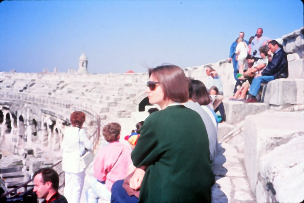
PROVENCE, France — Animals fighting animals, animals fighting men, men fighting men — often to the death. Entertainment didn’t lack for violence in the Pax Romana days.
Amphitheaters in Arles and Nimes that more than 1,500 years ago held such battles still are used today. From May to October, bullfights are waged in the ancient arenas.
Ah, the progress of civilization.
The Roman-era arenas in Arles and, especially, Nimes have survived the centuries largely intact. From their construction in the late first century or early second century until 404, they were used primarily for bloody spectator sports. Eventually, they both were converted to fortresses, and after that became enclosed towns — with streets, chapels and dozens of houses. In the 1700s, the Nimes amphitheater had 700 residents.
In 1809, buildings within Nimes’ arena were demolished and restoration began. It continues today; when I visited in the spring of 1994, the clacking of workers’ tools sometimes drowned out my tour’s guide. Still, we were able to climb to the top of 34 rows and gain not only an overview of the amphitheater, but also a superb look at the surrounding city.
We explored an elaborate design of seating, entrances and corridors that served two purposes. To protect the rigid class system, they prevented any mingling of the rich with the poor, the privileged with the masses. Also, they allowed a capacity crowd of 24,000 to clear out of the stadium in five minutes.
Think about that the next time you attend a professional sports event.
In Arles, visitors to the amphitheater in May 1994 were allowed to go wherever they pleased. One of the three surviving towers offered an inside-outside view similar to the top row at Nimes. The Arles arena is of a less-intricate design, though its 60 arches on each of the bottom two stories obviously were created with the Romans’ characteristic architectural flair.
Next to the ancient stadium are remains of a Roman theater built in the first century. A stage wall and portions of two marble columns still stand. If you visit, look under the wooden platform and try to make out the musicians’ pit.
Arles has other attractions that can be seen in a day trip.
A combination pass that costs $8 to $10 allows entrance to the arena, theater, three museums, St. Trophime Cloisters and the remains of a fourth-century bathhouse. Museon Arlaten, one of the museums, is crammed with so many pieces (including hundreds of dolls and a bizarre display of wigs) that it makes Hearst Castle seem uncluttered by comparison. The cloisters boast tapestries and two pillars of interesting design.
In Nimes, entrance to the arena cost about $4 in May 1994, with tours conducted every 30 to 45 minutes. A few blocks away is another Roman ruin, the Maison Carree, a temple constructed in the century before Christ. Its most-outstanding features are the pillars and entrance. The interior is unexceptional, but there is no admission charge.
For those interested in learning more about Romans and the civilizations that preceded them in southern France, a visit to the Musee d’Archeologie (Museum of Archaeology) might be in order. More ruins can be found in the botanical gardens, Jardin de la Fontaine). Atop the park is Tour Magne, a tower built in 15 B.C. to bolster Nimes’ defenses.
All the sights described in this article are within a mile or two of the cities’ train stations. There are at least a dozen trains daily from Avignon to Arles (about $6 each way) and Nimes ($8).
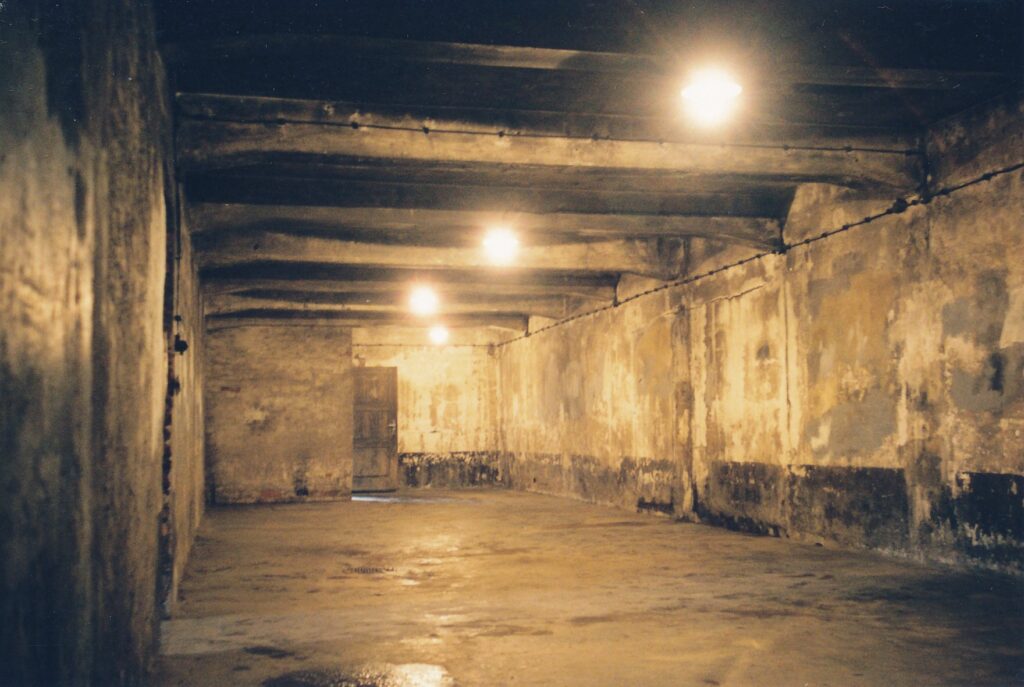
OSWIECIM, Poland — Shivering despite their caps, scarves and heavy coats, tourists walked slowly about the former concentration camp, through the gray, 35-degree February morning that felt colder due to wind and drizzle.
Winter might be the most appropriate time to visit Auschwitz (the Germans’ renaming of Oswiecim). Somehow, to see this place on a sunny, warm summer’s day would filter out some of the discomfort, some of the absolute horror. An estimated 1.5 million people were murdered here by the Nazis during World War II. To say they were “exterminated” applies, as that word hints at the systematic, pest-control approach Germans took toward their captives.
The story of the Holocaust has been told in many compelling ways, in books, documentaries and films such as Steven Spielberg’s “Schindler’s List.” A visit to the site, organized as the State Museum in Oswiecim, provides a different perspective, one that is personal and potentially more moving. This perspective is much easier to attain now, 11 years after Poland freed itself from Soviet control. Today, Americans need have only a passport to visit the east European country.
Exhibits within the partially restored Auschwitz complex do not delve into the Nazis’ genocidal motivations but rather focus on the Third Reich’s methods and their residue. Here, the mass killing of Jews and other victims was refined and quickened into an efficient operation. Germans used Auschwitz as a model for more concentration camps later in the war, including nearby Birkenau. The museum tells what conditions were like for prisoners, what was done to them and how their possessions were plundered.
What one finds to be the saddest or most shocking aspect about Auschwitz is a personal matter, as there are so many candidates from which to choose. Rather than imply any sort of ranking, this article will briefly describe some of the exhibits in the order they are presented by self-guided pamphlets and most tour groups. First, though, a bit more background is in order.
Polish political “criminals,” in June 1940, were Auschwitz’s first inmates in what had previously been military barracks. Soon second stories were added to existing buildings and new ones rose, bringing the total to 28. The eventual population was 20,000, consisting mostly of Jews but including large numbers of gypsies and Soviet prisoners of war. Birkenau, 2 miles away and also now a museum, held up to 100,000 captives at a time and became the Nazis’ mass-destruction star, peaking in 1944 when an estimated 100,000 people were murdered in August alone.
Auschwitz visitors start by walking through the main gate and under its cynical Gennan mandate, “Arbeit macht frei” (roughly translated as work brings freedom). Two rows of barbed wire fences, separated by a gravely no-man’s land, and watchtowers extend from both sides of the gate to surround the building.
Some of the structures house exhibits. Blocks 4 and 5 contain large mounds of inmates’ surrendered possessions, such as suitcases, clothing, brushes and bowls. Also displayed are shoes, artificial limbs and eyeglasses. Behind one long glass wall is piled 2 tons of hair shorn from inmates and their corpses. Such a “product” was used in Germany for the making of textiles, examples of which are shown.
Block 6 describes what the camp’s living conditions were like — the thin prison clothes, the meager diets, the hard labor, the flimsy excuses guards used to punish or kill. Mug shots of inmates line the ground-floor hallway, with expressions ranging from hardened defiance to, especially among the women, innocent and hopeful smiles. Underneath the faces are printed testaments to the Nazis’ obsessively statistical approach: always the prisoner’s ID number and arrival date, usually his or her date of death — sometimes only days apart — and often the date of birth. Inside the block’s rooms, more-graphic photographs and survivors’ drawings are displayed, along with a few sculptures.
The courtyard between Blocks 10 and 11 contains torture poles from which inmates were hanged by their manacled hands behind their backs, and a reproduction of the execution wall, where thousands of prisoners were shot by the Gestapo. In Block 11’s cellar are examples of three types of torture cells:
- The “starvation cell,” a concrete chamber in which prisoners were locked and ignored until being removed upon their deaths.
- The “suffocation cell,” a sealed and lightless tomb for its doomed inhabitants.
- The “standing cells,” in each of which four prisoners would spend several consecutive nights, all the while continuing their slave labors during the days. These pitch-black enclosures, entered through a crawl hole off the floor, had approximately 1 square yard of floor space.
At the former death camp’s other end is the restored crematorium, including furnaces used to dispose of bodies. On the side of the door leading to those ovens is the gas chamber, into which up to 700 people at a time were herded under the auspices of taking a shower. What they received instead were doses of Cyclon B, which killed everyone within 20 minutes.
Outside the crematorium is the single gallows on which the camp’s first commandant, Rudolf Hoss, was hanged as a war criminal on April 16, 1947. It is a fitting spot for visitors to muse about justice, and if it can be served at all in such a sprawling monument to man’s inhumanity to man.
Cracow Tours offers group outings to Auschwitz and Birkenau that depart from Krakow, 40 miles away. The cost is about $25 general, half that for children under 12. The guides speak English, but often in heavy Polish accents that may be difficult to understand. The Auschwitz gift shop can fill in the blanks with a 75-cent self-guided pamphlet, or with several larger publications. Independent travel to Oswiecim is possible, too; a few daily trains from Krakow take about 70 minutes and drop you off a mile or so from the ex-camp. Auschwitz hours are 8 a.m. to 7 p.m. from June 1 to Sept. 1, with earlier closing times during the off-season.
Imagine this scenario: A group of fun-loving Americans leaves behind the comforts of home to seek new fortunes in the wilds of northeastern Australia.
Twenty-seven years ago.
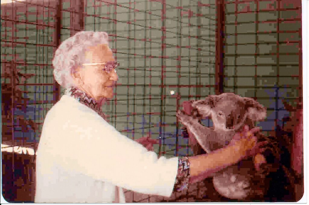
You see, television’s hottest reality show is not exactly breaking new ground by plopping some bumbling Yanks in the Queensland bush. I have been there, with my sister and parents, and I have done that, long before Australia became the cuddly koala of the tourism industry.
By my reckoning, “Survivor: The Australian Outback” seems like a piece of cake, or to be more culturally apt, like a slice of meat pie. The 16 pampered pretties who populate CBS’ hit program spend, at most, six weeks down under. And they are all adults. When the plane dropped me onto the tarmac of coastal Townsville in February 1974, I was 13 years old. Three birthdays passed before I returned to the United States.
My family, which settled about 150 miles southeast of where “Survivor” takes place, was not part of a tribe. We did not spend most of our time prancing around in bathing suits. We had plenty of adventures, but they were not artificially staged, captured from several flattering angles on film, packaged for the idiot box and interrupted every five minutes by beer commercials. No one voted anyone else off the island, though there were times we would have welcomed the opportunity. It took 27 months for our numbers to decrease, in our case from four to three.
In the summer of 1976 I returned to Denver without Mom, Dad (I still owe them big time for that) and my sister in order to re-start 11th grade. Though I had finished about one-half of 11th grade in Australia, where the school year began in early February, I wanted to be reunited with the U.S. classmates I had deserted in 1974. I also sought to resume my athletic climb to the professional baseball ranks.
In fact, sports fans, do you recall that shortstop for the Cubs and Twins in the mid- to late-1980s? Good clutch hitter with surprising power, strong arm and a steady glove? Had that well-publicized affair with one of the decade’s hottest supermodels?
Yeah, well, I don’t know who you are thinking of, but it certainly was not me. My high-school coach let me leave the bench about four times to pinch hit my senior year, and I never played organized ball again.
Anywho, back to Queensland in the 1970s. The Parsells survived. We live on to tell the tale. Neatly edited and packaged for a print medium – TV networks need not call, though I might entertain Hollywood offers – here is a small part of my own survivor story.
Hardships
When we arrived in Townsville, there was no color television or FM radio. President Nixon’s resignation speech was one of the few live U.S. news events to make the local airwaves. My TV time, discouragingly sparse, featured a lot of ABBA concert footage and reruns of “The Streets of San Francisco.”
Almost every store closed around noon Saturday and did not re-open until Monday morning. The implementation of “night shopping,” until 9 p.m. on Thursdays only, was for Australia revolutionary.
My sister and I wore uniforms to school. That felt quaint then but seems more practical now. We took copious notes, did scads of homework and took a lot of difficult tests – none of that was the case in Denver’s public school system. No American kids had studied so hard since the 1950s.
Riding our bikes to and from school could be uncomfortable, too, in a tropical climate that once doused us with 2 feet of rain in 24 hours. The streets, some of them unpaved, were rivers that day. Year -round, humidity registered under 90 about as often as my golf score. (Once?) Sure, Sacramentans struggle with summertime heat, but every time we take a shower, the mere motions used to dry off with a towel do not by themselves bring about the need for another shower.
Critters
Dad taught on the town’s outskirts at James Cook University, where students were not the only wildlife. One day upon entering the English department’s restroom, he saw a brown snake slither across the floor at a speed kangaroos would sweat to match. And speaking of those big, hopping marsupials, their smaller cousins, wallabies, sometimes were spotted in our neighborhood.
At home, the sight of lizards on the walls and ceilings was as common as mosquito bites on our arms and legs. The little, translucent reptiles were our friends, though, in that they helped keep the spiders away.
Frogs sometimes jumped out of the mailbox as I reached in for what I hoped would be aerograms from U.S. friends. They also were known to lurk under toilet seats. Some Australian boys liked to torture frogs by putting salt on their backs, thereby sucking out moisture, but my misbehavior manifested itself in other forms, as you shall see.
The tucker (that’s food, mate)
Today’s “Survivors” may be eating cow brains, and feeling all brave and proud about it, but please. What was in all those American hot dogs we ate as kids? When I lived in Australia, I craved hot dogs, drooled buckets at the mere thought of their foul ingredients but had to settle for what struck me as weird, exotic fare.
My first Aussie meal, a motel breakfast, was canned beans on toast. The milk delivered daily to our house had a curdled blob of cream floating on top. Ground meat came mostly from animals coated in wool, not leather. Baaa, baaa humbug!
One of my favorite dinner routines was when Dad brought home fish and chips, wrapped in the local Townsville rag and wonderfully squishy with oil. Newsprint bled onto the potatoes. (Was my quest for a career in journalism subliminally launched?)
Expecting Kool-Aid, I took a huge gulp when introduced to a fruity drink called cordial. Pancake syrup and Mister Rogers are less sweet; cordial has to be diluted with lots of water. As for that notorious Australian bread and cracker spread, Vegemite, an older expatriate from Ohio told us, “This tastes and looks like dried cow’s blood.”
He was wrong. Vegemite is much, much worse than that – it is indescribably awful, as far removed from the American pleasures of peanut butter as Alice Springs is from Carmichael.
People skills
Once in science class I whispered something that offended the boy sitting right in front of me. Without ceremony he wheeled about and punched me square in the face. Sensing trouble, the teacher – who had been delivering one of those dry, facts-packed lectures so typical then in Australian classrooms – turned and looked at me. “Something a-meese, Mis-tuh Pah-sell?” My eyes were watery and my nose was as red as strawberry cordial, but gamely I shook my head. No more provoking the natives that day.
My Ugly American act resurfaced in a less violent way when I was sitting on short steps leading down from a portable school building to the playground. I was looking back up at my pal Damien, ostensibly interested in our chat but in reality waiting for 13-year-old, short-skirted bombshell Jenny to walk by. Immediately recognizing the situation, she paused next to Damien and said into his ear, loudly enough for me to hear: “He’s hoping to see my unduh-pants.”
What a presumptive, insulting allegation that was! It was quite true, of course. As our new president reportedly has said, “When I was young and stupid, I was young and stupid.” Unlike George W. Bush, however, I claim to have made no great strides in the meanwhile.
Spirit of competition
Sports were a big deal back then, down under, and I tried my best to ably represent my faraway homeland on the Townsville playing fields. Soccer seemed simple enough until the evening, as practice was ending, that I inexpertly kicked the ball, felt a pop in my upper leg and fell to the ground. In considerable pain, I moaned and could not stand up.
“Up with ya, ya cry-zy Yank ya!” one of the other young blokes yelled. “Silly bugg-uh!” another chirped. The coach, unconcerned, chuckled. Everybody went home. The park was empty and the sun began to set. I limped to my bike and pedaled the mile or two home, later to learn my hip had been fractured.
So you think you’re tough, do you, you ripple-stomached 2001 “Survivors”? Break some of your bones and then pop off.
Near the end of my stay, Pimlico High School allowed me and some other boys to play basketball against the local Aboriginal school’s team. We won, thanks largely to my having partly pulled down the shorts of a faster foe who was breaking away for what would have been a game-clinching layup. It was not one of my prouder moments; the rich got richer that afternoon.
Australia was a segregated society in those days, make no mistake. It treated the native population as an inferior race. I understand improvements have been made – Cathy Freeman’s massive support at last year’s Olympics might be an indication of that – but I always will remember Australia as having been a somewhat two-tiered society.
Ending this tale on such a negative note might not be fair to a country that largely deserves its soaring popularity. Then again, maybe it helps to drive home the fact Australia is not paradise, and “Survivor” should not be taken too seriously.
WEOTT – To enroll in Coastal Redwoods 101, students of nature need only take an exit off Highway 101 about 60 miles south of Eureka. Then they head up the 31-mile Avenue of the Giants, pulling over at each of the automobile tour’s eight stops to read the interpretive signs and take the short hikes.
If only college were this immediately gratifying.
Avenue of the Giants runs roughly parallel with Highway101 between the tiny towns of Phillipsville, to the south, and Pepperwood. At each end is an introductory pull-off station where visitors can grab an auto-tour pamphlet. Count on spending a half-day here; rushing makes no sense in a place where trees can live for more than 2,000 years.
No one should feel limited to just the auto-tour stops, of course. Throughout this drive, much of it in Humboldt Redwoods State Park, are dozens of groves that can be explored. Small towns such as Miranda and Myers Flat offer shops and restaurants. But for an introductory course in coastal redwoods, the orderly driving tour is a solid foundation.
Following is a rundown of the eight stops, where they are along the Avenue of the Giants and what can be learned at each.
F.K. Lane Grove, 2.8 miles into the drive: Coastal redwoods’ longevity is the main topic here. “Sempervirens” is the scientific name for these trees, translated as “ever living.” Indeed, most coastal redwoods live more than 500 years, some many times more than that. Four things that contribute to the long lives are:
- An interweaving network of shallow roots that connect the trees during high winds.
- Thick bark that protects from insects and fires.
- A root system that can re-establish itself after flooding or siltation.
- The ability to sprout from its root system.
Bolling Grove, 10.2 miles: Coastal redwoods are closely associated with two other tree varieties in the world, visitors are told in this shady, peaceful spot. Giant sequoias in the Sierra Nevada foothills can grow to 250 feet high – compared with the coastal redwoods’ 360 feet – and have been known to live some 3,200 years. Dawn redwoods are shorter, in the 60- to 100-foot range, and exist only in the Szechwan province of China.
A plaque here pays tribute to Col. Raynal C. Bolling, said to be “the first American officer of high rank” to fall in World War I. He was 40 when killed during a German offensive near Amiens, France, in March 1918.
Visitors center, 16.1 miles: Several things are of interest here, including free coffee (donations accepted).
Inside is a small museum that, among other things, chronicles the colorful history of one Charles Kellogg, a conservationist who drove around in a “Travel-Log” fashioned from a coastal redwood. His whistling imitations of bird sounds was said to be spot-on.
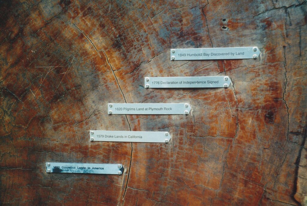
Outside the center is a small portion of a coastal redwood that, when it fell in 1987, had been alive 839 years. Turned on its side, the piece has markers that plot on its rings what world events were taking place during the tree’s growth, such as the Magna Carta, Christopher Columbus’ arrival in the New World and the Declaration of Independence. Nearby is a collection of the three types of redwood trees identified at the tour’s second stop. Planted in the 1980s, they are close enough for easy comparison of their bristles, bark and other characteristics.
In addition, this stop explains the vital role Save-the-Redwoods League has played in conserving these towering wonders since its founding in 1918. The league has planted tens of thousands of trees in Humboldt Redwoods State Park and established some 140 groves. Anyone interested in having a seedling planted in his or her name, for about $50, is encouraged to write the league at 114 Sansome St., Room 605, San Francisco, CA 94104.
Weott, 17.8 miles: In December 1964, an Eel River flood prompted in part by 32 inches of rain in three days destroyed more than 50 buildings in this rustic village. A pole beside the road indicates where the high-water mark was, some 33 feet above the ground. A sign reports that 30 miles downstream at Fernbridge, “the river’s flow was greater than the average flow of the Mississippi and Columbia rivers combined.”
Average annual rainfall in the area is about 65 inches, though as much as 120 inches has been recorded.
Mahan Plaque, 19.9 miles: Laura and James Mahan were largely responsible in the 1920s for spearheading a movement to save large swaths of the regions’ coastal redwoods from logging. A half-mile loop trail leads to their plaque. Also accessible here, via a trail of comparable length, is the Founder Tree.
This 346-foot-tall coastal redwood could be called the state park’s signature piece. Travelers on the fast track up or down Highway 101 can see this tree quickly thanks to a nearby exit. Taking the wheelchair-accessible nature trail, aided by a superior self-guided pamphlet, can enhance the experience without taking more than a half-hour.
Dyerville, 20.4 miles: Here is an overlook of the Eel River and a steel bridge that crosses it. Running awfully low this past May, the river once was teaming with salmon, Pacific lamprey (which are eel-like) and steelheads, all fished for hundreds of years by the native Sinkyone-Lolangkok people. Habitat degradation, water diversion, overfishing and the introduction of aggressive, nonnative fish have greatly changed the river ‘s character since the Indians’ day.
Chandler Grove, 22.9 miles: Another short trail here takes visitors through an “old growth” area. That term, synonymous with “ancient” and “all aged,” actually refers to the entire forest community. The multilayered top traps moisture and lets in sunlight, the dead trees and fallen logs on the floor provide homes for many creatures and nourishment for them and future plants. Everything, living and dead, plays a role here.
Drury/Chaney Grove, 28.6 miles: Avenue of the Giants wraps up here with another plaque, this one honoring Ralph Works Chaney. President of the Save-the-Redwoods League for 10 years beginning in 1961, Chaney is credited with discovering the dawn redwoods in China during a trip there in 1948.
For more information about Avenue of the Giants and Humboldt Redwoods State Park: (707) 946-2409 or www.humboldtredwoods.org.
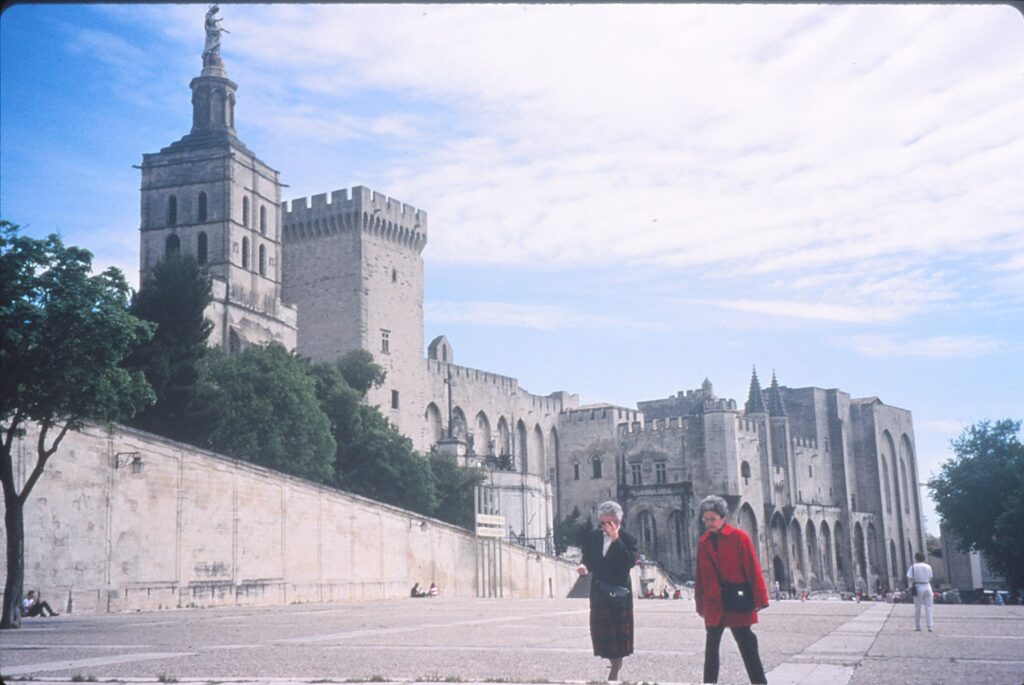
AVIGNON, France — The situation in Rome was without pope. Mounting political pressures had forced the Holy See to seek more hospitable headquarters in southern France.
From 1309 to 1376, a succession of seven popes ruled the Roman Catholic world from Avignon, a small city on the banks of the Rhone River. To accommodate their court, possessions and visitors, a great palace was erected. The halls were decorated with frescoes and tapestries, the furniture was of the finest quality and — in one room, at least — sacks of gold and silver were piled on the floor.
Today, more than 600 years after Gregory XI abandoned Avignon, Palais des Papes (Palace of the Popes) has been transformed into one of the area’s most fascinating tourist attractions.
Its 14th-century riches mostly are gone, but the former court’s grand scale can be appreciated through a thoughtful and leisurely visit.
Avignon (pronounced ah-veen-yo, the last syllable roughly rhyming with no) also boasts a tremendous museum of 13th- to 16th-century art, the Musee du Petit Palais. Contemporary charms include a variety of shops, hotels and restaurants — many of which are outdoor cafes. Located in the heart of Provence, this city of 92,000 residents also can serve as a base for day trips to places such as Arles, Nimes and Orange.
Palais des Papes’ exterior resembles a fortress, with 10 towers that are as high as 165 feet. Inside, the various rooms, halls and chapels overlook three open areas: the Great Courtyard and Benedict XII’s Cloisters and Gardens.
Visitors follow a one-way route through the palace that is marked by arrows. Self-guided tours begin in the Great Courtyard, where pilgrims assembled to receive the pontiff’s blessing. A large well is easily detectable, though it is substantially crumbled.
Across the courtyard, tourists enter Jesus’ Room, under which was stored the Holy See’s treasury of ornaments and precious metals. The adjacent Consistory, where newly appointed cardinals were announced, contains traces of frescoes by Simone Martini, a 14th-century Italian painter. From there, the tour ascends to the second floor, past cloisters named after Benedict XII (1335-42).
The Banqueting Hall, above the Consistory, is impressive on three levels. First, it is quite large — 157 feet long and 33 feet wide. Second, the walls are adorned with a series of 18th-century Gobelin tapestries. Third, the keel-vaulted ceiling has been restored, to glorious effect.
Near Banqueting Hall is the Papal Bedchamber, which has a fading but still pronounced blue decor. Farther along is the Stag Room, used by Clement VI (1342-52) as a study. Its ceiling is absorbingly ornate, and frescoes that depict hunting, fishing, bathing and other mundane activities are well-preserved.
The Re-Robing Room, or south sacristy, was where pontiffs changed their vestments when officiating at High Mass. Now, four of the Avignon popes are represented there by recumbent, tomb-like casts: Clement V (1304-14), Clement VI, Innocent VI (1352-62) and Urban V (1362-70).
Continuing, visitors pass through Clementine Chapel to Indulgence Window, from which popes would bless crowds in the Great Courtyard below. Not to be missed is a detour that leads to the next level and Corner Tower, with sweeping views of the plaza, Notre-Dame-des-Doms Cathedral and, across the Rhone, the town of Villeneuve-les-Avignon.
The tour ends in the ground-floor Great Audience Chamber, also known as the Palace of the Great Causes. There, the 13-member Tribunal de la Rota passed judgments. The chamber is divided by a row of columns; a precious few portions of Matteo Giovanetti’s 1352 fresco cling to the far walls.
Whereas the palace requires visitors to imagine the splendor that once was, the nearby Musee du Petit Palais is full of enduring artworks that can be closely inspected. Much of the museum’s collection has a predictable theme: virgin and child. Prime examples of that Catholic standard are a painting by Taddeo di Bartolo and an uncredited 1457 sculpture.
Also worth special note is the second of Petit Palais’ 19 galleries. Under a pointed-vaulting ceiling are remnants from the tomb of Cardinal de Lagrange. Visitors can compare a drawing of the 14th-century structure’s original appearance with the display. Some figures are almost wholly intact.
Palais des Papes is open year-round from 9 a.m. to 7 p.m. Adults’ general admission in May 1994 was 32 francs (then the equivalent of $5.50; the exchange rate being $1 equaled 5.7 francs), 43F for a guided tour. Children ages 8 to 17 — and students with valid identifications — were charged 25F for general admission and 35F for a guided tour. English tours began at 10 a.m. and 3:30 p.m.
The Petit Palais museum is open from 10:30 a.m. to 6 p.m. daily, May through September. The off-season hours are 9:30 a.m. to noon and 1 :30 to 5:30 p.m. Admission in May 1994 was 18F for adults, 9F for children under 13 years old, and free to all on Sundays between Oct. 1 and March 1.
Avignon’s Office de Tourisme (tourist information center) is located a few blocks from the train station, inside the ramparts. Write to 41 Cours Jean-Jaures, Avignon 84000, France; or call 90-826511 (from the United States, begin with 011-33-).
BAKERSFIELD — For the first time in 28 years, there is daily, direct passenger railway service between Sacramento and this city on the Central Valley’s southern end. If you go, upon disembarking, the first, glaringly obvious question you must ask yourself is:
Why?
Perhaps you have relatives in Bakersfield. Your occasional presence is required.
Maybe you are a train buff, or a supporter of rail travel being reinvigorated as an alternative to the mighty automobile. When the 5 1/2-hour, 272-mile run debuted on Feb. 21, throughout the morning people were seen cheering from trackside as Amtrak No. 702 clacked by.
Another reason to take the train to Bakersfield is it offers an alternative method of meeting up with friends from the Los Angeles area. Sure, you are covering two-thirds of the distance between you but are doing so in the comfort of a railway car. Your pals, meanwhile, are negotiating their four-wheelers out of the south-state traffic maze, which rarely is relaxing.
Or maybe you are bored and need a challenge. Which brings us to the second question you must ask yourself when you step onto the Bakersfield rail station’s platform:
What to do?
Playing tourist here can be difficult. The options are many, but excitement might not be among them. Provided you have good companions, the weather’s decent and you’re not expecting paradise, however, it is possible to spend an agreeable day or two exploring what this city of 215,000 — the metropolitan population is 380,000 — has to offer.
A good place to start is the Kem County Museum, about 2 miles north of the train depot, which itself is downtown. Pair that with the California Living Museum during the day, and in the evening choose among the Buck Owens’ Crystal Palace, a minor-league baseball game or a play. Dine in one of the city’s many Basque restaurants. Or scrap all that and shop for antiques. Try white-water rafting in Kem River Canyon. Go to one of the three speedways. Play golf See a movie. Find a bar. Get back on the train.
Whatever, try to make the most of the experience. Following is an abbreviated run-down of things to do in Bakersfield.
Museums: The Kern County Museum is a collection of 56 buildings, spread over 16 acres, that reflect what Bakersfield life was like 50 to 150 years ago. Visitors can step into almost any of the structures and examine, from a distance, the furniture and wares of yesteryear. Tours of the Howell House, a wealthy family’s Victorian residence built in 1891, are given four times daily. The main museum has several interesting displays, including three carriages from the 19th century and three pre-World War I motor vehicles.
The museum grounds’ shady trees and picnic tables are welcoming for families. Special events dot the calendar, including WineFest ’99 on April 23, Living History Day on May 22, Pioneer Day on July 24 and the Holiday Gala on Dec. 4. Kern County Museum, 3801 Chester Ave., is open from 8 a.m. to 5 p.m. weekdays, 10 a.m. to 5 p.m. on Saturdays and major holidays, and noon to 5 p.m. Sundays. Admission is $5 for adults, $4 for seniors over 60, $3 for children ages 3 to 12, and free for those under 3. For more information, call (805) 861-2132.
The California Living Museum, several miles northeast of downtown, allows close inspection of native plants. There also are animal exhibits, native artifacts, picnic tables and a play area for youngsters. Hours for the 13-acre museum, at 14000 Alfred Harrell Highway, change seasonally. Admission ranges from $3.50 for adults to no charge for infants. Call (805) 872-2256.
Children might enjoy the Buena Vista Museum of Natural History (1201 20th St.), which is big on fossils. It’s open from 9 a.m. to 5 p.m. Wednesdays through Sundays. Adults pay $3, children and seniors $2, and children under 5 are free. Call (805) 324-6350.
The Bakersfield Museum of Art (1930 R St.) plans to launch a “Women in Art” exhibit on May 20 and a showing of Georgia O’Keeffe works on Jan. 18, 2000. Hours are 10 a.m. to 4 p.m. Tuesdays through Saturdays, noon to 4 p.m. Sundays. For information about admission prices and exhibits, call (805) 323-7219.
Entertainment: I was told by several people who have no financial stake in the matter that Buck Owens’ Crystal Palace is worth a visit, even for those who dislike country music. Its museum reportedly is jam-packed with the native crooner’s memorabilia; there also is a theater and restaurant on site. Y’all can find the palace at 2800 Pierce Road, two miles west of downtown off Highway 99. Call (805) 328-7560.
Fox Theater, which opened on Christmas Day 1930, has special events throughout the year. The architectural landmark is at 2001 H St.; call (805) 324-1369. Among the local stage attractions is Melodrama (206 China Grade Loop; 805-393-7886).
Diverse events are scheduled at the new Bakersfield Centennial Garden and Convention Center, 1001 Truxtun Ave. (805-327-7553). The Bakersfield Symphony Orchestra has two more concerts this season: April 18 and May 23 (805-323-7928). When I visited, bull-riding was that evening’s convention center entertainment.
Adults can be in the chips at Golden West Casino, 1001 S. Union Ave. (805) 324-6936. Children might be happier at Hart Memorial Park, which I was told is a popular weekend diversion for the locals. The snake-shaped greenbelt, which among other things has paddle boats and a public golf course, is tucked under the Kern River, less than 10 miles northeast of downtown. Camelot Park, at 1251 Oak St. on the southwest edge of downtown, has miniature golf, go-carts, batting cages and bumper boats (805-325-5453).
Sports: Motor racing is a big deal in Bakersfield, especially at Mesa Marin Raceway, 8 miles east of downtown. Several NASCAR events have the track roaring through 1999, including Craftsman Truck Series Weekend, April 9-11; and the 24th Annual October Classic, Oct. 14-17. Call (805) 366-5711 (on the Web, visit www.mesamarin.com). Also in the vicinity are Buttonwillow Raceway Park (805-764-5333) and Famoso Raceway (805) 399-2210.
The Bakersfield Blaze baseball team, in the Class-A California League, unveils its 1999 squad on April 8. Home games continue in spurts (otherwise known as homestands) through Aug. 29, mostly begin at 7:15 p.m. and are played next to the Kem County Museum, on the north side. Call (805) 322-1363.
Among the outfitters that offer rafting adventures are Chuck Richards Whitewater Inc. (800-624-5950) and Kem River Tours (800-844-7238).
Shopping: Agriculture and oil are Kem County’s biggest industries, but a stroll through downtown Bakersfield reveals that furniture and antiques are economic heavyweights, too. I was told a lot of people the Los Angeles area frequent the antiques stores, many of which are clustered on 19th Street between Chester Avenue and Q Street, and on H Street between California Avenue and Brundage Lane.
Among the shopping malls — each with its own spiffy pamphlet and slogan — are The Marketplace (“The Ideal Setting for Everyday”), 9000 Ming Ave.; Valley Plaza (“Sometimes, You Just Gotta Go Shopping”), Highway 99 and Ming Avenue; and East Hills Mall (“Discover the Difference”), Highway 178 and Oswell Street.
Dining and lodging: Basque cuisine receives a lot of attention here. Among the options is Chalet Basque Restaurant, 200 Oak St. (805-327-2915). Uricchio’s at 1400 17th St. and John’s Incredible Pizza, at the Rosedale Highway (No. 178) exit off Highway 99, were talked up by a few locals whom I met.
To get a grip on the accommodations front, try calling the Greater Bakersfield Convention & Visitors Bureau (805-325-5051 or www.visitbfield.com) or the Greater Bakersfield Chamber of Commerce (805-327-4421), or pick up a copy of the Automobile Association of America’s California/Nevada Tour Book.
Transportation: The Amtrak station is at 15th and F streets. Train No. 702 departs Sacramento at 6:20 a.m. and is due to arrive at 11:45 a.m. The northbound No. 703 leaves Bakersfield at 5:45 p.m. and is to pull into Sacramento’s station at 11:15 p.m. (the night I rode, however, it arrived 20 minutes early). Stops along the way include Stockton and Fresno. A one-way fare is $39; call (800) 872-7245 for reservations and possible discounts, including a two-for-one offer for travel completed before April 1. Amtrak buses can relay you to and from several other Southern California locations, including Los Angeles, San Diego and Santa Barbara.
A public-bus ride costs 75 cents in Bakersfield. Find out more about the Golden Empire Transit’s system by visiting the GET center at 22nd Street and Chester Avenue, or by calling (805) 869-2438. Among the routes are No. 2, which goes up Chester Avenue past the Kem County Museum, and No.3, which can take you to Buck Owens’ Crystal Palace. Taxis are available at the train station.
If you are continuing on from Bakersfield to more touristy destinations, among the distances you might traverse are 146 miles to Disneyland, 235 miles to Death Valley National Park, 110 miles to Los Angeles and 235 miles to San Diego. Las Vegas, Nev., is 289 miles away.
Walking is fine downtown, where you will discover a disproportionate number of stores either sell furniture or are shuttered. See if, like me, you can stumble upon some interesting alley-wall murals.
Weather: Do not expect to walk around comfortably in the summertime, when high temperatures often top 100 degrees Fahrenheit. The good news for pedestrians is that winters are mild, and the average annual rainfall is under 6 inches.
SEATTLE — Life is an upstream struggle. For proof, watch salmon swim slowly and gamely up the fish ladder at Hiram M. Chittenden Locks, which bills itself as the city’s third-most-popular tourist attraction and which indisputably represents a fun learning opportunity for adults and children alike.
A few miles northwest of downtown Seattle in the Ballard neighborhood, the locks link the Puget Sound waterways with Lake Washington, the long and lanky body of choppy blue on whose shores lies the University of Washington and in whose southern portion sits well-to-do Mercer Island. Visitors are treated to an up-close look at how the two locks — the large one that can accommodate a cruise ship, the smaller one for small fishing boats, kayaks and the like — facilitate passage between saltwater (the sound) and freshwater (the lake).
Sidewalks run on all sides of the locks, including over the partially submerged gates when they are closed and the locks’ water level is being adjusted. When I was there on a warm and sunny late-summer weekday, young families, strolling seniors and several just passing-through bicyclists crowded the site. The process of enclosing boats in a lock and raising or lowering the water level to match where they were headed took about 15 minutes, and there was no need to worry about missing the “show” because watercraft kept approaching en masse from both directions.
Each year, about 775,000 vessels pass through what’s known locally as the Ballard Locks. Eighty percent of them are pleasure craft, though the commercial traffic that transports sand and gravel, forest products, petroleum products and various other cargo make a significant contribution to the local economy.
The most interesting passers-by from this tourist’s perspective, however, are the salmon. The fish ladder, reconstructed in 1976 to have 21 steps instead of the old ladder’s 10, provides a fascinating window into salmons’ migration. There are several windows, actually, in the viewing area beside the ladder, where in early September people were packed tightly to see the large fish (some appeared to be a yard long) as they struggled to return to their freshwater spawning grounds.
According to one of the exhibit’s interpretive signs, salmon typically are born in freshwater riverbeds or streams, make their way to oceans where they spend three to five years, then return to their places of birth to deposit eggs (the females) and fertilize them (the males). Sockeye, Chinook and Coho salmon tend to make that homeward journey from June through November, while steelhead — which unlike the other salmon varieties sometimes survive the spawning ordeal and repeat the cycle of going to the ocean and then returning — are on the go from January through May.
Unfortunately, salmon struggles these days are not limited to their migration. Their numbers are endangered by chemical pollution, dams, development, higher water temperatures and overfishing. The Army Corps of Engineers, which has operated the locks since their inception in 1917, has partnered with the state of Washington and local Indian tribes to facilitate the salmons’ safe passage and promote their long-term presence.
Entry to the locks compound is free and includes access to a comprehensive visitors center. There, be sure to catch a 12-minute introductory film, “Where the Activity Never Stops,” which chronicles the site’s history. Upstairs in a small display where you can learn how the locks’ creator — Hiram M. Chittenden– had the good sense to veto initial plans for a wooden assembly and insist on steel construction.
Chittenden, whose other engineering projects included the road and bridge system in YeIIowstone National Park, also had the foresight to order a second, smaller lock at the Ballard site and to cancel plans for an additional lock at Lake Washington. That ill advised proposal, according to the museum’s exhibit on Chittenden, would have raised Lake Washington by some 9 feet and triggered future flooding problems.
The museum also contains a functional scale model that allows visitors to operate a lock. It’s not by any means high-tech, but it clearly instructs how such systems make navigation between two separate and uneven waterways possible.
The Hiram M. Chittenden Locks are open year-round from 7 a.m. to 9 p.m.; the visitors center is open from l 0 a.m. to 4 p.m. Thursdays through Mondays from October through April, and from 10 a.m. to 6 p.m. daily the rest of the year. Surrounding the visitors center and locks is the Carl S. English Jr. Botanical Garden, which contains benches, handicap-accessible paths and more than 550 types of plants. For more information about the locks compound, call (206) 783-7059 or visit www.nws.usace.army.mil/ (then find “Locks & Dams” in the left column, click on the plus sign and scroll down to trigger ‘”Lake Washington Ship Canal).
Sidebar:
Hiram M. Chittenden Locks joins Pike Place Market and the Seattle Center – home of the Space Needle — as the three most popular tourist attractions in Seattle. Here’s a sprinkling of what the Emerald City also has to offer.
- Burke Museum of Natural History and Culture, which focuses on the Pacific Rim.
- (206) 543-5590 or www.washington.edu/burkemuseum.
- Discovery Park, 534 acres of forest, meadows and beaches, with more than seven miles of nature trails.
- KlondikeGold Rush National Historical Park, an extensive compJex that looks at how the city prospered thanks to Alaska’s gold fever of the late 19th century.(206) 553- 7220 or www.nps.gov/klse.
- Museum of Flight, an excellent facility that features 28 rare aircraft, among many other aerodynamic-related things. (206) 764-5720 or www.museumofflight.org.
- Safeco Field Tours, a look at where baseball’s Mariners play and at the stadium’s slick retractable roof (206) 346-4001.
- Seattle Art Museum, which has a celebrated collection of Asian, African and Indian art. (206) 654-3100 or www.seattleartmuseum.org.
- Seattle Asian Art Museum. (206) 654-3100 or www.seattleartmuseum.org/visit/visitSAAM.asp.
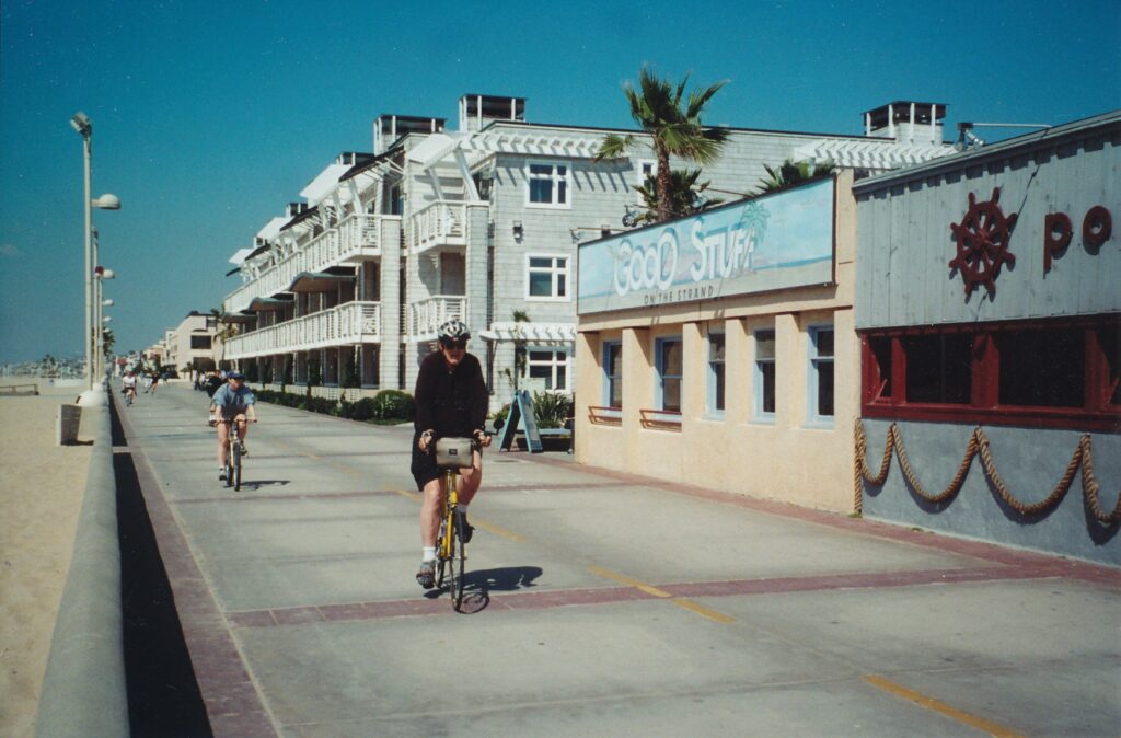
Summertime – anytime, really – and the living is breezy in the three beach cities southwest of downtown Los Angeles.
Manhattan Beach, Hermosa Beach and Redondo Beach are practically prototypical in their California laid-back atmospheres. These oases of calm are where tourists, and many Los Angeles County residents, come to escape some of the urban blues.
Freeways don’t have much of a foothold down in the beach cities, which helps reduce congestion and, many believe, crime. The air is almost always fresher than inland, thanks to soothing winds from the Pacific Ocean. After all, the local newspaper is called the Daily Breeze.
The beaches themselves are spectacular, stunningly wide and bright. All three cities’ charms easily can be explored by foot, somewhat of a rarity in this vehicle-is-king region. Furthermore, what is thankfully missing are the kookiness of Venice Beach and the hyper-materialistic programmed behavior of the theme parks.
The three coastal communities represent a place where adults can have a quiet, reasonably priced drink or meal, where they can take a romantic stroll along the ocean or a leisurely lope by the boutiques, and where families can bring paperbacks and sand-castle shovels and loll around on the beach. The tide comes in and out, but relaxation is always in.
Progressing from north to south, following is a very brief description of the beach cities and what they have to offer.
Manhattan Beach
Manhattan Beach Boulevard leads from the 405, or San Diego, freeway about three miles to dead-end at the state pier. A rectangle about six blocks up and down the coast and two blocks in defines the prime tourism area.
Manhattan Avenue, parallel to the beach one block inland, has eateries and shops from Eighth Street north to Manhattan Beach Boulevard. Highland Avenue, two blocks inland, has a few businesses north of the boulevard. Most people, however, flock to what’s on Manhattan Beach Boulevard between Highland and the pier.
Hennessey’s, a regional pub chain, and The Coffee Bean & Tea Leaf, two doors south at 321 Manhattan Beach Blvd., are popular examples of the coast’s many alcohol- and caffeine-themed establishments. Across the street, The Rocky Mountain Chocolate Factory (308) draws many longing looks, if not quite so many customers.
Closer to the pier, the Manhattan Beach Brewing Co. House of Brews (124) boasts entrees in the $8 to $10 range, while two doors down is the slightly pricier Shellback Tavern, whose ocean views are compromised by a conspicuously drab parking lot.
Lodging options abound on Sepulveda Boulevard, about a dozen blocks in from the pier.
Hermosa Beach
Pier Avenue, culminating in a one-block pedestrian mall, leads to this beach city’s pier. On a sunny Monday in mid-March, a whale was spotted a few hundred yards off the pier’s end.
“They never come this close. We’re so lucky!” said a local resident, standing at the rail with her husband. “People pay 30, 40 dollars to go out on a boat and see that.” The tours I know of cost about half that, but she did have a point.
From this pier one can appreciate the beach’s great width — perhaps a hundred yards in places. White volleyball poles are sprinkled throughout the sand, with green-gray lifeguard shacks every few hundred feet. Grooves from beach-patrol vehicles form a trail between the ocean and shacks, on the back of which are signs proclaiming: “No pansy trucks beyond this point.”
Hermosa Beach boasts at least two wonderful, modestly priced restaurants. The wildly popular Good Stuff, one block north of the pier along the strand, is open from 7 a.m. to 9 p.m. daily and often has a waiting list. The Spot, 10 mini-blocks south of the pier at 111 2nd St., has incredible vegetarian food served in generous proportions; if you go, consider ordering something with the eatery’s trademark “savory sauce.”
Motels and hotels are clustered on Pacific Coast Highway, a few blocks in from the beach and a mile or so. south.
Redondo Beach
Though there are restaurants worth frequenting here, nothing noteworthy is especially close to the coast. The best feature here is Redondo State Beach, a perfect place to walk off the day’s big meals and to catch an ocean sunset.
Though the sandy expanse is not quite as broad here as in Manhattan and Hermosa, it is as equally inviting. Also, there is an elevated walking path, along Esplanade street, that provides views more sweeping than from the beach-level path. By using the lower path one way and the upper path the other, walkers can complete a two-mile hike that punctuates the beach cities experience.
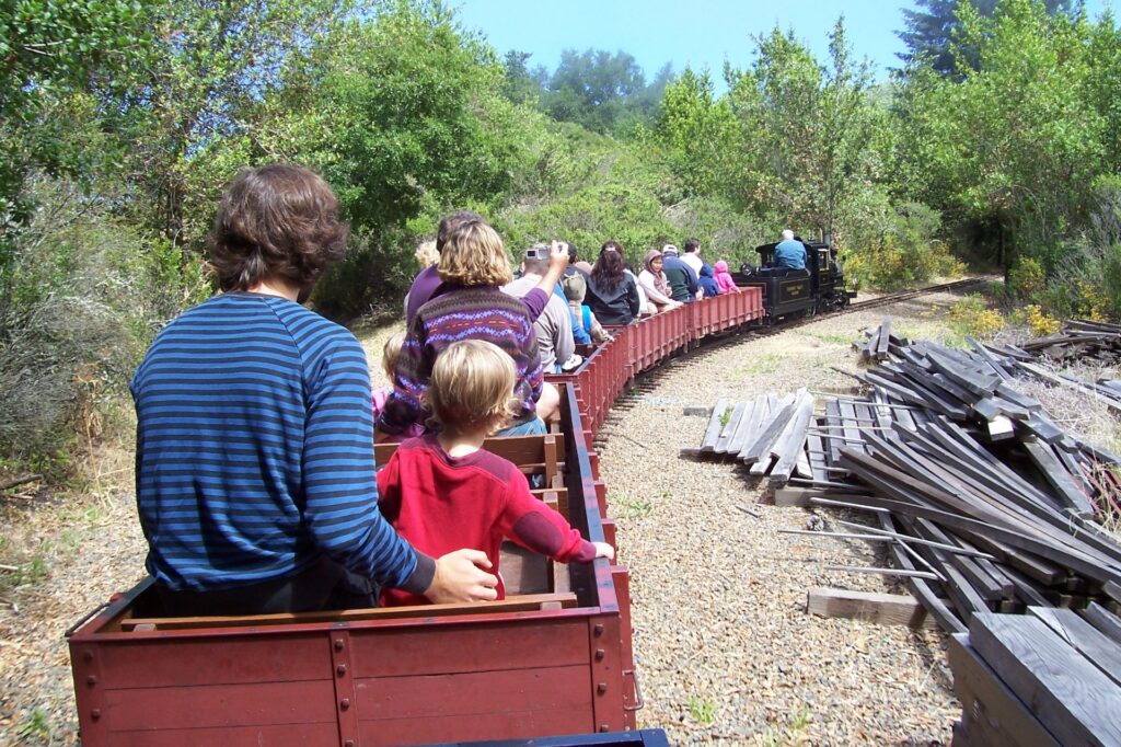
BERKELEY — Much of this Bay Area town’s reputation is tied to the University of California main campus, a driving force behind the free-speech movement of the 1960s and for decades considered to be one of the country’s premier colleges. “Radical” is a word often used to describe Berkeley, but spending a day here might tone down some people’s strong preconceptions.
The campus, and teeming College Avenue that runs into it, certainly are worth checking out. Ninety-minute tours of UC Berkeley, conducted daily, are free. Elsewhere in town, however, are other no- and low-cost attractions that though unrelated to higher learning are highly enjoyable. Tilden Regional Park and the Scharffen Berger chocolate factory are two fine examples.
Spread over 2,077 acres on Berkeley’s northern hills, Tilden is a dream come time for parents who have young children, and also holds great promise for picnickers, hikers, plant lovers and swimmers. The park, which also contains an 18-hole golf course, is open from 5 a.m. to 10 p.m. daily in a region whose climate is temperate and welcomingly outdoorsy year-round.
Entering Tilden from the west, visitors immediately encounter a turnoff for steam-train excursions that on a sunny late morning in early July were buzzing with small children. Rides on open-air benches and in miniature box cars last about 15 minutes and cost $2, which as my wife pointed out ‘”is cheaper than some of the coffees the parents are carrying.”
On down the road, past entry points for some of Tilden’s six nature trails and by at least a half-dozen pleasant spots for picnicking, the Botanic Garden showcases some of the state’s rare and endangered plants. The nearby Brazil Building, used for receptions and other special occasions, is so named because its interior was part of the South American country’s exhibit at the 1939 World’s Fair in New York City. lnspiration Point, a couple miles up Wildcat Canyon Road, looks down on undeveloped hillsides and San Pablo Reservoir, and is also a launching point for mountain bikers in search of a strenuous workout.
(Berkeley does tip its “lefty” hand in the park by closing South Park Drive, a direct route from the steam trains to the Botanic Garden, from Nov. 1 through March 31 in order to allow unhindered passage of migrating newts.)
A bit beyond the Brazil Building, Lake Anza and its broad sandy beach greet swimmers and sunbathers daily through Sept. 24, with lifeguards on duty from 11 a.m. to6 p.m.
Admission is $3.50 general and $2.50 for ages 16 and younger and 62-plus. Open weekends only in late spring and early autumn, Lake Anza is closed from November through mid-March. A short hike away is the Hershell-Spillman Merry-Go-Round, another children’s favorite that won’t break the piggy bank: $1 per 3.5-minute ride, or 13 rides for $10.
The park also has equestrian trails, an environmental education center that includes interactive exhibits, and four campgrounds on the west side. Many of its facilities are handicap-accessible. For more information about Tilden, which is named after the local park district board’s first president, Charles Lee Tilden, visit www.ebparks.org/parks/tilden.htm.
Visiting Scharffen Berger is a real treat, and not just because free samples are involved.
The smallest and youngest of our country’s 12 chocolate manufacturers, Scharffen Berger occupies a red brick building at the corner of Heinz Avenue and Seventh Street that originally was an explosives plant. Chocolate’s been made on the premises for 10 years, with dark (as opposed to milk) varieties being the main focus.
Free guided tours of the facility depart hourly on Saturdays and about every two hours the rest of the week. Sarah Langham, a teacher by trade who has been with Scharffen Berger for a half-year, conducted our afternoon tour. Among the sweet little bits of information that she shared:
- Eighty-three percent of chocolate consumed in the United States is milk chocolate.
- Seventy percent of cacao (chocolate’s key ingredient) now is imported from Africa, though originally it grew only in Latin America.
- The average shelf life of Scharffen Berger chocolate is 18 months.
The company produced 1 million pounds of chocolate in 2005 and plans to triple that amount this year by converting to a 24-hour operation.
Vegans, who avoid consuming or wearing any animal products, might be interested to learn that certain types of Scharffen Berger dark chocolate, including baking bars and animal figures, are packaged onsite on equipment that never processes dairy ingredients.
Visitors are asked to arrive at least IO minutes before tours start, must be at least l 0 years old and are asked to wear close-toed shoes; otherwise, Scharffen Berger lends out plastic shoes to substitute for sandals and the like. For more information about the chocolate factory and to reserve a tour spot, call (510) 981-4066 or visit www.scharffenber ger.com.
Unfortunately, bachelor’s and graduate degrees are not given out as samples on the University of California, Berkeley, tours. One must be content with walking by such renowned structures as the Valley Life Sciences Building, which alone covers 3 acres, contains three museums (and a 90 percent complete skeleton of a Tyrannosaurus rex) and underwent a $160 million renovation around the tum of the century and the Campanile Tower, built in 1914-19 I 7 with three times the amount of concrete that was ca11edfor, so that it would be especially resistant to earthquakes. A major fault line, after all, is only 60 yards away.
Elevator rides to the top of Campanile, from which on a clear day you reportedly can see the Golden Gate Bridge, operate daily from 10 a.m. till 3:45 or 4:45 p.m. Tickets are $2.
From l :30 till 3 p.m. on Sundays, the elevator is closed to allow for Campanile chimes concerts at 2 p.m. On the day we visited, featured tunes included – The Star-Spangled Banner” and, for regional diversity, I suppose, “Dixie.”
Free campus tours depart at 10 a.m. weekdays and Saturdays, and at l p.m. Sundays. For departure points and more information about the university, visit vww.berkeley.edu.
Although one of its landmarks, Cody’s Books, closed earlier this summer, Co1lege Avenue is part of the UC Berkeley/preconceived-notion-of-Berkeley experience, and must be strolled to believe. Be sure to venture at least three blocks down the funky street and consider grabbing dirt-cheap garlic fries from Smart Alec’s.
After spending a day in Berkeley, with luck, you will consider visiting here to have been a radical idea — with pleasurable consequences.
TOWNSVILLE, Australia — Using his paws like crutches, swinging massive legs forward one pace at a time, a kangaroo approached me on the dirt path.
I did a double take, mate.
Ever the photographer, I recovered quickly enough to crouch for a shot. But my focusing couldn’t keep up with the advancing ‘roo, and suddenly a fuzzy nose was all I could see in my view finder.
Putting the camera aside, I petted the animal much as I would a dog — scratch behind the ears, pat the back, rub the tummy. Soon he was licking my arm with an abrasive tongue that left a residue more dirt than saliva. Because of its novelty, I was tempted not to wash off the mess.
That friendly encounter occurred at Billabong Sanctuary, 10 miles south of Townsville, the unofficial capital of northern Queensland. Billabong, an aboriginal word that means water hole, offers visitors an up-close look at some of Australia’s trademark wildlife.
The definition of “up-close look,” naturally, varies on a per case basis. Crouching with kangaroos and scratching behind their ears is one case. Cavorting with crocodiles and dingoes is quite another. At Billabong, the ferocious animals are segregated in chain-link fences.
A self-guided, circular path passes swans, ducks, egrets, an emu, cockatoos, parrots, kookaburras and other birds, in addition to kangaroos, sheep, hogs and other tame mammals that can be petted. No Billabong outing is complete, however, without the two ranger-led tours.
Jeff Collett was the guide when I visited earlier this year.
The mustachioed former construction worker peppered his humorous, detailed narrative with a passionate commentary about man’s cruelty to the animal kingdom.
To familiarize visitors with species in the sanctuary, Collett introduced a “cast of characters.”
First to appear was “Elvis,” a 30-year-old python who “has never bitten anyone,” the ranger said. “We call him Elvis because he has a black haircut, the same pelvic motion …” Indeed, the snake had black skin on its head and slithered constantly.
All of a sudden, Elvis was placed on me.
“Where’s his head?” I asked to general laughter, the python’s tail completing a circuit around my neck while the rest of him was somewhere beneath, out of my vision. Elvis felt dry and surprisingly warm.
“Weeper,” a 22-foot crocodile, nearly jumped out of his enclosure in trying to snag a bird carcass Collett dangled teasingly.
The park ranger pointed out that when European settlers arrived, Australia had 1 million crocodiles. Now, only 55,000 remain.
The reptiles’ only chance for regaining their old stature, Collett said, is for humans to become extinct. “We might play into their hands within 100 years,” he said.
According to Collett, 90 percent of Australia’s crocodile attacks on humans occur in January. That’s the crocs’ time to mate, a tough proposition for males since they outnumber females by 9 to 1. Furthermore, those males that do mate have “harems” of more than a half-dozen females. As a consequence, Collett said, there are thousands of “sexually frustrated crocodiles” on the loose.
Northern Queensland’s largest native bird, the flightless cassowary, is represented at Billabong by “Charlie.” Only 500 cassowaries are left in Australia, and within 25 years they’ll all be gone, Collett said.
The ranger recounted how one day, Charlie cornered him, gave him “a thrashing” and kicked him through the enclosure’s gate. Liberated for the first time in four years, a confused Charlie “didn’t move,” Collett said. “A few stitches and about 300 cups of coffee later, I was ready to see him again.”
People on the tour helped feed “Batman.” Hanging upside down from our fingers, the fruit bat would crane his neck to take a grape. After a minute of sucking, he would spit out the skin, pulp and seeds. Fruit bats, which flourish in Townsville, eat two and a half times their body weight each night in order to fuel their 60-some miles of flying, Collett said.
“People come here and they say they hate fruit bats,” he said, showing us Batman’s gerbil-like face. “How can they hate this little guy? He’s a lot smarter than a lot of people who come here.”
Dingoes are not native to Australia, but they have roamed the island continent for at least3,500 years. Identical dogs exist in Indian villages, Collett said, an indication that Asians crossed to Australia long before white men did. Either that, or dingoes used to be marathon swimmers.
The ranger said it took him a month to get inside the five dingoes’ pen at the sanctuary, “and another month to stop being bitten.”
One of the males, 9-year-old “Todd,” likes to rip his shirts. While Collett was describing Billabong’s other dingoes, Todd pranced over to an empty feeding dish and piddled into it. “He always does that,” said the ranger, shaking his head.
Last to be introduced was “Blinky Bill,” the sanctuary’s friendliest koala. “Not koala bear,” Collett stressed. “They’re not bears; they’re marsupials.”
Indeed, koalas can be especially unbearable without 19 or 20 hours of sleep each day. Described by Collett as being “the best relaxers in the animal kingdom,” koalas subsist solely on one low-nutrient food: gum leaves from eucalyptus trees.
Because no other Australian animals eat the leaves, koalas need to expend energy fighting for their “tucker.” Hence, they have more time to hang out and look cute.
Alas, Australia is being a poor host to its wonderful creatures, Collett said. Two-thirds of the country’s forests have been cut down, and “we’re well along in cutting down the last third.”
Billabong Sanctuary is open from 9 a.m. to 5 p.m. daily except Dec. 25. Admission is $10 Australian for adults, $4 for children.
Three-hour tours from downtown Townsville cost $19 for adults and $8 for children.
For more information, in Australia call (077) 78-8344.
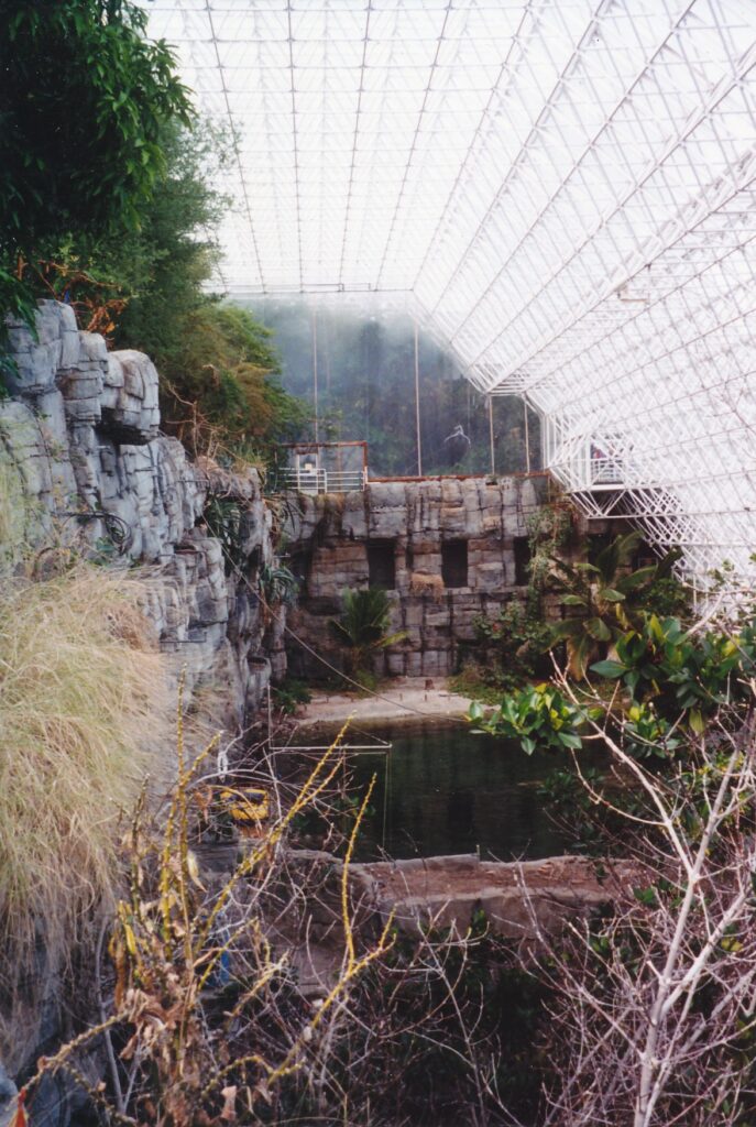
ORACLE, Ariz. — “You might be looking at the world’s biggest test tube,” docent Doug Johnson told his 3 o’clock tour group on a warm weekday afternoon early this spring.
Behind him was Biosphere 2, where in the early 1990s two small groups of scientists separately tried to inhabit the sealed-off structure for two years, growing their own food, recycling their own waste, having their own images shown in sometimes-mocking news reports on televisions everywhere. The first group (four women, four men) succeeded, but the second batch (two, five) bailed before seven months had passed. According to Johnson, oxygen was too scarce, carbon monoxide was too great and the food supply had fizzled.
Throughout that period and ever since, public tours have been given at the site, 115 miles southeast of Phoenix and about 40 miles north of Tucson. This February, Biosphere 2 launched an “Under the Glass” tour in addition to the general type that Johnson was leading. Both last an hour.
The new tour takes visitors into places that previously were off-limits, including portions of the “wilderness biomes.” Those glass-topped, glorified greenhouses, along with managed forests and the science center, represent Biosphere 2’s three main divisions. Since January 1996, the entire 3.15-acre facility (on 250 surrounding acres) has been managed by Columbia University in New York.
Claudio Gilardini led the 4 p.m. “Glass” tour. “I’m the only guy still here from the early days,” the bearded guide told the 20 or so people who, gathered in a lobby inside Biosphere 2, waited an awkwardly long time for the walk to begin. For some reason, the group was asked to assemble by 3:45 p.m.
At the top of the hour, Gilardini and assistant docent Bob Johnson took visitors to the savanna section, which overlooks a 900,000-gallon “ocean.”
“We are the only people who built an ocean,” Gilardini said. “Everyone else builds aquariums.” Modeled after a Caribbean coral reef, the tank contains 35 species of coral, 30 varieties of algae and 100 types of invertebrates. Among the two dozen or so species of fish are fresh grunts, stoplight parrotfish and yellow-tail damselfish.
After stopping in the adjacent mangrove forest, which offered splendid photographic angles for the “ocean” and the cliff that looms over it, Gilardini and gang entered the desert area. Actually, it is now referred to as the “coastal fog desert” and is appreciably cooler than the savanna and mangrove forest. Cacti are grown there, which could strike many as odd considering the flourishing cacti right outside in the real desert.
From there, Gilardini and Bob Johnson escorted their charges down a 200-foot tunnel to what is called the South Lung, where air pressure is controlled and excess water is gathered in a large reservoir before it is recycled in the self-contained facility. Concrete and a 500-ton steel liner are underneath Biosphere 2, sealing it from the earth below and around it.
Throughout his tour, Gilardini sprinkled his narrative with words such as biodiversity, biocarbons and biomass — appropriate, considering the location’s name. He also talked about rainfall amounts, droughts, evaporation, condensation, photosynthesis, respiration and the like, which probably was interesting for those who could keep up.
Biosphere 1, by the way, is planet Earth. Doug Johnson and Gilardini, along with narrator William Shatner in the visitors center’s 10-minute introductory film, drove home that fact. Biosphere 2 re-creates on a small scale some of the planet’s ecosystems. “The bulk of our research is on the effects of global warming,” Doug Johnson explained.
Carbon dioxide seems to be a common thread in much of that research. One of four major greenhouse gasses generated by humans — the others being fluorocarbons, methane and nitrous oxide — its concentration has increased roughly 30 percent since the beginning of the Industrial Revolution in the early 1800s. Biosphere 2 scientists and students are looking at how that might affect our soils, forests, water and coral reefs, among other things.
Tohono O’Odham Indians occupied what is now Biosphere 2 property for many centuries, until the Apaches forced them to move to the Tucson basin. In the 1920s, a 500-head cattle ranch was on the site, and a number of ownership changes followed before Space Biosphere Ventures took over in 1984. The first crew of live-in scientists were in the glass structure from 1991-93, followed quickly by the less-successful group.
Although self-containment and self-sufficiency have been a Biosphere 2 theme, the facility buys its power from the regional utility companies. Banks of solar panels are on the property but not used. This despite the Tucson area’s having more sunshine (330 days of it annually) than anywhere else in the world, according to Doug Johnson.
“The reason we decided not to go solar — let me try this one on ya’ — it cost too much,” said the good-natured guide.
One visitor, gazing at the 565-foot-long, 91-foot-high (at its peak) monument of glass, asked him how often the windows are washed. Every six months to two years, Johnson answered, with the process taking six to eight weeks.
Asked about what animals live in Biosphere 2, he said there are no large ones. “What do we have inside?” he added. “Bugs. Lots of them.” Indeed, the pedestrian handrail that runs through the “ocean” and mangrove forest sections is crawling with ants. If you go, think twice before casually leaning on it.
Biosphere 2 is open from 8:30 a.m. to 5 p.m. daily, with tours offered every hour or two. General admission is $12.95 general, $8.95 for children 13 through 17 years old, and $6 for those ages 6 through 12. “Under the Glass” tours cost an additional $10. For more information: (800) 828-2462 or www.bio2.edu.
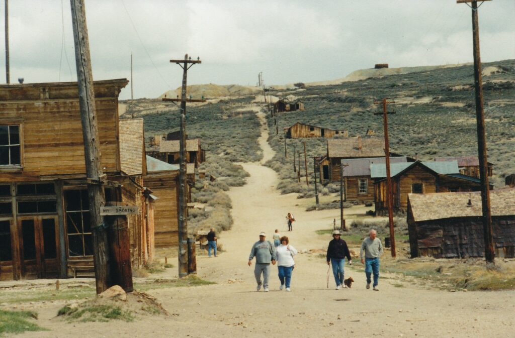
BODIE — Its dilapidated buildings constructed mostly of wood, a place twice nearly destroyed by fire, Bodie nevertheless has no trees. Not along its unpaved streets, not beside its shabby creek, not on the surrounding hills, which are covered only by sagebrush.
Perhaps the absence of peaceful, calming trees is appropriate for a place that was built on greed, fueled by sin and destined to quickly become a ghost town. Bodie State Historic Park, 200 miles east of Sacramento near Mono Lake and the Nevada border, gives visitors a visual and sensory lesson on how an ailment known as gold fever could make people live in such a forbidding environment.
Temperatures can plummet to minus-25 degrees Fahrenheit, with a wind chill of 60 below, here in the winter. Snowdrifts reach 20 feet. Even in its heyday, Bodie reportedly had just one green spot, a small garden in which only hops would grow.
Lawlessness bloomed in full, however, around 1880 when Bodie had some 10,000 residents, at least 60 saloons and dance halls, three breweries and a proliferation of prostitutes. Killings were common, with each victim’s age tolled by a fire bell during burials. Such justice as there was could be flimsy, one example being the fate of Joseph DeRoche, accused of murdering Thomas Treloar.
“Case dismissed,” Bodie’s justice of the peace wrote, “as the defendant was taken out and hanged by a mob.” A little girl, upon learning her family was moving to the remote mining town, made a significant contribution to
Wild Western lore by writing in her diary, “Goodbye God, I’m going to Bodie.”
On a breezy, cloudy afternoon this past May, three dozen or so tourists were exploring what must be considered one of the country’s most-distinctive ghost towns. Sixty-some large structures remain, representing 10 percent or less of what was here in the late 19th century. Many buildings have windows through which visitors can examine dust-covered remnants of a community crippled by a massive fire in 1932 and, for all intents and purposes, extinct by World War II.
Among the structures, and within their drafty walls, are:
- The morgue, in which can be seen at least three child-size, wooden caskets.
- The schoolhouse, by whose window ledges are cardboard jack-o’-lanterns presumably made by Bodie students. Then again, they might be stage props, as surely is writing on the blackboards such as “Eighth grade: Your projects are due on Friday.” Scattered on student desks and tables are such books as “Primer of Physiology” and “Carpenter’s New Geographical Reader.”
- The houses of Henry Metzger and Lester E. Bell, both of which have wicker-style baby carriages on their junky floors.
- Sam Leon’s bar, which contains two roulette wheels with stacked and scattered poker chips about them, and the Wheaton & Hollis Hotel and Bodie Store, housing a billiards table atop which are two cues and three balls.
The most elaborate displays can be seen inside the Boone Store and Warehouse, once owned by a direct descendant of frontiersman Daniel Boone. A poster shows a young wife using two sticks to lift a dripping piece of clothing from a bucket, with the caption, “It’s easy to dye with Diamond Dyes.” A tin container once held “15 Live Red Worms.” Wooden boxes have labels such as Varsity Sweets, Petite Soda Wafers and Queen’s Chop Extra Choicest English Breakfast Tea.
A well-conceived pamphlet, available for $1 just off the parking lot, points the way for a self-guided tour. Bodie is being preserved in “arrested decay,” meaning that while no construction or extensive renovation work is being done, what exists there now is being protected to whatever extent is feasible, given staff and monetary limitations. At least three of the structures are used as employee residences, and a small museum – open from 10 a.m. to 5 p.m. daily during the summer and for shorter periods other seasons – contains such curiosities as an opium lamp, hand-warmer and two very odd pencil sharpeners.
One of the tallest and largest buildings is the Methodist Church, which like the school still has a tower with bell inside. The Bodie Bank is all gone except for a crumbling brick wall around its safe, from which $4,000 was stolen in 1916. Behind the jail is a road sign that marks Bonanza Street, a.k.a. “Virgin Alley” or “Maiden Lane,” once a place where love came at a price.
Visitors also will be sure to see many precariously leaning outhouses, photographers scurrying about with tripods, people standing on tiptoes to gaze in windows at all manner of peeling wallpaper, rusty cars and mining equipment scattered about the site, a fire hydrant (ironically), rodents and, of all things, seagulls. Among the certain sounds are wind, birds, a comment such as “I’m going back to the car to get a second shirt” and someone speaking German. For whatever reason, Germans seem to have an inordinate appetite for all things Wild West.
Bodie’s brief life began in 1859 when Waterman S. Bodey and his partner, Black Taylor, discovered gold there. Things developed slowly until the Standing Mining Co. made a rich strike in 1877, prompting a population explosion in the next few years. One of the state’s first workers’ unions was established here in 1877, and the $4-a-day wages were magnificent, considering that 50 years later a Bodie miner was paid $1 per shift.
Bodey perished in a snowstorm a few months after his and Taylor’s discovery. He is buried in the town’s small cemetery, today accessible by a short trail. “This small, sturdy, indomitable man left Bodie to posterity, never knowing it’s (sic) importance,” reads a graveside marker installed in 1976.
Sturdy and indomitable as he may have been, Bodey lived to be just 45. The town for which he was named – its spelling was altered to promote the correct pronunciation, according to park brochures – lived about 85 years. Long may it rest, peacefully, as an offbeat tourist attraction.
Bodie State Historic Park is open from 9 a.m. to 7 p.m. from Memorial Day weekend through Labor Day and closes two or three hours other times of year. The most-direct route to drive there from Sacramento is east on Highway 50, south on Highway 89, south on Highway 395 and west some 13 miles, the last three unpaved, on Highway 270. For more information: (619) 647-6445; http://ceres.ca.gov/sierradsp/bodie.html;or write to Bodie State Historic Park, P.O. Box 515, Bridgeport, CA 93517.
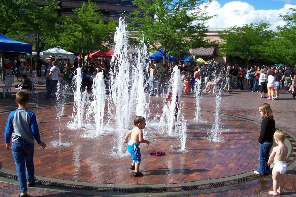
BOISE, Idaho — Compared with this capital of about 200,000 residents whose metropolitan area’s population tops a half-million, every other town in Idaho is small potatoes.
Any way you slice it, living here has its advantages. According to the Boise Convention & Visitors Bureau, the city’ s unemployment rate is 4.1 percent, the average wage is $42,432 per capita and the average price for a house in Ada County is $172,000. Sunshine prevails and there are distinct seasons, making Boise’s fabulous assortment of large and lovely parks and 25-mile riverside bicycle/pedestrian path a draw year-round. Ski areas are as close as 16 miles away, Boise State University has academics and athletics worth sampling, and the downtown area is clean, walk-able and friendly.
Tourists easily could spend a few days here sampling the many museums, cultural attractions, shops and restaurants, or use the city as a base for day trips into the Rocky Mountains. When I stopped in mid-June, I got oriented with the Boise Tour Train, spent a couple hours at the Old Idaho Penitentiary State Historic Site and topped off the day with a swing through downtown’s weekly “Alive at Five” celebration.
The train, whose small red cars ride on rubber wheels and are pulled by a locomotive-like truck on city streets, was a bit disappointing only because my particular tour was given by a trainee. His narration and driving were equally jerky, with a few puns thrown in to make things better or worse, depending on whether you’re amused by such things.
For example, when we passed the city’s old cemetery, our driver-guide said, “Little did planners know that it would end up in the dead center of town.” Or: “Believe it or not, this house to our right has five kitchens – Mr. Kitchen, Mrs. Kitchen and their three lovely children.”
Aside from those verbal distractions, the 90-minute tour was an entertaining and comprehensive look at central Boise. We started in Julia Davis Park, home to several museums and the zoo. It was there that we learned the “City of Trees” has only two trees that are indigenous: the cottonwood and willow. Once out of the park, we headed down Wann Springs Avenue and saw some of the town’s largest and most stately homes.
After turning around at the penitentiary road, we retraced our rickety-rackety route before veering by the Capitol building, modeled after the U.S. Capitol in Washington. We also passed the former Idaho Statesman building, from whose second-floor balcony the day’s news used to be yelled to passers-by.
Confined by a tight schedule, I hustled to my car and drove back out to the penitentiary. As prison tourist attractions go, this one’ s a gem, kind of like Alcatraz but with looming hillsides substituting for the San Francisco Bay as background scenery.
About 13,000 men and women were incarcerated at the site between 1872 and 1973, when a riot that destroyed much of the already deteriorating complex prompted its closing. Within the 17-feet-high, 2.5-feet-thick sandstone perimeter walls are a dozen buildings and scattered remains. An example of the latter are the rootless ruins of the 1898 dining hall, designed by inmate George Hamilton (a deeply tanned gentleman, perhaps) who committed suicide the day after he was released. He couldn’t stomach freedom, apparently.
Many of the buildings contain cells, of course, some “decorated” in the style they would have had with occupants. The maximum-security “5 House 1954” contains an exhibit of the 10 men who were executed at the prison, with murderer Raymond Snowden’s 1957 hanging being the most recent and the only one conducted in the building’s second-floor gallows, which vaguely can be seen behind darkened glass. Downstairs, shanks, saps, clubs and other prisoner weapons are displayed. There, I learned that such devices mostly were hidden in common rooms, not cells. “You’re crazy if you keep your weapons in your own house,” an ex-convict is quoted as telling a reporter.
Although a two-sided map and data sheet that are included with the admission price gives visitors the basics, a walking-tour booklet is a good investment at $2.50. In it, I was taken aback to read how prisoners in solitary confinement got their nicotine fix. Fellow inmates would place cigarettes in waterproof bags and flush them down the toilet, from where the bags would travel through open pipes that passed under the bathroom holes in solitary-confinement cells, whose occupants would go “fish.” When you gotta smoke, you gotta smoke, l guess.
“Alive at Five” enlivens a blocked-off Grove Plaza on Eighth Street, north of Julia Davis Park and Boise River by a few blocks, from 5 to 8 p.m. every Wednesday through September. Live bands, vendor booths that include beer sellers, lots of seating and a borderless fountain that kids like to run through on warm evenings are among the attractions. After a quick look at that lively scene, I slipped over to the companionably calm Table Rock Brew Pub & Grill, at Fulton Street and Capitol Boulevard, for a reddish pint of satisfying local beer, courtesy of a coupon included with my Boise Tour Train fee.
Somehow, even though I was in Idaho, I resisted ordering a side of french fries.
Old Idaho Penitentiary State Historic Site is open from 10 a.m. to 5 p.m. during the summer and from noon to 5 p.m. the rest of the year. Tickets are $5 general, $4 for seniors ages 59-plus and $3 for children ages 6 through 12. For more information: (208) 334-2682 or www.idahohistory.net/oldpen.html. The Boise Tour Train has at least four trips a day, Memorial Day through Labor Day, with limited excursions in the fall. Tickets are $9 general, $8.50 for seniors ages 65-plus and $6 for children ages 3 through 12. For more information: (208) 342- 4796 or www.boisetours.net.
Sidebar:
Boise’s other attractions include:
- Basque Museum & Cultural Center, 611 Grove St., honors the Basque culture’ s impact on Idaho.
- Boise Art Museum, 670 Julia Davis Dr., is the state’s only public art museum.
- Discovery Center of Idaho, 131 Myrtle St., is a highly regarded science museum that has more than 150 interactive exhibits.
- Idaho Anne Frank Human Rights Memorial, at the south end of Eight Street at the river, beckons book-readers on warm summer evenings.
- Idaho Black History Museum,508 Julia Davis Dr., pays tribute to African Americans who have helped shape the state.
- Idaho Botanical Garden, 2355 Old Penitentiary Road near the historic prison, has 13 theme gardens.
- Idaho State Capitol, at Capitol Boulevard and Jefferson Street, offers free tours Mondays through Saturdays.
- World Sports Humanitarian Hall of Fame, 1910 University Dr. at Boise State University’ s Bronco Stadium, tips its cap to sports stars such as Arthur Ashe and Jackie Robinson who have been heroes off the field as well.
IMPERIAL BEACH — Quite suddenly, a dozen men approached single file from the right. They appeared to coming from Mexico, less than a mile away.
The group’s leader anxiously looked to and fro, as if he were a platoon’s point man. He was startled to see me, but quickly sensed I was harmless and smiled. I raised a hand in greeting. A dozen hands were raised in response. The silent men crossed the trail behind me and continued north.
Just another afternoon at Border Field State Park.
Twenty miles south of downtown San Diego, Border Field is in the extreme southwest corner of the continental United States. I have been there twice, and each time I saw groups of tanned and dark-haired men walking or running north, in a furtive manner.
So if watching what might be aliens in transit is your idea of an adventure, you have a good chance of being satisfied at Border Field. A better chance, perhaps, than of seeing a kangaroo hop at San Diego Zoo or the Padres baseball team win at Jack Murphy Stadium.
Park ranger Olen Golden, who grew up in the area, pointed out that rangers are not concerned with immigration activity - that’s the bailiwick of U.S. Border Patrol agents. The park and adjacent Tijuana River National Estuarine Reserve are jointly managed by the U.S. Fish and Wildlife Service and the California Department of Parks and Recreation.
Furthermore, Golden and another ranger told me on separate occasions that crime is not a problem. In the early 1970s, first lady Pat Nixon was the driving force behind making Border Field a “friendship area,” which Mexicans could visit freely. A few cases of excessive drinking over the next two decades were all that marred an otherwise congenial park atmosphere, Golden said.
Two years ago, the friendship area effectively was cut off by the erection of a border fence that juts several dozen yards into the Pacific Ocean. It extends inland beyond the park; Golden said the Border Patrol might plan to continue the fence for several miles. He also speculated that quick approval and construction of the barrier may have been politically linked to development of the North American Free Trade Agreement.
Border Field State Park has “really quieted down” since the fence went up, Golden said. During my most recent visit, I walked to the obstruction — vertical, metal poles that are a foot apart and rise about 15 feet.
There was a solitary man on the other side, leaning against a pole. He was about my age, and wore a baseball hat, torn clothes and old tennis shoes. I took his picture with my $300 camera. I dimly was reminded of an old “Star Trek” episode that explored the possibility of a parallel universe.
There weren’t many people at the park, but skies were overcast and it was a weekday. Activity no doubt picks up during weekends and in sunny weather. Border Field State Park is an interesting place to visit, and not just because it stimulates thoughts about illegal immigration and parallel universes.
For example, it is one of the few places in California where horseback riding is permitted on the beach. The park’s inland trails are clearly marked, guiding riders and hikers past riverbeds and dozens of plants, including some that are not native to North America.
More than 340 species of birds have been spotted in the Tijuana River Valley. Blue herons, double-crested cormorants, black-necked stilts, brown pelicans and western sandpipers are among the feathered friends you might be able to see. Binoculars enhance the experience.
But if you visit between April and September, stay off the strip of dunes behind the beach. Two endangered species, the California least tern and snowy plover, need protection there. Warning signs explain: “camouflaged eggs are accidentally stepped on or run over by beach vehicles, horses, pets and people on foot.”
Border Field’s beach is a great place to stroll. It offers views of the Tijuana Bull Ring and Mexican community south of the fence, the Coronado Islands and, on a clear day, the skyscrapers of downtown San Diego. Swimming is discouraged, though, due to dangerously high bacteria counts.
To learn more about the estuary or to participate in nature walks and other presentations, go to the Visitor Center in Imperial Beach. An estuary exhibit will be there in June 1994. For more information, call (619) 575-3613.
Getting there: To reach Border Field State Park, take the Coronado Avenue exit off Interstate 5. Proceed through the light and head south for two miles on Hollister Street, passing the aptly named Southwest High School and several horse farms. Turn right on Monument Road; the park is about 1½ miles farther.
To reach the Visitor Center, take the same exit and turn right on Coronado. Head west for a few miles to Third. Turn left and within a few hundred yards you’ll reach the gravel parking lot.
BOSTON – Beantown, been there. Which means I have a few suggestions for those who are considering a trip to one of our country’s oldest and most tourist-worthy cities.
Why go: Boston is brimming with history. Seeing its Revolutionary War era sites makes some of those secondary-school history lessons more vivid in our minds. Architecturally, interesting buildings from as far back as the 17th century beckon. Academically, influential institutions such as Harvard and the Massachusetts Institute of Technology might inspire you to resume your studies. Walking through Boston Common, its adjacent Public Gardens or some of the many distinctive neighborhoods represents another pleasure.
The city’s broad cultural landscape is appealing; Irish Americans are especially likely to appreciate Boston’s Celtic undertones. The two orchestras (classical and pops) and ballet are much acclaimed. If you’re a baseball fan, it doesn’t get much better than seeing a Red Sox game at Fenway Park (although I prefer Chicago’s Wrigley Field), and if you’re a football fan, you have to tip your helmets to the world-champion New England Patriots (whose home games are in Foxboro, about 30 miles to the southwest of downtown).
How to get around once you’re there: Do not drive unless you are a masochist. If you enjoy honking the horn, routinely getting into near-accidents and being unable to find parking spots, go for it. Otherwise, Boston’s compact downtown easily can be explored on foot, taxis are everywhere and the public-transportation system is laudable, by U.S. standards.
Subways/trolleys, known as the “T,” can take you near most places in the central area, including Boston Logan International Airport. Tokens are $1.25 one-way, but visitor passes make more sense if you intend to make frequent forays. We opted for three-day passes, which are $18 apiece; a one-week pass is $35. Ask for a Massachusetts Bay Transportation Authority system map when you purchase your pass at the airport or downtown. For more information about MTBA services: www.mtba.com.
Keep your driver’s license handy, however. Because I had left mine in our hotel room, vendors at Fenway Park would not sell me a beer – no matter that I am 45 years old and look to be every hour of it.
What to do, days: The 2.5-mile Freedom Trail, which begins in Boston Common and ends at the Bunker Hill Monument in Charlestown, is in my opinion the city’s top attraction. (Perhaps I am influenced by it having been conceived by a journalist, William Schofield, in the early 1950s.) It links, via a red-brick and red-paint line that is impossible to lose, 16 designated historical landmarks (see sidebar). Doing justice to the trail requires a full day’s commitment, maybe even a few hours’ more.
My wife and I particularly enjoyed the Old State House Museum, at 206 Washington St. Its extensive if somewhat low-tech exhibits do a good job of summarizing the colonial town’s struggle with its English rulers. A display case about the Boston Tea Party includes a vial of the very tea that was tossed overboard in the 1773 anti-tax protest. For more information about the museum: www.bostonhistory.org.
A block away from the museum are Faneuil Hall and Quincy Market. The former was a prominent meeting place for the anti-slavery and women’s-rights movements, while the latter has a potpourri of food stands that can calm your hunger without consuming too much of your budget. A replica of the Cheers bar of 1980s TV fame is among its kitschier tenants. For more information about the always buzzing area: www.faneuilhallmarketplace.com. Nearest “T” stop: State, on the blue and orange lines.
The Paul Revere House, at 19 North Square in the North End, is the oldest wooden house in Boston and for almost 100 years has been open for tourists. Its four rooms feature furniture of the style likely owned by the famous horse-rider and silversmith himself, who lived there during the eventful 1770s. (Did you know, by the way, that Revere was accused of insubordination and cowardice during one Revolutionary War battle?) Admission is $3; for more information: www.paulreverehouse.org. Around the block is Hanover Street, a “little Italy” of sorts with several trattorias and pedestrians who are speaking Italian. Nearest “T” stop: Haymarket, on the green and orange lines.
Beacon Hill is fun to stroll around. The ritzy, 19th century, red-brick neighborhood’s homeowners include John Kerry and his wife, Teresa Heinz. According to one local we talked with, the famous Democrats’ abode is off the northeast corner of Louisburg Square and has a huge flag on display. My wife and I saw the place but could not confirm the occupants. Nearest “T” stop: Charles/Massachusetts General Hospital.
Another neat place to see on foot is the massive Christian Science Center, off Massachusetts Avenue near the Prudential Tower (nearest “T” stop: Prudential). Trinity Church in nearby Copley Square offers organ concerts at 12:15 p.m. most Fridays; Scott Foppiano of Fishers, Ind., was the guest artist during our visit in mid-September.
What to do, nights: Newbury Street in Boston’s Back Bay (nearest “T” stop: Hynes Convention Center) is lively after dark, with plenty of restaurants and shops. To the north, across the Charles River, is another safe place to walk about at night: the Harvard Square area in Cambridge. Harvard University is the alma mater of many presidents and a place where many students today can be heard saying “like” and “ohmigod” over and over again, just as students do at your local community college! Nearest “T” stop: Harvard, on the red line.
(Need another reason to snicker at Harvard? Its John Harvard statue, in the campus’s Old Yard, is a testament to sloppiness – or someone’s idea of a highfalutin joke? The inscription, “John Harvard, Founder, 1638,” gets the year wrong and misidentifies the founder. Furthermore, the person depicted resembles not the Rev. Harvard, but rather a 19th century student who was chosen at random to serve as model.)
Where to eat: Quincy Market, as mentioned above, has many low-cost options. Otherwise, my wife and I sampled only vegetarian fare, of which there are at least two good candidates: Grasshopper, 1 North Beacon St. in Allston near the Allston and Harvard Avenue “T” stops on the green line, serves generous portions of mostly vegan Asian food (617-254-8883); and Veggie Planet, 47 Palmer Street just off Harvard Square near the Harvard “T” stop on the red line, specializes in pizzas unlike any you’ll find elsewhere (617-661-1513 or www.veggieplanet.net). At night, Veggie Planet gives way to Club Passim, which we were told is a longtime and significant venue in the country’s folk-music movement.
Where to stay: We were content with a fifth-floor room at 463 Beacon Street House in the Back Bay. Our private balcony (off room No. 50) allowed us to see downtown to the right, MIT ahead across the Charles (we could see only a sliver of the river) and, to the left, the CITGO sign that is visible over the Green Monster (Fenway Park’s famous left-field fence) whenever games Red Sox home games are telecast. Walking to Fenway from our inn took 20 minutes, and the nearest “T” stop (Hynes Convention Center) was about half that distance.
Location was the primary strength of 463 Beacon Street House, as it’s on a tree-lined residential street, a block from the Charles River, and seemed quite safe after dark. The rooms were not well-scrubbed or lavishly appointed, though we appreciated the small fridge and microwave. We paid slightly under $100 a night, taxes included. For more information: www.463beacon.com.
Two good sources for finding guest rooms in greater Boston are www.bnbboston.com and www.boston-online.com/lodging/Inns.
The weather: January’s average high temperature is 36 and the low is 22, April is 56/41, July is 82/65 and October is 62/46. Precipitation pretty consistently is between 3 and 4 inches each month, with November marginally the wettest.
How to get there: Most major airlines fly to Boston Logan International Airport, including America West, American, Continental, Delta and United. A quick Internet search of roundtrip fares from Sacramento to Boston for Nov. 5-12 yielded quotes of $314 on America West and $228.30 on United. Flying’s not your thing? Amtrak will get you to Beantown for $137 one-way and take only three days and two hours to do so.
Bonus Boston tip: If you buy an MTBA visitor’s pass and have a spare morning or afternoon, consider hopping aboard the ferry from Long Wharf (near the Aquarium “T” stop on the blue line) and riding – for no extra charge – to and back from the Fore River Shipyard in Quincy. Along the way, you will have superb views of downtown Boston and many nearby islands.
Sidebar:
The Freedom Trail
Step back into Boston’s rich history by walking the 2.5-mile Freedom Trail. The contrast between 17th, 18th and 19th century graveyards, buildings and churches tucked into a modern city is striking. Following are the trail’s 16 designated historic landmarks.
- Boston Common, a public space comparable to New York’s Central Park.
- Massachusetts State House, the contemporary capitol building.
- Park Street Church, in whose basement gunpowder was stored during the War of 1812.
- Granary Burying Ground, where Samuel Adams, John Hancock and Paul Revere, among many others, were laid to rest.
- King’s Chapel, which was the first church anywhere in the British colonies to install an organ.
- First Public School. A plaque marks where the school, long since destroyed, was built in 1645.
- Old Corner Bookstore, the building in which works by Nathaniel Hawthorne, Ralph Waldo Emerson, Harriet Beecher Stowe and others were published but which in September appeared to be the site of a future jewelry store.
- Old South Meeting House, where many revolutionary speeches were given in the 1770s.
- Old State House, whose museum details Boston’s history.
- Boston Massacre Site, a circle of stones in a traffic island.
- Faneuil Hall, where among many other things new citizens still are sworn in, on the second floor.
- Paul Revere House, onetime home of the silversmith patriot.
- Old North Church, where two lamps signaled to Revere just exactly how the British were coming.
- Copp’s Hill Burying Ground, whose 11,000-plus colonial graves include 1,000 African Americans from a nearby settlement nicknamed “New Guinea.”
- USS Constitution, which fought the British in the War of 1812.
- Bunker Hill Monument, a 221-foot obelisk that can be climbed, though it mind wind you.
BUENOS AIRES — While walking between tourist sites here, look both ways before crossing the street. And make sure your next of kins’ phone numbers can be found on your body after it’s scraped off the pavement.
Pedestrians in Argentina’s capital encounter delights and frights, the trick being to make the former more memorable. Architecture, sculptures and cafes are among the charms this metropolis of 12 million has to offer, but to visit them via your feet can be a treacherous endeavor.
Taxis — black and yellow beasts that seemingly compose half the city’s vehicles — represent the most frequent danger. They zip through and make squeaky turns at intersections, many of which lack stoplights or signs. Buses are deceptively quick, too, and their stopping power is pretty much limited to what they can do to you, the unfortunate pedestrian.
But the locals seem to manage, most of them brazen enough to jaywalk or take a few steps out on a crosswalk before the road has quite cleared. Taxis and buses miss them by inches. What better place than Argentina to tango with traffic?
Such dangers aside, Buenos Aires can be enjoyed through walking. The city has almost 50 barrios, but the seven in and around the “centro” contain the most worthwhile attractions.
Plaza de Mayo makes a logical focal point for the downtown area and for walking tours that can stem from it to the north, west and south.
The plaza’s obelisk marks the revolution of May 1810, which followed victories over invading British forces in 1806 and 1807. At the plaza’s east end is Casa Rosada, the presidential palace from whose balcony Argentine leaders such as Juan Per6n have addressed the little people below.
Several architecturally interesting buildings are nearby, including Catedral Metropolitana and, three blocks south, another lovely church, Iglesia y Convento de Santo Domingo.
Among the six other barrios worth walking through is, directly west of Plaza de Mayo along Avenida de Mayo, the combined Corrientes and Congreso. On sunny days, the Plaza del Congresso throbs with tourists, pigeons and schoolchildren. The parliament building and statue before it are sure to please shutterbugs.
Highbrows can get their fix at the Teatro Colon, about 10 blocks northeast of the plaza. Before the Sydney Opera House was built, Colon was the Southern Hemisphere’s largest theater, and world-renowned artists have performed there since 1909. Tours of the building are offered in English.
In strolling between Plaza de Mayo and Plaza del Congresso, pedestrians traverse what local postcards hail as “the world’s widest boulevard,” Avenida 9 de Julio. Considering that 20 lanes of it cross at Avenida de Mayo, such a claim seems possible.
Directly north of Plaza de Mayo is Retiro, a banio whose primary attraction is the Museo Municipal de Arte Hispanoamericano Isaac Femndez Blanco. Colonial art, costumes and antiques are displayed in the small museum.
West ofRetiro is the combined Recoleta and Banio Norte, whose Cementerio de la Recoleta is a cemetery that must be seen to be believed. Survivors have parted dearly with plenty of pesos to create tombs that can be appreciated as art. The layout resembles a miniature city, with pedestrian paths serving as “roads” and the memorial as “skyscrapers.” Evita Penfo’s remains ended up in Recoleta after first being planted in Milan then housed briefly in her husband’s Madrid retreat.
A few hundred yards north of the cemetery, across Plaza Francia and another dicey proposition for pedestrians, the roaring Avenida del Libertador, is the city’s best art museum. Museo Nacional de Bellas Artes has an extensive collection of 19th-century European works, several rooms devoted to Latin American paintings and large areas for touring exhibits. Best of all, the museum is free.
Parks are what make Palermo, the barrio west of Recoleta and Banio Norte, worth visiting. The botanical, rose and Japanese gardens all provide natural and beautiful relief from the city’s noisy, smelly streets.
Another safe haven — at least for humans — is Jardtn Zoologico, also in Palermo. A respectable number and variety of animals are exhibited, while the zoo’s cafeteria serves up less lively cows, pigs and chickens. Sculptures of naked women greet visitors at each of the park’s two entrances; the San Diego Zoo should be so welcoming.
Ruminations about sculptures’ artistic merits aside, one benefit of walking through the barrios is you discover how attractive the real people in Argentina really are. The pronounced youth and friendliness of the city’s residents offer hope that Buenos Aires’ problems — such as noise, smog and decaying structures — can be softened in the next century.
South of Plaza de Mayo are the two other barrios worth trodding through. San Telmo is at its liveliest on weekends, when its Plaza Dorrego hosts a crafts fair from about 10 a.m. to 5 p.m. both days. Reasonably priced souvenirs and paintings are one lure, another is the possible demonstration of the tango. On a sunny Sunday in October, a young and competent couple had the surrounding tourists applauding loudly with their dancing … and scattering shamelessly when the hat was passed for donations.
No walkers’ exploration of Buenos Aires could be complete without La Boca, immediately south of San Telmo. The lower-class neighborhood has gained a reputation for its wildly colored structures, and a two-block pedestrian mall has wares every day that might be cheaper than those sold weekends at other markets.
A final, personal comment about the dangers posed by Buenos Aires’ traffic is that during my seven days in the city, I saw not one accident. By all rights, I should have witnessed hundreds. Perhaps the correlation between reckless driving and wrecks that week as askew.
When legs and street-crossing nerves begin to wear down, pedestrians can hop aboard the cheap public buses, which are fairly easy to understand and for which timetables can be bought at many kiosks. The five-line subway system serves the central area well, and costs about 50 cents per ride. Taxis, as has been dwelled upon earlier in this article, are omnipresent.
BUENOS AIRES, AT A GLANCE
Getting there: American Airlines, Canadian Airlines International and United Airlines are among the many carriers that serve Buenos Aires.
Climate: The annual rainfall of 36 inches is spread pretty evenly throughout the year. The average high temperature in January is 85 degrees Fahrenheit, in April and October about 70, and in July, 57.
Currency: One Argentine peso is roughly equivalent to one U.S. dollar, handily enough. Exchanges might as well be made at the international airport, which has competitive rates and has less-involved transactions than banks in town tend to impose.
Language: A working knowledge of Spanish is most helpful. People are generally friendly in Buenos Aires, but at least in the lower-expense tourism circles, few speak much English.
A warning to book-lovers: Take plenty of paperbacks from the States or be prepared to spend $15 apiece for them in Buenos Aires.
Travel literature: “Buenos Aires,” a city guide from the Lonely Planet series, is an excellent source of information for travelers of all means.
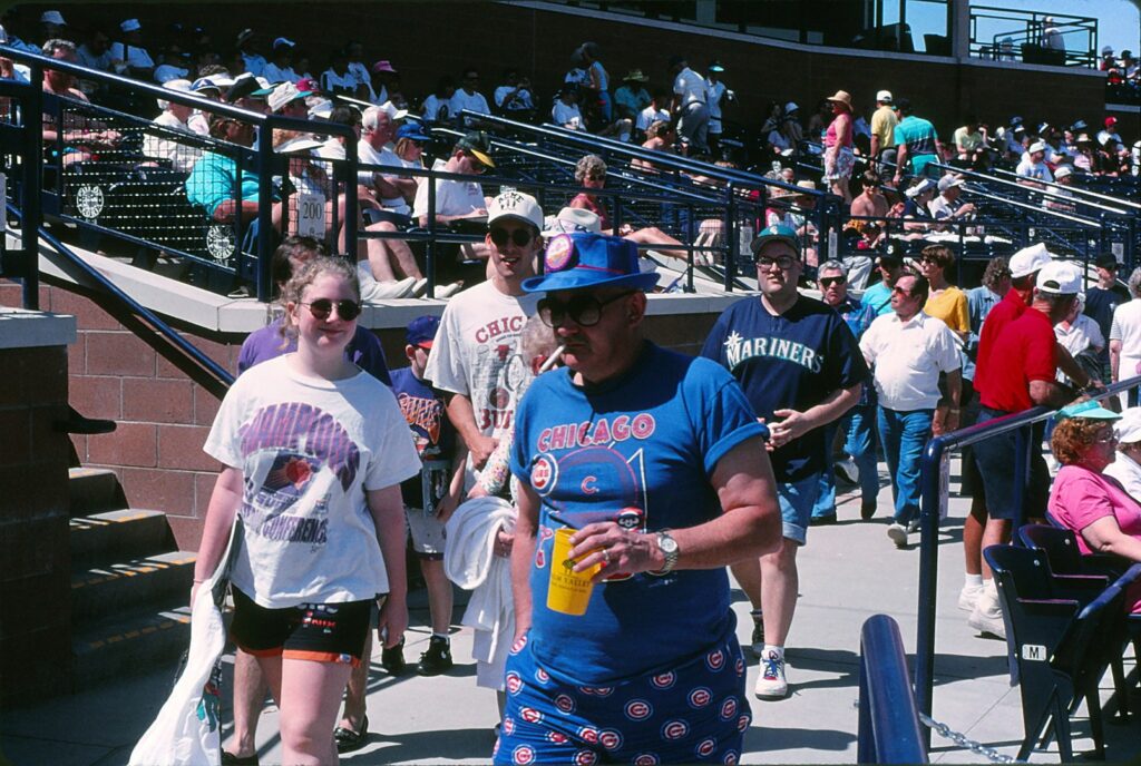
Although the World Series might be a fresh memory – the Cubs played the Red Sox, didn’t they? I went on vacation just as both teams were poised to win the pennant – it’s not too early to make plans for attending 2004 spring-training games in Arizona.
Flights and lodging should be reserved months in advance, as baseball fans must compete for the best deals. Spring-breaking students and “snowbirds” from colder states also flock to Phoenix and Tucson in March, when the weather is as good as it gets in Arizona. (People who have allergy issues might disagree.)
Individual game tickets, which at least in one case go on sale Jan. 2, should be purchased in advance for certain, perennially popular teams: the Chicago Cubs and San Francisco Giants for any home games, and the Seattle Mariners and Arizona Diamondbacks for weekend home games.
Those four squads are joined by eight others in what is called the Cactus League (the other big-league teams train in Florida’s Grapefruit League). Nine of the 12 are based in greater Phoenix, while the Diamondbacks, Chicago White Sox and Colorado Rockies have their spring-training homes in Tucson. The Phoenix-area home fields range geographically from the Kansas City Royals and Texas Rangers, in the western suburb of Surprise, to the Cubs, who hang out in east-suburb Mesa, about 45 miles across the Valley of the Sun. The Milwaukee Brewers (Maryvale) and San Diego Padres and Mariners (both Peoria) also are in the western area, the Oakland Athletics (Phoenix) and California Angels (Tempe) are central, and the Giants (Scottsdale) are east.
Only a few teams have released tentative schedules so far, but it is apparent that the 2004 Cactus League season will begin Thursday, March 4, and pretty much wrap by Thursday, April 1. As many spring-training aficionados know, early games tend to involve a staggering number of substitutions, with star players likely to be in for just a few innings and minor-league prospects populating the later frames. The closer it gets to April and the regular season’s Opening Day, the longer the projected starters will play. For example, Barry Bonds or Sammy Sosa might have two at-bats on March 4, but four or five at-bats on March 28. Randy Johnson or Barry Zito would throw three innings maximum in early March, and up to seven innings by month’s end.
Such nuances are too many to list or even contemplate, considering the generally complicated nature of baseball and the hugely varied preferences for what its fans like to see. However, based on the 13 consecutive spring-training seasons I have sampled with my parents (who tend to spend the entire month in greater Phoenix, whereas I pop by for a week or so), here are some random thoughts, suggestions, etc., for planning a Cactus League adventure:
- Pay more to sit in the shade, which generally means in seats behind home plate and extending out both directions, just past first and third bases, in the higher rows. At $10 to $15 each, they are less expensive than close-to-the-field box seats and more expensive than bleachers and lawns, but those areas are fully exposed to the sun. Temperatures can reach the lower 90s in mid to later March, and we have known people to get so toasted (in the nonalcoholic way, though that way’s far more common) that they are taken to the hospital. Ticket sellers, at the parks’ box offices or even on the telephone, should be able to steer you toward shaded areas.
- Be aware that many games are played by split squads, which means your favorite player might not be in the ballpark. Colorado, let’s say, is playing at the same time (1:05 p.m. is standard for most Cactus League contests, though a handful begin at 7:05 p.m.) on the same day – one game at home in Tucson, the other on the road in Phoenix. In such cases, especially when a Tucson-based team is involved, the best players are likely to avoid the 110-mile bus ride between Arizona’s two largest cities. Rockies superstar Todd Helton would play first base in the Tucson game, while Homer Slowbat or Sly Leadglove would handle that position in Phoenix.
- In games not involving the Cubs, Giants or Diamondbacks, especially on weekdays, the best ballparks at which to buy tickets on game day are in Surprise, Maryvale and Tucson. Maryvale Baseball Park is especially easygoing. Obtain any ticket there other than lawn seating, and after an inning or two sit wherever you want.
- At most stadiums, parking fees can be avoided if you don’t mind walking 10 or so minutes. Two possibilities: the huge shopping mall’s lot off Bell Road north of the Peoria Sports Complex, and the residential streets south of Mesa’s Hohokam Park.
- Pack a poncho. Many springs are bone-dry in Arizona, but last year 10 Cactus League games were washed out, including my second in 16 Cactus League seasons (the other one occurred in 1969).
- Pet peeve time. If you want to leave or return to your seat during a game, wait until the half-inning ends. If you are really desperate, wait until an at-bat’s been resolved before standing up and plowing through to the aisle. Fans want to see the game, not you loaded down with nachos and drinks. Attending ballgames is a very informal activity, granted, but common courtesy should apply anywhere.
Most teams sell tickets through Ticketmaster (480-784-4444 or ticketmaster.com). The Cubs, bless their losing hearts (for the record, the recently completed World Series saw the Florida Marlins defeat the New York Yankees; the Cubs and Red Sox continued their cursed ways), use Tickets.com (800-905-3315) and have announced Jan. 2 is when home-game seats can be purchased. (They open in Mesa on March 4 against the Giants.)
Southwest and America West airlines have hubs at Phoenix International Airport and tend to have the best prices and times; I’ve flown United Airlines from Sacramento once or twice via a Los Angeles-area airport stopover. I’m happy with a round-trip fare of $200 or less.
Dad tends to rent an apartment in Peoria for the month; I’m guessing he pays around $1,500. Weeklong stays can be arranged for suites in chain hotels that are scattered throughout the Phoenix and/or Tucson areas: Extended Stay America (877-587-7288; www.exstay.com; mid-$400s), Select Suites (800-821-8005; www.selectsuites.com; from $179) and Studio 6 (800-466-8356; www.motel6.com; $229-$409) are among the thriftier options.
For the best Cactus League schedule, one that prints nicely on a 8.5-by-11-inch page, keep checking the Mesa Chamber of Commerce’s Web site (www.mesachamber.org). Another great resource is www.cactus-league.com, which has directions to all the ballparks and other helpful information.
In the immortal words of Harry Caray, from the press box waving a microphone to the crowd, “Let me hear ya! A one, a two, a three … Take, me out to the ballgame …”
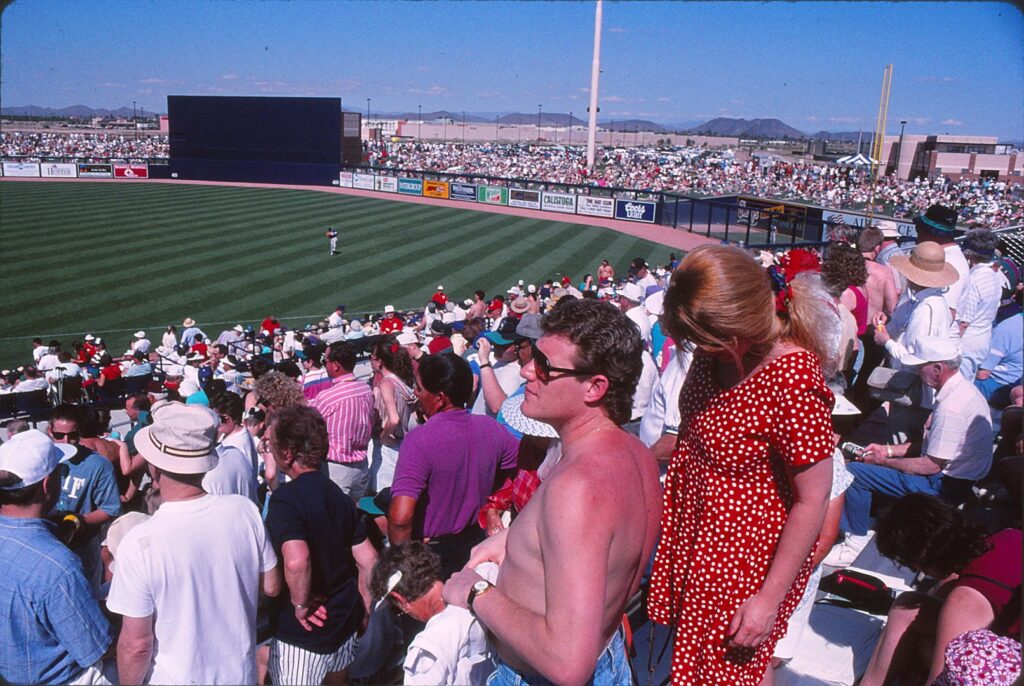
For those of you wise enough to appreciate baseball and fortunate enough to be attending spring-training games in Arizona this year, keep in mind there are plenty of things to do besides drinking beer and getting sunburned in plastic seats or on outfield berms.
Near the nine ballparks in Tucson and greater Phoenix that will host the 12 major-league teams this March are several tourist attractions that can be explored before the traditional 1:05 p.m. first pitch. (Although this season’s tentative Cactus League schedule contains an unusually high number of 7 p.m. starts – 13 of them.) Sites that star Mother Nature, Frank Lloyd Wright and firefighters, among others, are ready to receive your vacation dollars.
Tucson, where the Arizona Diamondbacks, Colorado Rockies and world-champion Chicago White Sox train, is a city of more than 485,000 that is about 120 miles southeast of Phoenix. Home to the University of Arizona and birthplace of actress Barbara Eden, Tucson is near several dreamy attractions, including:
- Arizona-Sonora Desert Museum. More than 300 animal and 1,300 plant species are on display at this popular spot, 14 miles west of downtown. Admission is $12 general and $4 for ages 6-12 until May 1, when rates are lowered for what could be called the “too hot to bother visiting” season, through October. For more information: (520) 883-2702 or www.desertmuseum.org.
- Biosphere 2 Center. See where scientists were quarantined in large glass houses to conduct research about ecosystems and how elements can be recycled. For details about tours and for other information: (520) 838-6200 or www.bio2.com.
- Saguaro National Park. The anthropomorphic cactus whose blossom is Arizona’s state flower has an awesome presence in this two-region park, especially in late winter/early spring. Both the east and west regions are 15 miles from downtown Tucson and have visitors centers. For more information: (520) 733-5100 or www.nps.gov/sagu.
- Titan Missile Museum. This place is the bomb for Cold War enthusiasts: It was one of 54 Titan II Intercontinental Ballistic Missile (ICBM) complexes in the U.S. military system and today offers one-hour tours. The museum is about 25 miles south of Tucson in Sahuarita, at 1580 W. Duval Mine Road. Admission is $8.50 general, $7.50 for seniors and $5 for ages 7-12. For more information: (520) 625-7736.
Greater Phoenix is where the other nine Cactus League teams train: the Oakland Athletics in Phoenix itself, the San Francisco Giants in Scottsdale, the Chicago Cubs in Mesa, the Kansas City Royals and Texas Rangers in Surprise, the Los Angeles Angels of Anaheim in Tempe, the Milwaukee Brewers in Maryvale (a western Phoenix neighborhood), and the San Diego Padres and Seattle Mariners in Peoria. Driving around this dusty metropolitan sea of stucco houses, dry riverbeds and fast-food joints can take forever, but if you are adept at time management, consider seeing any of following tourist attractions before a game. (This sampling is based on personal experience; other options abound.)
- Desert Botanical Garden in Papago Park. A few minutes east of Sky Harbor International Airport, this 145-acre spread has an excellent discovery trail that tells you all you want to know about plant life in the Sonora Desert. Admission is $10 general, $9 for seniors, $5 for students with ID and $4 for ages 3-12. For more information: (480) 941-1225 or www.dgb.org.
- The Hall of Flame Museum of Firefighting. Ladders, wagons, helmets and the like are assembled in astounding quantity in this warehouse tribute to blaze busters. Adjacent to Phoenix Municipal Stadium, at 6101 E. Van Buren St., the museum is natural before an A’s game. Admission is $6 general, $4 for ages 6-17 and $1.50 for ages 3-5. For more information: (602) 275-3473 or www.hallofflame.org.
- Heard Museum. American Indian art and culture is honored in this highly regarded downtown museum, at 2301 N. Central Ave. Admission is $10 general, $9 for ages 65-plus, $5 for students with ID and $3 for ages 6-12. For more information: (602) 252-8848 or www.heard.org.
- The Mystery Castle. This one’s a bit weird, but worth a gander. In the 1930 and early ’40s, an eccentric named Boyce Luther Gulley built this quirky manse for his daughter, who as of last spring still was conducting the tours herself. In South Mountain Park, several miles south of downtown. For more information: (602) 268-1581.
- Taliesin West. This was architect Wright’s winter home, and tours give insights on his honor-the-surroundings designs and property’s desert surroundings. On Frank Lloyd Wright Boulevard in Scottsdale, this spot is closest to Giants games. Its prices ($18 to $22.50 general) are as upscale as the suburb. For more information: (480) 860-2700 or www.franklloydwright.org.
- White Tank Mountain Regional Park. A pleasant nature trail here makes the list primarily because it represents one of the few attractions in the western Phoenix suburbs, near the four teams in Peoria and Surprise. For more information: (623) 935-2505.
Although it is possible to purchase Cactus League tickets onsite on game days, ordering ahead is a good idea, especially for Giants and Cubs home games, which often sell out. For online ticket purchases, visit www.mlb.com, surf to your team’s site and click on “Schedule” or “Tickets.”
Athletics: Tickets, $8 to $22, are available now, through the Web or by calling (877) 493-2225. Games, 17 of them this spring, begin March 3 and will be played at Phoenix Municipal Stadium, 5999 E. Van Buren in Phoenix.
Giants: Tickets, $8 to $25 (games on Fridays, Saturdays and Sundays cost more, greedily), will become available Tuesday (Jan. 10) on the Web or by calling (800) 762-2277. Games, 15 of them, begin March 3 at Scottsdale Stadium, 7408 E. Osborn Road in Scottsdale.
(Alphabetically from here on out:)
Angels: Ticket sales dates and prices were not available at press time. Games, 15 of them, begin March 3 at Tempe Diablo Stadium, 2200 West Alameda in Tempe.
Brewers: Tickets, $6 to $17, are available now on the Web and by calling (800) 933-7890. Games, 15 of them, begin March 2 at Maryvale Baseball Park, 3600 N. 51st Ave. in Phoenix.
Cubs: Tickets went on sale Thursday (Jan. 5). Check the Web for prices or call (800) 905-3315. Games, 15 of them, begin March 2 at HoHoKam Park, 1235 North Center St. in Mesa.
Diamondbacks: Ticket sales dates and prices were not available at press time. Games, 14 of them, begin March 3 at Tucson Electric Park, 2500 East Ajo Way in Tucson.
Mariners: Tickets, $6 to $21, will become available on Saturday (Jan. 14) on the Web and by calling (480) 784-4444. Games, 16 of them, begin March 3 at Peoria Stadium, 16101 North 83rd St.
Padres: Tickets, $6 to $21, will become available on Saturday (Jan. 14) on the Web and by calling (619) 220-8497. Games, 13 of them, begin March 5 at Peoria Stadium, 16101 North 83rd St.
Rangers: Tickets, $6 to $17, are available now on the Web and by calling (800) 326-4000. Games, 14 of them, begin March 2 at Surprise Stadium, 15850 N. Bullard Ave.
Rockies: Tickets went on sale Saturday (Jan. 7). Check the Web for prices and other information. Games, 16 of them, begin March 2 at Hi Corbett Field, 3400 East Camino Campestre in Tucson.
Royals: Tickets, $6 to $17, are available now on the Web and by calling (480) 784-4444. Games, 15 of them, begin March 3 at Surprise Stadium, 15850 N. Bullard Ave.
White Sox: Ticket sales dates and prices were not available at press time. Games, 15 of them, begin March 1 at Tucson Electric Park, 2500 East Ajo Way in Tucson.
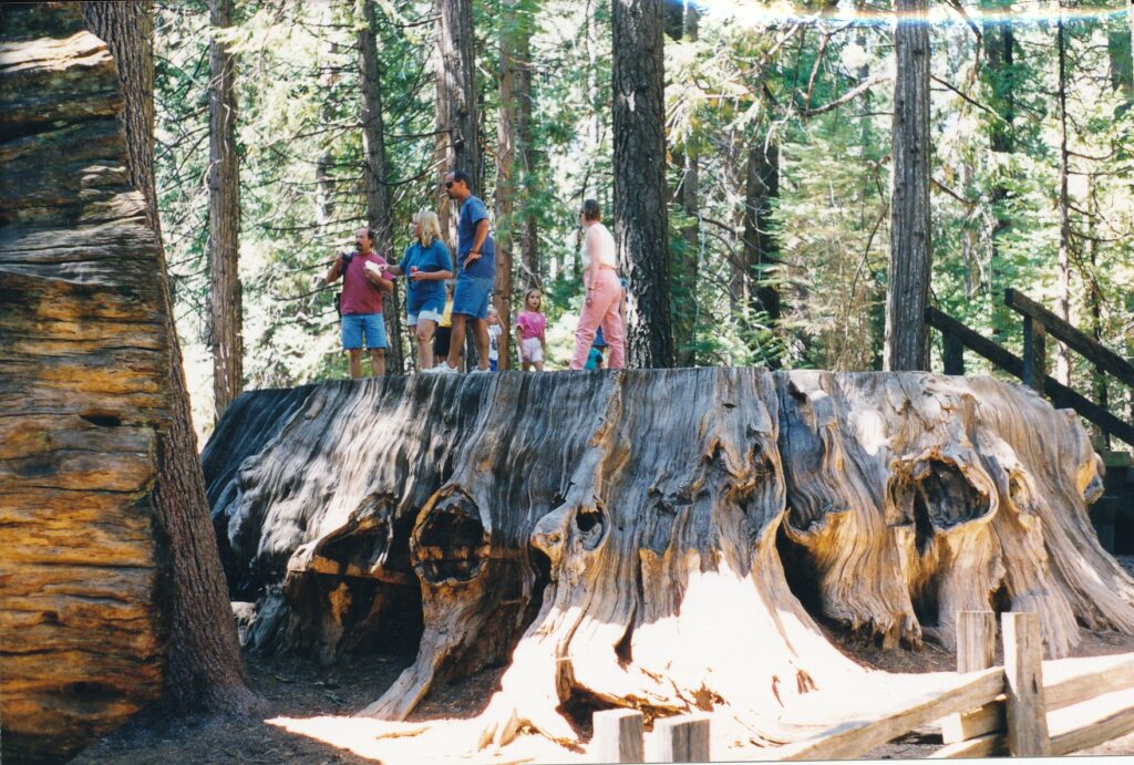
A healthy-looking man of perhaps 40 years pulled up to the entrance shack and asked senior park aide Theresa Plowman whether he could see the main attractions from his expensive white sedan.
No, Plowman said, you will have to walk a bit.
He shook his head, U-turned the wheel and departed hastily in the car that perhaps he drives to an upscale health club and its treadmills. Calaveras Big Trees State Park and its magnificent — though generally not drive-through — redwoods did not have a place in his busy lifestyle.
“It always baffles me, too,” Plowman said after I expressed surprise at the man’s attitude. Some people, she continued, have suggested trams and other mechanized contraptions be installed to make nature less tiresome to access.
Assuming you have the transportation to get there and the willingness to stretch your legs on gentle, well-tended trails, Big Trees might be worth your time and energy. The park, approximately 120 miles southeast of Sacramento near the small town of Arnold, contains two of the 75 or so Sierra redwood groves that are scattered along the mountain range’s western slope.
Big Trees lets you closely examine, even touch, what novelist John Steinbeck dubbed “ambassadors from another time.” Redwoods indeed are historically impressive, as the trees can live more than 3,000 years and they flourished during the dinosaur days (though likely not in the North America region). Due to climatic and geological changes, and to man’s influence, today there are three species left: the dawn redwood in China, coastal redwood in Northern California and Oregon, and the Sierra variety found in Big Trees’ North and South groves.
The North Grove is near the park entrance, off Highway 4. If you have just a few hours, Plowman advises, take this grove’s 1-rnile trail and check out the nearby visitors center. With a full day at your disposal, also visit the South Grove, which has many times more redwoods — an estimated 1,000 of them — and boasts the biggest of the big at Big Trees. The South Grove is 9 miles from the park entrance off a curvy, paved road, and takes at least two hours to explore.
The North Grove greets visitors with “The Big Stump,” used as a dance floor during the Gold Rush era. Its bark was stripped and reassembled for a traveling exhibit — though the bark burned not long after — and its fallen tree was converted into a two-lane bowling alley. Once you have climbed atop and admired the stump’s square footage, open the trail guide (25 cents), limber your neck for many skyward glances, and set off.
The wheelchair-accessible path is dotted with numbered signposts that signal descriptions in the guide and has many benches from which the sites can be absorbed leisurely. Among the first featured redwoods are “The Three Graces of Greek Mythology” (Aglaia, Euphrosyne and Thalia), “The Pioneer Cabin Tree” (through the base of which a tunnel was carved late in the 1800s) and one named for Abraham Lincoln shortly after the president’s assassination.
Signpost No. 10 marks a “sacrificial tree,” another victim of speculators who stripped its bark for traveling exhibits; this one’s outer layer was reassembled in New York City and London. Without its bark the tree was defenseless against fires and is now a blackened ruin. John Muir, the pioneer naturalist who is quoted extensively throughout the park and its literature, said the bark-stripping was “as sensible a scheme as skinning our great men would be to prove their greatness.”
More encouragingly, nearby signpost No. 11 points out a crop of young redwoods whose future is protected, thanks to the grove’s state-park designation in 1931.
On a warm, sunny day in early September, Hal and Shirley Glazener from Alexandria, Va., stopped to appreciate No. 13 — a hollow, fallen giant redwood that can be walked through lengthwise. I took their picture and, as I was leaving, heard Shirley tell her husband as she peered down the tree’s corridor: ‘Come here. You didn’t see this. Feel the temperature! It’s much cooler.”
At No. 16 — there are 25 signposts in all — life within and around the trees is described. Wasps and flies mate at the treetops. As many as 100,000 juice-sucking aphids live in the lower foliage, attracting other insects and birds. Beetles, snakeflies, mites and spiders reside in the cones, of which each Douglas squirrel (also known as a chickadee) can eat up to 3,500 a year. Chipmunks and robins take “dust baths” in the powdered bark as a way to repel insects. Woodpeckers, bluebirds and flickers nest in the bark.
The Three Senses Trail, which also branches off from the big stump, is a 600-foot path whose signposts are translated into Braille. Here is as good a place as any to feel the spongy redwood bark, which can be 2 feet thick. The Grove Overlook Trail, which forks from the main North Grove path, allows an overview of the area.
There are a number of ways to experience the South Grove trail, 3.5 to 5 miles long, all on gently sloping and well-tended pathways. A beginning portion leads, about a mile later, to a loop that passes many imposing redwoods. The first big tree took me 28 paces to circumnavigate. At the top of the loop, a half-mile path proceeds on to the grove’s biggest tree and reportedly among the top 10 Sierra redwoods. It is named after Swiss born Louis Agassiz (1807-1873), who became one of our country’s leading naturalists. I needed 41 paces to go round the Agassiz tree.
Plowman, who has worked at the park for 10 years, said its most popular event is Family Day, held annually the third Saturday in August. Other summertime activities include 4 p.m. Saturday bike rides and nightly — except Sundays — programs, all originating in the North Grove area. The Stanislaus River offers fishing possibilities. Wintertime camping is allowed on a limited number of sites, with cross-country skiing among the options, weather willing. The Bear Valley ski area is about 30 minutes farther northeast on Highway 4.
If you plan to spend the night at Big Trees, you have a choice of two campgrounds, one off the North Grove and the other some 4 miles toward the South Grove. Plowman says that reservations are a necessity on weekends from mid-May to mid-September; the summer 1999 charge was $16 per vehicle, the off-season (mid-October through April) rate was $12. Seniors paid $2 less. There was a dollar-per-dog surcharge, and day use only was $5 per vehicle. The visitors center is open from 11 a.m. to 3 p.m. daily in late spring, summer and early fall, and for the same hours, weekends only, the rest of the year.
For more information about Calaveras Big Trees State Park: (209) 795-2334, fax (209) 795-7306 or Web site www.sierra.parks.state.ca.gov. For camping reservations: (800) 444-7275 or Web site www.cal-parks .ca .gov.
Directions: From Sacramento take Highway 99 south to Stockton. Go east on Highway 4, follow road signs through a right and left turn in Angels Camp and continue on Highway 4 another 27 miles to the park entrance, on the right.
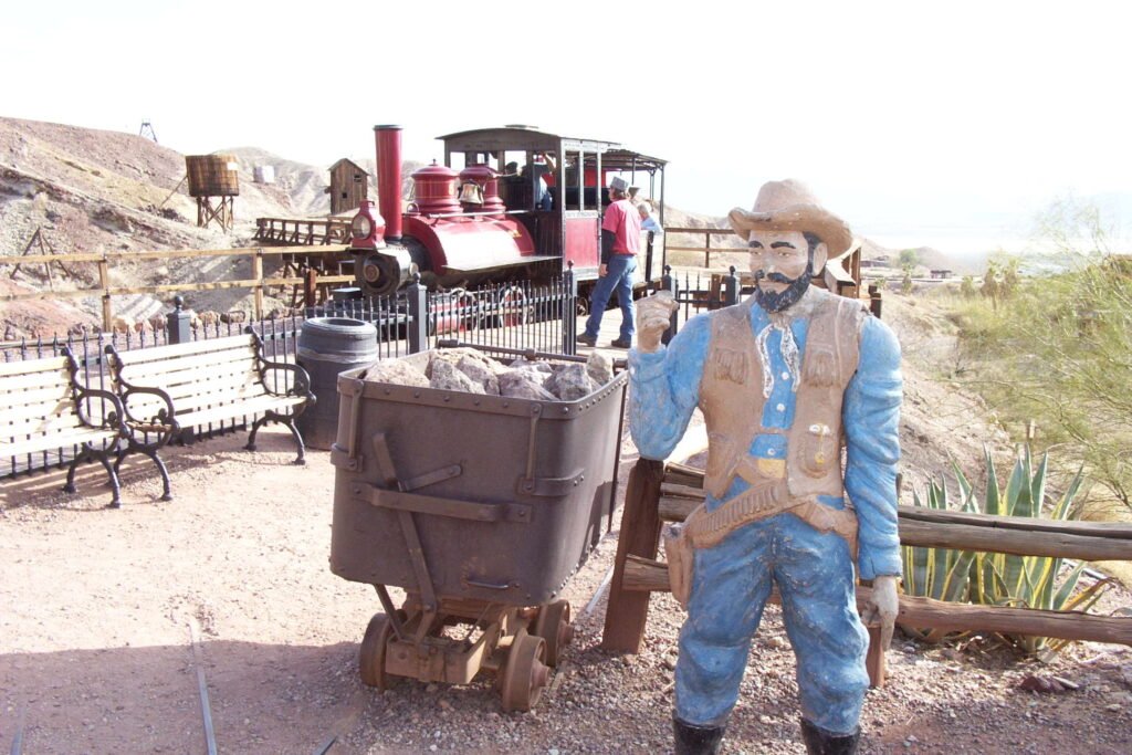
BARSTOW – On the spic-and-span front porch of a 1-year-old building, which has a chic gift store inside and a combination heating and air-conditioning unit on top, a woman sat on a bench. Dressed in a 19th century homesteader’s costume, she was talking into a headset connected to a cell phone.
Welcome to Calico Ghost Town. This isn’t your great-great-grandmother’s ghost town, that’s for sure. It has restaurants that sell foreign beers, candy machines, shops where a can of peanuts goes for $6.95, clean bathrooms with hot-water taps and flush toilets …
No specter worth her white-cloudy, translucent self would be caught dead in Calico. And any tourists hunting for a truly haunting town should instead visit Bodie State Historic Park, in Northern California near Mono Lake. Bodie, very much off the beaten track, is in a state of “arrested decay.” Buildings there pretty much rot at their own, natural pace. It’s a place for contemplative types who are fond of nature and history. Calico is more for the fast-food crowd.
To be fair, it should be acknowledged that Calico is appropriate for its location: roughly halfway between the glitzy cities of Los Angeles and Las Vegas, just off Interstate 15. People zipping by are likely to want something substantial (by their definition) from a two-hour stopover, such as cold drinks, lots of food, room for the kiddies to run around and, as a bonus, some corny entertainment. Calico comes through on all counts.
Also to be fair, it should be noted that five of the town’s buildings burned to the ground in July 2001. Reconstruction, which cost $1 million, was done in the spirit of careful re-creation and was completed last year. Only a few of the town’s 30 or so attractions date from the 1880s, including Lane’s General Store and the courthouse.
Calico was founded in 1881, and its population peaked six years later, at about 1,200 residents. Mining through 1907, when the town was in it dying throes, yielded 15 million to 20 million ounces of silver and a multimillion-dollar amount of borax materials. Walter Knott, who founded Knott’s Berry Farm, restored the town a half-century ago and donated it to San Bernardino County in 1966.
Today, Calico is a tourist trap with some minor charms.
Gunfights are staged daily on the main street (it’s not paved, at least not yet). On a sunny Monday afternoon in March, about three dozen tourists lined up before shops across from Lil’s Saloon to watch a Wild West melodrama. Two drunken thieves were confronted by a sheriff, who also appeared to be in his cups.
The bad guys complained their father had been arrested and pulled by his hair to jail. “You drug my pa!” one of them yelled at the sheriff. “No,” the tipsy tin star responded. “Calico’s a drug-free town.”
Later, a deputy threatened to shoot the thieves full of holes. “Is it Sunday?” rejoined one of the desperados. “No, it’s not, so you can’t make me holy.”
Groaners such as those were in startling contrast to the extreme loudness of the gunshots, including a monstrous shotgun blast. One thief was shot in the back and the other lured out on a lawman’s false pretense of peace. Pretty gruesome stuff for the under-6 crowd. Maybe because of such concerns, the bad guys “wake up” and are warned to get off the street, as there’s “a $50 fine for littering.”
Humor of a less-violent sort is displayed on the community billboard, near the entrance. Among the postings: “Notis: Wife run off with best frind and dog. If seen plez send dog home. – Lonesome” and “For rent: Cabin with stove. $10.00 month roof needs fixin and well has run dry otherwise in good shape. – D.J.”
Small children might enjoy an eight-minute ride on the Calico/Odessa railroad, which costs $2.50 general and $1.25 for ages 12 and younger. Nearby is the Maggie Mine Tour, a self-guided affair that on hot summer days must be a popular attraction. Inside the mine, one of 50 that operated in Calico’s heyday, visitors learn that wooden pipes were used because metal ones would quickly rot. Past a ladder, ore chute and open area called “Dead Man’s Drift” (because its soft walls were prone to collapse), prospector “Big John’s” voice is triggered by motion detectors.
“I’m going to strike it rich! Mark my words,” he says in a tone that’s purely Hollywood Western stereotype. You can almost see his brown teeth and smell his boozy breath. “And when you get back to Main Street, would SOMEbody make me a candle? It gets dark in here, you know. And a cup of coffee out of the spice shop would be nice, too.” Yes, the town’s marketing can be pretty insistent.
From the mine, visitors must mount several dozen steps to emerge at street level and can continue climbing to gain a nice view of the town from atop a rocky overlook. On another hill is a replica of the original schoolhouse. You cannot enter, but through windows can see a classroom and chalkboard, on which is written “Welcome 2/29/1880.” That seems to be a rather sloppy mistake in a town not founded until 1881 and whose school operated from 1882 to 1899.
But this place is not so much about history as it is about shopping, eating and entertainment. Best treat visiting Calico as a lark, rather like spending $9 to ride up the “Eiffel Tower” in Las Vegas’ Paris casino. That’s no Eiffel Tower, and Calico’s no ghost town.
Calico Ghost Town Regional Park, 10 miles east of Barstow and 150 miles from Las Vegas, is open from 8 a.m. to dusk daily, with its shops operating from 9 a.m. to 5 p.m. Admission is $6 general, $3 for ages 6 through 15 and free for younger kids. Campsites run from $18 to $28 per night, with reservations recommended. For more information: (800) 862-2542 or www.calicotown.com.
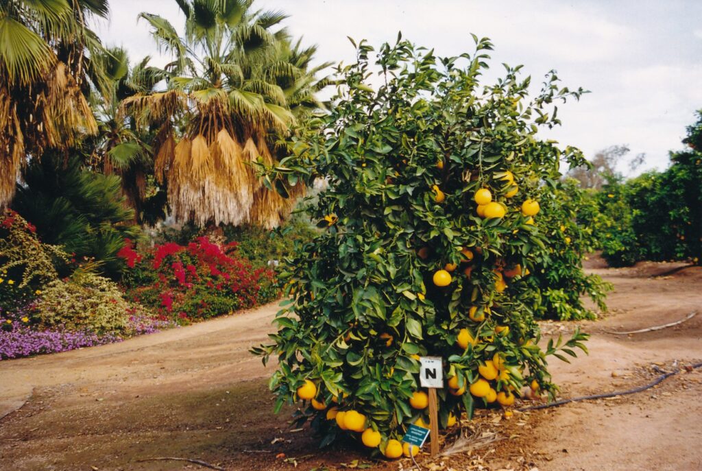
RIVERSIDE — Hollywood is known for its glamorous screen idols , of course. An hour’s drive or so east from Tinseltown, out here in the immodestly named Imperial Valley, the leading lady is sweet, well-rounded and has a thick skin. She is a star with a peel.
That first paragraph is mighty ripe, and so are many oranges, grapefruit and lemons at the California Citrus State Historical Park. In late January, fruit bulged brightly among the dark-green leaves and accumulated under more than 100 varieties of trees.
Much of the fruit still was green, though, and the same can be said for the park itself It was launched in the 1980s and many of its 377 acres are covered with nothing more than dirt and weeds. Ambitious plans call for a museum, workers’ camp and a grower’s home that might also serve as a restaurant. Park literature speculates Citrus State might become a “Colonial Williamsburg (Va.) West” in terms of how the region’s heritage will be shared through volunteer-fueled living-history programs. Annual visitation is hoped to top 425,000.
Be that as it may, today’s park has a half-hour’s worth of gently sloping trails that pass by many rows of citrus trees and a pleasant amount of other landscaping. Noise from bustling Riverside and Van Buren Boulevard is largely filtered out. Parking spots and empty picnic tables abound. A generous grassy area offers recreational possibilities; when I visited, a father and son were flying a kite, while a prostrate mom soaked up some sun nearby.
Through a self-guided tour’s pamphlet and a few signs in an open-air interpretive center, guests can learn as much as they probably care to about Southern California’s citrus success story. The first chapter was written by, of all people and places, a missionary in Brazil. She came across a sweet, largely seedless orange and sent seeds to the U.S. Department of Agriculture, which in turn passed them along to Eliza Tibbets in Riverside.
Soon, Tibbets’ new trees were fruitful and multiplied. The Washington Navel orange, so named because of its “belly button” bottom, caught fire. Orange-hot fire. Groves sprang up all over the region, attracting more people to the state and resulting in agricultural advances. An example of the latter was the 20-mile canal, built by Matthew Gage, that tapped the Santa Ana River and provided lots of cheap irrigation for the new, popular crops. The Gage Canal can be seen from a Citrus State trail.
The south state’s post-World War II population boom, which continues with gusto in commuter counties such as Riverside and neighboring San Bernardino, has resulted in markedly less farmland. Where once were sweet-smelling groves are now subdivisions and strip malls. It is not a heart-wanning story, nor certainly is it a novel one, but Citrus State is the California park system’s fledgling attempt to honor a proud past.
Any future expansion will be partly funded by some ongoing activities, such as the sale of harvested fruit and fees collected for weddings, receptions and other gatherings held at the Sunkist Center and gazebo at the park’s trail head. Donations are accepted, and eventually a fee system may be implemented. Publicly funded bonds also may come into play.
If Citrus State’s future is as bountiful as officials hope, this park will be a savory side dish amid Southern California’s juicy tourist attractions.
California Citrus State Historical Park is open daily from 8 a.m. to 5 p.m.; the combination visitors center and gift shop unlocks its doors from 11 a.m. to 3 p.m. weekends only. To reach the park, take the Van Buren exit off of Highway 91 and proceed southeast to Dufferin Avenue, and turn left. An early 20th century fruit-stand reproduction and jumbo fake orange unmistakably mark the spot to turn off Van Buren. For more information: (909) 780-6222 or www.calparks.ca.gov/DISTRICTS/losla go/ccshp.htm .
To see the state flower in a natural setting, pop down here sometime in the spring.
The Antelope Valley California Poppy Reserve is a hilly homage to a yellow- and orange-blossoming plant whose nicknames include “flame thrower” and “copa de oro,” Spanish for “cup of gold.” West of Lancaster by 15 miles, on the western side of the massive Mojave Desert, the reserve is a peaceful place where eight miles of trails lead to commanding vistas of the high-desert floor and surrounding mountain ranges.
The California poppy, which grows throughout the American West at elevations up to 6,500 feet, was proclaimed the state flower in 1903. (The annual California Poppy Day is April 6.) It blossoms as early as mid-February through mid-May, although winter rains and temperatures need to be just right for the reserve to erupt in its springtime golden glory.
“What ‘just right’ is, is hard to know,” said Judy Elgin, a senior park aide in the Mojave Desert Information Center in Lancaster. “We’ve been trying to figure it out. Last year was a good year, but not the best.
“The spring of 2003 was one of the best we’ve had. We had another great year sometime in the 1990s — ’94 or ’95, maybe. This year looks like it will be pretty good so far, but it is still too early to know for sure.”
When I stopped by the reserve last month, brown grasses dominated the gently rolling landscape. In abnormally warm, mid-60s temperatures under a cloudless sky, I had the place to myself. Not surprisingly, Elgin reports that more than 90 percent of the reserve’s visitors in 2008 came during the three-month bloom season.
“We don’t have to persuade anyone to come visit,” she told me. “Once they see a picture of what it can look like, they are eager to come see for themselves.”
The trails, some of which are paved but are rather steep for wheelchairs and baby strollers, spread out from the parking lot and seasonal interpretive center. The most commanding of three vista points is called Kitanemuk.
From there, perhaps as you catch your breath sitting upon one of three benches. To the north you can see the Tehachapi mountain range and the gigantic wind turbines sprinkled on the hillsides next to Highway 58. To the east are the Los Angeles commuter towns of Lancaster and Palmdale, which really boomed in the 1990s before being hit by the housing market crisis and recession. Beyond them are the San Bernardino and San Gabriel mountains.
Interpretive signs scattered about the site alert you to the possible presence of jackrabbits, coyotes, bobcats, red-tailed hawks, burrowing owls, roadrunners , ladybird beetles, gopher snakes and desert spring lizards.
On many occasions, you also are warned that rattlesnakes live here.
“They are import ant members of the natural community, ” multiple postings say. “They will not attack, but if disturbed or cornered, they will defend themselves.”
In addition to the California poppy, plant sightings could include other native wildflowers such as cream cups, lupine and owl’s clover. Non-native, or ” exotic, ” plants such as periwinkle and yellow star thistle reportedly wreak a little havoc. (Ironically, California poppies are classified as a non-native pest in Tennessee.)
If you visit the Southern California reserve, be sure to treat the flora and fauna with respect.
“The native plants in the area, poppies included, are very fragile and can’t tolerate being walked on by thousands of people, ” Elgin said. “We also have to remind people that it is against the law to pick the poppies in the park or to remove anything — plant, animal, or mineral — from a state park.”
For updates on this season’s poppy prospects, check the reserve’s Web site, accessed via www.parks.ca .gov, or call its poppy hotline at (661) 724-1180.
For another signature California experience that is within a 90-minute drive of the poppy reserve, visit the Desert Tortoise Natural Area, home to the state reptile. Keeping with the Golden State theme, it’s a few miles north of a small town called California City.
IF YOU GO
The Antelope Valley California Poppy Reserve is open year-round. Its Jane S. Pinheiro Interpretive Center has tentative hours of 10 a.m. to 5 p.m. weekdays and 9 a.m. to 6 p.m. weekends, mid February through mid-May.
To reach the reserve from Highway 14, take the Avenue I exit in Lancaster and drive 15 miles to the west. Parking, which costs $5 per vehicle, is abundant.
For more information about the reserve, call (661) 942-0662.
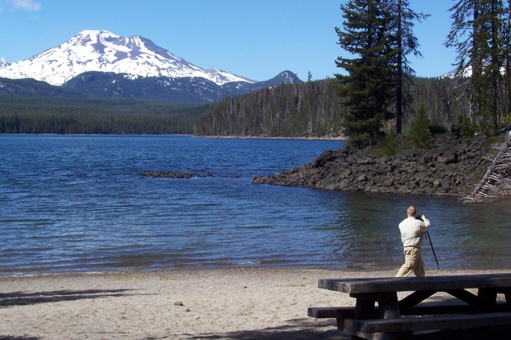
Among our country’s bounty of beautiful roads, Oregon boasts 10 that have been designated as America’s Byways. Only Colorado has as many, and there are 126 nationwide.
Cascade Lakes National Scenic Byway, in Deschutes National Forest southwest of Bend, is one of the most spectacular drives in Oregon. Like the equally awesome route around Crater Lake, l 00 miles or so to the south, Cascade Lakes is fully open only during summer months. Mid-July through mid-September is prime time, when all hiking trails tend to be snow-free (or reasonably close to it) and temperatures are warm enough to allow swimming (or at least encourage sunbathing).
The 87-mile Cascade Lakes byway begins in Bend, a central-state town of about 50,000 people that for a century has prospered from the lumber trade. Trees aplenty, including ponderosa and lodgepole pines, carpet the Cascade Range that looms to the west and through which the byway meanders. Finding its starting point can be difficult, with Bend’s many traffic roundabouts and curvy one-way streets creating confusion, but once you are on Southwest Century Drive (Highway 46) and pass Widgi Creek Golf Club, you can relax and start enjoying the scenery.
Keep your eyes peeled for a turnout, on the left about 10 miles past Bend, that has free pamphlets describing 34 points of interest that are along the byway and on two roads that branch off Highway 46 and head back east toward Highway 97 (a major north-south road through Oregon). Beyond the Swampy Lakes trailhead, where hiking paths venture two to 10 miles into the wilderness, you will encounter the ski area at Mount Bachelor.
From July Fourth through Labor Day, ride one of the resort’s nine ski lifts to the 9,000-foot summit for far-reaching views of the surrounding mountains and bodies of water.
Keep your camera close at hand because a few miles beyond Mount Bachelor is Sparks Lake, a picture-taker’s delight. Ray Atkeson, Oregon’s only photographer laureate who died in 1990 at age 83, proclaimed it his favorite lake view. Sparks is a strikingly visual example of a lake that slowly is turning into a marsh, meadow or forest: Reeds emerge liberally throughout its vast surface, and its maximum depth is just 8 feet.
Nearby, Devil’s Garden has an otherworldly claim to fame. Its lava surface was used for NASA training in the mid-1960s, and astronaut James Irwin of Apollo 15 actually took a rock from Devil’s Hill and left it on the moon as a tribute to that training. The aqua-green Devil’s Lake is another shallow one, measuring 9 feet at its deepest point.
If you like to picnic, consider stopping at Elk Lake, where a grocery store that’s open most of the year (exceptions occur between seasons) can augment your supplies. Mount Bachelor provides a beautiful backdrop to the lake’s blue expanse and to the boats docked near the parking lot. Lava Lake is another good picnic spot; when I visited in mid-June, one of the campers there had cables running out to a satellite-TV dish that was propped on a tripod. Ah, wilderness.
Little Lava Lake boasts a beach and several picnic tables. A photographer who I had encountered throughout the day’s drive was intently shooting the scene. And although there are several other attractions down the road that are listed on the pamphlet, this lake was the end of the byway’s intensely rewarding scenery, as far as I was concerned. Well, perhaps that’s a hasty judgment. After all, on down the road a bit is South Twin Lake, where President Hoover stayed in a cabin during a fishing trip in 1940. Hardly has the same exciting ring as “George Washington slept here,” does it?
In addition to the lakes, hikes and picnic possibilities it showcases, Cascade Lakes National Scenic Byway can lead you to many satisfying bird-watching spots, I was told. Clark’s nutcracker and the golden-mantled ground squirrel are animals that the free pamphlet touts as native inhabitants.
For more information about this and other America’s Byways, visit www.byways.org.
Sidebar:
In the 1990s, Cascade Lakes Highway was designated by the U.S. Department of Transportation as one of one of America’s Byways, which include National Scenic Byways and All-American Roads. Nine other routes in Oregon also have attained that status.
- Hells Canyon Scenic Byway, a horseshoe-shaped drive in extreme northeast Oregon that ventures through North America’s deepest canyon.
- Historic Columbia River Highway, a comparatively short (50 miles) journey in the northwest that passes by several waterfalls and the lush Oneonta Gorge.
- McKenzie Pass-Santiam Pass Scenic Byway, a circular route northwest of Bend whose stunning vistas include many snowcapped volcanoes.
- Mount Hood Scenic Byway, which skirts around the mountain as it passes through Mount Hood National Forest in north-central Oregon.
- Outback Scenic Byway, where the forest meets the desert, just north of California in south-central Oregon.
- Pacific Coast Byway, Highway 10l’s complete trek up through ocean-side Oregon, from Brookings to Astoria.
- Rogue-Umpqua Scenic Byway, on the “highway of waterfalls” west of Crater Lake in the state’s south-central region.
- Volcanic Legacy Scenic Byway, which straddles the California border and encompasses Crater Lake to the north and Lassen Volcanic National Park in the south.
- West Cascades Scenic Byway, the best way to travel between Portland and Eugene if you have enough leisure time to check out waterfalls, lakes and forests.
(Source: www.byways.org)
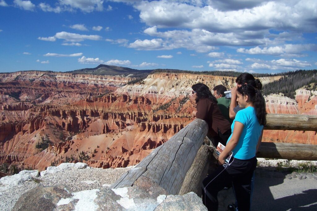
CEDAR CITY, Utah — Sometimes, the low-profile, quiet beauties get overlooked.
Southwest Utah offers you a chance to give one her due.
Although less well-known than nearby Zion, Bryce Canyon and Grand Canyon national parks, Cedar Breaks National Monument provides one of the most breathtaking visual experiences in the American West, if not the world. Its three-mile-wide, 2,500- foot-deep amphitheater is a moving, colorful work of nature that immediately pleases without requiring much of your time or energy.
Twenty-one miles east of Cedar City off Highway 14, on the way to Bryce Canyon, Cedar Breaks can be visited and fully enjoyed in a half-day. A mile past the monument’s south entrance, park your vehicle at the visitors center lot and walk about 100 yards to the Point Supreme lookout.
Once you have caught your breath, imagine how the scene before you once instead was a massive lake, 250 miles long by 75 miles wide. Over millions of years, the water receded and volcanic activity pushed up the massive mounds of rocks that since have eroded to their present form. The Southern Paiute, who starting as many as 9,000 years ago lived on the Markagunt Plateau overlooking the amphitheater, referred to Cedar Breaks as “the place where the rocks are sliding down all the time.”
The Indians are not responsible for misnaming the place — that honor goes to white settlers who, looking down over the cliff, thought the trees they saw below were cedars when in fact they are mostly junipers. “Breaks” is another word for badlands, or an especially eroded and forbidding landscape.
When I visited on a mostly sunny Saturday in mid-August, Cedar Breaks was celebrating its birthday (President Franklin Delano Roosevelt designated the monument in 1933) and the $4-per-person entry fee was waived. Buoyed by that good fortune, I drove four miles up Highway 143 to the northernmost of the five lookouts, North View. There, a woman with a camera was at the railing watching her male mate venture out onto the rocks down below. Apparently, he was pursuing a dramatic pose.
” Stay there! Stop! You’re killing me!” She yelled, then looked over at me and said, “How you doing? … He’s killing me!” Out on an extreme edge the man imitated Kate Winslet on the bow of the Titanic, extending his arms as if he were floating through the air. (How many times have you seen that particular attempt at humor in the past nine years, fellow travelers?)
He made it back without harm, and after the couple left, I made the seriously stupid mistake of retracing his steps out to the precipice. Do not follow my example; anyone who slips and tumbles down into the amphitheater would have no more chance of surviving than Leonardo DiCaprio’s character did when he sank into the Atlantic Ocean.
Besides, Cedar Breaks has two outstanding hikes that should satisfy any prudent person’s compulsion to wander. Back at the visitors center, the Ramparts trail leads to the amphitheater’s edge up and down to Spectra Point, the monument’s southernmost lookout. As I approached its rail, I spotted a mammal I could not identify- about the size of a fat cat, with a white bit of fur on his nose and a tail that was a different shade of brown than the rest of his body — that was resting on the exposed root of a bristlecone pine. Such trees, by the way, have been known to live 4,000 years.
Alpine Pond Trail lacks unobstructed views of the amphitheater but is a good romp through the forest. Buy a $1 guide at either the visitors center or trailhead and read descriptions of 25 stops (marked by wooden posts) along the two-mile loop that passes by a pond. Standing by that small but picturesque body of water, if you’re not careful, mosquitoes will have you for lunch. Among other things, the pamphlet informs you:
- Bristlecone pinecones are found only in the Great Basin and Rocky Mountains.
- Subalpine firs have flat and flexible needles Engelmann spruces’ needles are sharp and square.
- Pocket gophers spend most of their lives underground and carry “‘snacks” in fur lined cheek pouches.
Golden-mantled ground squirrels, Uinta chipmunks (I believe I got a glimpse of one), yellow-bellied marmots and, though rarely seen, mountain lions also inhabit the area. Birdwatchers might spot Clark’s nutcrackers, mountain bluebirds and broad-tailed hummingbirds, among others.
The sounds of chirping birds and wind-nudged branches, a profusion of wildflowers (especially in the early part of summer), Cedar Breaks’ stunning scenery and the cool air of 10,000 feet above sea level add up to quite a rich experience for visitors. Someone had an inspired idea when she or he posted this verse, from Lord Byron’s “Manfred: A Dramatic Poem,” at one of the monument’s information kiosks:
There is a pleasure in the great woods
There is a rapture in the lonely shore
There is society where none intrudes
I love not man the less, but nature more.
Cedar Breaks National Monument is open year-round, though due to snow accumulation its main road is closed from mid-October through May — cross-country skiing and snowmobiling are popular activities during those colder months. The visitors center is open from 8 a.m. to 6 p.m. daily from Memorial Day through Columbus Day; at 10 a.m. Saturdays and Sundays, rangers lead two-mile, “”moderately strenuous” hikes to a cluster of bristlecone pine trees. For more information about the monument, call (435) 586-9451 or visit www.nps.gov/cebr.
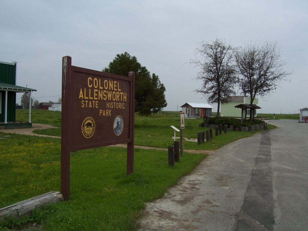
Driving to Los Angeles can be a tedious experience, as many of us know from the countless hours we’ve spent on California’ s equivalent of the German autobahn: Interstate 5. For those who obey the speed limit, cars careen by on the left faster than birthdays blow by an octogenarian.
We all grow old motoring on I-5. Unfortunately, the scenery is not magnificent enough to warrant repeat viewings. After a trip or two, the only thing less interesting than what you see out the window is what you’ll see out the window in another five minutes.
Aside from flying, taking the train or bus, or bicycling down back roads, do you have an alternative?
Well, there’s Highway 99, which parallels Interstate 5 for about 300 miles, to just past Bakersfield. It’ s an alternative. Not a great alternative in the sense that going for a walk in the park is a great alternative to having a root canal, but it’ s an option with some potential benefits. If time allows and you have a relatively relaxed standard of being entertained, you might consider trying it sometime.
South of Stockton, Highway 99 goes through or passes nearby all the major cities and towns of California’s Central Valley. Modesto, Merced, Fresno, Visalia, Hanford and Bakersfield all welcome tourists, albeit without excessive fanfare. Following are a few suggestions about each place and a few words about a genuinely worthy side trip, all researched on a trip through the Central Valley that I made earlier this spring.
Modesto
What to see: The McHenry Mansion, an 1883 Victorian, has been renovated carefully. Its furnishings and exquisitely wallpapered walls are worth a gander, especially considering admission is free. Hours are limited, though: 12:30 to 4 p.m. Sundays through Thursdays. Also, check out McHenry Museum of Arts, also free, a block away (mansion at 15th and I streets, museum at 14th and I; mansion 209-577-5341, museum 209-577-5366; www.mchenrymuseum.org).
Where to eat: Tresetti’s World Cafe stresses seasonal cooking and, year-round, is known for its Cajun-style crab cakes. The downtown restaurant also has a huge wine-shop (927 11th St.; 209-572-2990) . For a drink beforehand, try St. Stan’s microbrewery (821 L St.; dinner entrees $15 to $26; 209-524-2337).
Where to stay: Best Western Town House Lodge is only a block or two from the McHenry attractions, and has rooms – all with refrigerators, microwaves and high-speed Internet — from $69 to $79 for two per night (909 16th St.; 209-524-7261).
Merced
What to see: The Merced County Courthouse Museum is worth seeing, even if you don’t go inside. I’m told the white, three-story building is in the Victorian Italianate style. A surrounding park offers picnic and shade possibilities. {Museum open 1 to 4 p.m. Wednesdays through Sundays; 21st and N streets; free; 209-723-2401.)
Where to eat: DeAngelo’s receives very high marks from guidebooks, though I didn’ t eat there. Entrees run from $15 to $30; a pizza oven and bistro also are within the confines (350 W. Main St.; 209-383-3020).
Where to stay: Hooper House Bear Creek Inn, a mile east of downtown, is a five-room (one a suite, another a cottage) bed-and-breakfast that has admirably landscaped grounds and is across the street from a bicycle and pedestrian trail along the creek (575 W. N. Bear Creek Drive; $95 to $135 for two per night; 209-723-3991; www.hooperhouse.com).
Fresno
What to see: Sprawling Roed1ng Park, just northwest of downtown, has a zoo ($7 general) and small amusement park (pay-per-ride) that make it a popular hangout for 1oca1s. The Fresno Metropolitan Museum (1515 Van Ness Ave.; $8 general; 559-441- 1444; www.fresnomet.org), Fresno Art Museum (2233 N. First St.; $4 general; 559-441- 4221; www.fresnoartmusewn.org) and Meux Home Museum (Tulare and R streets; ,$5 general; 559-233-8007; www.meux.mus.ca.us) deserve an hour’s visit apiece; call for times.
Where to eat and where to stay: Lots of choices, no strong recommendations (based more on ignorance than on experience). Consider Irene’s (747 E. Olive Ave.; entrees $10-$13; 559-237-9919) for breakfast or lunch, and convenient-to-downtown La Quinta Inn (2926 Tulare St.; $75-$90 for two per night; 559-442-1110) for lodging.
Visalia and Hanford
What to see: These towns, 20 miles apart on either side of Highway 99, offer little for tourists other than pleasant downtowns to explore via foot. The courthouse square in Hanford is nice, with an art-deco auditorium its visual standout.
Where to eat: Henry Salazar’s (123 W. Main St.; entrees $4-$13; 559-741-7060) in Visalia and La Fiesta (106 N. Green St.; entrees $3-$12; 559-583-8775) in Hanford serve Mexican food that draws raves.
Where to stay: I liked the looks of the Irwin Street Inn (522 N. Irwin St.; $89-$165 for two per night; 559-583-8000; www.irwinstreetinn.com) in Hanford. Its 24 rooms and three suites are scattered among four Victorians, all painted a rich blue.
Bakersfield
What to see: The Kem County Museum, a few miles north of downtown, is a walk-through village of more than 50 buildings that reflect Bakersfield’s ambience between the Civil and Second World wars (10 a.m. to 5 p.m. Mondays through Saturdays, noon to 5 p.m. Sundays; 3801 Chester Ave.; $8 general; 661-852-5000; www.kcmuseum.org).
Where to eat: Country music’s influence here is profound, so you might as well check out Buck Owens’ Crystal Palace, which serves up drinks, grub, music and memorabilia (2800 Buck Owens Blvd.; entrees $17-$32; 661-328-7560; www.buckowens.com).
Where to stay: Four Points by Sheraton can be rather costly ($89 to $189 for two per night), but it’s far enough (a few miles west) from Bakersfield’s grim downtown to ensure a higher comfort level (5101 California Ave.; 661-325-9700; www.fourpoints.com).
A genuinely worthy side trip
Colonel Allensworth State Historic Park, between Hanford and Bakersfield off Highway 43 (which runs north-south between Highway 99 and Interstate 5), is a pleasant place to go for a walk and have a picnic. The isolated park’s collection of restored and re-created buildings is on the site of the state’s first settlement founded and run solely by African Americans. Named after a former slave who was a longtime Army chaplain, Allensworth thrived for a few years after its founding in 1909, but by the 1970s was dead.
A self-guided walking tour leads visitors past buildings and historic signs. One of the latter has this touching testimonial from a former resident, Grace Hackett:
“It is 23 years since I have been in Allensworth, but my recollections are sharp and clear. The graves of my parents are there, ten years of my life are there. Some part of what I am is inevitably Allensworth. Yes, I remember Allensworth. God willing, I’ll return one day to witness what the years have done with the colonel’s dream.”
OAKLAND – Climactic considerations aside, Venus might be a decent place on which to live. The gassy planet takes some 5,832 hours to spin on its axis, which means you potentially could get a lot done each day. Also, your body there would weigh 10 percent less.
Darn those pesky poisonous fumes.
Learn more, plenty more if you care to, about our solar system and beyond at the year-old Chabot Space & Science Center in Oakland’s sprawling Joaquin Miller Park. At Chabot, where curious people of all ages are likely to find things of interest, there is honor in being a space cadet.
One of the most important facts to attain here, or to be reminded of, is that the sky above us has some serious size to it. Our solar system, with its sun and nine planets (let’s still count the mildly disputed Pluto, shall we?), is joined by some 400 billion other stars in the Milky Way Galaxy. To date, Earth’s scientists have found no conclusive evidence that life exists on any planets around those stars, but what are the chances that it does?
To address that question, Chabot turns to an “expert” on the subject: Spock from the original “Star Trek” series.
Leonard Nimoy, who played the brainy, brawny buddy of Captain Kirk on the 1960s TV show, narrates “Other Worlds! Other Beings?” in the center’s Ask Jeeves Planetarium. According to the multi-visual presentation and its “Vulcan” voiceover, 25 million of the Milky Way’s stars have characteristics similar enough to our sun’s that they may support intelligent life within their solar systems.
The numbers game continues beyond our galaxy, of course. We’re talking really, really big numbers, larger than the tally of Mickey Rooney’s ex-wives or even PBS’ pledge drives.
One Chabot display is of a blown-up photograph taken from the world’s best-known flying mirror, the Hubble. The image, representing a portion of space that from our perspective is one-30th of our moon’s diameter, contains hundreds if not thousands of small, shiny objects, most of them representing galaxies. As a continually screened, three-dimensional film nearby explains, the universe is composed of hundreds of billions of galaxies.
“This is where we come from, this is where we live,” the film’s narrator says dreamily as the computer-generated image pans farther and farther from Earth into deep space. “We are all children of the universe. Welcome home. Welcome home.”
At which point, on a weekday afternoon in October, a young man turned to his girlfriend and said, “I’m scared. It’s too big.”
Indeed, one’s mind can feel overwhelmed by such heavy concepts. And speaking of weight, among Chabot’s most entertaining and quirky exhibits are the “solar system scales” scattered about the museum. For no extra charge, stand on one, push a button or two and you will be told how much you would weigh on each of our solar system’s other planets.
This “large-boned” reporter, for example, would weigh a tidy 169.6 pounds on Venus, but a Krispy Kreme-like 474.4 pounds on Jupiter. That made sense to me, the logic being that on smaller planets, gravity would be less and so would my weight. Why, then, did the scale claim that I would weigh some 33 pounds heavier on Neptune than on Uranus, even though the latter planet is slightly larger?
Spock would know, for sure.
One of the scales is upstairs in the Dellums Building, which represents the outer wing of Chabot and the place where interactive exhibits can be found. By turning cranks or pushing buttons, visitors – mostly children, presumably, as many school field trips stop here – can create miniature dust devils, lightning, erosion and other atmospheric and geological phenomena. The nearby Gravity Well, where coins (i.e. donations) can be rolled into a “black hole,” is entertaining.
The center’s main building, Spees, has among its second-floor exhibits a collection of documents, photographs and maps that describe how the original Chabot Observatory consisted of an 8-inch retractor telescope erected downtown in 1883. A 20-inch retractor telescope was built a few decades later in Oakland’s Leona Heights district. Also discussed are California’s other well-known observatory sites: Lick, which is near San Jose, and Mounts Palomar and Wilson in the south state.
Hanging over the Spees Building’s rotunda is a model of the International Space Station, a beleaguered project that if completed would be 359 feet long, weigh 500 tons, make 16 daily orbits of Earth at 17,500 miles per hour, and have a full-time crew of seven. Sixteen nations, including the United States and Canada, are participating – with a sometimes-debilitating lack of coordination – in the far-out venture.
The planetarium has shows other than “Other Worlds?” that are presented throughout the day. Tien MegaDome Theater, also in the Spees Building, screens IMAX films. In October, those included “Mysteries of Egypt” and “To Be an Astronaut.” Admission to each auditorium is $8.75 general, less for children, seniors and groups.
The Chabot Space & Science Center’s hours are from 10 a.m. to 5 p.m. Tuesdays through Sundays, with planetarium and theater shows Friday and Saturday evenings, when the Observatory Complex also is open. Chabot admission is $8 general and $5.50 for those between 4 and 12 or over 64 years old. Discount tickets that include planetarium and theater shows are available at the front counter.
Directions: Exit from Interstate 580 on Warren Freeway/Highway 13, and from there exit at Joaquin Miller/Lincoln Avenue. Go up the hill to Skyline Boulevard and turn left. Chabot is another mile or so farther, on the right.
For more information: (510) 336-7300 or www.chabotspace.org.
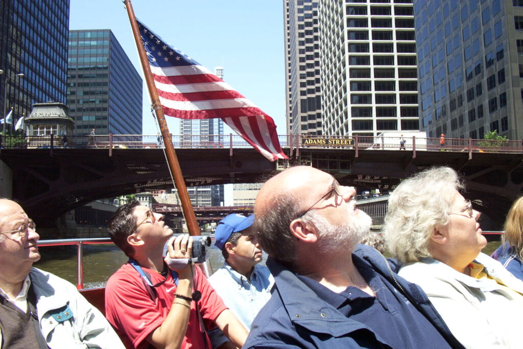
CHICAGO – One of the minor frustrations of being a working-age adult who likes to travel is that there is rarely enough time to fully explore interesting places. This sprawling Midwestern city, whose many nicknames include “Paris on the Prairie,” is a very interesting, in many ways cosmopolitan place. Recently, my wife and I had four days to explore it.
We each had been to Chicago before, but not lately and never together. Despite a few family obligations that claimed part of our already short stay, we were determined to see what we could and calmed our anxieties by promising ourselves a return visit. On our agenda: an architecture river cruise, the Magnificent Mile, a walking tour, a Cubs game and as many vegetarian meals as we could find. We set about our touristy tasks on a cool but sunny midweek morning in early June.
We got off to a rocky start when our boat ride of choice, one offered through the Chicago Architecture Foundation (which offers a broad range of tours and programs; www.architecture.org), was sold out. We scrambled back across the Michigan Avenue Bridge and, beneath the Wrigley Building, discovered space was available on a 90-minute Wendella Boats tour (312-337-1446; www.wendellaboats.com). We paid $18 apiece and boarded.
What followed was agreeable, though neither one of us cared for the too-chipper tour narrator, Rob. We would have preferred a little more architecture and a little less Robin Williams-like hyper comedy. He did manage, however, to calm down often enough to pass along some Chicago tidbits I had not known: The city’s name stems from its smell, and is the Potawatomi Indian word for “wild onion”; “the Windy City” refers to Chicago’s windbag politicians, not its breezes; and the Chicago River is indeed turned green on St. Patrick’s Day, though such a thing is accomplished with orange dye.
The gray, soiled river, with its mist of steam and smoke, was the only beauty. And that smelled to heaven.
— Frank Lloyd Wright, describing the Chicago of 1887
Among the buildings we boated by as we approached the downtown Loop area were what Rob called the “corncob towers,” formally known as the twin towers of Marina City. Architect Bertrand Goldberg’s 1965 creation on North Street consists of two 60-story apartment buildings, each containing 450 units and 21-story parking garages.
Our open-air watercraft turned around next to the 110-story Sears tower, completed in the early 1970s and from whose observation deck one can see up to four states (Illinois, Indiana, Michigan and Wisconsin). On our way out to Lake Michigan, we re-passed what our narrator identified as the second-largest office building in the world and also went by baseball slugger Sammy Sosa’s skyscraper apartment building.
From the lake we were treated to a skyline vista that rivals what one can see of Manhattan from the New Jersey side of the Hudson River. Skyscrapers are abundant in Chicago, with the Sears Tower and John Hancock Center the two most distinctively tall. The latter, completed in 1970, is said to be the world’s tallest apartment building and has a 95th-floor bar, reachable via a free elevator ride, that is an alternative to the Hancock Observatory (312-751-3681; www.hancockobservatory.com).
Michigan Bridge is on the southern end of the Magnificent Mile, a shopper’s gantlet that lines Michigan Avenue from the stately old Drake Hotel on down. Käri pointed out how clean everything seemed, not just along this fashionable street, but in downtown Chicago in general. Having been born in central Illinois and made several trips to the city as a boy, my memories were of a dirtier place. Maybe our favorable impressions were due partly to good late-spring weather. A wintertime snow’s slushy aftermath cannot be too sparkling.
It rained and fogged in Chicago and muddy-flowing people oozed thick in the canyon-beds of the streets. Yet it seemed to me more alive and more real than New York.
— D.H. Lawrence, in a letter to a friend in 1923
The next day we followed up on a friend’s tip and sampled the Chicago Greeter program (312-744-8000; www.chicagogreeter.com), an extraordinary endeavor of volunteerism overseen by the city’s office of tourism. By signing up at least seven business days in advance, travel parties of up to six people are escorted by a “greeter” on a free walking tour of the tourists’ choice. Options include some 25 neighborhoods, from Andersonville to the West Loop, and more than 40 special-interest tours, from African American heritage to the zoo. Käri and I opted for an architecture tour, with a sub-theme of ethnic Chicago.
Our guide was Ed Kramer, a retired jeweler in his mid-70s whose enthusiasm for the city first charmed but ultimately overwhelmed us. We spent more than four hours with Kramer, first strolling about and within some of the Loop’s noteworthy buildings, then light-railing it out to his childhood neighborhood of Wicker Park. We could have done without that supplemental excursion, presumably done to satisfy our “ethnic Chicago” request but during which our guide talked too much about himself and his personal history, for our tastes. Käri and I were itching to see such downtown attractions as the blossoming Millennium Park on the waterfront, but after our Chicago Greeter trek, we were too exhausted to do so.
Our mistake was not establishing time parameters before we set out. “Ed, we have just two hours available today. What would you like to show us?” might have done the trick. Or we could have pulled the plug at some point during the tour, which my wife eventually managed to do. The blame was partly ours, we admit, but our guide was culpable, too.
Nevertheless, Kramer touched on a number of interesting topics. While standing in what used to be the main downtown library, he said that following the great fire of 1871, Queen Victoria and the British government gave Chicago a boatload of books that created the world’s largest circulating library. That fire also spurred revolutionary thinking in terms of construction, with wood replaced by concrete and steel, making Chicago a leader in the development of modern skyscrapers. Meantime, before 1871 and for many years afterward, the town had been characterized by its agricultural trade, especially its mass production of meat products.
Chicago was a town where nobody could ever forget how the money was made. It was picked up from floors still slippery with blood, and if one did not protest and take a vow of vegetables, one knew at least that life was hard, life was in the flesh and in the massacre of the flesh – one breathed the last agonies of beasts.
— Norman Mailer, “Miami and the Siege of Chicago,” 1968
Kramer verified what we already had noticed touring about town: Chicago’s real-estate developers are on a rampage with one particular type of housing. “We have a problem here in Chicago,” he said. “It’s called condomania. We build condominiums out of anything.” Indeed, at least a dozen times during our tour he pointed out old buildings of varied origin – including a church – that are being converted.
We saw several impressive structures that likely will never be condos, including the 38-floor Pittsfield Building (completed in 1927, at 55 E. Washington St.), in which Kramer worked for 30 years. “This is a beautiful art deco building,” he told us, one of the more beautiful symbols of the city.” Design students from all over the world, he said, visit to make rubbings off the intricate brass detailings outside and within the downtown building’s ground floor. The glass- and steel-dominated James R. Thompson Center (at Clark and Randolph streets), finished in 1985, impressed on a more modern level. Its 17-story interior atrium must be seen to be believed.
As we approached the Thompson Center, which contains state government offices, Kramer displayed some quick wit after the three of us had been addressed by a complimentary street vendor (to Kramer: “My, look at the gentleman in the nice hat with a feather in it!”). Our dapper guide kept us moving, mumbling to the two of us: “Be careful who you bump into. It could be a politician.” Earlier, Kramer had shared the old line, “Chicago has the best politicians money can buy. And it usually does.”
Chicago is as full of crooks as a saw with teeth.
— John Gunther, “Inside U.S.A.,” 1947
Speaking of feeling cheated, I am a lifelong fan of the Chicago Cubs baseball team (www.chicagocubs.com). The “lovable losers” have not won a World Series since the Roosevelt administration – Teddy’s, not Franklin’s – and yet have a huge nationwide following, thanks in no small part to (a) Chicagoans migrating en masse to nicer climates and keeping tabs on their hometown heroes, (b) Harry Caray and his wildly entertaining broadcasts of Cubs games on cable’s WGN in the 1980s and ’90s, and (c) north-side Chicago’s Wrigley Field, with which Fenway Park represent baseball’s vintage architectural jewels.
We stayed with a relative who lives less than 10 blocks from Wrigley in a neighborhood known as Wrigleyville, a mix of brownstones and small businesses. The ballpark – whose main entrance, as Cubby nuts know, is at the corner of Clark and Addison streets and out of which home runs often land on Waveland (left field) or Sheffield (right field) avenues – is rich with character, such as having a huge, hand-operated scoreboard in center field and vines that cover up the bricked outfield walls.
This season, thanks to high expectations (“Hell Freezes Over: The Cubs Will Win the World Series,” Sports Illustrated stated on its baseball-issue cover this year), tickets are difficult to obtain. The best we could do were view-obscured seats (fly balls and pop-ups were blocked by the second-deck overhang) on a Wednesday afternoon. Worse yet, Houston and Roger Clemens defeated the Sosa-less Cubbies, 5-1. (The slugging superstar missed a month of games because, adding to the team’s loser lore, he injured his back while sneezing.)
The scene around Wrigley before, during and after games is memorably festive, definitely worth checking out if you’re in the area. We drove or walked by Wrigley on four game days, and soaked in the atmosphere of souvenir stands, beer-swilling but good-natured (even during losses) fans spilling out of bars such as Murphy’s, ticket scalpers buying and selling even as late as the third inning, and sassy exchanges between motorists and traffic cops.
Every team is entitled to a bad century.
— Jack Brickhouse, longtime Cubs radio broadcaster
By accident, our staying near “the friendly confines” (as Wrigley Field is known) was a gustatory blessing for my wife and I, both vegans. One of the metropolitan area’s premier vegetarian restaurants, the Chicago Diner, is six blocks from the ballpark at 3411 N. Halsted St. Among our favorites there were the sloppy-joes sandwich with tempeh, tofu Thai rice and the weekend-brunch pancakes and french toast. The edgier Pick Me Up Café, three blocks south of Wrigley Field at 3408 N. Clark St., had wonderful vegan carrot cake in addition to mostly nonvegan fare. Vegetarians also might enjoy a trip to the northern suburb of Evanston, where the Blind Faith Café (525 Dempster St.) serves excellent entries and desserts for modest prices.
Käri and I were disappointed that we could not check out a few of the city’s wonderful museums, including as the Art Institute of Chicago (111 S. Michigan Ave.), and suburban attractions, such as architect Frank Lloyd Wright’s creations in the Oak Park neighborhood. We also missed out on Chicago’s many night-life offerings, such as its classical concerts and jazz and blues clubs. Two weeks after I had returned to Sacramento, I was reminded – by a Cubs broadcast, of all things – that during our next visit we also must make plans to sample the city’s live theaters.
William L. Petersen, star of the hit CBS series “CSI: Crime Scene Investigation,” had thrown out the ceremonial first pitch and sung “Take Me Out to the Ballgame” during the seventh-inning stretch, a Wrigley Field tradition. During the bottom of the seventh inning, he was asked on-air by WGN baseball analyst Steve Stone, “What was your first acting gig full-time?”
“Well, it was here in Chicago,” Petersen replied. “We started, in fact, my theater company right across the street in the old Gingerman Bar. It was our main theater’s first space in 1979. We had our theater company together for about 15 years.
“And, you know, it was really the city of Chicago that gave me the career. You know, a lot of people think that you go to New York, you go to L.A., and that’s how you break into the business. But the theater scene here in Chicago is so phenomenal, and the audiences that came out to see us in little, tiny storefronts all over the north side, you know, really built careers for me and 50 of my friends.
“The theater in Chicago, for me, will always be my first love. And as soon as I get done with the TV show, I’ll be back here to do that. I just don’t have enough time right now to be able to really focus on that.”
We hear you, brother Bill. Chicago is our kind of town, too.
For thousands of more quotations about places throughout the world, see “The Travellers’ Dictionary of Quotation: Who Said What, About Where?” Routledge & Kegan Paul, 1983).
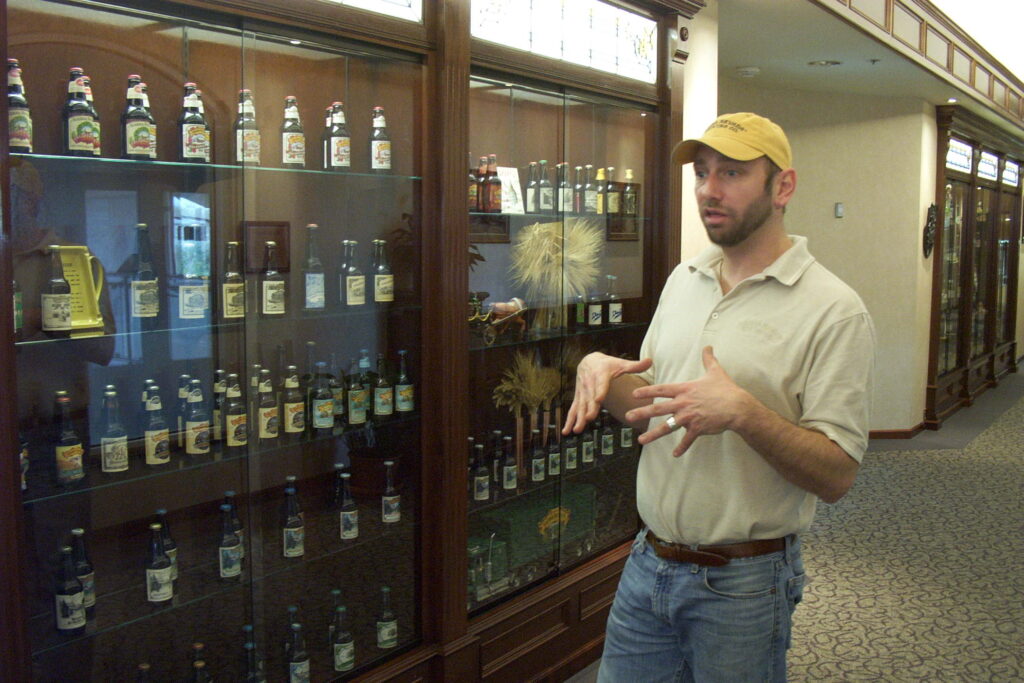
CHICO – On a sunny Saturday afternoon in late February, 14 glasses of beer were placed before the two of us. Less than an hour later, we paid our bar bill and drove off to explore the rest of town.
Perhaps I’d better back up a bit.
On a sunny Saturday morning in late February, my wife and I decided to spend a day in Chico, something we had been wanting to do for months. The drive up Highway 70 through Marysville, past Oroville then over to Highway 99 and up, took about an hour and a half. To our left were stunning views of the Sutter Buttes. Closer by were several fields of white-blossoming almond trees; anyone making the drive in March or April can expect to see flowering peach and plum trees.
Our idea was to tour Bidwell Mansion, scope out Bidwell Park and the university’s campus, stroll along a few downtown streets, check out the National Yo-Yo Museum and tour the Sierra Nevada Brewing Co. Dinner would be at some unspecified funky vegetarian hangout, which as a college town Chico was likely to have.
As it happened, we had little choice but to make Sierra Nevada our first stop. I don’t mean to say that a free brewery tour was my top priority. Rather, I will take the high road and merely imply it. Saturday tours are offered only from noon to 3 p.m., and as we pulled into town about 11:45 a.m. with a long list of things to do and only six hours of daylight remaining, the decision on where to start was an easy one. At least I thought so.
Jeff Howse, a 13-year brewery employee, was our tour guide. He met us in the sparkling-clean facility’s lobby, just outside the gift shop, and spent the next hour telling a Redding couple and us about how Sierra Nevada makes its popular craft brews. (The word “microbrew,” which is passé among those in the know, cannot really be used in reference to the country’s ninth-largest beer-maker.) He was friendly, enthusiastic and without question knowledgeable about beer; among his other duties is to serve on the company’s tasting committee, which oversees product consistency and such. Most of us have friends who would kill for that kind of job.
Howse began by saying Sierra Nevada was founded by two home-brew enthusiasts, Ken Grossman and Paul Camusi, in 1979. Once financing and equipment were obtained, they rolled out their first barrel – a stout variety – in 1981. About 500 barrels were produced that year.
Sales began to skyrocket, which our guide said was substantially due to the beer’s popularity among fans of the Grateful Dead. “Jerry Garcia’s favorite beer was our porter,” Howse said. “Deadheads from all over would come to Chico and load up their vans with Sierra Nevada.”
By the late 1980s production had exceeded 15,000 barrels annually, and operations moved to their current site on East 20th Street. By 1993, annual output topped 100,000 barrels, prompting a major expansion effort from 1997-1999. Meanwhile, Camusi retired and Grossman, by buying out his partner, became the sole owner of what is now the country’s largest privately owned brewery. This year, Sierra Nevada is expected to produce some 700,000 barrels of beer.
Ninety percent of that liquid gold will be of the pale ale variety. It and the company’s other beers are made with barley malt, hops, water and yeast. A few varieties also employ wheat. “We’re a very hoppy beer,” Howse said. “We have about five times the amount of hops as is the industry standard.”
He escorted us past a hydrating malt mill and a display of Sierra Nevada’s bottle-design history to a brew house whose walls are decorated with murals by Eric Grohe, whose “hop addition” panel shows a worker modeled after Grossman himself. Two enormous brew kettles inside the brew house have a shiny copper skin that matches, as we soon discovered, the bar top in the facility’s restaurant. The tour ended beside windows that overlook the bottling operations. Most Sierra Nevada beer, we learned, attains its carbonization through “bottle conditioning,” which takes a dozen days.
“The fresher the beer, the better,” and any beer older than eight months is past its prime, Howse said. While Sierra Nevada’s cases (which as most experienced beer drinkers know means 24 bottles) are stamped with production dates, six-packs are not.
In parting, the genial Howse suggested we try a “sampler” at the complex’s restaurant. That is how, for $8, we were presented with 14 glasses of different Sierra Nevada beers. They ranged in color from pale crystal wheat to dark stout and in quality from good to excellent, though frankly, after taste-testing 13 beers, the 14th was bound to be excellent.
OK, now we’re back to where I began. Let me point out the glasses were small, holding only a few ounces apiece. We nibbled through a basketful of so-so Cajun fries while we sipped the brews. Getting tipsy would have required a much-greater effort, if effort’s the word, than what we did. Although I will not say that my wife – who drank much less of the sampler than I did – drove from there the mile or so to the Bidwell Mansion, I will imply it.
Chico founder John Bidwell (1819-1900), who became wealthy through Gold Rush good fortune and Mexican land grants, was a two-time California gubernatorial candidate and one-time presidential aspirant. (Each bid was under a different political party, never Republican or Democrat, though his roots were in the latter.) Bidwell’s Rancho Arroyo Chico at one time covered 22,000 acres. The three-story mansion, which publicity pamphlets describe as Italian villa or country estate, was completed in 1868.
After widow Annie Bidwell’s death in 1918, the mansion was owned for five years by a church, which then sold it to what is now California State University, Chico. Guide Amber Drake told our tour group that the house was a women’s dormitory in the 1920s, sheltered the men’s basketball team in the 1930s and after that, contained classrooms. For the past 40 years, it has been part of the California State Parks system.
Tours of the mansion, at 525 The Esplanade, begin on the hour from noon to 4 p.m. Wednesdays through Fridays and from 10 a.m. to 4 p.m. weekends, cost $2 general and are informal affairs. Drake encouraged us to play the 19th century piano, which was owned the Bidwell’s. Visitors leaned against beds and fingered other pieces of furniture. Two things we were not allowed to do were use flash photography or ascend to the tower, from which John Bidwell would survey his farm.
We did not have time to explore 3,700-acre Bidwell Park, billed as the nation’s third-largest city greenery, beyond a quick drive-through. The Chico State look-see was a quickie, too. Walking about downtown was more leisurely and included a stop in the extensive and impressive Bird in Hand toy store at 320 Broadway. At its back is the National Yo-Yo Museum, which beyond the world’s largest (256 pounds, 50 inches tall) yo-yo has nothing too surprising, namely scores of smaller-stringed wonders.
Our day in Chico ended with a bang when we stumbled upon Moxie’s Café & Gallery, a spare, plain and reassuringly funky eatery at 128 Broadway. Chico’s vegetarians and vegans are well-served there with a wide assortment of splendid baked goods and entrees that include tamales (two for $6.75, with carrot salad, guacamole and great homemade salsa) and a grilled-vegetable sandwich ($5.25, with chips and salsa; add $1 for vegan focaccia bread). We loved the vegan cream of broccoli soup.
Chico is about 90 miles north of Sacramento. The gift shop at Sierra Nevada Brewing Co., 1075 E. 20th St., is open from 10 a.m. to 6 p.m. daily; free tours are given at 2:30 p.m. Sundays through Fridays, and from noon to 3 p.m. Saturdays. For more information about the brewery and its bustling, upscale restaurant: www.sierra-nevada.com or (530) 893-3520.
One final thought: A Sierra Nevada Brewing Co. self-guided tour booklet contends, “Humans have been making beer longer than history has been recorded.” Where, then, is the proof? Let me have another “sampler” while I puzzle it through.
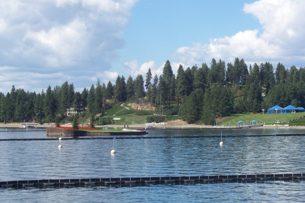
COEUR D’ALENE, Idaho — A house built on a boulder and a putting green that is an island are eye-opening sights during 90-inute tours of beautiful Lake Coeur d’ Alene, Idaho’s second-largest body of water that ripples far north in the state’s panhandle region.
Too bad the otherwise enjoyable cruises are weakened by a too-slick, canned narration and, worse, by nonstop grating music between the narrators’ comments. Silenced speakers would be infinitely preferably, so that passengers could listen to the lapping water, to chirping birds or to each other in relaxed conversation. Lake Coeur d’Alene Cruises, which operate through October and resume for light-show excursions during the holiday season, are a victim of some office dweller’s overwrought idea of “entertainment.”
Oh well. The lake’s scenery is too good to miss if you find yourself in northern Idaho and have an early afternoon to kill. The town of Coeur d’Alene has a main drag, Sherman Avenue, whose mostly locally owned shops and restaurants are clustered tightly in a four-block stretch that is worthy of leisurely exploration. The 18-floor Coeur d’Alene Resort overwhelms the town’s neighboring waterfront area, and when we stopped by in late August the hotel’s main lobby area was teeming with light-skinned men in expensive casual attire who pranced to and fro as they held tightly to their briefcases and cellphones.
Some of those important blokes must have been in town for the golf. The hotel complex’s 6,735-yard, par-71 course has been hailed as among the best resort golf courses in the Hawaii-excluded United States. Its 14th hole is the one that floats on the lake or, more precisely, is attached to the mainland by cords. A computerized pulley system changes the hole’s length every day: The tee box and flag are separated by anywhere from 100 to 175 yards, and golfers are transported between the two by a small watercraft.
As we cruised by the floating green, the boat’s narrators — in voices that are almost parodies of TV game shows’ masters of ceremonies — said that golfers are allowed two shots from the tee. (Whether that means hackers are entitled to two “mulligans” on the course is unclear.) As a result of the linksters’ miscalculations and inexpertly executed swings, some 24,000 balls are hit into the drink every year. The green may encompass 15,000 square feet, we’re told, but “it looks a lot smaller from the tee!”
Earlier, we had passed a multi-story house on a 25-foot-high rock (I’m estimating) that juts out into the lake from the western shore. The gray structure has lots of sharp angles, plenty of big windows and an enormous wraparound deck. What appeared from a distance to be a sunbather on the deck proved instead to be, upon closer inspection, a bikini-clad mannequin with a hat and — no surprise – a blank expression.
Among the more interesting things we were told during the cruise (a stretch, admittedly) is that ospreys are the lake’s most prolific birds. They feed almost exclusively on fish, diving feet first into the lake to catch their prey. Their wingspan? A rather daunting four and a half to six feet. The best time to spot bald eagles is during the holiday cruises, which operate Nov. 24 through Jan. 1 and cost $13.75 general.
We also received a lesson in Idaho basics. The state, 43rd in the nation in terms of population, is 13th-largest in size. Pend Oreille, 20 miles north of Coeur d’Alene, is the largest of ldaho’s 2,000-some lakes. State bluebird? The mountain bluebird. State fish? Cutthroat trout. State vegetable? Well, you probably know the answer to that, although potatoes are grown mostly in Idaho’s southern regions. “We just eat them up here!” intones the boat ride’s annoying commentary.
Lake Coeur d’ Alene’s 90-minute daily cruises continue through Oct. 29 and start at 12:30 p.m. Fees are $17.75 general, $16.75 for ages 55 and older and $9.75 for ages 6 through 12. For more information: (800) 365-8338, ext. 7143; or visit www.cdaresort.com.
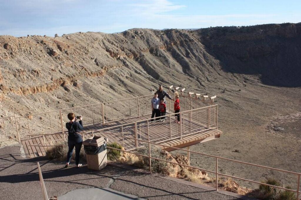
Looking at them, you might wonder if they are twins. About the same size, similar profile.
Truth is, they had starkly different upbringings. And then there is the matter of their age difference: some 49,000 years.
Meteor Crater in Arizona and Ubehebe Crater in Death Valley National Park are mere cousins in terms of geology. The former went from an egg (a meteorite going 26,000 miles per hour) to full adulthood (a humongous hole in the ground) in about 10 seconds. The latter was born in comparably quick fashion from a case of bad gas (magma-heated, exploding-upward steam).
The two arguably represent the most scenic and accessible craters in the American Southwest. Although they are remote – Meteor is 186 miles northeast of Phoenix, and Ubehebe is 182 miles northwest of Las Vegas – uninterrupted asphalt leads to both, their rims possess paved parking lots, and, in Meteor’s case, there is a well-conceived visitors center and museum.
My buddy Dave and I stopped by both craters on a recent windy weekend, shivering a bit on the sidelines and finding calm relief by descending into one of the big old bowls.
Meteor Crater
Pair the phrase “impact crater” with North America and your brain may summon images of hadrosaurs, stegosaurs, tyrannosaurs and the rest of their leathery, prehistoric brethren being blasted into eternal smithereens by an astronomical missile. However, dinosaurs went extinct long, long before Meteor Crater was formed about 50,000 years B.M.C. (Before Michael Crichton, who wrote “Jurassic Park.”)
“When our meteorite hit, it was a colder and wetter climate,” we were told outside the museum by Kim Merrill, a third-generation Arizonan and Meteor Crater tour guide for seven years, as we ourselves were being blasted by gusts that may have topped 50 mph. “We had mastodons, wooly mammoths, giant sloths, we think there might have been some camels in the area, but we don’t think there were any people here at the time.”
Merrill’s facts-intensive spiel, which she gave at high volume due to the ferociously loud wind, spotlighted three men who played key roles in Meteor’s metamorphosis from landscape curiosity to its current, self-lauded status as “the world’s best-preserved impact crater site.” They were:
- Karl Gilbert, a chief geologist for the U.S. Geological Society who in the 1890s investigated the site’s origins. He initially suspected that a meteorite the size of the crater had formed it, but when he found no evidence of such a massive space rock underneath, he chalked it all up to subterranean steam and shuffled off into history with a half-mile-wide misinterpretation.
- Daniel Moreau Barringer, a Philadelphia mining engineer, dug around for the meteorite for 27 years, fruitlessly, until his death in 1929.
“It wasn’t until years later he was proven right that this actually is an impact strike,” Merrill said. “But he made such amazing discoveries, especially considering what they knew back in those days. And scientists now call it Barringer Crater, in his honor, so he finally some recognition in the end.”
A fourth generation of Barringers continues to own and operate the crater today.
- Eugene Shoemaker, who in 1963 published a scientific paper that proved beyond a reasonable doubt that Meteor was indeed an impact crater.
“He was a geologist, but he was hoping to be an astronaut,” Merrill told us. “He wanted to be the very first geologist on the moon. Of course this was during the age of the Apollo program.
“He thought the best thing to do was to become an expert on craters, so he came out to see ours. Before that he studied nuclear test sites, especially the underground explosions. Ours was basically underground, too. He found this site had a lot in common with the nuclear sites he had been studying.”
Shoemaker’s breakthrough led to the subsequent discovery of some 200 other impact craters around the world.
As Dave and I gazed into the shadowy abyss, Merrill put Shoemaker’s breakthrough in layperson’s terms. She pointed out how the terrain surrounding the crater was reddish sandstone, but the meteorite’s impact drove the subterranean layers, composed of beige-colored rocks, on top.
“It’s just like throwing something into water and everything is splashed out, only with rocks,” she said. “… We’re on that uplifted, ejected material. And that’s what Dr. Shoemaker taught the astronauts. How to recognize an impact strike and see which rocks had surfaced.”
Yes, although Shoemaker never realized his own outer-space dreams, he helped astronauts by persuading NASA to use moon-esque Meteor Crater as part of its lunar-mission training. (Asteroids and comets account for the moon’s pockmarked appearance, having not been compromised by an atmosphere; “meteorite” refers only to space debris that manages to strike the Earth’s surface.)
“One day one of the astronauts was testing his space suit when he fell, and the space suit tore,” Merrill recounted. “You can imagine how upset he was: If that would have happened on the moon, he never would have survived. Thank goodness it happened here first. They fixed the suits, made them more sturdy.”
Today’s visitors can look out on the crater from three areas: one on the rim and the other two a few dozen feet down the crater’s north interior side. Fixed-view telescopes are trained on particular points of interest across and below. Only scientists venture down to the bottom. A short film in the visitors center complex touches on why they bother.
“At any given time, perhaps a thousand asteroids larger than a kilometer are headed our way,” says Dr. David Kring, who heads the Center for Lunar Science and Exploration. Immediately he tries to reassure:
“Impact events the size of Meteor Crater occur about once per 1,600 years on Earth. Most of those impact events occur at sea. The United States and other governments sponsor several astronomical search programs designed to detect and track objects in the solar system that pose a threat to the Earth in the future. The goal is to be able to detect them early enough so that we can deflect them out of harm’s way.”
If you have seen the 1998 movie “Deep Impact,” you are excused for feeling skeptical of Kring’s can-do comments.
The meteorite that 50,000 years ago crashed into what is now Arizona weighed “several hundred thousand tons,” according to Meteor Crater’s website.
“Anything within a 10-mile radius would have died or been seriously injured by the shock blast,” Merrill said. “And they would have felt hurricane-force winds as far as 19 miles out.”
As for dinosaurs, Merrill said a meteor strike in Mexico might have played a role in their extinction some 65 million years ago. “That one, the meteorite was about the size of Mount Everest, about 6 miles across, and the crater is about 110 miles in diameter.”
Ouch.
Ubehebe Crater
Five hundred miles west of Meteor Crater, as we rounded down Towne Pass and Mesquite Flat unfolded before us, reddish-brown clouds of dust interrupted what had been a bright, clear Monday morning drive up from Ridgecrest and into Death Valley National Park. The atmosphere reminded us of 1978 and our first semester at the University of Redlands, when it wasn’t until November when the smog lifted enough for us to notice that, Whoa!, mountains towered over the Southern California college town.
Our luck prevailed as we quickly passed through the haze on Scotty’s Castle Road to Ubehebe Crater, whose surrounding gray-rock terrain and beige east-side walls exulted in the winter morning sun. Pronounced you-bee-hee-bee, the crater is about a half-mile across (Meteor is closer to three-quarters of a mile in diameter) and 600 feet deep. Guesses on its origin, as part of the Maar cluster of volcanos in the area, range from 300 to 7,000 years.
Our intention had been to take the gently sloping, rim-side trail up and past Little Ubehebe Crater to the south and on around, something I had enjoyed doing years before. But a European couple, about to drive off in the parking lot’s only other vehicle, encouraged us to walk down into the big pit. “It’s just like going down stairs, and the bottom is incredible,” the man told us in what we thought was a French accent.
Turns out the trek down, begun just to the north of the parking lot, took not quite 20 minutes and felt especially gentle because with each downward step there was a cushiony give. On our return trek, not surprisingly, that “give” was the opposite of helpful, and we needed at least a half-hour to ascend.
One of the wonderful things about standing at the bottom of Ubehebe Crater that day was we were protected from the rim level’s whipping wind, whose chill had made my exposed ears numb. We also marveled at the bushes rising from the soft, level floor, which was still moist from rare rains that had passed through that weekend.
And obviously, the 360-degree scenery was outstanding, inspiring lots of slow-motion twirls and panoramic picture-taking on our smartphones.
Soon we noticed two people making their way down, too. Cousins Michaela Hänel of Aufkirchen, Germany, and Larissa Moss of Idyllwild happily accepted my offer to take their picture and chatted with us for a few minutes, sharing their impressions of the crater.
“It’s a completely different perspective,” Moss, who had been here before, said in comparing the views from atop and within Ubehebe. “I think when you’re on the bottom, you have a feeling as if you are part of the crater. At least I do.
“The top is just something like sightseeing. You look at it like the outside of a cathedral, whereas when you are inside, you can kind of feel the atmosphere, you can imagine, you know, the earth underneath being on fire.
“I don’t know, it’s like being part of something, as opposed to just looking at something.”
Hänel, enjoying her first visit to the park, said, “From the top you can’t imagine what it’s really like here.”
“The vegetation, I think, is just fantastic,” Moss added. “That anything grows here – and the colors, the different shapes and colors, are just incredible.”
Incredibly fortunate is how I felt as we drove back to civilization and our busy, big-city lives. We had just seen two of nature’s most beautiful, in the starkest sense, creations. Meteor and Ubehebe, alike but also different, made for a most satisfying, twin adventure.
Sidebar:
Interested in more crater exploration? Sunset Crater National Monument is an 80-minute drive northwest of Meteor Crater, and in addition to its volcanic vistas offers hiking opportunities atop lava trails. For more information, go to www.nps.gov/sucr.
In addition to Ubehebe, California has at least 24 other explorable craters, which have varying levels of accessibility challenges. Learn more at http://california.hometownlocator.com/features/physical,class,crater.cfm.
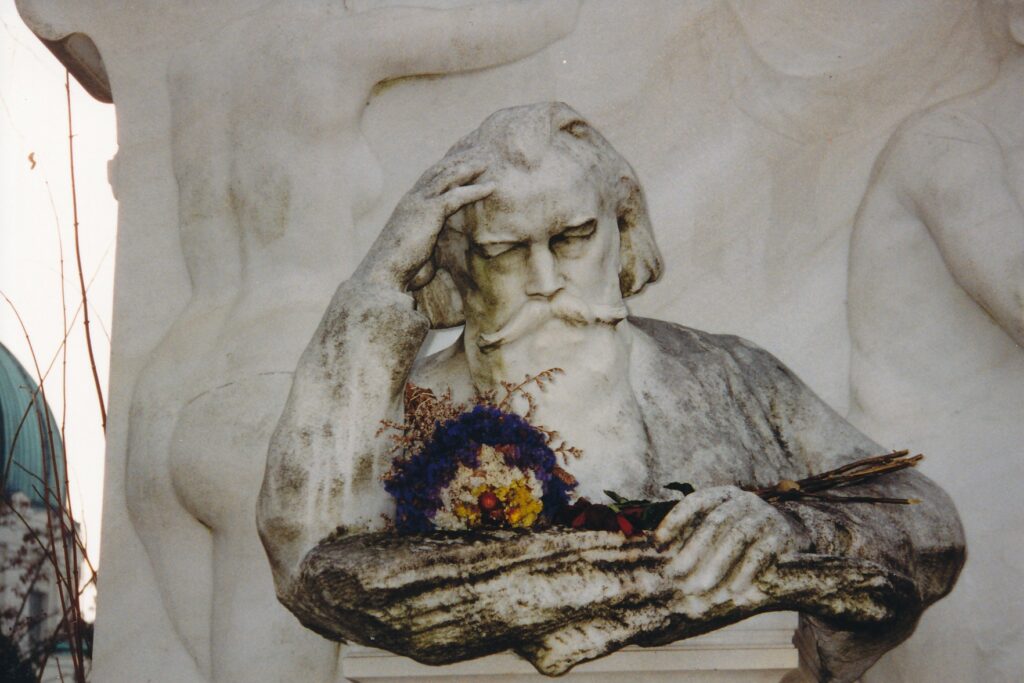
VIENNA, Austria – Who are the greatest of the greats? My vote is for those who have brought lasting beauty into an often ugly world, whose work gives my life and that of millions more a finer sense of meaning.
With all due respect to Raquel Welch, slick-fielding shortstops and English spy novelists, my vote is for composers, preferably European and long-dead. Which brings me to the point of this story.
Today, this bright, unseasonably warm February morning in Austria’s largest city, I will pay tribute to “my” greats by tracking down the places that honor them. Using a $15 Vienna Card, which allows unlimited public-transit rides and museum discounts for 72 hours, I intend to visit a series of relevant statues, exhibits and grave sites.
So, ladies and gentlemen, please take your seats, plop a cough drop into your mouths and presume the proverbial orchestra has been tuned by its oboist. The time is 9:22 a.m., and the first movement in this Dead Composers Waltz is a 5-minute walk from my hotel to the subway, which will take me to the Volkstheater stop. Let us see what experiences, and memories, await.
9:53 a.m.: As I arrive before the Wolfgang Amadeus Mozart (1756-1791) statue in Burggarten, just inside the central city’s Ring, a group of Asian tourists approaches. They happily snap pictures and are gone before 10 a.m. For them, this stop was but a brief intermezzo .
I linger and recall how in junior high school I played Mozart’s Clarinet Concerto, which years later I heard in New York’s Lincoln Center. Any similarities between the two performances in terms of execution and reception were, at best, vague.
Cherubs and gold lettering grace this memorial, which now has attracted a long-haired, cigarette-smoking man who is eyeing me like prey. On that note of paranoia, I depart for the Musikverein via Philhannoniastrasse and Mahlerstrasse, behind the Opera House.
10:26 a.m.: Accompanied by the percussive strains of a limb-cutting chainsaw outside the konzertkassa, I impose on a cashier’s limited English to purchase a ticket for tonight’s concert in the music hall. All I know is that it features works by Giuseppe Verdi, Ludwig van Beethoven and Johannes Brahms. How bad could it be? Other than the Verdi, of course, if it’s more than an overture.
Brahms (1833-1897) is memorialized in the Karlsplatz across the street. Unlike the vibrant pose of Mozart’s statue, his is of a tired, old man. Perhaps the chainsaw irritates him, too.
As consolation there is a rather attractive woman, albeit made of stone, playing a harp below him. Adding to the good cheer are three park workers who remove trees’ refuse with brooms refuse rather than with those disharmonious leaf-blowers that curse America.
Brahms had at least a passing acquaintance with Yankee ingenuity, though. I recall some radio program in the early 1990s that played a glass-cylinder recording of the composer’s own voice. He was greeting Thomas Edison. “Hello, Mr. Edison. This is Herr Brahms,” or something like that. Eerie .
10:43 a.m.: Chalk up the day’s first miscue, or missed cue, as it were. The Johann Strauss Jr. exhibit in the Vienna city-history museum is closed Mondays, despite the contrary claim of my travel brochure. Oh well, so I save $3. Music to my ears. On to Beethovenplatz, after a short stroll past Konzerthaus .
10:54 a.m.: Herr Beethoven (1770-1827), who has the platz to himself, does not appear to be any more chipper in his memorial than is Herr Brahms. From what I hear, however, true artistry can be torturous. One of my favorite Beethoven memories is how, on fall Sundays, I used to listen to all nine symphonies , in order, while watching a football doubleheader on my muted television. Ideally, John Elway would orchestrate a last-minute, triumphant touchdown drive just as “Ode To Joy” sprang from the speakers. Two maestros at the top of their form.
The beat continues, uptempo , to more statues in Stadtpark, across Johannesgasse.
11:13 a.m.: In Vienna, all that glitters is Strauss (1825-1899). “The Waltz King” is a gold-plated violinist here in one of the city’s larger parks. In high school, I remember installing a car radio on which the first thing I heard was his “Blue Danube.” Or maybe it was Linda Ronstadt signing “Blue Bayou.” Blame the blur on too many intervening decades.
Four beautiful young blondes now are swarming about the golden boy, putting their arms around the statue and giggling. Being a dead legend might have its rewards.
11:31 a.m.: In his statue, Franz Schubert (1797-1828) looks contented enough, but like Mozart he never had the chance to grow old and bitter. His eighth symphony was unfinished, and so will be my visit to Stadtpark. I have been unable to find the purported Anton Bruckner statue.
Bruckner (1824-1896) was a bit of a compositional windbag, in my opinion, but I feel sorry for the guy in that John Williams seems to have lifted a theme from Bruckner’s fourth symphony for the “Star Wars” score. Surely someone besides me has noticed that.
Moments la ter: I found Bruckner’s bust. My map misplaced him. To be a second- or third-tier composer has its drawbacks.
11:54 a.m.: My “high-brow” adventure encountered a low-brow bump in the strasse when I passed a bookstore showcasing a German translation of Monica Lewinsky’s memoirs.
Can anyone appreciate Monica and Mozart?
Now I’m standing before Anker Clock, on Hober Markt, a few blocks’ north of St. Stephen’s Cathedral. At noon daily, the clock is supposed to come alive with music. Let it be classical, or it’s on to Mozart’s House and, a long tram ride away, the Central Cemetery.
12:12 p.m.: Hallelujah, it was a classical collage of 12 pieces, culminating in a snippet of Franz Joseph Haydn. This midday treat was enjoyed by scores, so to speak, craning our necks to watch the charming display of moving characters and sound.
12:30 p.m.: Mozart’s Figarohaus, at 5 Domgasse, is tucked away a few hundred paces east of the cathedral. A sign says it, too, is closed Mondays, but other English-speaking pedestrians have entered the composer’s former domicile.
Ah, they quickly have re-emerged. “All you can see is the door,” laments one member of the foursome, whose members hail from Texas and New Jersey. They pause to say how much they liked the Vienna Boys Choir concert yesterday, then we set off in opposite directions on this narrow, cobblestone street.
2:08 p.m.: My “monumental” journey, as it were, nears an end here in the Central Cemetery, Europe’s second-largest. Preceding has been a 25-minute tram ride, the purchase of an $8 plot guide (in English , bitte) and a few hundred missteps that took me past an extraordinary collection of Soviet Army gravestones from mid-April 1945. Now I sit on a bench outside the cemetery’s Group 32A, in which Beethoven’s remains are joined by those of Brahms, Schubert and Strauss.
It seems to me that years ago, I heard about Beethoven’s heart having surfaced in some other location. Or maybe it was a different part of his anatomy. Does that ring any bells? (Note: Later I read that Mozart’s heart is in Salzburg while the rest of his remains are in Vienna. Furthermore, Haydn’s scull was stolen and for 145 years was separated his body, buried in nearby Eisenstadt, Austria. Decompositional counterpoint?)
On cue, bells are ringing in this massive cemetery, peaceful other than the workers’ vehicles that seem to pass by every few minutes. Between those annoying sputterings I shall continue to sit here awhile, remembering the moments these greatest of the greats have provided me, mourning the masters.
Postscript : Mozart’s grave is in the St. Marx Cemetery, between the Ring and Central Cemetery, also off Tram 71. As for the concert, it could not have been better: a Verdi overture (“Die Macht des Schicksals”), Beethoven’s third piano concerto and Brahms’ fourth symphony. Musikverein is a beautiful, 19th century hall containing what I think are especially interesting gold pillars. Two hundred eighty shillings for this evening could not have been better spent.
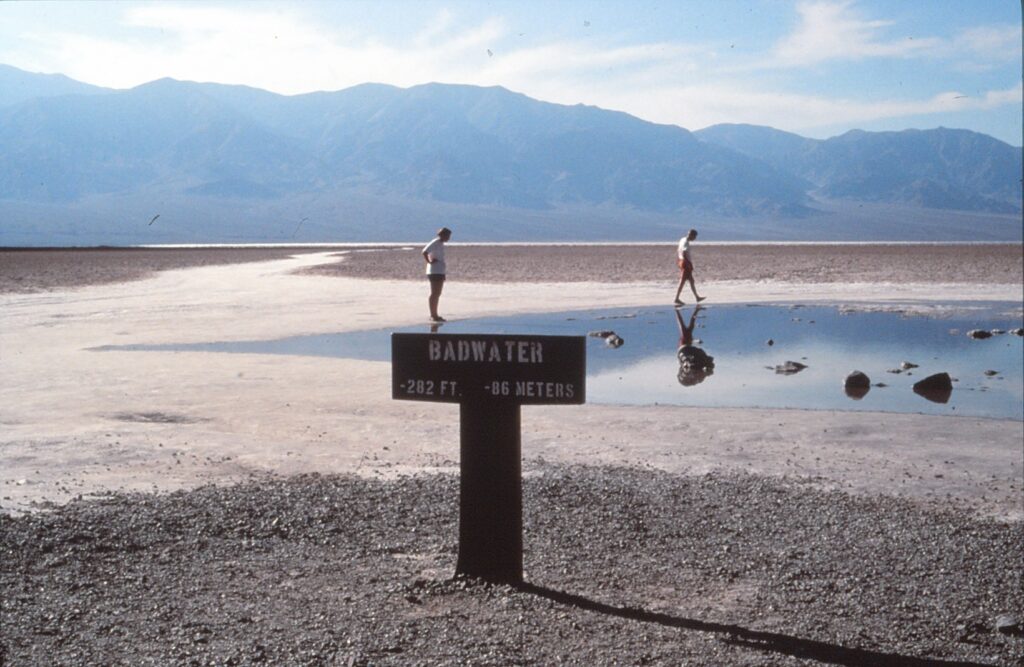
Daybreak in Death Valley. Ominous clouds drift over the dark blue shape of Tucki Mountain and roll toward the sleepy settlement at Furnace Creek. Geckos scurry to their daytime beds.
The zipping sound of a tent being opened interrupts the absolute quiet at Texas Spring Campground. A bearded man emerges, and rocks shift under his weight as he begins a morning stroll. Crunch, crunch, crunch.
Into this scene falls a raindrop, and others quickly follow. The man does a quick turnabout and hustles back to his canvas shelter. Yet he has accomplished something very few people manage in Death Valley National Monument: He has gotten wet.
The average annual rainfall at the monument since 1985 is 2.2 inches, though just.38 inches fell in 1989. The rain that fell on Furnace Creek that November morning lasted two minutes and left few signs of its having passed through.
But small amounts of precipitation in such a dry place can have pronounced consequences. A heavier rain in September washed out one of Death Valley’s most-popular roads: Artists Drive, a five-mile, paved loop off Highway 178 that swings under the colorful rock formations of Artists Palette. Park officials hoped to have the road reopened before 1991.
The monument’s tourist season runs from December through March, when year-round attributes of striking scenery and clean air are joined by tolerable temperatures. Services such as tours and extra camping space are offered until M other’ s Day, but by the beginning of May daytime highs tend to hover around 100 degrees, and visiting the park becomes more of an endurance test than a vacation.
Since most people associate Death Valley with heat, a sketch of temperature specifics is in order. The monument’s hottest day was in July 1913, when the mercury rose to 134 degrees. July traditionally is the park’ s hottest month, with an average high temperature of 116.2 and a low of 88.5. June and August have similar readings. The coolest months are December and January, which feature days of 65-degree weather, and nights in the low 40s.
According to the Furnace Creek Visitor Center, the average ground temperature in Death Valley is 191 degrees, with 201 degrees being the record.
The lowest ground in the Western Hemisphere is 16 miles south of Furnace Creek, at Badwater. A small pool of water just off Highway 178 is 279.8 feet below sea level, but for the real lowdown, an hour-long trail leads to a point 282 feet below sea level.
Furnace Creek is the monument ” s pivot point, if not quite its geographic center. It has three campgrounds, one of which — Sunset — contains 1,000 sites and caters primarily to recreational vehicles. Furnace Creek Ranch is a settlement within a settlement, boasting indoor accommodations, a golf course and other sports facilities, a gift shop, general store, saloon and two restaurants, though they offer food best suited for those with thick wallets and non-discriminating palates.
A variety of tours branch out from the ranch, including guided horseback outings that cost $15 for one hour and $25 for two. Also conducted daily are a morning tour of the South Valley, an afternoon swing out to Dante’s View, and a five-hour excursion up to Scotty’s Castle. Tickets all are under $30 and can be purchased in the Fred Harvey Transportation Co. offices at the ranch’s entrance.
Though tours are an option in visiting Death Valley, individual exploration can be the most-rewarding plan of attack. Provided, of course, automobile and body are fit enough to cli mb hills and go long distances without breaking down.
The best protection against breakdowns is an adequate supply of water. Park officials recommend vehicles carry a minimum of five gallons. Hikers are urged to carry all they can.
There are few places at which drinking water is available in Death Valley, though tanks of non-purified water are a frequent sight along paved roads and can satisfy thirsty radiators.
Once safety precautions are taken, visitors can tour in their cars on paved surfaces. Dirt roads to a few other sites are traversable by regular passenger cars, but trips to Greenwater and Skidoo ghost towns and to some wells deep in the valley require four-wheel-drive transportation.
Overnight tramping is a heartier alternative.
Many of the monument’s featured attractions are within 10 miles of Furnace Creek. To the south, Natural Bridge awaits those willing to ascend a quarter-mile, rocky trail up to a dry riverbed. On the other side of Highway 178, to the west, is Devil’s Golf Course, a field of salt mounds formed from the evaporation of several ancient lakes.
A few miles north of Furnace Creek are the Harmony Borax Ruins and 20-Mule-Team Wagon, the latter used to transport minerals out of the valley during mining operations in the late 18th century. Crumbling remnants of miners’ quarters can be seen on the horizon.
Scotty’ s Castle, 52 miles north of Furnace Creek, was built in the 1920s as a vacation resort for Chicago millionaire Albert Johnson. The Spanish-Moorish-style structure 1s named after one of Johnson’s friends, Walter Scott, a cowboy and colorful storyteller. Scotty’s grave is atop a small hill that overlooks the mansion. It contains the epitaph:
“I got four things to live by: Don’t say nothing that will hurt anybody; don’t give advice — no one will take it anyway; don’t complain; don’t explain.”
The only way to see the interior of Scotty’s Castle is by taking guided tours, which cost $6 for adults and $3 for children. The wait for tickets can be several hours; a gift shop and cafeteria can help kill time. An alternative is driving 11 miles west to Ubehebe Crater, which offers more hiking possibilities.
Furnace Creek is about 300 miles from Los Angeles and 200 miles from Las Vegas. Though the monument is accessible by several roads, the prettiest entrance is on Highway 190 over Towne Pass, west of Death Valley.
An entrance fee of $5 per vehicle is collected at the Furnace Creek Visitor Center and is good for a week. General information about the park can be obtained by phoning (619) 786-2331, or (619) 786-2471 for the hearing impaired.
To inquire about guided tours and accommodations at Furnace Creek Ranch, call (619) 786-2345.
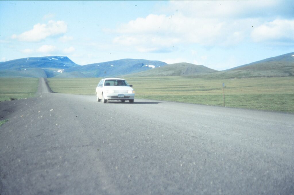
YUKON, Canada — Two hundred twenty-six miles stood between us and the last gasoline pump when we arrived at Eagle Plains. We had little choice but to pay the equivalent of $3.50 per gallon to fill our tank at the settlement’s only business, a combination service station, restaurant, motel and campground.
For the last six and a half hours, we had driven our abused rental car halfway up the Dempster Highway, one of the most intimidating routes you’ll find on any map of North America. Opened in 1979 after two decades of construction, the Dempster goes farther north than any road in Canada — all the way to Inuvik, an Arctic town of 3,500 in the Northwest Territories.
We figured we had encountered fewer than 40 vehicles so far that day, or about one every 10 minutes. The only one going our direction was a road-chewing, rock-spewing semi-truck. In the interest of preserving our windshield, I pulled over and stopped so that the rig could pass by unchallenged.
Empty chairs and tables greeted us when we entered the Eagle Plains Hotel restaurant. The only voices were corning from a radio. Among the first words we heard were “traffic jam,” “severe slowing” and “90-minute delays.” Whoa! Was the Dempster suddenly congested?
The radio report was being piped in from Vancouver, whose rush hour may have been frustrating news 2,000 miles to the south, but was high comedy to those of us 19 miles from the Arctic Circle. My companion and I shared a big laugh, celebrating our escape from big-city problems and the awesome view we had of vast, hilly forests under a cloudless, late-June sky.
Our triumphant trek up the Dempster, which for me was culminated by wading in the Arctic Ocean, almost never occurred. Gail, a game traveler who nevertheless has a generous appetite for personal safety, had been concerned we were not prepared for driving the unpaved highway. More than once since leaving Seattle six days before, she had recited the Dempster driving “tips” listed in several travel publications.
Specifically, the material recommends all vehicles carry two spare tires, extra fuel, a tow rope or chain, window squeegee, pail, ax, basic repair kit, steel-mesh headlamp protectors, rock guards and mudflaps.
Of that, all we had was one spare tire — the puny, 10 -miles-if-you’re-lucky kind that comes with new cars these days. But the Mercury Tracer was only 10,000 miles old, I’m penurious and the Dempster was beckoning me. Gail’s concerns took a back seat, next to our dusty camping gear and the jar of peanuts.
“I assume all responsibility for the car and whatever happens to it,” I promised in a vain attempt at machismo.
As it turned out, we completed the 920-mile round trip without any crippling car problems. To our knowledge, the only damage sustained by our station wagon was a small crack in the windshield; a barreling pickup was the vandal, and the finest rock guard in the world probably wouldn’t have helped.
The highway begins where the Klondike and North Klondike rivers merge, 25 miles east of Dawson City and 310 miles north of Whitehorse, the Yukon’s capital and largest town. Klondike River Lodge helps launch Dempster daredevils with gasoline pumps, a coffee shop and accommodations.
Despite our travel-safety concerns — repressed, in my case — we quickly came to appreciate the varied landscape traversed by the Dempster. Driving through the spruce- and poplar-packed North Klondike River Valley, we slowly approached the Ogilvie Mountains. Along the way, we were forced to stop for a small herd of horses that was blocking the road, reminding me of the sheep “traffic jams” in New Zealand.
As it turned out, we saw no other animals while we drove the Dempster. Larry Vezina, co-host of the 5th Avenue Bed & Breakfast in Dawson City, that morning had told me animals such as moose, caribou, reindeer, Dall’s sheep and grizzlies have learned to keep three to five miles from the road. They were spooked by the flurry of hunters who shot up the Dempster after it opened.
The road’s first campground is adjacent to the Dempster Highway Interpretive Center, about 45 miles from the Klondike rivers’ merger. The friendly ranger there explained that the light rain falling outside probably was restricted to the Ogilvie Mountain area, a forecast that proved correct. She also had updated road condition reports and pointed out dozens of pamphlets on hiking trails and wildlife.
A few miles north of the center is a panoramic view of Tombstone Mountain, which has an elevation of 7,191 feet. The gently sloping terrain around Tombstone and the nearby North Fork Pass, at 4,229 feet the highest point on the Dempster, offer many opportunities for hikes. Bird watchers might be able to detect eagles, falcons, jaegers, ptarmigan, ravens, robins, short-eared owls and swallows.
At kilometer marker 150, which translates to roughly 95 miles, the Dempster begins weaving through a series of lunar-like hills, their distinctive appearance provided by shale embankments.
About 50 miles farther north, past the second campground, is a stretch alongside the North Klondike River that reportedly attracts grizzly and black bears. We saw tracks, but no bruins.
Eagle Plains was a welcome sight for us, and it seems unlikely many people driving the Dempster would pass it by. The price of gasoline was high, but only a few cents’ more than it was in Dawson City. The food was neither worse nor more expensive than it typically would have been elsewhere in western Canada, despite the restaurant’s having completely cornered the market.
Hearing a traffic report wasn’t the only wacky experience we had at Eagle Plains. Gail’s iced tea was served without ice, which surely can’t be difficult to make considering we were so close to the polar ice cap and the restaurant probably sits on tundra.
The Arctic Circle is 24 miles north of Eagle Plains. At a latitude of 66 degrees, 33 minutes north, it represents the most southerly point where the sun doesn’t set on the summer solstice. We stopped to take our pictures under the commemorative sign but had to fight off a swarm of mosquitos. Gail’s analogy of Alfred Hitchcock’s “The Birds” was most apt.
Another signpost picture opportunity, the Northwest Territories border, is 42 miles up the Dempster. It marks the third and final time the highway crosses the Continental Divide. For the next 46 miles, the road wends its way down 2,800 feet to the first of two ferry crossings, at Peel River.
The 42 miles between the Peel and Mackenzie river ferries represented the roughest stretch of the Dempster Highway when we drove it in the summer of 1992. The gravel was looser and consisted of larger stones, one of which cracked our windshield.
Tire ruts were deep enough that we scraped bottom at least once.
Both the ferries are free, and operate daily from 9 a.m. to 12:45 a.m., from early June through late October. The Peel River crossing takes only a few minutes. At the Mackenzie, the ferry has a triangular route that serves the community of Arctic Red River. We experienced delays of up to 45 minutes.
In between the rivers is the Nutuilie Campground and Information Centre, the fourth and final campsite before Inuvik. We stayed there “overnight,” perhaps a misleading word in that we could have slept outside the tent and worked on our tans. Limited services included pit toilets and an outdoor water faucet, but the setting was beautiful. Mosquitos were the only menace.
Whereas Arctic Red River has a largely Dene population, the Dempster’s other community, at Fort McPherson, is home to Gwich’in people. The Fort McPherson co-op, located about a mile off the Dempster, has accommodations, grocery supplies, a restaurant and gasoline, and appeared to be the only place other than Eagle Plains that sells coffee to go.
Past the Mackenzie River, the highway cuts through the relatively flat Mackenzie Delta. We found scenery was not as spectacular there as it had been south of the ferries, but the road improved to the point where we occasionally could attain 60 mph.
Inuvik, home to 3,500 Dene, Inuvialuit (Eskimo) and various non-native people, was established in 1955. Canadian government officials envisioned it as a remote pocket of “civilization” in the far north. As it turned out, Inuvik (pronounced ih-NEW-vik) has grown to contain five hotels and B&Bs, perhaps a dozen restaurants, a variety of gift shops, two banks and a general hospital. Its most photographed attraction is the Roman Catholic church, which resembles a gigantic igloo.
Being so far north of the Arctic Circle, Inuvik enjoys almost 60 days of 24-hour sunlight, beginning in late May. That allows some unique events, such as the Annual Midnight Madness, on June 21, when the streets are used for dancing and stores are open past 12 a.m. Gail and I missed the event’s sanguine “Mosquito Marathon,” a 10-kilometer race, by a week.
The flip side of so much summer sunshine is, of course, winter darkness. According to an Inuvik tourist brochure, the sun hibernates from Dec. 6 to Jan. 6. Temperatures, which topped 80 degrees during our summertime visit, descend to minus 20 on an average winter day.
We stayed at the Happy Valley Campsite, a block from the main downtown street. Showers were free and unlimited, somewhat of a rarity in western Canada.
Our total Dempster driving time to reach Inuvik was 16 hours, including several stops for photographs and our meal at Eagle Plains. We picked up the pace in returning south, taking less than 11 hours to go the entire 460 miles. Light Sunday traffic, along with foolish confidence in the durability of our rental car, inspired me to drive as fast as 65 mph.
We lucked out in our Dempster experience, let there be no doubt. The weather was perfect. We had no need of a shovel, headlamp protectors or extra fuel.
Our biggest gamble, in my opinion, was not having a decent spare tire. Replacements are sold in Eagle Plains, Fort McPherson and Inuvik, but at prices that are, indeed, inflated. When Gail and I returned to the Klondike rivers’ junction down near Dawson City, we talked with a woman who said her recreational vehicle had six flat tires on the Dempster. Earlier, I overheard another woman say her all-terrain vehicle blew four new tires on the highway, in just a one-way trip.
If you’re thinking of touring the Yukon, and especially if your mode of transportation would be a rental car, driving the Dempster should be a priority. It is a gravel road paved with incomparable vistas and entertaining, enduring memories.
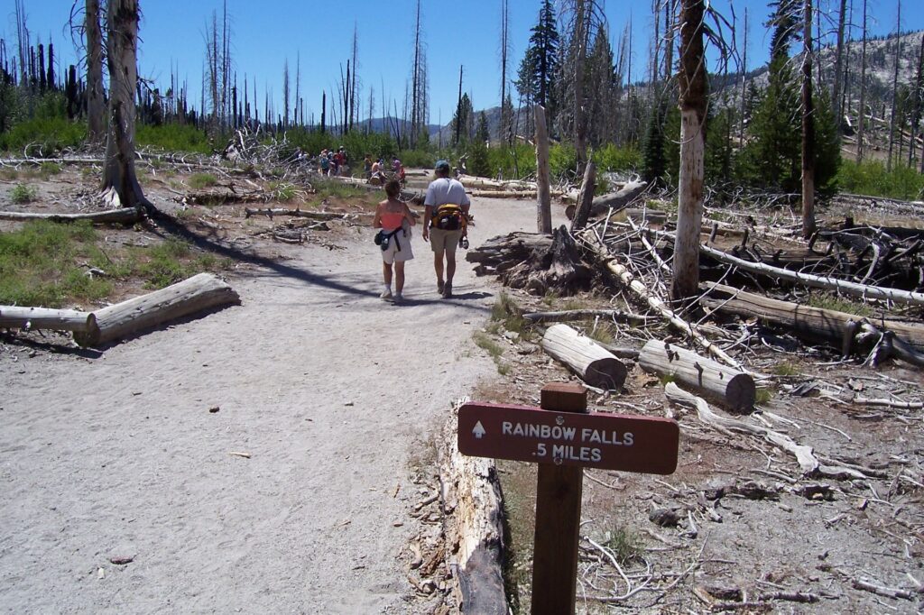
MAMMOTH LAKES, Calif. — If you have ever cooked spaghetti, chances are that on at least a few occasions several strands will have stuck together, forming a thick and unwanted clump of pasta dough that is difficult and frustrating to pull apart.
What you see then, greatly multiplied in size and turned brown, is roughly what you will encounter at the signature attraction of Devil’s Postpile National Monument in east-central California. The basalt columns, many of them ramrod straight and reaching 60 feet tall, constitute a striking geological feature in an area that has no shortage of natural beauty. An hour’s drive from Bishop and at an elevation of 7,560 feet, Devil’s Postpile represents a reclusive and cool retreat from the state’s crowded and hot attractions.
Getting there is part of the fun. From mid-June on into September, visitors must park their vehicles at the Mammoth Mountain ski complex and take a shuttle bus ($7 general, $4 for ages 3 through 15) from there to the monument. The ups-and-downs, seven-mile, one-way ride on Reds Meadow Road takes about a half-hour on the old school buses; from the latter part of September to mid-October, visitors can drive themselves. The shuttle system was instituted in the late 1970s to decrease traffic problems and lighten tourists’ environmental impact.
Once they have arrived at the monument’s ranger station, visitors must hoof it to Devil’s Postpile, two-fifths of a mile away on a fairly level (but not handicap-accessible) path. Immediately off the trail to the left, a sprawling pile of boulders leads up to the basalt columns. Rather than seeing spaghetti clumps, hikers instead might liken the formation to a frozen waterfall. A city of dense high-rises is another imaginative possibility.
A side trail leads to where you can walk on the three- to seven-sided columns, whose tops were smoothed by a glacier some 12,000 to 20,000 years ago. Before that but within the past 100,000 years, lava flowed into the valley at a depth of up to 400 feet. As it cooled, it cracked, and the conditions were such that those cracks assumed a pattern that can be observed today thanks to the glacier’s having carved out part of the postpile.
If you venture atop the formation, be sure to stop and appreciate the columns’ tops, which form something akin to a tile floor. Also, be careful: No fences have been installed to block probably fatal falls off the side.
Although not within the monument’s borders, Rainbow Falls is considered a co attraction with the postpile and can be reached via a path – again, mostly level, although with a few semi-steep portions — that two miles later arrives at the 101-foot waterfall. (A fire in August 1992 devastated the area just south of the postpile on to the falls, in the Ansel Adams Wilderness, and vegetation has not yet regained a strongly visible foothold.)
When the sun shines brightly, a rainbow decorates the waterfall, hence the name. More than two dozen people gathered there the day I visited in early August to see this loud and splashy portion of the San Joaquin River’s middle fork. People enjoyed the fresh air and paused to reflect whether they would retrace their steps to the ranger station, making their hike a total of five miles, or cut over to Reds Meadow Resort where a shuttle bus would return them to the Mammoth Mountain ski complex — for a total hike of 3.8 miles.
The John Muir (211 miles, from Sequoia and Kings Canyon national parks to the northern Sierra) and Pacific Crest (from Mexico to Canada) trails both run through the monument and coincide with portions of the postpile and Rainbow Falls paths.
Shops and restaurants are open year-round at Mammoth Mountain, where gondolas that carry skiers during the winter and spring are used for sightseeing excursions during the summer. (Round trips are $16 general, $12 for teenagers and $8 for younger children.) For more information, visit www.mammothrnountain.com.
Campgrounds abound in the area, including one inside the monument that has 21 sites. The small town of Mammoth Lakes, a few miles west of Highway 395, has many hotel and motel options. Mammoth Lakes is 170 miles south of Reno and 310 miles northwest of Las Vegas.
Shuttle buses operate from 7 a.m. till 7:30 p.m. For more information about Devil’s Postpile, which was designated a national monument in 1911 by President Taft: (760) 934-2289 or www.nps.gov/depo.
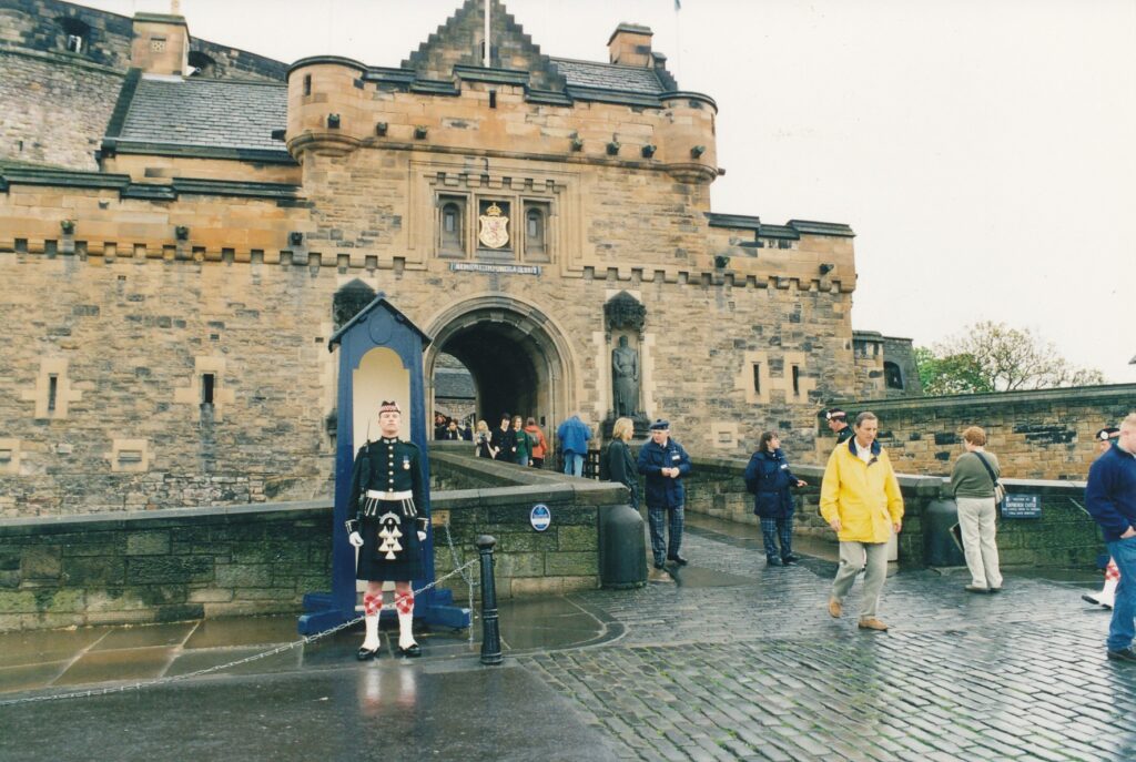
EDINBURGH, Scotland — Scotland took a step toward independent governance in May when its own parliament was seated for the first time since March 1707. For visitors, however, the situation has not changed: Their first order of business is to adopt a fulfilling agenda of capital-city sites in the time allowed.
Dominating the local tourism scene in both appearance and interest is Edinburgh Castle, atop the most central of Edinburgh’s many hills. That being a mandatory stop, what else is there to see and do? Following are descriptions of what I sampled during my two-day stay, and a brief mention of other attractions that are reputed to have their charms.
Edinburgh Castle is in the old town, a maze or curvy, oftentimes steep streets that change names seemingly every other block. New town, across the slim valley that contains the railway yards and Princes Street Gardens, is laid out in grid fashion. To walk from one town to the other takes a few minutes and many deep puffs of air.
Upon entering the castle, visitors receive at no extra charge an audio guide to be strapped about the neck and shoulders. Noteworthy sites have numbers posted that can be punched into the electronic contraptions for more information. The Scottish crown jewels are the castle’s sparkling star, while there is also a medieval chapel, many artillery guns pointed toward the surrounding city (the castle never successfully was stormed), a large war memorial building and even a dog cemetery for officers’ prize pooches. Views from the castle must be spectacular on clear days, of which I experienced none during a week in Scotland.
Edinburgh Castle is open daily from 9:30 a.m. to 6 p.m. April through September; the rest of the year, it closes at 5 p.m. Admission is 6.50 pounds general, 5 pounds for seniors, 2 pounds for ages 5 to 15. For more information: 0131-225-9846.
An impressive collection of European paintings from the Renaissance to post impressionism — and no admission charge — make the National Gallery of Scotland another worthwhile outing. The Scottish artwork downstairs is extensive and includes the museum’s signature piece, the whimsical “The Rev. Robert Walker Skating on Duddingston Loch,” by Sir Henry Raeburn in 17 94.
National Gallery is on what’s called The Mound, which bridges the city’s old and new towns, a few minutes’ walk from the railroad station. Hours are from 10 a.m. to 5 p.m. Mondays through Saturdays, and from 2 to 5 p.m. Sundays. For more information: 0131- 624-6200.
Big on ceramics, clothing, rocks and stuffed animals, the Royal Museum also is distinguished by its Victorian architecture and glass-topped main hall. “Art & Industry Since 1850” is one of the more interesting exhibits, with display cases that explain the arts and crafts movement, art nouveau and art deco, among other things, to the uninitiated or unsure. On the top of three floors is a stupefyingly extensive “Instruments of Science” exhibit, which includes the esoteric “Development of the Microscope in the Late 19th Century” table, containing no fewer than 22 microscopes.
Connected to the Royal Museum is the Museum of Scotland, a seven-floor potpourri of items that follows the region’s progress from geological beginnings to last year’s major news events. Hours for the two museums, on Chambers Street in old town, are from 10 a.m. to 5 p.m. Mondays through Saturdays (extended to 8 p.m. Tuesdays), and from noon to 5 p.m. Sundays. Admission, which covers both museums, is 3 pounds general, 1.50 pounds for seniors and students, free for anyone 18 years old or younger. For more information: 0131- 247-4219 (Royal Museum) or 0131-247-4422 (Museum of Scotland).
Scotland’s national drink is celebrated, in great detail, in The Scotch Whisky Heritage Centre. A multimedia tour explains, among many other things, that the firewater’s light brown color results from being matured in oak barrels for three to 30 years. The mildest varieties, known as “breakfast whisky,” come from southern Scotland. Stronger brews emanate from the Highlands area to the north, where colder temperatures and a preponderance of peat help drive up the alcoholic content.
Among the tour’s comic touches is a ghost distiller, or “noser,” who materializes out of a bottle after a few moments’ delay. “I apologize for being late, but I was caught in a bottleneck,” he says. Next, visitors hop aboard a slowly moving “barrel ride” past scenes depicting whiskey’s role in Scottish history. At the end, a sign declares 164,000 bottles have been sold worldwide during the 15-minute journey. Adults then receive a complimentary shot from the gift shop’s collection; mine was an 8-year-old grain whiskey from the Isle of Skye.
The center is open daily from 10 a.m. to at least 5:30 p.m. The tour and barrel ride cost a combined 4.95 pounds general, 3.50 pounds for students and seniors, and 2.50 pounds for the questionable — considering the topic — demographic group encompassing ages 5 to 17. For more information: call 0131-220-0441 or visit the Web site www.whisky heritage.co.uk.
The Writers’ Museum, which like the whiskey center is in the old town near Edinburgh Castle, could be paired nicely with the Literary Pub Tour (see the accompanying story). It focuses on the lives and works of Robert Bums (1759-1796), Walter Scott (17 71-1832) and Robert Louis Stevenson (1850-1894). A posted excerpt from one of Stevenson’s books, “Travels With a Donkey in the Cevennes,” explains his adventuresome spirit and perhaps strikes a chord among many of today’s travel-section readers:
“For my part, I travel not to go anyplace, but to go. I travel for travel’s sake. The great affair is to move; to feel the seeds and hitches of our life more nearly, to come down off this feather- bed of civilization and find the globe granite underfoot and strewn with cutting flints.”
The Writers’ Museum is open from 10 a.m. to 6 p.m. Mondays through Sundays from June through September; it closes at 5 p.m. the rest of the year. Admission is free. For more information: 0131-529-490 l.
Everyday folks, not royalty or famous writers, star in The People’s Story, another free museum in the old town, at 163 Canongate. Artifacts and “living history” interviews with retirees tell of days gone by in Scottish workplaces such as offices, bread factories and distilleries. Wax figures abound, as they do at the castle, whiskey center and Writers’
Museum. One depicts “Rodney Relax,” a punker from the late ’70s dressed in a black leather jacket and belt, torn black T-shirt, ratty blue jeans and big black boots.
Rodney “uses sugar on his hair to spike it up and also egg whites and soap,” the accompanying sign reads. “He colours his hair with food colouring. His favourite band is the Edinburgh-based Scars. He formed his own band.” The People’s Story hours are the same as for The Writers’ Museum. For more information: 0131-529-4057.
Unseen by me but touted by others are the Scottish National Gallery of Art, Belford Road; Palace of Holyroodhouse, eastern end of Canongate; Museum of Childhood, 42 High St.; Outlook Tower and Camera Obscura, Castle Hill; and the Edinburgh Zoo, 134 Corstorphine Road.
For accommodations, you may find the south area — about a 20-minute walk from old town — acceptable. There is a cluster of hotels and bed-and-breakfasts in a four-block area on Minto Street, between Salisbury Road and Ventnor Terrace. I stayed at, and was very content with, Barony House (4 Queen’s Crescent, Edinburgh EH9 2AZ; phone 0131- 667-5806; fax 0131- 667-6833; e-mail Susie Berkengoff at baronyhouse@cableinet.co. uk).
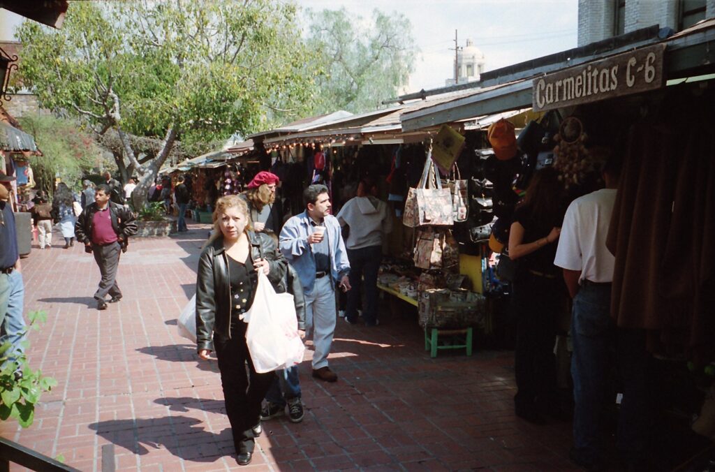
LOS ANGELES – “My grandmother used to have stuff like that,” said Gloria Baca, touring an adobe house outfitted with 19th century-style furniture. “It takes you back.”
The Gardena resident’s nostalgia is something many people of Latin American descent can tap into at El Pueblo de Los Angeles. Latin-flavored food, wares and entertainment are things anyone can enjoy at the state historic park, site of the city’s first settlement 220 years ago.
Baca was visiting El Pueblo on a sunny, late-winter day. Walking through Avila Adobe, built around 1818 and believed to be the city’s oldest existing house, she pointed out things to her granddaughter that reminded Baca of her own childhood. A small pot beneath a child’s bed, she said, was like what she used when nature called in the wee hours. Outside, the sight of a cactus pear reminded Baca that her own grandmother had prepared the plant’s purple flower with onions, tomatoes and cilantro. Clearly, it was a tasty memory.
Avila Adobe is part of El Pueblo’s main museum and one of many options for visitors to the 44-acre park. It also is one stop on the free tours scheduled Wednesdays through Saturdays, though on the Saturday Baca visited the docent was a no-show. Next to the visitors center, coincidentally, volunteers at that moment were being trained to give tours.
Aself-guided stroll should suffice, and pamphlets that outline one are sold for 50 cents in the visitors center.
This tour starts with the central plaza, which features a central bandstand flanked by four Moreton Bay fig trees planted in the 1870s. Entertainment is provided daily; the colorfully costumed and drumbeat-accompanied Xipe Totec Aztec Dancers performed at noon that Saturday.
Pedestrian-only Olvera Street shoots off from the plaza’s north. Tightly packed stalls run down its center, with shops and restaurants on its sides. All told there are more than a dozen eateries and 40-some stores on Olvera, which has been a Mexican-style marketplace since 1930. At the street’s entrance is a wooden cross that commemorates the city’s founding in 1781.
Casa Bernal appears to be the street’s largest store, offering colorful clothes, jewelry, dolls, ornate chess sets and a 4-foot-tall carved skeleton, among many other things. Leather products dominate the stalls, which also sell a lot of T-shirts, postcards and oddities. One example of the latter was a framed poster featuring a goofy-looking man holding forth a frosty mug, with the message: “Beer! Helping ugly people have sex since 1862.”
Halfway down Olvera is the Avila Adobe museum. One of its most interesting exhibits is on Christine Sterling, an Oakland native through whose perseverance in the late 1920s El Pueblo was transformed from a seedy, run-down part of town to a bustling marketplace and historic attraction. Excerpts from her diary illustrate not only her dedication to the project, but a fine sense of humor as well.
“Work started this morning on Olvera Street with my two children, 25 prisoners, 50 percent protest from the property owners and a lawsuit thrown in for good measure,” she wrote in November 1929. “We put the first picks and shovels into the dirt of the old street. Heaven bring fulfillment of this dream. The prisoners were good workers; one escaped but we managed to keep the rest.”
Sterling, who died in 1965 in her mid-80s, had a distinguished father, the museum reports. Edward Austin Rix invented the cable car and the world’s first “atom smasher.”
Don Francisco Avila, for whom the museum is named, was born in 1772 in Sinaloa, Mexico. Acattle rancher, he came to the El Pueblo settlement in the mid-1790s and in 1810 served as Los Angeles’ mayor. Made a widower in 1822, he then married a 15-year-old before dying 10 years later.
Avila Adobe is open daily from 9 a.m. to 4 p.m. Admission is free.
Among the self-guided walking tour’s other highlights is a 1978 mural by Leo Politi that depicts the annual “Blessing of the Animals.” Children will enjoy identifying the large artwork’s many creatures, which include cows, dogs, sheep, turtles and at least one duck. This year’s blessing was celebrated at El Pueblo on April 14.
Afew strides from the “Animals” mural, which is on the Biscailuz Building, home for the Mexican Consulate General, is Placita de Dolores. This small, tranquil plaza has a mural too and is a good place from which to admire the stately Union Station across Alameda Street.
Each year, El Pueblo de Los Angeles features not only the Blessing of the Animals but also marks Cinco de Mayo with a weekend of events (May 4-6 this year), has an evening concert series in August and another action-packed weekend to hail Mexico’s independence (Sept. 14-16). On Sept. 3, the city’s 220th birthday will be celebrated with special events such as historic re-enactments.
Sterling, who cared enough about the city’s heritage to spearhead its preservation, no doubt would approve of the birthday bash.
“The ignorance of most of the people in Los Angeles for their history is pathetic and tragic,” she wrote in her diary in the late 1920s. “Los Angeles today is like a great tree which has attained a fine growth. Her people are so busy decorating the top branches that they do not see the roots decaying under the ground. She is a transient, orphan city; her birthplace, now the gutter; her grandparents, too shabby to associate with.”
The free, 45-minute tours are scheduled at 10 and 11 a.m., and noon, on Wednesdays through Saturdays. If possible, call ahead to confirm: (213) 628-1274. The visitors center, in the Sepulveda House at 622 N. Main St., is open from 10 a.m. to 3 p.m. Mondays through Saturdays. Inside is a small gift shop.
El Pueblo de Los Angeles State Historic Park is a half-mile or so east of the intersection of the 110 and 101 freeways, just north of the modern downtown district. For more information, including directions and parking options: www.ci.la.ca us/ELP/.
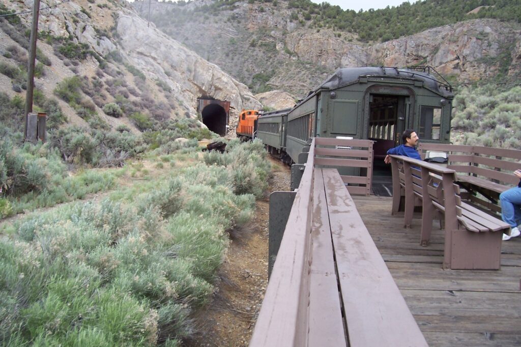
ELY, Nev. — Scarcity is celebrated here in east-central Nevada where a famously quiet road meanders by, well, not much.
For more than 300 miles, from Fallon eastward to the turnoff for Great Basin National Park near Utah, Highway 50 rolls gently over several mild mountain passes and through three small towns. Depending on one’s perspective, the scenery is boring (“There’s nothing to see!”) or sensational (“Look at all the nothingness! How refreshing!”).
Twenty years ago, a Life magazine writer pinned “the loneliest road in America” status on Highway 50, and Nevada’s tourism commission has tried to turn that insult around by making it a motto. Travelers practically are dared to find something fun to do along the lightly trafficked stretch. The attractions they encounter are, for the most part, modest at best. A historic walking tour of Eureka, anyone?
The Nevada Northern Railway Museum in Ely is a worthy stop, however, especially for historic-train buffs. Its steam- and diesel-powered excursions, which operate at least twice daily through Labor Day and on weekends through December, represent rides into history. The clickety-clack feel and racket of its two 1920s passenger cars and slightly younger outdoor car, with a yellow caboose in tow, give modem riders an idea of what traveling on the tracks was like when the Nevada Northern was at its peak.
One hundred years ago this September, Ely (about 250 miles north of Las Vegas) became linked to the Southern Pacific railway line that ran across the state’s northern region, through Wells and Winnemucca. Passengers were hauled up and down the branch line but eventually were crowded out by ore trains, dozens of which passed through Ely each day on their way from the mines west of town to the concentrator a few miles to the north, in McGill. Passenger train service to and from Ely ended in 1941, when bus service took over until the Ely Depot’s closing.
On a cool and clouding morning in mid-June, I boarded the 9:30 a.m. train toward Ruth, site of what once was the world’s largest open-pit mine. Talk about lonely: Only two other tourists were on board, a couple from Phoenix. We were outnumbered by the crew, which consisted of the engineer, a narrator and two snack-bar workers who sat with her, and the conductor, Gene Rogers.
Rogers, a longtime resident of the Truckee/Lake Tahoe area in Northern California, joined me for a while on the outdoor car’s wooden benches and supplemented the narrator’s commentary, which came through speakers that I found difficult to hear. Among other things, he pointed out that best-selling novelist Stephen King was inspired to write “Desperation” after a visit to the area.
“He’s got an active imagination,” the gray-haired Rogers said when I asked his opinion about King. ‘They made a TV movie of that book. l watched for about 10 minutes and then found something else to do.”
We got a good view of downtown Ely from hil1side tracks that then snuggled next to Highway 50 and continued through two tunnels, one old and the other modern, toward the mines. Although we stopped short of Copper Flat, we got close enough to its humungous mounds of mining-displaced rocks to gain a fundamental understanding of how productive this operation was before World War II. These days, molybdenum is among the minerals extracted from the west-of-Ely hills and shipped to China for processing, Rogers said with a tone that suggested frustration, but that have been my imagination.
Raindrops drove the Arizona couple into an enclosed passenger car for a portion of our 45-minute return. As the train chugged toward the depot, the 1915 locomotive occasionally belching out clouds of black smoke, passengers were asked if they cared to take a post-ride walking tour of the museum and its grounds, at no extra charge. l couldn’t spare the time, but luckily had squeezed in a quick tour of the depot before hopping on board
Keith Stone had been kind enough to show me about the building’s second floor. Our first stop was in the storage room, where ledgers, forms and other items occupied shelves as they had since the depot’s closing in 1983. “We dust it pretty carefully and, who knows, maybe some of this stuff will still be around a couple hundred years from now,” Stone said. He pointed out a telegraph machine, about the size of a shoe box, from around 1900 and a watt meter made in 1909.
We also stopped briefly in the control room, superintendent’s office and assistant superintendent’s office before I had to scurry downstairs to heed Rogers’ bellowing ”All aboard!”
Nevada Northern Museum’s excursion trains cost $23 general, $15 for children ages 4 through 12 and are free for younger kids. Combination tickets, which include the ride to Ruth plus an outing north to McGill, which also takes 90 minutes to two hours, are sold for $35 general and $20 for children. Special-event trains are scheduled throughout the year, including “Ales on Rails,” 7 p.m. excursions that offer snacks and hand-crafted beers, on July 22 and Aug. 26; “Sunset at Steptoe Wine Trains,” also at 7 p.m. and stocked with hors d’oeuvres, on July 8 and 29, Aug. 12 and Sept. 9; “Haunted Ghost Trains,” Saturdays in October; and holiday-themed “Polar Express” outings from Nov. 24 through Dec. 23. Last year, more than 13,000 people rode the rails from Ely’s quaint, charming museum and depot.
For more information, ca11 (866) 407-8326 or (775) 289-2085, or visit www.nnrv.com.
Sidebar:
Several other historical train rides are offered in the West, including:
- The Silver Line Express in Virginia City, Nev. The Virginia & Truckee Railroad makes 35-minute round trips to Gold Hill, through Oct. 3 l. For more information: (775) 847- 0380 or www.virginiacitv-nv.org.
- Heber Valley Railroad in Heber, Utah. A variety of steam- and diesel-powered train routes, including “Comedy Murder Mystery” and ”Tube ‘n Train Adventure,” are offered year-round. For more information: (435) 654-560 l or www.hebervalleyrr.org.
- Railtown 1897 State Historic Park in Jamestown. Calif Steam locomotives power through California’s Gold Country on weekends, April through October. For more information: (209) 984-3953 or www.csnnforg/raiJtown.
- Durango & Silverthorne’s narrow-gauge steam railroad in Durango, Colo. Trains run year-round, going a11 the way to Silverton from early May through October, and to and from Cascade the rest of the year. For more information: (970) 247-2733 or www.durangotrain.com.
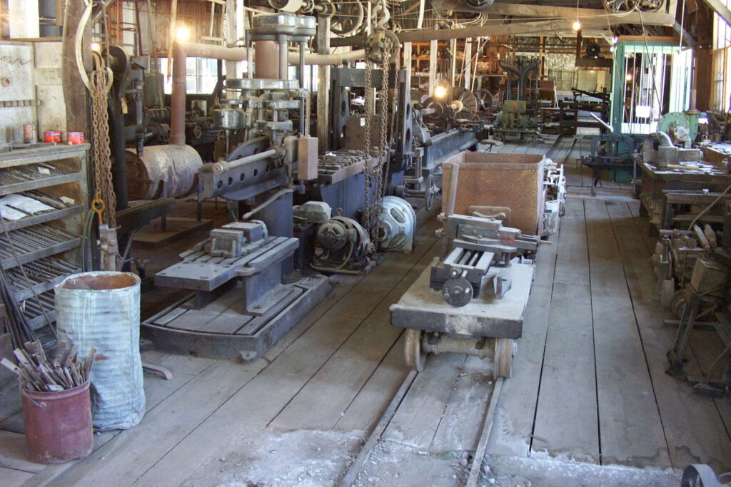
GRASS VALLEY – If you are looking for a family outing that has gentle education and exercise possibilities in slightly cooler temperatures than we endure in the Central Valley, Empire Mine State Historic Park is a most-worthy candidate.
Plenty of shady parking spots and picnic tables welcome those who arrive at the 800-acre park, which is a couple of miles south of downtown Grass Valley and a bit more than an hour’s drive northeast of Sacramento, off Highway 49. Seeing remnants of the mine, which closed in 1956 after a century’s digging that produced nearly 6 million ounces of gold, can broaden the mind. Sampling the 10 miles of hiking trails, which go off in many directions past abandoned mining-related sites, lets visitors work off a picnic lunch and immerses them in nature’s quiet beauty.
Back in the mine’s heyday, a long stretch of success from 1884 to World War II, quiet was not something one could enjoy in the area. At one point the operation had 80 stamps, 1,750 pounds apiece, that smashed ore into particles from which gold eventually could be extracted. What a racket that must have been.
“If you woke up in town, it was because the stamp mill stopped, and there was a problem,” one of the park’s volunteer docents, Pricilla, told a Saturday afternoon tour group earlier this spring. “I’m sure a lot of the miners went deaf.”
A lot of those miners had roots in southwestern England. They had flocked to the Northern California foothills in the late 19th century to practice their expertise in hard-rock mining. Tin and copper had been taken from Cornwall’s hills for more than a thousand years, and these immigrants knew how to get the job done in Grass Valley. By 1890, the town’s population reportedly was 85 percent Cornish.
“In the 1880s,” Pricilla told us, “almost everybody in Grass Valley had a Cornish accent.”
Mining yard tours such as Pricilla’s cost $1.50 general and are given two or three times daily, though a free self-guided exploration suffices in that most attractions are accessible and aptly described by signs. One must-see exhibit is near the dilapidated headframe’s base: a flight of stairs down to a view of the main shaft. Between 1865 and 1914, the tunnel grew from 200 feet to four-fifths of a mile long. Offshoot shafts extended thousands of feet more, and reached almost one vertical mile below the surface, according to a park brochure.
What went on down there could be grim. Air-powered drills, which came into play in the 1870s, created so much dust that “at least half the workers in Western mining were stricken by silicosis, an often-fatal lung disease,” reports one of the park’s nugget-rich signs. Water-propelled drills of the 1890s improved matters somewhat.
Mules that pulled ore cars had it rough, too, living most of their lives underground. Another park sign tries to make light of the situation by saying miners loved the mules and often gave them what apparently passed as treats. “Some mules refused to start their day without a snack of tobacco.” Animals didn’t have many rights in those days.
Today, the Grass Valley area’s 367 miles of mining tunnels are mostly submerged in water. Empire Mine’s surface is much more inviting thanks to an extensive network of trails. Three main ones, the Hardrock, Osborn Hill Loop and Union Hills, are described nicely in a self-guided pamphlet available in the gift shop for $1. Also worthwhile is a short stroll from the visitors center over to the Empire Cottage, home to the mine’s longtime owner, William Bowers Bourn Jr. (1857-1936). The grounds around it are immaculately landscaped. Cottage tours are given at least once a day; best arrive before 1 p.m. to make sure you don’t miss them.
A scale model of the mine, in a room off the visitors center, also merits a look.
Other mining-related tourist attractions in the foothills include Angels Camp Museum in Angels Camp, the California State Mining and Mineral Museum in Mariposa, Gold Bug Mine in Placerville, Gold Country Museum in Auburn, Kennedy Mine Tours in Jackson (affiliated with the Amador County Museum) and Malakoff Diggins State Historic Park, about 30 miles northeast of Grass Valley.
Empire Mine State Historic Park is open from 9 a.m. to 6 p.m. daily through August, and from 10 a.m. to 5 p.m. September through April. Admission is $2 general. For more information: (530) 273-8522 or www.parks.ca.gov.
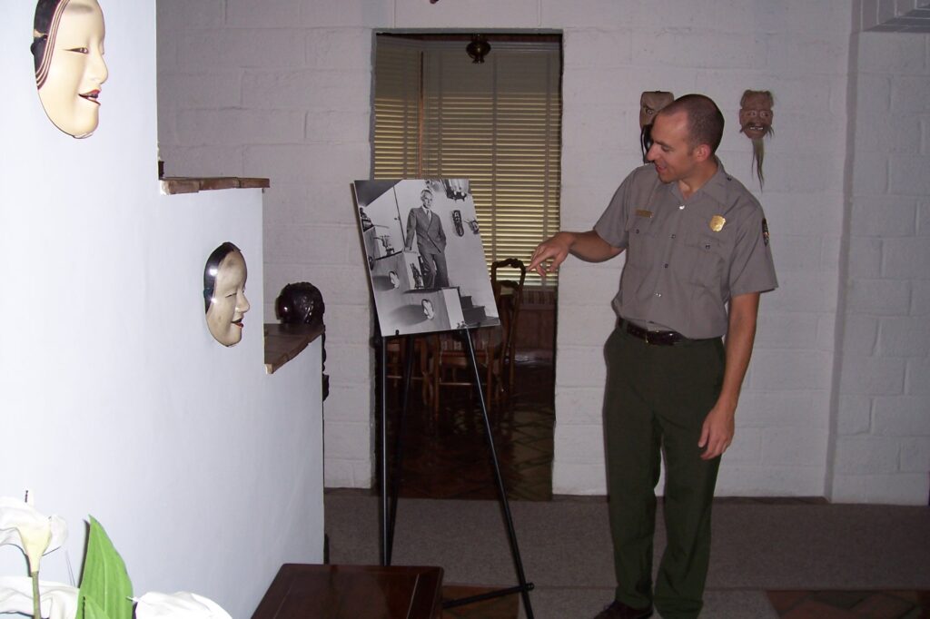
DANVILLE — A short day’s journey southwest of Sacramento is a dwelling influenced by the Far East. Tao House, with its Chinese lettering on the front gate and feng shui-correct front garden, also is the onetime home of Eugene O’Neill.
The only American playwright to be awarded the Nobel Prize (in 1936), O’Neill also won four Pulitzers: for “Beyond the Horizon,” “Anna Christie,” “Strange Interlude” and, posthumously, “Long Day’s Journey Into Night.” He often has been hailed as our nation’s best and most influential dramatist.
Some of O’Neill’s greatest works were written when O’Neill and his third wife, Carlotta, lived in Tao House, from late 1937 until early 1944. Tours of the structure, part of the 13-acre Eugene O’Neill National Historic Site, are offered on a reservations-only basis year-round by the National Park Service. I went there on a hot Friday in late August, when only one other visitor showed up.
Our intimate tour was led by Matthew Greuel, who has worked at the site since March. The friendly and impressively studious park ranger spent two hours telling us about the O’Neills as we went room-by-room through the thick-walled, decoratively cold house.
First, though, we stood in the garden out front, where Greuel pointed out that none of the various brick paths is in a straight line, and a few lead to nowhere in particular. He identified this as a feature of feng shui, one that confuses evil spirits, who as you may not know travel only in straight lines. The name Tao House was inspired by O’Neill’s interest in Eastern thought and his wife’s appreciation of Asian art.
The entryway is distinguished by a picture of a severe-expressioned O’Neill taken there by Life magazine in the early 1940s. Some of the masks shown in the photograph, or approximations thereof, are hung nearby.
We moved into the sparsely furnished living room, which has a large blue-tinted mirror inset in the wall. The O’Neills originally planned to have these spaces serve as bookcases but quickly rejected the library-like ambience and stored their thousands of volumes elsewhere. A stunning, large rug in the middle of the room is one of the house’s many period furnishings, though only some are original.
Greuel shared other details about O’Neill’s life as the tour progressed through more rooms and up to the second floor. The radio room, in which the O’Neills kept apprised of World War II doings, has many photographs of friends and relatives. Several depict James O’Neill, the playwright’s father. He was one of the 19th century’s most revered actors and someone whose career had a deep impact on his son’s writings.
The elder O’Neill in 1885 purchased the rights to Alexandre Dumas’ “The Count of Monte Cristo” and spent the rest of his life performing as its title character, Edmund Dantes. Greuel said James O’Neill played the role about 6,000 times (which calculates to almost 16 1/2 years’ worth of daily stagings). Repulsed by such melodrama through constant exposure to it as a child, Eugene O’Neill pursued and mastered serious and avant-garde playwriting inspired by European masters such as Henrik Ibsen and George Bernard Shaw.
Also downstairs is a picture of the playwright with the third of his three children, Oona, born to O’Neill and his second wife, Agnes, in 1925. Oona enraged her father by marrying, as a teenager, film legend Charlie Chaplin – born in 1889, the year after O’Neill entered the world.
“You are never going to hear of our entertaining Mr. and Mrs. Chaplin or of their entertaining us,” O’Neill wrote to a friend, according to a display in the gift shop. “Enough is enough.”
Greuel also outlined O’Neill’s association with Carlotta Monterey, a thrice-married actress who first caught the playwright’s eye during rehearsals of his “The Hairy Ape” in the early 1920s. Years later, the two encountered each other again in Maine and began an affair. Once O’Neill divorced Agnes in 1929 (he also had a short marriage, in 1909, to Kathleen Jenkins), he and Carlotta tied the knot near Tours , France, returned to the United States and settled in Georgia.
A trip out West to visit Carlotta’s mother and daughter led the couple to Danville and the construction of Tao House. There, O’Neill hoped that the land’s isolation would allow him to overcome physical challenges and resume a stalled writing career.
That intention was fully realized. In his upstairs study, which could be closed off by three doors, he composed his final plays, including “The Iceman Cometh,” “Hughie” and his last completed work, “A Moon for the Misbegotten.”
In this room he also wrote “Long Day’s Journey Into Night,” his favorite and largely autobiographical masterpiece, with his parents, brother and himself depicted by characters named Tyrone. The experience was an emotionally draining one, as Carlotta reportedly said , “For every day he worked, he looked like he had aged a year.”
“I give you the original script of this play of old sorrow, written in tears and blood,” O’Neill writes in the play’s dedication to Carlotta on their 12th anniversary. “A sadly inappropriate gift, it would seem, for a day celebrating happiness. But you will understand. I mean it as a tribute to your love and tenderness which gave me the faith in love that enabled me to face my death at last and write this play – write it with deep pity and understanding and forgiveness for all the four haunted Tyrones.”
Greuel handed us laminated copies of O’Neill’s penmanship – from “The Web” in 1913, “The Emperor Jones” in 1920 and “Long Day’s Journey Into Night” in 1940. The last is impossible to read without a magnifying glass, the lines crammed seven or eight to an inch. They illustrate the struggles O’Neill had with an illness that was similar to Parkinson’s disease and caused his hands to shake so much that by 1944 he no longer could write.
Our tour ended downstairs in the gift shop, which has copies of O’Neill’s major works.
O’Neill died in a Boston hotel in 1953. Three years later, despite his orders that the play not be staged until a quarter-century after his death, Carlotta released “Long Day’s Journey Into Night” to great and lasting acclaim.
Sidebar:
WHAT: Free tours of the Tao House in Danville begin at 10 a.m. and 12:30 p.m. Wednesdays through Sundays.
TO GET THERE: Tours start at the Sycamore Valley Road exit’s park-and-ride lot a few hundred yards east of Interstate 680; park rangers drive visitors from there to the house. Reservations are required at (925) 838-0249.
INFORMATION: www.nps.gov/euon
SPECIAL EVENT: The 2005 Eugene O’Neill Festival, to be held Sept. 28-Oct. 2 in Danville, will include the on-site staging of “Hughie” and various special events.
INFORMATION : www.eugeneoneill.org or (925) 820-1818.
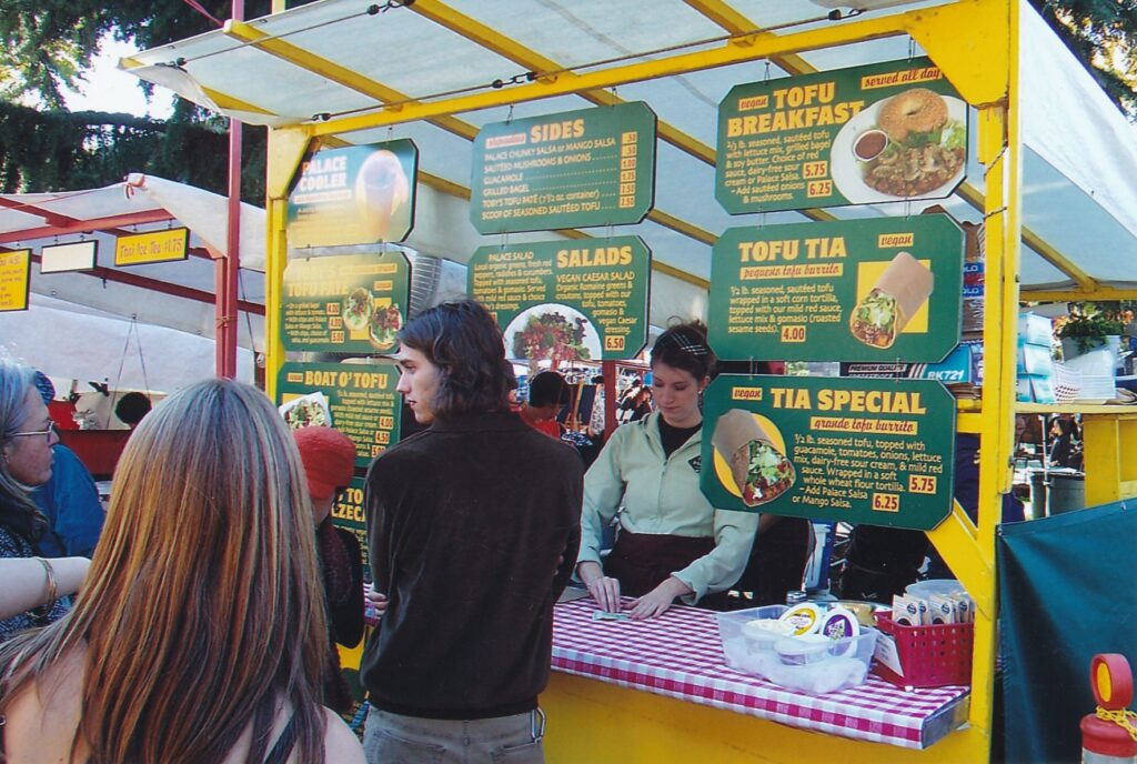
EUGENE, Ore. — Reggae music blasted as the laid-back waiter in an apron arrived with our pizza. The 14-incher was loaded with spinach, peppers, onions, pesto, broccoli, cauliflower, acorn squash, pears, apricots and corn — still on the cob – among other unconventional things. The sauce was vegan and the vibe was way cool, mon.
So it goes in the countercultural portion of Eugene, which is a substantial portion and one worth exploring if you find yourself in this central-west Oregon town of 140,000 residents. Although you easily could find a chain pizzeria here whose fare is the same in all 400 nationwide locations, it’s more likely you would remember your experience at the Pizza Research Institute (at 1328 Lawrence St, a hard-to-find locale), which the local alternative weekly newspaper proclaims is the best in town.
Home of the progressive University of Oregon and surrounded by thickly forested hills, Eugene is like the Northwest version of Boulder, Colo., or Santa Cruz. There’s a lot of hippie residue here, with tie-dye shirts galore, bicycling students and commuters, old VW bugs, dreadlocks and a bunch of exceptionally realized vegetarian restaurants. All the brand-name motels, restaurants and stores are here too, including a Wal-Mart on the western part of town. A sister city on the eastern side of interstate 5, Springfield, is billed as a conservative counterweight. But the heart of Eugene is what my vegan wife and I refer to as “crunchy” — in other words, it caters in large part to what’s often derogatorily referred to as the “granola crowd.”
The town’s crunchiest event, the Saturday Market at Eighth Avenue and Oak Street, calls itself the oldest weekly, outdoors crafts fair in the United States. From 10 a.m. to 5 p.m. Saturdays, April through early November, its crafts vendors, organic-farm stands and Grateful Dead-esque bands draw appreciate crowds from throughout the Willamette Valley. Its many food stands include Tofu Palace, whose marionberry-topped cheesecake will help you realize that luscious desserts need not contain milk or eggs. For more information about the “rain or shine” market, which for the six weekends leading up to Christmas moves indoors to the nearby Lane Events Center: www.eugenesaturdaymarket.org.
Fifth Street Public Market, off High Street, provides another downtown shopping experience, seven days a week, inside a warmly restored building. In no way does its ambience compare with the Saturday Market’s, however.
Green and yellow are a big part of the ambience at the University of Oregon, home of the Ducks — a mascot and concept embraced statewide (outside of Corvallis, home of the Oregon State Beavers). The school’s signature colors are displayed not just on the sweatshirts of its proud students but also in the beautiful landscaping. We learned on a tour that more than 4,000 trees of some 1,000 varieties provide shade (and limited protection from frequent rain) on the campus. In mid-October, many of those trees’ leaves were in their golden, dying glory.
The 90-minute campus tours, offered at 9:30 a.m. and 12:30 p.m. weekdays when school is in session, are free and cater primarily to prospective students and their parents (the tours conclude with a sit-down Q&A session about admissions). Julie Blakley led our group of two dozen or so on a sunny Friday afternoon. She showed us a typical dorm room (pretty tiny), pointed out features of the green-friendly Lillis building (powered significantly by solar energy), said class sizes never exceed 250 students and average about 30, and reported that Oregon graduates lead the nation per capita in post-college Peace Corps service.
“I consider U of O to be the perfect size,” said Blakley, a journalism major and honors student from Colorado. The senior explained that with about 15,000 students, Oregon is large enough to have “all the amenities” but small enough so that students can pretty much take whatever classes they desire. She also pointed out that due to its student population being 10 percent Californian, the school sometimes is referred to as “UC Eugene.”
The school’s amenities include a diverse food court in the centrally plotted Erb Memorial Union universally referred to as EMU. Health-food enthusiasts are sure to appreciate the Holy Cow Cafe (www.holycowcafe.com), which specializes in no-cholesterol Indian, Mediterranean and American fare. The university’s main dining hall was the site of a colleges-in-the-movies classic: The food-fight scene in 1978′ s ‘”Animal House,” starring John Belushi.
Off-campus, more scrumptious desserts can be found at the Sweet Life Patisserie (www.sweetlifedesserts.com), open until 11 p.m. daily at 755 Monroe St. (between Seventh and Eighth avenues). When we stopped by at 10 p.m. on a Frida y, the place was packed with people getting their late-night sugar fix. We tried the cherry-chopped cheesecake and raspberry chocolate cake; like every other food dish we sampled in Eugene, they were superb.
Keeping with the sweet-tooth theme, Luna & Larry’ s Coconut Bliss ice creams (www.coconut bliss.com) are not to be missed. The local, organic product is made simply, with coconut milk instead of regular milk and with none of the chemicals and other hard-to-identify ingredients found in most big-brand ice creams.
Although walking around campus is a pleasurable way to bum off such dessert-delivered calories, climbing Spencer Butte represents a more vigorous workout. A few miles’ south of town and allowing 360-degree views from its summit, Spencer gets the heart pumping with its rocky switchbacks near the top of a 1.5-mile ascent. lf you go, expect plenty of company: Hundreds of hikers visit there each day, many of whom incorporate the butte into their workout routines.
Another great place to take a walk is Hendricks Park, a few blocks east of the campus on one of the region’s many hills. Established in 1906, the 78-acre park contains several trails that wind through thick forests, a native plant garden and the popular Rhododendron Garden, which is at its blossoming best from mid-April through mid-May.
One of the better places to stay in town is the admittedly mainstream Best Western New Oregon Motel, directly across from the campus at 1655 Franklin Blvd. In addition to its prime location, the motel has private rooms that overlook a creek. Make certain to ask for that kind of room when you reserve well in advance and you will be rewarded with daily sightings of ducks, many of whom fit right into U of O’s school pride with their green heads and yellow bills. For more information about the motel: (541) 683-3669 or www.bestwesternoregon.com.
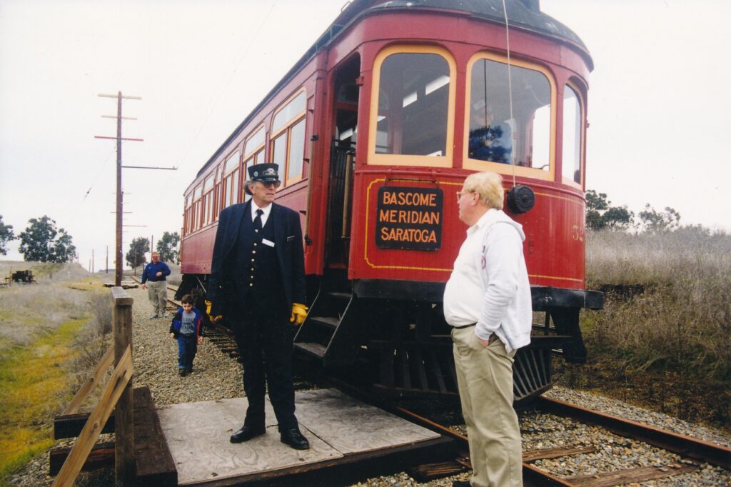
FAIRFIELD — One of the problems with being a grown man is, sometimes, inside there’s a little boy who wants to come out and play. Can any day trip from Sacramento satisfy both the mature adult and the child trapped within?
Allow me to suggest a looping drive, of about 125 miles, down to the Delta, across to Fairfield and back via the freeway. Along the way are, for that little boy in you, unlimited train rides. And for the grown man? Free beer.
The Western Railway Museum, about 10 miles southeast of Fairfield off Highway 12, displays a widely assorted but largely decrepit stock of trolleys, “interurbans,” passenger cars and assorted other rickety-racks that used to go clickety-clack on the nation’s once proud rail system. After admission to the museum is paid, visitors can ride a 10-minute trolley or 45-minute interurban as often as they wish until closing time.
Over on the west side of Fairfield, a landmark for motorists traveling along Interstate 80 and the nearby-merging Highway 12 is the Anheuser-Busch brewery, where tours are offered hourly. Visitors assemble in a lobby, where the guide pours forth with Budweiser’s advertisement spiel while a bartender dispenses free suds.
The train rides are bone-shakers. The beer goes down smooth. Call this day trip the Bumps and Brews.
Or reverse the loop, as I unwisely did one recent, overcast Saturday — visiting first the brewery, then the railway museum. Kegs and Cogs… with a little indigestion.
Anheuser-Busch Fairfield Brewery Tour: Before having a seat in the lobby, everyone of legal age can select from among seven beers that are served in 8-ounce (approximately) cups. Soft drinks and pretzels also are available. Fifteen to 20 minutes later, the walking portion of the tour begins, and the paper cups are left behind.
The most cups anyone can leave is, gulp, three.
“We have a lot of repeat customers,” admitted David Bunuan, who guided the nine of us that morning on the 10 o’clock tour. “And many of them don’t bother with the walking part.”
While visitors are still seated in the lobby, numbers bubble out of the guide so big and so fast that your head is spinning, even before the alcohol hits. The plant can process 1,200 bottles, or 2,000 cans, of beer each minute. Ina 24-hour period, 3.5million six-packs can be readied for shipment. More statistics flow from two of the megacorporation’s videos, which further explain the beer-making process and the much-ballyhooed born-on-dating markings.
Ever wonder what all that “beechwood-aging” braggadocio is about? A video explains it. The tremendously large brewing tanks — exactly how large will be spelled out within a few paragraphs — have 800 pounds of beechwood chips lying on the bottom, soaking up the yeast as part of the fermentation process. A factory worker is shown raking the brown, curly-cue chips while wearing rubber boots before the barley, water and rice come pouring in. Beer soaked for days in wood chips — my ignorance was bliss.
From the lobby we strolled, in soberly single file, along the second-story platform past the packaging floor, big enough to hold at least two football fields and, perhaps, a few NFL superstars’ egos. The machinery was sparkling, but mostly silent. Bunuan explained that the plant was in a down cycle, awaiting orders for more shipments to the Northwest United States, Canada and Hawaii.
We stepped outside for a few feet before entering the five-story “brew house,” which contains 120 brewing tanks that hold 56,000 gallons of beer apiece. In order to drink one full tank’s worth, Bunuan claimed, a person would have to consume a 12-ounce beer every hour of every day for, gulp again, 74 years.
“Are any of you on that pace?” he asked the group, some members of whom chuckled nervously. I mused about some journalists I’ve known, and then the tour continued for a few minutes before, handily, ending in the gift shop. Needless to say, in this room that is drunk with Budweiser clothing, hats and kitsch such as kitsch cans, the money not spent on the tour and beer quickly quenches the thirst of Anheuser-Busch’s cash registers.
Western Railway Museum: The little-boy within the grown-man idea certainly applies here, but any child and probably most female adults also would enjoy the laid-back atmosphere at this modest attraction. Visitors are free to ride, and inspect old railway cars, at their leisure. None of the displays is as spit-and-polish gleaming as the brewery’s equipment, and the tour guides aren’t college-age hip, but the overall effect is pleasing and mirrors the slower-paced times the museum represents.
Bouncing along in the interurban — a type of one-car train that typically was faster than trolleys and slower than long-range lines — motorman and guide Dennis Sloate pointed out it was built 98 years ago.
“Remember that back in 1901,” he shouted about the interurban’s noise as we passed farmland hardly blurred by our modest pace, “people weren’t in a very big hurry.” The car in which we rode, No. 52, served the San Jose-Los Gatos area and is one of the oldest operating railcars in the country, Sloate said.
Kids bustled about noisily and happily during the little trip, which is offered at the top of every hour. Beginning and ending its outing in the museum’s yard, the “Peninsular” passed a dizzying collection of old, donated railroad gear. The better-preserved railcars are kept in a steel-covered barn, where the ones with open doors may be inspected by visitors on self-guided tours. Detailed pamphlets are available but must be left behind for subsequent guests.
Among the railway relics is a trolley that logged some 1.29 million miles on the streets of Melbourne, Australia, from 1930 until 1982, and for another two years hauled passengers along San Francisco’s Market Street as part of the Historic Trolley Festival. Since 1986, it has been displayed at the museum.
Western Railway rolls out the welcome wagon for families. Children can explore to their hearts’ content, there are plenty of picnic tables and other shaded areas, and families of five or more are given an admission discount.
It was my intent also to visit the touted Travis Air Force Museum (707-424-5605), which is on the base between the brewery and railway museum. Recently heightened military security dissuaded me, however — visitors must call the museum ahead and arrange an appointment, a procedure I had not known about and didn’t have time to complete. But it is possible for in one day to visit the air and rail museums, along with the brewery.
Call it Planes, Trains and Designated Drivers.
AT A GLANCE
Anheuser-Busch Fairfield Brewery Tour: Take the Highway 12 exit off Interstate 80, follow signs for Chapman University, go under the Highway 12 overpass and tum right on Busch Drive. Tours are offered free, at the top of each hour, daily from 9 a.m. to 4 p.m. Call (707) 429-7595.
Western Railway Museum: On the south side of Highway 12, 10 miles southeast of Fairfield and 28 miles west of interstate 5. Open 11 a.m. to 5 p.m. weekends; from July Fourth through Labor Day it also is open Wednesdays, Thursdays and Fridays. Admission is $6 for adults, $5 for seniors 65 and older, $3 for children under 14, $18 for a family of two adults and at least three children. Call (707) 374-2978, or visit the Web site (www.wrrn.org ).

FERNDALE – “Where are you folks from?”
We were at the corner of Main Street and Ocean Avenue, catercorner from the Victorian Inn. The question had come from an unshaven, middle-age man who wore a rather ratty-looking sweatshirt and nonmatching sweatpants. My first thought, uncharitably, was that he would ask for money.
I thought wrong.
After we told him we were from Sacramento, which is 310 miles away, he suggested in an upbeat, innocent tone that we should walk up the Northern California town’s hillside cemetery. From there, on a clear day one can see the Pacific Ocean, about five miles to the west. In the foreground would be an overview of Ferndale, a town of about 1,400 residents that is renowned for its Victorian charm. Before the man walked off with a smile and wishes for a good visit, he squeezed in the fact he owned a house by the ocean.
No, he did not need any of our money. An independent comfort level seems to be common in Ferndale, where many homes and businesses have been spruced up to resemble their young selves around the end of the 19th century. This is no “architectural Disneyland,” as my wife pointed out, but genuine. The town’s careful restoration work along with its manageably small size have spurred a softly humming tourism trade.
Another tourism boost is Ferndale’s tasteful quality of shops. Kitsch is not king here, as it is in other Western historic towns such as, say, Virginia City, Nev., or even Old Sacramento. The sweet aroma outside the candy store is enticing without being overstated; the blacksmith store is full of high-quality, of-the-period items that are made onsite, as are some contemporary pieces. Other stores offer high-end trinkets typical of what might be encountered by visitors to St. Helena, in the Napa Valley.
Sri Venkat of Fremont, in town during Labor Day weekend with her husband, Vijay, seemed to be impressed, even relieved, with the low-stress nature of Ferndale shopping. Choices are simple when the “main drag,” Main Street between Shaw and Ocean avenues, is only three blocks long. “There’s one store for everything,” Venkat said. “You want to visit a wine shop? There’s just one wine shop.”
In researching a visit, it is likely that you would come across promotional claims to the effect that downtown Ferndale features a frictionless blend of locals, simply going about their business, with tourists. My wife and I found that to be true. From what we could tell, locals were out and about on Labor Day, and if anything tended to be friendlier than the tourists. Many of them are nearby farmers, which brings up another Ferndale attraction: The surrounding bucolic area is appealing in a rolling-hills, neat-and-tidy-farmhouses, green-pastures, happy-looking-cows kinds of way.
Main Street’s buildings are highlighted in a self-guided walking tour whose map and written blurbs provide dates of construction and, in some cases, architectural style (Mission Revival, Italianate, Victorian False Front, etc.). That tour and chatty stories about buildings and other attractions are in the readily available Ferndale Enterprise Souvenir Edition. The regular, weekly Enterprise, by the way, has been published continuously for 125 years.
Sprinkled throughout the rest of Ferndale, among well-maintained houses of other styles, are many beautiful Victorians. Take time to walk around town and you likely will appreciate whatever you see. Among the more colorful Victorians is the Gingerbread Mansion, a bed-and-breakfast at 400 Berding St. Several other fine examples of the 19th century architectural style that coincided with Queen Victoria’s reign in Great Britain (1837-1901) are on Berding, parallel with Main Street one block to the east. Ferndale is, after all, The Victorian Village. That nickname is beyond informal; it has been trademarked.
The Arnold Berding House, between Berding and Main streets on Ocean Avenue, should not be missed. Out front are five distinctively pruned coast cypress, or “gumdrop,” trees. They reminded me of beehive hairdos from the 1960s.
Another residence of note was built by town founder Seth Shaw in 1854-1856. The Carpenter Gothic Revival mansion, inspired by novelist Nathaniel Hawthorne’s house of seven gables, is a half-block north of the shopping district. My wife and I were fortunate enough to experience it intimately, as paying guests. Our decision to spend the night in Ferndale had been made rather last-minute, and we felt fortunate to secure a room during a holiday weekend in what is now the Shaw House Inn Bed & Breakfast.
Good luck extended well beyond mere availability. We loved the place. The common rooms are warm, with contrasting furniture pieces that manage to work beautifully together. Each of the eight private rooms has its own bathroom. Our room, the second-floor Garden, has a splendid balcony on which we enjoyed the drinks and dinner we had brought ourselves. The 1-acre grounds are well-cared for, almost like a botanical garden, and provide a lot of privacy.
Breakfast on Labor Day was a good experience, too. Owner Jan Culbert generously accommodated our vegan diets while serving quiche Lorraine to other guests. Common items included organic coffee, a tidy assortment of fruit and homemade scones. (Culbert rushed about to serve cookies the late afternoon before; her astounding assortment of teas also were available at that time.) Her homemade muesli, with old-fashioned oats, wheat germ, brown sugar and dried fruits – but no raisins; Culbert made it clear she’s no fan of those little wrinkly things – was another yummy breakfast treat.
Sri and Vijay Venkat were our breakfast companions. The couple, both software engineers, like us were spending just one night at Shaw House. They had driven up from the Bay Area on Sunday, managing to get a taste of the very visitable, redwoods-rich Avenue of the Giants along the way. Vijay said he was especially impressed with how Culbert runs Shaw House.
“We’ve been to other B&Bs that are more commercial. It’s like, ‘Here’s your breakfast, you have to leave by this time …’ Here, she’s not like that. It’s more relaxed.”
Culbert has owned Shaw House a bit more than two years and said she has been coming to Ferndale for 40 years. At our breakfast table, the Marysville-area native spoke with much enthusiasm about the small town and its many special activities. Among the latter are the Victorian Village Oktoberfest & Harvest Day in October, the Ferndale Christmas Lighted Tractor Parade on Dec. 14 (“Have you seen those electric-light boat parades?” Culbert asked. “Those boats have nothing on our tractors!”) and the Kinetic Sculpture Race, whose 35th annual version will be held over Memorial Day weekend 2004.
After breakfast, Kari and I strolled about town, not minding that some of the shops and museums were closed for the holiday. Our visit ended with an aerobic walk up the steep cemetery hill, where indeed the view of Ferndale and coast was lovely. We agreed that Ferndale is very much worth an overnight visit, though perhaps is not substantial enough to warrant a multiple-days adventure. If you are heading up the North Coast and have time, stop by if interesting architecture, laid-back local flavor and yummy muesli are your thing.
By the way, driving from Ferndale to the ocean is worthwhile primarily for the scenery along the way. The beach is nothing special by California standards.
Ferndale bills itself as the westernmost town in the United States’ “lower 48.” It is five miles west of Highway 101, 24 miles southwest of Eureka. For more information about Ferndale attractions and special events, contact the Chamber of Commerce at (707) 786-4477 or visit its Web site, www.victorianferndale.org/chamber. For more information about the Shaw House Inn Bed & Breakfast, whose room rates range from $85 to $185, with AAA and other discounts available: (800) 557-7429; www.shawhouse.com; e-mail stay@shawhouse.com; or write to 703 Main St., Ferndale, CA 95536.
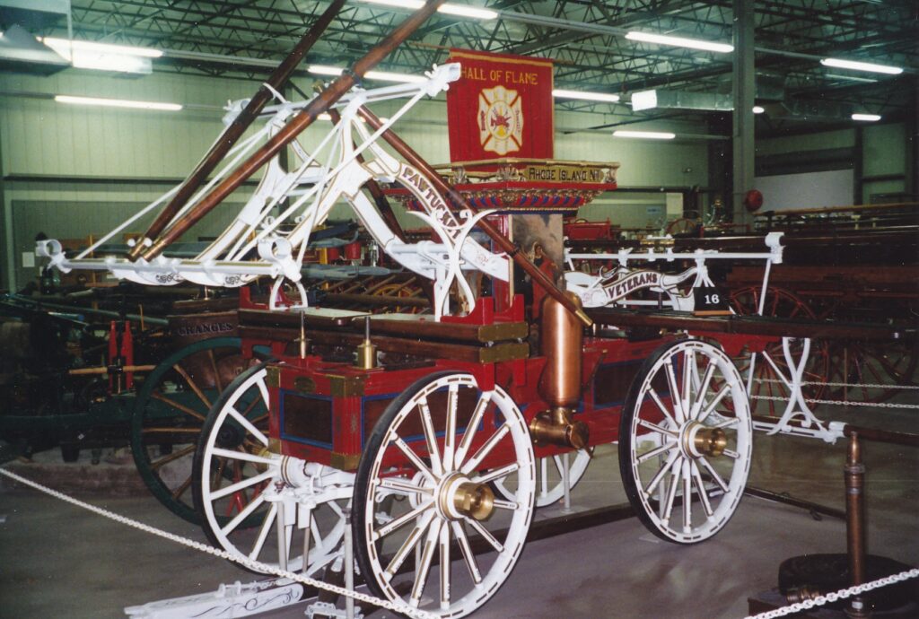
PHOENIX — Take a crack at this bit of trivia: For what purpose did Philadelphia purchase what came to be known as the Liberty Bell?
Here’s a not-so-subtle hint: The answer can be found at the Hall of Flame Museum of Firefighting, founded 41 years ago in a city where summer temperatures routinely climb the ladder well past 100 degrees Fahrenheit. Where better to have a shrine that honors one of the world’s most dangerous, and most respected, professions.
The museum, in Phoenix Papago Park near the city zoo and baseball stadium where the Oakland Athletics host spring-training games, perhaps has more allure than ever in light of the Sept. 11 attacks in New York, Washington, D.C., and Pennsylvania. Americans have been made more aware of how noble and brave firefighters can be. Here is a place to honor them and to learn more about firefighting history and traditions.
Most of the museum’s floor space is occupied by nearly 100 wagons, trucks and trailers that date back to 1725. That earliest contraption is first up on the self-guided tour laid out in a very-detailed book available from the front desk. Visitors can take as long as they like to walk through the four main galleries and the National Firefighting Hall of Heroes. They also can watch any of six 30- to 60-minute films, whose titles include “Escape! Infamous and Tragic Fires.”
Anyone with merely a flickering interest in firefighting equipment is likely to be most interested in the Hall of Heroes. Vivid photographs of wild-land blazes, mannequins dressed in various types of gear and many tales of heroism are exhibited. Each of 343 firefighters who perished in the World Trade Center attacks is pictured next to a large painting Sandy Boyer’s “Ground Zero,” that depicts two firefighters raising a U.S. flag amid the site’s devastation.
For every year beginning with 1981, the gallery names all those whom the U.S. Fire Administration lists as having died in the line of duty. For example, 135 were killed nationwide in 1988, including four Californians. Sacramentan Gary D. Nagel, a member of the state’s Department of Forestry, was among 95 firefighters who perished in 1998.
Tales of individual acts of bravery abound. Following is the museum’s write-up about Jack Baker, a firefighter from Turn of River, Conn., who received a Heroism and Community Service Award from Firehouse Magazine 24 years ago:
“It was 3 a.m.July 26, 1978. Volunteer firefighter Jack Baker was awakened by an automobile crash and he rushed to the scene. A car had overturned; a young woman was trapped, her legs caught beneath the dash. The car was on fire, the flames quickly expanding, but Baker kept trying to free the entrapped girl.
“The fire grew and the girl’s legs began to burn. Baker kept on, suffering the heat and smoke, until he finally extricated the girl. Both the victim and firefighter were rushed to the hospital with second- and third-degree burns.”
The various distinctions between and accomplishments of volunteer and professional fire departments are exhibited in a room off the Hall of Heroes. Two Currier and Ives lithographs depict a 19th century New York City volunteer firefighter — Nathaniel Currier himself — in action. A nearby display about fire alarms explains the Liberty Bell was bought to serve such a purpose.
Another piece of art worth checking out is a small copy of William Hogarth’s 1762 parody of the English political scene, with King George III shown struggling to put out a fire. The theater room contains glass-fronted cases filled with helmets old and not so old from around the world, and a wooden statue of Florian, the patron saint of firefighters. A 18th century cathedral in Krakow, Poland, is among many Roman Catholic tributes to him in Europe.
Much of the museum’s machinery has been superbly restored by retired firefighter Don G. Hale. If you go, be sure to check out the astonishingly ornate 1870 Buckley & Merritt Parade Carriage. Hand-drawn pumpers, horse-drawn wagons, an 1890 firefighting sleigh from Michigan’s Upper Peninsula, a 1919 truck from Baltimore with an “escape net” (“Many of the people who tried to jump into the nets missed and suffered injury or death,” the self-guided pamphlet says) and a 1935 engine from Norfolk, Neb., that is painted white — as opposed to the traditional red — are among the many other vehicles displayed.
Gallery 3 features a restored Phoenix Fire Department alarm room from the 1956-1982 era. Through a merger of telegraph lines, punch cards and telephone and radio technology, it monitored fires within the ever-expanding metropolitan area. Live PFD transmissions are aired at the display. “You are hearing real calls taking place right now,” a sign tells museum visitors. “It is NOT a tape!”
The Hall of Flame Museum of Firefighting, about a 10-minute drive from downtown Phoenix, is open from 9 a.m. to 5 p.m. Mondays through Saturdays and from noon to 4 p.m. Sundays. Admission is $5.50 general, $4.50 for seniors ages 62 and older, $3 for students ages 6 through 17, $1.50 for children 3 to 5 years old and free for anyone younger. For more information: (602) 275-3473 or www.hallofflame.org.
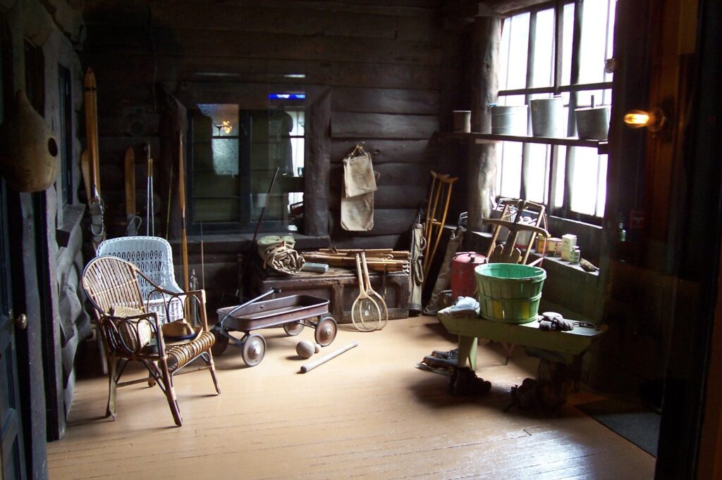
FLAGSTAFF, Ariz. — Forget for a moment that this high-plateau town of 53,000 residents and seemingly half that number of motels is the gateway to Grand Canyon National Park, 84 miles to the northwest. Instead, recognize it for a truly far-out achievement: Here, Pluto was discovered.
That little remote rock has been in the news lately, what with its planetary status having been seriously questioned and then emphatically revalidated by au international scientific panel that, for good measure, might tack on some other planets to our solar system as well. Long live Pluto!
Lowell Observatory, where 24-year-old Clyde Tombaugh discovered Pluto in 1930, is one of several tourist attractions in Flagstaff None of them has the jaw-dropping impact of the Grand Canyon, of course, but together they can constitute a seri.es of short stops that add up to a pleasant day.
Percival Lowell founded the observatory in l894 and spent the rest of his life searching for what he was convinced was a ninth planet. Tombaugh made his discovery 14 years after Lowell’s death, but the young astronomer waited until Lowell’s birthday – March 13 — to announce his find. Also, the plane’s name is an extension of Lowell’s initials.
Visitors can see the telescope Tombaugh employed to detect Pluto during 45-minute tours that are conducted on the hour from 10 a.m. to 4 p.m. through October (1 to 4 p.m. from November through February). At least they can when the weather cooperates.
During my visit on a Sunday afternoon in August a fast-moving storm cut short the tour because, our guide shouted persuasively over a thunderclap, large metal telescopes can act as lightning rods.
Before the meteorological pyrotechnics got out of hand, we were able to see the 6.5-ton Clark Telescope, built in 1906 and which was used extensively to help map out the moon during the 1960s Apollo program. In 1963, astronauts inc1uding Ed White, Frank Borman and Neil Armstrong peered through the telescope at what six years Jater was the site of Armstrong’s “one small step for man, one giant leap for mankind.” Their signatures are in a logbook displayed in the observatory’s rotunda.
Lowell Observatory continues as a research station and looks to uncover more mysteries of deep space with a state-ot-the-art Discovery Channel telescope nearing its start date. If you visit the hilltop observatory complex, be sure to park your car just outside its entrance for a sweeping view of the town below.
Riordan Mansion, another Flagstaff attraction, represents an impressive earthly endeavor from the town’s formative years. Technically it’s a duplex, but its Arts and Crafts construction, Gustav Stickley furniture and 40 rooms spread out over 13,300 square feet make this woodsy retreat a residential standout.
Commissioned by two brothers who oversaw the local logging industry and designed by the same architect, Charles Whittlesey, who created Grand Canyon’ s Hotel El Tovar, Riordan Mansion consists of two multi-story homes connected by a large common area known as the “cabin.” Tours, conducted hourly from 11 a.m. to 4 p.m. daily (summertime tours begin at 9 a.m.), first examine the right-side house occupied by Timothy Riordan and his family. According to Eli Milazzo, our guide that Sunday, practically all the furniture and knickknacks are original. “The Riordans were packrats,” he said.
They also had a father with a playful sense of humor. In the cabin, Milazzo pointed to a pair of humongous shoes near the fireplace. Apparently, Timothy Riordan would tell people that he was good friends with Paul Bunyon and that these were his baby shoes.
Tours end in the less-preserved, left-side home, built for Michael Riordan and his family, which now contains exhibits such as a brief biography of Stickley (1858-1942). Known as the father of the Arts and Crafts movement of the early 20th century, the Wisconsin native eschewed ornate designs and pursued a simpler, more functional approach to furniture-making. You can check out two of his desks, close up, in this side of the mansion.
Two miles north of town, the Museum of Northern Arizona beckons with extensive and well-organized exhibits about the region’s native peoples and their ancient customs. For example, the Kiva Gallery describes how from roughly 900 to 1625, Indians of the Southwest painted colorful murals that were in observance of religious ceremonies.
Known as kivas, they were painted over — sometimes dozens of times — for subsequent observances in what a museum sign says illustrates «the Pueblo adherence to cyc1es of renewal and decline.”
Also interesting, I thought, is a display of Katsina dolls. These brightly colored figurines are regarded by the Hopi people as spirit beings — most of them benevolent, but some amusing and other frightening. “The Katsinarn act as bearers of the prayers of the living to the deities and interceded with the forces of nature to provide growth and abundance for a people living in a harsh environment,” according to the exhibit’s introduction. To the great chagrin of Hopis, many non-Hopis are making these popular dolls for great profit.
Children might be more inclined to enjoy a dinosaur exhibit in the Geology Gallery. There, they can check out a full-scale skeletal cast of the meat-eating Dilophosaurus of the Jurassic era. After that? Maybe it’s time for a picnic on one of the museum’s outdoor tables.
Flagstaff’s other attractions include the Arboretum, which displays more than 2,500 regional plant species; and the Pioneer Museum, a largely outdoor tribute to the town’ s roots in the logging and cattle industries. Downtown, the old rail station serves as a visitors center whose pamphlets include a walking tour of nearby historical buildings.
Route 66 runs right through downtown; east of there, the old road brims with lodging options, which also are abundant on parallel Butler Avenue, a few blocks to the south.
Riordan Mansion State Historic Park (409 W. Riordan Road) tours cost $5 general, $2 for ages 5-17; for more information, call (928) 779-4395 or visit www.azstateparks.com. Lowell Observatory (1400 W. Mars Hill Road) tours are the same price; for more information, call (928) 774-3358 or visit www.lowell.edu. The Museum of Northern Arizona (3101 N. Fort Valley Road) charges $5 general admission, $4 for seniors, $3 for students and $2 for ages 7-17; for more information, call (928) 774- 5213 or visit www.musnaz.com.
Sidebar:
Flagstaff is a cool place, literally, compared with the southern Arizona cities of Phoenix and Tucson. It’s also cool in a figurative sense, with a detectable hippie ambience (especially around the University of Northern Arizona campus — check out Macy’s coffee house and eatery at 14 S. Beaver St.) and events throughout the year than bring people together. They include:
- The Northern Arizona Book Festival in the springtime.
- Family-friendly movies screened, for free, in downtown’s Heritage Square from May through mid-September.
- Route 66 Days, including a car show and parade, the second weekend of September.
- New Year’s Eve Pinecone Drop, Flagstaff’s funky answer to the Times Square extravaganza.
Also, the San Francisco Peaks just north of town are adorned with outdoor-activity possibilities. They include skiing at Arizona Snowbowl on Humphrey’s Peak, at 12,633 feet the state’s highest mountain.
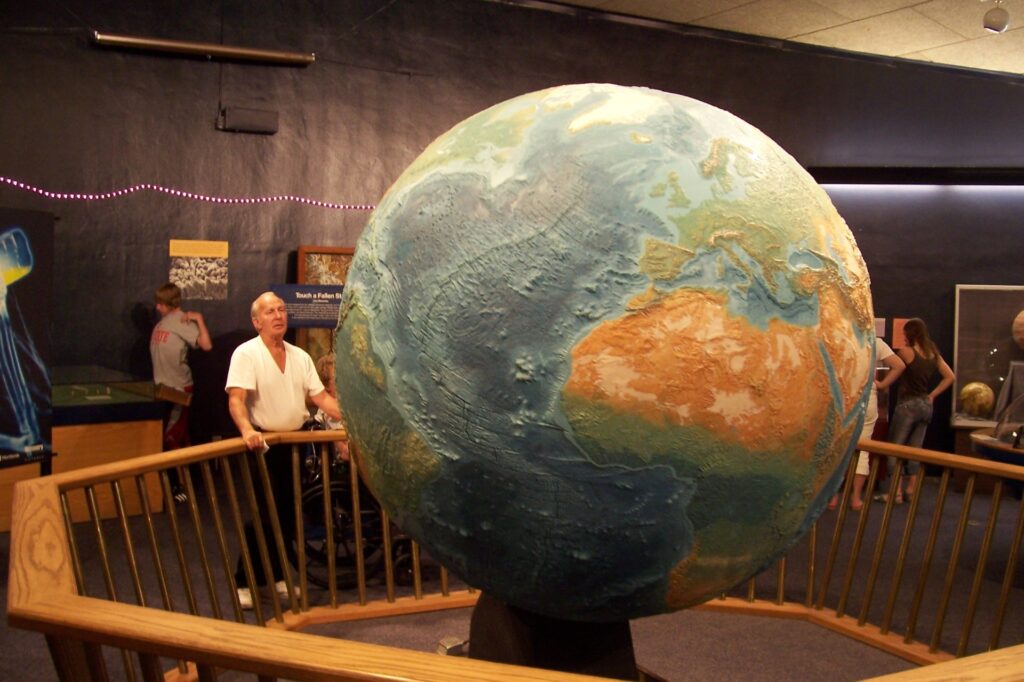
RENO, Nev. — Although gambling and buffets can imperil your savings and waistlines here in “The Biggest Little City in the World,” those seem like mild problems compared with the hopeless odds of surviving “spaghettification.”
That gruesome though entertainingly named transformation, from proportionally sized human to a hideously stretched-out beanpole that puts medieval racks to shame, would occur to an astronaut who comes too close to a black hole. Having passed by the event horizon, the point at which o jects no longer can avoid being sucked into dark oblivion, the helpless space traveler’s fate would be quickly cooked as his suddenly spaghetti-like frame disintegrates into utter nothingness.
A glass of red wine to go with that story, anyone?
Learn all about such space phenomena in “Black Holes,” a digital star show being screened through Jan. 5, 2007, at the Fleischmann Planetarium on the University of Nevada, Reno campus. A mile and a half north of downtown, the 43-year-old planetarium offers science-appreciating travelers a higher-brow break from the big casinos, which have a gravitational pull of their own.
Fleischmann prides itself on being the first planetarium in the world to show dome movies. To be in its 60-seat Star Theater seems, ironically, a bit like time travel as the aging chairs don’t recline as much or as comfortably as ones found in newer semi spherical-screen rooms. However, “Black Holes” and its daily companion film, “‘The Human Body,” represent wonderful experiences once the lights are dimmed and the educational lessons unfold above.
“The Human Body” describes in some detail how we function, including graphic visions of what happens to food once it enters our stomachs. It points out that each of us has a reasonable expectancy of seeing 27,000 mornings in our lifetimes, a reminder that our time — like that of stars destined to tum into black holes – is finite. Visiting a planetarium always has the potential to make one feel quite insignificant in the grand scheme of things, what with it repeatedly telling us there are billions of billions of stars or by showing us a biology film that says our brain cells have been dying off in massive quantities since we passed puberty.
Fleischmann’s free museum, the Hall of the Solar System, contains several hands-on exhibits that tie in with “The Human Body.” Test your reflexes by seeing how fast you can grab a metal pole that starts falling once a light goes on. My reaction time, measured at .14 of a second, qualified as halfway between “Lightning fast!” and ”A little slow-try again.” Place your hand under a translucent screen and blue appears at the hottest spots; for me, the bluest area was on my palm between the thumb and index finger. Turn a doorknob and be told that such an action requires some 50 muscles in your hand. arms, shoulder and chest, and includes movement by 32 bones.
Permanent exhibits include a bisected meteorite, weighing about a ton, that crash landed about 90 miles east of central-state Tonopah a couple centuries ago and was discovered in 1908. Its composition, in case you are interested, is predominantly iron, with a little nickel. Earth Globe, in the middle of the room, is a 6-foot-3 model of our planet whose scale is 1 to 6.72 million. My favorite display was a computer screen that shows nine space films, 15 to 52 seconds long, that include “Mercury Transit of the Sun.” I was mesmerized to see the planet pass before the sun, appearing as a black dot against a background of sizzling reddish-orange.
On weekends, family fare takes over the theater. At 11 a.m., “The Secret of the Cardboard Rocket” follows two young adventurers as they explore our solar system. At noon, “Dark Star Adventure” finds a young heroine and her chummy robot trying to solve a space riddle. Adults, especially baby boomers, are more likely to enjoy “Dark Side of the Moon,” a digital light show at 8 p.m. Fridays and Saturdays that visually imagines Pink Floyd’s best-selling album from the 1970s. Tickets for “Dark Side” are $8; for all other films, admission is $5 general and $4 for children and seniors.
Fleischmann Planetarium is open from 10:30 a.m. to 8 p.m. Sundays through Thursdays (till 7 p.m. during the fall and winter), and from 10:30 a.m. to 9 p.m. Fridays and Saturdays. To get there, take the Virginia Street exit north off Interstate 80. Parking, free with validation, is on the third level of a huge structure next to the campus’s Lawlor Events Center. For more information, call (775) 784-4811 or visit www.planetarium.unr.edu.
Sidebar:
Reno’s other non-casino attractions include the impressive National Automobile Museum, at the comer of Lake and Mill streets just south of the Truckee River. You could spend hours there checking out such old beauties as a 1907 Thomas Flyer, a 1934 Dymaxion and Elvis Presley’s 1973 Cadillac. For more information: (775) 333-9300 or www.automuseum.org.
Also in the Reno area:
- Animal Ark Nature Center and Wildlife Center, 25 miles northwest of town, is a refuge for predators and “exotic animals” that have been uprooted from their native environments. General admission is $6; call (775) 970-3111 or visit www.animalark.org.
- Nevada Historical Society Museum, 1650 N. Virginia St., is the state’s oldest museum and includes casino memorabilia. General admission is $3; call (775) 688-1190 or visit http://dmla.clan.lib.nv.us/docs/museums/reno /his-soc.htm.
- Nevada Museum of Art, 160 W. Liberty St., has extensive permanent and temporary exhibits in a striking building that opened in 2003. General admission is $10; call (775) 329-3333 or visit www.nevadaart.org.
- Wilbur D. May Center, in Rancho San Rafael Park not far from the planetarium, includes a museum, arboretum, botanical garden and geared-toward-children Great Basin Adventure. Prices and hours of the attractions vary; visit www.rnaycenter.com.
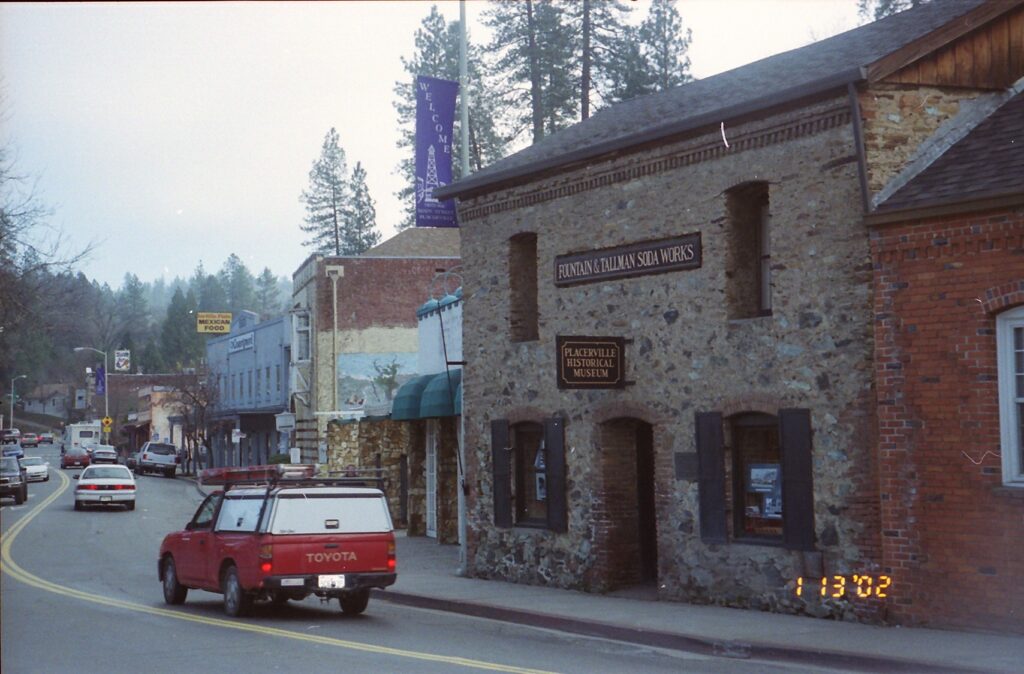
Walking tours appeal to me. Exercise, a leisurely pace, window-shopping, pleasant discoveries within shops and restaurants, architecture, people-watching – nothing beats a well-organized and informative walking tour.
Too bad I couldn’t find one in Northern California’s Gold Country last month.
Earlier, while stumbling about on the Internet looking for story ideas that would keep me fairly close to Sacramento, I came across Amador City’s walking tour. Its Web site’s map, descriptions and photographs yielded eight pages when I hit “print.” Eight pages! While that discovery did not make me yell “Eureka!” and skedaddle immediately to them thar foothills, prospecting pen in hand, I felt encouraged enough to investigate further.
A bit more searching, Googling and Yahooing yielded a Placerville walking tour (three pages, but with small type and no photographs). Also, a friend and I in December had passed through Sutter Creek, where we picked up a brochure containing yet another walking tour. (It, too, is posted on the Web, at www.suttercreek.org/walkingtour.htm.)
So said friend and I, armed with three walking-tour descriptions for towns scattered over some 30 miles of Highway 49, set off on a cloudy, cool Saturday in hopes of enjoying a trio of free, fascinating strolls. We enjoyed the walking, all right, and saw many interesting things. But the tours – as outlined in the two Web printouts and one flier – proved disappointing.
Placerville’s (www.visit-eldorado.com/day_trip1.html) was the worst. For starters, the starting point could not be found. According to the printout, 248 Main St. “is a favorite gathering place for residents and visitors alike.” We found a 250 Main St., but not a 248. Furthermore, the walking tour’s description for 248 mentions John “Snowshoe” Thompson, a hardy soul who for 20 years schlepped mail and other supplies back and forth across the Sierra Nevada range into what then was the Utah Territory. The printout says Thompson made his treks from 1856 to 1858 (in fact they continued to the mid-1870s).
Other mistakes and misrepresentations followed. According to the walking-tour Web site, 360 Main St. is an iron-front building. Not that we saw. The reportedly “restored” iron front of No. 364 actually was replete with rust and chipped paint. Farther down the street, No. 450 was supposed to house “D&E Western Wear” – Butterfield & Co. is what the sign out front said, and the store was shuttered – and No. 542 was to be “covered with ivy today.” Maybe it was covered yesterday, maybe it was covered a whole lot of yesterdays ago, but it was not covered the day we visited.
The strangest feature of the Placerville tour is that it addresses just one side of Main Street. All the odd-numbered buildings are ignored, including one with a hanging-man effigy that attests to the city’s “Hangtown” nickname and another than houses Placerville Hardware. The latter, 441 Main St., has on its outside walls a plaque calling it “the oldest continuously operating hardware store west of the Mississippi River.” Placerville Hardware opened for business in 1853 and is definitely worth checking out.
Also not mentioned on the printout is the charming little Fountain Tallman Museum, even though at No. 524 it is on the walking-tour side of Main Street. Inside, friendly docents Dorothea Engstrom (“I’m a Johnny-come-lately,” said the 48-year local resident) and Joan Szumski (Placerville initially was known as “Dry Diggin’s” because of a lack of water, she said) enthusiastically talked about Placerville’s past and described some of the exhibits. The free museum is open from noon to 4 p.m. Saturdays and Sundays year-round, and also on Fridays from March through October.
Tiny Amador City was our next stop. Navigating its walking tour (accessible at www.amador-city.com/walkingtour.html) took about 20 minutes and included an invigorating uphill portion of perhaps 100 yards. All nine of the featured buildings date from the 19th century. The Fleehart Building, built in the 1860s by a mine owner, and the Amador Hotel’s Western-atmospheric porch and main entrance survived an 1878 fire that razed the rest of town.
Whoever put together this tour should be applauded for making the most out of not much, what with the color photographs for each of the 11 stops (two are abandoned mines) and for the chatty descriptions of each. Typos such as “enw” and “buillding” are jarring, and outdated information (for example, Bellflower Annex Garden Gallery is where the Web site claims Miranda’s Memories does business) needs attention. Also, small cemetery behind the schoolhouse might be worth mentioning.
We were running out of energy and daylight by the time we parked in Sutter Creek, a hopping little Gold Country town where Highway 49 traffic can come to a crawl, even in wintertime. Sixty buildings scattered about 11 streets are very briefly described in the walking tour, whose nicest feature is that the Main Street (Highway 49) buildings – 33 of them – appear on the pamphlet as small drawings, making them easily identifiable. However, side-street structures are difficult or impossible to spot, despite a map, because no addresses are provided. As a consequence, we missed seeing the “probable site of the town’s first wedding.”
You see, expectations for walking tours can be modest. Too bad they could not all be met in Placerville, Amador City and Sutter Creek.
Basic information about other regional walking tours, including ones for Drytown, Ione and Plymouth, can be found at http://historichwy49.com/jack/jackcultatt.html. San Francisco has a wealth of free and guided walking tours. For more information about them: www.walking-tours.com/cityguides/.
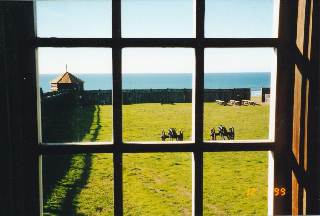
The Russians aren’t coming! The Russians aren’t coming! They already were here in Northern California, for 29 years, and had left more than a century before the Cold War began.
As odd as that concept is the sight of Fort Ross when you, especially for the first time, drive along Highway 1 about 10 miles north of Jenner. Eyes are bound to blink and jaws drop when off toward the ocean — out of the blue, almost literally, as there is a lot of surrounding green vegetation, too — appear a wooden fortress and buildings within, one of which has two towers that for all the world look like Russian Orthodox Church spires.
If such surprise sparks curiosity, and the desire to learn about and observe firsthand a quirky slice of 19th century history, pull on in to Fort Ross State Historic Park. Take an hour or two to walk about leisurely within the fort, admire the coastal setting and, in the visitors center’s fine museum, see how this place came about.
Until the Russians’ arrival in the early 1800s, the area had been occupied by the Winahrnah-Bahkay-Yahchmah, which has been translated as “people from the top of the land” and is commonly referred to as the Kashaya Pomo Indian tribe. lts 1,500 or so members were scattered along the coast and up to 30 miles inland. For what land the Russians inhabited, according to one account, the Kashaya received “three blankets, three pairs of breeches, two axes, three hoes and some beads.”
Russia had been pushing its influence eastward for hundreds of years, since Ivan the Terrible. By 1809, when Ivan Kuskov of the Russian-American Co. first landed at Bodega Bay, the Russians had crossed Siberia, established settlements on the Aleutian Islands and in Alaska, and were hoping to gain a foothold lower on the North American continent. In 1 812, Kuskov returned to build his trading company’s fort, accompanied by a few dozen fellow Russians and larger numbers of Aleutian and Alaskan natives.
Fort Ross, whose name stems from the word “Rossiya,” meaning Russ ia, thrived for a few years on sea otter pelt trading. However, by 1828 the Russian-American Co. informed the head office that “this species has finally been almost completely exterminated, at least along our coast, and now the hunting of sea otters does not bring by far… its former profits.”
The small colony had some luck with growing fruits and vegetables. In 1818, for example, a Captain Vasily M. Golovnin wrote that gardens had yielded a 48-pound horseradish, 54-pound pumpkins and a 12-pound turnip. From 1816 to 1823, Fort Ross constructed the first four ships produced on California’s coast. Ranching developed to the point where 1,700 cattle grazed there in 1841. But by that year the fort was losing tens of thousands of rubles every year, and the Russians sold it to John Sutter for some $30,000 in wheat installments over three years, thereby abandoning any of their motherland’s activities along the California coast.
Actually, Russians have returned to Fort Ross, but as peaceful tourists rather than as their aggressive and well-armed forebears came 190 years ago. Those earlier visitors had two blockhouse towers, with a total of 26 gun posts, to protect against an attack that most likely would come from the Spanish. However, no fighting occurred, which makes it fitting that today within the stockade, tourists are bound to see more picnic tables than canons: In early December, the count was 11 to four.
Since being acquired by the state in 1906, the fort has undergone extensive reconstruction work. According to a walking-tour pamphlet sold in the visitors center for 35 cents, the Rotchev House is the only remaining structure that contains Russian materials. The Kuskov House and Officials Quarters also are freestanding within the stockade; there is no trace of three other buildings that were there during the 1812-1841 Russian occupation.
The chapel, introduced to Fort Ross in the 1820s, is a pleasant place from which to regard the rest of the yard, enclosed by 1,087 feet of redwood fencing. A bell outside the chapel features Russian words in the Cyrillic alphabet.
Of the perimeter’s three gates, the western one that looks out toward the Pacific Ocean has a sign nearby that explains: “Sally Port is the term used to describe the openings or gates in a stockade wall. It was from such ports that the besieged could ‘Sally -Forth’ against the enemy.”
Linguistics lessons can be encountered in the strangest places.
Fort Ross State Historic Park is open year-round from dawn to dusk, the visitors center from 10 a.m. to 4:30 p.m. Entrance is $6 per vehicle general, $5 per vehicle for seniors. Twenty primitive camping sites are available from April 1 through November. Each July, there is a Living History Day that features scores of volunteers who help recreate the long-lost days of Russian occupation. For more information: (707) 847-3286 or www.mcn.or g/1/rrparks/parks/fortr.htm.
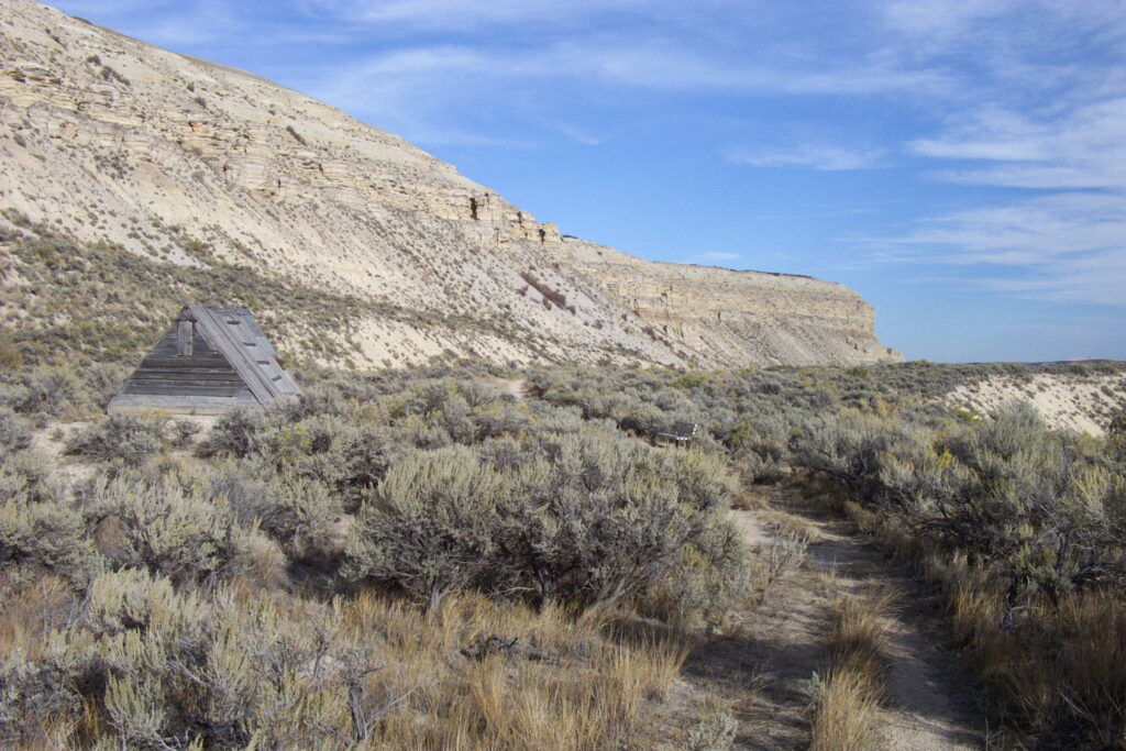
KEMMEMER, Wyo. – Even the most shameless tourism promoter would stop well short of describing southwestern Wyoming as subtropical. This cold-desert region, its hills and valleys covered mostly with sagebrush and hardy grasses, offers little for the skimpy-swimsuit and citrusy-beverage crowd.
There was a time, however, when the area was warm and watery, with a huge diversity of plant and animal life. That time was about 50 million years ago, and Fossil Butte National Monument celebrates those good (very) old days with a well-conceived museum and a pair of pleasant hiking trails.
Fossil Butte, about 150 miles northeast of Salt Lake City and 460 miles northwest of Denver, is a half-day attraction worthy of consideration by travelers making a leisurely drive up to Grand Teton and Yellowstone national parks. They need not have a passion for paleontology to appreciate the remote monument and its insights into ancient history.
In the visitors center’s lobby, for example, is a glassed-in display that speaks not just to highbrow scientists. Beneath a crocodile fossil replica, whose original is in the Field Museum of Natural History in Chicago, is a sausage-shaped, fossilized coprolite. Do you know what that is? For those whose knowledge of such matters is scat … er, scant, here is another clue: “copro” means dung and “lite” is stone.
On the late-September afternoon I stopped by Fossil Butte, the monument’s lead interpreter, Marcia Fagnant, was demonstrating how fossils are cleaned, or exposed, in their limestone coffins. A dozen or so people gathered before a desk as she used a series of small air guns, resembling felt-point pens, on a fossilized fish. Above her, a black-and-white video screen zoomed in on her slow progress. “I basically just remove one layer at a time,” she said.
Such painstaking work leads to the type of displays found at Fossil Butte. The small museum within its visitors center contains the carbonized shapes of creatures that lived in and around Fossil Lake, which at its largest was 50 miles long and 20 miles wide. A herring known as Knightia was its most-prolific inhabitant. Fossils from that and more than 20 other species of freshwater fish have been found in the region.
The abundance of fossils here can be attributed to the steady, thick “shower” of lake sediment that covered the dead, sunken carcasses. “If the fish were buried before they had a chance to be torn apart by scavengers or decomposed by bacteria,” an exhibit explains, “they stood a good chance of becoming well-preserved fossils.” As the mineral layers thickened and hardened, they slowly turned to limestone. Once the lake dried up after a comparatively long existence of some 2 million years, the stage was set for erosion that created a butte and led to the 19th century discovery of fossils on its sides.
Their dark-brown appearance contrasting with the beige limestone that surrounds them, cleaned fossils bring into sharp focus the skeletal patterns, and in some cases the skin, of ancient life. Fossil Butte’s museum displays, among other creatures, crayfish, freshwater shrimp and snails, surface and bottom feeders, stingrays, a soft-shell turtle, a snake, birds, a dragonfly and many plants, including a six-foot palm frond.
On a wall behind those samples is a large, colorful chart that tracks the history of life on Earth and serves as a kind of refresher course for aging elementary-school graduates. The Precambrian Era began 4.5 million years ago, the Paleozoic 570 million years ago, etc. Today we are in the Cenozoic Era, whose Eocene Epoch that premiered some 60 million years ago covered the time of Fossil Lake. A sub-chart tracks the oldest fossils that humankind has found for various forms of life: land plants, 430 million years; insects and amphibians, 400 million years; reptiles, up to 345 million years; dinosaurs, 225 million years; mammals, 200 million years; and birds, 190 million years.
No matter how interesting one finds the museum, the monument’s contemporary charm should not be neglected. The 2.5-mile Quarry Trail leads to the base of Fossil Butte and continues beneath it, passing by a triangular wooden shack used by David Haddenham, who “hunted” fossil samples there for a half-century before he died in 1968. A steep, 600-foot side trail ends at a quarry worked to the 1970s.
Fossil Lake Trail, about a mile shorter, goes through an aspen grove – the trees’ leaves turn a magnificent yellow in early autumn – to the base of Cundick Ridge. Hikers are asked to stop short of where fossil excavation and research continue today, so the trail’s appeal lies mostly in its surrounding flora and the overview it offers of the 8,198-acre monument. Both it and the Quarry Trail have uphill portions that are steep enough to warrant switchbacks but are not too strenuous overall.
Up from the visitors center, on past Fossil Lake Trail, the road loses its pavement and most of the tourists; I was the only one who drove up it that late afternoon. A couple of miles long, it climbs to more-commanding views of the area and, as National Park Service ranger Fagnant had told me, offers wildlife-viewing possibilities. Two deer crossed the road just ahead of my car both times it passed their evergreen-grove home. Moose, mule, beavers, porcupines, red foxes, golden-mantled ground squirrels and white-tailed jackrabbits also live in the area.
The fish, palm trees and crocodiles are long gone. Memories of them, though, remain etched in stone.
Fossil Butte National Monument is open year-round. Fagnant says up to 300 people visit on a summer day, when temperatures can top 90 degrees. Winter days, sometimes obliterated by subzero blizzards, can fail to attract anyone. The visitors center is open from 8 a.m. to 7 p.m. from Memorial Day through Labor Day weekends, closes three hours earlier the rest of the year and is closed on winter holidays. For more information: (307) 877-4455 or www.nps.gov/fobu.
Fossil Butte has no campgrounds; the nearest lodging possibilities are 10 miles away in the small town of Kemmerer.
COLORADO SPRINGS, Colo. – A couple of miles from the Pikes Peak Cog Railway is Garden of the Gods, a free park that seems to be as popular with local residents as it is with tourists.
Covering 1,300 acres in west Colorado Springs, where the city starts giving way to the mountains, Garden of the Gods is packed with striking, red sandstone formations with nicknames such as Kissing Camels and Balanced Rock. Several miles of easy trails allow views of the formations from several angles. The large visitors center has a gift shop, short film on the area’s geological history and is the departure point for nature walks and, during the summer, 20-minute bus tours.
Those supplemental activities have fees, but the park can easily be explored and enjoyed via a combination of driving to various parking lots and taking the offshooting trails. Walking about and looking at trail-side signs, one can learn that Ute Indians have inhabited the site for some 3,000 years. Gold-seekers came here in the 1850s and ’60s.
Charles Elliot Perkins, a friend of city founder Gen. William Jackson Palmer, bought one-third of the parkland in the late 19th century. In 1909, Perkins’ wishes were fulfilled by his heirs when they gave the property to Colorado Springs’ city council under these four conditions: that it remain forever free to the public, that it always be known as Garden of the Gods, that no liquor be made or sold on the premises, and that no structures would be built other than those needed for maintenance of the park.
Legend has it the site’s name stems from a short exchange in 1859 when a group of men were looking for a place to settle under Pikes Peak. Malancthon Beach, looking down over the red rocks, said he thought the place would be perfect for a beer garden. His buddy, Rufous Cable, replied it was “fit for the gods.” Merge those first impressions, a trail-side sign contends, and voila: Garden of the Gods.
Wildlife such as bighorn sheep, mourning doves, prairie falcons and Townsend’s big-eared bats frequent the area. Flora include Douglas firs, Ponderosa pines and 1,000-year-old, one-seed junipers.
Garden of the Gods Park is open from 5 a.m. to 11 p.m. May through October, until 9 p.m. the rest of the year.
The visitors center is open from 8 a.m. to 8 p.m. in the summer, and from 9 a.m. to 5 p.m. other times. For more information: (719) 634-6666.
CHIRIACO SUMMIT – Add sweat and stamina to “blood and guts” and you begin to explain the atmosphere Gen. George S. Patton created for soldiers in the sprawling Desert Training Center (DTC) during World War II.
Twenty of the U.S. Army’s 87 divisions that served in the war, constituting some 1 million men, learned the basics for battle in an 18,000-square-mile desert landscape that extended from Southern California into western Arizona and southern Nevada. In operation for two years until D-Day preparations siphoned off its support staff in the spring of 1944, the DTC was dismantled by, among others, Italian prisoners of war.
Traces remained, however, and since 1988 some of them have been displayed in the General Patton Memorial Museum. On the barren drive from Palm Springs to Blythe, this historical nugget just off Interstate 10 is worth an hour’s stop for anyone who wants to learn more about a 20th century military legend.
Patton oversaw selection of the DTC site and its Camp Young headquarters, where the museum stands today. Within four days of Camp Young ‘s opening, the story goes, Patton led the training center’s first troops on a desert hike. The dry, hot terrain tested soldiers’ mettle and toughened them up for the sands of North Africa and some of the war’s numerous other battle zones.
“Patton’s training regime required that all the men run a mile in 10 minutes with full pack and rifle by the time they had been at DTC a month,” a museum display reports. “Unaccustomed to the rigors of the desert, initially the units constantly suffered from heat prostation, severe cramps brought on by the heat, and general weakness from constant exposure to the elements.
“Required to take salt tablets three times a day, the men actually ate dozens. It took several weeks to get used to the desert, living on a gallon of water a day. By the time their 13-week training period was over, the men who had trained at the Desert Training Center were the best-trained, best-conditioned men on the front lines.”
The museum’s exhibits include fighting gear and other items soldiers used at the DTC, including personal hygiene kits. Some of the spoils of war are displayed, too, such as a few bright-red German fabrics with the swastika insignia.
It was in Africa and Europe that Patton, an aggressive tactician, made his enduring mark. By late 1942 he had left the DTC to lead troops into Morocco. Later he oversaw the retaking of Sicily and, one day after D-Day, he arrived in northern France to begin a charge into Germany, along the way playing a key role in preventing a U.S. catastrophe at the Battle of the Bulge.
A few months after World War II ended, Patton was mortally injured in a vehicular accident. The museum marks that occasion with a Dec. 21, 1945, front page from the Call Bulletin in San Francisco, whose main headline screams, “PATTON DIES.” He was 60.
A 26-minute video, screened continuously throughout the day, further chronicles a military man whose reputation was forever tainted by an incident re-created in the 1970 film “Patton,” for which George C. Scott won the Oscar for best actor. While visiting severely wounded troops at a field hospital during the war, Patton came across a patient who showed no signs of external injury. The contrast between this young man and those who had lost limbs, their eyesight or whatever to battle overwhelmed the general, who slapped the patient – who turned out to be a shellshock victim.
Patton soon apologized and admitted his error. It must have been a bitter pill to swallow for a man largely regarded as a soldier’s soldier, someone who inspired his troops to greatness. In the museum’s film, one of Patton’s press officers, Lt. Col. Lester Nichols, implies the slapping incident was blown out of proportion.
“Any other general under these circumstances might have done the same thing,” he says.
Nichols also addresses Patton’s nickname, “Old Blood and Guts.”
“I’m so struck by how easy it was to talk to him …” he says. “He wasn’t all blood and guts as people thought he was. He was very compassionate, particularly when he brought medals into the field hospitals and presented them to troops.” Indeed, in a clip of Patton giving a stateside speech sometime between Germany’s and Japan’s surrenders, the general appears to be fighting back tears while talking of his men’s ultimate sacrifices.
The DTC’s headquarters was named after another U.S. military giant, Samuel Baldwin Marks Young. He attained the rank of colonel in the Civil War, participating in 28 battles that included Gettysburg and Appomattox. At the turn of the next century he was appointed the nation’s first Army chief of staff.
Patton, though not one of West Point’s better students, distinguished himself in other ways. An excellent marksman, he represented his country as a pentathlete in the 1912 Summer Olympics. He was among the first U.S. soldiers to fight in World War I, and he was the nation’s first-ever tank commander, according to the film.
In addition to the Patton and DTC exhibits, the Chiriaco Summit museum contains a massive, to-scale model of Southern California’s water district. The Holocaust is acknowledged in a small exhibit. Outside is a collection of World War II-era tanks.
Curator Jan Holmlund says visitors include German and Japanese tourists, evidence that the sands of time — a phrase especially apt in this part of the world — have healed some wounds.
The General Patton Memorial Museum, 30 miles east of Indio and about 165 miles from Los Angeles, is open from 9:30 a.m. to 4:30 p.m. daily, except for Thanksgiving and Christmas. Admission is $4 general, $3.50 for those ages 62 and above, and free for children under 12. For more information: (760) 227-3483.
Winding through two national parks, a national monument and a national forest in just 43 miles, central California’s Generals Highway is a four-star attraction that outdoor enthusiasts should be tempted to salute.
For any other road to top its scenery would be a tall order. More than 300 feet tall, actually.
Generals Highway is the main automobile artery of Sequoia and Kings Canyon national parks, home to the world’s biggest trees. No living thing weighs more than the 1,385-ton General Sherman, which every year adds to its heft the equivalent of a normally proportioned 60-foot-tall tree. Standing at its base and contemplating its enormity is among the many pleasurable possibilities in one of the state’s lower-profile tourist regions.
When I visited in early May, lingering snowbanks and debris blocked the highway’s two main branch roads that venture farther into the jointly operated parks, to Mineral King in the south (Sequoia) and Cedar Grove in the north (Kings Canyon). Snow also was an obstacle on many of the trails, but the main ones were negotiable and by June all roads and hiking paths typically are ready for summer traffic.
Having approached from the nearby hamlet of Three Rivers on Highway 198, I paid the $20-per-vehicle fee at the Ash Mountain Entrance and entered Sequoia National Park on a warm, nearly cloudless day. Heading north, past the first of three visitors centers, I stopped at a small campground and picnic area that pays tribute to the Potwisha, an Indian tribe that lived in the area for some 500 years before being displaced by white settlers and adventurers in the 1860s. Interpretive signs point out the sad fact that between 1770 and 1910, the California Central Valley’s native population declined from 32,500 to 3,125.
A more cheerful story can be told at the efficient Grant Forest Museum, about 15 miles into the park. Between the world wars, scores of buildings that included cabins, restaurants and stores crowded the site and threatened the “Giant Forest” that surrounded it. Preservation and restoration efforts that gained steam in the 1970s have resulted in a quieter, gentler ambience today.
The museum details, in several well-imagined displays, characteristics of the sequoias. Though unsurpassed in mass and capable of topping 300 feet, they are shorter than the more-slender coastal redwoods, which grow on a narrow strip along the state’s northern shores and can reach 360 feet. Sequoias can Jive for more than 3,000 years.
They grow naturally only in the Sierra Nevada mountain range, which has 75 sequoia groves that are scattered over several hundred miles at altitudes from 5,000 to 7,500 feet.
One of the museum’s cleverest exhibits uses a large spinning contraption, in the spirit of TV’s “Wheel of Fortune,” to show how difficult it is for a sequoia seed to grow into what colloquially long has been called a “big tree.” When I spun the thing, it stopped on the dispiriting “Seed lands in bad spot — never sprouts.” Oh well, it was a reminder that trees, humans, bugs, Pauly Shore… we all overcome long odds to live on planet Earth.
Immediately south of the museum is the turnoff to Moro Rock, the national park’s best non-tree attraction. A bit more than a mile off Generals Highway via a decaying paved road, the big formation offers panoramic views to those fit and determined enough to mount its 350-ish steps. In a case where the journey rivals the destination. Moro’s stone stairway (built by the National Park Service in 1931 to replace a 14-year-old wooden structure) is so impressive in its twisty inventiveness that in 1978 it was entered on the National Register of Historic Places. The rock’s 6,725-foot summit overlooks the Middle Fork Canyon, sculpted by the Kaweah River and approaching the depth of Arizona’s Grand Canyon.
Reportedly, California’s coastal mountain range 100 miles to the west is visible from Moro Rock on a clear day. Regrettably, clean air over Fresno and the rest of the dust- and smog-blanketed Central Val1ey is about as easy to imagine as no lines at Disneyland.
A few hundred yards north of the Grant Forest Museum is Big Trees Trail, a level, 0.6-mile stroll around fetching Round Meadow, over which several sequoias tower and where interpretive signs continue to instruct. It serves as a warm-up for the neck-craning needed to fully appreciate the General Sherman Tree, which is another mile or so up the Generals Highway and accessible via a short, wheelchair-accessible path. One more fun fact about this giant among giants: Plopped on a freeway, it would block three lanes.
Trails, picnic areas, another visitors center and several options for overnight accommodations (see sidebar) follow on the drive the rest of the way up Generals Highway to Grant Grove Village, headquarters for Kings Canyon National Park. {By that point, the road has passed through a portion of Sequoia National Forest and Giant Sequoia National Monument, the latter a two-portion park that was created in 2000.) Grant Grove is where Gen. William Tecumseh Sherman’s Civil War boss, Gen. Ulysses S. Grant, has his tree namesake. The General Grant Tree is the world’s third-largest living thing and has the biggest base diameter of any sequoia: 40.3 feet President Coolidge, in the 1920s, designated it as “the nation’s Christmas tree.”
The General Grant Tree Trail, about a mile north of the village and its visitors center, restaurant, lodge and post office, is one-third of a mile long and best enjoyed through the $1 purchase of a self-guided tour pamphlet, available at the trailhead. One of the tour’s highlights is the Fallen Monarch, a toppled sequoia whose hollow base was used in the second half of the 19th century as a home for settlers, a saloon and even to stable U.S. Cavalry horses. The trail offers equal time for those still caught up in the North-South struggle of 1861-1865: Near the Grant tree is one named after Gen. Robert E. Lee.
Though some of their trees are named after key players in our nation’s bloodiest war, the national parks, forest and monument along Generals Highway represent a peaceful, inspirational side trip from glitzier California, a true back-to-nature experience that deserves to be cherished.
The Highway 198 entrance to Sequoia National Park is 32 miles from Visalia, and the Highway 180 entrance to Kings Canyon National Park is 52 miles from Fresno.
Annual precipitation in the parks typically exceeds 50 inches; the driest (and warmest, obviously) times to visit are in the summer months and October. For more information: www.nps.gov.
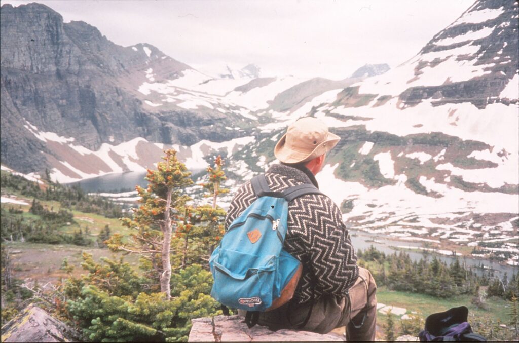
The mountain goat might have been auditioning for a wildlife film, or at the very least for a postcard.
Several people had gathered along the Hidden Lake Nature Trail to stare at him. Cameras were in hand, poised to capture the right moment. Perhaps sensing his opportunity for stardom, but stubbornly trying to hide his enthusiasm, the goat nonchalantly stepped over to a rock and placed his front hooves on it. He raised his head and assumed a far-off gaze.
Thus he remained, unmoving, for more than 10 seconds. A mountain goat frozen in ascent, rocks and grass as his path, snow-capped mountains and The Big Sky — Montana’s motto — as his background. Shutters clicked and videos whizzed.
“Show us some emotion,” someone said. “Pout, baby. Pout.”
Such was the scene on Independence Day 1994 on Glacier National Park’s most-trodden trail. Much of the 1.5-mile hike, which rises 500 feet, still was covered with snow. A few opportunists hauled skis and boots uphill and managed to glide down without being slowed too often by patches of exposed terrain.
“I’ve never seen this much snow up here,” said a woman who had stopped after a member of her group slipped and fell. Other hikers found the icy snow treacherous, especially on the trail’s steep portions. However, no one suffered much more than red faces of embarrassment and the laughter of friends.
Two park rangers with shovels paused a few hundred yards up the path. “Is this a good place to start clearing?” asked the female ranger, harpooning her shovel’s blade into the snow.
The male ranger — who may have been kidding; it was difficult to tell — replied, “Nah. I can still see the (visitors center) and all the people.” Nearby visitors laughed, though uncertainly.
Snow and one ranger’s possible aversion to crowds should not deter anyone who’s reasonably fit from hiking to Hidden Lake Overlook. In addition to goats, hoary marmots and Columbian ground squirrels populate the area. Bighorn sheep also can be seen, with a bit of luck and/or binoculars.
Among the differences between mountain goats and bighorn sheep is the latter have darker coats. Mature rams have curved horns, whereas goats’ horns are slimmer and straighter. Bighorns tend to graze on moderately sloped, grassy meadows.
Bears are not frequently spotted, according to a ranger who answered hikers’ questions at the overlook. There are an estimated 600 bruins in Glacier National Park, about one-third of which are grizzlies and the rest are black bears, he said. No formal attempt to count the creatures has been made in a quarter-century, he said, and some rangers speculate that bears have been resettling in Glacier from outlying areas.
In summertime, mountain bluebirds, rufous hummingbirds and golden eagles migrate to the park. White-tailed ptarmigans are year round residents, changing from brown-speckled feathers in warm weather to a snow-white appearance in the winter, as a way to be camouflaged from predators.
Subalpine fir, Engelmann spruce and whiteback pine are the principal trees. There is a clearly visible point, however, above which the trees cannot survive due to harsh winds, poor soil and a lack of water. Glacier’s “tree line” is between 7,000 and 8,000 feet above sea level.
The trail begins behind Logan Pass Visitor Center, at an elevation of 6,680 feet. Inside the building are displays and books that describe the parks’ many geological and biological features. Pamphlets about the trail are sold for 50 cents.
At the overlook, hikers can be content to peer down on Hidden Lake or continue another mile and a half down to its shores, 800 feet below. The continental divide and one of the park’s 50or so glaciers, Sperry, also can be seen. Snow-capped peaks include Mt. Reynolds and Bearhat Mountain.
Glacier officials have established a few common-sense rules about the trail and its four-legged attractions, such as the posing mountain goat. Hikers are asked to help protect plant life by remaining on the path. Also, a park newsletter advises:
“Wild animals often appear to tolerate humans, but approaching at close range can cause them stress. … If you cause a change in an animal’s behavior, you are too close.” In other words, the posing-goat crowd was pushing it.
Among the books that describe the park’s 200 miles of trails are Short Hikes and Strolls ($6) and Hiker’s Guide to Glacier National Park ($10). To request a publications catalog, contact the Glacier Natural History Association, Box 428, West Glacier, MT 59936; telephone (406) 888-5756.
For information about Glacier’s Canadian partner, the adjoining Waterton Lakes National Park, call (403) 859-2224 weekdays from 8 a.m. to 5 p.m., Mountain Time Zone.
Not convinced it’s beginning to look a lot like Christmas in Sacramento? Consider visiting the slightly colder climes of Gold Country towns along Highway 49.
For the next three weeks, these small communities embrace the holiday spirit with a variety of special activities that include parades, tree lightings, music and plays. Who knows? Maybe your kid will have the opportunity to sit on the lap of a white-bearded man in a red suit and say, “You sleigh me, Santa!”
Kathy Hillis, a proprietor in historic downtown Nevada City, is especially fond of the foothill town’s annual Victorian Christmas.
“This event has grown by leaps and bounds since I moved here 20 years ago, ” said Hillis, who owns the toy and game store Mountain Pastimes.
“It is a beautiful sight to see all the white tents lined up on Broad Street. The entire street is a vision, and with the chill in the air, people bundled up with steaming coffee, hot chocolate or a hot toddy in their hands, it makes for a charming Christmas experience.”
She is less intimate with neighboring Grass Valley’s big late-year event, Cornish Christmas, but sums it up this way: “It is a lot of fun, because many of the kids who went away to college are home for the Thanksgiving weekend, and they gather on Mill Street to catch up with their old friends.”
Cornish Christmas continues Fridays through Dec. 19.
To the south on Highway 49, in Sutter Creek, Bob and Faye Fyock are going to portray Santa and Mrs. Claus during the city’s annual Old-Fashioned Christmas Open House on Friday evening. On Saturday, he will be a “praying Santa” for the annual Las Posadas parade, which re-enacts the biblical story of Joseph and Mary looking for shelter.
The weekend after that, on Dec. 13, the Fyocks will get more mileage out of their Claus costumes during the Parade of Lights, which he described in an e-mail:
“Participants from Sutter Creek and surrounding communities decorate their cars, trucks, tractors, horse wagons, dogs and children with lights, ribbons and ornaments for the parade down Main Street. Santa and Mrs. Claus ride in a horse-drawn wagon at the end of the parade passing out candy to the onlookers.”
From north to south, here’s a sampling of special holiday events along Highway 49. See the calendar listings in Weekend Ticket and Explore for updates and other events.
Nevada City/Grass Valley
Today: The three-day Country Christmas Faire, a handicrafts event with more than 130 artisans, ends at the Nevada County Fairgrounds (11228 Mccourtney Road) in Grass Valley. Hours are 10 a.m.-3 p.m.; admission is $4 general, free for ages 12 and younger.
Today: The three-day Artisans Festival at Miners Foundry (325 Spring St.) wraps up in Neva da City. Hours are 10 a.m.-5 p.m.; admission is $3 general, free for ages 12 and younger.
Today: The three-day Christmas Craft Faire & Sandwich Shoppe at the United Methodist Church (433 Broad St.) concludes in Nevada City. Hours are noon-4 p.m.; free.
Wednesdays through Dec. 17, plus two Sundays (Dec. 14 and 21): Nevada City makes its historic downtown area pedestrians-only for the annual Victorian Christmas. From 1 to 4 p.m. Dec. 14, the Miners Foundry Cultural Center (325 Spring St.) hosts a special children’s shopping event. Victorian Christmas hours are 6-9 p.m. Wednesdays and 1 :30-6 p.m. Sundays; free.
Fridays through Dec. 19: The 41st version of Grass Valley’s Cornish Christmas turns Mill and Main streets (closed to automobile traffic) into a 1900-era gold-mining town. Hours are 6-9 p.m.; free.
Dec. 11 and 18: The annual Candle light Tour of Historic Bed & Breakfast Inns of Grass Valley and Nevada City, on back-to-back Thursdays, gives participants ideas about home decorating. Hours are 4:30-7:30 p.m.; tickets are $10 (free to inn guests). For reservations, call (530) 477-6634 or (800) 250-5808.
Through Dec. 28: The Foothill Theatre Company is staging two plays that have the holiday spirit: “Little Women,” through Dec. 28 at the Nevada Theatre, 404 Spring St., Nevada City; and “Santaland Diaries,” Thursday through Dec. 21 at the Off Center Stage, Center for the Performing Arts, 314 Richardson St., in Grass Valley. For more information about these plays, visit www.foothilltheatre.org.
For more information about the other events listed in Grass Valley and Nevada City, visit www.grassvalleychamber.com or www.nevadacitychamber.com.
Amador City
Saturday and next Sunday: The tiny town is at its bulb-ous best for the holidays with its 36th annual Calico Christmas celebration. Most stores will open at 10 a.m., and the tree-lighting ceremony is at 5:30 p.m. Saturday. Caroling follows.
For more information, visit www.amador-city.com.
Sutter Creek
Friday and Saturday: The jolly couple from parts far north, the Clauses, will be on hand for the annual Old-Fashioned Christmas Open House. Activities, which begin at 5 p.m. Friday, include a tree-lighting ceremony and will conclude Saturday with the Las Posadas parade at 7 p.m.
Through next Sunday: Sutter Creek Theatre presents “A Christmas Carol,” which despite its title is not a musical — a little yuletide humor there — at 44 Main St. Tickets are $14 general, $8 for ages 12 and younger. For more information, visit www.suttercreektheater.com.
Dec. 8: The 25-piece Amador County Community Band presents a free Christmas concert at 7 p.m. in the Grand Oak Ballroom, Jackson Rancheria Hotel, 12222 New York Ranch Road.
Dec. 13: Electrified vehicles are a powerful sight during the Parade of Lights, which proceeds down Main Street starting at 5:30 p.m.
Dec. 14: Sutter Creek Theatre features “A Celebration of Christmas” concert with the Amador County Community Band. The show is at 2 p.m.; tickets are $7 general, $5 for children and students.
For more information about Sutter Creek events, visit www.suttercreek.org.
Jackson
Next Sunday: The Hospice Tree of Lights will make its seasonal debut at the Hospice of Amador Thrift Store, 10776 Argonaut Lane. Donate $10 and a light will be placed on the tree in memory of someone you designate. Festivities begin at 5 p.m. For more information, visit www.hospiceofamador.org. San Andreas
Saturday: The Hospice Tr ee of Lights will make its seasonal debut at the Calaveras Senior Cent er, 956 Mountain Ranch Road. Donate $10, and a light will be placed on the tree in memory of someone you designate. Festivities begin at 5 p.m. For more information, visit www.hospiceofam ador.org.
Columbia State Historic Park
Throughout the month: A number of special events are scheduled, including candy cane-making demonstrations (through Dec. 21), a Lamplight Docent Tour (Saturday and next Sunday), “A Miner’s Christmas” (through Dec. 21) and an all- equestrian Christmas parade (11 a.m. Dec. 14). For more information, visit www.thegreatunfenced.com.
Through Dec. 21: “The Christmas Foundling, ” set during the Gold Rush, is being staged at the Fallon House Theatre. Tickets are $15-$28. For more information, visit www.sierrarep.com.
Sonora
Dec. 13: Travis Allen stars in Sierra HOPE’s “A Very Elvis Christmas, ” a fundraiser for regional HIV and hepatitis services, at Sonora Opera Hall, 250 S. Washington St. Sequined attired is definitely optional. Showtime is 8 p.m.; tickets are $25 in advance, $30 at the door. Call (209) 736-6792 or visit www.sierrahope.org.
Dec. 20: Tap into your inner Irish as regional musicians present the seventh annual “A Celtic Christmas” at Sonora Opera Hall, 250 S. Washington St. Showtime is 7 p.m.; tickets are $15. For more information, visit www.myspace.com/acelticchristmas.
Mariposa
Saturday: The annual Merry Mountain Christmas Festival & Parade steps into motion at 10 a.m., and holiday events continue throughout the day, including a tree-lighting ceremony at 5 p.m. on Main Street.
SAN FRANCISCO — In a city that can pose daunting challenges for parents with children in tow, what with all the traffic, hills and “colorful” characters, Golden Gate Park stands ready as a comfort zone.
Once inside the 1,107-acre rectangular greenbelt, which stretches 3 miles westward from the Haight-Ashbury neighborhood to the Pacific Ocean, guardians can let their guard down. Maybe not all the way down, but enough to be able to focus on enjoying the park’s many kid-friendly attractions.
My family, which includes a 7-year-old, went there twice in recent weeks and sampled as many attractions as we could manage. Golden Gate Park is roughly bisected by Highway 101, and we restricted our movement, which proved to be substantial, to the eastern side.
Afterward, we concluded that our wish list of seven sites — a playground-carousel combo, one indoor and two outdoor gardens, paddle-boating and two museums — was too ambitious for the time we had allotted. It is remotely possible you could see all those things in one day, but unless you are willing to short-change most of them (or you are a marathoner and your kids star on their schools’ cross-country teams), be choosy.
In the spirit of helping you plan a family outing to Golden Park, I have divided the seven attractions into three groups:
A time commitment of two hours or less: Conservatory of Flowers, de Young Museum, Japanese Tea Garden, San Francisco Botanical Garden at Strybing Arboreturm, and Stow Lake Boathouse.
Four to six hours: California Academy of Sciences.
Wild card: Koret Children’s Quarter Playground and accompanying Herschell-Spillman Carousel.
If you accept those time-limit suggestions and can manage two full days (not necessarily consecutive) at Golden Gate Park, you should be able to do all the two-hours-or-less attractions, or several of them in addition to the California Academy of Sciences. Fit in the playground/carousel as you can, although it might be of little interest to teenagers.
If you park in one spot for the day and walk among the attractions, wear proper footwear and, if your children are young enough, bring a stroller. One morning we parked (for free) on Kezar Drive near the playground and walked, all told, nearly 7 miles to and from Stow Lake.
Following is a brief description of five attractions in the order we experienced them, and a few words about the two others we could not squeeze into our visits.
Play, play and plants, plants
Koret Children’s Quarter, which originated in 1888, is thought to be one of the country’s oldest public playgrounds. Its huge play structure is modern and in good repair. On a Saturday afternoon in early June, Cindy Cornejo and her 7-year-old daughter, Ellyana Cornejo, of Tracy climbed to the top of a cone-shaped rope structure.
“I used to come here when I was younger,” the mother told me after having gingerly descended. “I really wanted to bring her here to experience this.”
We had come to the park that day with friends Camilla Kendall and her 5-year-old daughter, Gia Nichols, of Rancho Cordova. Gia made good use of the rock waves and two cement slides down which kids glide (pretty slowly; it’s not anywhere near bobsled-esque). She also took a couple of spins on the neighboring Herschell-Spillman Carousel, which was constructed in 1914 and operated in Los Angeles and Portland before being installed at Golden Gate Park in 1940.
Kendall, a vegan activist, called the carousel “incredible,” pointing out it “had anything from a cat to a wild boar to ride. And after all, the only way to ride any animal is on a carousel!”
Although the 5-acre Japanese Tea Garden has lush greenery to stroll through, a striking five-story pagoda and other serene delights, Gia and my daughter quickly became fixated on the circular bridge. Up and over they went, again and again, giggling, as did many older people who seemed to find the steep, wooden structure a perfect place on which to pose for photographs.
The tea garden, created in 1894, is the oldest such site in the United States. The pagoda dates from the Panama-Pacific International Exposition of 1915, and the bronze Buddha sculpture behind it was cast in Japan in 1790.
The Conservatory of Flowers is Golden Gate Park’s oldest building. Its white, curvy, windows-and-metal exterior has served as a signature sight since 1879. Inside are crammed 1,700 species of aquatic and tropical plants.
The conservatory’s kids booklet “Tropical Trekkers!” includes a checklist and other activities can engage those who might not otherwise be interested in what they see. Two pages are devoted to dinosaurs, and how they ate ferns and cycads 200 million years ago.
“How do we know what dinosaurs ate?” the booklet asks, then answers with scatological talk that is certain to amuse little ones: “Scientists look at fossilized dino dung, called ‘coprolites,’ for evidence of plants or bones from prey animals.” Sure enough, next to that description is a photograph of a 7-inch-long pile of a fossilized No. 2.
Then there are the purple, dangling, pitcher-shaped insect-eaters.
“On land, carnivorous plants catch gnats, flies, moths and, rarely, small animals,” explains a sign, neatly weaving education into a childhood “ew” factor. “In water, the plants ‘eat’ mosquito larvae and other tiny, aquatic organisms. Nearly all these plants dissolve their prey with enzymes and absorb the nutrients.”
We enjoyed strolling around 12-acre Stow Lake and scoping out all the ducks, paddle-boaters and rowboaters. Human-made in 1893, the roundish body of water contains Strawberry Island, which has a walking path and is accessible via some very handsome stone bridges. Later we learned there is a 110-foot waterfall; next time we will check it out.
Our two-day visit’s low point occurred at the San Francisco Botanical Garden at Strybing Arboretum, a 55-acre site that opened in 1940. We were impressed with the 8,000 varieties of bushes and trees, certainly, but got frustrated in trekking to the children’s area. Tucked as far as possible from where we entered at the main gate, with minimal and confusing signage not helpful in directing us there, we found it bereft of children and looking a bit derelict.
Along the way, though, our daughter was happily distracted by a black, orange-spotted insect that slowly crossed a path in the California Native area. The pipeline swallowtail butterfly caterpillars, we learned, “feed exclusively on California Pipevine (Aristolochia californica) from which they sequester toxins that make them poisonous and unpalatable to predators.”
For most children, that’s cool trivia.
Lunch — and some other time
Despite our high-minded intentions, we did not make it into either the de Young Museum or California Academy of Sciences. The latter contains an aquarium, planetarium and natural history museum, and is chock-a-block with opportunities for children to sow scientific seeds into their developing minds. San Francisco Recreation & Parks calls http://sfrecpark.org/destination/golden-gate-park/california-academy-of-sciences/ the current version of the academy, which opened in 2008, the world’s largest “green” museum.
The de Young’s building is three years older, and includes a 144-foot-tall tower from which visitors can look down and over the park and city. The museum offers several programs for children, including two 90-minute Saturday classes https://deyoung.famsf.org/education/families-children/free-saturday-classes geared for 4- to 12-year-olds.
As you walk among the attractions in eastern Golden Gate Park, you are sure to develop an appetite. Able to answer that call are several snack bars, including one by the carousel that serves hot dogs (both traditional and vegan) and pretzels. A few food trucks park behind the band shell at Spreckels Temple of Music; we sampled samosas (two for $4) and Chana Masala ($8) from the Annakoot Indian truck. There was also a coffee/pastry stand and a Sam’s Chowder Mobil whose offerings included lobster rolls ($13-$18) and fish ’n’ chips ($11.25-$14.50).
The Japanese Tea Garden’s very popular cafe sells, of course, cups of tea (genmaicha, hojicha, jasmine and Sencha). They cost $3.25 to $4.99. Food items, which include soup, edamame, green tea cheesecake and sandwiches, run $3.95 to $8.99.
The boathouse has a snack bar, and both museums contain cafes.
The fine print
- California Academy of Sciences is at 55 Music Concourse Drive. Admission is $34.95 general; $29.95 for ages 12-17, students, and ages 65-plus; $24.95 for ages 4-11; and free for ages 3 and younger. Hours are 9:30 a.m. to 5 p.m. Mondays through Saturdays, and 11 a.m. to 5 p.m. Sundays. For more information, call 415-379-8000 or visit calacademy.org.
- Conservatory of Flowers is at 100 John F. Kennedy Drive. Admission is $8 general, $6 for ages 12-17, $2 for ages 5-11, and free for ages 4 and younger. Hours are 10 a.m. to 4 p.m. Tuesdays through Sundays; it’s also open on Memorial and Labor days. When a volunteer is available, tours are offered at 11 a.m., 12:30 and 2:30 p.m. For more information, call 415-831-2090 or visit conservatoryofflowers.org.
- De Young Museum is at 50 Hagiwara Tea Garden Drive. Admission is $15 general, $10 for ages 65-plus, $6 for college students with ID, and free for ages 17 and younger. Audio tours are $8. Hours are 9:30 a.m. to 5:15 p.m. Tuesdays through Sundays; it’s also open Labor Day, Dec. 19 and Dec. 26. For more information, call 415-750-3600 or visit deyoung.famsf.org.
- Japanese Tea Garden is at 75 Hagiwara Tea Garden Drive. Admission is $8 general, 6 for ages 12-17, $2 for ages 5-11, and free for ages 4 and younger. Hours are 9 a.m. to 6 p.m. daily (through November; last entry is 4:45 p.m. December through March). For more information, visit japaneseteagardensf.com.
- Koret Children’s Quarters Playground is off Kezar Drive, north of Kezar Stadium. It is free and always open. The nearby Herschell-Spillman Carousel offers rides from 10 a.m. to 4:30 p.m. daily through Labor Day, and Fridays through Sundays from then until Memorial Day weekend. Rides are $2 general, $1 for ages 6-12, and free for ages 5 and younger if accompanied by a paying adult. For more information, call 415-831-5500 or visit sfrecpark.org.
- San Francisco Botanical Garden at Strybing Arboretum is at 1199 Ninth Ave. Admission is $8 general, $6 for ages 12-17 and 65-plus, $2 for ages 5-11, and free for ages 4 and younger. Hours are 7:30 a.m. to 5 p.m. daily (through early November; last entry is at 4 p.m. from the first Sunday in November through January, 5 p.m. from then until early March, and then until 6 p.m. starting the second Sunday in March). Free tours depart daily at 1:30 p.m. from the Main Gate, weather permitting. For more information, call 415-661-1316 or visit sfbotanicalgarden.org.
- Stow Lake Boathouse is at 50 Stow Lake Drive. Hours are 10 a.m. to 5 p.m. Mondays through Thursdays, and 10 a.m. to 6 p.m. Fridays through Sundays. Rentals fees are $21.50 per hour for rowboats, $27 per hour for standard pedal boats, and $37 per hour for both electric boats and pedal boats that hold up to six people. For more information, call 415-386-2531 or visit stowlakeboathouse.com.
Last summer, the first moon landing’s 30th anniversary was celebrated in what has become familiar fashion. Apollo 11’s three astronauts met the press, original TV coverage of the NASA mission was replayed, and there was speculation about what next space “frontier” will be visited, if any.
“One small step for man, one giant leap for mankind” on July 20, 1969, indeed marked a spectacular scientific achievement. But 100 years before Neil Armstrong lowered his foot upon the moon and gave the Earth that stirring phrase, another transportation milestone was signaled. Does “D-O-N-E” ring any bells?
That blunt message was telegraphed to the world following the final spike being driven in the nation’s first transcontinental railroad. The seven-year project to lay rails from Sacramento to Omaha, Neb., was completed in May 1869 at Promontory Summit in Utah Territory. Today, Golden Spike National Historic Site, 80 miles northwest of Salt Lake City, marks the spot and recounts the 130-year-old occasion.
On a gloriously sunny afternoon last September, Sara Allison stood between a loose gathering of two dozen tourists and a steam-spouting replica of the Union Pacific’s “119” locomotive. The seasonal Park Service employee explained how the original “119” from the Midwest and Central Pacific’s “Jupiter” locomotive from the West came face-to-face those many years ago. Allison is something of a transportation expert — when not at Golden Spike, she is a flight instructor.
With a seemingly genuine air of enjoyment, she explained how the two railroad companies labored to reach this remote site, though their meeting point was belatedly and rather arbitrarily fixed by Congress. The two rail companies’ grades had overlapped by more than 200 miles, as the competitors each sought to win more land subsidies.
The Golden Spike ceremony on May 10, 1869, was not without glitches, either. Both the Union Pacific vice president, Thomas C. Durant, and Central Pacific’s president, Leland Stanford, whiffed in their attempts to drive the final spike. A rail worker did the deed. Also, the staged photograph of all the bigwigs and some others on hand had to be retaken, later in the day without some of the principals, because the photographic plate had been broken.
Twenty years ago, Allison said, Golden Spike obtained carefully crafted replicas of the two original locomotives — which incidentally were ”mistakes,” too, in that Durant and Stanford each had intended a different engine be used for the 1869 ceremony. The new “119” and “Jupiter” normally make short demonstration runs through the historic site’s busy season, from May 1 through Columbus Day. On the day I visited, however, Jupiter was being repaired.
Inside the visitors center are exhibits that flesh out outdoor presentations such as Allison’s. Among the tidbits:
- The United States’ time zones were created thanks to the first transcontinental railroad.
- Previously towns had set their own time based on the sun. As such, clocks that were a few miles from each other often disagreed. In order for cross-country trains to operate on a schedule, the four time zones were established that continue to represent the nation’s “lower 48.”
- Traveling by rail made the West more easily and quickly accessible. To traverse the continent by overland stage, for example, took some 45 days. A journey via the Isthmus of Panama took about 35 days, and a voyage around Cape Horn required almost a half-year.
- Construction of the Promontory line, which by the early 20th century was of waning importance and in 1942 was totally scrapped for World War II materiel, involved plenty of parts. For each mile of track, there were 400 rail sections, 2,500 ties and 4,000 spikes that needed a total of 12,000 blows to drive.
The hard work on Central Pacific’s portion was done mostly by Chinese laborers. On the Union Pacific side, European immigrants, defeated Confederate soldiers and former slaves were employed. In the West, the Sierra made progress a sometimes inch-by-inch ordeal, while Midwestern efforts were impeded by Indian attacks. Some Irish workers were moved to write this song about their experiences:
Last week a premature blast went off And a mile in the air went Big Jim Goff. Now when next pay day came around, From Goff a dollar short was found.
He asked the reason; came this reply:
You were docked for the time you were up in the sky.
If you visit Golden Spike and have the time and inclination, the 1.5-mile Big Fill Walk offers a revealing perspective of how the Promontory line came to be. The mostly level, looping trail follows a portion where the Union Pacific and Central Pacific grades competed, within yards of each other. A helpful pamphlet guide at the trail head costs 25 cents.
The visitors center, which runs a variety of short railroad-themed films (including the first motion-picture feature ever made, Thomas Edison’s 10-minute “The Great Train Robbery” from 1903), has a small gift shop and friendly staff members such as Allison and Bob Hanover to answer questions. Hanover also produces the site’s yearly newspaper and told me the Web site — www.nps.gov/gosp/ — he is developing is about one-third completed.
Golden Spike National Historic Site is open daily from 8 a.m. to 4:30 p.m., with the hours extended to 6 p.m. from Memorial Day through Labor Day. It is closed only on Thanksgiving, Christmas and New Year’s. Admission is $3.50 general up to $7 per vehicle during the main tourist season, with those fees falling to $2 and $4 between Columbus Day and May 1. For more information: (435) 471-2209.
Directions: From Salt Lake City, take Interstate 15 north to exit 368, toward Corinne. After a few miles veer left on Highway 83 to the Golden Spike turn. Golden Spike is 32 miles from I-15.
SAN FRANCISCO — Sen. John Glenn has made two remarkable appearances in space, and those have resulted in countless tributes throughout the world. One of the stranger ones is here at Grace Cathedral, where high above the nave is Glenn’s image in stained glass. He has a space suit and helmet on, oxygen cord dangling off to his side.
In the window opposite Glenn, on the church’s north side, is Albert Einstein. Two 20th century masters of scientific accomplishment and theory, facing each other in a religious setting. This pairing is yet another quirky attraction in a city that overflows with them.
Grace Cathedral, billed as the third-largest Episcopal church building in the country, is four blocks from the Cable Car Museum and offers a quietness that visitors might crave after being exposed to the Car Barn’s noisy machinery. But be forewarned it is not an easy four blocks — walking literally up Washington Street, then turning left (still up) on Taylor Street toward the cathedral, can leave pedestrians feeling as though they have undergone an astronaut-in-training workout.
Once the cathedral is reached, however, the rewards are many. A self-guided tour, which costs 25 cents for a pamphlet, spotlights the Gothic structure’s many compelling features. In addition to the stained-glass windows, attractions include murals that depict events such as Father Junipero Serra’s arrival at Monterey in 1770 and the 1906 earthquake, a high altar made of Sierra granite and 2,000-year-old California coastal redwood, a 16th century Brussels tapestry and an organ with 123 ranks and 7,286 pipes.
Also noteworthy, and a possible source for more exercise, is the labyrinth floor tapestry, a circular carpet modeled after a design at Chartres Cathedral in France. Once they have removed their shoes and willed themselves into a calm, reflective mood, visitors enter and follow many tight turns to the center, and out again. A church sign explains the appeal:
“Walking the labyrinth invites us to experience our gratitude for life and meets our longing for a change of heart. It challenges us to refine the way we live together on this fragile island home and provides the energy, vision and courage to meet the demands of the 21st century.”
There is a similar labyrinth painted on the concrete in front of Grace Cathedral. Across Taylor Street, between California and Sacramento streets, is tiny but tidy Huntington Park, a pleasant place to picnic and reflect on cable cars, space travelers and one’s faith.
Self-guided tours of Grace Cathedral can be taken from 1 to 3 p.m. weekdays, 11:30 a.m. to 1:30 p.m. Saturdays and 12:30 to 2 p.m. Sundays. For more information about the church and its services, call (415) 749-6300 or visit the cathedral’s rather spiffy Web site, www.gracecom.org .
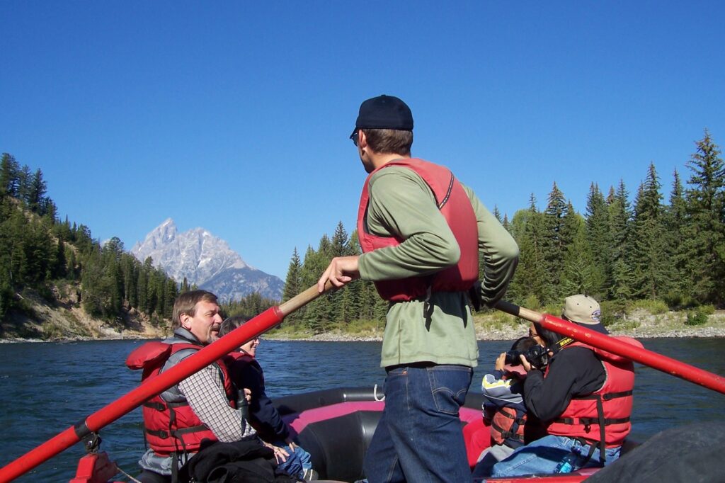
JACKSON HOLE, Wyo. — You know you are in a special place when bald eagle sightings are so frequent that you don’ t pay much attention to them anymore.
That was the case as we floated down the Snake River in Grand Teton National Park, northwest Wyoming’ s “other” fabulous attraction. Although neighboring Yellowstone is more famous and more visited, Grand Teton has a more immediately striking visual impact, with its magnificent rocky peaks. It also can be explored suitably in one day, which is all my wife, Kari, and I had on the sunny Monday that we visited in late August.
Covering 485 square miles, Grand Teton is less than one-seventh the size of Yellowstone. The park’ s signature attraction is in its southern portion, but visible for many miles around– including in the upscale mountain resort town of Jackson. Grand Teton peak reaches 13,770 feet above sea level and stands in the middle of a five-peak cluster that surely has awed anyone lucky enough to have seen it.
From south to north, South Teton, Middle Teton, Grand Teton, Mount Owen and Teewinot all top 12,300 feet. Their gray peaks are spotted with a dozen glaciers. The shape of those peaks was suggestive to lonely (I imagine) French trappers in the early 19th century, who nicknamed the South, Middle and Grand Tetons “Les Trois Tetons,” meaning the three breasts. I imagine there is an acceptable joke to be made here, but all I can think of is to reference the protagonist in an old James Bond film, “The Man With the Golden Gun.” If you’ve seen the film, you know what I mean.
The Teton Range includes at least eight other mountains, four on each side of the main cluster, most of whose summits exceed 11,000 feet. Floating down the Snake River is one of the best ways to admire the range. That was our morning activity, and although we both thought the nearly three-hour commitment cut too much into our plans for the rest of the day, we enjoyed the experience and would recommend it. You must understand, however, that it does not represent whitewater railing; these are called “float trips” because all the rafts do is amble along with a tame current.
Our laid-back and seasoned guide, a young Midwesterner named Adam Spring, maintained a nice balance of talking with the nine passengers in his raft and staying mum to let us soak in the sights and sounds of nature. We saw at least five bald eagles perched on high branches and another predatory bird that swoops directly over us with a big fish in its mouth. Binoculars would have enhanced the trip’ s bird watching, but we needed no magnification to see the hundreds of fish that sped by in the cool, clear and shallow Snake waters below us.
In Spring’s opinion, there is no guaranteed best time of day to see wildlife from the river. Bears, coyotes, elk, moose, mule deer and weasels make their homes in the mountains and huge Jackson Valley but not often are spotted near people pathways such as roads and the river. Spring suggested that visitors take float trips in the morning and avoid evenings, when the summer sun’ s angle creates the need for a lot of squinting.
Also, Kari and I noticed that in the late afternoon of a tilI-then cloudless day, the skies suddenly thickened with a smoky haze that greatly reduced the distances we could see.
Our guide also talked about Jackson, a few miles south of Grand Teton along the park’s main road, Highway 191. The town has two main drags, West Broadway and Cache Street, that pass by Western-themed businesses that are patronized by Jackson’s 8,700 residents and its legions of tourists, many of whom come for extended stays to learn mountain climbing in the summer or to go skiing in the winter. Dick Cheney spends quite a lot of time in Jackson, Spring said, although the comparatively high concentration of Wyoming Democrats there must make him snarl.
Jackson was “discovered” as a ski resort in the 1980s and remains a hotspot today. According to Spring, the median price for a home in town was $90,000 in 1979; now, that figure exceeds $550,000. “The saying around here is that the millionaires have been replaced by the billionaires,” he said.
After our raft excursion, which cost $43 apiece, we spent a few minutes exploring the Moose Visitor Center. About 15 miles north of Jackson, Moose is the only park facility that’s open year-round. Facilities there include a small museum and post office. From there, we drove about 10 miles up the park’s interior road (closed during the winter) to Jenny Lake.
Aside from staring at the Teton Range, our early afternoon at Jenny Lake was our day’s highlight. After taking a shuttle boat ($9 round trip) from the southeastern to western shore, we walked up to Hidden Falls and Inspiration Point, the latter allowing us sweeping views of the lake and valley below. The hike took about 90 minutes and was not especially easy; we encountered several switchbacks along the way. Many other people in worse shape than we were in, however, conquered the trail and appeared to enjoy doing so.
Time was running out so we settled for one last activity: a trip up and down Signal Mountain. In the park’s central section near Signal Mountain Lodge (which has several shops, restaurants and a grand lobby), the five-mile uphill drive tops off with views of the Teton Range and valley, although as I alluded to above the late-afternoon haze prevented us from seeing anything we had not seen more clearly before, first on the river and Jater from Inspiration Point.
From now through April, Highway 191 (which also includes portions of Highways 26 and 89) is open and allows visitors some satisfying ogle time with the Teton Range. Winter activities there include cross-country skiing, ice fishing, photography and snowshoeing. For updated road information, call (307) 739-3682.
Entrance to Grand Teton National Park is $25 per vehicle and includes admission to Yellowstone National Park as long as you visit there within a week. Temperatures in the valley range from an average high of 79 degrees in July to an average low of l in January; annual snowfall is in the 175-inch range. For more information: (307) 739-3300 or www.nps.gov/grte.
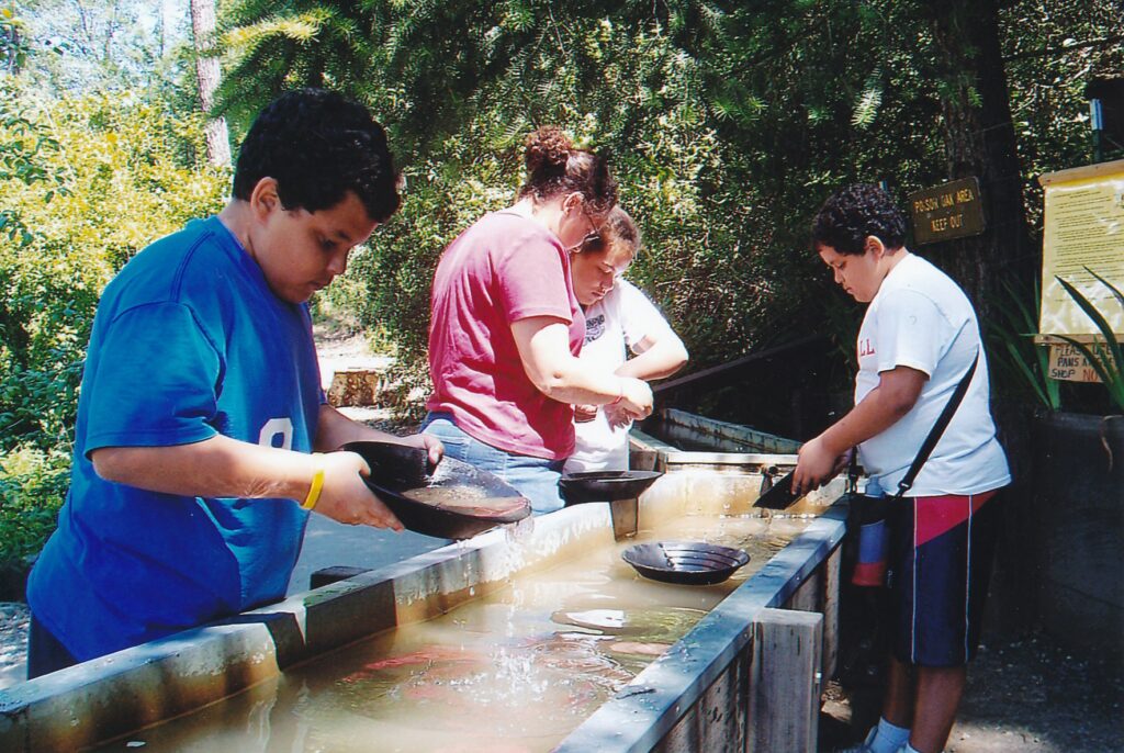
PLACERVILLE – The heat’s on to find a cool place for a few hours of summertime relief. A golden opportunity exists less than 50 miles east of Sacramento at Hangtown’s Gold Bug Park.
A few minutes’ drive north of historic downtown Placerville, Gold Bug lures families with low admission fees ($4 or less), gold-panning possibilities (though you’re better off playing the lottery if you want to get rich) and a well-conceived, self-guided audio tour through a mine drift in which temperatures are easily 20 degrees cooler than they are outside. Picnic tables, two-plus miles of pleasant hiking trails and a soothing backcountry ambience also beckon.
Visitors check in at the Hattie Museum, on the second story of a wooden structure whose first floor is a gift shop. After paying, they are given orange hardhats to wear in the mine and the option of spending one dollar more for a 13-stop audio tour. From the rented telephone-like apparatus comes a crusty voice that seems to be the norm for such Old West offerings; here the narrator’s dubbed “The Ghost of Gold Bug.” His commentary is worth the extra cash.
For one thing, Mr. Ghost will boost or refresh your mining vocabulary. His introduction explains you will be stepping into the “drift” (a tunnel that follows the mineral vein) through an “adit” (a horizontal entrance to a mine, as opposed to a vertical shaft). Ready “ore” not, into the mine you go.
Soon you will spot light-colored stripes of rock above the tunnel path. These mineral veins are where miners struggled mightily to find gold, though for the casual viewer, “fool’s gold” is in abundance. That brownish, comparatively worthless rock has been rusted over by pyrite-containing water that has seeped through the tunnel’s walls. Mr. Ghost points out that slate is Gold Bug’s dominant mineral, one that was not sought by 19th and early 20th century miners though which can be used to make billiard tables, roofing shingles and chalkboards – not that the latter has much applicability anymore.
Past a series of archlike formations on the walls that represent how ancient seabeds have been twisted by earthquakes to be more vertical that horizontal, visitors pass through an example of “post and cap” timbering, which in tender spots supports the mine’s ceiling. These big beams might reassure the claustrophobic among you.
The audio tour’s sixth stop (reflective yellow markers clearly indicate where the voice of Mr. Ghost is to be summoned for his folksy snippets) explains hard-rock mining. This old-school approach to precious-mineral extraction required two men, one holding a drill (which miners called a “steel”) while the other pounded it from behind with a sledge. The resulting yard-long holes (whose diameter approximated a 50-cent piece, Mr. Ghost says) were stuffed with explosives. “Fire in the hole!” scrambling miners would yell.
Holes in which insufficient gunpowder was used, and therefore remained just holes, were referred to as “bootlegs.” One such example is a bit farther down the drift, too dark to see but easy enough to finger just above the tour’s No. 8 sign. By this time, visitors’ shoe soles will be damp from unavoidable puddles. The situation would be wetter were the tunnel not slanted slightly so that water gravitates down to the adit.
At a fork in the drift is a 110-foot air shaft under which a light breeze is detectable. What relief it must have provided for miners, who prior to the shaft’s creation hardly could work more than 15 or 20 minutes in the foul air, according to Mr. Ghost.
The fork’s right tunnel fades off into darkness. “There may be more gold just beyond,” the narrator says. “But we can’t mine here no more cause this is a park and a protected site for all to enjoy.” Small-time prospectors used the mine, visitors already had learned, from 1924 until its wartime closing in 1942.
An oar car and wall of drilled explosives holes mark the end of public access to the drift. Visitors turn around and make their way back to the adit, a few hundred feet away.
“Oh say,” Mr. Ghost pipes up, grasping for a humorous finale. “Before I go, though, I’m going to answer a question that I bet has been on the tip of your tongue the whole time. And that is, ‘Just how much gold did they take out of the mine?’ Well, I would say that it was probably enough to keep them in beans and Levi’s for a long time.”
The mine tour is to be applauded not just for its cooler temperature and cute audio accompaniment. It has the (ital) feel (unital) of a subterranean adventure, with the dank air, wet ground, raggedy walls and ceiling that’s low enough to occasionally tap the hardhat of travel writers and other careless types.
Hot summer air can feel strangely refreshing as one steps out of the Gold Bug mine. Then it’s time to pan for gold in one of the park’s wooden troughs ($2 an hour per pan), rest and/or replenish at one of the many shaded tables or go for a hike up above the mine (where the air shaft’s top structure can be seen) or over to the Joshua Hendy Stamp Mill.
On Memorial Day, when my wife and I explored the 61.5-acre park, Doris Foster was on duty in the stamp mill. The sparkly-eyed senior, who has volunteered at Gold Bug for three years, patiently explained how gold was extracted from rocks brought to the eight-stamp mill, which was erected in the 1890s to serve the area’s many mining operations. (Coloma, where James Marshall discovered gold in 1848, is only a few miles to the north.) The old stamps, which can be studied from many angles in the modern building that houses the mill, weigh 1,500 pounds apiece and administered 100 blows a minute to the rock, reducing it to the coarseness of table flour. From that, a process that involved water and magnetism (mercury’s involved; sorry, my science isn’t up to the task of meaningful explanation) removed the gold particles from the sludge.
Foster encouraged a group of us to gather around a working scale model of the mill. She turned on the clackety contraption for a few seconds, pointing out that the original mill equipment is 100 times louder.
One of the most satisfying aspects of the trail that accesses the stamp mill is the manzanita forest through which hikers descend on their way back to the parking lot. The dark-red-barked plants don’t grow very tall but nevertheless provide some welcome shade. Gold Bug’s trails are on the tame side, though a few uphill portions are steep enough for hikers to work up an appetite.
My wife and I, who as vegans often struggle to find good places to eat, struck dietary gold a bit later at the Cozmic Café in downtown Placerville. The “natural foods” eatery is housed in an 1859 building (Pearson’s Soda Works) that is on the National Register of Historic Places and which burrows into the hill behind it. We enjoyed the Asian Style Rice Bowl (organic basmatic brown rice, cabbage, carrots and tofu with sesame ginger sauce, all over a bed of fresh spinach; $6.95) and Very Veggie Wrap (with guacamole and basil hummus; $6.25). Cozmic Café is at 594 Main St. (530-642-8481 or www.cozmiccafe.com).
Hangtown’s Gold Bug Park is a mile north of Highway 50; look for signs that will lead you there once you enter Placerville. Grounds are open from 8:30 a.m. to 5 p.m. daily, weather permitting, year-round. The mine is open from 10 a.m. to 4 p.m. April through October and from noon to 4 p.m. the rest of the year. Admission is $4 general, $2 for ages 7-16 and free for those 6 and younger. Self-guided audio tours are $1 extra. For more information: (530) 642-5207 or www.goldbugpark.org.
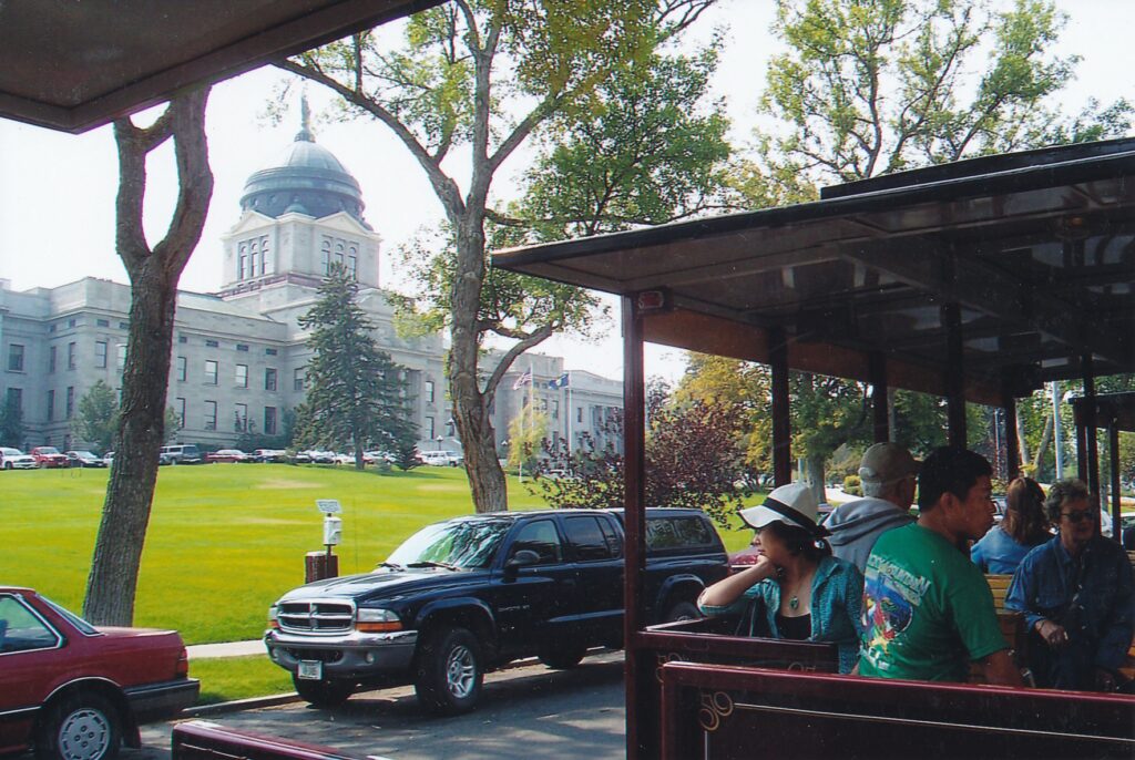
HELENA, Mont. — This capital of some 26,000 residents was not looking its best on a smoky afternoon in late August. Regional forest fires and wind patterns had col1uded to smother whatever mountainous backdrop exists, and the drive into town on westbound Highways 12 and 287 went through a somewhat shabby stretch of motels, used-car lots and strip-mall blight.
Once we found the Capitol, however, the scene brightened and so did our moods. Helena, Montana’ s governmental headquarters since 1894, contains a trio of tourist-worthy attractions about a mile east of downtown. Although one of the attractions — the Last Chance Tour Train — is closed for the season and won’t start chugging again till next Memorial Day weekend, it is the weakest of the three and can be substituted with a driving tour of your own.
We began and ended our day’s sightseeing in Montana’ s Museum, across the street from the 14-acre Capitol grounds. Inside we were introduced to Charles M. Russell, a cowboy painter whose engaging works fill a 2,000-square-feet gallery of their own. The St. Louis native came to Montana as a 16-year-old in 1880 and worked as a sheepherder and wrangler for several years before fully unleashing his creative side as a full-time artist. His watercolors, oils and drawings depict life in Montana as it was, generally, before he arrived on the scene.
“When the Land Belonged to God,” from 1916, is a good example of the respect Russell showed for animal and Indian life in his works. A herd of running buffalo, dust in their wake, ascend a hill after having crossed a river below. A big sky, appropriate for Montana, contrasts nicely with the sunrise- or sunset-lit movement below. Another oil painting, 1922’s “Charles M. Russell and His Friends,” finds the artist on horseback gesturing in tribute to cowboys and Indians who are riding behind him.
Russell’s drawings include “All Who Knew Me — Respect Me,” a chuckle-inducing nighttime scene in which three prospectors tip their hats and tread gingerly as a skunk scavenges their campsite and eats their vittles. Even Russell’s letters to friends are illustrated with humorous doodles.
To see what many regard as his masterpiece, however, one must cross over to the Capitol and enter its House of Representatives room. Russell’ s massive ” Lewis and Clark Meeting the Indians at Ross’ Hole” rises behind the speaker’ s podium. Tour guide Adam Blacker pointed out that the painting’s foreground has a wolf staring angrily at the podium. Apparently, Russell didn’t care for the House speaker at the time, though later they became friends and the politician was one of Russell’s pallbearers in 1926.
Blacker was a delightful docent, a young man who enjoys the part-time job and told me later that he wants to continue with the assignment provided his college schedule allows.
During the free, hour-long tour, Blacker was especially enthusiastic in talking about Mike Mansfield, a Democrat whose 17-year tenure as U.S. Senate majority leader is the longest in history. Our guide said he was in the middle of reading a biography about Mansfield, who along with his wife are subjects of a bronze statue in the Capitol’ s Rotunda area. Maureen is included in the 2001 artwork, Blacker explained, because Mansfield insisted on it; she and Jacqueline Kennedy Onassis are the only spouses buried next to their husbands in Arlington National Cemetery.
A nearby statue salutes another famous member of Montana ‘ s congressional delegations of the past, Jeannette Rankin. She holds two distinctions: In 1916, she was the first woman elected to Congress; and she was the only member of the national legislature to vote against U.S. entry into both world wars. (She was out of Congress from 1919 to 1941). In the 1960s, the dedicated pacifist participated in Vietnam War protests.
Earlier in the day, my wife and I had interrupted our exploration of Montana’ s Museum to take the “train” tour — which actually is automotive in nature, a loco motive like truck pulling three passenger cars, all on rubber tires. It was similar in concept to a tour I had taken a few months earlier in Idaho’s capital city, Boise, although not as worthwhile because Helena doesn’t strike me as being as interesting a town.
Our driver and guide, “Dale,” said he had taught for 30 years at Helena High School (which 1920s-1950s film legend Gary Cooper attended)·.· Now, I get a chance to finish all my sentences, which I wasn’t always able to do in the classroom,” he to]d us over the “train’s” intercom. Unfortunately, his sentences, paragraphs and chapters were not all that compelling. But he was upbeat and well-informed about what we passed by: the new governor’s mansion, the old governor’ s mansion, the trying-to-spruce-up-itself downtown area (main drag: North Last Chance Gulch, aka North Main Street) and St. Helena Cathedral, with its striking 230-foot pair of spires.
We ended our afternoon’ s tourism activities by returning to the museum. Its ‘”Treasure State Treasures” room contains an impressive assemblage of artifacts and trinkets of Montana’ s past, including a billiard cue that after being broken in an 1864 barroom brawl was converted into a buggy whip. The main exhibit area, “Montana
Homeland Gallery,” includes many objects that speak to regional Indians’ ancient past. A major exhibit on explorers Meriwether Lewis and William Clark and the native peoples who long had inhabited their 1804-1806 trail, “Neither Empty Nor Unknown: Montana at the Time of Lewis and Clark,” was launched in September.
Montana’s Museum, 225 N. Roberts St., is open from 9 a.m. to 5 p.m. Tuesdays through Saturdays (until 8 p.m. on Thursdays) from Oct. 1 through April30. Admission is $4 general, $1 for ages 5 through 18. For more information:(406) 444-2694 or www.his.state.mt.us/m use um/default.asp.
From now through December, Capitol tours are offered from 10 a.m. to 2 p.m., on the hour, on Saturdays only. From January through April (in odd-numbered years only, including next year), the state’s Legislature meets and the tour schedule ramps up: from 9 a.m. to 3 p.m. (again, on the hour), Mondays through Saturdays. For more information: (406) 444-4789 or www.montanaca pitol.com.
Ride Helena’s Last Chance Tour Train from Memorial Day weekend through mid-September. Fares in 2006 were $6.50 general, $6 for ages 59 and older, and $5.50 for ages 4 through 12. For more information: (888) 423-1023 or www.lctours.com.
To learn more about Charles M. Russell, visit a museum dedicated solely to the artist in Great Falls. For more information: (406) 727-8787 or www.cmrussell.org.
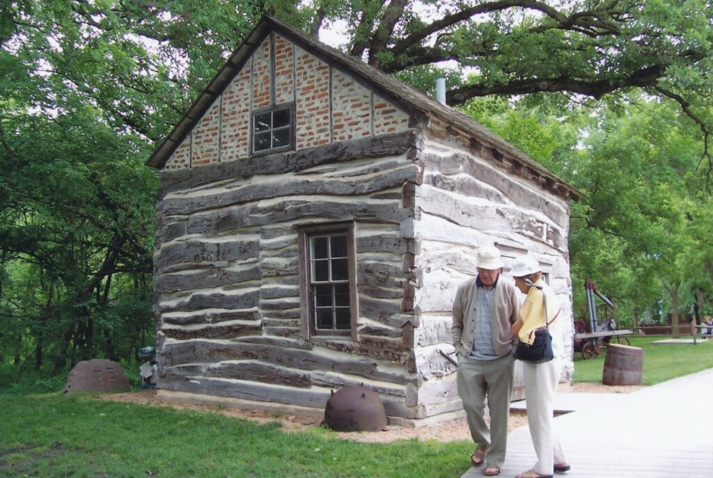
BEATRICE, Neb. — Gathering storm clouds were not the only thing casting a shadow over Homestead National Monument of America when we visited in late May. What is celebrated at the site has a dark side, one that is acknowledged but not with any vigor.
The Homestead Act of 1862, truly a law of the land that lasted for more than a century, helped some 780,000 people successfully put down roots in 30 states. Famous Americans who have ties to the program include inventor and educator George Washington Carver, pioneer congresswoman Jeannette Rankin and entertainer Lawrence Welk. Up to 160 acres apiece were given to men, women (including single mothers and ·widows) and freed slaves who agreed to build a habitable dwelling on the property and make a living on it for at least five years.
“I will simply say that I am for these means which give the greatest good to the greatest number,” remarked President Abraham Lincoln, who signed the act.
Once the Civil War ended in 1865, “homesteaders” in great numbers indeed high-tailed it to the fertile hills west of the Missouri River on over to the dusty plains before the Rocky Mountains. Some prospered and others failed, but their emigration’s impact was nothing but bad news for the American Indians who had lived in the region for centuries, and for the plants and animals around them. Indians were killed off and displaced at an astonishing rate, and native grasslands and buffalo herds all but disappeared by the tum of the century.
The monument about 185 miles northwest of Kansas City and 100 miles southwest of Omaha in southeastern Nebraska, puts a mostly upbeat spin on the Homestead Act and its repercussions. On the afternoon that I was there, dozens of fourth-graders on a field trip from Lincoln certainly were in good spirits. They ran and screamed all about the 195-acre site, stopped occasionally by their chaperones and park rangers for quick history lessons and for a homestead game that involved collecting flags.
Without question, the homesteaders that the monument hails were pioneers. Equipped with little more than a plow and hope, they tried to tame wild lands into prosperous farms. Among those who succeeded was Ohio native and I11inois-trained doctor Daniel Freeman (1826-1904). His homestead claim, at the monument site, was among the first granted when the act became effective on Jan. 1, 1863.
A short trail leads visitors past sites where Freeman built a cabin and to another where, nine years later, he constructed a farmhouse. (Neither structure survives.) According to one of the trail’s interpretive signs, Freeman thrived because he diversified: In addition to farming and practicing medicine, he also served as sheriff and justice of the peace, dabbled in real estate and sold horses. He and his wife, Agnes (1843-1931), raised eight children on the land and she lived there for almost 60 years.
Obstacles abounded for homesteaders, especially for those who — unlike Freeman — got into the act after plum lands had been taken. When settlers arrived at their new property in late spring or early summer, they were confronted by deeply rooted, chest-high grasses that had to be plowed and seeded in time for a fall crop. Ravenous grass fires, rampaging grasshoppers and severe storms foiled many attempts to establish farms. Isolation and loneliness were other factors that prompted people to flee to developing regional cities such as Omaha and Denver.
“Imagine if you can the urgency, the heat, the aching muscles, and be grateful for the heritage of the homesteaders,” notes the audiotaped narrator at a museum exhibit inside the visitors center.
Fraud played a disquieting role in the Homestead Act, as speculators would hire phony claimants to amass property that otherwise would have been given, for free, to sincere settlers. By turn, speculators sold the land at inflated prices, using dishonestly positive advertising campaigns (wheat grows like weeds, that kind of thing), to lure innocent – and often doomed to fail — buyers.
Out back of the visitors center is the restored Palmer-Epard Cabin, a one-room shack that was built 14 miles away by a homesteader in 1867. Visitors can step inside to see how it would have been furnished in the 1890s. Nearby, farm implements such as a McCormick Reaper and 10-foot windmill top are displayed in another small museum that will ring bells for children and grandchildren of late 19th and early 20th century farmers.
The trail that passes by Daniel Freeman’s lodging sites also features a tidy display of 40- some native grasses, which have nonscientific names such as Illinois Bundleflower, Jerusalem Artichoke and Whorled Milkweed. Animals that inhabit the area include deer, ring-necked pheasants and prairie voles.
A shorter trail goes to Freeman School, where a teacher who used the Bible as a textbook and for references was taken to court by Freeman, who demanded the separation of church and state. After several setbacks at lower levels, he prevailed after three years before the Nebraska Supreme Court. The school, restored to its 1890s appearance, was before it closed in 1967 the oldest operating one-room schoolhouse in the state.
Homestead National Monument of America can leisurely be explored in two hours, including an 18-minute video that’s screened in the visitors center. The film approaches the Indians’ plight on several occasions, but always abruptly steps back from the injustices and resumes its promotional tone.
Although the monument dwells mostly on the past, sometimes with rose-colored glasses, I thought a displayed quote by Homestead Act author Galusha Grow has relevance for today’s corporate culture, in which fewer hands are controlling more and more p1aces and things.
“Why should not the legislation of this country be so changed,” Grow wrote 144 years ago, “as to prevent for the future the evils of land monopoly, by setting apart the vast and unoccupied territories of the union, and consecrating them forever in free homes for free men?”
For more information about the monument, which is open from 8:30 a. m. to 5 p.m. daily (during weekends from Labor Day until Memorial Day, it opens at 9 a.m.), visit www.nps.gov/home. On May 20, 2007, the 145th anniversary of the Homestead Act’s passage, the monument is scheduled to expand with a Homestead Heritage Center.
By the way, as my parents and I were driving away from the monument and stopped at a rest area in McDonald, Kan., late that afternoon, we spotted on a message board an offer that had a weird echo: Anyone wil1ing to build a house and live in it for five years could have a free plot of land in the tiny town. So how about it, 21st century homesteaders?
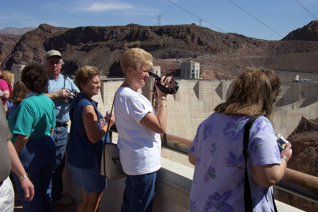
BOULDER CITY, Nev. – Peering out from the observation deck, Hoover Dam just to the left and the re-emerging Colorado River 800 feet below, visitors may find it difficult to process the structure’s size. Then a solitary bird flies before it, about a third of the way down. The bird looks so tiny, so far away.
Perspective has been gained. What we have been told all our lives is true. Yes, Hoover Dam is enormous, fully the awesome architectural and engineering wonder described to us in American history classes and TV travelogues.
Seeing is believing at Hoover Dam. Opened on Sept. 11, 1936, the dam’s most important function today is the role it plays in water services. It also provides electricity for 1.5 million to 2 million people. More than half the juice is transmitted to California, with the two states that sandwich the dam, Nevada to the west and Arizona to the east, sharing the remaining 40 percent.
The Depression-era project features another power, though: that of luring lots of tourists. A million come each year, and hundreds were flocking about and walking across the dam on a sunny morning in mid-March. A never-ending stream of cars flowed across on Highway 93, many on their way to or from the visitor center’s five-story parking lot.
Covered parking can be a blessing here, especially in the busy summer months, when daytime temperatures often top 100 degrees. That’s more proof that this place is all about big numbers.
Six point six million tons of concrete were used in the dam’s construction. That’s enough to, according to various displays in the visitors center and frequently asked questions on the official Web site:
- Pave a 16-foot-wide highway from San Francisco to New York.
- Make a 4-foot-wide sidewalk around the Equator.
- Create a 100-square-foot monument that rises 2.5 miles.
Hoover Dam, about 30 miles southeast of Las Vegas, is 1,244 feet wide at its top; vehicles take about a minute to cross, giving way to frequently crossing pedestrians. Its base is a fraction of that width, though down there the dam is nearly twice as thick, at 78 feet. Behind it is Lake Mead, the planet’s ninth-largest reservoir. It extends some 110 miles upriver, toward the Grand Canyon, and stores the equivalent of two years’ flow by the Colorado River. That’s enough water to:
- Spread 10 feet deep over Connecticut, reports the visitors center.
- “Cover the state of Pennsylvania to a depth of one foot,” counters the Web site.
(Aside: We’re in the West, so why the persistent East Coast slant?)
Although walking or driving across the dam is free, visitors should consider taking a “discovery tour” ($10 general, $8 for seniors 62-plus and military personnel, $4 for ages 7 through 16). Included are a 15-minute talk by a Bureau of Reclamation representative, somewhat instructive about the dam but largely a promotional pitch for the Department of Interior’s sub-agency; access to the observation deck; and a crowded elevator ride down to the seven power generators (there are eight more on the Arizona side). Prior to the 2001 terror attacks, visitors also could walk out onto a platform for a closer look at the river.
Discovery tour tickets also allow access to a few rooms’ worth of exhibits that suffer from too many video screens whose speakers are too loud, creating an air of media pandemonium. A quiet display that poses questions with three possible answers is somewhat enjoyable, though. How many workers are buried in Hoover Dam? “Three high-schoolers and two carpenters” is among the choices. Truth is, the structure is bone-free.
Parking in the Nevada-side’s big garage costs $5 per vehicle; uncovered lots on the Arizona side are free but require much-longer walks. The Hoover Dam visitors center is open daily from 9 a.m. to 5 p.m. Discovery tour tickets are sold until 4:30 p.m., though visitors are urged to arrive by 3 p.m. For more information: (866) 291-8687 or www.usbr.gov/lc/hooverdam.
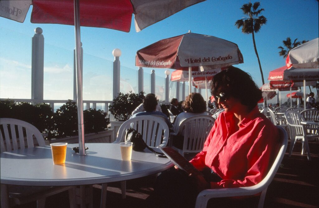
SAN DIEGO — It isn’t exactly a fantasy come true, but it’s close. I’m taking a beautiful young woman to the Hotel del Coronado, one of the world’s most-seductive seaside resorts. Host of presidents, future kings …
And Marilyn Monroe. As we drive past the main entrance to “Hotel del,” I almost can see the late, great Norma Jean on the steps, looking somewhat chunky yet entirely desirable stuffed into one of her “Some Like it Hot” costumes.
And who is that spry, dashing figure in a yachtsman’s outfit climbing up and down this magnificent Victorian structure?
Why, it’s Tony Curtis, circa late 1950s, ready to launch into his uncanny impersonation of Cary Grant. Surely his “Some Like it Hot” co-star, Jack Lemmon, is nearby, puckering his lips, wearing a dress and swinging his hips.
In case you haven’t seen director Billy Wilder’s classic 1959 film — featuring 121 minutes of saucy, hilarious dialogue — here’s a brief description of the plot. Two Chicago musicians, Joe and Jerrie, don drag outfits and become “Josephine” and “Daphne” in order to ioin an all-female band bound for a “Flodda” resort. The dupery is designed to avoid the Chicago mob, and the resort — in real life — is the Hotel del Coronado.
Heading down to the gig on a train, Josephine (Curtis) and Daphne (Lemmon) discover one of their new colleagues is the sweet-looking but often-imbibing Sugar Kane (Monroe). “I tell you, it’s a whole different sex,” Lemmon says, feeling inappropriately masculine. Curtis responds:
What are you afraid of? No one’s asking you to have a baby.
But I digress. The beautiful young woman and I have left my car in a hotel lot that charges $2.50 for the first hour and $2 for every subsequent 60 minutes. We could have opted for valet parking, but as I said, this is a limited fantasy. I’m not rich.
We approach the original wooden section of the hotel, which has been designated a National Historic Landmark. Nearby is Ocean Towers, a hideously modern, seven-story addition. But we ignore that, since we’ re interested solely in the 103-year-old building — the one with charm.
Dressed casually in blue jeans and tennis shoes, we’re no match for the various suits and gowns that adorn Hotel del’s entrance this sunny December day. We pause for a moment.
I feel naked. I feel like everyone’s staring at me.
With those legs. are you crazy? Now, come on!
Upon entering, we are overwhelmed by a gigantic Christmas tree that takes up much of the lobby. We see another large holiday tree in the Crown Room, site of a 1970 state dinner hosted by President Nixon. Hotel del’s three dining rooms also were used by FDR, Carter and Reagan for presidential functions. In 1920 the Prince of Wales, later King Edward VIII, dined here and likely met his future wife, Coronado Island housewife Wallis Simpson.
We look at the Crown Room’s menu and are surprised to see many luncheon items are under $15. A group of prosperous-looking men are dining at a far-away table, under one of the crown-shaped chandeliers.
Millionaires. Flocks of them They all go south for the winter, like birds.
Oh? Are you going to catch your own rich bird?
I don’t care how rich he is as long as he has a yacht. his own private railroad car and his own toothpaste.
Let’s look around before we eat, urges my companion, brushing back dark hair to reveal a lovely face. Out of curiosity, let’s see how much it costs to stay here, I suggest. We skirt the lobby’s tree on our way to the front desk.
A smiling clerk says yes, there’s a price list, and here it is. For the Victorian building, a standard, limited-view room is $145 per night, single or double occupancy. A deluxe room with an ocean view is $195 per night, while lanais and suites run $295 to $415. The modern complex, for some reason, charges more — up to $985 for a two-bedroom apartment.
Well. it’s all rather complicated. What we call high finance… A man of my position has a certain responsibility to the stockholders. You know, all those little people who have invested their life savings.
Good thing my companion and I aren’t intending to spend the night. Remember, this fantasy has its bounds. To be frisky, however, I ask the clerk if we can see a room. She’s sorry, she replies, but they’re all occupied. Reservations usually are made months in advance, especially for weekends. A one-night deposit is required to confirm stays, she says, pointing to the hotel’s phone numbers: (619) 522-8000 and (800) 522-3088.
We pass through a perfectly landscaped courtyard, under some of Hotel del’s 1,011 rooms, and turn left, toward the ocean. We go by light-equipped tennis courts and look out on a deep, white-sanded beach. We consider having a drink, but it’s after 2 p.m. and I’m hungry.
He’s got an empty stomach and now it’s gone to his head.
The burger and hot dog bar, open until 3 p.m., seems reasonable at under $6 per selection, but my scrumptious friend and I are in the mood for lighter fare. We settle for generous orders of fruit salad, which cost $8 apiece.
Finished with the main course, we indulge in pleasant conversation for dessert. The sun peeks under the canopy, and my dream woman covers her sparkling eyes with sunglasses. Taking the cue, I put on my prescription shades and look left, hoping to impress her with my modest profile.
Men who wear glasses are so much more gentle. and sweet. And helpless. Haven’t you ever noticed it?
Now how ’bout that drink, I suggest. We stroll across to a large deck that overlooks one of Hotel del’s two large swimming pools. More canopy-topped tables surround a full-service bar. I spring for the $3 beer and $3.50 glass of chardonnay, trying not to think about the mounting parking bill.
We gaze westward across San Diego Bay toward Fort Rosecrans Military Reservation, on a finger of land that sticks down from the city’s Point Loma neighborhood. Mycompanion, finished with her wine, lurches a bit as she stands to get a better view. She’ s not had alcohol in a long time, she explains with an intoxicating smile.
I don’t want you to think I’m a drunk. I can stop any time. I want to only I don’t want to, especially when I’m blue.
All the other girls think it’s just that I’m the one that gets caught The story of my life. I always get the fuzzy end of the lollipop.
How quickly our day has gone. I’ve had a wonderful time visiting Hotel del. and hope the lady I’ve escorted feels the same. I stare at her as she looks out on the ocean, and wonder if I’ve fallen for her as blindly as Joe E. Brown’ s Osgood Fielding III fell for Jack Lemmon’s “female” character in that great old film.
Osgood. I’m going to level with you. We can’t get married at all.
Why not?
She’s out of my league, I think, admiring the shimmer of late-afternoon sun off her pretty hair.
In the first place, I’m not a natural blond.
It doesn’t matter.
This woman has a high-paying job. Could she learn to love a poor journalist?
I smoke! I smoke all the time.
I don’t care.
She lives in San Diego — two hours from my apartment in the South Bay section of the Los Angeles basin. How often could we see each other?
I have a terrible past. For three years, I’ve been living with a saxophone player.
I forgive you.
She’s a mother, I suddenly remember. She has an adorable baby boy.
I can never have children.
We can adopt some.
This is exasperating. Here I am fulfilling a partial fantasy by taking a beautiful young woman to one of the world’s most-seductive seaside resorts. But she’s … she’s … married!
You don’t understand, Osgood. I’m a man!
Well, nobody’ s perfect.
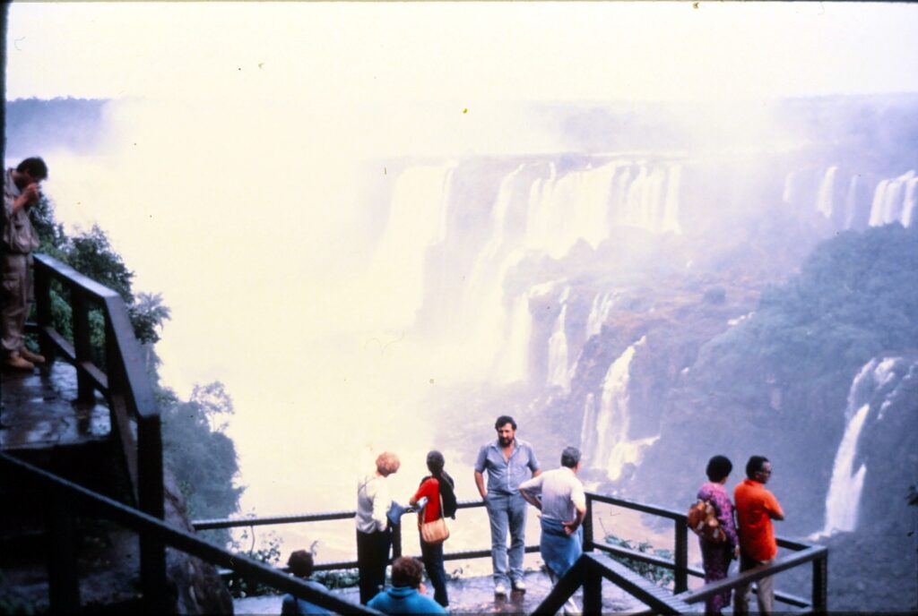
The sight of Iguacu Falls is breathtaking, by any standard. More than 250 waterfalls of substantial height and volume emerge from a dense rain forest to crash down on the rocks below. But it is the sound — the ceaseless roar makes Iguacu more than just another pretty place.
“Foz do Iguacu” has recently emerged as one of the biggest tourist attractions in South America. Located at the juncture of Argentina, Brazil and Paraguay, the falls are drawing a growing stream of visitors. A few years ago, the wonders of Iguacu were stunningly exposed in the Oscar-nominated film, “The Mission.”
Comparisons between Iguacu Falls and Niagara Falls are inevitable. Each can be viewed from two different countries. Each is fed by one river. Neither offers much hope for errant boats and swimmers.
But as for volume and scope, there is no comparison. The cascades at Iguacu tumble 190 feet and have a frontage of a mile and a half, making them 50 percent higher and wider than their North American counterparts. Eleanor Roosevelt said it best: Iguacu makes Niagara “look like a kitchen faucet.”
There are two principal walking paths that unveil the splendor of Iguacu Falls, one each in Brazil and Argentina. For picture taking, the Brazilian trail offers more possibilities. Along its gentle slopes are many spectacular views. After a mile or so, walkers reach the side of ” Garganta do Diablo” (Devil’ s Throat), where they can take an elevator above the falls for a comprehensive look at Iguacu.
It is at Devil’s Throat where the sound of Iguacu is most intense. By leaning over the railway, you can almost touch the thunderous white waters. Staying dry is not an option, however; a thick spray finds everyone, and ponchos or raincoats are needed even on cloudless da ys.
When the sun is out, rainbows are all over the falls. Again, Devil’s Throat is the best vantage point. Unfortunately, sunshine is a fickle friend at Iguacu and often misses tourists no matter how long they stay. The dry season runs roughly from May through October. However, “Rio Iguacu” (Iguacu River) is at its highest level from April through July, and as a consequence the falls increase in volume and noise.
The Brazilian-side trail begins at the luxurious Hotel des Cataratas, the only accommodation within walking distance of the falls. The front desk sells tickets to helicopter rides, which are about $50 per person and last 10 to 15 minutes.
South of the river, on the Argentinian side, a half-mile catwalk skirts over marshland and the river to the edge of the main body of waterfalls, an extension of Devil’ s Throat. It offers a different perspective, though more limited than from Brazil.
Both walking paths are about 15 miles from the town of Foz do Iguacu, which though small offers a wide range of accommodations. Local buses run frequently to the Brazilian path and to the airport, which is approximately halfway between the town and the falls. There are many tours available from town, but they’re not worth the expense.
Tour packages are more practical for access to the Argentinian catwalk. Without them, it’s necessary to take two local buses. Also, tour vehicles seem to pass through customs more quickly. Tours cost about $10.
Similar in cost are half-day tours of the nearby Itaipu Dam. Completed in the late 1980s, Itaipu is a staggering five miles wide and supplies a significant amount of power to its co-sponsors, Brazil and Paraguay. Tours consist of a short film and 30-minute ride by the dam. Public transportation also runs between the town of Iguacu and Itaipu Dam’ s visitor center.
If the natural beauty of Iguacu Falls and manmade wonders of Itaipu aren’t sufficient entertainment, gambling and other vices are available in the Portuguese town of Puerto Stroessner. The border is completely open between the towns of Iguacu and Stroessner; tourists can cross the interceding Friendship Bridge as many times as they wish without encountering the hassles of passport control.
Inexpensive leather goods are in abundance in Stroessner’s open market area.
Three- and four-day flight packages to Iguacu cost about $280 from Sao Paulo. Most deals include accommodation and breakfasts in four-star hotels, along with tours of the waterfall paths, Itaipu and Puerto Stroessner.
Bus packages from major cities also are available, cost about half as much as air deals, and often include three meals a day in addition to the tours and fancy lodging.
Almost any package deal can be obtained in South America a week or more in advance. Arrangements made through U.S. travel agents are likely to be more expensive.
LONDON — A pair of behemoth 15-inch naval guns stand menacingly out front and set the tone for what is more than just a war museum.
To borrow from military vernacular, classify this as a total war museum. Inside is aII manner of war exhibits — machines, weapons, clothing, videos, artwork, walk- through “experiences” and more history than you can shake a stick, flash a sword or fire a gun at. To examine everything would take many hours, perhaps all day.
That the Imperial War Museum is large should come as no surprise. To borrow from queen’s English vernacular, Great Britain has had a bloody run of wars, and this waning century has been the bloodiest of all.
A clock in the museum’s lowest floor pays symbolic tribute to the more than 100 million people worldwide who have died in 20th century wars. Each 15-second rotation of the clock’s hand represents five deaths, which a digital board tallies below. On the day I visited in early May, the board read 89,751,314; it will hit 100 million at the stroke of midnight on Dec. 31.
On this “lowest ground floor” are two of the museum’s showpieces, each depicting a notorious aspect of the two world wars. “The Trench Experience” is a dark and musty re creation of World War I that brings to mind Stanley Kubrick’s 1956 film, “Paths of Glory.” One lighter scene in this somber exhibit finds a soldier writing home about his diet, which consists of biscuits for breakfast, biscuits for lunch and, alas, biscuits for dinner.
“The Blitz Experience” is more theatrical. Visitors assemble in a World War II bomb shelter, listening in the dark to a taped collection of voices from the London Blitzkrieg. “Roll Out the Barrel,” the voices bravely if shakily sing moments before a German bomb rattles the shelter. Directed outside, visitors pass by an upturned baby carriage, whose wheels spin squeakily.
Broken walls and a model of a city neighborhood’s battered skyline complete the experience. “Off you go,” a shelter warden says. “Don’t forget us!”
One of the floor’s smaller exhibits is a room devoted to the April 1945 liberation of the Bergen-Belsen concentration camp in northern Germany. More than 60,000 prisoners were crammed into the Nazi death camp at war’s end, hundreds having been dying each day.
Black- and-white mug shots of 11 Germans executed for their genocidal roles at the camp cover the back wall.
“Conflicts Since 1945” goes on and distressingly on. The Berlin Airlift, Cold War, Cyprus, the Suez Crisis, Northern Ireland, Persian Gulf … the carnage never seems to stop.
Famous quotes about war are paired with expressive wartime photographs in the lower floor’s hallway. Among them:
- “Victory at all costs, victory in spite of all terror, victory however long and hard the road may be; for without victory there is no survival.” Winston Churchill to the House of Commons, 1940.
- “The essence of war is violence and moderation in war in imbecility.” Lord Macaulay, 1831.
- “There were great numbers of young men who had never been in a war and were consequently far from unwilling to join in this one.” Thucydides, fifth century B.C.
Tanks, planes, missiles and artillery guns populate the museum’s ground floor. One of the most imposing items, from a British perspective, is the towering German Vergeltungswaffen, or V2 also known as a “doodlebug” or “bug bomb.” More than 6,500 V1s and V2s were showered over Belgium and Britain during the later stages of World War II, killing thousands of civilians. Not far from the V2, visitors can walk through the cramped and spooky front fuselage section of a Handley Page Halifax B Mark VII, which deposited secret agents and supplies behind enemy lines.
The “first floor” (what we would refer to as the second floor) contains more machinery and a section on covert war operations. On the top, or “second,” floor are paintings from this century’s two largest conflicts. Notable works include C.R.W. Nevinson’s “French Troops Resting,” from 1916, and Meredith Frampton’s “London Regional Civil Defence Control Room,” 1943. I found the dark, haunting images from World War I superior to the WWII-era paintings.
Through May 29, 2000, the museum features “From the Bomb to the Beatles,” a multimedia look back at Britain from 1945 to 1965. Among the tidbits to be gleaned here is that in the postwar ’40s, furniture could be purchased only by those whose houses had been bombed, who were setting up home for the first time, or who were having a baby. Chocolate and other sweets were rationed until 1953, meat a year longer.
Near the end of the “Beatles” exhibit are these haunting words from a U.S. Cold Warrior, President John F. Kennedy, spoken in 1961: “Every man, woman and child lives under a nuclear sword of Damocles, hanging by the slenderest of threads, capable of being cut at any time by accident or miscalculation or madness.”
The Imperial War Museum, on Lambeth Road, is a 15-minutewalk south of the Waterloo railroad station; the nearest Underground stop is Lambeth North. It is open daily from 10 a.m. to 6 p.m. except Dec. 24-26. Admission is 5.20 pounds general, 4.20 pounds for seniors and students, and free to all after 4:30 p.m. For more information: call O171-416-5320; write to Imperial War Museum, Lambeth Road, London SEl 6HZ; or visit the website www.iwm.org.uk.
Note to military enthusiasts: There are two other war-related attractions in the London area that are affiliated with the Imperial War Museum. Both are open from 10 a.m. to 6 p.m. They are, with the nearest Underground stops and phone numbers: Cabinet War Rooms, Westminster or St. James’ Park, 0171-930-6961; and HMS Belfast, London Bridge or Tower Hill, 0171-407-6434. Duxford Airfield, 8 miles south of Cambridge, 01223-835-000, also is affiliated with the IWM and has the same hours of operation.
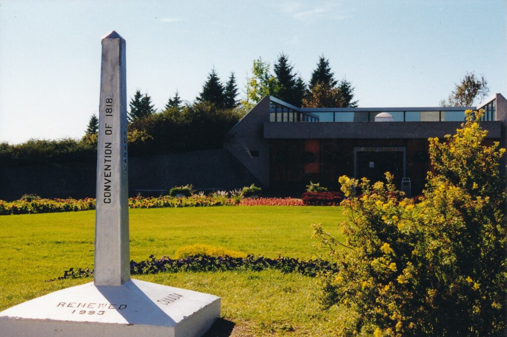
Our country’s relationship with Canada, like any lasting friendship, is easy to take for granted. The world’s longest unfortified frontier, like a companionable silence, does not fire up our emotions.
The International Peace Garden, straddling North Dakota’s border with the Canadian province of Manitoba, is a quiet, suitable celebration of that relationship. More than 150,000 flowers are planted each year for displays such as an 18-foot floral clock and the formal garden that forms a colorful, fragrant boulevard from the park entrance to a 120-foot Peace Tower. The entire, 2,300-acre park is a wildlife refuge.
Summers find two youth groups there that give free public concerts: the International Music Camp and the Royal Canadian Legion Athletic Camp. Park staff generally is composed of a balanced mix of Americans and Canadians. Supplies for the cafe and other park services are bought in roughly equal amounts from north and south of the border.
Visitors, of which there were a quarter-million in 1998, can explore the peace garden in a variety of ways. A 1.5-mile sidewalk frames the formal garden and leads past the tower to Peace Chapel, built right on the border. Each country’s side has a 3-mile scenic drive, with several picnic grounds. A 1.5-mile nature trail is in Canada; the U.S. side has a campground.
People from more than 70 countries come to the park each year, but of the two primary nations, which is better represented? Joshua D. Bye, who among other park duties oversees the Web site (www.peacegarden.com),said foreign exchange rates play a role for American and Canadian tourists.
”It depends on the strength of the Canadian dollar,” said Bye, who during the peace garden’s off-season lives in Bellingham, Wash. “This summer, as for park attendance it’s been about 50-50. In the cafe, it’s been predominately U.S. … I’d say 60-40.”
I talked with Bye late one afternoon in mid-September, which found the peace garden mostly deserted. Leaves were beginning to turn their fall colors, the sun sparkled off the several small lakes and a deer, startled by my passing behind the chapel, scampered off – with complete freedom of choice — toward Canada.
Bicycling was how I explored the park, easy enough to do on such a nice day over mostly flat terrain. Doing so I quickly experienced a few cultural differences. The U.S. side has a bike path, while in Canada there is more of a sense of humor displayed (one sign says visitors are entering “sasquatch territory”). You can drive faster in the Canadian portion — 50 kilometers per hour, as opposed to 25 mph in the south. More buildings are in the United States, while nature endures fewer such intrusions in Canada.
In the spirit for which it is named, the Peace Chapel posts dozens of quotations from people famous and otherwise. Friendship and cooperation prevail in these words, engraved on the marble walls. Some examples:
- Don’t walk ahead of me. I may not follow. Don’t walk behind me. I may not lead. Walk beside me, and just be my friend.’ (Albert Camus)
- That long Canadian frontier from the Atlantic to the Pacific oceans, guarded only by neighborly respect and honorable obligations, is an example to every country and a pattern for the future of the world.’ (Winston Churchil1)
- Until you have become really, in actual fact, a brother to everyone, brotherhood will not come to pass.’ (Feodor Dostoevski)
- Friendship doesn’t exist to criticize. Its function is to inspire confidence.’ (Jean-Paul Sartre)
- So long as we love, we serve. So long as we are loved by others, I would almost say we are indispensable. And no man is useless while he has a friend.’ (Robert Louis Stevenson)
Among annual activities are International Motorcyclist’s Day in June, the International Ham Radio Festival and Borderfest in July, and Garden Party in August. During the summer garden tours, crafts programs, campfire programs and other activities are offered. Cross-country skiing is one of the few options in wintertime, which can be quite cold.
The peace garden was dedicated in 1932 on July 14, Canada’s independence day. A plaque near the entrance marks that occasion with this inscription: “To God in his glory, we two nations dedicate this garden and pledge ourselves that as long as man shall live we will not take up arms against one another.”
The International Peace Garden never closes. Each vehicle is charged $7 to enter; pedestrians and bicyclists pay $3 apiece. Camping fees range from $5 for overflow to $12 for a site with electricity and water. For more information: (888) 432-6733 or www.peacegarden.com.
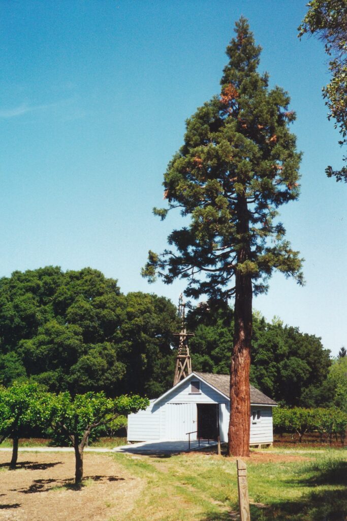
MARTINEZ — “John Muir talked even better than he wrote,” according to Theodore Roosevelt. “His greatest influence was always upon those who were brought into personal contact.”
Contact with the famous conservationist, who died in 1914, in a way can be achieved through a visit to the John Muir National Historic Site, which includes the mansion in which Muir lived his last 24 years. School groups often visit. The students — mostly fourth-graders, according to park ranger Barbara Phillips — seem to sense that the Scotland-born Muir had a great fondness for children.
“Adults, he could take ’em or leave ’em,” Phillips said. But young people he adored, she continued, and that warm feeling is reciprocated today through the student visitors. “They just love John Muir. Something special is going on there. I just love that.”
The 8.8-acre park, about 90 miles from Sacramento in the Alhambra Valley south of Martinez, incorporates ground that he himself cultivated in the 1880s. The property was part of a 2,600-acre farm owned by his father-in-law, Dr. John Strentzel, who died in 1890. Muir then moved into Strentzel’s 17-room house and presided there until his death at age 76.
That last third of Muir’s life is when he earned his fame. He became a tireless advocate for conservation. Through his direct influence, five national parks were established: Yosemite, Sequoia, Mount Rainier, Petrified Forest and Grand Canyon. He traveled extensively, including to Alaska and Africa, and wrote books and more than 300 magazine articles. In 1892, he helped found the Sierra Club and served as its president for the rest of his life.
A look at Muir’s role with the environmental group shows how he cared about matters beyond wilderness. The former schoolteacher, also a lecturer, geologist, botanist and inventor, had credentials as a feminist, too.
“John Muir did not accept the stereotype of his time that women were too delicate for a wilderness experience…” according to a sign on the mansion’s second floor, next to a picture of Muir and his “outing secretary” — a woman — on horseback in 1908. “He encouraged women to take an active part in all Sierra Club activities.” About one-third of the club’s early members were female.
In fact, Muir’s personal life revolved around three women. He and his wife, Louie, had two daughters. Little Wanda and Helen, no doubt blessed with some of their father’s adventure some spirit, reportedly made good use of the mansion’s attic and bell tower.
The tower’s view has changed since their day, however, and not in ways that would have pleased Muir.
Today from that perch, accessible by stairs leading from the attic, visitors can see to what extent nature has given way to the sprawl of humanity. Not more than 100 yards away is busy Highway 4, its vehicular roar reduced to a constant but distinct hum inside the large house. Scanning to the left, one can see through the tower’s windows first a bank, then a shuttered gas station, an oil refinery in the distance, huge power lines and stands cutting across the visage, a subdivision on the hillside and, directly across Highway 4, a rusty railroad trestle.
Children can add to the commotion by ringing the tower’s bell, Phillips said.
“Over and over again, it’s the loud, overbearing kid who does it beautifully,” according to the park ranger, “and it’s some pipsqueak kid who just yanks it.” Another lesson to be learned at the house is a backpacker’s obligation to pack out what he or she packs in. If school groups stay for lunch, Phillips said, students are responsible for carrying out their own garbage.
Muir himself was an accomplished backpacker, a long-bearded, thin man whose association with Roosevelt included a four-day hike into Yosemite in 1903. One morning, the two — who slept without a tent — awoke to find themselves covered with snow. The president himself was instrumental in our country’s early conservation movement, authorizing many national parks and monuments before leaving office in 1909. After their Yosemite trip, Muir commented about Roosevelt: “I was surprised to find he knew so much natural history.”
What the two had done together, exploring the Sierra, was one of Muir’s passions. He liked to describe such excursions in specific terms, as is evident by the following quote attributed to Muir in one of the historic site’s exhibits.
“You know, when the pilgrims were going from England to the Holy Land, the French would ask them, ‘Where are you going?’ And they did not speak French very well, but they would say, ‘Sante Terre’ (holy land). That is where we get our word ‘saunter’ and you should saunter through the Sierra, because this is holy land, if there ever was one.”
Sauntering is something visitors can do at the historic site, learning as they go thanks to the mansion’s exhibits and a self-guided-tour pamphlet that costs $1 in the visitors center. The trail, which can take a leisurely 90 minutes to complete, passes by two trees Muir planted: a dying fig and a growing sequoia.
Long before Muir’s family plowed the earth here, Saklan Indians of the Miwok tribe and Karkin Indians of the Ohlone tribe inhabited the valley. Their way of life, in place as early as 2,000 B.C., surely appealed to Muir.
“As hunters and gatherers, they did not cultivate crops,” a sign about the Indians explains inside the Martinez Adobe, part of the self-guided tour “Instead, they used sophisticated techniques like controlled burning to promote plant growth and seed propagation. Their lifestyle established a harmony and balance with nature that lasted for many thousands of years.”
This past New Year’s Eve, as a century much influenced by the legendary conservationist drew to a close, television cameras in time zones around the globe followed the arrival of the new century. Midnight shots of people’s celebrations gave way, a few hours later, to the sun’s rising. Muir’s own words would have been an appropriate narrative.
“This grand show is eternal. It is always sunrise somewhere; the dew is never all dried at once; a shower is forever falling; vapor is ever rising. Eternal sunrise, eternal sunset, eternal dawn and gloaming, on sea and continents and islands, each in its tum, as the round Earth rolls.”
John Muir National Historic Site is open from 10 a.m. to 4:30 p.m. Wednesdays through Sundays; it also is closed on New Year’s Day, Thanksgiving and Christmas Admission is $2 per person or $4 per vehicle; anyone 16 and younger is not charged. For more information: (925) 228-8860 or www.nps.gov/jomu.
Directions: From Sacramento, take Interstate 80 west to Highway 4. Go east to the Alhambra Avenue exit to Martinez. Tum left at the bottom of the ramp, and after driving under the overpass tum left into the site’s small parking lot. Bus No. 116 from the site offers connections to BART and Amtrak.
When times are tough, one of the best people to turn to for insights is John Steinbeck. That was the case when he published “The Grapes of Wrath” in 1939, and it remains true today– 40 years after his death at age 66.
One of the best places to learn more about the 20th century literary giant is at the National Steinbeck Center in Salinas, which earlier this year marked its 10th anniversary. The complex takes a colorful, creative and comprehensive look at Steinbeck’s childhood here, his affection for the Central Valley and, of course, his works.
“The Grapes of Wrath” was written during the Great Depression and, in the smallest of nutshells, tells how an Oklahoma family uprooted by the Dust Bowl tries to start a new life in California. The John Steinbeck Exhibition Hall, the Salinas facility’s centerpiece, excerpts passages from the novel and screens scenes from the film adaptation that starred Henry Fonda. It also delves into the widespread wrath directed toward the author.
“The book ridicules those who see ‘reds’ threatening American life, ” wrote Loyola University professor Arthur D. Spearman in a newspaper review of the book. “It honors and appeals for the adoration of communism but tactfully refuses to use or accept the name.”
Spearman’s critique is part of a display about the controversies surrounding “The Grapes of Wrath, ” which was subject to bans and burnings. Growers complained that the book misrepresented their attitude toward migrants. Oklahomans said Steinbeck exaggerated the effects of the Dust Bowl.
Some professed to be repulsed by “Wrath’s” profanity and its ending.
Steinbeck, who won the Pulitzer Prize, observed the uproar warily. “The vilification of me out here from the large landowners and bankers is pretty bad, ” he wrote. “The latest is a rumor started by them that the Okies hate me and have threatened to kill me for lying about them. I’m frightened at the rolling might of this damned thing. It is completely out of hand. I mean a kind of hysteria about the book is growing that is not healthy.”
“East of Eden,” published in 1952, was another masterpiece but not one so passionately received by the public. Basically, Steinbeck adapted the biblical tale of Cain and Abel into a modern Salinas Valley setting. “East of Eden” is a heartfelt work, obliquely autobiographical of the author’s upbringing. According to the exhibition hall, Steinbeck created the book for his two sons.
“I want them to know how it was,” he later wrote. “I want to tell them directly, and perhaps by speaking directly to them I shall speak directly to other people.”
Regarding the 1955 film adapt at ion starring James Dean, Steinbeck remarked with what might have been modesty, “It is a real good picture. I didn’t have anything to do with it. Maybe that’s why. It might be one of the best films I ever saw.”
Snippets from that movie also are shown in the exhibit ion hall, as is the case with “Of Mice and Men, ” set in Soledad, and “Lifeboat” — one of director Alfred Hitchcock’s lesser efforts and a movie for which Steinbeck, despite his protestations the final script had racist overt ones, is listed as head writ er.
Presumably, Steinbeck would not object to the Salinas center’s adoring tone, even though the townsfolk didn’t always, and reportedly still don’t, universally hail his brilliance. (“Aft er I had written the ‘Grapes of Wrath’ and it had been to a large extent read and sometimes burned, the librarians at the Salinas Public Library, who had known my folks, remarked that it was lucky my parents were dead so that they did not have to suffer this shame, ” Steinbeck once observed.) He might appreciate, too, that the modified camper truck he called “Rocinante” that he drove around to research 1962’s “Travels With Charley: In Search of America” is protected behind glass walls.
After a lengthy illness, Steinbeck — who was born in Salinas on Feb. 27, 1902 — died Dec. 20, 1968, in New York City.
Susan Shillinglaw, an English professor at San Jose State University, calls the Steinbeck National Center “a wonderful place.” She has written extensively about Steinbeck, including the 2006 book “A Journey Into Steinbeck’s California,” a combination biography and travel guide. In an e-mail interview, I asked her to characterize his legacy.
“He was popular when he was alive and he remains so, ” she wrote. ” ‘The Grapes of Wrath’ is still widely read — and seems prophetic in these times. ‘Of Mice and Men’ captivates, and is required reading for students across the country.
“People sometime look for different issues in a writer as decades pass — and Steinbeck’s concern with environmental holism, in a book like ‘Sea of Cortez’ — has caused many to take a fresh look at his career. But his empathy, his lifelong stance as a Democrat, his humor, his lucid prose — these qualities were evident in 1968 and are evident today.”
I asked her about a seeming contradiction raised in the Salinas exhibits about Steinbeck’s involvement with the Vietnam War. In 1967, he went there as a correspondent and to see both his sons, who were serving in the military. On the one hand, he is quoted as saying, “I know that we cannot win this war, nor any war, for that matter.” On the other hand, a photo shows him smiling with President Lyndon B. Johnson, and a caption reports Steinbeck supported Johnson’s Vietnam policies.
Shillinglaw explained that Steinbeck “just bought into the whole notion that the war was making the world safe for democracy. He hated communism — had been to Russia three times, hated the curbs to creativity. So his response to Vietnam came out of that.” She also pointed out that Elaine Anderson Scott Steinbeck, who was the writer’s wife from 1950 until his death, was a close college friend of Lady Bird Johnson.
Steinbeck also had first-hand exposure to World War II, having been a correspondent for the New York Herald Tribune in the Mediterranean region. His 1958 collection of some of those dispatches, “Once There Was a War, ” contained a sobering forward for those of us paying attention to world events 50 years later.
“Once upon a time there was a war, but so long ago and so shouldered out of the way by other wars and other kinds of wars that even people who were there are apt to forget.”
IF YOU GO
The National Steinbeck Center, at 1 Main St. in Salinas, is about 200 miles from Sacramento. One way to get there: Take Interstate 80 west to Interstate 680 south to Highway 101 south. At Salinas, exit on Main Street and after the third light look for the center’s parking lot on left.
Admission to the center, which also includes the Rabobank Agricultural Museum and an art exhibition area, is $10.75 general; $8.95 for students, military members and for seniors ages 62 and over; $7.95 for ages 13 through 17; $ 5.9 5 for ages 6 through 12; and free for children younger than 5.
In the center’s gift shop, among other things you can buy are T-shirts with this characteristically perceptive Steinbeck quote: “No one wants advice, just corroboration.”
Information: www.steinbeck.org or (831) 775-4721.
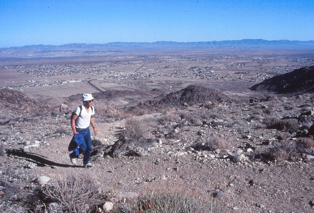
JOSHUA TREE NATIONAL MONUMENT, Calif. — Drip, drip, drip. An unusual sound in such an arid place, but a refreshing rhythm for any desert rat, including those with backpacks containing water bottles and sunscreen.
Joshua Tree National Monument is brimming with pleasures such as the water drops at Fortynine Palms Oasis. Most of them can be experienced through day hikes.
Five “official” trails in the monument — there are countless opportunities to explore off the beaten paths — give visitors a sprinkling of the desert’s charms. Joshua trees, of course, are the star attraction, and can be viewed without aid of hiking boots and backpacks. To see some of the supporting cast, such as palm-tree oases and a deserted mine, requires legwork.
The trails described in this article range in round-trip distance from 1.1 to 7.5 miles, and conceivably all can be conquered
in a weekend outing. Because Joshua Tree is roughly 150 miles from Los Angeles and 4,000 feet above sea level, it is a convenient and invigorating way to escape the city’s brown cloud.
Four of the trails are located in the monument’s northwestern portion, with three of them clustered about 10 miles from the West Entrance Station. Provided hikers are reasonably fit and start early, these three paths can be traversed and fully appreciated in one day.
Ryan Mountain Trail, with a 700-foot gain, is the most strenuous. It begins from a parking area that is surrounded by gigantic, quartz monzonite boulders. Those and other rock formations can be viewed jutting out amid the Joshua trees as hikers mount the first half of the 2-mile trail.
This impressive panorama is interrupted during the ascent’s second half, which contains a few treacherous corners where deadly drop-offs await any missteps. The trail broadens and levels somewhat during the final approach to Ryan Mountain’s summit, which at 5,461 feet above sea level towers over surrounding valleys. Binoculars help hikers spot some of the monument’s attractions.
A sign off the parking lot warns that the trail takes from two to three hours, and that at least one gallon of water per person should be lugged. However, several people I saw during a cloudless, 70-degree December day tramped up and down within 90 minutes and carried no water.
Not far away is Lost Horse Mine Trail, which is just under 2 miles from the parking area and features a moderate, steady elevation gain of 400 feet. About halfway along the path, the abandoned mine becomes visible. A wire fence surrounds the wooden structure and its underlying shaft. Chunks of rusty machinery are scattered outside the fence, about the hillside.
Legend has it that in the early 1890s, Johnny Lang stumbled upon the site when he was looking for his lost horse — hence the rnine’s name. Lang and his father, George Lang, purchased the land rights for $1,000. The mine, in operation from 1893 to 1936, yielded some 9,000 ounces of gold. Today, such a haul would be worth about $3.5million.
On the way back from Lost Horse Mine, I passed a young woman who asked if I thought the hike had been “worth it.” My sincerely affirmative reply was quickly answered with a scowling: “Well, I didn’t.” Maybe she would have been cheerier in boots or tennis shoes, rather than sandals.
Back up the road a few miles is the turnoff for Hidden Valley Campground and a distressingly bumpy dirt road to the Barker Dam Loop Trail. At 1.1 miles, it is the shortest of the featured five hikes. The payoff, however, is among the most profound.
Who could construct a reservoir in the desert?
The feat was managed a century ago by C.O. Barker and his cowboys to help nourish their cattle. Though the darn was fortified and raised in the 1950s, cows no longer are steered there. Many species of birds, however, raise a flap at the place, and ducks splash about in the artificially created though genuinely picturesque lake. Carrying on, hikers pass Indian petroglyphs.
The other two hikes are on the monument’s fringes, and feature palm-tree oases. To the north, near the town of Twentynine Palms, is the Fortynine Palms Trail. It is there that water drops can be heard, at the end of the 1.5-mile (one way) trail.
The hike is — like the abandoned mine trail — moderate and composed of two stages. The first has hikers ascending to a lookout of Twentynine Palms and the neighboring high desert. During the second stage, trekkers descend to the secluded oasis.
The cluster of palms seems almost jungle-like in its center, with thick vegetation and a trickling stream that is dotted with ponds of murky water. Many of the trees’ trunks are charred from several fires over the years. A few visitors have succumbed to the destructive urge to scrape graffiti on the trunks, including the mundane: “I love Steve.” Next time, with luck, the “artist” will say it with flowers.
Finally, 10 miles north of Interstate 10 in the southeastern part of the monument, is the Lost Palms Oasis Trail. It took me about three and a half hours to navigate the 7.5 miles, round trip. It was not easy, however; this trail more than any other I tried at Joshua Tree has passages from which it is easy to stray and become lost. Several washes (dry creek beds) are deceptive.
Hikers who stick to the path are rewarded after about an hour and a half with a sight below of the serpentine oasis, strung out alongside a stream. Climbing down to the palms is rather dangerous. Up to that point, the trail is relatively flat.
When I hiked to Lost Palms Oasis late last year, I needed a heavy coat to stay warm. Afterward, I told a park ranger that I was surprised the desert could be so cold, even on a clear day.
With the air of a patient tour guide, confronted daily by ignorant city folk, he explained that Joshua Tree tends to cool when Santa Ana winds are warming coastal Southern California. “It feels like winds are blowing off the Rockies,” he said.
Anyone interested in learning more about the monument should visit the North Entrance Station, a few miles south of Twentynine Palms. The address is Superintendent, Joshua Tree National Monument, 74485 National Monument Drive, Twentynine Palms, CA 92277, telephone (619) 367-7511.
A great source for nature trails throughout the region is “Day Hiker’s Guide to Southern California,” by John McKinney (Olympus Press, Santa Barbara).
IF YOU GO
Where it is: Approximately 150 miles east of Los Angeles, 250 miles southwest of Las Vegas,275 miles west of Phoenix. Bordered roughly on the west and north by Highway 62, on the south by Interstate 10, and on the east by Highway 177.
Where to stay: There are eight official campgrounds within the monument, but they tend to fill up early during winter and spring days. The nearby towns of Indio, Palm Springs, Twentynine Palms and Yucca Valley contain many motels and hotels.
When to go: The most popular time to visit is during wildflower season — mid-March through mid-May, when there has been sufficient precipitation. Have the place largely to yourself in the summer.
What to do other than hike: There are several short, informative nature trails. Picnic possibilities abound. Wildlife sightings are, with patience and luck, possible. Among the native creatures: bighorn sheep, kangaroo rats, roadrunners, golden eagles, sidewinder rattlers and tarantulas.
For more information: Write to Superintendent, Joshua Tree National Monument, 74485 National Monument Drive, Twentynine Palms, CA 92277. Or call (619) 367-7511.
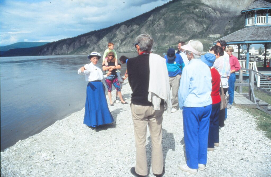
JUNEAU, Alaska — If you’re fortunate enough to be in this capital city when it’s warm — the temperature reached 70 degrees only 19 days here in 1990 — one of the best ways to discover its attractions is by taking the Juneau Walking Tour.
The route officially begins at Marine Park, a strip along the Gastineau Channel that features picnic areas, an information kiosk and, throughout the summer, musical entertainment. A boardwalk heads from the park toward the Cruise Ship Terminal, which also has an information booth.
From the terminal, walkers turn left and are treated to a grand view of Mount Juneau, which at 3,576 feet towers over the main business district. The mountain, channel and colorful architecture combine to make this one of the United States’ most picturesque cities.
Franklin and Front streets boast the bulk of Juneau’s downtown shops, restaurants and other commercial activities. Nearby, on Third Street, is the Davis Log Cabin, a replica of Juneau’s first public school. It serves as the main visitor’s information center, and has
Less than a block away, on Main Street, is a life-size bear sculpture created by a local artist, Skip Wallen. Looming over the bronze beast is the State Capitol Building, which has free tours on weekdays.
For the next half-mile or so, the tour veers toward the hills. The oldest Russian Orthodox church in Alaska, St. Nicholas, is at the corner of Fifth and Gold streets. A gold leaf sparkles on its onion-top dome.
An “optional extension” route heads two blocks up a rather steep incline to Seventh Street and the Wickersham House, refurbished in the summer of 1992. It is the former residence of Judge George Wickersham, a leading proponent of Alaska statehood. Just past the house is a pedestrian stairway that goes toward the Capitol and passes a totem pole on the way down.
On Fourth Street, across from the Capitol, is the Juneau-Douglas City Museum. Formerly a library, the building now contains exhibits that focus on the area’s mining history. Nearby are a walking bridge, which provides an overview of the area, and the Governor’s Mansion, built in 1912.
The Evergreen Cemetery is the principal attraction of another optional trek. It contains gravestones of the city’s founders, Richard Harris and Joe Juneau.
Alaska State Museum is the tour’s last stop. The best permanent exhibit is, arguably, the Alaska Native Gallery. It contains examples of clothing, tools and hunting weapons that help the various peoples adapt to life in a harsh climate.
The museum is open daily until 6 p.m. from mid-May to mid-September. During the off-season, hours are 10 a.m. to 4 p.m., Tuesday through Saturday. Admission is $2 for adults and free for anyone 18 years old or younger.
One “must-see” not covered by the walking tour is the Mendenhall Glacier, a few miles from downtown, closer to the airport and ferry terminal. The river of ice and snow extends down from the mountains to its 1.5-mile-wide face at Mendenhall Lake. Visitors have six hiking trails to choose from, ranging from 0.3 to 3.5 miles.
Mendenhall Glacier bus tours can be taken from the Davis Log Cabin for $9 per adult. The last bus, however, leaves before 1 p.m. Public buses run every hour or two from the Cruise Ship Terminal. The 20-minute ride costs $1 and stops within a 35-minute walk of the glacier’s visitor center.
For more information, contact the Southeast Alaska Tourism Council, P.O. Box 20710, Juneau, AK 99802-0710, telephone (800) 423-0568.
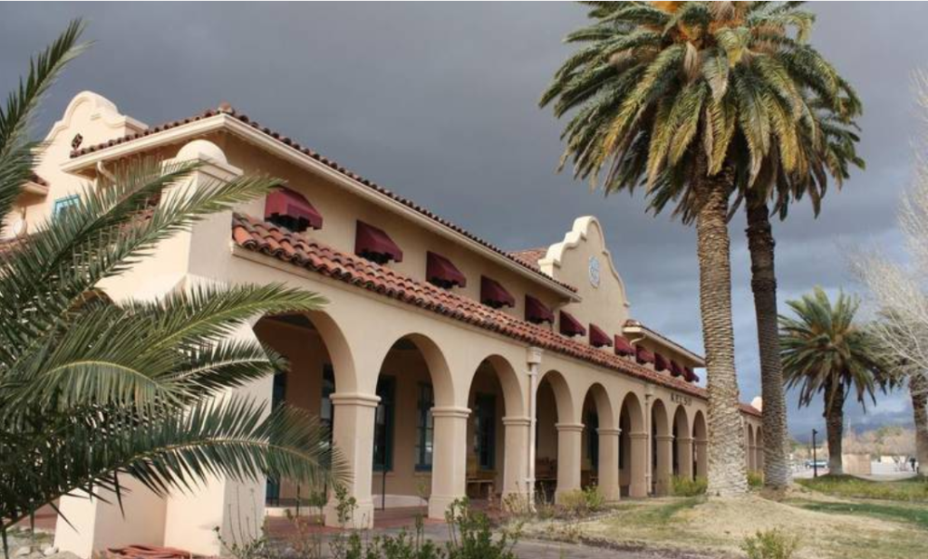
What is your favorite tourist destination in California? Drawn to the historical and remote, I long have fancied Kelso Depot.
Ninety-five miles southwest of Las Vegas, the depot has a solitudinous sparkle as its Spanish mission-revival-style structure comes into view for motorists traversing Mojave National Preserve on Kelbaker Road. Palm trees are the most decorative trees that, along with green grass, mostly surround the two-story building. It has been respectfully restored to its original, 1924 appearance and contains the preserve’s visitors center and museum.
Over the years I have stopped by a half-dozen times, always curious how renovations are going and eager to stand outside in the desert vastness and soak up the calm. It is, above all, a wonderful contrast to metropolitan life.
Kelso came about when the Union Pacific Railroad line from Los Angeles to Salt Lake City was completed in 1905. The track between Kelso and Cima, 18 miles to the northeast, rises 2,000 feet as it meanders through the Providence Mountains, and such a steep grade required supplemental locomotives to be attached at Kelso. The depot there housed railroad workers, and its cafeteria fed those workers, as well as train passengers, for decades.
Nearly 2,000 people lived in Kelso in the years around World War II, but by 1959 train technology had eliminated the need for extra locomotives, and in 1985 the building was shuttered. Concerned citizens rallied to prevent a razing by persuading Union Pacific to sell Kelso Depot to the federal government in 1992 (price: $1).
Today, visitors encounter a spare and pristine interior that harks back to the site’s bustling prime. The horseshoe lunch counter, surrounded by a couple of dozen swiveling wooden chairs, is a showpiece. A video that airs upon demand in the small theater is an up-to-date, top-notch production. The exhibits upstairs, including refurnished rooms and railroad-history displays, are concise and engaging. In the basement, there’s a scale model of the building, landscape and tracks.
My feelings about the place pretty much echoed what Huell Howser (1945-2013), the folksy host of PBS’ travelogue “California Gold,” said at the depot’s grand reopening in 2005: “This depot here in Kelso, this oasis, this place of tranquility and rest and wonder.”
Then I asked Mojave National Park tour guide Phillip Gomez what he thought, anticipating that he would validate my ethereal appreciation of the place.
“I don’t know if it’s so different from any place else, really, any other visitors center that you have spent some time in,” Gomez said, with a thud, on the phone in late February. “You get a lot of routine questions.”
For example?
Gomez, in a perfectly polite but dry tone, commenced: “ ‘Do passenger trains still come by?’ You know, many of them are pretty mundane. ‘Is the restaurant open?’ When it’s obviously not. It’s been closed for two and a half years, but they still are hoping against hope.”
I thought he might be done, but when I started to speak, he continued:
“ ‘Where do you live?’ That’s a typical one. And then my favorite, ‘What is this huge, outsized building doing out here in the middle of nowhere?’ It’s amazing how many people ask that question, almost word for word. ‘What do you do out here?’ is another one. ‘Where to you go to shop?’
“It’s all from the perspective of the visitor driving here, in their automobile, with the windows rolled up and the air conditioner going, and they’re in the early 21st century asking about a different time and place.”
Trying to keep some gild on the lily, I asked Gomez: “Aside from the people who come here and ask these questions, do you yourself have any sort of special feelings for the depot, or any part of it? Is it just a job, or does anything appeal to you about the place?”
“That’s an interesting question,” he responded, unpromisingly. “As it pertains to the building itself, no. I have worked here, even from the very beginning; it’s a nice work environment. It’s an interesting work environment, I would say.
“There’s a staircase that I have to climb up and down every day several times to get to the offices and lunchroom upstairs. But no, I don’t have anything, any fetish or anything like that about this building.”
Confronted with Gomez’s spin on the depot, one based on his seven years’ worth of experiences there, I admitted that my infrequent, short visits may have created a myth in my mind. Looking at pictures I took there in early February revealed that, actually, the grass beside the depot wasn’t all that green, some of the trees were kind of scraggly, and there was an unsavory sprinkling of shacks, trailers and trucks in the vicinity, too.
Had the often-blistering desert’s emptiness been infiltrating and compromising my brain? Maybe, but if so, I am not alone.
Tony Schlencker and his wife, Lesley, of Brisbane suburb Bracken Ridge in Queensland, Australia, were traveling from Joshua Tree National Park to Death Valley earlier this year when they stumbled across Kelso Depot.
“Even driving into the ‘town’ from the south and seeing the depot building it immediately exuded an air of a bygone era,” Schlencker told me a few weeks ago, via email. “I doubt you could pass through without stopping it had such an allure.”
“It has the most interesting museum and history of the railway, as well as formation on the natural aspect of the desert. … Our biggest regret was that we were only passing through and we determined to come back another time and spend a couple of days poking around.
“There was just something special about the place, and the building in particular. The restoration was fantastic.”
Even straight-shooter Gomez agreed with that assessment and then touched on the site’s special qualities.
“I think the depot, in the larger picture, it’s not so much the building itself,” he said. “The building itself, there were many copies of this building made all along the line. Most of those places are all torn down. There’s one in Caliente, Nevada, and there’s one on the Santa Fe line, in Riverside, California. Those are not nearly in the pristine condition that this one is since the restoration.
“And also this one is in its natural desert surroundings; it doesn’t have a lot of concrete, and parking lot pavement and so forth like these other places.”
Not exactly the gushing praise I had solicited, but someday I will stop by and admire Kelso Depot again – although perhaps with a recently acquired dose of reasonable restraint.
Sidebar:
Kelso is about 510 miles southeast of Sacramento via Highways 99 and 58, Interstate 15 (or Interstate 40 – the mileage difference is negligible) and Kelbaker Road.
In addition to a visitors center and museum, the building contains a small gift shop that sells, among other things, a copy of the 2005 “California Gold” episode in which host Huell Howser visits Kelso Depot on its renovation’s “grand opening” day. The DVD costs about $20.
Tour guide Phillip Gomez of the National Park Service says that in addition to Kelso Depot, visitors to Mojave National Preserve should also consider visiting the Hole-in-the-Wall area to the east, lava tubes to the north, the Teutonia Peak trail to the northeast, and nearby Kelso Dunes, a few miles south of the depot.
The depot, at 90942 Kelso Cima Road in Essex, is open from 9 a.m. to 5 p.m. daily. For more information, call (760) 252-6100 or visit www.nps.gov/moja/learn/historyculture/kelso-depot.htm .
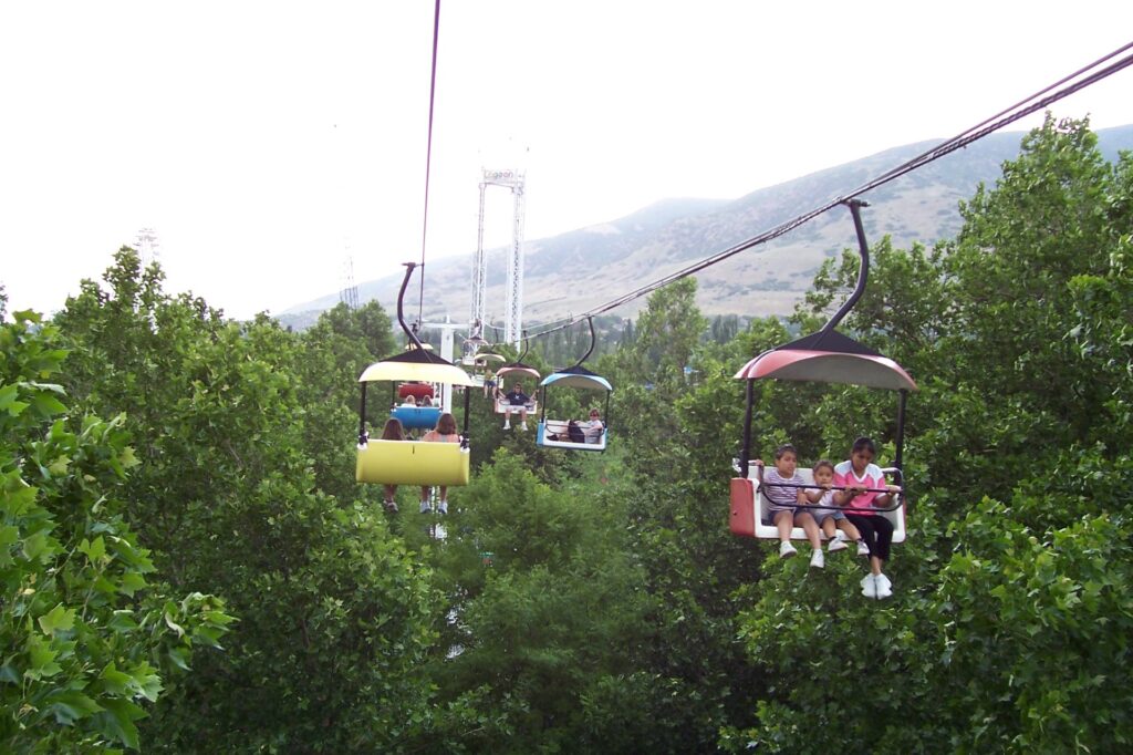
FARMINGTON, Utah–A tired-looking man trudged through the rain while an excited young boy tugged at his sodden T-shirt and two teenage girls slipped in orbit around them.
“Can we go on the Rattlesnake Rapids right now?” the boy asked, all bug-eyed and fidgety. He was referring to a ride that sends spinning round tubs floating slowly under waterfalls, faster through dark tunnels then at breakneck speed so that they can bash against turns’ walls.
The man paused and ran a hand over his face, like a squeegee over a soaped-up windshield. He managed to make his blank expression even blanker as he said, monotonically, “Might as well.”
That little scene pretty much summed up my impression of Lagoon, the massive amusement park complex about halfway between Salt Lake City and Ogden, just off Interstate 15. People under 30 love the place, and the rest of us? Not so much.
Lagoon is among several family-friendly attractions along Utah’s Wasatch Front, and the place to come for adrenaline junkies. In the past few years I also have visited Thanksgiving Point, a sprawling complex with museums and learning centers in Lehi, about 20 miles south of Salt Lake City; and George S. Eccles Dinosaur Park, an interactive homage to prehistoric times in Ogden, 32 miles north of the capital.
Having debated whether threatening skies and a $36.16 ticket (after taxes; parking already had cost me $7) would make Lagoon worth my while, I was persuaded to give it a try by the sight of people streaming in on this mid-June evening. Past the entry gate, a wave of youthful energy washed over me as I walked by a huge fountain in which kids were playing and past several scream-inducing rides. Disoriented and drifting, I ended up in Pioneer Village, a restoration of 19th century buildings that has “Geezerville” written all over it.
Alas, the ambience was too dead even for a killjoy baby boomer. Few people were there, being bored by too little to do. Try as it might, Pioneer Village cannot whip up much fervor. A placard before Rock Chapel, for example, contends it “”has as fascinating a history as any building in Utah.” Built in 1863 as a fortress against Indians, it subsequently became a courthouse, jail and, in 1869, a worship hall for the Church of Jesus Christ of Latter-day Saints. That’s it. Doesn’t exactly blow you away, does it?
I made my way past a food-court area (where another enthusiastic boy seemed to think that finding Arby’s there was worth a celebratory scream) and water park (Lagoon A Beach; no separate admission is charged) to the base of an imitation ski lift that ferries visitors from one end of Lagoon to the other. After a very short wait I boarded and largely enjoyed the 10-minute ride, even though the concrete below seemed very far away at times.
From that lofty, slow-moving perch I spotted several adventuresome rides: four roller coasters, including an old-fashioned wooden one; Catapult, in which two people strapped tightly in a round object are shot upward like a slingshot; Skycoaster, which under an arch has thrill-seekers dangling out by rope horizontally, face down, swinging back and forth; and Rocket, one of those terror-tower contraptions that lift upright riders way up before dropping them in free fall. Too scary for my hardening arteries, thank you very much.
Sky Scraper, the giant Ferris wheel, looked more manageable. As I boarded one of its 36 gondolas, which each can hold up to six people, I asked the attendant, “Which seat has the best view?” He shrugged and replied, ‘”I don’ t know. Never been on this ride. I just run it.”
Suddenly the wheel started turning and oh my, it seemed fast. After a couple of rotations it stopped, with me at the very top. Light rain began falling and winds that a few hours earlier had prompted severe-storm warnings began to increase. Sky Scraper grunted, squeaked and swayed a little bit. A bubbly girl in a gondola near mine chirped to her mom, “] can see Idaho!” If l stay up here much longer, l thought while gripping the center pole and keeping my head down, I might get another look at my lunch.
After the wheel finally resumed spinning and ride mercifully ended, what seemed like a few years later, the attendant asked, “So, did you get some thrills and excitement?”
“l haven’ t been on one of these things in 30 years,” l responded shakily, ” and it scared the (bleep) out of me.”
Fortunately for me, the startled teen managed a chuckle. For a second there, I thought he was going to order me back to Rock Chapel for penitence.
Lagoon is open daily through Aug. 22, and intermittently after that through October, weather permitting. On Fridays and weekends from Sept. 29 through Oct. 28, the park adopts a Halloween theme with “Frightmares,” featuring most of the summertime rides plus five walk-through haunted attractions.
Lagoon, easily accessible via Exit 324 (Lagoon Drive) off interstate 15, generally opens Memorial Day weekend. Admission this year is $33.95 general, as long as you’re at least 51 inches tall; $28.95 for anyone who’ s at least 4 years old and no taller than 50 inches; $19 for ages 3 and younger; and $22 for ages 65 and older. For more information, call (800) 748-5246 or visit www.lagoonpark.com.
Sidebar:
Although the current complex covers 100 acres, dozens of rides, a water park, Pioneer Village and entertainment stages, Lagoon’s roots as a tourist attraction date to the late 1800s, when it featured a big beach and open-air dance pavilion.
In 1893 the Great Salt Lake started receding, however, so the resort was moved 2.5 miles to its current location. The first amusement ride opened in 1906, as did the Merry Go-Round that still operates today. Activities continued to swell, and included appearances by Big Band stars Benny Goodman and Duke Ellington, before the park was mostly burned down in 1953.
Rebuilding began promptly and expansion continues, more than a half-century after the destructive blaze. Artists as diverse as Ella Fitzgerald, Frankie Avalon and the Rolling Stones have performed in Patio Gardens. Pioneer Village was added in 1976, Lagoon A Beach in 1989.
LAGUNA BEACH– Decades ago, many artists lived here and drew inspiration from the scenery and ambience. Nowadays, even the lowest rental might expose them to a brush with bankruptcy.
Although this Orange County community no longer has affordable shelter for struggling artists, it is a fine place to see 20th-century California art. There are several festivals in July and August, and year-round exhibitions at Laguna Art Museum.
The museum typically has separate exhibits on each of its three floors, with the star attraction at ground level. When I visited in mid-April, LAM headlined works by Augustus Vincent Tack, a landscape painter with no significant ties to California.
Downstairs, however, the museum’s Golden State emphasis was evident in a series of collaborative paintings by four Orange County artists from the past 30 years. In the small upstairs area were works sculpted from 1949 to 1965 by Seymour Locks, who lives in Sonoma.
Through Oct. 9, some of August Gay’s California landscapes are being displayed. Gay, born in France, painted in Northern California during the early 1900s. Scheduled through July 24 is “Commodity Image,” a collection of photographs that explores Americans’ preoccupation with consumption.
Later this year, from July 29 through Oct. 9, “Fragile Ecologies: Artists’ Interpretations and Solutions” is scheduled. For 11 weeks beginning Oct. 28, LAM plans to show some of the abstract paintings by John McLaughlin, a Southern Californian who died in 1976.
Works in the museum’s permanent collection are exhibited only occasionally. Karen Drum, LAM’s public information officer, said two of the collection’s most acclaimed paintings are Joseph Kleitsch’s “Post Office,” 1922-23; and Diane Gamboa’s “Painted Lady,” 1990.
On display indefinitely, in a stairway landing between levels 2 and 3, are three watercolors by Sam Colburn (1909-1993). A USC graduate, Colburn is described on an accompanying plaque as “one of the more experimental California regional artists, evolving a modernist approach to· landscape and genre scenes during a period when most artists shunned abstraction.”
Also interesting is a miniature of the Laguna Art Gallery as it appeared in 1918. With luck, it still will be near the museum’s entrance if you decide to go.
In addition to the 10 galleries in its Laguna Beach building, LAM has a satellite gallery at South Coast Plaza in Costa Mesa.
LAM officials say the museum annually attracts 210,000 visitors. Drum attributes much of its appeal to location, what she called “the whole kind of small-town feel of Laguna Beach.
“It’s so far inland, and such a small community,” she said. “It’s just a real California, ‘outdoorsy’ experience.”
Indeed, less than a block to the west of LAM is Heisler Park, which offers a panoramic view of the town, its beach and the ocean. A paved path provides access to sand, on the left, and rocks, on the right.
Also near the museum are two popular restaurants that have indoor and outdoor seating, The Cottage and Las Brisas. I tried the former but found service to be a bit wanting. Las Brisas — with Mexican fare — offers better ocean views and is farther from the highway noise, though it is more expensive.
Laguna Art Museum is open from 11 a.m. to 5 p.m., Tuesday through Sunday. Adults are charged $4, seniors and students pay $3, and children under 12 are admitted at no charge. For more information, call (714) 494-6531. The address is 307 Cliff Drive, Laguna Beach, CA 92651-9990.
Getting there: Laguna Beach is roughly 50 miles from the South Bay. Take the San Diego Freeway south past John Wayne Airport to southbound Highway 133, Laguna Canyon Road. Once you enter town, stay in the right lane. You’ll veer off to the right and encounter a light at North Coast Highway. Turn right.
Within a minute you’ll see the museum’s pink exterior on your left, at the intersection of North Coast Highway, Cliff Road and Aster Street. Parking in the immediate area is metered, at the stiff rate of a quarter for 15 minutes, maximum two hours.
To avoid parking meters, continue on North Coast Highway past the museum — this block features galleries on both sides and turn right on Jasmine Street. Turn right again at the next corner, one-way Cypress Drive. Proceed a hundred yards or so and park for free on either side of the street.
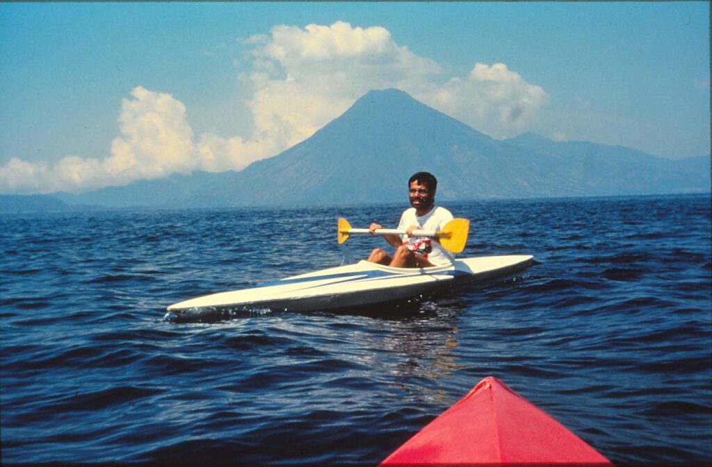
My friend turned to me and said: “This is the perfect place for a honeymoon.” We were on a boat in Guatemala, crossing one of the most picturesque bodies of water in the world, Lake Atitlan.
A honeymoon in Guatemala? Sounds more dangerous than going to Washington, D.C., our nation’s murder capital. At least that’s what I would have thought before I’d arrived in this Central American country. But three days later, I had to admit my friend had a valid point. Even if Lake Atitlan is not the “perfect” place for a honeymoon, it is an excellent spot for a vacation.
Consider the safety. Yes, there is internal fighting in Guatemala, some of it not far from the lake. Armed guerrillas in the hills oppose the right-wing government, which came to power in 1954 thanks to a CIA-implicated coup. But there have been no violent incidents involving American tourists.
North Americans tend to view Central America as a homogenous zone of poverty and violence. In truth, each of the eight countries has its own personality. Guatemala is distinguished by wonderful scenery, Central America’s largest indigenous population, colorful Indian clothing and art, friendly natives and a welcoming mat for tourists.
The Lake Atitlan region is especially receptive to foreigners. Many Americans make their homes in Panajachel, the area’s largest village which even has a “gringo” trading market each Saturday evening. Panajachel is often referred to as “Grigotenango” (Home of the Gringos).
Consider the scenery. Aldous Huxley called Atitlan the most beautiful lake in the world. It’s surrounded by mountains, including three volcanos: San Pedro, Taliman and Atitlan.
Dotting its shores are Indian villages that not only yield high-quality and inexpensive artifacts but also provide glimpses of the natives’ way of life.
Consider, most of all, the cost. You can rent a house on or very near the lakefront for around $25 a month. That’s under $1 a day. Or you can blow a wad at a hotel in one of the Indian villages — say, Santiago — by paying $3.75 a night for a clean double, with your own toilet and shower.
Food is another drop-dead bargain. For breakfast in Panajachel, have coffee, bread and strawberry jam, potatoes, scrambled eggs, salad and steak, all for under $2. For lunch in Santa Cruz, have a beer and a sandwich for less than $1. For dinner, it’s about impossible to pay more than $7, anywhere.
Souvenirs can fit into a thrifty budget, too, though the best deals are made through tough bargaining. At one of the many stalls in Panajachel, for example, the quoted price for a tastefully designed, hand-woven large blanket was 95 quetzales (about $24 in April). My friend, who lives in Quetzaltenango and has honed his bargaining skills, talked the vendor down to 75 guetzales.
Trinkets and food are sold by children who walk about Panajachel. On the first day we were there, a solemn little boy came up to us on the beach and proposed that we buy some hand-woven bracelets.
“Five for one guetzal,” he said in Spanish. My friend shook his head.
“Seven for one guetzal.” My friend yawned and looked away.
The boy reached into his bag and brought out a clump of bracelets. “All of them for 15 guetzales.”
My friend took the clump and slowly counted the bracelets. There were 120. “Ten quetzales,” he offered.
“All of them for 11 guetzales. It’s a good price.”
My friend nodded. A deal had been struck, Panajachel-style. The next day, the same boy approached us with the same wares. I wanted to remember him, so I said I’d give him a guetzal (25 cents) if he’d pose for a picture. He smiled, and I clicked.
As we walked away, we heard the boy yell to passers-by: “Take my photo for one quetzal! Photo for one guetzal!” A star was born.
Unfortunately, public transportation to Panajachel leans toward the unpleasant. Unless you rent a car, you’ll be forced to take a “chicken bus.” They are cheap — a one-way ride from Guatemala City or Quetzaltenango costs just over $1 — but they usually are overcrowded. People often sit seven across in the converted U.S. school buses, which have the added disadvantage of leg room adequate only for people under five feet tall. And beware the frantic vendors who assault the buses each time they stop in towns.
Once you’re at the lake, however, it’s easier to get around. Boats leave frequently from Panajachel to the shoreline Indian villages. Going between Panajachel and Santiago takes 60 to 90 minutes, depending on the size of the boat, and costs 75 cents. Boats can be hired for $10 per day. Single and double-seat kayaks rent for $1 an hour. But don’t try kayaking after 2 p.m., when the “El Norte” wind makes the waters treacherous.
One of the tastiest restaurants around Lake Atitlan is La Unica Deli in Panajachel. Its cinnamon rolls, “rollos de canela,” are served hot and for under 50 cents. But avoid the nearby “Casablanca,” which unlike most other area eateries offers deflated portions at inflated prices.
Accommodations are plentiful and clean, and generally dirt cheap. My friend and I were impressed by Santavar’s Rooms in Panajachel ($4.75 for a double, no bathroom), Arca de Noe in Santa Cruz ($6.50 per room, with bathroom) and, especially, Hotel Chi Nim Ya in Santiago ($2.75 for a double, add $1 for own bathroom). The latter features delicious, large pieces of cake sold oven-hot every evening.
KIRKWOOD, Calif — A lovely lady named Margaret beckons from the Sierra Nevada. She cares not how you look or whether you are a fitness buff. She will accept you as you are.
Tall, fragrant firs shade her rocky porch. Her air is cool, quiet, welcoming. Bring her your picnic. Bring your swimming suit. Hey, you can even bring your dog, but there is no need to bring flowers. She has plenty of those.
Margaret is a body — what a body! — of water, a small, clear lake in Eldorado National Forest. She waits serenely for suitors at the end of a gentle trail off Highway 88, near the Kirkwood Ski and Summer Resort west of Carson Pass.
The Lake Margaret Trail, whose elevation begins around 7,700 feet and does not change significantly during its 2.3 miles, attracts day-hikers and backpackers. On a recent Friday, when temperatures topped 100 degrees in the Central Valley, it was a cool escape for both types of adventurers.
Mary Wade, who had backpacked in with her family, was sitting against a tree, reading. A few feet away her young son, Tony, was using binoculars to scan Lake Margaret and its shores. They were visiting from South Lake Tahoe, spending a couple of nights at one of the handful of official campsites. It was pleasantly warm, perhaps too much so for hiking, but perfect for swimming, which the Wades had done much of the day.
As Mary Wade related how she had camped at the lake in previous summers, drawn to water she says is warmer than that of most other Sierra lakes, Mike Wade emerged from one of the family’s tents and joined our conversation. He repeated what his wife had said about the swimming and pointed to a rocky area from where people could safely dive into water 20 to 30 feet deep.
He also talked about wildlife they had seen since arriving the day before — deer, squirrels, lots of marmots. No bear had come by, though the Wades had taken precautions against them and another, much-smaller threat to their happiness and comfort: mosquitoes.
“We thought they were going to be horrible,” Mike Wade said. During a day hike to the site three weeks earlier, he said, the blood-loving pests “ate us alive. This whole area was cloudy with mosquitoes.”
Early August, however, seemed to be late enough for that itch-inducing annoyance to have made its seasonal exit. The Wades didn’t bother unpacking the insect repellants and bug-zappers they had hauled in from the trailhead.
Of the seven cars parked in the trailhead’s lot, most belonged to day-hikers. They were content to make the round trip — which can take as little as two hours, at a brisk pace — without being weighed down by camping gear.
The trail begins with a mild descent that is indicative of the low level of hiking difficulty that continues until the final approach to Lake Margaret, where an especially rocky and somewhat steeper climb requires a moderate amount of exertion and caution. The trail’s surface is sometimes wide and soft dirt, occasionally a stretch of uninterrupted granite, but mostly a compromise between the two.
The first of three stream crossings comes about 15 minutes into the hike, shortly after Caples Creek appears. Look carefully at the opposite bank for where the trail continues; many hikers have missed the turn and wandered off into a meadow. Markers in the form of carvings on tree trunks — a square on top of a rectangle — and stacked rocks, or “duck heads,” serve as guides throughout the trek.
A wooden bridge with a few precariously loose slats marks the second crossing of Caples Creek. Ten minutes later, or about a half-hour from the trailhead, is a large, fallen tree that has decomposed to the point where it has practically become one with the boulder on which it rests.
Fallen and decaying trees are a common sight along the trail, but so are quite-lively oaks, firs and grasses. Red, blue, yellow and white wildflowers seemed to be fading in early August. A volunteer at the Carson Pass information center said the prime wildflower season is mid-July, but depending on spring rains can be as many as five weeks later.
About an hour into the hike, you should be able to hear a rustling sound similar to distant ocean waves or a river. Actually, what you are hearing are rustling leaves in a field of aspens, whose light bark makes quite a contrast to other vegetation. Some hikers have amused themselves, if no one else, by carving graffiti into the aspen trunks — clever messages such as “Tony,” “Turtles ’86” and “Tom+ Linda.”
Following the aspen field, and the most precarious of the three stream crossings, hikers reach the final, comparatively taxing approach to the lake. Margaret’s beauty, however, makes the effort worthwhile.
The trail leads first to a small outcrop of the lake that on the day I visited had five swimmers — six, if you count their canine companion. Among the happy splashers were three girls from the Sacramento area: Libby Sexton and Sara Baumann, both 11, and their 13-year-old friend, Laura Randle.
Walking around the lake takes about 30 minutes, but the trail is not as heavily tread and there are several fallen trees to climb over and steep granite slopes to navigate. The Wades, along with another group camping nearby, had settled on the far side of Lake Margaret, directly across from where the young girls were swimming. There are a handful of official campsites that have rock-sheltered fire pits, but there was evidence of several other, less-formal places where now-departed backpackers pitched their tents.
Dogs, such as the one swimming with the girls, are allowed on the trail. Caples Creek and the lake provide plenty of opportunities for their refreshment, and healthy mutts should have no trouble negotiating the various rocky slopes. However, their presence has led to some complaints, according to Eldorado National Forest’s information center director.
Troubles have come not from dogs scrapping with wild animals, said Karen Finlayson, but mostly from dog owners arguing with other hikers who haven’t brought dogs and feel the pets detract from the back-to-nature experience.
Amador County law requires dogs that are outside of their own yards be kept on a leash. However, Finlayson said the U.S. Forest Service has adopted a more-lenient, if unofficial, policy.
“We simply encourage people that if they bring pets, they keep them under physical control,” she said. “Some people consider voice control to be adequate. … When I advise people, I ask them to use common sense and common courtesy.”
Directions: Take Highway 88 east from Jackson about 55 miles, past the Kirkwood ski area turnoff. Soon the Kirkwood Inn will appear on the left. Slow down — the Lake Margaret Trail turnoff is less than two-tenths of a mile past the inn, on the left. It is a dirt road that, as of early August, was not marked. If you come upon Caples Lake, you have gone too far. There is room for about 10 vehicles in the trailhead’s lot.
For more information: Call the Carson Pass information center at (209) 258-8606.
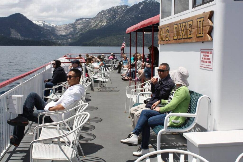
Many of us in Northern California occasionally welcome friends and family from out of the region who want to experience Lake Tahoe. What is a simple and rewarding way to do that?
I’m on it.
Specifically, I am aboard the M.S. Dixie II, the lake’s largest cruising boat. The picturesque paddle-wheeler glides at least twice daily between Zephyr Cove, Nev., and Emerald Bay on the California side. I have opted for an 11 a.m. Saturday excursion in mid-June. Today’s other departure, at 2:30 p.m., looks as though it might be rained upon.
As people make their way up and down steep and narrow stairs, through two dining rooms, past red-painted railings and about three decks looking for the best place to sit, the ship’s not-too-loud speakers serenade us with baby boomer soft rock.
“Hands across the water,” instructs Paul McCartney. “Heads across the sky.”
Most of the hundred-plus passengers, dozens of them not boomers, opt for outdoor seating options at the front and on top of the boat, mostly on armrest-equipped chairs but also on benches that underneath contain, probably, life vests or rafts.
The mostly sunny, 65-degree weather is warm enough to make sweaters or sweatshirts optional.
The Dixie II starts away from its dock with no jolt or noise that I had noticed. We seem now to be at full speed and I am feeling at most a slight hum, but certainly no waves,
Soft rock gives way to a man’s unaccented voice on the P.A. system. His message is canned, but cordial.
“As we get underway on our westward crossing, there are a few nautical terms that we would like to acquaint you with,” the friendly man says. Good. As a tourist, I often must re-learn the lingo.
“The forward section, where you came aboard, is the bow,” the friendly man continues. “The rear of the boat, where the Dixie II has its paddle wheel, is the stern, and that’s why she may be called a stern-wheeler. When you’re facing the bow, the right side of the boat is the starboard side, and the left is the port side.”
So port (which has the same number of letters as “left”) is to the left—unless you are facing toward the back of the boat, in which case port is right. Got that?
Zephyr Cove recedes behind us. The resort there has a comparatively (for Lake Tahoe) deep and wide beach south of the dock. Volleyball players and other young people are gathering there for late-morning exercise and socializing.
“Here on the lake, we’re guests of Mother Nature,” the friendly man says, winding down his first announcement. “Ashore, in a backcountry area, you should leave nothing behind but your footprints. Out here on this beautifully clean lake, let’s leave nothing behind but our wake.” He gives way to music again.
“There’s no need for argument,” Van Morrison intones. “There’s no argument at all.”
On this day, there is plenty of room to roam around on a boat whose capacity is 500. For those wanting food, menus are ready to be perused on each table in the first- and second-level dining rooms. Items cost $10 to $13, and run the gamut from cheeseburger to chicken salad, with coconut curry wrap representing the flair. A bartender also awaits orders (including $9 mixed drinks) in a covered area on the promenade (top) deck.
A powerboat goes by on the port side, sailboats can be seen off the starboard, and a few miles straight ahead hovers a parasail decorated with a smiley face. The Carson Range rises to the east, the Crystal to the west.
It is easy to get lost in the scenery from this 360-degree vantage from right atop one of the planet’s prettiest bodies of water, but there is learning to do. We are “experiencing” Lake Tahoe, remember. The friendly man is back, giving us the basics, so take a deep blue breath and follow along.
“Before the last ice age, the lake was actually about 600 feet deeper and made its exit at the Brockway Summit, just east of Mount Pluto,” he begins. “During the last ice age, the Truckee River valley was carved out, and the lake now makes its exit at the Truckee River in Tahoe City.
“Today, snowmelt and rain collect in the lake to form a body of water 22 miles long by 12 miles wide. The lake is 70 miles around, and covers 193 square miles, making it the second-largest alpine lake in the world. Only Lake Titicaca, in South America, is a larger alpine lake.
“The deepest spot of the lake, which is located about 5 miles south of the north shore, is 1,645 feet deep, and for most of this cruise, we’ll have 12 to 13 hundred feet of water under our hull. Lake Tahoe is the third-deepest lake of any type in North America. …
“For its size, Lake Tahoe is the cleanest and clearest lake to be found in the world. Because of this amazing property, the lake acts like a giant reflecting prism. The deep section, which is most of the lake, reflects the color of the sky. So on a clear day, the water is a beautiful blue. …
“Unfortunately for swimmers and water skiers, our pure, clean water is also quite cold. Surface temperatures in the peak of summer will get up to the mid-60s, and maybe a bit warmer in wind-sheltered shallow spots. In winter, it gets down to a bone-chilling 42 to 48 degrees. And yet Lake Tahoe never freezes. Our winter weather does not get cold enough, long enough, to freeze a body of water this size.
“And this is a sizeable body of water. Because of its great depths, the volume of Lake Tahoe is staggering. If emptied, it would cover the state of California to a depth of 14 and one-half inches or float the state of Texas under eight and a half inches of water. And if the lake were drained, it would take at the current average annual precipitation, at least 300 years to fill it back up.”
We get our fill of great views during the next half-hour as the Dixie II approaches Emerald Bay. Every now and then the friendly man returns with more insights.
He describes how the Tahoe basin’s original tree, the Jeffrey pine, was severely depleted by the need for wood to support 19th-century silver mining operations of Nevada’s Comstock Lode. White firs, which are not as alpine-hardy as the pines, took advantage of their competitors’ decline and flourished. Today, after years of drought have killed off many firs, the pines are making a comeback.
“What’s occurred here in a natural phenomenon, a classic example of survival of the fittest,” the friendly man says.
Upon entering Emerald Bay, a quick look over Dixie II’s outer rails confirms that what had been deep water is now quite shallow—4 to 5 feet in a few spots, according to the narrator. The looming Crystal Range, with its snow-topped mountains, tree-green lower regions and gray-granite outcroppings predominant throughout, is spectacular but to my eyes is outdone by Fannette Island, the lake’s only isle and one of the world’s most-photographed.
As we float around Fannette to begin our return, we are able to glimpse the grandeur of a shoreline castle built in 1929 for the recently divorced Lora Josephine Knight. She and her still-husband had been Charles Lindbergh’s main sponsors for the aviator’s milestone 1927 trans-Atlantic flight. Her nephew by marriage, a Swedish architect, designed the castle, which explains its Scandinavian name: Vikingsholm.
(It can be toured, for $10 general and $8 for ages 7-17, from 10:30 a.m. to 3:30 p.m. daily between Memorial Day weekend and Labor Day. Parking is another $10, and a long walk from the small lot is involved. For more information, visit vikingsholm.com.)
Emerald Bay strikes me as the boat tour’s highlight, and as the Dixie II eases back onto the main body of the lake, most passengers seem to be settling in their deck chairs or disappearing to one of the lower decks for lunch. The friendly man wraps up the Tahoe primer by bringing us up to date.
Following the silver mining rush and arrival of the 20th century, he recounts, “the basin became a lightly used summer resort area that remained that way until the end of the Second World War. That marked the start of another boom, a commercial one, when real estate developers, promoters and casino operators discovered the lake.
“The resulting development of facilities and services catering to the varied recreational wants of the public has indeed made Lake Tahoe America’s all-year playground.”
Boomer tunes resume and I decide to ask a few co-passengers what they think of the tour. (Simon & Garfunkel egg me on: “We’d like to know a little bit about you for our files.”)
“It’s terrific,” responds Tim Jung of Lincoln, Neb. “We’ve gone a couple of other places. The Ozarks, that sort thing. We’ve always kind of gone out on a paddleboat. … We love these old, beautiful boats.” His fiancée, Yvette Montes, agrees.
David Offenback and Linda Buscher, visiting from Anaheim, say they feel the boat tour’s $55 cost ($20 for children ages 11 and younger) is justifiable.
“If it was warmer, I’d like (the tour) more,” she says. “But the wind – we were sitting up front, and it was a little chilly up there. It’s nice, it’s a nice tour.”
“It’s a nice boat,” he says. “It’s relaxing, and very informative, tells you about the locations around it. … I would do it again.”
David Yarc of Waukegan, Ill., and his cousin Mariellen Yarc of Orange County are sitting at the bow of the boat on the promenade deck. It is his first trip to Lake Tahoe.
“I really had no idea what to expect when I got here,” he says. “You don’t know how big everything is, and how it’s going to look. I mean, it’s really nice.”
Mariellen says she “really enjoyed” the tour: “I was surprised by surprised how much you learn. … They gave you the depth, and the history, and some little anecdotes about people.”
I thank them for their comments and prepare to walk away when David turns to Mariellen and asks, “So, should I give the additional information?”
“Oh,” she responds, smiling and facing me again. “I am the mayor of Cypress.”
“Nice to meet you, mayor,” I say, laughing despite the absence of wit.
“Thank you. Well, The Sacramento Bee, I read (it) all the time.” She says she comes to the capital every two months or so.
“How long have you been mayor?”
“Not quite a year yet. I’ve been on the city council, this is my fourth year.”
“What do you think so far, of being mayor?”
“It’s a lot harder than I thought, dude. There are a lot of unhappy people out there.”
“Must be good to get away now and then.”
“Yes, yes it is.”
I think most passengers agree it has been good to get away for a few hours on the M.S. Dixie II. A little after 1 p.m. we dock at Zephyr Cove and slowly we disembark. As I wait near the back of the line, my face feeling mildly sunburned and knee joints a little weary as I think about the two-hour drive back to Sacramento, Christopher Cross croons one of his hits.
“And I’ve got such a long way to go. Such a long way to go.”
Much of my life has been spent in the dark, but nothing compares – at least on a literal level — with the pitch blackness that surrounded me in Golden Dome cave at Lava Beds National Monument.
For about 10 minutes I had been gingerly stepping deeper and deeper into this elongated cavern, my two borrowed flashlights il1uminating the loose rocks below that passed for a path. I entered a large “room,” two or three turns from the cave’s entrance and far enough away that no natural light ever reaches there. 1 turned off the battery-powered beacons and waited for my eyes to adjust.
Even after a couple minutes, nothing came into view. Not a hint of any shape at all.
Noises? There may have been a few, but they could have been my imagination. I was frightened, for sure, but something about the experience was exhilarating, and I will never forget it.
Admittedly, going into Golden Dome alone had been a dim idea. Tourists-turned-amateur-spelunkers should always partner up in exploring caves. What if my flashlights had failed to restart, or I had slipped and hurt myself? Fortunately, those questions remain rhetorical and after safely re-emerging into the sunny mid-June afternoon, I was left with the impression that Lava Beds offers a unique experience in our parks system.
Fifty-six miles south of Klamath Falls, Ore., in extreme northern California the national monument is remote and not especially large – about 10 mi1es from north to south, a little less from east to west. One paved road leads by most of the attractions, which in the northern part of the monument focus on the Modoc War of the 1870s and to the south concentrate on caves. Lava beds are visible throughout. All can be explored in a leisurely day, and it would be best to begin at the visitors center, where the $10-per-vehicle fee is collected and rangers hand out flashlights that must be returned by 5 p.m.
Cave Loop Road, which heads south from the visitors center, winds by a dozen subterranean delights. In addition to Golden Dome, I sampled Juniper and Sunshine, the latter so named because it contains at least a couple of spots where vegetation thrives thanks to holes in the “ceiling.” Those three caves all are examples of tunnels or tubes that have drained lava that flows from Medicine Lake, the Cascade Range’s largest volcano and one that remains active after a half-million years. Medicine Lake, whose base has a circumference of some 150 miles, is mostly south of the monument.
My favorite cave along the loop road — which, by the way, at two miles long constitutes a nice hike — was Hopkins Chocolate. No flashlights are needed to navigate its brief underground portion before the overhead brownness gives way to open skies and, just ahead, a natural bridge composed of volcanic rock. Another distinctive cave, a few miles northwest of the visitors center at the end of a short dirt road, reportedly has ice formations in its depths. Unfortunately, when I stopped by I had not yet secured flashlights, so my investigation of Merrill Cave and its icy innards must wait until next time.
My visit had begun in the monument’s northeastern corner, and I spent more time than I probably should have (at the expense of cave exploration) at Hospital Rock, site of an Army-Modoc skirmish; Canby’s Cross, the burial site of Edward Richard Sprigg Canby, the only regular Army general killed in the Indian Wars; and Gillem’s Camp, where as many as 600 U.S. soldiers slept during the winter of 1872-73 in their struggles against the besieged Indians.
Captain Jack’s Stronghold was a more-worthy stop. A hiking trail there passes through defense fortifications that Modoc leader Kientpoos (settlers called him Captain Jack) oversaw as up to 60 Indians beat back attacks by the Army for five months. This stronghold, created by ancient lava flows, served as the Modoc’ s impenetrable natural fortress until it was abandoned in April 1873. Within two months Kientpoos was caught and, in October of that year, he was hanged. The surviving Modoc people, who had lived peacefully in the region for centuries, were forcibly relocated to a reservation in Oklahoma and, not surprisingly, struggled mightily there.
If someday you find yourself at Captain Jack’s Stronghold, be sure to fork out 25 cents for a trail pamphlet that should be available, on the honor system, at the tra.il head.
Devil ‘ s Homestead Flow, about halfway between the stronghold and the visitors center, is a choppy lake of hardened lava that extends more than three miles and is visible on both sides of the monument’s main road. For a superb gander at it and the larger Schonchin Flow, hike the.7-mile trail to Schonchin Butte Lookout, elevation 5,302 feet.
In all, Lava Beds has 13 trails that range from.3 miles long to almost 10 miles. Rattlesnakes are among the monument’s full-time residents, so tread carefully. Bald eagles frequently are sighted in the wintertime, when mule deer also make an appearance. Other critters include kangaroo rats, yellow-bellied marmots and jackrabbits, along with birds that monument literature claims come from as far away as Siberia.
Tule Lake Internment Camp, a few miles east of the monument, held more than 18,000 people of Japanese ancestry captive during World War II as a result of President Franklin D. Roosevelt’s Executive Order No. 9066. Remnants of the camp, including many buildings that have been converted to private residences, can be seen throughout the small contemporary town of Newell.
Although Lava Beds National Monument represents a pleasant diversion for tourists, it remains a region of great sadness and anger for many Modoc descendants and for Japanese Americans with connections to the internment camp.
For more information about the monument, call (530) 667-2282 or visit www.nps.gov/labe.
Sidebar:
Lava Beds National Monument is one of several volcano-created attractions in the West. Others include:
- Crater Lake National Park in southwestern Oregon
- Craters of the Moon National Monument in south-central Idaho
- Lassen Volcanic National Park in northeastern California
- Mount St. Helens National Volcanic Monument in southwestern Washington
- Newberry National Volcanic Monument in central Oregon
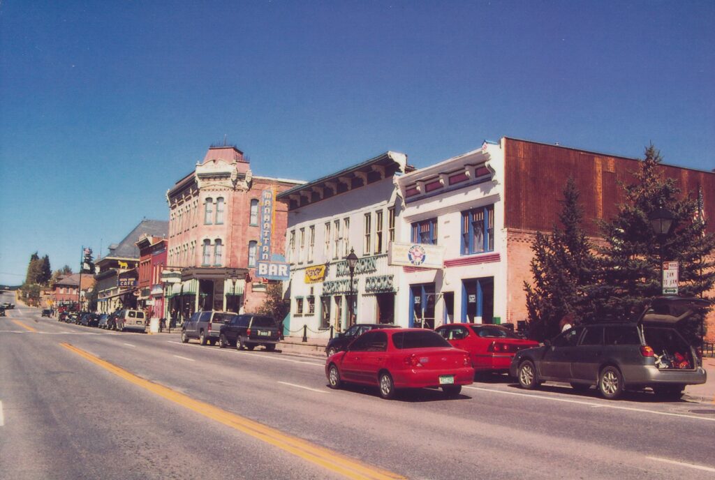
LEADVILLE, Colo. – Some towns are so quirky, in terms of past events or current characteristics or whatever, that they lovingly can be labeled “out there.” Leadville certainly qualifies, and does the concept one better by being “up there,” too.
At 10,200 feet above sea level, Leadville is the highest incorporated city in the continental United States. The air is so thin that during a visit in late summer, despite having been generously caffeinated after a good night’s sleep, I struggled mightily to stay awake during a truly interesting tour. We were seated inside the tiny, wooden cabin in which Baby Doe Tabor, widow of Colorado’s most famous miner, lived as a hermit for the last 35 years of her life. It was a bit stuffy, the guide’s cigarette-coated voice was a strange combination of gravel and gentleness, my eyelids felt as heavy as grand pianos …
The Tabors represent but one rich vein of the gold mine that is Leadville’s history. Here, many fortunes were made and lost during a late 19th century mining boom and bust. “Unsinkable” Molly Brown’s husband extracted a 23-ounce piece of gold from his Little Johnny Mine. Horace A.W. Tabor parlayed his mineral wealth into a seat in Congress and a scandalous second marriage to a woman 24 years his junior (Baby Doe). He built a renowned opera house whose front sidewalks were paved with pure-silver bricks to honor a visit by Ulysses S. Grant. Oscar Wilde, Susan B. Anthony, Harry Houdini and Jack Dempsey were among those who performed or spoke in the building.
Gold, silver, zinc and copper were mined around Leadville during the boom years, with the town’s name inspired by the abundance of silver-laced lead ore. Prospectors flocked here, and some succeeded enough to construct large homes and businesses. Tabor, for example, made $10 million in the 14 years he ran the Matchless Mine. Most of the National Historic Landmark District buildings date from 1880 to 1905.
At its peak, before silver prices fell in 1893, Leadville had some 35,000 residents. These days, approximately 3,000 durable souls live here, making the most of a tough climate. The local tourism board contends “Leadville is a year-round paradise for outdoor enthusiasts, history buffs or antique hunters,” but tourists are likely to enjoy the place only during the summer. Wintry weather is such a bullying force here that the St. Patrick’s Day parade is held in September – it’s called a “practice” for what can’t take place in frozen-over March.
From Denver, Leadville is a scenic three-hour drive up through the foothills and deep into the Rocky Mountains. Colorado has 52 peaks that top 14,000 feet, and the tallest – Mount Elbert, at 14,433 feet – looms just west of town. Harrison Avenue is the historic district’s main drag, passing by the opera house, visitors center and an inordinate number of shops that sell fudge. The visitors center has free maps for a four-block walking tour up and down Harrison that gives visitors a real feel for the place. Tracks, a popular combination coffeehouse, restaurant and nightclub at the corner of Harrison and Eighth Street, last Sept. 27 hosted the “Village Idiot Competition,” subtitled “What Will You Do for $200 Cash.” Contestants could “sign up as individuals or as a team.”
I found another hint that Leadville doesn’t take itself too seriously in the local newspaper. George Gipson’s “On the Edge” column that week addressed a conundrum known to many a high-mountain party animal: “Which beer goes best with breakfast cereal?”
Tourist attractions such as the opera house and Baby Doe’s cabin are open only a few months each year. The Healy House & Dexter Cabin, which contains “lavish” Victorian furniture, and the Heritage Museum, which focuses on “Leadville’s colorful past,” are two other tourism-touted sites that we didn’t have time to visit. We did, however, devote a couple of hours to the fabulous National Mining Hall of Fame & Museum.
Even people who aren’t geology hounds are likely to enjoy this museum, which sensibly and patiently talks down to the nonscientist masses. Its Magic Room of Industrial Minerals contains a mock house whose various doors, when opened, reveal signs that explain what minerals are used to manufacture such items. Lift up the toilet seat and read, “Clay is used to manufacture ceramic sinks, tubs and toilets.” Open a kitchen cabinet: “Silica sand and soda ash are combined in glass products.” Chewing gum has limestone (“the white powder you see when you unwrap it”), Oreo cookies contain titanium dioxide. Nothing beats a tall glass of milk washing down a mouthful of titanium dioxide, eh?
Displays within the 16-year-old museum, whose core building dates to 1899 and originally was Leadville High School, are too numerous to fully list. Highlights include a walk-through replica mine, complete with ore cars, blasting tools and goofy mannequins; a series of hand-carved dioramas that illustrate how difficult, dreary and dangerous mining can be; a fully functioning, somewhat-hypnotic, downscaled-mining-camp exhibit through which two model trains are running; and a hall of fame that as of last summer had 166 inductees, with floor space available for many more.
By the way, molybdenum is the mineral that today is mined commercially around Leadville. From the Greek word “molybdos,” meaning lead, the mineral was nicknamed “molly-be-damned” by its early extractors, who apparently also were detractors. Among its uses is as a bonding agent for steel.
The museum also remembers a 16,000-square-foot indoor skating rink whose walls were solely composed of 5,000 tons of ice blocks. Construction began in November 1895 on the Leadville Ice Palace, which had a 4,000-square-foot restaurant on one side of the rink and a similarly sized ballroom on the other. It was supposed to pick up an economy sagging from mining’s decline. Those dreams melted along with the palace, which closed for good after just two months.
Speaking of soggy, what beer does go best with breakfast cereal? “A nice coffee porter,” reports Leadville Chronicle columnist Gipson.
The National Mining Hall of Fame & Museum, just off Harrison Avenue at 121 W. Ninth St., is open from 9 a.m. to 5 p.m. daily May 1 through Oct. 31, and from 10 a.m. to 4 p.m. Mondays through Saturdays the rest of the year. Admission is $6 general, $5 for ages 62 and older and $3 for children under age 12. For more information: (719) 486-1229 or www.leadville.com/miningmuseum.
Getting to Leadville: From Denver, take Interstate 70 west to Exit 195, just past Frisco. The road, Highway 91, goes south about 25 miles and passes through a more modern, strip-mall-dotted part of Leadville before spilling out onto historic Harrison Avenue. Allow a full day for the drive and visit.
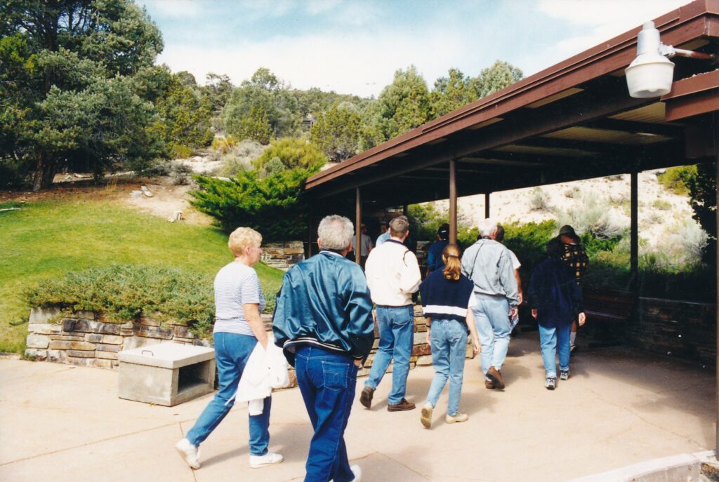
Parachute sightings generally occur in the sky, though there is an especially famous one, fully deployed, more than 100 feet below the ground in eastern Nevada.
Spelunking, not skydiving, is the method to access this particular parachute. In scientific terms it is a shield, a calcite formation different from common stalactites and stalagmites, and as such it helps distinguish Lehman Caves from other underground attractions.
Guide Bryan Hamilton told his tour group one morning in September that of the country’s 6,000 or so major caves, only 60 have shields. The formation is circular at the top, where two discs are separated by a small crack. Sometimes, as with the parachute, stalactites and draperies hang from the lower plate.
About 300 shields have been detected in Lehman Caves, part of Great Basin National Park, 66 miles southeast of Ely, Nev. Tours of varying lengths are given there year-round on a comparatively level path. This cavern is entered from the side, not from above, though there are the usual passages where ducking and other mild spinal contortions are necessary.
Shields’ genesis is a mystery, said Hamilton, but the prevailing theory is that mineral deposits from water shooting out from cave walls slowly form the discs. Only one shield has been seen with water spurting out, however, and that was in France.
“I keep waiting for it to spray on cue,” Hamilton told the 20 or so of us gathered beneath one of the more prominent Lehman Caves shields. “It hasn’t happened yet. But if it did, we’d all be very wet.”
The parachute is in Lehman Caves’ Grand Palace, the third of four rooms inspected during the 90-minute tour. Earlier we had seen the Gothic Palace and Inscription Room, with the Lodge Room to follow. Throughout the morning the underground temperature remained around 50 degrees Fahrenheit, and Hamilton remained cheerful and informative.
Once we entered the cavern after a brief introduction behind the visitors center, he quickly offered this memory device for novice cave spectators: downward-growing stalactites “hang tight from the ceiling” and rising stalagmites “just might make it to the ceiling.” When the two formations meet, they compose a column, of which there are many thick ones in Lehman Caves.
Whenever a stalactite’s waterdrop falls on a tourist, he or she has received a “cave kiss,” containing a minute amount of minerals. That is the only way, Hamilton said, you can take home a piece of the cave. Breaking off or merely touching any of the formations is forbidden.
Back in the cave’s early tourism days, from 1885 until well into the 20th century, there was quite a bit of souvenir-gathering that today is considered outright vandalism. Hamilton pointed out a few stalactites that were broken off years ago. However, some of them are showing signs of resuming growth. That is the upbeat geological news. The bad news is “all caves eventually collapse,” Hamilton said.
As environmentalists like to say, nature bats last — sort of a pun for caves, where the furry, flying rodents typically terrify wayward adventurers in movies and TV shows. Hamilton said only 10 bats were counted last year in Lehman Caves, which also contains a nominal number of scorpions, rats and crickets.
Humans also left their mark in the Inscription Room, a shallow area that originally was accessed via a 50-foot belly crawl known as “Fat Man’s Misery.” Many celebrated the feat by burning dates and other graffiti into the room’s ceiling, such as “1891″ — though that of course could have been burned in 1960. Regardless, the inscriptions are part of the cavern’s past, as are at least three wedding ceremonies.
“What a rocky way to start a marriage,” Hamilton quipped.
No belly crawling is needed these days, as a tunnel dubbed the Panama Canal now leads to the Inscription Room. Times have changed in the Lodge Room, too, which Hamilton says is so named because supposedly there used to be parties staged there in the 1920s — a sort of subterranean speakeasy.
Flash photography is allowed inside the cavern, though postcards of the most intriguing calcite formations — including the parachute — are available in the visitors center and its adjacent gift shop. A cafe, open from 8 a.m. to 4:30 p.m. April through late October, features light breakfast and lunch fare.
Outside the visitors center is a pleasant nature hike, a physically undemanding quarter-mile though too steep and rocky for wheelchairs. The trail begins at Rhodes Cabin, which between world wars was part of a cluster of buildings for tourists and the cave’s caretakers.
A pamphlet that can be borrowed from the visitors center explains the trail’s highlights. Through that and signposts, hikers can learn much about the area’s plant life. Pinyon pines provided American Indians with high-calorie nuts, and the bark from Utah juniper was used to make mats, rope, sandals and even diapers. Among the less-prolific flora are joint firs, from whose boiled stems Indians and early Mormons made tea; cliffrose, whose creamy yellow flowers are said to smell like orange blossoms; and big sagebrush, the Nevada state flower eaten by deer and cattle.
Near the trail’s end is the cave’s original opening, used by fruit farmer Absalom S. Lehman and subsequent guides and visitors until the late 1930s. Now it is a 2-by-2-foot square hole in the middle of a concrete slab, with a steel cage surrounding it. The cage prevents hikers from tumbling down 38 feet to the cavern floor but allows Lehman Caves’ few bats to fly in for daytime naps and flap out at night.
The trail pamphlet reprints one of the more colorful “tall tales” about how Lehman found the cave. It was written in 1922 by a Delta, Utah, newspaperman named Frank Beckwith. The story’s plausibility diminishes as the long, first sentence proceeds.
“Well, legend says that a mountain rat was gallopin’ off with a slab of sowbelly that Lehman was at times nibblin’ off of and that Lehman was in hot pursuit on horseback, just a whoopin’ it up, when both rat and horse fell down the shaft with Lehman astride (the horse of course, you dam fool) an’ he saved his life only by his quick wit and unerring eye, for as he felt his foot going out beneath him, he uncoiled his lariate, and with that precision that all plainsmen have, deftly lassoed a cedar tree just as he shot through the hold, and there he sat in midair clenching the horse for four days until a rescue party gave him a lift, yanking the rider and horse back up out and started the story going. The clenching made Lehman bow legged for life. Pretty hard on legs, such a stunt is!”
Lehman, born in Pennsylvania in 1827, settled in the Snake Valley region in 1869 and grew apples, pears, peaches, plums and other fruits. Some of his apricot trees survive, outside the visitors center. His cave “discovery” — Indians knew about the cavern for centuries — occurred in 1885.
Several more strenuous hikes at Great Basin National Park are clustered 12 miles up from the visitors center, off a scenic road that climbs toward 13,063-foot Wheeler Peak. The summit trail is 8.6 miles long and has an elevation gain of 2,900 feet. Two shorter options, but both quite appealing in terms of alpine scenery, are the lakes loop (2.7 miles; 600 feet) and the bristlecone (2.8 miles; 600 feet) trails. Four campgrounds can be found along the Wheeler road, including one at the top and another down by the visitors center. For general information about the park: (775) 234-7331.
Lehman Caves tours are offered daily year-round, most frequently between Memorial and Labor days. General prices for the 30-, 60- and 90-minute tours are $2, $4 and $6, respectively; children under 12 years old and seniors with the Park Service’s Golden Age passports receive a 50 percent discount. Children under 16 must be accompanied by an adult, and those under 5 cannot take the long tour. Summertime tickets may be purchased up to one month in advance by phoning (775) 234-7331, Ext. 242.
Average temperatures at the visitors center, elevation 6,825 feet, are January, 41 degrees Fahrenheit high, 18 degrees low; April, 56 and 31; July, 86 and 57; and October, 62 and 37. Afternoon thunderstorms are common during the summer.
Directions: If driving from Sacramento, which is a road trip of perhaps 520 miles, take Interstate 80 or Highway 50 to Nevada, and get or stay on Highway 50 through most of the state past Ely. Not far past Sacramento Pass, turn right on Highway 487 and follow signs through the small town of Baker to the park. Distances from other cities include Reno, 385 miles; Las Vegas, Nev., 286 miles; Salt Lake City, 234 miles; and Cedar City, Utah, 142 miles.
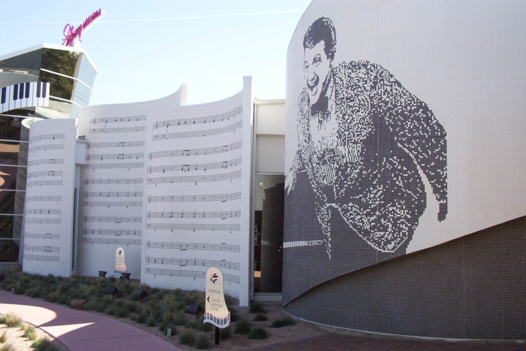
LAS VEGAS –What word best describes Liberace, docent Nedra asked those assembled for the 11 a.m. tour.
“Flamboyant!” was the first response, one quickly endorsed by the tour guide. Anyone 35 or older is likely to have memories of the classically trained pianist, who died in 1987 due to AIDS. Nicknamed “Mr. Showmanship,” he was especially well-known for his outrageous costumes and jewelry. He also had what could be described as a wickedly fun sense of humor. Millions adored him, but it is fair to say that many others, armed with more 1970s and ’80s TV images of Liberace than facts about the man and his entertainment skills, thought he was goofy.
Such a negative opinion could change with a visit to the Liberace Museum, 2.5 miles east of the Strip. Founded by the entertainer in 1979 and extensively renovated last year, the two-building facility contains basic biographical data along with many of Liberace’s possessions. If you go, try to spend at least a leisurely hour or two looking over the exhibits. And consider leaving your sunglasses on, because some of what you see might blind you.
Witness, for example, the piano watch, which has 247 diamonds. That’s right, two hundred forty-seven girl’s best friends. A well-conceived audio tour includes a recording of Liberace talking to an audience about the extraordinary piece of jewelry. “It keeps very good time,” he said, with a twinkle in his voice. “It’s about 20 rubies till 11 diamonds.”
Eight shiny buttons, each containing some 50 diamonds, are in the same display case.
“Yeah, they’re real diamond buttons,” Liberace tells museum visitors through their rented headphones. “Yeah, in fact, the buttons cost more than the suit, you see, but I couldn’t come out in just the buttons. (The audience roars.) Coax me! Hah hah hah hah hah! I’ll make that centerfold yet! Hah hah! You know what the gimmick is with these buttons. On each one there’s a letter, see, and all together they spell out my name. That makes them deductible. (Laughter again erupts.)”
In the same room, 19 Liberace-like mannequins model his costumes. The exhibit, which changes occasionally to show off the much broader scope of his wardrobe, in March featured duds Liberace wore to celebrate the nation’s bicentennial in 1976 and/or the Statue of Liberty’s 100th anniversary a decade later – museum descriptions are unclear on that point. What’s certain, though, is that the ensemble is wildly patriotic. Its blue hot pants, red vest and many white stars on a glittery cape scream “Look at me!”
Designers “who helped create the sparkle that was Liberace” are acknowledged. Sy Devore dressed the young pianist in “well-fitted tuxedos.” Frank Acuna introduced “exquisite brocade suits.” Frank Ortiz put sequins and rhinestones on the older, less-inhibited performer. Michael Travis took Liberace “to new levels of flamboyance.” Anna Nateece “smothered him in fabulous furs.”
Wladziu Valentino Liberace made his grand entrance into the world on May 16, 1919, in West Allis, Wis. He had a smaller twin brother, who was stillborn. His three other siblings were musically talented, as was their mother. Their dad played French horn in the Milwaukee Philharmonic Orchestra.
Wladziu (the Polish equivalent of Walter) made his debut as a piano soloist with the Chicago Symphony at age 14. By 1940 he was playing in New York nightclubs, and he first performed in Las Vegas in The Last Frontier Hotel (later called The Frontier) four years later. By 1947 he had introduced a candelabra to his act and had dropped his first two names. In 1952, Liberace’s first television show was launched as a summer replacement for Dinah Shore’s. When the next Emmys were awarded, he won for best entertainment program and most outstanding male personality.
His career surged from that point, becoming a blur of sold-out concerts, worldwide tours, movie cameos, TV specials, popular books and, of course, increasingly outlandish outfits. Museum pictures show him with a playful Elvis Presley in 1952, Mr. Showmanship on guitar and The King playing piano. Queen Elizabeth II greets him in another shot, this one from 1956. In 1982, museum visitors learn, Liberace performed all best-song nominees during the Oscars telecast. His last live concert was Nov. 2, 1986, at Radio City Music Hall, scene of many Liberace triumphs. He died three months later at age 67.
“The man himself was quite shy,” but very kind and generous, tour-guide Nedra told the two dozen or so gathered for her tour. (Five raised their hands when Nedra asked who had attended a Liberace concert.) “He was very folksy. He never ever ran one foot away from anyone who wanted to shake his hand or give him a hug.” She said that in Las Vegas, he was known to approach strangers in supermarkets and ask what they were planning to make with their purchases and often ended up swapping recipes.
Liberace’s kindness extended to dogs, of which he had 26 upon his death. His favorite, Nedra said, was a blind poodle named Baby Boy. Liberace also loved children, though as a gay man he never fathered any.
If he could be compared with Cher for his taste in clothing and with Mr. Rogers for his personal warmth, Liberace was rather like William Randolph Hearst in terms of collecting. Museum displays of his cars, pianos and furniture indicate he was not deterred by cost or gaudiness. Among his automobiles was a “Volksroyce,” his publicist’s description of a pink and mirrored VW Cabriolet to the front of which was welded a Rolls Royce hood and ornament. A re-creation of Liberace’s bedroom in Palm Springs (he had seven residences upon his death, including one in Las Vegas) contains a Louis XV desk that reportedly once was owned by Russian Czar Nicholas II.
“It’s the most priceless possession in this room,” Liberace’s voice coos in the audio tour, implying that there were more-valuable things in the living room or, perhaps, kitchen pantry.
Though outwardly Liberace displayed a jaw-dropping materialism, inside apparently was a man whose opinion of the possessions differed from that of other famous collectors. In an autobiography, he wrote:
“I feel that all these things I live with have been placed in my care to look after. They don’t really belong to me; they belong to the world. After all, they belonged to famous people before me. Somewhere, somehow, they had been abandoned or not cared for. Then I came along and saw a broken chair or an unwanted dog or a forgotten antique that cried out to be saved.”
The Liberace Museum, at 1777 E. Tropicana Ave. in Las Vegas, is open from 10 a.m. to 5 p.m. Mondays through Saturdays, and from noon to 4 p.m. Sundays. Admission is $12 general, $8 for seniors 65 and above and for students from age 6 through college. Kids under 6 are admitted for free. The audio-tour headsets can be rented for $3 apiece. For more information: (702) 798-5595 or www.liberace.org.
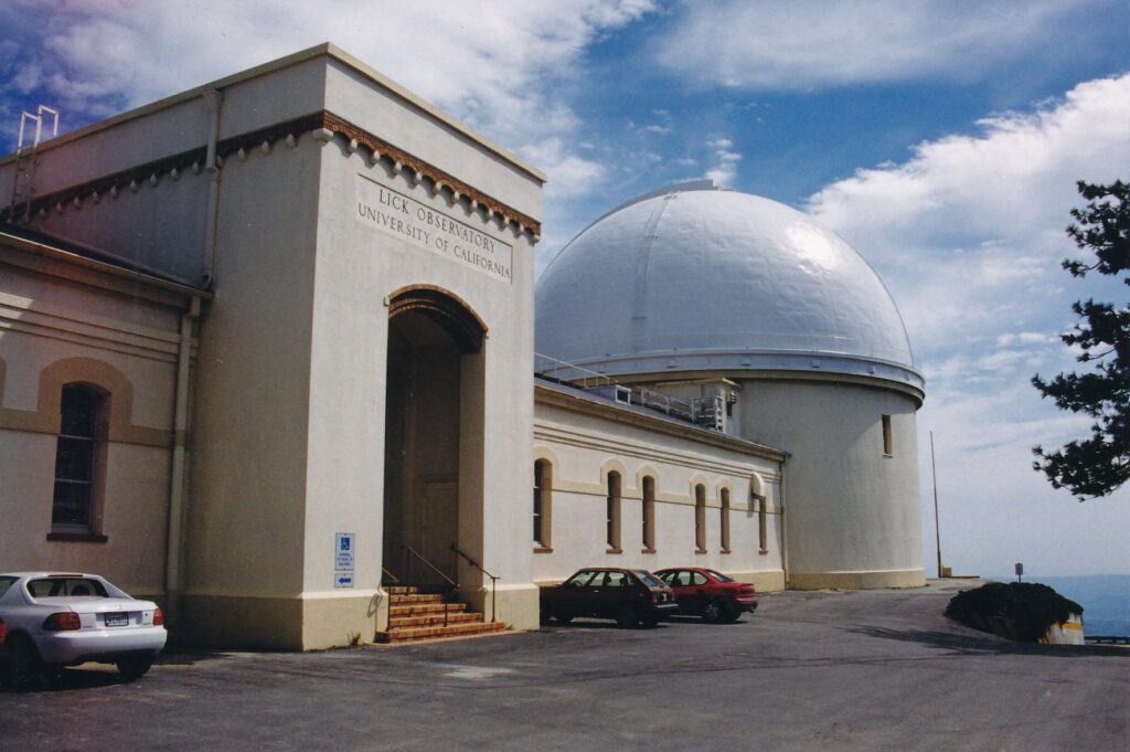
Sometimes, where you have gone is less memorable than how you got there. Such was the case when I drove to Lick Observatory, 25 miles east of San Jose.
The last 18 miles are about as curvy as driving gets, other than down the famous, one block stretch of Lombard Street in San Francisco. Caution signs advise speeds as low as 10 mph. At some points, State Road 130 is only slightly wider than a bike path. Its condition is neglected, with several potholes. Snowfalls have closed the route as recently as the first week of April. Mild rockslides have left their mark, and the drop-offs are fairly precipitous; I recall only one guardrail.
On top of all that, the road is popular with bicyclists, due to its relatively low grade of climb. I encountered several such hardy, and brave, souls the afternoon I visited.
For drivers, it’s eyes-on-the-road all the way. For passengers, there are great vistas of San Jose receding on the horizon. On a clear day, reportedly, you can see as far north as the Golden Gate Bridge, but without possessing cast-iron stomachs, that might be a non-issue.
Assuming you attain Mount Hamilton’s summit, at 4,209 feet, you will be rewarded with a complex of telescope domes and residential structures that have a mildly run-down look. It is a pleasant enough place for a picnic, certainly, with those potentially nice views and the undeniably clean, clear air.
That air quality, of course, explains the presence of Lick Observatory, a system-wide University of California-operated facility since construction was completed in 1888. Its 36-inch refractor telescope was the world’s largest then but has been second-largest since the 40-inch Yerkes Observatory was built a few years later in Wisconsin.
Free tours of Lick’s 36-inch refractor are given every half-hour from 1 to 4:30 p.m. weekdays, and from 10:30 a.m. to 4:30 p.m. weekends. A small gift shop is open from a half-hour before the day’s first tour to a half-hour past the last one. Visitors also can hike a quarter-mile over to the 120-inch reflector telescope, which was the world’s second-largest such stargazer when it began measuring the night skies in 1959.
On the face of it, daytime visits to an observatory might seem pointless. However, many things can be learned without looking through the big telescopes. Just don’t expect any stellar excitement, so to speak.
Lick, after all, is still very much a working facility. Students, scientists and other staff members perform research on the nine telescopes, housed in eight domes. More than 50 people reside on the mountaintop year-round, thereby avoiding a killer commute up windy State Road 130. The fewer distractions (i.e., tourists and their vehicles’ headlights) during the night, the better.
During the 15-minute refractor tour, my small group learned that the 7-ton telescope, under a 90-ton dome, has been the instrument used for several important discoveries. Among other things, astronomers there have first spotted the fifth moon of Jupiter, one of the dark rings around Saturn and a binary star network.
We were told that the wood floor surrounding the telescope’s base can be raised up to about 16 feet. The telescope, despite its weight, is so delicately rigged that it can be hand-turned by just one scientist. Practically the entire night sky is accessible and can be observed at a magnification 400 to 500 times more powerful than the human eye.
Photographs taken by the refractor telescope are displayed in a hallway that leads to the dome; pictures of the moon are especially sharp and interesting.
Underneath the telescope, in the basement, is the tomb of his truly, Mr. Lick. Born in 1796 in Pennsylvania, James Lick spent much of his youth in South America before moving to San Francisco mere weeks before gold was discovered at Sutter’s Mill in 1848. He made an unsuccessful stab at prospecting but quickly turned his entrepreneurial smarts to real estate during the Gold Rush. His estate was worth some $3.5 million when he died in 1876, $700,000 of which he wanted used for construction of the world’s first, all-year mountaintop observatory.
It is said Lick never ascended Mount Hamilton as a live man. But as the observatory neared completion in 1887, his casket was pulled uphill from Santa Clara and entombed below the telescope — an interesting variation on winding up in the heavens.
The 120-inch reflector telescope is named after C. Donald Shane, a longtime University of California educator who also was involved in the World War II era’s Manhattan Project, serving as assistant director of personnel for two years at Los Alamos, N.M. The telescope, which began measuring the skies in 1959, weighs 145 tons. Its glass disk is 13.5 to 15 inches thick and weighs 4 tons. To avoid sagging, it rests on 18 support points.
Lick Observatory literature claims the Shane reflector is the eighth-largest operating telescope in the world.
For more information: (408) 274-5061 or www.ucolick.org/public/visitors.html.
Directions: From Sacramento, take Interstate 80 west to Interstate 680. In San Jose, take the Alum Rock Avenue exit and go east for a few miles to Mount Hamilton Road (State Road 130); turn right and proceed 18 extremely curvy miles to the observatory.
EDINBlJRGH, Scotland — Getting lit is unavoidable on this pub crawl, even if you don’t tipple till you topple.
Getting wet also was unavoidable the evening I took Edinburgh’s Literary Pub Tour, a two- hour stroll that captures the spirit of Scotland’s most-acclaimed writers and, if you’re so inclined the spirits of local establishment. Rain pitter-pattered steadily outside as my tour group assembled in the Beehive Inn, at 18/20 Grassmarket in the old town.
We were encouraged to check out the bar and, purely optional, of course, buy a drink to consult while the evening’s entertainment unfolded.
Actors Keith Hutcheon, as. Mr. Clart, and Mark Kydd, as Mr. McBrain, quickly set the transient stage. Clart opened with a brief lecture on how ink was not the only liquid that Robert Burns, Walter Scottand other Scottishscribe.s used to express their creativity. The northern city’s seedy side, including its brimming band of prostitutes (which Clart pronounced “who-ers”), was a source of inspiration.
What an outrageous affront, loudly interjected a riled McBrain. How dare you soil these literary giants’ images with such filthy lies, he told Clart. Burns, Scott, Robert Louis Stevenson and the rest triumphed without descending into the dark side.
The debate evolved into a battle of dueling recitations from the writers’ works and anecdotes about their Edinburgh experiences. Eventually, Clart and McBrain agreed to let the tour group decide which man’s thesis held the most merit. Off we went on soggy sidewalks to three more pubs, where our actor-guides flushed out their cases while their hair became as matted as wet grass trampled over by a bagpipe brigade.
At The Ensign Ewart, 521 Lawnmarket we were encouraged to check out the bar and, purely optional, of course, buy a drink to consult during the humorous debate — which inexplicably seemed to spark more laughter as the tour progressed. (Gulp!) We continued at the Jolly Judge, 7 James Court off Lawnmarket, and concluded in the new town, across the railroad tracks, at Milnes Bar, 35 Hanover St.
Along the way, Clart and McBrain in their literally moving drama provided a sweeping introduction to Scottish literature. Among the tidbits taught about Stevenson, for example, is that Jekyll is pronounced “jeek-uhl,” despite what Hollywood tells us (to paraphrase Clart). The duality theme of that fabled story, “The Strange Case of Dr. Jekyll and Mr. Hyde,” also can be applied to the professional and social lives of Scottish writers, Clart and McBrain agreed. This shared opinion was part of what led the two, at tour’s end, to concede their debate had been a draw.
I would like to pass along other insights, but what with the rain preventing note-taking and the evening’s nature of bonhomie and mildly bawdy asides, it is perhaps more prudent to step aside and merely encourage you to take the tour should you be fortunate enough to visit Scotland’s capital city. You are bound to learn a lot, laughing all the way — with wetting your whistle purely optional, of course. But do take an umbrella.
Edinburgh’s Literary Pub Tour departs at 6 and 8:30 p.m. daily in July and August; at 7:30 p.m. Thursdays through Sundays in September, October, April, May and June; and at 7:30 p.m. Fridays from Nov. 1 through March. Tickets can be purchased on the spot for 6 pounds general, 5 pounds for seniors and students; groups of 10 or more should reserve in advance by phoning 0131-226-6665.
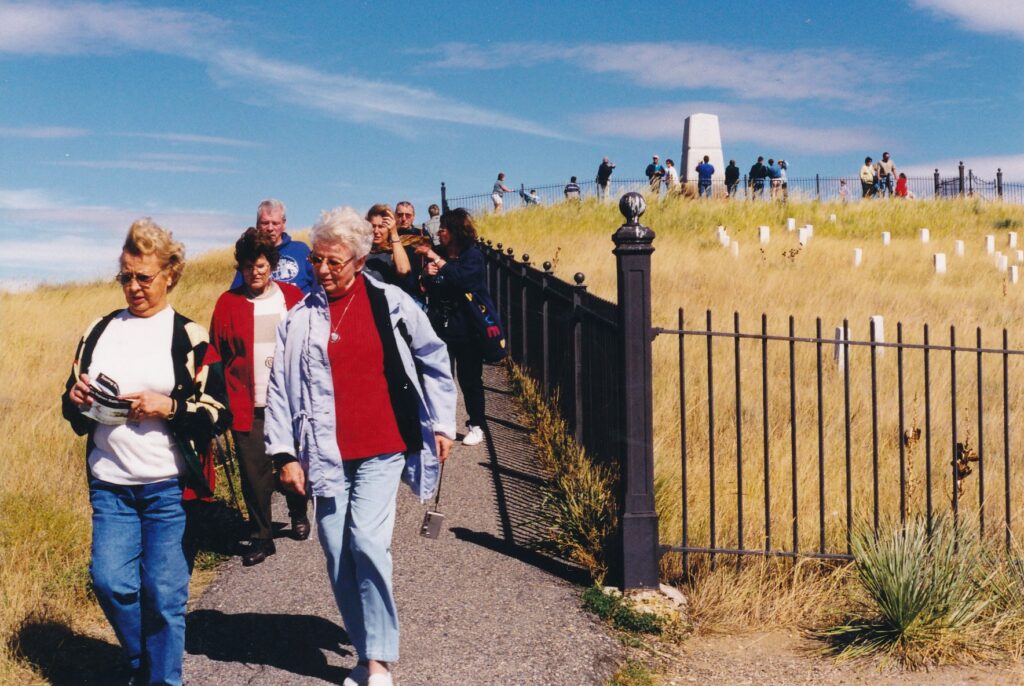
Kristin Scott Thomas – whose birthdate I share — took a nap there in Robert Redford’s film “The Horse Whisperer.” That was enough enticement for me to visit Little Bighorn Battlefield National Monument in southeastern Montana.
Tums out that like Custer, I couldn’t stand the place.
No, no, that is an overstatement and a miserable pun to boot. Lt. Col. George Armstrong Custer, along with the other men from both sides who died that early summer’s afternoon in 1876, have been abused by too many jokes, tall tales and criticisms over the decades. Furthermore, the countryside is so pretty that seeing it makes up for all the “Custer’s last stand” hoopla — a crowded visitors center, on- and off-site gift shops, even a Little Bighorn Casino.
The experience reminded me somewhat of Tombstone, Ariz., another tourist attraction driven by Wild West legends of macho heroism and dusty, fast deaths. There is a more somber air at Little Bighorn, however, where the National Park Service oversees the battlefield site with its usual efficient dignity and a military cemetery serves as a reminder that this is more hallowed ground that playground.
Tom Morgan, a retired police officer who has volunteered to give talks at the monument for a month each of the past four years, told a large group gathered outside the visitors center that there are many misconceptions about the June 25, 1876, battle. Hollywood, he said, would have you believe Custer stood fighting the encircling American Indians with a saber in one hand and a gun in the other, and was the last soldier to fall.
“Folks, it never happened,” Morgan said. Many in the audience chuckled. Brightly sunlit behind Morgan, up Last Stand Hill, was a spiked monument under which more than 200 soldiers, scouts and citizens are buried. Among the dozens of white markers below the monument, signifying where the bodies fell during battle, is one for Custer. His is easy to spot upon closer inspection, for it is the only marker to have white lettering upon a black background.
Truths about the battle are not black-and-white. Back in those pre-CNN days there was no immediate, mad rush for eyewitness testimonies and expert analyses. For example, a photograph taken of Last Stand Hill in 1879 shows makeshift body-placement markers and scattered horse bones. Historians, more than a century later, continue to refine their estimations of how events unfolded. Little Bighorn Battlefield National Monument, through its rangers, presentations, free pamphlets, books sold in the gift shop and 4.5- mile automobile tour, gives visitors more data than they likely will want to process.
Morgan provided a broad outline in his 45-minute talk. The long series of events that led to Little Bighorn’s battle began to accelerate in 1874, when gold was discovered on the Great Sioux Reservation in the South Dakota badlands. White speculators wanted access and many Indians resisted with force.
“By the summer of 1875,” Morgan said, “it was absolute, total warfare. White men were killing all the Indians they could. Indians were killing all the white men they could. It was a total mess here on the western frontier.”
President Ulysses S. Grant and his top military aides, Gen. William T. Sherman and Lt. Gen. Philip H. Sheridan, the following year decided to act forcefully. They mobilized many troops, but in June 1876 an unprecedented number of Indians gathered with Lakota leader Sitting Bull for a sun dance, an annual ceremony for mind and spirit.
Making a shortened story absurdly shorter, the U.S. 7th Cavalry stumbled upon more Indians than it had anticipated. Through bad tactics, poor communication and an efficient Indian attack — Morgan says the battle on Last Stand Hill may have taken less than a minute — Custer and the 200 men under his direct command were wiped out. (And the so-called last stand, Morgan said, probably was down by the river, far from Custer.) Some 60 to 100 Indians died during the complete day of fighting, which extended to the Reno-Benteen Battlefield on today’s automobile tour.
Any contemporary visitors, regardless of their level of interest in battle details and the wider scope of Indian affairs, can gain some sort of emotional sense of the battle by walking up to the monument and gazing down over the markers and visitors center toward the Little Bighorn River Valley. The challenge might be to ignore the tourists’ babble, their photograph-taking and videotaping, the RV-packed parking lot and all those preconceptions about Custer’s last stand.
Some casualties from that battle are interred in Custer National Cemetery, beside the parking lot. Custer’s remains were reburied at West Point, N.Y., in October 1877. The nearly 5,000 plots at Little Bighorn are the final resting places for soldiers in other Western frontier campaigns, their wives and children, and U.S. veterans from conflicts through the Vietnam War.
Little Bighorn Battlefield National Monument is just off Interstate 90, about 65 miles southeast of Billings, Mont., and 70 miles northwest of Sheridan, Wyo. Admission is $6 per vehicle and $3 per pedestrian, bicyclist or motorcyclist from mid-April to mid November; free the rest of the year. The visitors center is open from 8 a.m. to 8 p.m.
Memorial Day through Labor Day, from 8 a.m. to 6 p.m. April 1 to Memorial Day and the day after Labor Day through Sept. 30, and from 8 a.m. to 4:30 p.m. the rest of the year. For more information: (406) 638-262].
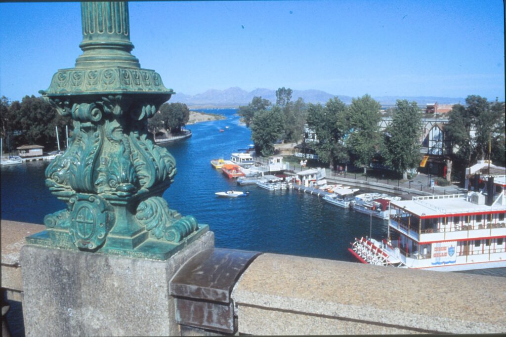
LAKE HAVASU CITY, Arizona — Dueling loudspeakers hawked tours across the Colorado River.
“Take a ride on the world-famous Lake Havasupai II, the original and most popular tour of Lake Havasu,” bellowed speakers on one side. “Captain Claude has been written about in national magazines and is known for his personality and interesting tours.”
“Final boarding call for the Dixie Belle, the largest tour boat in the state of Arizona,” proclaimed speakers on the other side. “There’s a full-service bar aboard!”
“It’s family appreciation day on the Kon Tiki,” entreated another amplification device. “Two dollars off the regular adult price today!”
Actually, all three tour operators were offering reduced fares. Curious, I sauntered over to what I hoped was an impartial popcorn vendor.
“Pardon my cynicism,” I said to the man behind the counter, “but are there $2 discounts every day?”
His smile vanished. “Well, yeah, since Labor Day,” he stammered. “Why do you want to know?”
OK, I’ll admit mine was a hostile question. But the London Bridge environs were getting on my nerves.
Earlier that day, I caved in when a woman in a funny straw hat lobbied me to take the Lake Havasupai II tour. “I can’t describe it,” she said when I asked for a description. “You’ll enjoy it,” she said when I asked if it was worthwhile.
Captain Claude greeted us as we stepped onto the small craft, and immediately went into his free-lance huckster act. “Are you going to Laughlin? Here, lunch is on me,” he said, handing us what turned out to be 2-for-1 coupons for some Laughlin, Nev., casino’s buffet.
Next, the enterprising captain produced a bottle of pretentious mustard. “In case anybody asks, I’ll show them my Grey Poupon,” he said, laughing. “The good people at Grey Poupon heard about how we help with their product, and they’re thrilled!” No doubt.
Three times during the tour, Claude cut the engine, drifted up to leery boaters, and shouted: “Excuse me, do you have any Grey Poupon? I do!” Each time, the captain laughed. The rest of us groaned.
I should have taken the booze cruise.
Not surprisingly, many people we encountered on the tour were floating on water and drowning in beer. Rumor has it that on many of the hot, sunny days that perpetually bake Lake Havasu, party animals get toasted enough to frolic naked. Unfortunately, I can’t confirm that.
Tour boats, sailboats, speedboats and Jet Skis carry passengers — sober or otherwise — under the bridge’s four arches. Back and forth they go, some of their horns tooting or bells ringing, all of them spewing smoke. During the many hours I spent around London Bridge, I saw only one rowboat. All the other craft were powered by internal-combustion engines.
On the east, or mainland, side of the channel is a smattering of souvenir stores and restaurants that strive to exude an English flavor. The stores are “shoppes” and the bars are pubs, and the prices are a bit dear, what?
On the west, or island, side is the Island Fashion Mall. One of its strengths is Kozy’s Island Kafe, which has daily specials and shaded tables that offer a great view of the bridge. I also enjoyed Shugrue’s Restaurant, featuring tasty lunches for under $10.
There were a few other pleasant touches during the mid-September weekend I visited Lake Havasu. On Saturday evening, the 20th annual Campbell Boat Regatta added color and laughter around London Bridge, which was caught in a flattering pose by light from the setting sun. The next morning, a couple got married under the mainland side of the span. But while vows were being exchanged, a strutting, party-dude-type passer-by yelled: “Don’t do it!”
The scene was further evidence that for London Bridge, the Thames — they are a changin’.
The biggest change occurred more than 20 years ago, when the famous span was broken down into 10,276 blocks of granite, shipped to Long Beach, Calif., trucked to Lake Havasu and reassembled on a sand bank. In the summer of 1971, a mile-long channel was dredged and, once again, water flowed beneath London Bridge.
Originally, it had spanned. The Thames River. For the record, it was not the London Bridge that, according to the children’s song, was “falling down, falling down.” This one, completed in 1831, was sinking — about an inch every five years. Mounting traffic was becoming too much of a burden, and London city officials decided they needed a new bridge.
Lake Havasu City’s founder, Robert P. McCulloch Sr., is credited with buying what local pamphlets describe as “the world’s largest souvenir.” In 1968, when his town was just 4 years old, McCulloch devised a shrewd strategy for obtaining the heavy bridge and, with it, tons of publicity.
He heard London would have to pay $1.2 million to tear down the span. In making his bid, McCulloch doubled that figure to give London a 100 percent profit, and added $1,000 for each year of his anticipated age (60) at the bridge’s reopening. So the winning offer was $2.46 million.
According to Captain Claude, comedian Red Skelton earlier had bid $2.44 million. His intention was to use the bridge’s granite to build a restaurant and nightclub in Los Angeles.
In London, the bridge was 1,005 feet long. In Lake Havasu City, it’s 53 feet shorter and, due to a steel-reinforced structure inside the granite shell, 50 tons lighter. Bits of the leftover rock are sold in various sizes and disguises — for 98 cents to $48 — in the London Bridge Rock and. Jewelry Shoppe.
If you motor to London Bridge, you can join the locals in driving over it. The “souvenir” has a practical function of connecting the mainland and the island, which has no official name.
To save $2, don’t park in the main lot, off the bridge northeast side. The nearby Ramada Inn and Island Fashion Mall lots are free, and just as close to the bridge.
LONDON BRIDGE, IF YOU GO
Where it is: In Lake Havasu City, which is 235 miles from the Grand Canyon, 150 miles from Las Vegas, 315 miles from Los Angeles and 200 miles from Phoenix.
Average daily temperatures: January, 67 degrees high, 37 low; April, 87-54; July, 109-79; October, 91-58; overall, 88-56.
What’s happening in early 1993: 6th Annual Dixieland Jazz Festival, Jan. 15-17; Spring Arts & Crafts Extravaganza and Bluewater Invitational Regatta, March; Lake Havasu Pro Am Golf Tournament, April 2-4.
Where to stay: Lake Havasu City has 22 motels and five campgrounds. The Windsor Inn, a 15-minute walk from the bridge, has a pool, sauna and rooms starting around$30.
For more information: Contact the Lake Havasu Area Visitor & Convention Bureau, 1930 Mesquite Ave., Suite 3, Lake Havasu City, AZ 86403;(800) 242-8278. Or call the bridge’s English Village Information Center at (602) 855-4115.
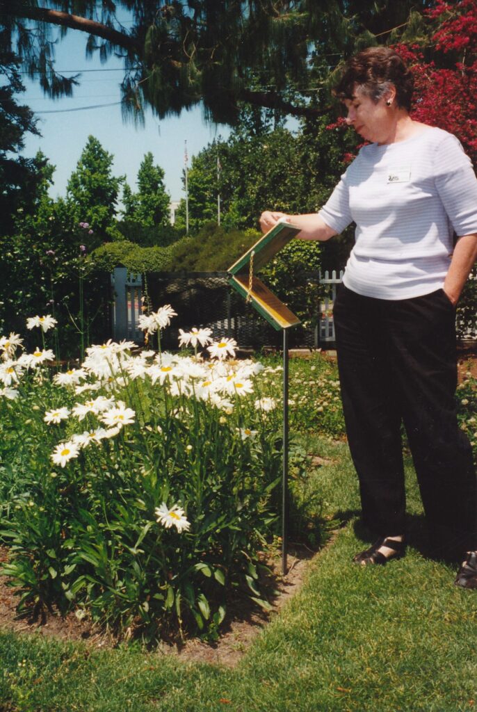
SANTA ROSA – Among the more than 800 plant varieties Luther Burbank introduced to the world were a faster-growing hardwood tree and a cactus with practically no needles.
His “paradox” walnut tree was a cross between a California black walnut and Persian walnut. Its hardwood can result in beautiful furniture, though the fact it needs to be air-dried rather than kiln-dried, a much-faster procedure, hurts its market value.
His spineless cactus was sold throughout the world, including to many Australian ranchers, as a food source for cattle. Turns out cows liked the plant so much they would eat it to the ground. Unlike grass, it could not grow back quickly.
“Once again, it turned out to be better in concept than in reality,” said Cynthia Nestle, a docent at the Luther Burbank Home & Gardens. The tour she led made clear, however, that the longtime horticulturist made many significant contributions in his field, and was just plum good at developing new fruits and flowers.
Some 25 of Burbank’s plants are cultivated at the gardens, free to the public and open all year. For a small fee, visitors from April through October can receive a tour of the 1.6-acre site and enter the house that Burbank bought along with the property after he came to Santa Rosa from his native Massachusetts in 1875.
“I firmly believe, from what I have seen, that this is the chosen spot of all this Earth as far as nature is concerned,” he wrote to his family. Soon, his mother and sister moved in with Burbank on what was then a 4-acre experimental farm. During his half-century of work in California, he also owned and oversaw an 18-acre farm in nearby Sebastopol.
In 1889 Burbank designed an innovative greenhouse, still used today to nurse plants for the public gardens, that sustained not so much as a cracked window in the 1906 Bay Area earthquake. The 1893 publication of his catalog “New Creations in Fruits and Flowers” brought him worldwide fame. One of his greatest achievements occurred in 1901, when after 17 years and 34 generations of breeding, Burbank unveiled the Shasta daisy.
Four varieties of daisies were used to develop the Shasta, Nestle said. The result was a long-stemmed plant with pure-white petals around a yellow core. The Shasta remains a favorite with gardeners to this day.
More than 100 of the plants Burbank developed involved plums or prunes. Many in the industry believe his work with plums represents his most-significant contribution to California agriculture. One of his offbeat plum concoctions, a crossbreeding with apricot trees to produce a “plumcot,” is grown in the Santa Rosa gardens – though a recent aphids infestation has reduced this year’s production, Nestle said.
The Santa Rosa plum is one of Burbank’s other creations, as are the Burbank potato, Burbank cherry and the drought-resistant Burbank crimson California poppy. “I shall be content if because of me there shall be better fruits and fairer flowers,” he once said.
The lovely house that today can be toured was where Burbank lived until moving across the street to a larger structure, where he resided until dying in 1926 and which was torn down for other development in the 1960s. What helps to make the surviving house special, and gives it most of its character, is that Burbank’s widow lived in it from a year after his death until 1977.
Elizabeth Waters was 29, to Burbank’s 67, when they married in 1916. She never remarried. During her 50 years in the Burbank house, which along with the grounds she willed to the city, she brightened up the place by adding windows and doors, and gave it such distinct touches as a long series of decorative tiles that tell the story of Miguel de Cervantes’ “Don Quixote.”
Burbank assuredly retains a presence in the house. One of the sitting room’s walls is loaded with pictures of the horticulturist and many significant figures of his day. One photograph shows him standing in a garden with Helen Keller and another has him seated on a porch between Thomas Edison and Henry Ford. In the kitchen, a room Nestle said Burbank supposedly entered only to make his Thanksgiving turkey stuffing, are free copies of that recipe. The dining room contains a beautiful China cabinet built from his paradox walnut tree, along with framed certificates and recognitions he received during his lifetime.
Finally, in the only other downstairs room and the last one accessible to the public, are the “Quixote” tiles and a guest book. One of the latter’s entries is from Jack London, who expresses envy of his host by writing: “I’d rather do what you are doing than be Roosevelt, Rockefeller, King Edward and the kaiser rolled into one.”
Burbank is buried on a lawn outside the house. His grave is unmarked, though for years a cedar of Lebanon tree shaded it. Root disease forced the tree to be removed in 1989, but one of its “descendants” is growing at the gardens’ entrance.
As a final anecdote, Nestle – a volunteer docent for six years – recounted an exchange Burbank had on the only occasion he revisited his home state after moving out West.
“If you were in Massachusetts today, what would you raise?” the man sometimes referred to as the “Plant Wizard” was asked.
“I would raise enough money to go back to California,” Burbank responded.
Nestle pointed out that Burbank disliked his nickname because it implied some sort of magic was involved.
Long hours, hard work and creativity were the primary forces behind his success. Did he have any hobbies?
“Well, he liked children a lot,” Nestle said. Indeed, inside the gardens’ gift shop is a photograph of an elderly Burbank doing a precarious handstand for a group of youngsters. The store also contains a book Nestle recommends for anyone interested in learning more about the man: “A Gardener Touched With Genius: The Life of Luther Burbank,” by Peter Dreyer.
Tours of the Luther Burbank Home & Gardens, at the corner of Sonoma and Santa Rosa avenues, cost $3 and are offered every half-hour from 10 a.m. through 3:30 p.m., Tuesdays through Sundays. For more information: (707) 524-5445 or visit www.lutherburbank.org.
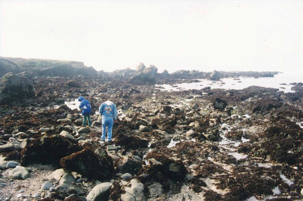
FORT BRAGG — Harbor seals stretch out on the Pacific Ocean rocks, flapping their flippers only occasionally as the sun warms them. Nearby, a mother and daughter move gently around tidepools, quietly and respectfully examining the small sea life. A few surfers ride the modest waves, and a couple on horseback mosey along one of many trails. On a grassy headland, a lone painter gazes seaward and brushes her canvas.
The excitement level is low at MacKerricher State Park, but for its blubbery, offshore residents and the many humans who visit, that makes it highly satisfying.
“There are so many different things to do,” said Mark Hoffmann when asked what is the park’s best feature. The ranger paused a moment before deciding the answer is “just R&R. Scenic beauty and relaxation.”
The slow pace and low-tech character of MacKerricher contrast with the increasingly commercial feel of Fort Bragg, a few miles to the south, and touristy Mendocino, 8 miles farther down the coast. It is also a place for drivers to rest their weary arms and shoulders after negotiating the region’s curvy roads. Being an unhurried five hours’ drive from Sacramento, the park also can be timed as a picnic spot.
Tucked between Highway l and the ocean, MacKerricher is a slender 8 miles long. On the south end are rocky bluffs, giving way northward to gentler slopes and tidepools, and stretching on with an uninterrupted, dune-bedecked beach of some 4 miles. Near MacKerricher’s center are Lake Cleone and 143 nicely arranged campsites that are very popular in the summertime.
Cleone, which is defined by park publicity as Greek for “gracio us,” is a small body of water circled by a trail that takes no more than a half-hour to complete. Portions are on a boardwalk that is handicap-accessible. The lake is stocked with trout in April, May and June, Hoffmann said, and only nonmotorized boats are allowed, helping to maintain the park’s peaceful nature.
Many visitors are drawn to MacKerricher by whale-watching. The season runs roughly from December through March, and there are a few free, naturalist-led “Whale Walk” tours remaining this season — all departing on Sundays from the visitors center, at 10 a.m. on Feb. 14 and 21, and March 7, 21 and 28. You don’t need to register, but be sure to bring binoculars and appropriate clothing.
There are no guarantees, of course, that you will spot any of the blue, humpback or gray whales that tend to pass by on their journey between the arctic north and tropical south. However, “I’ve seen them every time I’ve been out there,” said Hoffman, who admitted there can be a lull in whale passings in February.
A likely place from which to spot whales is the Laguna Point platform. In late January, the wooden deck also served as a vantage point to the harbor seal colony, its members sunning themselves about 100 yards offshore. In addition to its many benches from which people scan the seas and breathe the salty air, the platform contains two interpretive signs that each has a reproduction of aquatic-themed paintings by Erica L. Fielder. They are a nice touch at a special spot.
Branching off from the boardwalk that leads out to Laguna Point from a parking lot is a log- and sand-structured stairway down to a tidepool area. There are also interpretive signs that point out, among other things, that the San Andreas fault runs parallel to the shore, about 10 miles from land. Those who wish to examine tidepools are told to look for California mussels, gooseneck barnacles, shore crabs, bat stars, surf grass, hermit crabs and black turban snails.
A sign between the tidepools and the Laguna Point platform reports that Coast Yuki and Pomo Indians have harvested seafood from the area for more than 2,000 years. That practice continues today, monitored by the state Department of Park and Recreation to ensure sea-life population levels remain robust. The Indians’ diet has included sea flowers toasted on sticks and octopus tentacles baked in earth ovens.
Diving for abalone joins surfing as an offshore activity for MacKerricher visitors, though swimming is discouraged, ranger Hoffmann said. One land-based exercise option that many local residents take advantage of is the so-called Haul Road, a rail bed and later truck path that was abandoned for commercial use in the late 1960s and now serves as a walking, biking and horse-riding path. It extends the length of the park and boasts great views of the ocean. Be advised that any bicyclist under age 18 is required to wear a helmet.
In late January, only a dozen of the campsites were available for use. By April, Hoffmann said, all four of the park’s campgrounds are fully open, and remain so through mid-October and then again, typica lly, for a Thanksgiving rush. Sites cost $16 per night, though there are added charges for extra vehicles ($5 apiece) and dogs ($1 apiece). There are no hookups for recreational vehicles; hot showers can be bought for a few quarters. Reservations can be made for April 1 through Oct. 11, with a fee of $7.50 per order, by calling (800) 444-7275. There are 10 walk-in campsites.
For more information about MacKerricher State Park, call (707) 964-9112 or visit the Web site (www.mcn.org/1/macpark/mspl. htm), from which you can download park and campsite maps.
AT A GLANCE
Directions: To best avoid Bay Area traffic, take Interstate 5 north to Williams, Highway 20 west past the Clear Lake region to Highway 101 north, then tum left in Willits for the final 35 miles over the Coast Mountain range on curvy Highway 20 to Fort Bragg. Tum north on Highway 1, pass through the town’s main commercial area, then look for the MacKerricher State Park entrance a mile or two north of Fort Bragg, on the left. This route from Sacramento is almost 200 miles.
Climate: During the winter months, highs typically are in the 50s, and lows around 40 degrees Fahrenheit. “And there’s no fog,” pointed out ranger Mark Hoffmann, who says the park gets “swamped” with Central Valley visitors in the summertime, when MacKerricher’s high temperature rarely reaches 80 degrees.
Lodging: In addition to the park’s 143 campsites, there are several campgrounds outside the park, and a growing number of hotels and motels in and around Fort Bragg. Contact the Fort Bragg-Mendocino Coast Chamber of Commerce for more information: P.O. Box 1141, Fort Bragg, CA 95437; (800) 726-2780 or (707) 961-6300; Web site www.mendocinocoast.com ore mail chamber@mcn.org .
SIDEBAR
FORT BRAGG — Whales and skunks are the strange pairing that stars in the local tourist industry.
The annual Whale Festival, a joint venture of the Fort Bragg and Mendocino communities, is held annually in late winter. As the world’s largest mammals swim by offshore, rising, dipping and spurting to the onlookers’ delight, a different sort of wet adventure entertains festivalgoers on dry land: wine tasting in Mendocino, and beer tasting in Fort Bragg.
March also marks the beginning of the Skunk Train season. The half- and full-day excursions between Fort Bragg and Willits continue through December, sometimes offering special services and entertainment that complement local festivals and national holidays.
This year’s Mendocino Whale Festival is the weekend of March 6-7. In addition to wine tasting Saturday and Sunday afternoons, there will be chowder tasting, music, marine art exhibits, lighthouse tours, wooden boat display s, a benefit barbecue and Local Licks Live Concert. The Fort Bragg Whale Festival, two weekends later on the 20th and 21st, includes beer and chowder tastings, a 5K and 1OK walk/run on Saturday morning, a classic car show, lighthouse tours, arts and crafts fair, music and Portuguese fish and Mexican dinners.
For more information on the whale festivities, contact the Fort Bragg-Mendocino Coast Chamber of Commerce, whose street address, phone numbers and Internet access are given in the “if you go” glance box accompanying the MacKerricher State Park story.
For more information about California Western Railroad’s Skunk Train, which was founded in 1885 and today costs riders $14 to $100 — the latter for riding with the engineer — call (800) 777-5865, the Fort Bragg Depot at (707) 964-6371 or the Willits Depot at (707) 459-5248; or visit the rail line’s Web site (www.skunktrain.com).
HALIFAX, Nova Scotia — Most victims of one of the world’s worst maritime disasters were on land.
On Dec. 6, 1917, in Halifax Harbor, a munitions supply ship collided with another vessel and caught fire. The burning Mont Blanc drifted toward shore.
At 9:04 a.m. it exploded, destroying 1,600 buildings and damaging 10,000 others. More than 2,000 people died, and more than 9,000 were injured.
The “Halifax Explosion” is chronicled at the Maritime Museum of the Atlantic, a waterfront building that also features displays of other sea disasters, ship technology and the marine history of Canada’s Atlantic provinces.
The museum, which charges no admission, is at the base of the hilly central business district. A few miles to the north, past a bridge that connects Halifax with its twin city, Dartmouth, the harbor constricts to what is called The Narrows — where the explosion occurred.
Loaded with 26,000 tons of gasoline and explosives, the Mont Blanc was making its way from New York to war-torn Europe. It collided with The Imo, headed for New York to load relief supplies for Belgium.
Jack Tappen, 19, was nearby on the Middleham Castle steamship in Halifax Harbor. He was helping lower a large, cast-iron pipe into the engine room when his labors were interrupted by a commotion outside. A museum plaque picks up Tappen’s story.
“At the cry, ‘Two ships just collided off us! 1 there was a rush to the deck. Jack had a ringside seat. He saw the crew of Mont Blanc leave in their lifeboats, the smoke and fire going higher, the burning ship drifting ever closer to shore and bursts of flame shooting up through the black smoke.
“Then, suddenly, he was blown back through an open door behind him, landing on some fellow workers. He was lucky. Others crashed against the steel bulkhead and were killed instantly.
“He and two companions made their way to the raft, floating between the ship and the deck, and hauled out many of the men struggling in the water.
“When they got ashore, they found flattened buildings all around, many on fire. They made their way through ruined streets, rescuing people from wrecked and burning buildings and pulling bodies from the destroyed Richmond Printing Works.
“He later returned to work at the dock and found bodies still lying around. Huge boulders had landed on the deck of the badly damaged Middleham Castle.”
Tappen lived to see the museum exhibit open in the 1980s. So did another survivor, who was literally buried under her family’s flattened house.
Annie Liggins was 18 months old that late-autumn morning. She was living with her mother and brother on Barrington Street, a block from the harbor. Her father was in the armed forces, helping fight World War I in France.
The explosion leveled their home. The next day, after a snowy night, Annie was found in the rubble, under a stove ash pan.
She was cold, hungry and covered in soot, but otherwise was fine. Her mother and brother were dead.
Among the other fatalities were 88 students of a neighborhood Protestant school. Classes were to begin that morning at 9:30, which meant many of the children were killed at home or on their way to school.
Fewer people died in an earlier Nova Scotian maritime disaster, but as described by one of the museum’s displays, it was comparably dramatic. On April Fool’s Day 1873, the S.S. Atlantic crashed against rocks off Mosher Island, near the town of Lower Prospect.
“The heroic efforts of members of the crew, aided by men and women of Lower Prospect, saved 371 of the 933 passengers and crew,” a plaque reads. “Those who perished included all the women, married couples and every child but one.”
A museum worker bristled at my suggestion that S.S. Atlantic crew members might not have done much to save their passengers. “Have you ever been on a rowboat in 40-foot seas?” he demanded, huffing at my quickly apologetic, submissive expression.
Landlubbers be forewarned.
HALIFAX — IF YOU GO
Where it is: Located on the eastern coast, Nova Scotia’s largest city is served by many airlines. It is approximately 500 miles by automobile from Bangor, Maine.
What to see: In addition to the Maritime Museum of the Atlantic, the Halifax Citadel National Historic Park and Art Gallery of Nova Scotia are worth visiting.
Shopping: Halifax has a high concentration of quality used-book stores. There are scores of other downtown shops and restaurants, many of which are accessible via a fully enclosed “pedway” (a series of above-street corridors that resembles the Minneapolis skyway system) that runs between the city’s two ritziest hotels, the Sheraton Halifax and Chateaux Halifax.
More information: Contact Tourism Halifax, Visitor Information Center, Duke and Barrington Streets, P.O. Box 1749, Halifax, Nova Scotia B3J 3A5.
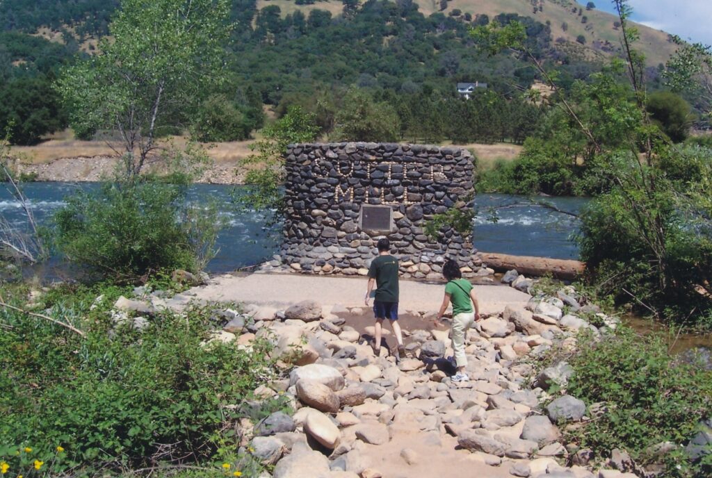
COLOMA, Calif.– California’s Gold Rush, in some ways the 19th century’s equivalent of last decade’s dot.com boom, was launched courtesy of a modest construction project in the foothills 45 miles east of Sacramento.
Thirty-seven-year-old James W. Marshall, who had partnered with Sacramento founder John A. Sutter to establish a lumber business in Coloma, was inspecting progress on the sawmill’s tailrace (which carries water away from the mill) when he saw golden specks in the riverbed. They turned out to be pure gold. Although this was not the first time gold had been discovered in California, something about this particular find triggered a mass migration not just from the eastern United States, but from other parts of the world as well.
Marshall Gold Discovery State Historic Park, created in 1942, celebrates the milestone event of Jan. 24, 1848, and its explosive aftermath. Once visitors arrive via curvy, rural roads to this tiny community, they encounter a valley that pretty effectively takes them back in time to Coloma’s heyday. The park, surrounded by gentle hills, is mostly on the west side of Main Street, which on its east side is lined with Old West themed buildings such as a gun shop, blacksmith’s shop and country store.
Attractions within the park are scattered about the valley within easy walking distance of each other via a series of short, level hiking paths. The Gold Discovery Loop Trail passes a sawmill replica on it way down to the shores of the south fork of the American River, where Marshall made his discovery. Although to be fair, it should be pointed out that American Indian laborers who were creating the tailrace were as much responsible for the gold sighting as Marshall was.
In any event, an interpretive sign marks the spot. ‘”Here on a chilly morning in January 1848, carpenter James Marshall picked up the small pieces of gold that touched off one of the largest, most frenzied mass migrations in history,” it reads. ‘”Within a year of Marshall’s discovery, six thousand gold seekers swarmed over the western slope of the Sierra Nevada. Thousands more who followed completely changed what had been a quiet, remote Mexican province.”
The reference to Mexico is interesting in light of the fact Coloma and its surrounding territory were not part of the United States until nine days after Marshall’s discovery. The land was granted by Mexico as part of the treaty that ended the Mexican American War.
Monument Trail leads to, not surprisingly, the James Marshall Monument. Erected in 1890, it was California’s first state historic monument. The trail also passes by Marshall’s Cabin, where he lived during a briefly prosperous time in the 1860s as a wine grower. The gold discovery had not, alas, made Marshall rich. Before he died at age 75 in 1885, he owned and operated a blacksmith shop and a few small gold mines and reportedly fought a losing battle with the bottle.
Also on the grounds is a recently updated visitors center. Nearby jails ruins will appeal to children who might otherwise be bored by the low-tech scene. The ruins include a metal prisoner cage from the old county courthouse in nearby Placerville. For a while after its rise to fame, Coloma served as the seat of El Dorado County.
Before Marshall’s discovery, Nisenan and Miwok people had inhabited the region for centuries. Their diet included acorns, which they ground in hollowed-out holes in bedrock. You can find a few of those holes in the park today. In the aftermath of Marshall’s find, many Chinese crossed the Pacific Ocean in hopes of striking it rich in California, and they were the last prospectors left in Coloma by the early 1950s. That quickly, the community had resumed its quiet, agriculture-based existence.
These days, thousands of California students are bused to the park each school year for a little on-site historical instruction. Many Sacramentans and other California Central Valley residents drive to Coloma in the summer for the clean air and to get tiny relief from three-digit heat; in the winter, they come to escape the Central Valley’s fog.
Coloma’s a pleasant place to have a picnic and a leisurely half-day stroll. It’ s also a place to reflect on one of the most significant events in our nation’s history.
“If gold had not been discovered, California’s climate, resources and location might have been ignored for another generation or two,” a park brochure explains. “There would have been little interest in building a transcontinental railroad to bind the nation together. The United States treasury might not have been adequate to finance the Civil War. More importantly, without Marshall’s momentous discovery, a more gradual influx of ‘foreigners’ to the U.S. might have been quietly absorbed into California’s Spanish/Mexican cattle- and agriculture-based community.”
Marshall Gold Discovery State Historic Park is open daily from 8 a.m. to sunset; museum hours are 10 a.m. to 4:30 p.m. (closed Mondays from July 1 through February). For more information: (530) 622-3470, www.parks.ca.gov (the state’s site) or www.marshallgold.org (the Gold Discovery Park Association).
Coming events in the area include “Christmas in Coloma” from 10 a.m. to 4 p.m. on Dec. 10. Mrs. Claus and her jolly husband will be on hand for activities and events that include 19th century children’s games, historic trade demonstrations and strolling musicians. “Gold Discovery Day,” on Jan. 20, 2007, commemorates the 159th anniversary of Marshall’s gold discovery. Tours, historic demonstrations and speeches will be given throughout the day.
Sidebar:
If you find yourself in need of accommodations after a visit to Marshall Gold Discovery State Historic Park and are interested in keeping with a 19th century theme, consider staying at the Red Castle Historic Lodgings in Nevada City, a charming Gold Country town 45 miles north of Coloma.
The bed-and-breakfast, a state historic landmark, is situated atop a hill that overlooks the town. Constructed in 1857, the Gothic-revival mansion is meticulously furnished in a Victorian style. My wife, who is very interested in such things, was impressed with the elaborate window treatments and era-appropriate rugs and furnishing. We both loved the spectacular full breakfast.
For more information about the inn: (800) 761-4766 or www.historic-Iod gings.com.
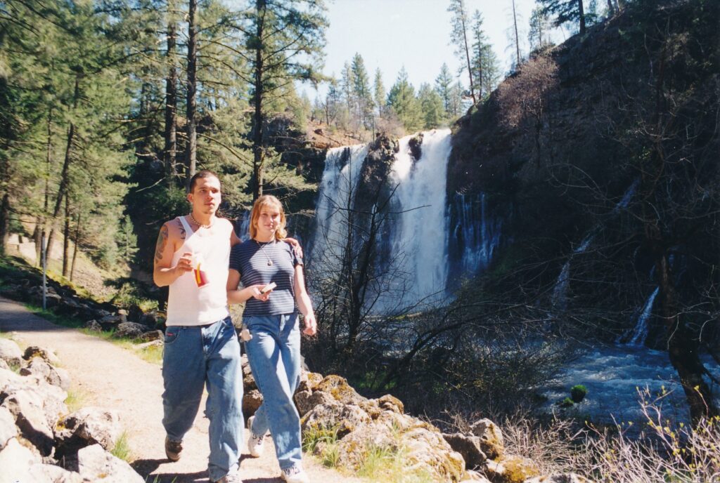
BURNEY — Sightseeing, hiking, camping, fishing, boating… McArthur-Burney Falls Memorial State Park is packed with possibilities — overflowing with them, actually, thanks to the waterfall that is its centerpiece.
Which brings us to the phrase that seemingly must be included in any travel story about this Northern California destination: So captivating is its 129-foot cascade that one of the nation’s most important figures in land conservation, President Theodore Roosevelt, called it “the eighth wonder of the world.”
Not so fast, says Shirley Plumhof. The friendly senior park aide, now working her 14th season at McArthur-Burney, upon learning I was a travel writer quickly pointed out Roosevelt never bestowed that compliment “Everyone gets that wrong,” she told me, producing an information sheet by local historian Thelma Shiplet on which the “true” facts of the matter flow freely.
Roosevelt, in a book, referred to the waterfall simply as a “wonder,” Shiplet scooped. Any talk of “the eighth wonder of the world” is hyperbolic fabrication. Blame the media in general, if you must, but don’t blame Plumhof, Shiplet or The Bee.
McArthur-Burney, about 65 miles northeast of Redding, is one of the state system’s oldest parks, having been established in the early 1920s. Since the Depression-era Civilian Conservation Corps built a viewing platform, forged trails and established campsites, it has been a popular tourist destination. From Memorial Day weekend through Labor Day, it is especially crowded.
“This is real destination camping,’ Plumhof said. “Lots of people come up from the Bay Area and stay a long time.” To claim one of the 128 campsites during summer months, she said, “You absolutely need reservations.”
Happily, you do not need to pitch a tent and stay overnight to enjoy the falls. The observation platform that overlooks the falling water is a 2-minute stroll from the parking lot and is wheelchair-accessible. The 1 million gallons of water that topple daily over the broad cliff produce a soothing roar and, for those who continue down to the falls’ base, lots of cooling mist.
The 1.2-mile loop trail that stems from the main platform allows hikers several perspectives, including of Burney Creek both above and below the falls. Along the gently sloping path are interpretive signs that explain the area’s plant and animal life, as well as its geological history.
One rather striking bit of information to be learned is the falls once were more than a mile downstream. A process of ”horizontal erosion,” by which the sediment below water kept breaking up and causing the falls to retreat, has occurred within the past 3 million years. Today that process continues, as the “nose” earth that prominently divides the falls eventually will crumble and washaway, backing up the cascade a few more feet.
The falls’ retreat is evident in the talus slope downstream. Piles of rock go uphill from the creek and trail several dozen feet. At one time, they formed the stream bed, but due to the basalt lava’s porous nature and winter temperatures that froze and expanded the water trapped within, the stream bed broke up. Eventually, with the help of roots, insects and bacteria, the rocks will become soil.
Burney Creek and falls are within the Cascade Mountains, one of the Earth’s newer formations at some 20 million years old. Lava, according to a trail sign, once flowed “like fudge” through the region.
Most prominent among trees here is the ponderosa pine, whose cones are scattered throughout the park. Black and white oaks, the latter producing acorns that Indians ground into flour, also are numerous. The area’s earliest known residents, the Tlmawi tribe, may have dug out canoes from the incense cedars that also grow in the area.
Other plants visible along the path include green leaf manzanita, whose bitter fruit is treasured by bears; flowering currant, whose black berries also are edible; mountain misery, a ground cover also known as bear mat or bear clover; and vine maple, whose leaves turn yellow and red in the fall.
Black bears still inhabit the area, though the most visible creature is the far-less-imposing squirrel. Other mammals include chipmunks, deer, muskrats and raccoons. Black swift are the predominant bird — park aide Plumhof compared their annual spring arrival with the swallows’ appearance at San Juan Capistrano. Bald eagles, merganser ducks, Oregon juncos and stellar’s jays also fly about the park.
If you plan to take the loop trail, be advised there is a crucial turn that is not especially well-marked. A few hundred yards past the waterfalls’ base, downstream, is a wooden bridge that must be crossed to continue with the trail. I missed it the first time and ended up walking another 10 minutes to Lake Britton. It was a pleasant enough stroll, as the receding falls and rushing creek noises gave way to birds’ chirping, but the extra walk put me out of the loop, so to speak.
McArthur-Burney Falls Memorial State Park is open year-round, as indeed all seasons seem to have an appeal. When I visited on a warm, sunny day in late April, Plumhof shepherded me into the office headquarters so I could see photographs of snowy scenes at the park. To borrow again from Teddy Roosevelt, they showed a wintry “wonder” land quality.
The average high and low temperatures in December are 42 and 23 degrees Fahrenheit. August is the hottest month, when those average temperatures are 87 and 45; in April they are 61 and 32, in October 68 and 33. Most precipitation occurs November through March, when monthly totals typically are 3.5 to 5 inches.
From May 1 to Sept. 30, campsite fees are $14 to $16 and may be reserved by calling the statewide system at (800) 444-7275. Day use of the park is $5 per vehicle, or $4 if the visitors are senior citizens. Dogs are an additional $1, must be kept on a leash and are not allowed on the trails.
Those visitors who like to fish can catch up to two trout per day from Burney Creek. Downstream, at Lake Britton (created by a dam), is a boat launch; dock rental is posted as $8 per day, or $48 per week. During the peak season, motorized boats are rented from $15 for one hour to $70 for eight hours, and canoes can be rented from $10 to $45. Sand is trucked into the park to create a swimming beach near the boat launch.
For more information about McArthur-Burney Falls Memorial State Park: (530) 335- 2777.
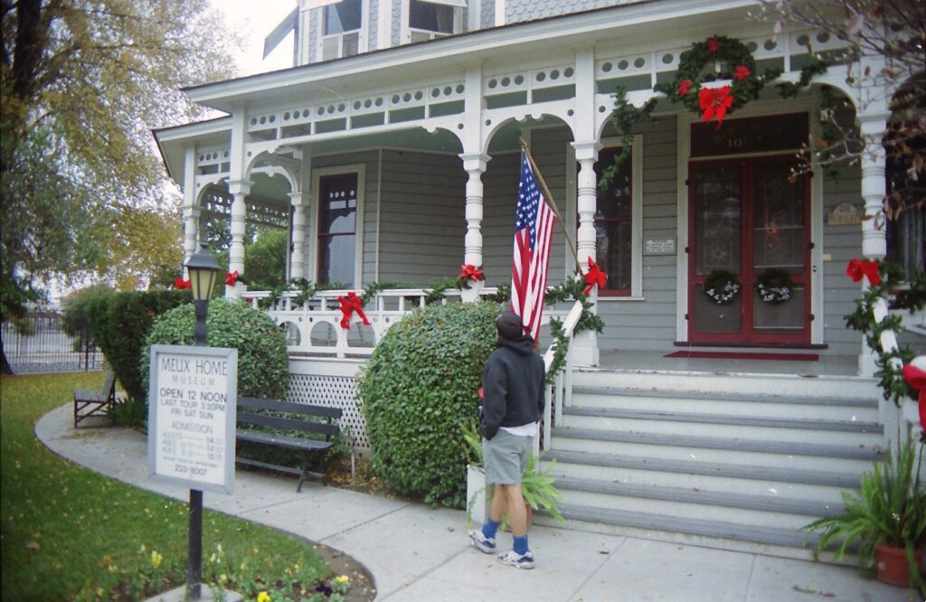
FRESNO — As we prepare to carry increasingly high-tech gadgets and gizmos into our 21st century households — caller-IDs and HDTVs, pets with implanted computer chips and keyboards that respond to verbal quips — some of us are tempted to seek out a simpler place. Where life is dominated by unhurried musings and uncomplicated physicality, rather than by satellites and megabytes.
Such a place can be found in downtown Fresno. The Meux Home, a carefully restored 19th century Victorian, allows visitors to walk through and get a grip on the past — sometimes literally.
Meux Home is one of the few cultural charms in a sprawling Central Valley city that few would dare call a tourist attraction. Many people who have not been to Fresno figure it is a flat, dusty, boring place. Many people who have been to Fresno can confirm that speculation. But there are interesting things to see, including the Meux Home and the Fresno Metropolitan Museum.
At the museum, for example, tribute is paid to a native who once bragged he was the greatest writer not just in Fresno, but in the world. And he possessed a Pulitzer and Oscar to support his claim. But more on Mr. Modest later. First, let’s get back to that simpler place.
Dr. Thomas R. Meux, who as an assistant surgeon for the Confederacy confronted head-on the carnage at Shiloh, Atlanta and other Civil War battles, decided in the 1880s to move from Tennessee to California in order to establish a comfortable residence for his three children and their ailing mother. The resulting Victorian structure, which at $12,000 cost several thousand dollars’ more than the nearby courthouse built a year earlier, was completed in 1889. It remained in the Meux (pronounced mee-yooks) family for 81 years.
In 1973, Fresno’s City Council approved purchase of the house, and a thorough restoration project was undertaken. Placed on the National Register of Historic Places in 1975, the Meux Home now is open for guided tours from noon to 3:30 p.m. Fridays through Sundays.
Docents in period costumes usher guests through first- and second-floor rooms, pointing out various furnishings — as well as gadgets and gizmos — typical of a household that flourished the last time calendars clicked over from ’99 to ’00. Docents even allow some of the items to be held, such as a phonograph player’s music cylinder, circa. 1881, and a photo-card holder that many baby boomers’ parents and grandparents used to see 3-D images when they themselves were children.
In the kitchen, members of my little tour group were encouraged to hold clothes irons that were set on the stove. “Wow! These are really heavy!” said a grade-school girl. Indeed they are. A washboard for clothes-washing, 3-foot rug-beater with wooden handle, hand-pumped vacuum cleaner and large tongs for stocking the icebox also attest to a time when servants’ lives were muscle-intensive.
The homeowners might have had bulging bank accounts but buffed-up servants surely would have won any tug of war.
In the dining room — where the Meux children were admitted only for Sunday meals, during which they were not supposed to speak — can be found another of domestic history’s artifacts: a knife holder. Translucent and cylindrical, with knobs on each end, the small, glass object served as a place to rest dirty knives beside dinner plates.
Among other decidedly low-tech items within the Meux Home are display cases of human hair, hanging in the reception room; a butter-maker and cherry-pitter in the kitchen; a cloth medicine bag, hanging off Dr. Meux’s bed frame; and a chamber pot in the servants’ quarters. The library has a Victorian courting couch, which once upon an innocent time served as a three-place setting where an older relative would sit firmly between the two lovebirds, preventing any racy touching of hoop skirts and woolen trousers.
From the day after Thanksgiving through December, the house is decorated with Christmas trees in almost every room. During my visit in late November, the docent explained that in tum-of-the-century America, unwrapped presents indicated they were from Santa Claus. And in the Meux household, the first child to detect a hanging pickle ornament on the main Christmas tree would be entitled to receive an extra gift.
Another nostalgic tale concerned Anne Meux, who lived in the house from its completion in 1889 to her death, at age 85, in 1970. As a girl, the docent explained, Anne would tie a string to her toe before going to sleep Saturday nights in her second-floor room. The string would extend across the floor to and out of the window, dangling down to the sidewalk. At 6 a.m. Sundays, a friend would pull on the string to awaken Anne, so she could go horseback-riding without the doorbell disturbing her parents.
Little Anne also enjoyed sliding down the banister, catapulting the last portion onto a feather mattress at the foot of the stairs.
During Anne Meux’s long tenure in her family’s home, another Fresnoan was striking out for the big time, and achieving success in literature and Hollywood. William Saroyan’s life is recounted in a major permanent exhibit in the Fresno Metropolitan Museum, housed in what used to be the Fresno Bee’s offices, also downtown.
Saroyan (1908-1981) burst onto the literary scene in 1934, with the publication of his critically acclaimed short story, “The Daring Young Man on the Flying Trapeze.” His play from 1939,
“The Time of Your Life,” won the Pulitzer Prize and was made into a movie starring James Cagney and William Bendix. His screenplay for “The Human Factor,” which featured Mickey Rooney and Frank Morgan, won an Academy Award in 1943.
Saroyan had a way with words, without question. The museum has some of his flashier comments posted, such as:
- “When I left Fresno in 1929 my idea was never to go back. That was a good idea until I discovered that New York was Fresno all over again.”
- “A man himself is junk and all his life he clutters the earth with it…… He lives in it. He worships it. He collects it and stands guard over it.” And, putting himself at the head of a rather distinguished class:
- “There is no other writing anywhere in this living world that is better than mine.”
Through May 31, 1999, the Fresno Metropolitan Museum also features “Harley-Davidson: An American Legend.” The exhibit tells how Milwaukee buddies William “Bill” Harley and Arthur Davidson, in1901, decided to make a motorized cycle, and how that partnership Jed to immense success and enduring fame. Six motorcycles are displayed, including a 1917 model with a V twin motor.
Among the museum’s other special exhibits planned for 1999 are “Where Adventures in Flight Take Off,” from Jan. 27 to May 31; “Sherlock Holmes and the Clocktower Mystery,” June 16 to Sept. 12; and “Reflections in a Looking Glass: A Lewis Carroll Centenary Exhibition,” Sept. 27 to Nov. 21
.
AT A GLANCE
Directions: From Sacramento, take Highway 99 south to the Fresno Street exit. Go east. For the Meux Horne, continue past Van Ness Avenue and the railroad tracks; turn right on R street. The house is at the corner of R and Tulare streets. For the Fresno Metropolitan Museum, turn left on Van Ness. The museum is at No. 1555.
Hours: Meux Home tours are offered from noon to 3:30 p.m. Fridays through Sundays; no reservations are required. The Fresno Metropolitan Museum is open from 11 a.m. to 5 p.m. Tuesdays through Sundays, except New Year’s, Easter, July Fourth, Labor Day Thanksgiving and Christmas.
Admission: Tours of the Meux House cost $5 per person. The Fresno Metropolitan Museum charges $5 for adults and $4 for seniors 62 and older, full-time students and children ages 3 to 12; those age 2 and under are admitted at no charge.
For more information: Call the Meux Home at (209) 233-8007. Call the Fresno Metropolitan Museum at (209) 441-1444.
Winter doesn’t get no respect. Especially in Minnesota, where the double “negatives” of cold and snow provide more fun than frustration. Only an absence of mountains keeps the North Star State from being the perfect place to chill out.
The hot spots for travelling between November and April are, traditionally, the hot spots: Florida, the Caribbean, Mexico, Hawaii. Visions of scant bathing suits on white beaches and thoughts of cool, fruity drinks in bars crowded with tropical plants are appealing to bone-chilled commuters.
How quickly they forget those stifling, sweaty summer days of a few months back. And how blindly they fail to contemplate the hot misery of a few months hence. Even those who plan ski trips are more likely to dwell on fireside camaraderie in lodges rather than on activities in the less-cozy outdoors.
Nature serves up four distinct, wondrous seasons. Why does winter get the short shrift?
Loved ones may laugh when you propose or announce a wintertime visit to Minnesota. They’re likely to consider just the cold facts: the average temperature on a January day in Minneapolis-St. Paul is 12.2 degrees Fahrenheit (the average low temperature that month is four below); 46.3 inches of snow fall during a typical winter. But don’t let their lack of adventurous spirit deter you. In this case, to go against the mindset of the general public is to go with the flow of nature.
Minnesotans are prepared to show you a good time. To many of them, winter is not a season to survive. It is a season to be felt, to be seen, to be enjoyed.
“We don’t hide from winter. We celebrate it,” said Jean Otteson of the Greater Minneapolis Convention & Visitors Association. “People create and build things for the people who live here. We aren’t stupid people.”
And they’re neither afraid nor idle when it’s cold. There are countless opportunities for outdoor activities in wintertime Minnesota, many of which can be experienced in the easily accessible Twin Cities.
The metro area’s headliner cold-weather attraction is the annual St. Paul Winter Carnival, running from Jan. 24 to Feb. 4. It consists of more than 100 events, including an ice-carving contest, softball games on ice, golf in the snow, car races across frozen lakes and, finally, a torchlight parade and fireworks. Featured in the coming festival will be an attempt to build the world’s biggest snowman, planned to stand 80 feet tall in front of the State Capitol.
Reigning over the festival are King Boreas and Queen of the Snows, whose joint coronation on Jan. 26 can be witnessed for $40. A royal feast is included. During the 12-day celebration, visitors can receive up to $4,000 for finding the king’s hidden medallion. Clues concerning its whereabouts are published daily in the St. Paul Pioneer Press Dispatch.
The festival’s worst enemy is warm weather. Last year, the temperature reached a record 48 degrees two days after the ice-carving contest, rendering many of the sculptures milky and mushy. By the eve of the Torchlight Parade, however, the mercury had fallen to an accommodating 24 below zero, and the wind chill index froze at minus 65. The Pioneer Press Dispatch understated: “Bundle up for 2nd to last treasure clue.”
Last year’s master of ceremonies for the Torchlight Parade was Willard Scott, a network TV weatherman who must have known what he was getting himself into. It was 6 below zero at parade time. The 1990 parade master probably won’t notice the chi11. “Peanuts” cartoonist Charles Schulz is, after all, a Twin Cities native.
More information about the festival may be obtained from the St. Paul Convention and Visitors Bureau, (800) 328-8322.
If you’d like to participate in as well as observe wintertime in Minnesota, a good place to start would be the Wirth Theo recreation area in the western suburbs. Ice skating, tubing, sliding, cross-country skiing, downhill skiing, and even ski jumping facilities are provided. A set of skis, boots and poles rents for $6-$7, with a $2 fee added for use of the rope tow. The three lighted cross-country trails are rated beginning, intermediate and expert. The downhill portion challenges only novices.
Wirth Theo is located in Golden Valley, at the intersection of Glenwood Parkway and Plymouth Avenue N orth. Hours are 4 p.m. to 9 p.m. Monday through Friday, 10 a.m. to 9 p.m. Saturday and 10 a.m. to 6 p.m. Sunday. For more information, call the Minneapolis Parks and Recreation Board at (612) 348-2226.
Two Minneapolis golf courses are used for cross-country skiing during winter weekends from 10 a.m. to 6 p.m. Columbia (33rd Street and Central Avenue Northeast) has a 2-kilometer beginners’ trail, and Hiawatha (46th Street and Longfellow Avenue South) has a 2.5-kilometer course that has portions rated intermediate.
Fort Snelling State Park, adjacent to the international airport at the merger of the Minnesota and Mississippi rivers, offers weekend programs throughout the winter. Mark Cleveland, the resident naturalist, conducts workshops on cold-weather equipment and leads visitors on hikes. Usually, there is no charge. The park also features ice fishing on Snelling Lake, 18 miles of cross-country trails and a warming house on Picnic Island. Details about Cleveland’s programs and other Fort Snelling activities may be obtained by phoning (612) 727-1961.
Farther up the Mississippi River, past the I-94 bridge and University of Minnesota, is another opportunity for winter frollicking, with downtown Minneapolis the backdrop. Free carriage and hay rides take bundled-up sightseers and romantics across Riverplace and Nicollet Island. Hay rides are conducted Saturday afternoons, while carriage rides are given Friday and Saturday evenings and Sunday afternoons, all through December. Rides depart from St. Anthony Main and last about 20 minutes.
Even the hardiest tourist will want to go inside now and then, and for that Minneapolis-St. Paul obliges on a grand scale. Most striking are the skyway systems that link buildings within the two downtown areas. In central Minneapolis, 15 miles of clean, heated walkways connect 42 buildings and parking lots. The system runs 10 blocks north-south and six blocks east-west, providing direct access to about 300 retail businesses, including dozens of fine restaurants. Minneapolitans are proud to point out that Saks Fifth Avenue has just arrived in the downtown shopping district, and a Nieman-Marcus store is soon to appear.
Culture can be found in the Twin Cities’ many theaters, of which there are more per capita than in any American city other than New York. The critically acclaimed Guthrie Theater, just west of downtown across from Loring Park, is presenting “A Christmas Carol” from Thanksgiving to New Year’s Eve, and “Candide” from Jan. 19 to Feb. 25. Tickets are $6 to $32 and may be ordered by calling (612) 377-2224.
For those daring enough to venture from Minneapolis-St. Paul, “outstate” Minnesota offers many head-on confrontations with winter. Three hours north of the Twin Cities is the Taconite State Trail, which boasts more than 1,000 miles of connecting loops and spurs for snowmobiles. It extends 170 miles from Grand Rapids to Ely and allows snowmobilers to zip unhindered through nature or veer off to the many adjoining towns and establishments. Snowmobiles can be rented at Hilltop Sports (218-697-8188) in Hill City for $75 a day.
Downhill skiing is Minnesota is hardly worth mentioning, but rewarding cross-country opportunities exist throughout the state. There’s plenty of snow, lots of hills, and more than 12,000 lakes to admire in their frozen beauty. In fact, skiers may want to carry a pick and pole for a bit of ice fishing, which is especially popular at Mille Lacs Lake, north of Minneapolis-St. Paul by 100 miles.
Mille Lacs Lake also hosts the annual National UpSki Race, held in February as part of the Mille Lacs Crystal Carnival. Upskiers are propelled by colorful canopies over frozen lakes. Training for this new sport is available at Mille Lacs and at Lake Minnetonka, in the western suburbs of Minneapolis. Half-day lessons cost $37.50, and canopies can be rented for $42.50 per full day. UpSki Minnesota, (612) 722-9428, has more information.
Multi-day outings can be arranged through a number of adventure-trip companies. Participants usually are given the choice of tent or indoor lodging between bouts of cross-country skiing, dog sledding, ice fishing, snowmobiling and snowshoeing. Prices range from $15 to $500 per day. Adventure-trip companies include:
- Boundary Country Trekking, (800) 322-8327
- Snow Trails, (218) 663-7530
- Venture Out (women only), (612) 591-1909
- Wild Wings Outfitters, (218) 993-2451
- Wintergreen Treks, (218)365-6022
- Woodswoman, (612) 822-3809
To obtain free guides on cross-country and snowmobiling in Minnesota, call Minnesota Travel Publications at (800) 657-3700.
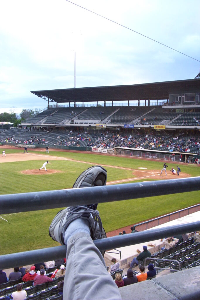
COLORADO SPRINGS, Colo. – “Oh, that’s a bad bird,” said the baseball promotions guy during yet another between-half-innings contest. A middle-age woman was running around with a small wire basket, trying to catch a rubber chicken improperly launched with surgical tubing from atop the home team’s dugout. Foul territory, indeed.
Another ersatz entrée took faux flight.
“Ooh, that’s a good bird!” the PR guy enthused into his microphone. Alas, another crash landing ensued. No matter – the clucky contestant received a coupon for free buffalo wings at a neighborhood eatery.
Welcome to the goofiness of minor-league baseball. On this chilly Sunday afternoon in mid-May, the Sacramento River Cats were visiting the Sky Sox in a setting that lacks the pretensions of major-league baseball stadiums perhaps epitomized by San Francisco’s Pacific Bell Park. It also lacks the outrageous ticket prices; general admission entry to Sky Sox home games is $4.
Sacramento’s Raley Field has oddball promotional contests and reasonable prices, too, but seeing the River Cats there is old hat for many of us. As a change of pace and way to see parts of two countries, how about tracking down our young heroes on their summer travels? Following is a list of the team’s road foes, how to find out more about them, when the games are scheduled and what else there is to do in or near the host cities.
Calgary (Alberta, Canada) Cannons: (403) 284-1111 or www.calgarycannons.com. Someone’s bound to have a blast when the Cannons host Sacramento July 27-30. Three of the showdowns start at 7:05 p.m.; the July 28 is at 1:35 p.m. Outside the ballpark: Banff is beautiful, and it’s not too far away. It’s not too close, either, but as long as you’ve come this far …
Edmonton (Alberta, Canada) Trappers: (780) 414-4450 or http://trappersbaseball.com. Go north, young Cats and their fans, go north – on Aug. 1-4, the first three games at 7:05 p.m., the last at 1:35 p.m. Outside the ballpark: I hear the zoo is nice.
Fresno Grizzlies: (559) 442-1994 or www.fresnogrizzlies.com. Head down Highway 99 to see the River Cats at 7:05 p.m. June 1, 2:05 p.m. June 2, 7:05 p.m. June 3 and 12:05 p.m. June 4. Sacramento also visits July 11-14, the first three games at 7:15 p.m. and the last at 6:35 p.m. Outside the ballpark: Learn more about native author William Saroyan at the Fresno Metropolitan Museum.
Las Vegas (Nevada) 51s: (702) 386-7200 or www.lv51.com. Take a break from casino life to see the visiting Cats at 7 p.m. June 14, 6 p.m. June 15 (doubleheader) or 2:30 p.m. June 16. Sacramento returns Aug. 30-Sept. 2. Three of those late-season games start at 7 p.m.; the Sept. 1 starting time is 2:30 p.m. Outside the ballpark: Get married, divorced, rich or broke. Anything’s possible, if not always palatable.
Portland (Oregon) Beavers: (503) 553-5400 or http://portlandbeavers.com. Dam, what a nickname. Sacramento will play here June 26-29, all games at 7:05 p.m. Outside the ballpark: Relax your body in Washington Park or broaden your mind at the Portland Art Museum.
Salt Lake Stingers: (801) 485-3800 or www.stingersbaseball.com. The Kings eliminated the Utah Jazz, so why shouldn’t the Cats claw the Stingers? Sacramento’s baseball team comes calling Aug. 13-16, all games at 7 p.m. Outside the ballpark: Want to learn more about Mormonism? Just say the word, or visit the downtown tabernacle.
Tacoma (Washington) Rainiers: (253) 752-7707 or http://tacomarainiers.com. Barring rain-outs, the Cats will play here June 30-July 3, the first game at 4:05 p.m., the rest at 7:05 p.m. Outside the ballpark: You’re so close to Seattle, you might as well head up there and have a cuppa in Pioneer Place Park.
Tucson (Arizona) Sidewinders: (520) 434-1021 or www.tucsonsidewinders.com. The weather, if not necessarily the competition, is bound to be hot when the Cats come calling June 10-13 and July 23-26, all games at 7 p.m. Outside the ballpark: Don’t miss Tucson Mountain Park, and don’t forget to wear a broad-brimmed hat and sunscreen, either.
If traveling to see the Sacramento River Cats doesn’t quench your minor-league baseball thirst, you can drown in the West region’s other possibilities. Consider that:
- California also has the Bakersfield Blaze, High Desert Mavericks, Lake Elsinore Storm, Lancaster Jet Hawks, Modesto Athletics, Rancho Cucamonga Quakes, San Bernardino Stampede, San Jose Giants, Stockton Ports and Visalia Oaks.
- Idaho has the Boise Hawks and Idaho Falls Padres.
- Montana has the Billings Mustangs, Great Falls Dodgers and Missoula Osprey.
- Oregon has the Eugene Emeralds and Salem-Kaizer Volcanoes.
- Utah has the Ogden Raptors and Provo Angels.
- Washington has the Everett AquaSox, Spokane Indians, Tri-City Dust Devils and Yakima Bears.
- Wyoming has the Casper Rockies.
A handy first source for information about all the teams mentioned above, but not to be trusted for game times (for those, visit the individual teams’ Web sites), is www.minorleaguebaseball.com.
Remember, if major-leaguers go on strike as they are threatening to do, minor-league ball might be it. That was the case in 1994, the first year since 1904 without a World Series. Think about that the next time you look up and see a rubber chicken.
VALLECITO — Try this riddle: On a cold, wet winter’s day, there is a nearby place that is comparatively warm and dry. On a hot, dry summer’s day, it is comparatively cool and moist. It’s in neither a building nor any other artificial environment. On the surface, it sounds too good to be true.
But it’s not on the surface. What, then, is it?
Getting to the bottom of this riddle requires some deep thinking, but not in the brain-strain sense. Just think 105 miles southeast of Sacramento, 61 degrees Fahrenheit year round, and 160 feet below the surface.
Think Moaning Cavern, one of a modest number of underground passages in Northern California that are accessible to non-cavers — including to those who might guess that “spelunker” describes someone who dunks a donut into coffee.
Moaning Cavern Park is operated by Caverns of California, which also oversees (so to speak) California Caverns in Cave City and Boyden Cavern in Kings Canyon National Park. Only Moaning Cavern is open year-round, including holidays. And for anyone who has never visited a major cave, its features and size are a stunning introduction.
On the Friday afternoon I visited, a dozen or so students fortuitously showed up at the same time, giving guide Dave Roser an attentive and impressionable group to lead down into the cavern. He also had a captive group when, on a rock ledge those 160 feet below the surface, he turned off the lights and there was only blackness.
“There are only two places in the world where there is complete darkness,” he told the suddenly agitated visitors. “On the bottom of oceans, and in caves.”
At least in Moaning Cavern, unlike some caves with small rooms and narrow passages, there is room to stretch in the darkness. One of the park’s public relations battle cries is that the Statue of Liberty can fit in the cave’s main chamber. Roser amended that claim by saying the iron lady would have to be upside-down, her torch shoved below the rocky platform on which we stood.
Most of Roser’s presentation, which along with negotiating the 470 (round trip) steps took about 45 minutes, was made with the caverns ‘electric lights on. To illuminate some of his points, however, they were switched off
Holding a candle, he explained that such a small source of light can be quite helpful once the human eye completely adapts, usually after 20 minutes in such an inky place. Using a flashlight, he entertained the group by pointing out various stalactites, stalagmites and other calcite formations whose shapes suggest things found above-ground. Among them are a melting ice cream cone, elephant, tiger, walrus, mushroom patch (a.k.a. chocolate cupcakes, Roser said) and — the guide’s favorite — a screaming skull. There also are shapes reminiscent of Santa Claus, E.T. and a couple of dark characters from the “Star Wars” series, Darth Vader and Jabba the Hutt.
By the way, if you have trouble remembering the difference between stalactites and stalagmites, Roser offered this suggestion: the former name contains a letter “c,” as in the ceiling from where it grows down, and the latter has a “g,” as in the ground from which it rises. Both stalactites and stalagmites advance at the rate of an inch every 100 to 500 years, he said.
Whereas the cavern’s main chamber is now a place of wonder for tourists, it once was a deadly trap. In the mid-19th century, when prospectors inspected the cave in a fruitless search for gold, they came upon a pile of bones that Roser said was more than 10 feet high. Apparently, it resulted from people and animals falling down a hole up at ground level. Their bodies would strike a few rocks near the chute-like top before accelerating through the chamber’s 16-story depth, crashing only a few feet from what is now the observation ledge. (The pile has been removed, and fragments are displayed in a glass case in the gift shop.) Bones from an estimated 100 to 125 people have been found in Moaning Cavern, Roser said.
The cave’s name, he explained, stems from days gone by, when a moaning sound above ground could be heard from as far as a quarter-mile. Rainwater falling through the chamber would strike water-filled holes — their openings the size of dollar coins, perhaps — scattered over a bumpy but somewhat-level calcite formation also near the observation ledge. The echoing plop, or plunk, noise would escape up through the chamber and ground-level gap, emerging as a moan.
Now, however, the gift shop rests atop that hole, and a 100-foot spiral staircase that was installed in 1922 further squelches those once-moaning acoustics.
Informative, imaginative and — when all sources of light were extinguished — scary, Roser’s tour also benefited from his good humor. Pointing to a wall that loomed out over the observation ledge, he said its rather large cracks “were a bit bigger than they were this morning.”
Not to worry. “There’s a new insurance policy here at the cavern,” he told the group. “It’s through Prudential. So if that wall falls down, we’ll all be covered by a piece of the rock.”
And for just a moment, Moaning Cavern became a groaning cavern.
Those who are interested in a more-interactive exploration of Moaning Cavern can pay $35 to rappel from the hole at the gift shop down through the main chamber. All equipment and instruction are provided; no experience is necessary. For $75, visitors can take the three-hour Adventure Tour into deeper and unlighted parts of the cave structure. Reservations are required for the Adventure Tour.
The main chamber walking tour, which I took, costs $7.75 for adults, $4 for children and is offered daily, upon demand, even if the demand consists of just one visitor.
California Caverns, also in Calaveras County, about a 40-minutes’ drive from Moaning Cavern, contains miles of paths and several deep lakes. That water, which Moaning Cavern does not contain in such significant amount, causes passageways to flood during the rainy season. Boyden Cavern, about two hours east of Fresno, is closed from November through April because of cold-weather road conditions.
For more information about any of the three Caverns of California, call (209) 736-2708 or visit the Web site (www.caverntours.com).
BAKER — Overshadowed by Death Valley National Park to the north and Joshua Tree National Park to the south, nothing more than a passing fancy to most drivers on the two interstates that sandwich it, Mojave National Preserve is a tranquil place.
On a midweek morning in March, two of the preserve’s premier hiking trails were traipsed only by me. They and a guided tour of Mitchell Caverns made for a full and at times pleasurably lonely day in the National Park Service’s second-largest property (behind Death Valley).
Mitchell Caverns, overseen by the California park system since 1956, is arguably the preserve’s top attraction. Guided visitors have access to two caves, “El Pakiva” (devil’s house) and “Tecopa” (the name of a Shoshone Indian chief), that are connected by a man-made tunnel. The caverns’ limestone formations are billed as being rather unusual and the object of scientific studies.
Anyone who has been in a Gold Country cave, such as Moaning Cavern near Angels Camp, will notice a difference upon entering Mitchell Caverns. These Southern California caves are what some would call “dead,” meaning stalactites, stalagmites and such no longer are being formed. The Mitchell caves feel dry and dusty, though a little water drips through after rain and snowstorms.
Marianne Shuster, the state parks ranger who guided 20 of us through the 105-minute tour, used words such as “dormant” to describe the caverns. After all, she said, who can say for certain what will happen 100 or more years from now in this vast, dark place.
The dark aspect was illustrated, as it has been in all cave tours I’ve taken, by at some point the guide’s turning off the lights for a minute or two. We all managed not to panic, at least not outwardly. Shuster also followed the cave-tours formula by offering a mental aid for discriminating between a stalactite and a stalagmite: The former, which has a “c,” hangs from the ceiling, while the latter, which has a “g,” rises from the ground.
Shuster began the tour by talking for 15 minutes about the caverns’ first owner and promoter, Jack Mitchell. Starting in the early 1930s, he did some prospecting in the area and, along with his wife, ran a B&B-like operation for years. During World War II, when some 10,000 of Gen. George S. Patton’s troops trained in the adjacent valley, Mitchell led soldiers on desert hikes up to the hillside caverns, Shuster said.
What with our guide’s detailed descriptions of the caves’ formation and exploration/exploitation history, our walk to and entry into the caverns took another 30 minutes. We spent an hour inside, where the temperature varied within the 60s and our path was widely paved and never strenuous.
I had more exercise earlier in the day with the two outdoor hikes. Teutonia Peak Trail, 15 miles or so directly north of Mitchell Caverns but 82 miles away via paved roads, starts with a flat stroll through a Joshua tree forest. Reaching the peak requires a 700-foot climb and rewards hikers with awesome views of the sprawling landscape and, to the east, Cima Dome.
A trailhead sign explains that Joshua trees are of the lily family of plants and produce cream-colored flowers “every few springs.” Living in and around the trees are ladder-backed woodpeckers; desert night lizards, which actually are diurnal, at nighttime hiding from snakes and owls; wood rats; Scott’s orioles, which are black with yellow under parts; yucca moths, which pollinate the trees; yucca boring weevils; termites; and night snakes, also known as spotted night snakes. The trail is four miles round trip and should take 90 minutes to two hours.
Much more taxing is the Kelso Dunes trail, a few miles directly west of Mitchell Caverns and 55 miles away via paved roads. After a quarter-mile formal beginning, the trail becomes a free-lance affair over sandy terrain sprinkled with hardy small plants. I attempted a left-side ascent of the largest dune and came up a hundred feet short; reduced to slip-sliding on all fours and breathing heavier than an overweight marathoner, I vowed to try again some other spring.
Details of the area again are offered by a trailside sign: Kelso Dunes rise 600 feet off the valley floor and cover 45 square miles. They were created some 25,000 years ago by winds that swept over a sand field known as Devil’s Playground. Hiking to the tallest dune and back — coming down is a snap, with somersaults a temptation — probably would take a fit person two hours, and a really determined one an hour more.
Mojave National Preserve is between Interstates 15 and 10, from Baker east to the Nevada border. Mitchell Caverns tours cost $4 general and $2 for ages 6 through 16, and are offered at 1:30 p.m. daily and also at 10 a.m. and 3 p.m. weekends. For more information: (760) 928-2586.
DENVER — Scott Nelson’s delivery was lightning-fast when he conducted a tour of the Molly Brown House on a sunny afternoon in early June. He had no choice, really, because Brown’s life was so astonishingly active that a slow approach would have missed the boat.
Yes, this was the same woman whose survival of the 1912 Titanic disaster inspired “The Unsinkable Molly Brown,” still an often-staged musical. Regarding the 1964 film version, with Debbie Reynolds in the title role, Nelson commented, “That movie, though highly entertaining, was not based on any facts or research.”
The one-hour tour, therefore, was partly an exercise in setting the record straight. On the home’s spacious front porch, machine-tongue Nelson spewed rapid-fire facts such as: Molly grew up poor, but not dirt poor. Despite assumptions otherwise, Molly was comparatively well-educated, having completed eighth grade in an era when topping out at fourth grade was the norm. Molly mastered five languages and dabbled in at least three others. And during her lifetime, she was never called “Molly.”
Margaret “Maggie” Tobin was born in 1867 in Hannibal, Mo., and died 65 years later of a cerebral hemorrhage in New York City. Her middle years were spent largely in Colorado, first in the mountain town of Leadville and by century’s end in the 7,600- square-foot mansion at 1340 Pennsylvania Ave. (now Pennsylvania Street), three blocks east of the Capitol and near downtown. Tours of the historic home, designed by renowned architect William Lang, are conducted daily and represent one of Denver’s most civilized tourist attractions.
At age 18, Maggie Brown came out West to visit her brother in Leadville and in 1886 married James J. Brown, 13 years her senior. “I loved Jim, but he was poor,” Maggie later said. “Finally, I decided that I’d be better off with a poor man whom I loved than with a wealthy one whose money had attracted me.” Ultimately, she didn’t have to settle for just one or the other, as by 1893 he was a millionaire thanks to the gold and copper extracted from his Little Jonny Mine.
In 1894, the Browns bought the Denver mansion — whose influences were Classic Queen Anne, Richardsonian Romanesque and refined neoclassical, according to the attraction’s website — for $30,000. According to Nelson, it was a rather small residence compared with some of the other homes on Quality Hill (now referred to as Capitol Hill), which had one of the highest concentrations of wealth in the country. However, the home was technologically advanced for its day, boasting electricity, central heating and four rooms with plumbing.
Maggie Brown owned the house until her death in 1932, but by the early 1900s was traveling a lot. She and J.J. were apart much of the time (they separated in 1909 but were good friends by the time he died in 1922) and their two children were in boarding schools; eventually the house was rented to families for long stretches, and she would sleep in the landmark Brown Palace Hotel when she was in town. The home’s 35-year restoration project, which Nelson says is 90 percent complete, largely has been based on interior photographs taken at the time of a huge garden party Brown threw in 1910.
Nelson used plastic-covered copies of those pictures to show how today’s rooms resemble the way there were 96 years ago.
The entry is a real eye-opener, with its handsome wooden staircase leading upstairs and dark, highly detailed, original wallpaper from about 1890. Nelson pointed to an 1895 telephone and a push-button-lighting panel from 1907 Cit was very unusual for its time,” the guide said). Then we entered the front parlor, whose lavish decorations include a polar-bear hide on the floor and a symphonium that plays short tunes by reading metal discs that look to be 30 inches in diameter. “Kids on the tour get it when I tell them it was Maggie Brown’s CD player,” said Nelson, who as we gawked at the room’s visual busy-ness added, “In 1910, you could try, but you sure could not overdecorate a room.”
After peeking at the library and back parlor, we spent a few minutes admiring the dining room. Its ceiling has been intricately painted to appear as it did in Brown’s day, when the design inspired diners to fancy they were looking up at an arboretum’s roof Below, three original tapestries (actually two — Brown had one cut down the middle so its two halves could sandwich a piece of furniture) and what Nelson called a “remarkable” silver punch bowl are among the restored mansion’s collection of 40 percent original artifacts.
As we walked up the stairs, I asked our guide if Brown was considered in her day to be an attractive woman. “She was handsome,” Nelson said, adding that her strong features and 5-foot-8, big-boned frame contributed more to her imposing presence than to her beauty. The second-floor landing proved to be a stunning sight of a different sort, with its windows that look down onto Pennsylvania Street and in late afternoon transform sunlight into rainbow patterns on the floor.
All four bedrooms are on the second floor. Brown’s is heavy on green, her favorite color, and has three large south-side windows that afforded her views of Pikes Peak, a famously distinctive 14,110-foot mountain more than 60 miles down the Rocky Mountains’ front range, near Colorado Springs. Son Lawrence’s room is decorated “in the spirit of Leadville,” Nelson explained, because pictures of it were not taken when the rest of the house was photographed in 1910. In the hallway, a framed inventory of Brown’s insurance claim from the Titanic lists a $20,000 necklace.
Rich and already famous for her extensive charitable work and spirited parties, Brown booked the voyage rather last-minute, having cut short a tour of Europe to return to the States to see her ailing grandson. On board, she mingled with high-society friends Jacob and Madeline Astor, and with a famous partner in her fund-raising efforts, Benjamin Guggenheim. Of those four people, only Brown survived the calamity that claimed more than 1,500 lives.
According to Nelson, Brown was the only passenger on board who tried to help other passengers get on lifeboats. She herself was unceremoniously dropped four feet onto Lifeboat No. 6, as it was being lowered, by insistent crewmen. “Very few people roughed up Maggie Brown in 1912,” Nelson mused. The lifeboat, designed for a capacity of 65, tragically contained only 21 women, two men and a 12-year-old boy. Brown helped row from the quickly sinking ocean liner, and after several hours was rescued by the Carpathia.
By the time the Carpathia reached New York and was greeted by 30,000 people, Brown had cajoled its first-class passengers into contributing $10,000 to Titanic survivors and their families. (For years afterward, she was president of the Titanic survivors committee.) When reporters asked how she had managed to stay alive, she told them, to the future delight of librettists and screenwriters, “Typical Brown luck. We’re unsinkable.”
Brown’s life continued its eventful course when, in 1914, she unsuccessfully sought election to the U.S. Senate. During World War I she raised money to rebuild French houses, schools and libraries destroyed near the front and assisted with distribution of food and clothing to victims of the carnage. For those efforts, she was awarded the French Legion of Honor. For the last three years of her life, she toured worldwide in “L’Aiglon,” winning praise for her acting.
Her two children sold the Denver mansion for $6,000. Before it was rescued for $80,000 in the early 1970s, it served as a gentlemen’s boardinghouse, a home for wayward girls and an apartment house. Now, an estimated 40,000 people a year get to see its restored beauty and learn the truth about an eternally buoyant spirit.
Tours of the Molly Brown House are given every half-hour from 10 a.m. until 3:30 p.m. Mondays through Saturdays during the summer, Tuesdays through Saturdays from Sept. 1 until May 31. Sunday’s tours run from noon to 3:30 p.m. The facility includes a well-stocked gift shop and a small museum that, through this summer, is celebrating the 1920s. (Did you know that the term “flapper” stems from young women of the time wearing unfastened boots whose buckles flapped when the women walked?) For more information about the Molly Brown House: (303) 832-4092 or www.mollybrown.org.
The sky was uniformly blue, the sun was warming, the ocean breeze was invigorating and the humpbacks put on a frolicking good show. All in all, it was a whale of an afternoon.
And yet, my thoughts kept migrating toward vague feelings of guilt. Do whale-watching excursions, which operate year-round off California and many of the world’s other coastlines, harm these magnificent creatures?
I pondered that question throughout the three-hour outing, operated by Monterey Whale Watching off Old Fisherman’s Wharf. About 40 of us rode the waves out across Monterey Bay, where after an hour we came upon the telltale spouting of three or four humpbacks, a breed that passes by May through November. (Gray whales appear from December through April.) I’m happy to report that only once did I hear a passenger yelp, “Free Willy!”
Although the tour is billed as “narrated, ” I found it difficult to understand the few words that came through the outdoor speakers. The visuals were what really mattered, however, and we got plenty of those during the next 45 minutes as we bobbed about near the giant mammals.
To watch their progress — their sleek backs gliding gently up and down on the sea’s choppy surface, their tails dramatically pointing skyward as the animals dived — was a sublime and memorable experience.
There’s something about seeing creatures in their natural habitats, as opposed to in zoos, that inspires a sort of awestruck humbleness.
But still, for me there was that nagging feeling of guilt. Was I participating in a destructive act? Time to cast about for some expert opinion, I decided.
“Whale watching can be harmful to whales, dolphins and other marine animals if it is not carried out responsibly, ” said Elizabeth Griffin, a marine wildlife scientist for the environmental advocacy group Oceana. “This includes approaching too closely or doing anything that causes them to alter their normal diving, breathing, foraging or mating behaviors.”
How close is too close? The three people I contacted all mentioned that the Marine Mammal Protection Act prohibits harassment of the whales and asks that boats stay at least 100 yards from the whales.
“Responsible captains will avoid chasing a whale at high speed or approaching it too closely,” said Vicki Cornish, vice president of marine wildlife conservation for the Ocean Conservancy, another environmental organization. “Care should be taken not to encircle or trap whales between vessels, or to separate moms from calves.”
I cannot say this for certain, but it appeared as though the boat I took came within 100 yards of the humpbacks, at least for a few minutes. That might have been accidental, but then again, the home page of Monterey Whale Watching’s Web site has a picture of the company’s 75-foot Pacific Explorer (the boat I rode on) literally hovering over a whale.
“In some areas private individuals in boats may not be as careful about encroaching on whales,” admitted Jim Covel, senior manager of guest experience training and interpretation at the nearby Monterey Bay Aquarium. However, “most commercial operators are conscientious about observing that stand-off distance.”
The Coast Guard cannot keep close tabs on the whale-watching industry, which is vast and growing. Fortunately, Cornish pointed out, self-policing plays a role.
“Peer pressure from other whale-watch captains will prevent any one captain from harassing whales, ” she said.
Smooth migrations, free of hassles and disruptions, mean a lot to whales. As Covel explained, grays have to conserve a limited “fuel supply” for their trips between Alaska and Mexico, and humpbacks and blues “fuel up” by feeding along the California coast. He drew parallels between the watched and the watchers.
“So while we humans are now realizing that we have to be very careful with how we use our limited energy resources, many animals in nature — including whales — have been working on tight energy budgets for a long time, ” Covel said.
“With global climate change and its effects on the oceans, we may be creating much larger challenges for whales in the future.”
Indeed, for whales to survive and thrive, it is helpful for humankind to have an awareness of their migratory patterns and an empathy for their struggles. Whale-watching excursions, done with proper respect and at least a little audible narration, can be educational. As I heard more from the experts, the tide of my guilt began to retreat.
“For the most part, whale watching is a way of connecting people with the ocean in ways that otherwise would not occur,” said Ocean Conservancy’s Cornish. “The sight of a whale breaching at the surface is a sight few ever forget. Instilling an appreciation of the ocean and its rarely seen inhabitants has the potential to turn whale watchers into lifelong ocean lovers.”
Cornish also mentioned the industry’s positive economic impact.
“Whale-watching operations can be extremely beneficial to coastal communities, especially as fisheries collapse and fishermen must find alternative work,” she said. “Most fishermen would prefer to stay working on the water whenever possible.”
In the United States, according to Oceana’s Griffin, whale watching generates more than $1 billion.
“The industry also gives an economic incentive to protect marine mammals from threats such as whaling, commercial fishing ‘by-catch,’ and pollution,” she said.
Positive environmental impacts of whale watching can be both short- and long-term, Covell said, thanks to conscientious captains and onboard naturalists.
“Many make a point out of scooping up floating trash they might encounter as a way of promoting stewardship of the seas,” he said. “Many collect valuable observations that are shared with local scientists who study marine mammals.”
So, all in all, guilt doesn’t have to be the catch of the day when you go whale watching. Just remember that although you probably will see whales and, as I did, other creatures such as otters and sea lions, nothing is guaranteed. Nature is not a Swiss timepiece.
As Griffin says, “Responsible tour operators understand that whales are wild animals and that the point of whale-watching tours is to observe marine mammals in their natural state, which may require some patience and understanding from tourists.”
IF YOU GO
Interested in taking a whale-watching trip that gives special emphasis to environmental concerns? Marine wildlife scientist Elizabeth Griffin of Oceana recommends Baja Expeditions, south of the border (www.bajaex.com).
Closer to home, about 200 miles from Sacramento in Monterey, you can choose from among three tourist boats, all of whose offices can be found on the Old Fisherman’s Wharf. Expect to pay about $15 per hour for the outings.
CAMP VERDE, Ariz. — Sunshine brightly defined the 700-year-old castle on the cliff Below, a steady stream of people moved by on a paved path, gazing up at the five-story structure, many expressing wonder at what it would be like to reside in such a place.
“My wife asked me how they could stand living in a cliff,” a cheerful man of retirement age said to a small group gathered around an interpretive sign before Montezuma Castle. “I told her they didn’t mind the climb, because it got them away from all the to tourists.”
The threat of invading tribes with weapons — not tourists with video cameras –was among the reasons Sinagua Indians built the pueblo “high-rise” around 1300. Why they had left by 1450 is a mystery. Their cliff home has endured for centuries, though, and is one of the best-preserved of such sites to be found in the Southwestern United States.
Montezuma Castle National Monument, about 50 miles south of Flagstaff, Ariz., and 90 miles north of Phoenix, near Interstate 17, was visited by more than 850,000 people in 1998. The cliff structure and Montezuma Well, 11 miles to the northeast in a detached section of the monument, constitute a leisurely day trip that is informative and provides light exercise at an elevation — 3,200 feet — a fraction cooler than the lower Sonoran Desert.
The one-third-mile path that goes past the castle begins right outside the visitors center, which contains display cases and a gift shop. Alongside the trail, which is mostly wheelchair-accessible, are signs that describe the castle, the Sinaguan culture and the native plants and animals. Plenty of steel benches provide opportunities for rest and reflection.
One of the first things to be learned on the self-guided tour is that Montezuma Castle was so-named because of the mistaken belief it was built for the Aztec warrior, who in fact never ventured that far north. Sinaguans came to the area in roughly A D. 1100, perhaps having left what is now Flagstaff due to overpopulation. Beaver Creek and the limestone cliff teamed to make the new site a fertile and secure place to settle down.
The castle — visible within a few minutes on the trail — was constructed in six phases, ending with the three-story tower in the center foreground. An estimated 35 Indians lived within the castle’s 20 rooms. Ninety percent of today’s structure is original, according to U.S. Forest Service literature, with the 10 percent restoration work having most recently included a replastering of the tower and exterior wall to its right. At some point, floors were paved, said ranger Thea Cohen, to accommodate those who climbed about the structure before public access was cut off in 1951.
Farther down the trail are remains of what used to be a larger cliff structure, known now as “Castle A.” Some 100 Sinaguans occupied it until fire destroyed most of its interior features in the 1400s. Today, bits of collapsed walls and a partially reconstructed foundation are all that can be seen.
Casting big shadows over the Castle A viewing area are Arizona sycamores, which in the Sinaguans’ time were a source for posts and construction beams. Among the many other trees and plants that served vital purposes in the community were:
- Arizona walnut trees, which provided shade and whose nuts were eaten by the Sinaguans and used for medicinal purposes.
- Banana yucca, whose leaf fibers were woven into baskets, mats, ropes and sandals. The plant’s sharp tips, with threads attached, were nature’s convenient sewing kit.
- Catclaw acacia, whose beans were ground to prepare “pinole” cakes. Its wood was used to make tools and utensils, and as fuel.
- Velvet mesquite, whose beans also were ground for pinole. Sap from the plant yielded candy, black dye and adhesive for pottery repairs. The inner bark was woven into baskets or brewed to make tea.
- Western soapberry, a source of clothes soap that still is used for laundry in Mexico.
Past Castle A, at the oval-shaped trail’s far side, is Beaver Creek. Ancient farmers — including those who came before the Sinaguans — dug ditches from the stream to nourish fields of beans, com, cotton and squash. Indians also hunted animals that were drawn to the water. Today, critters that frequent the area include beavers, jackrabbits, mule and whitetail deer, muskrats and skunks. I believe I saw a bobcat up on a cliff ledge just below the castle; ranger Cohen said other visitors reported similar sightings.
Birdwatchers don’t need to be told to bring binoculars to Montezuma Castle National Monument. They can spot canyon wrens year-round, cliff-side swallows and their nests on the limestone rock face during springtime, and, potentially, eagles. The visitors center has a list of 33 birds that are common to the surrounding Verde Valley. Binoculars also allow closer inspection of the castle, its doorways and support beams sticking out above each floor.
Near trail’s end is a glass-enclosed miniature of the castle as it may have appeared in its heyday. Small figurines include an elderly man atop the fifth floor acting as a lookout, a young mother chasing her toddler and a young man preparing to make fire with a friction drill. Not far from the displays, a trailside sign ponders:
“The Sinaguan people who made their homes here may have been a closely knit community of family and friends. Even though the trappings of civilization change over time, people’s social needs don’t. Take a moment to imagine busy villagers doing their daily chores, perhaps chatting about the weather, crops, an upcoming hunt or a recent death in the community.”
Why did the Sinaguan (which in Spanish means “without water”) Indians desert Montezuma Castle and Well five and a half centuries ago? Possible explanations include disease, drought, invasion, internal strife or a breakup of trade networks. “I suspect it was overpopulation, and the game became scarce,” said Jim Gracom, a volunteer ranger over at the well.
Circular in slope and more than 350 feet across, Montezuma Well contains water that is 55 feet deep and usually right at 76 degrees Fahrenheit. Inside its cliff-side frame are two examples of one-room structures built by Indians. Just outside the rim are scattered remains of pueblos, one of which contained as many as 30 rooms.
Visitors who trek down roughly 100 stone steps can, near the well water’s outlet or “swallet,” look a few feet over a rail at 800-year-old pueblo ruins. The multiple-room structure, of which only stone-wall portions remain, is a cool-air place tucked under the cliff overhang and behind a row of high vegetation. Parts of the ceiling are black, an interpretive sign says, as a result of the Sinaguan occupants’ indoor fires.
As at Montezuma Castle, the well features a short, paved trail, though this one begins with a comparatively steep ascent to the rim.
“It’s such an exciting thing to walk over the hill and see the well,” said Brenda Jobe, who that day was in the visitors shack with fellow volunteer ranger Gracom. “It just blows your mind when you look at it.”
If your trip to Montezuma Castle and Well includes a picnic, best have it at the latter’s park, which is a half-mile before the visitors shack (which is where the trail begins). The park has more than a dozen picnic tables, lots of shade and clean restrooms. Also there are ruins of a 1,000-year-old canal that was carved by Indians from the well to irrigate their crops. Not quite as inviting are a dozen picnic tables outside the much-busier castle visitors center.
A final note: There are 14 Indian tribes now recognized in Arizona, living on 20 reservations that constitute 27 percent of all state land, and they speak four languages. No separate Sinaguan tribe exists anymore, as its people have been integrated into other groups.
IF YOU GO
Directions to the castle: From Phoenix, go north on Interstate 17 to exit 287 or 289, and follow signs to the parking area. From Flagstaff, go south on I-17 to exit 289.
Directions to the well: If coming from Phoenix or the castle, go north on I-17 to exit 293, and follow signs to the parking area. From Flagstaff, take exit 298 and follow signs.
Hours: Open every day of the year, from 8 a.m. to 7 p.m. in the summer and from 8 a.m. to 5 p.m. the rest of the year. At the castle, tour buses tend to arrive between 10 a.m. and 1 p.m., so to avoid the resulting crowds, plan accordingly.
Cost: General admission to the monument is $2 per person. Available are $50 Golden Eagle Passes, which allow unlimited visits to all national parks and monuments for the 12 months after purchase. Seniors ages 62 and older may buy a Golden Age Lifetime Passport for $10.
For more information: Write to Camp Verde, AZ 86322; call (520) 567-3322; or visit the Web site (www.nps.gov/moca/).
ALTADENA — Sixty years ago, it was one of the area’s premier tourist attractions. Today, it is a long strip of dirt leading to busted concrete and a few pieces of twisted metal.
The Mount Lowe Railway, also known as the Alpine Division trolley, thrilled visitors for more than 40 years with a spectacular ride up the San Gabriel Mountains to a recreational lodge. A fire in 1936 destroyed the Alpine Tavern lodge, and floods two years later doomed the railway.
Nature has had the right of way ever since. The railroad bed has become a wide, gently rising trail. Birds’ chirping and the crunch of hikers’ boots are the loudest sounds. Music and laughter from the tavern have been silenced forever, but what remains certainly has its charms.
One of Mount Lowe Railway Trail’s most appealing features is its proximity — about 40 miles from the South Bay. On a clear day, it boasts sweeping views of Pasadena and neighboring cities. On any day, it offers hikers a challenge in endurance.
The trail is 10 miles long, round trip, and ascends 2,700 feet. People who are in good shape can reach the top in two hours, but only if they are in a hurry. This is one “getaway” that will make your heart giddy-up.
For the first quarter-mile or so, hikers follow the paved Suns t Ridge Fire Road, which is closed to all motorized vehicles.
Along this stretch, to the left, is access to a half-mile side trail down to Millard Campground and Millard Falls.
After that first quarter-mile, hikers can veer left on Sunset Trail, which parallels the road for two miles. Ten minutes into it is an easy-to-miss right turn, just before a metal bridge over a small creek. Thirty minutes later is a concrete trough, across from which a wooden sign helps point the way.
Sunset Trail is the hike’s steepest portion, with several switchbacks. However, it allows a more intimate experience with nature than does the road. Lizards dash across the smaller path, while squirrels and other mammals scurry about on the periphery.
Back on the road, hikers within minutes encounter another side excursion, off to the right. Echo Mountain Trail retraces the old railway line from what used to be White City, a collection of hotels and shops that was wiped out by a fire in 1900 and is a ghost town today. This half-mile path sustained damage in the October 1993 Altadena firesand was closed temporarily; call (805) 574-5200 to check its status.
Beyond the Echo Mountain Trail turnoff, Sunset Ridge Fire Road retraces the old railway’s many turns as it climbs to the former site of Alpine Tavern. The longest of 114 straight segments was 225 feet, according to a trail sign.
Another sign, about 15 minutes beyond Echo Mountain Trail, relates an anecdote from the trolley’s heyday:
“Horseshoe Curve enabled the railway to gain the elevation necessary to climb out of Millard Canyon. Just beyond Horseshoe Curve was the steepest grade on the railway, 7 percent (a rise of seven feet on each 100 feet of travel). During this climb, conductors would often jokingly ask the happy passengers to lean forward in their seats to help the trolley climb the hill.”
Farther up was Circular Bridge, a portion of the railway that hovered nearly 1,000 feet above Las Flores Canyon. It and two other bridges were toppled in the 1938 flood and never were rebuilt. Today’s hikers can proceed without obstacles, however, on the dirt road.
Before reaching Alpine Tavern, trolleys passed through Granite Gate. During construction in the early 1890s, blasting through this large rock took eight months. Remnants from the railway still are visible: two pieces of metal protrude from one side. Twenty-five minutes’ walk beyond Granite Gate is the spot where Thaddeus Lowe originally wanted to build a small clubhouse for friends. On Dec. 14, 1895, his modest plan had terminated into the opening of Alpine Tavern.
The lodge contained “all the amenities of city living,” a trail sign reports, including a billiard room, circulating library, croquet and tennis courts, dance floor, souvenir shop and miniature golf course. Bungalows and tents were scattered nearby.
On Sept. 15, 1936, a fire leveled most of the lodge. All that survives are a few scraps of metal and a crumbling portion of the train platform. Contemporary visitors may contemplate the past while eating lunch on one of the site’s picnic tables.
During its 41-year existence, the lodge once was operated by Jared Sidney Torrance (1852-1921), who founded the South Bay city of his name. He also founded the Valley Hunt Club, a Pasadena high-society group that launched the Tournament of Roses Parade in 1890.
To return, hikers can stick exclusively to the road, or once again avoid a few miles of pavement by taking Sunset Trail.
Getting there: Take the Foothill Freeway(I-210) to Lake Avenue in Pasadena. Exit north to where Lake ends and Loma Alta Drive heads west. After one mile, turn right on Chaney Trail Road.
Proceed up the foothills to a “Y,” turn right and park. The trail starts beyond the locked gate.
KEYSTONE, S.D. – If the election season has you shaken and stirred, Mount Rushmore stands ready with presidential politics served on the rocks.
Behold the massive head sculptures of George Washington, Thomas Jefferson, Theodore Roosevelt and Abraham Lincoln, clustered in perhaps the most famous way imaginable. Steadily they gaze over the needle-pointed Black Hills of western South Dakota with their, well, fixed expressions.
Mount Rushmore National Memorial, in the heartland not quite halfway from West Coast to East Coast, was completed 75 years ago this fall. It is considered by many Americans to symbolize the heart of patriotism.
On warm summer evenings, visitors gather in an amphitheater below the carvings to honor our country. On their way there from the largely covered parking lot (which wintertime visitors no doubt appreciate), they pass through the well-conceived Avenue of Flags. All 50 states are represented.
It makes for a stirring approach.
At one point in the sundown ceremony, military veterans are called to the stage to share their name and branch of service. They stand proudly, and the crowd cheers.
What did those four presidents, whom my young daughter calls “the men on the mountain,” do to deserve such an honor? John Perkins of Indianapolis, who with wife Christine was visiting Mount Rushmore for the first time, had an answer when we spoke one weekday morning last month on the Grand View Terrace just behind the amphitheater.
The memorial, he said, “reminds us of our history and the importance of these specific presidents in our nation’s history. You know Washington got the formation of the country and he had to make the Constitution work. Jefferson opened up the West. Then you take Roosevelt, he was the man, his presidency changed the presidency from what it was before. And of course Lincoln, he’s the one that preserved the union.”
“You have a certain presidential passion about you,” I said. “Are you a teacher? What’s your interest in this?” Christine Perkins laughed, perhaps reacting to some inside-marriage awareness of John’s propensity to improvise so lucidly.
“No. I’m just very interested in the history of our country. As a citizen, I think this is an important thing for every American to know.”
Depending on the visitor, one’s first impression upon seeing the heads atop Mount Rushmore can range anywhere from awe to “how odd.” Each of us arrives with our own lineage, interest and historical knowledge. And much like the memorial’s ceremony that straddles the transition from day to night, any general account of Mount Rushmore should supplement bright praise with a nod to the site’s undeniably darker aspects.
Drill, baby, drill
Tom Brokaw, who was born in Webster, a small town in northeastern South Dakota, narrates a 14-minute introductory film that is shown throughout the day indoors, under the Grand View Terrace. He begins:
“It was, critics say, a preposterous idea. An outrage against South Dakota’s Black Hills. What arrogant stone carver could possibly improve upon God’s mountain sculpture? But as the faces of the great men sprang lifelike from the mountain, Rushmore simply overwhelmed its critics and dazzled the world. Just as the republican ideals and honor had inspired and dazzled mankind in 1776.”
Brokaw recounts that South Dakota state historian Doane Robinson is credited with spearheading the memorial in 1923, when he proposed that Black Hills spires be carved in likenesses of Lewis and Clark, Buffalo Bill Cody, Chief Red Cloud “or other Western heroes.”
The man who was hired to perform the work, then-60-year-old artist and sculptor Gutzon Borglum, thought the spires were too weathered, and instead sought a suitable cliffside. He rejected Robinson’s list of carving candidates.
“Borglum argued that a monument on this scale should represent our entire national experience,” Brokaw says. “His final concept would be a tribute to the founding, preservation, growth and development of the nation. These events would be symbolized by the images of four Americans who never lost sight of the simple idea that man has a right to be free, and to be happy.”
The mountain was dedicated for the project on Aug. 10, 1927. Newsreel footage shows President Calvin Coolidge handing a set of drill bits to Borglum. Fourteen years later, several months after Borglum’s death, his son Lincoln (now there’s a coincidence!) Borglum oversaw the work’s completion. The final drilling took place on Halloween 1941.
The carving process, detailed in the film and in a couple of on-site galleries, took six and a half years total as winter weather and funding hiccups idled the site for the balance of those 14 years. Hundreds of men, mostly locals, earned 30 cents to $1.50 per hour for their labors, much of which they performed in swing-set-like chairs that dangled over the mountaintop. They used dynamite to remove half a million tons of rock, which is haphazardly piled beneath the memorial.
How safe was that work? Allow me to quote from my tray table in Mount Rushmore’s cafeteria, once I set aside my plate of fried potatoes to read the script:
“The drillers had respirators, but they did not always wear them because they plugged up with dust. The workers did not have hard hats or steel-toed boots, and a wad of cotton was the best ear plug of the time. There were many bumps and bruises and some close calls, but no fatalities.”
That clean safety record is impressive. And the finished product is impressively popular, not just in classrooms where American history is taught, but also in popular culture (Alfred Hitchcock’s 1959 thriller, “North by Northwest,” rather absurdly climaxes there) and, of course, in tourism. According to the National Park Service, Mount Rushmore National Memorial drew 2.44 million visitors in 2015, ranking 36th in the NPS domain – one spot above Glacier National Park in Montana, and one behind Rock Creek Park. (I had not heard of that latter site; perhaps you have, if you have encountered it inside the Washington, D.C., beltway.)
The Brokaw-narrated visitors center film ends with soaring, upbeat verbiage. It lacks any hint of disapproval, but as old-time radio man Paul Harvey used to say, now for the rest of the story.
Stone-cold controversy
The Black Hills, a small mountain range that tops out at 7,242 feet, for thousands of years was home to American Indians. In 1868, the Fort Laramie Treaty between native peoples and the U.S. government (Gen. William Tecumseh Sherman was on the negotiating team) essentially promised that the Lakota Sioux would enjoy sole ownership of the Black Hills in perpetuity.
Perpetuity, in this case, lasted only a few years. Prospectors ignored any notion of Indian proprietary rights of the Black Hills when they got wind, in the early 1870s, of the presence of gold. War erupted, punctuated in 1876 by Gen. George Custer’s annihilation at Little Big Horn in Montana, a rapid rebound by government troops, and U.S. annexation of the Black Hills in 1877.
A century later, in 1980, a U.S. Supreme Court ruling mandated that the eight tribes displaced by that annexation be awarded $105 million. Tribal representatives refused the payment, insisting instead that their homeland be returned. Bitterness, anger and regret, emotions that depend on where one stands on this issue, remain sharply present today.
How the four sculpted presidents interacted with American Indians is a source of controversy, too. Consider what journalist Tim Giago, an Oglala Lakota who was born, raised and educated on the Pine Ridge Reservation in South Dakota, wrote in the Lakota Country Times in 2008:
“Abraham Lincoln gave the go-ahead to the U.S. Army to hang 38 Dakota warriors in Minnesota in the largest mass hanging in the history of America. Thomas Jefferson, a slave owner, signed on to the Louisiana Purchase, a deal that took millions of acres of land from many Indian tribes without their approval, including South Dakota, and in the end, caused misery, suffering, death and poverty that is felt by the Native Americans of this region even to this day.
“And we should not forget that the man known as the father of this country (at least to the white people), George Washington, ordered the extermination of the Indian people of New England.”
Those are striking observations, but something Theodore Roosevelt said during his presidency was more starkly lacking in humanity. After he met with Apache legend Geronimo, who for the last 24 years of his long life was essentially a prisoner of war, Roosevelt had this to say:
“I don’t go so far as to think that the only good Indians are dead Indians, but I believe nine out of 10 are, and I shouldn’t like to inquire too closely into the case of the tenth.”
Mount Rushmore does not ignore such touchy matters entirely. Gerard Baker, a Mandan-Hidatsa Indian reared on the Fort Berthold Reservation in North Dakota, was the national memorial’s supervisor from 2004 until 2010. He introduced an American Indian interpretive program, and though he brought native pride to the job, he also promoted an ambiance of conciliation.
“We have stories that are very hard to tell; we have stories that are very hard to listen to,” Baker said after the interpretive program was launched a decade ago. “Primarily, the reactions have been very positive but there are always those few that condemn; they didn’t want to hear about the American Indian plight, or they don’t want to hear about the breaking of treaties. Because it happened a long time ago, it doesn’t affect us today. And I believe it still affects us today.”
In addition to the problematic American Indian issues, Mount Rushmore National Memorial’s creation story has this nasty twist: The site’s visionary sculptor, Gutzon Borglum, was a muckety-muck in the Ku Klux Klan.
Before his involvement at Rushmore, he was the leading artistic force at Stone Mountain, Georgia’s cliffside carving that showcases heroes of the Confederacy. He clashed with his Klan sponsors over finances, though, and quit early.
Groan.
Come to think of it, maybe this year’s presidential race is a safer topic for all concerned.
At a glance
The site is 23 miles south of downtown Rapid City, S.D., which has myriad lodging options. Keystone, three miles from the memorial, bustles during summertime with motels, restaurants and museums.
Mount Rushmore grounds are open from 5 a.m. to 11 p.m.; all the site’s amenities are open at least part of the day for 364 days a year (Christmas excepted). A half-mile Presidential Trail off the Grand View Terrace is extensively wheelchair-accessible. Parking costs $11 per vehicle and is good for one year.
For more information, go to www.nps.gov/moru.
Can’t get enough cliffside carving? Check out the Crazy Horse Memorial, a work in progress since 1948 that is 16 miles southwest of Mount Rushmore. For details, go to crazyhorsememorial.org.
Boulders serve as picnic tables, while a 100-foot waterfall provides beauty and– in concert with birds ‘chirping – nature’s background music at Murietta Falls. This lovely environment rewards hikers who persevere on one of the region’s best springtime hikes.
Perseverance is very much needed to complete the 12.5-mile round trip, which at its highest is more than 2,500 feet above the trailhead. Two grueling portions within the route involve separate descents and ascents of several hundred feet. Hikers should be prepared to carry lots of water or take Dennis Mulligan’s lead and bring a small filtration system to tap a stream.
“It’s a tough trail for me, but fun, challenging. Pretty good for this area,” said the Livermore resident, who was refilling his water container at Williams Gulch, which the trail crosses after about three miles. This was his third spring adventure along the Ohlone Wilderness Regional Trail, which for backpackers such as Mulligan can continue more than 20 miles beyond Murietta Falls to the Stanford Avenue Staging Area just south of interstate 680 and Ohlone College.
Those who are content with a day hike leave their vehicles at the southern end of Del Valle Reservoir, about 12 miles south of Livermore. As you drive into the huge parking lot, which also accommodates the many people who enjoy the lake and surrounding fields, the trail head is to your left. It begins on an old fire road, and for the most part remains wide and fairly smooth to Murietta Falls.
Springtime is the trail’s best season for several reasons. Temperatures are kinder than in the hot summer months. Trees, plants and grasses are at their greenest, at points appearing almost as lush as a jungle. Wildflowers are at their colorful best. And, as park service attendant Bill Arnold points out, the cascade is at its peak performance.
“It’s usually best right after the rainy season, (because) most of the falls come from runoff,” he said. “Usually it will run until August, but there’s not as much water in August”
Assuming hikers adopt a modest pace that includes a few short breaks, the trek to Murietta Falls takes three to four hours. Landmarks along the way include:
- At 1.02 miles, there is a sign-in post for all hikers, day or overnight, who must have purchased a trail permit back at the park’s entry shack. Permits, which come with a detailed trail map, are $2 apiece, while parking is $5 per vehicle. One dollar is charged per dog.
- At 1.85 miles, a short path to the right leads to a water faucet. By this point, the elevation is more than double the trail head’s 750 feet.
- At 2.38 miles, Rocky Ridge is 1,630 feet above the trailhead and is a good place to tum around for those who are feeling weary. Though the trail has been steep so far, it gets more difficult ahead.
- About a half-mile past Rocky Ridge is Williams Gulch, where Mulligan replenished his water supply. Getting here from Rocky Ridge represents the day trail’s first major elevation drop, as you lose nearly 500 feet of what you earlier had worked so hard to attain. To regain the lost altitude, a few switchbacks lie ahead.
- At 4.64 miles, Schlieper Rock looms large to the left. It is named after Fred Schlieper, whose ashes are scattered there. He was a silversmith for Harry Rowell, who decades ago owned most of what today constitutes the Ohlone Wilderness.
- At roughly five miles is the trail’s highest point, 3,300 feet above sea level. This is another place to consider turning back, as continuing to the waterfall means negotiating the trail’s second significant, separate descent.
- At 5.34 miles is Johnny’s Pond, a serene but unpotable body of water named after another of Rowell’s workers.
Not quite a mile beyond is Murietta Falls, tucked pleasantly into a little green valley. The climb down from the trail to the falls’ base, is treacherously steep, with slippery rock surfaces. But that’s where the picnic-table boulders are.
On a gloriously sunny Saturday in mid-April, three friends shared a lunch at Murietta Falls’ base. Leanne Clement of Sunnyvale, Bob Cook of Livermore and Jim Moore of Pleasantville ate and chatted leisurely while cascading water splashed a few yards away. They were interested in my attempt to exit from the side opposite the creek from where we all had descended; it was a successful climb, perhaps not as dangerous but certainly as strenuous as the way in. r don’t know if the three picnickers followed suit, and I wouldn’t recommend my alternative escape, either.
Reportedly, downtown San Francisco can be seen from the trail on a clear day. On the day I hiked, however, distant haze prevented anyone from seeing much beyond Livermore.
Animals might also be spotted from the trail. Cow pastures line the wilderness area and sometimes cross it. Arnold, the park service attendant, says that it is possible to also encounter eagles, foxes, coyotes, bobcats, wild turkey, lots of birds and maybe even a peacock or wild pig.
For more information about recreational activities at Del Valle Regional Park, call (925) 373-0332.
Directions: From Sacramento, take Interstate 5 south past Stockton to Interstate 205 west, which merges with Interstate 580. Take the North Livermore Avenue exit, go south through town and after a few miles tum right on Miles Road. Follow signs to Del Valle Regional Park.
SEATTLE — Even the president’s plane has a cramped bathroom. In case you were wondering.
At least that can be said about the first presidential jet, which began its 37 years of service by flying Dwight D. Eisenhower to Europe in 1959. That same year, it transported Soviet Premier Nikita Khrushchev to the United States for a fabled visit, and on Nov. 22, 1963, it landed in Dallas with Lyndon B. Johnson aboard. In 1972, Richard M. Nixon went to China on the modified Boeing 707-A, which continued flying vice presidents and other VIPs until 1996.
Visitors are not allowed to kick back in the presidential armchair or dial the presidential telephone, but a self-guided walk-through provides a unique civics lesson. It represents one of the many fun things to do and see at the Museum of Flight, a few miles south of downtown Seattle just off Interstate 5.
The museum, which though not owned by the aeronautics giant boasts several retired Boeing engineers who volunteer as docents, has three large display areas: outdoors, where the presidential plane has been since 1997; the Red Barn, a former manufacturing plant; and the Great Gallery, the museum’s jewel.
More than 40 aircraft are housed in the gallery, a six-story, glass-and-steel structure that has many planes hanging from its ceiling, at “cloud” level. The preponderance of natural light gives the huge room an appropriate outdoors feel. Large-print, succinctly written signs explain the history and dimensions of each craft. For anyone at least remotely interested in aviation history, an hour can pass quickly here.
In late April, the “Crashing for a Living” display near the gallery’s entrance told the story of Dick Grace, Hollywood stunt pilot. In the early days of flight and film, he staged some 50 intentional crashes, sustaining almost 80 broken bones.
A photograph found Grace standing on the set of “Wings,” a silent film, between director William Wellman and writer John Monk before the crumpled plane, just after his stunt. Later that evening, Grace learned his neck had been broken in three places. A small TV monitor continually showed a clip of the crash.
Among the gallery’s permanently displayed aircraft are:
- A Ryan M-1, dubbed “the plane that pays a profit” when it made mail runs in the mid- 1920s. Charles Lindbergh visited Ryan’s San Diego plant and ordered a bigger, modified version for his proposed trans-Atlantic flight. Sixty days and $10,580 later, there merged “The Spirit of St. Louis.”
- A Curtiss-Robertston Robin C-1, also manufactured in the ’20s. Displayed at the museum is one called “The Newsboy,” which flew 380 miles a day, delivering 5,000 copies of the McCook Daily Gazette to rural areas of Nebraska. Douglas Corrigan, who helped build “The Spirit of St. Louis,” on July 17, 1938, piloted a Robin to Dublin, Ireland. The problem is he had told friends he was headed for California. “Wrong Way” Corrigan explained, “I guess I made a mistake.”
- An Aerocar HI, which is a small, red, Geo Metro-like vehicle that instead of hauling a trailer has two wings and a tail attached behind it. The experimental plane, made around 1950, can fly at 105 miles per hour with a range of 300 miles. Converting the plane into a car takes about 10 minutes.
- “Laima,” which on Aug. 21, 1998, became the first model plane to fly nonstop across the Atlantic Ocean, traveling 2,044 miles from Newfoundland to a Scottish island. The Aerosonde has a wingspan of 9 feet, 8 inches and a length of 5 feet, 8 inches. Its cruising speed is 50 miles per hour.
- A Mikoyan-Gurevich aircraft, otherwise known as a MiG. The museum’s particular Soviet-made jet fighter was first used in Egypt in 1965 and was donated by the Czech Republic.
- A Hiller YH-32 Hornet, an early ’50s helicopter that has a 12.7-pound ramjet on each end of its main blade. Both the Army and Navy manufactured a few of them.
The gallery also contains a traffic-control tower, which through a series of telephone headsets lets visitors pilot an imaginary flight from Denver to Seattle. The recorded dialogue can be a bit dry, as when Denver airport controller “Greta Ground” tells the pilot, “Taxi to runway three-four via foxtrot. Monitor tower frequency one-three-five point-three.”
While children seemed to enjoy that interactive display, a few adults memorized a complete listing of phonetic alphabet. Who knows… such a skill might be “Foxtrot Uniform November” to show off at a party.
Space exploration is portrayed in a couple of ways. For an extra $3 apiece, visitors can ride in a NASA space flight simulator. In a tribute to the Apollo program, a mannequin family watches the first lunar landing on an old, black-and-white television. Where were you on July 20, 1969?
“Our TV wasn’t very clear, but you could definitely see (astronaut Neil Armstrong) come out of the aircraft and step down, and wondered if he would disappear from sight,” says Shirley Wood in one of the posted testimonials from everyday citizens. ”Because we didn’t know at that time what the moon’s surface would be… I mean, he might go knee deep in dust. It was absolutely fantastic. You couldn’t believe what you were looking at.”
The museum’s William M. Allen Theater shows videos throughout the day, with topics including the Berlin airlift, presidential jets and jet manufacturing. Walter Cronkite narrates the 8-minute “Dream” video that plays most often and serves as a quick introduction to aviation’s role in this century.
The Museum of Flight is open daily from 10 a.m. to 5 p.m., with extended hours to 9 p.m. on Thursdays; the facility is closed only on Thanksgiving and Christmas. Admission is $8 for ages 18 to 64, $7 for age 65 and older, $4 for ages 5 to 17, and free for age 4 and younger.
For more information: (206) 764-5720.
AT A GLANCE:
Among the Museum of Flight’s exhibits is a listing of the phonetic alphabet. For fun, before reading the words below, try to see how many out of the 26 you already know.
Alpha, Bravo, Charlie, Delta, Echo, Foxtrot, Golf, Hotel, India, Juliett, Kilo, Lima, Mike, November, Oscar, Papa, Quebec, Romeo, Sierra, Tango, Uniform, Victor, Whiskey, X ray, YYY, ZZZ
LOS ANGELES — In so many things, the beauty is in the details. That is true with prenuptial agreements and baseball box scores, to cite two offbeat examples. It also applies to one of this city’s offbeat tourist attractions.
The Carole & Barry Kaye Museum of Miniatures takes the concept of details to an extreme, with often astonishing results. Comments such as “This is remarkable!” and “Honey, come look at this!” were overheard many times during my visit in late April.
After all, who could not but enjoy a place known as MOM?
Places and people, real and imagined, present and historic, receive the tiny treatment on the museum’s two floors. These small wonders are full of so many fascinating touches that to spend an hour here is, well, too little. Think bigger, perhaps two hours.
“Vatican” might be the museum’s showstopper. Ten and a half feet tall, this creation by Richard Albanese, Robert Dawson, Nina Eklund, Peter Marsh and Frederica Vannacore is the next best thing to being there, provided you don’t mind squinting. The Sistine Chapel reproduces Michelangelo’s painted ceiling, even adding cracks as they have appeared in the actual structure. Raphael’s tapestries are re-created as well.
Whereas “Vatican” is serious, Wayne Kusy’s “Titanic” is miniature-making with a comic twist. The sunken ship whose legend lately has buoyed a few Hollywood careers is composed of 75,000 toothpicks, patched together with 2 gallons of Elmer’s glue. While it lacks the realism precision of MOM’s other displays, it is compellingly curious.
Seriously satirical is a courtroom scene by Glenda Hooker. Titled “Who Says It’s a Big Trial?”, it shows the O.J. Simpson court case, the honorable Judge Lance Ito presiding, with all the defense and prosecuting lawyers who starred in that highly rated legal dance regarding the witness stand. So far, so straightforward. However, atop the witness stand is a dog, presumably the “plaintive wail” pooch that was the crime’s only eyewitness.
Next to Hooker’s work is “Hollywood Bowl,” depicting a more civilized example of pop culture. The miniaturized musical stage has Louis Armstrong leading the way, with guest performers who include Nat King Cole, Ella Fitzgerald, Michael Jackson and Sarah Vaughn. “Hollywood Bowl” comes from the Kayes’ Petite Elite collection.
The works described above all are on the second floor. Among the first floor’s lilliputian lovelies are:
- “Chateau de Fontainebleau,” by Kevin Mulvaney and Susan Rogers. The French castle’s curving front steps contain approximately 1,000 pieces, and the roof has some 30,000 individually cut tiles. Behind this facade are nine elaborate rooms.
- Seven “roomboxes” by Tom Roberts. “I think miniatures; I dream miniatures,” the artist is quoted in a brief biography posted with his work. If you visit, be sure to examine the small paintings in his “Garden of Delights,” the quality of museum artifacts in “Le Bon Vie ux Temps” and the rolls of wallpaper in “Papiers Peints.”
- The three dozen or so historical figures by George Stuart. French “Sun King” Louis XIV is depicted at ages 20, 50 and 70, looking more full of himself at every tum. Marie Antoinette is dressed as a shepherdess, a leashed sheep at her side. Abraham Lincoln is shown as a young wood-chopper, in debate with Stephen Douglas, as a brooding Civil War president and as a relaxed theater patron who momentarily will be assassinated by John Wilkes Booth, shown with an up raised gun in one hand and a dagger in the other.
Two miniatures artists, David Rose and Alan Wolfson, have works at MOM that can be purchased. The creations of Rose, who is drawn to the quaint architectural styles of buildings along old, dying highways, include “The Satellite.” The Oklahoma drive-in restaurant is crumbling, slowly being taken over by weeds, but signs inside the dusty windows proclaim meatball sandwiches are 60 cents, and milkshakes 35 cents. “The Satellite” is yours for $9,000.
Wolfson’s “Ma’s Home Cooking” is $19,000 more. The decrepit, New York-like scene features Chinese script, tiled entrances, a spill at the bottom of stairs and trash strewn about the street that are exquisitely realized. A museum sign explains:
“It is most often the seamy underside of urban/human life that fires Wolfson’s imagination. When asked why he chooses to re-create with such loving care dirty subway cars, run-down diners and tawdry hotel rooms, he is apt to state that he finds them more colorful, more interesting and more genuine than fancier ‘uptown’ environments which have been artificially created to be attractive.”
The Carole & Barry Kaye Museum of Miniatures is at 5900 Wilshire Blvd., across from the Los Angeles County Museum of Art. It is open from 10 a.m. to 5 p.m. Tuesdays through Saturdays, and from 11 a.m. to 5 p.m. Sundays. Admission is $7.50 general, $6.50 age 60 and older, $5 students ages 12 to 21, and $3 ages 3 through 11.
For more information: (323) 937-6464 or visit the Web site www.museum of miniatures.com.
LOS ANGELES — Neon lights seem to come at us from every direction, in every corner of the country. Vacancy. This beer’s for you. Nude!
Rarely are such beseeching, colorful, pulsating signs at all subtle. Nor are they very humorous. The idea of grouping them for some sort of art exhibit is absurd. Or is it?
Judge for yourself at the Museum of Neon Art, at the northeast comer of West Olympic Boulevard and Hope Street. In this wildly sprawling megalopolis with an even wilder spectrum of cultural attractions, MONA fits somewhere between the County Museum of Modern Art and Disneyland’s animated Abe Lincoln. Probably closer to the latter.
Exhibits at the neon museum change every few months, and I was lucky enough to see a series of works by Michael R. Flechtner, a local artist with a studio in Van Nuys. His “Ecce Signum: Behold, the Sign” exhibit runs through March 12. If in the meantime you find yourself in downtown Los Angeles with a half-hour to kill, a visit to MONA might prove illuminati ng, so to speak: Neon lights can be funny things indeed.
Take Flechtner’s “Nopen.” All it consists of are four orange letters on a platform, with “ope” fixed. Every three minutes, however, the “n” springs into action, rising from either the end of “open” or the front of “nope” to pivot and form the other word.
Or how about his “Cat and Mouse (Say cheese!)”? The large, wall-mounted display depicts a blue cat, whose tail wags, moving a yellow computer mouse while on the red computer his face is reflected in green. Above are three pink birds, blinking on and off as if in flight, and to the left is a big piece of white Swiss cheese. It is all done with neon light tubes, it is all quite corny, it is very weird and I found it strangely amusing. Would you?
Maybe you could relate to Flechtner’s ode to late-night drivers on dark rural roads, “Highway Kachina.” By the mid-’80s Flechtner himself had done significant red-eye time behind the wheel, “and had become familiar with some of the hallucinations it could generate.” So he created a neon “hallucination” of a blue stick man with an orange happy face, fired it up with a generator 8 miles north of Wichita, Kansas, off Interstate 35, and I hid in the shadows to keep track of passing traffic for whether or not the cars would put on their brakes.”
Flechtner, quoted on a MONA sign next to “Highway Kachina,” reports that most drivers did brake, with several of them pulling off the road to take a closer look.
“In those cases, I would come carefully out of the woods and politely ask for their opinion.” he said. “I got some amazing explanations from these intrepid souls. Everything from my ‘kachina’ being some guy ‘who’d been laserized’ to being the ‘victim of a nuclear attack. Finally, I would ask if the experience had ‘woken them up’ from driving fatigue and all reported a marked increase in adrenaline.”
Flechtner’s creativity, along with his resourcefulness, are evident in “Rheumatoid Chicken Thighbone Meteorological Array.” Difficult to describe, its oddness can be implied through its title and a list of its components: a fan, seven neon bulbs, electronics, eight chicken bones and ‘found objects.’
Also continuing at MONA through March 12 are a tribute to the annual Burning Man Festival in northwestern Nevada and “Plasma: The Fourth State of Matter.” The latter has a sort of psychedelic, lava-lamp feel. One of its works, Ed Kirshner’s “My Baby,” consists of a V-8 engine block and eight cobalt blue sherry bottles, each housing bluish-green, spark-plug-like series of lights.
According to executive director Kim Koga, on March 25 the museum will open “Dichroism in Light,” sculptures by Ray Howlett; and a group exhibition from 15 artists that has been showing in Hsinchu City, Taiwan. This summer, MONA will unveil a politically themed show as an acknowledgment of the Democratic National Convention to be held a few blocks away.
“I want one of the artists to do an American flag to have during the convention,” Koga said. “If I can’t get anyone to make one, I’ll do it myself” She is indeed more than just an affable administrator; two of the talented artist’s neon artworks were for sale in MONA’s gift shop.
The Museum of Neon Art, which also shows permanent works in window displays around the building, is open from 11 a.m. to 5 p.m. Wednesdays through Saturdays, from noon to 5 p.m. Sundays, and on the second Thursday of each month remains open until 8 p.m. (Note: MONA closes for several days when exhibits change.) General admission is $5; seniors and students pay $3.50; children 12 and younger are not charge d. Admission is free for everyone on those Thursday evenings. For more information: (213) 489-9918 or www.neonrnona.org.
Getting there: From Highway 110 take the Ninth Street exit east. Tum right on Grand Avenue, and park in the Renaissance Tower basement lot (on the west side of Grand, just before West Olympic Boulevard). Using the gate intercom, tell the guard you are visiting MONA There is no charge.
LOS ANGELES — For those of you with a low tolerance for stodgy museums that force you to read lots of small-type interpretive signs and wait for other visitors to get out of your way, the City of Angels has a heaven-sent revelation.
The Museum of Tolerance is embracingly modern, functionally high-tech and very user-friendly. Those qualities are enough to set it apart from most other museums in the country, but its most important achievement is it educates people — in candid though appropriately entertaining ways — about some of the world’s historical and contemporary intolerances.
Visitors, of which there are about 300,000 every year, are subject to a comparatively (for museums) intense security process that includes being questioned by the guard for the parking garage, where all visitors must park; and passing through metal detectors. You are presented with the option of seeing one of the museum’s two major exhibits or buying a combination ticket. If you can stay for at least three hours and have the slightest interest in world peace and harmony, opt for the combo pass.
The 10-year-old museum’s signature attraction is its Holocaust exhibit. Ticket holders, after having been given a “passport card” that depicts a real-life child who was affected by the Holocaust, enter the exhibit in a regulated flow (a group goes every 10 minutes or so). Once inside, they proceed along a series of scenes that tell how Germans floundered after World War I; out of desperation, ignorance and coercion came to endorse Adolf Hitler in the 1930s; and allowed his genocidal policies against Jews and other peoples to advance as far as they did during the Second World War.
As visitors walk on a dimly lit path from one scene to another, what they’ve just observed returns to darkness and what they approach is subtly illuminated. Among the best-realized stops along their journey is the “Outdoor Cafe Scene.” Set in the early to mid-l 930s, the mannequin-populated tableau finds a number of sidewalk-cafe tables occupied by Germans having intent conversations related to the ominous events ahead. The idea is that there were Jews who had inklings they should leave the country but often didn’t have the means to do so, there were non-Jews whose prejudices were coming to the surface thanks to governmental encouragement, and so on.
“Wannsee Conference” is presented in a rectangular room that contains a long table on which papers, cups and saucers are scattered before empty chairs. The curators’ decision to not clutter the scene with mannequins allows the Nazi officials’ voices to have more impact. What they are saying is horrifying: They are rationalizing and planning the extermination of the Jewish race.
The Holocaust exhibit ends with the “Hall of Testimony,” a concrete room with blocky features that give it a most sobering ambience. Small TV screens recall tales of courage and sacrifice during the Holocaust, which resulted in the deaths of some 6 million Jews and millions of other peoples, including homosexuals, gypsies and those with disabilities.
Immediately outside the exhibit’s exit is a hall that pays tribute to people who resisted the Holocaust. Among the 96 plaques that honor ‘”a few of the many who risked their lives for others” is one that refers to Oskar Schindler, whose WWII heroics of saving hundreds of Jewish lives were depicted in Steven Spielberg’s Oscar-winning film “Schindler’s List.” In this room, visitors learn the fates of their “passport card” children: Mine was of Bronislawa Goldfischer, a Polish girl born in 1930 who narrowly avoided death in a Nazi-inflicted Jewish ghetto and today goes by the name Barbara Bronia Goszer.
The museum’s other major exhibit, “Finding Our Families Ourselves,” also has staggered starts to facilitate a smooth flow of visitors. You are escorted from room to room by a videotaped Billy Crystal, who manages to squeeze in some truly funny lines while he salutes the diversity of our country through visits with other famous Americans — who also appear on tape. They include basketball legend Kareem Abdul-Jabbar, poet and screenwriter Sherman Alexie, author Maya Angelou, ice-skating champion Michelle Kwan, New York Yankees manager Joe Torre and former San Francisco 49ers quarterback Steve Young.
The museum, operated by the Simon Wiesenthal Center, regularly features speeches by Holocaust survivors. Talks by former white supremacists, and reconciliations between hate-crime perpetrators and victims, also are frequently presented. The archives and documents center includes original letters by Holocaust icon Anne Frank and artifacts from the Auschwitz death camp in Poland.
The Tolerancenter, which is included with admission to the Holocaust exhibit, is a collection of interactive exhibits that focuses on post-Holocaust racism and hate crimes. To begin, visitors are told by one of the museum’s 200 volunteers that they must choose between entering through the door marked “Prejudiced” or the one marked “Unprejudiced.” The catch is that the latter doesn’t open, another reminder that each of us can become a better person.
The Musewn of Tolerance, at 9786 W. Pico Blvd., is open from IO a.m. to 6:30 p.m. Mondays through Thursdays, from 10 a.m. to 5 p.m. Fridays, and from 10 a.m. to 7:30 p.m. Sundays. Admission to the Toleracenter and Holocaust exhibit is $10 general, $8 for seniors and $7 for ages 18 and younger. Fees for the “Finding Families” exhibit are $8, $7 and $6; combination tickets are $15, $13 and $11. For more information: (310) 553- 8403 or www.musewnoftolerance.com.